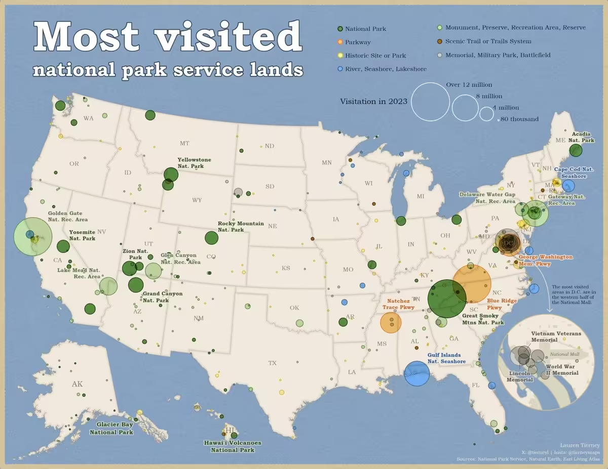
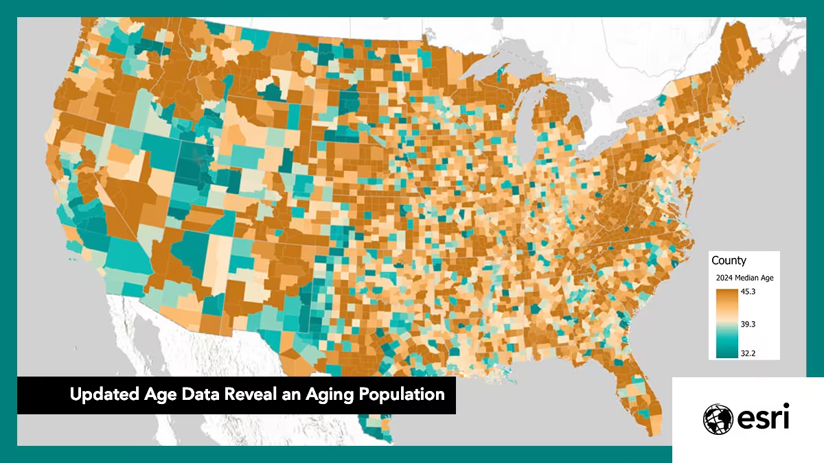
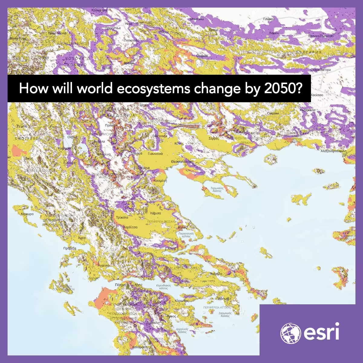
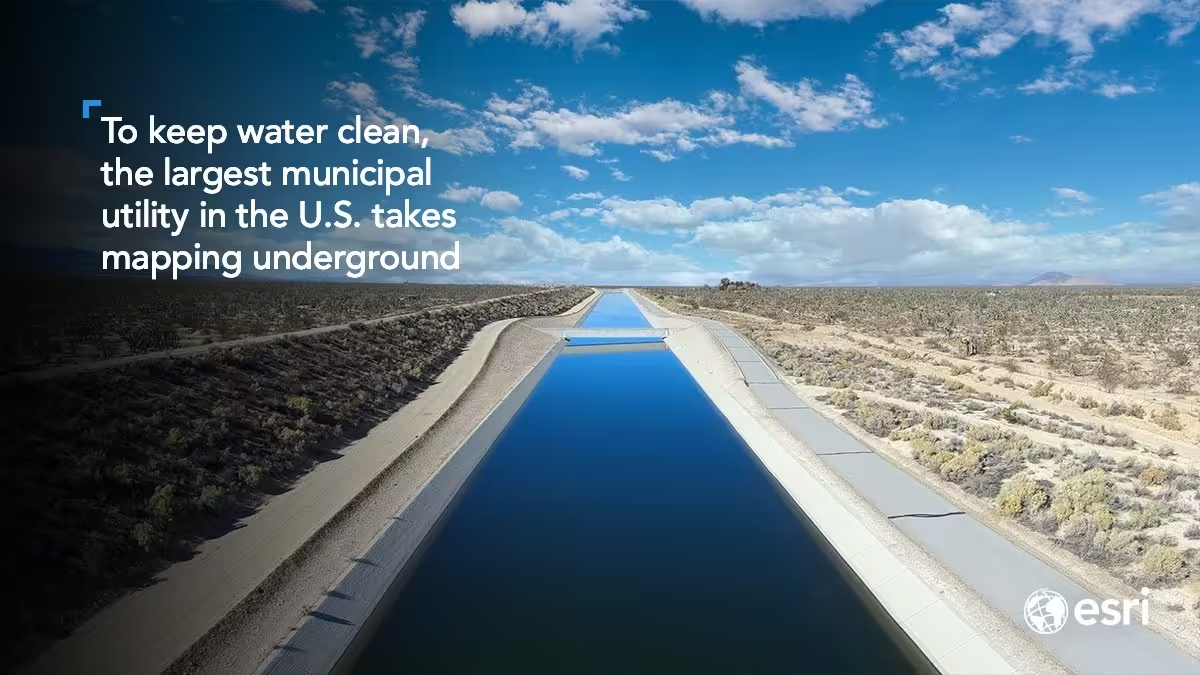
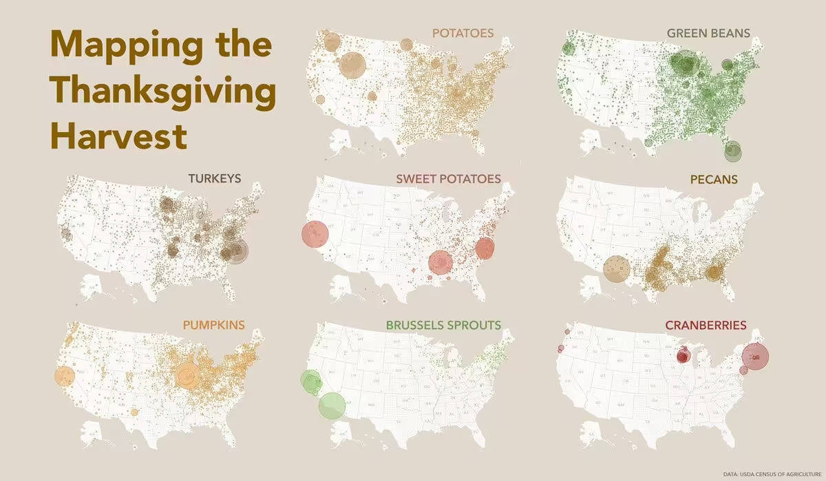
Thank you to everyone who voted! 🏆 National Geographic MapMaker won two Gold #anthemawards, and we’re proud to celebrate this with our partners at @InsideNatGeo.
www.anthemawards.com/winners/list/entry/national-geograph…
Esri
Environmental Systems Research Institute, Inc., doing business as Esri (), is an American geographic information system (GIS) software company headquartered in Redlands, California. It is best known for its ArcGIS products. With 45% market share as of 2015, Esri is one of the world's leading suppliers of GIS software, web GIS, local intelligence, and geodatabase management applications. More on Wikipedia
-
Esri
@Esri
-
Esri
@Esri
Still have a question for @John_M_Nelson? Good.
We still have room for it.
The map question. The GIS question. The career question.
Join us for "You Are Here: A Live AMA with John Nelson" on November 17.
🔸Register: www.linkedin.com/uas/login?session_redirect=https%3A%2F%2… -
Esri
@Esri
Oxford, England and Oxford, Mississippi are an ocean apart, but both use ArcGIS to connect location data and make smarter decisions. Proof that you don’t have to be a big city to make a big impact. Learn more: www.esri.com/en-us/arcgis/small-business-municipalities/o…
-
Esri
@Esri
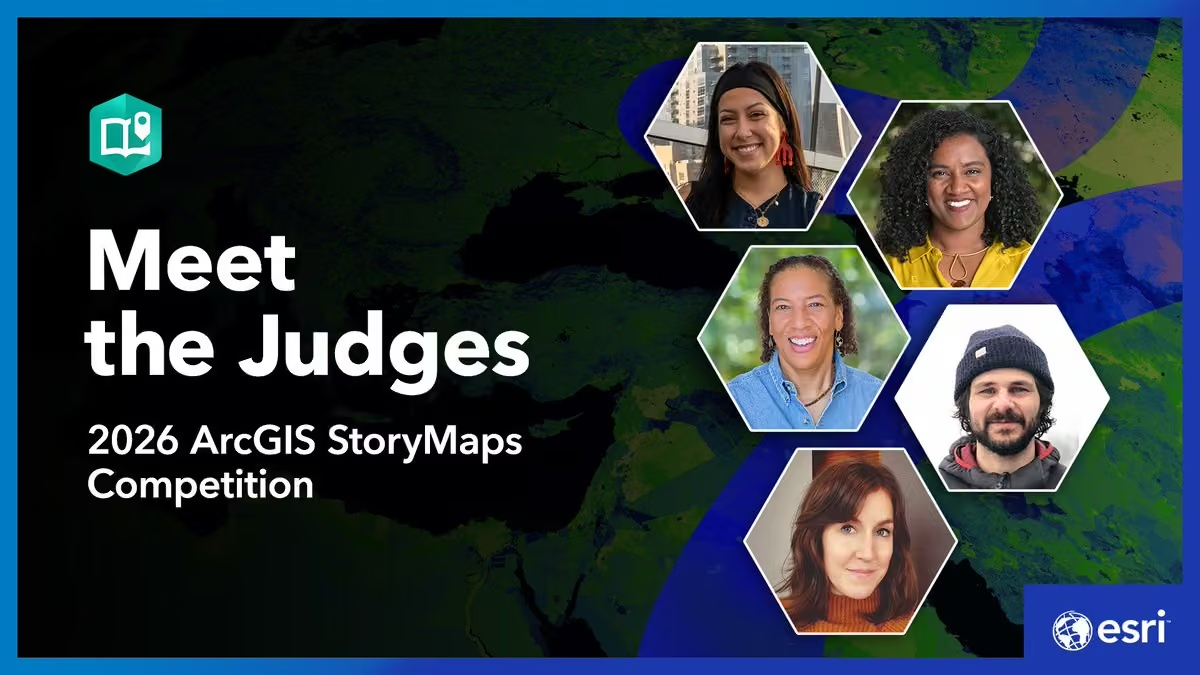
Want to tell a geospatial story that makes an impact? 🌎
Get advice from the 2026 @ArcGISStoryMaps Competition judges on using maps and GIS to inform, inspire, and drive change. storymaps.arcgis.com/collections/2c0a57f7d958430294b5a5a9…
#storymaps -
Esri
@Esri
ArcNews, is that you? 👀
The redesigned magazine brings together stories from the Esri user community and practical ideas for GIS professionals of all skill levels.
Read the latest issue: www.esri.com/about/newsroom/arcnews -
Esri
@Esri
Boo! 💀 Did we get you?
Give your maps a spooky twist this Halloween. See how layers and symbology can bring a little Halloween spirit to your cartography: www.esri.com/arcgis-blog/products/arcgis/mapping/shades-i… -
Esri
@Esri
From Down Under to the Sunshine State, cities use ArcGIS to connect location data, reveal insights, and make better decisions. No matter the size, ArcGIS helps governments innovate, adapt, and thrive. See how: www.esri.com/en-us/arcgis/small-business-municipalities/o…
-
Esri
@Esri
Your plans for @gisday? Consider them mapped! 🗺️
Celebrate the innovators, problem-solvers and storytellers using GIS to make a difference. Register your event: www.gisday.com/en-us/overview
Plus, event hosts receive three free ArcGIS for Personal Use licenses.
#gisday2026 -
Esri
@Esri
A milestone 50+ years in the making. 👏 Jack Dangermond has been inducted into the American Academy of Arts and Sciences, recognizing his leadership in GIS and his vision for a more connected, sustainable world. Congratulations, Jack!
-
Esri
@Esri
Show your support for geospatial literacy! National Geographic MapMaker, powered by Esri, is an Anthem Awards finalist. Cast your vote in both categories. #anthemawards
🔸K-12 Education Innovation: celebrate.anthemawards.com/PublicVoting
🔸Education or Literacy Platform: celebrate.anthemawards.com/PublicVoting -
Esri
@Esri
How do you become a cartographer?
What makes a map good? 🗺️
Why a woodshed?
Ask Esri cartographer @John_M_Nelson during our upcoming GIS Week AMA. Tune in on November 17th!
Register now and share your questions in the comments: www.linkedin.com/uas/login?session_redirect=https%3A%2F%2… -
AWF
@AWF_Official
1/2 - Africa’s biodiversity commitments depend on decisions about land, infrastructure and investment. At #cbdcop17, evidence must shape those choices. AWF’s approach connects geospatial intelligence with African leadership to turn commitments into action.
AWF
@AWF_Official
2/2 - AWF’s Geospatial Leaders Fellowship builds skills; APAD strengthens peer learning; Conservation GeoHubs with @Esri make evidence accessible to inform development decisions.
Read David Williams’ perspective: www.awf.org/news/mapping-what-matters-geospatial-intellig…
Esri
@Esri
This is what turning insight into impact looks like. 👏 We're so proud to partner with AWF.
-
Esri
@Esri
Where will it flood? The National Water Center’s new high-resolution flood prediction maps answer that for nearly the entire US population. Now in ArcGIS Living Atlas. @nwsnwc
🔗: www.esri.com/arcgis-blog/products/arcgis-living-atlas/pub… -
Esri
@Esri
What's the most valuable insight you use when evaluating a market?
📍Demographics
🛍️ Consumer spending
🚗 Traffic patterns
🏪 Competitor analysis
Learn how ArcGIS Business Analyst helps turn location data into smarter decisions. www.esri.com/en-us/esri-press/browse/top-20-essential-ski… -
Esri
@Esri
Ever watched a @John_M_Nelson video and wished you could ask a follow-up question? Now's your chance! 🙌🏽
Join us for a live AMA with Esri cartographer John Nelson on Nov 17.
Comment your questions below.
🔹Register: www.linkedin.com/uas/login?session_redirect=https%3A%2F%2… -
Esri
@Esri
Ever seen a map that makes you want to lace up your boots? 🥾
This shaded-relief map brings one of Alaska's most iconic backcountry routes to life, blending GIS, cartography, and alpine artistry into a stunning visual experience. mapgallery.esri.com/submission-detail/42521
🗺️ Abigail McHenry -
Esri
@Esri
Seeking a screen-free, creative activity? 📵
“Color Me Mappy: A Cartographic Coloring Book” invites you to interact with maps in a tactile, hands-on way.
Transform iconic, real-world places into immersive coloring experiences: www.esri.com/en-us/esri-press/browse/color-me-mappy-a-car… -
Esri
@Esri
Want a fast way to get started with GeoAI in ArcGIS? We'll give you 13. These beginner-friendly tutorials will put you on the path to becoming a deep learning model master: learn.arcgis.com/en/paths/try-deep-learning-in-arcgis/
Already using GeoAI? Drop your favorite model in the comments. -
Esri
@Esri
New terrain analysis capabilities are here! ⛰️
With ArcGIS Maps SDKs for Native Apps 300.1, you can now calculate slope and aspect from a raster, making it easier to build apps that analyze and visualize terrain.
🔹Learn more: www.esri.com/arcgis-blog/products/developers/developers/c… -
Esri
@Esri
Point Reyes National Seashore is home to one of California's most dynamic coastal ecosystems. Explore how rising seas could reshape rocky intertidal habitats and the species that depend on them in the story map, Rise & Tide. 🌊
🔗: storymaps.arcgis.com/stories/add001be0a36407397824521420c… -
Esri
@Esri
Africa, reimagined. 🌍
From the Congo Basin to the Sahara, this stunning map blends satellite imagery, terrain, and land cover data to reveal the continent in remarkable detail. What feature stands out to you? mapgallery.esri.com/submission-detail/42976
🗺️Raven Maps & Images, @EVGeospatial -
Esri
@Esri
From data to action. 💧🗺️
Discover how hydrologist David Maidment uses GIS to advance water and forecasting in “Geowater: A Geographic Approach to Water Data and Forecasting”. Part of The Power of Where Collection.
🔹Explore the book: powerofwhere.com/geowater/?aduc=Social&aduca=2026-MUL-Esr… -
Esri
@Esri
What can you find in a 3D scene?
Cars ✅
Bike racks ✅
Entrances ✅
Windows ✅
Even clock faces ✅
Advances in 3D GIS are making it easier to identify and extract features at scale, with AI helping automate the process behind the scenes. -
Esri
@Esri
The Mediterranean Sea is home to 17,000 species, but many are under threat. Now, a team of independent scientists is using GIS to shine a light on these endangered species and help shape smarter policies that safeguard the Mediterranean’s sea life.🪸 www.esri.com/about/newsroom/arcwatch/supporting-mediterra…
-
Esri
@Esri
At this week’s @OSCE event, Jack Dangermond joined policymakers and technology leaders to discuss how GIS brings clarity to complex information, enabling better decisions and stronger co-operative security.
OSCE
@OSCE
“Here’s where we’re disagreeing. And here’s where we’re not.”
🗺️ @Esri Founder and President Jack Dangermond on why maps can be a common language, and what that could mean for cooperative security.This media couldn't be displayed. See it on the original post. -
Esri
@Esri
How has your community changed over the last five years? 🏡
Discover new 2020-2024 American Community Survey (ACS) layers with updated housing, demographic, social and economic insights. www.esri.com/arcgis-blog/products/arcgis-living-atlas/ann…
Featured:
🔸Veteran Status in Tennessee -
Esri
@Esri
How do you monitor biodiversity at a national scale? Built on ArcGIS, the National Biodiversity Information System helps governments track species, monitor habitat change, and meet global conservation commitments. Guyana is helping lead this approach: www.esri.com/about/newsroom/arcnews/new-scalable-system-f…
-
Esri
@Esri
What happens when cartography meets creativity? 🗺️
This Arizona map reimagines the state's terrain with a unique tile based design to reveal the state's terrain in a whole new way. A must-see for map lovers and LEGO fans alike! www.esri.com/en-us/about/events/uc/agenda/virtual-map-gal…
🔸Authored by: Atlas Guo -
Esri reposted
ArcGIS StoryMaps
@ArcGISStoryMaps
🥳The wait is over! The 2026 ArcGIS #storymaps Competition is now open.
It's a great opportunity to showcase your work — and demonstrate how GIS can drive meaningful action locally and globally.
Get the details: www.esri.com/en-us/arcgis/products/arcgis-storymaps/conte… -
Esri
@Esri
Watch your data come to life over time. ⏰
New Map Viewer enhancements make it easier than ever to create dynamic time-based visualizations and uncover trends in your data. www.esri.com/arcgis-blog/products/arcgis-online/mapping/v… -
Esri
@Esri
Want to get more out of ArcGIS Business Analyst?
Make smarter, location-informed decisions for market planning, segmentation, and analysis. Learn essential workflows in both the web app and extension in ArcGIS Pro.
🔸Learn more: www.esri.com/en-us/esri-press/browse/top-20-essential-ski… -
Esri
@Esri
Satellites 🛰️ collect an enormous amount of information about our planet every day but much of it was locked behind complicated formats. Not anymore. @NASA teamed up with Esri to make that data easy to use. www.esri.com/about/newsroom/arcnews/nasa-makes-it-easier-…
-
Esri
@Esri
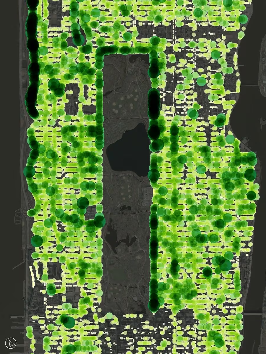
Some New Yorkers count steps others count trees! 🌳
Volunteers are using ArcGIS Field Maps to help NYC Parks map over 800,000 street trees revealing how the urban canopy changes and where more shade is needed. This map shows street tree size from the 2015 count. -
Esri
@Esri
Beneath the ocean's surface, small details can have a global impact. 🌊
Straits, ridges, and channels help control the flow of heat, oxygen, and nutrients across the globe. See how multiscale analysis in ArcGIS Pro reveals these hidden ocean connections. www.esri.com/arcgis-blog/products/arcgis-pro/analytics/ho… -
Esri
@Esri
Global Wet Bulb Globe Temperature Baseline combines temp, humidity, wind, sun angle, and clouds to provide a 30‑year view of global heat stress, supporting safer outdoor work, heat risk planning, and nighttime cooling trends. Explore the dataset: www.esri.com/arcgis-blog/products/arcgis-living-atlas/map…
-
Esri
@Esri
Every day, millions of people travel through New York’s subway system, spanning over 400 stations and 600 miles of track!🗽🚇 This animation illustrates how travel patterns change throughout the day.
🔹Explore the story map: storymaps.arcgis.com/stories/b1465b5130eb4ca99a647d0a515d… -
Esri
@Esri
Even Jack has his copy. Do you? 📗
𝘊𝘰𝘭𝘰𝘳 𝘔𝘦 𝘔𝘢𝘱𝘱𝘺: 𝘈 𝘊𝘢𝘳𝘵𝘰𝘨𝘳𝘢𝘱𝘩𝘪𝘤 𝘊𝘰𝘭𝘰𝘳𝘪𝘯𝘨 𝘉𝘰𝘰𝘬 features 39 maps of real-world destinations to color, explore, and enjoy. Coming this September! www.esri.com/en-us/esri-press/browse/color-me-mappy-a-car… -
Esri
@Esri
Millions of antelope. One extraordinary migration. 🌍
GPS tracks reveal glowing pathways across South Sudan, tracing journeys shaped by rain, drought, & survival. More than a map, it's migration in motion. mapgallery.esri.com/submission-detail/42666
🗺️ Inge van den Meiracker, @AfricanParks Network -
Esri
@Esri
Want better insights from your data?
These Esri Demographics data guides cover the essentials, highlight key datasets, and share practical use cases to help you get started.
🔸Learn more: www.esri.com/en-us/arcgis/products/arcgis-data/resources?… -
Esri
@Esri
A poorly placed store can’t be easily moved. In one of Europe’s most crowded retail landscapes, ALDI SÜD treats site selection like an intelligence problem, not a gut instinct.
🔸See how: www.forbes.com/sites/esri/2026/07/20/how-aldi-sd-finds-gr… -
Esri
@Esri
Geospatial digital twins go beyond 3D models; they capture real world behavior, relationships, and live dynamics using GIS and location intelligence. 🌍
Watch the full video and get more insights here: www.youtube.com/watch?v=MkZQ2ly2cYIThis media couldn't be displayed. See it on the original post. -
Esri
@Esri
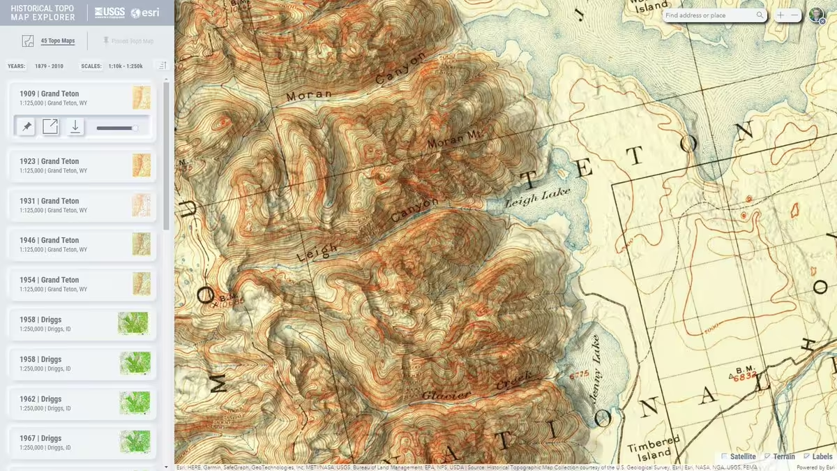
What did your city look like decades ago? Explore more than 180,000 historic @USGS topo maps from across the US with the Historical Topo Map Explorer. livingatlas.arcgis.com/topomapexplorer/?adusf=twitter&adu…
Featured:
📍Portland, Oregon (1897)
📍Boston, Massachusetts (1903)
📍San Francisco, California (1948) -
Esri
@Esri
Featuring exaggerated shaded relief and natural landscape colors, this map of Utah brings to life the diverse beauty spread across Utah's 84,900 square miles. 😍 mapgallery.esri.com/submission-detail/39939
Fun fact: 34,375 of those square miles are managed for multiple uses by @BLMNational. -
Esri
@Esri
How do you find the perfect spot for your next store? 💎
See how @swarovski is using GIS to find new opportunities and support retail growth around the world. www.esri.com/about/newsroom/publications/wherenext/giving… -
Esri
@Esri
"Let's do a water book."
A conversation between Jack Dangermond & David Maidment led to a new addition to The Power of Where collection. Explore how geography helps reveal the connections, challenges, & opportunities surrounding water. 💧🌎
Learn more: www.esri.com/en-us/esri-press/browse/geowater?aduc=Social… -
Esri
@Esri
Finding the right information on esri.com just got easier! Our new AI-powered assistant can help answer questions about Esri products and solutions, all without requiring a sign-in. Now in beta.
🔹Learn more: www.esri.com/en-us/ai-assistant?aduc=Social&aduca=DG_Chat… -
Esri
@Esri
Splatting is the new mapping. ✨👌
Create photorealistic experiences right in your browser with the Gaussian Splat Layer in ArcGIS Maps SDK for JavaScript 5.0. www.esri.com/arcgis-blog/products/js-api-arcgis/announcem…
🔍 Featured scenes: experience.arcgis.com/experience/e2e1e497d13b41cab368c894… (Credit: Brian Connolly)This media couldn't be displayed. See it on the original post. -
Esri
@Esri
Extreme heat affects communities differently.🌡️
About 8.8 million U.S. households live without air conditioning. New Local Air Conditioning Estimates (LACE) data from the @uscensusbureau helps organizations identify cooling needs & prepare for heat waves. www.esri.com/arcgis-blog/products/arcgis-living-atlas/ann… -
Esri
@Esri
Searching for a relaxing, map-related activity? 🗺️
“Color Me Mappy: A Cartographic Coloring Book” features real maps to color, from simple to intricate. Slow down and enjoy the details, one line at a time.🖍️ www.esri.com/en-us/esri-press/browse/color-me-mappy-a-car… -
Esri
@Esri
A big round of applause for our @EsriUC Map Gallery winners! 🏆
Your creativity, storytelling, and cartographic skills continue to inspire us. Explore the winning maps and all the incredible entries for this year's Map Gallery. 🗺️ www.esri.com/en-us/about/events/uc/agenda/map-gallery-awards
#esriuc2026 -
Esri
@Esri
Ready to level up your spatial data science game? 🔥
Dive into topics like deep learning, predictive analysis, and data engineering in our upcoming Spatial Data Science MOOC opening September 23.
🔸Register: www.esri.com/en-us/training/catalog/5d76dcf7e9ccda09bef61… -
Esri reposted
Esri User Conference
@EsriUC
That's a wrap for Esri UC 2026! 🌎 To our incredible GIS community: thank you for showing up, sharing your stories, inspiring one another, and reminding us what makes this community so special. The incredible work you do continues to make a positive impact around the world. We'll see you in 2027! 💙
#esriuc2026 -
Esri reposted
Esri User Conference
@EsriUC
Jack and Laura thank you for making this another amazing Esri UC! With GIS, you are helping create a more intelligent world, and this week proved it. 🌎
#esriuc2026 -
Esri
@Esri
What an incredible week it’s been at #esriuc2026! 🌎
Esri User Conference
@EsriUC
Running on GIS, coffee, and pure UC energy. ☕🌎
What a fantastic week of maps, tech, and community. Let's keep the momentum going!
#esriuc2026 -
Esri
@Esri
Experience the excitement of the Plenary! 🤩 Catch the biggest moments and watch the videos here: mediaspace.esri.com/channel/2026+Esri+User+Conference/406…
#esriuc2026This media couldn't be displayed. See it on the original post. -
Esri reposted
Esri User Conference
@EsriUC
Celebrating the new @NatGeo Museum of Exploration! 🎉
“Experience the world like never before through museum exhibits and immersive experiences that reveal the wildlife, landscapes, communities and cultures that make up our incredible planet.” -National Geographic Society moe.nationalgeographic.org/en/about/our-story
#esriuc2026 -
Esri
@Esri
Every map tells a story. 🗺️ What's yours?
Save the date! The 2026 @ArcGISStoryMaps Competition opens on September 8. Tell a story about making your community better with maps and GIS.
🔹Get the details: www.esri.com/en-us/arcgis/products/arcgis-storymaps/conte…
#storymaps -
Esri reposted
Esri Training
@EsriTraining
Thanks for the shoutout, Jack! 🌟🌎
MOOCs are a great way to learn, and we are 100 days out from one of our brand-new MOOCs opening. Explore the latest ArcGIS and GIS tools to create 2D and 3D information products.
Save Your Spot → link.esri.com/701UU00000ZXAvhYAH_a4H229a/M8nHdOX?adusf=tw… -
Esri
@Esri
The big day is here! 🤩
The @EsriUC Plenary session live stream starts TODAY at 8:30 AM PT. See visionary leaders, cool demos, and real-world GIS stories from teams doing amazing work.
🔹Sign in to watch: registration.esri.com/flow/esri/26uc/eventportal/login?de…
#esriuc2026 -
Esri
@Esri
Major soccer events mean more travelers. @flySFO uses ArcGIS technology to bring infrastructure, operations, and real-time data, enabling faster decisions, better coordination, and a smoother passenger experience across one of the busiest airports in the U.S.🛫
This media couldn't be displayed. See it on the original post. -
Esri
@Esri
Digital twins are helping electric utility operators reimagine a safer, more efficient grid. Find out how on The Esri and The Science of Where Podcast.🎙️ www.esri.com/about/newsroom/podcast/the-future-of-utiliti…
Follow our new feeds on Apple, Amazon, Pandora, IHEARTRADIO, and Spotify.
#digitaltwin -
Esri
@Esri
The countdown is on! ⌛
Watch the @EsriUC Plenary session live stream on Monday, July 13 at 8:30 AM PT. See the latest innovations, cool demos, and real-world GIS stories from teams doing amazing work. 🤩
🔹Sign up to watch: registration.esri.com/flow/esri/26uc/reglandingPlenaryOnl…
#esriuc2026 -
Esri
@Esri
By popular demand, a new book on #geoai workflows is on the way! 🤩
Exploring GeoAI: Tools and Workflows dives into ready-to-use, pretrained deep learning models in ArcGIS Pro and ArcGIS Online.
🔹Learn more: www.esri.com/en-us/esri-press/browse/exploring-geoai-tool… -
Esri
@Esri
Travel back to Boston, 1775. 🗺️
Using ArcGIS and historical records, Esri cartographer Charlie Frye recreated Boston as it looked during the American Revolution.
See the landscape transform through time with this interactive swipe map: www.arcgis.com/apps/instant/basic/index.html?appid=fbb3a8…This media couldn't be displayed. See it on the original post. -
Esri reposted
Esri User Conference
@EsriUC
Ready to geek out on maps? 🗺️
Catch Mappy Hour during the first Plenary break on Monday, July 13. Make sure you're registered!
🔹Register here: www.esri.com/en-us/about/events/uc/overview?aduc=Social&a…
#esriuc2026 -
Esri
@Esri
The Esri UC Q&A is available! 🙌
Discover the latest in Esri technology, track emerging GIS trends, get answers to your ArcGIS questions, and see what's next. www.esri.com/en-us/about/events/uc/plan/q-a?aduc=Social&a…
#esriuc2026 -
Esri
@Esri
Ready to map out your next big idea? 🗺️
Join us at @EsriUC for hands-on training, fresh innovations in mapping and analytics, and real stories of organizations turning data into action.
🔹Register: www.esri.com/en-us/about/events/uc/overview?aduc=Social&a…
#esriuc2026 -
Esri
@Esri
The latest update in @ArcGISOnline is here! 🙌🏽
Unlock smarter content management, richer data and imagery, streamlined workflows, and more dynamic mapping and sharing capabilities.
🔸Learn more: www.esri.com/arcgis-blog/products/arcgis-online/announcem… -
Esri
@Esri
ArcGIS #storymaps frames is out of beta. 🙌
Turn your text, media, and ArcGIS content into a mobile-first, short story. Then, with our built-in video output, share it on social!
🔹Get the details: www.esri.com/arcgis-blog/products/arcgis-storymaps/announ…This media couldn't be displayed. See it on the original post. -
Esri
@Esri
In a city where weather conditions shift by the minute, static dashboards don’t cut it.
@HoustonOEM worked with @dymaptic to build Atlas—using AI + GIS to turn data into a living, evolving story, helping teams respond to crowds, traffic, and operations in real time.This media couldn't be displayed. See it on the original post. -
Esri reposted
Esri User Conference
@EsriUC
Whether you're attending, going virtual, or just curious—get tips for a great UC! 🌎
Don't miss the UC Orientation live stream TODAY at 8:30 AM PT!
Watch here: 👉 www.youtube.com/user/esritv?cbrd=1&ucbcb=1
Join the conversation: 👉 registration.esri.com/flow/esri/26uc/eventportal/page/det…
#esriuc2026 -
Esri
@Esri
Mapping water just got easier!💧
With SAM3 and text prompts, automatically extract water bodies in ArcGIS Pro for Reality Mapping
Take a look: www.esri.com/arcgis-blog/products/arcgis-pro/3d-gis/fast-… -
Esri reposted
ArcGIS StoryMaps
@ArcGISStoryMaps
Here at Esri, we love exploring unexpected patterns, trends, and relationships, and the newest exhibit at the Smithsonian National Museum of Natural History does just that!
🔎Explore the 600+ items in From These Lands—in person or virtually: storymaps.arcgis.com/stories/ceb72324b471492ba19f7c589927… -
Esri
@Esri
Level up your #esriuc2026 experience. 🙌 Get helpful tips at the UC Attendee Orientation live stream on June 23 at 8:30 AM PT. Not attending? Tune in for a sneak peek.
🔹Add to schedule: registration.esri.com/flow/esri/26uc/eventportal/page/det…
🔸Watch: www.youtube.com/user/esritv?cbrd=1&ucbcb=1This media couldn't be displayed. See it on the original post. -
Esri
@Esri
Understanding when something happens can be just as powerful as knowing where. ⏱️
New calendar heat charts in ArcGIS Online Map Viewer make it easier than ever to spot temporal trends and reveal insights buried in your data. www.esri.com/arcgis-blog/products/arcgis-online/mapping/v… -
Esri reposted
Esri User Conference
@EsriUC
We're excited to welcome Kristine Tompkins, President and cofounder of Tompkins Conservation, as our keynote speaker! 🙌
Get inspired by her mission to create a more wild, beautiful, and equitable world. 🌎
🔹Learn more: www.esri.com/en-us/about/events/uc/agenda/plenary?aduc=So…
#esriuc2026 -
Esri
@Esri
The Map Africa Initiative is on @FastCompany's World Changing Ideas list! 🙌 We are honored to be named alongside organizations making a difference in the world.
🔹See the full list: www.fastcompany.com/world-changing-ideas/list
#fcworldchangingideas #gis -
Esri
@Esri
Inspire your future self with this stunning 2027 wall calendar! 🤩 This 16-month calendar features maps made by some of your favorite Esri cartographers.
🔸Take a peek at each month’s map: www.esri.com/en-us/esri-press/browse/2027-esri-press-wall…This media couldn't be displayed. See it on the original post. -
Esri
@Esri
Movement isn’t just eye-catching—it can shape how your story is understood. Maps that move reveal where things go, how they get there, and what changes along the way. 🗺️
Explore stories and learn techniques for adding dynamic movement to your own maps. storyscape-esriwhere.hub.arcgis.com/pages/june-2026-movin…This media couldn't be displayed. See it on the original post. -
Esri
@Esri
Sonoma’s architecture reflects layers of history from Indigenous communities to Spanish, Mexican, and early American eras. A new ArcGIS Experience Builder app helps staff manage historic sites with data that is easier to access and maintain.
Read more: www.esri.com/about/newsroom/arcwatch/how-the-city-of-sono… -
Esri
@Esri
Most of our planet is ocean, and most of that is still a mystery! 🌊
Dr. Sylvia Earle shows us how GIS and Esri software are helping scientists uncover powerful patterns hidden deep below the surface.
#worldoceandayThis media couldn't be displayed. See it on the original post. -
Esri
@Esri
Headed to @EsriUC?🌎Get the inside scoop before it starts! Don't miss the UC Attendee Orientation live stream on June 23.
#esriuc2026
Esri User Conference
@EsriUC
Get the most out of your UC experience! 🙌
Join the UC Attendee Orientation live stream on June 23 at 8:30 AM PT. We'll share key tips and helpful info for both virtual and in-person attendees.
🔹Add to your schedule: registration.esri.com/flow/esri/26uc/eventportal/page/det…
#esriuc2026This media couldn't be displayed. See it on the original post. -
Esri
@Esri
Health Professional Shortage Areas are now in ArcGIS Living Atlas. Access Primary Care, Dental Health, and Mental Health HPSA layers for smarter policy mapping. Included:
🔸Simple symbology
🔸Clear pop-ups
🔸Built-in metadata + monthly updates
Details: www.esri.com/arcgis-blog/products/arcgis-living-atlas/hea… -
Esri
@Esri
Discover the world - one line at a time. 🖍️
“Color Me Mappy” is the perfect coloring book for cartographers, map lovers, travel enthusiasts, and anyone who enjoys a little screen-free creativity.
Don’t worry, get mappy. 😁🗺️ www.esri.com/en-us/esri-press/browse/color-me-mappy-a-car… -
Esri
@Esri
How do you manage a museum campus at scale? The Henry Ford uses 3D GIS with ArcGIS Indoors to improve operations, safety, and visitor experience. Explore the story: www.esri.com/about/newsroom/arcwatch/from-artifacts-to-as…
-
Esri
@Esri
Discover Dominica! 🏝️
This Eastern Caribbean island has it all. Rugged terrain, lush forests, and incredible biodiversity, beautifully shown in this map. Learn more: mapgallery.esri.com/submission-detail/35680
🗺️ Melinda Felicia Lowe, Western Illinois University -
Esri
@Esri
Ready for some inspiration? ✨
Hear from visionary leaders, watch live demos, and experience GIS in action through real-world stories of teams delivering meaningful results.
🔹Learn more: www.esri.com/en-us/about/events/uc/agenda/plenary?aduc=So…
#esriuc2026 -
Esri reposted
ArcGIS StoryMaps
@ArcGISStoryMaps
🎨Alternative text. Color contrast. Headings and repeatable structure.
Little choices have big impacts on a story's #accessibility. Learn the basics in this NEW tutorial series—Foundations of accessible storytelling with #maps. learn.arcgis.com/en/paths/foundations-of-accessible-story…
#gaad #storymaps -
Esri reposted
Forbes
@Forbes
From the @america250 x Forbes America Innovates stage, Jack Dangermond, president of Esri, the mapping software company behind modern digital maps, and a Forbes 250 America’s Greatest Living Innovators honoree, spoke on AI and building a “nervous system for the planet.
⠀
#forbes250 #america250This media couldn't be displayed. See it on the original post. -
Esri
@Esri
Ocean currents are vital to life on Earth, regulating climate and transporting nutrients and organisms. This animated map from @NASA’s Scientific Visualization Studio (SVS) highlights ocean currents at different depths. 🌊 www.maps.com/animated-ocean-currents-map-shows-currents-a…
This media couldn't be displayed. See it on the original post. -
Esri
@Esri
Mark your calendar for #gisday2026! 🌎 Check out these great resources to plan your event.
GIS Day
@gisday
The #gisday2026 theme is here! Celebrate 𝐆𝐈𝐒: 𝐏𝐨𝐰𝐞𝐫𝐢𝐧𝐠 𝐏𝐮𝐫𝐩𝐨𝐬𝐞 𝐚𝐧𝐝 𝐈𝐧𝐧𝐨𝐯𝐚𝐭𝐢𝐨𝐧 on November 18. 🌎😍
Start planning your event with our media kit! There are stickers, social graphics, and videos to help you get started. storymaps.arcgis.com/briefings/1228b872d0fd43d1a8343348b6… -
Esri
@Esri
Put your map skills to work. 🗺️
Learn how visual structure, interaction, and layout come together to build powerful web maps. storyscape-esriwhere.hub.arcgis.com/pages/may-2026-anatom… -
Esri
@Esri
Global Wet Bulb Globe Temperature Baseline combines temp, humidity, wind, sun angle, and clouds to provide a 30‑year view of global heat stress, supporting safer outdoor work, heat risk planning, and nighttime cooling trends. Explore the dataset: www.esri.com/arcgis-blog/products/arcgis-living-atlas/map…
This media couldn't be displayed. See it on the original post. -
Esri
@Esri
Coming soon! 📘 Learn ArcGIS basics, how to create and edit spatial data, the advantages of geocoding, and more in 𝘎𝘦𝘵𝘵𝘪𝘯𝘨 𝘵𝘰 𝘒𝘯𝘰𝘸 𝘈𝘳𝘤𝘎𝘐𝘚 𝘗𝘳𝘰 3.6. www.esri.com/en-us/esri-press/browse/getting-to-know-arcg…
-
Esri
@Esri
Maps used to show us where things were. Now, they help us understand what’s happening and where to act.
In @Forbes, Jack Dangermond explores how modern maps are becoming dynamic, AI-enabled systems for decision-making across industries. www.forbes.com/sites/esri/2026/05/11/a-new-operating-syst… -
Esri
@Esri
City to countrywide, mapped in jaw-dropping detail. 🗺️🤯
See how drone imagery and ArcGIS Reality Studio are redefining large area reality mapping with stunning 2D and 3D results. www.esri.com/arcgis-blog/products/arcgisrealitystudio/map… -
Esri
@Esri
Discover the beauty of geography and maps with this 2027 wall calendar! 💚🌏 Each month features a beautiful map, fun facts, and more. www.esri.com/en-us/esri-press/browse/2027-esri-press-wall…
-
Esri
@Esri
How can a carefully constructed map strengthen your story? 🗺️
See how configured popups, simple legends, and symbols transform sample stories - then apply those techniques to your own projects. storyscape-esriwhere.hub.arcgis.com/pages/may-2026-anatom…
#storymaps #gis -
Esri
@Esri
How do you monitor biodiversity at a national scale? Built on ArcGIS, the National Biodiversity Information System helps governments track species, monitor habitat change, and meet global conservation commitments. Guyana is helping lead this approach: www.esri.com/about/newsroom/arcnews/new-scalable-system-f…
-
Esri
@Esri
Version 5.0 of ArcGIS Maps SDK for JavaScript is here! 🙌
Build AI applications with AI components (beta), draw & edit curves with curve tools, create realistic nighttime 3D scenes with light emitting symbols, code faster with new web components & more! www.esri.com/arcgis-blog/products/js-api-arcgis/announcem…This media couldn't be displayed. See it on the original post. -
Esri
@Esri
Time to map out your @EsriUC experience! Explore the agenda and chart a course that even your basemap would be proud of. 😉 registration.esri.com/flow/esri/26uc/eventportal/page/det…
#esriuc2026 -
Esri
@Esri
Cloud patterns reveal more than weather. 🌥️
USA Cloud Cover Days shows average cloud covered days per year across the U.S. from 2020 to 2024 using @NASA satellite data.
Explore insights for energy, agriculture, and health: www.esri.com/arcgis-blog/products/arcgis-living-atlas/ana… -
Esri
@Esri
What if weeks of work took minutes? 🤯 Discover 3 AI tools in ArcGIS for faster spatial analysis. www.youtube.com/watch?v=G0_PZrD8j2Q
This media couldn't be displayed. See it on the original post. -
Esri reposted
ArcGIS StoryMaps
@ArcGISStoryMaps
🌱 💚 Happy #earthday!
Use #ai to map urban trees. Track mountain lions. And explore Long Island Sound Watershed with the 2025 ArcGIS #storymaps Competition winners.
Celebrate the planet 🌏 and #gis for good with the 9 winning stories: www.esri.com/arcgis-blog/products/arcgis-storymaps/sharin…
#livingatlas -
Esri
@Esri
Want to make your maps truly stand out and tell compelling stories with your data? 🗺️ Transform how people experience your maps with this learning plan.
Get started: www.esri.com/en-us/training/catalog/5b29690fe620ca23e6541… -
Esri
@Esri
This isn’t just a 3D scene, it’s a geospatial digital twin built with Gaussian splats in ArcGIS. This new GIS layer type brings the physical world into your maps, even adding lifelike detail to vegetation, thin structures, and other complex surfaces.
This media couldn't be displayed. See it on the original post. -
Esri
@Esri
AI can process data, but geography creates understanding. GIS with AI gives leaders real spatial insight to manage risk, respond to crises, and make smarter decisions. Read more from Jack Dangermond in @Forbes: www.forbes.com/sites/esri/2026/04/15/creating-a-more-inte…
-
Esri
@Esri
Enterprise AI is getting smarter fast. But many of the hardest decisions aren't just data problems, they're geography problems. Esri CMO Marianna Kantor explains why Geospatial AI is equipped to solve them. www.forbes.com/sites/esri/2026/03/30/ai-knows-what-geospa…
-
Esri
@Esri
Did you know? You can now buy #esripress ebooks in the Esri Store! Instantly access a wide range of GIS and mapping titles to support your professional development. Available for users in the US.
🔸Explore: www.esri.com/en-us/store/products/all?q=books&aduc=Social… -
Esri
@Esri
Geospatial digital twins go beyond 3D models; they capture real world behavior, relationships, and live dynamics using GIS and location intelligence. 🌍
Watch the full video and get more insights here: www.youtube.com/watch?v=MkZQ2ly2cYIThis media couldn't be displayed. See it on the original post. -
Esri
@Esri
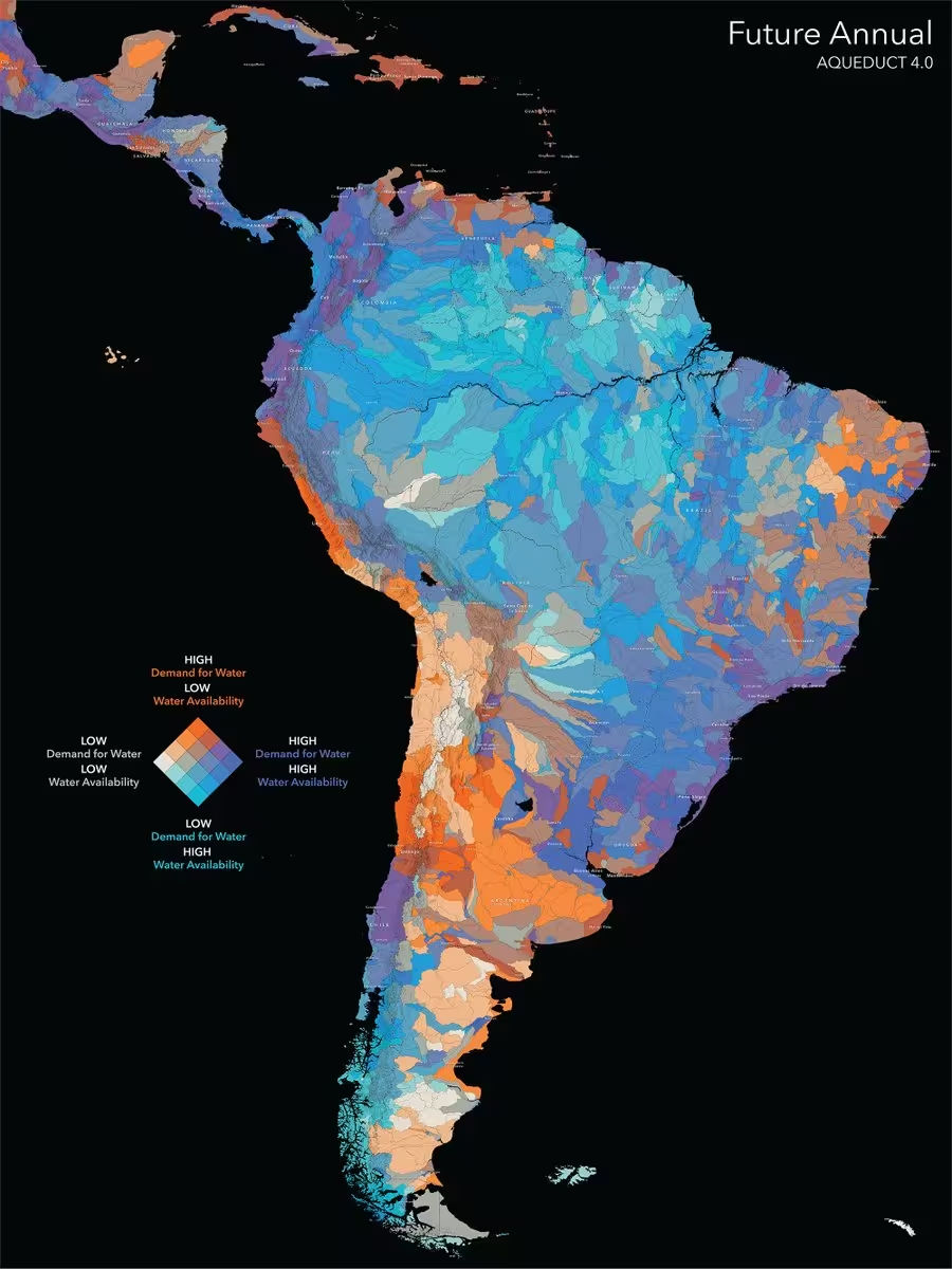
How will freshwater availability change in 50 years? 💧
The Aqueduct 4.0 Global Water Risk dataset from @WorldResources helps us prepare for future needs. Available in ArcGIS Living Atlas: www.esri.com/arcgis-blog/products/arcgis-living-atlas/wat…
#hydrology #conservation -
Esri reposted
mapsdotcom
@mapsdotcom
We're sure it is better to be there. But even if you're still firmly on planet Earth, you too can explore the Moon.
Our map of the lunar surface shows named craters, landing sites, and other features of our only natural satellite.
www.maps.com/lunar-surface-craters/ -
Esri
@Esri
Discover 12 ways to get the most out of ArcGIS Living Atlas. 🗺️ www.esri.com/arcgis-blog/products/arcgis-living-atlas/map…
-
Esri
@Esri
Join us at this year's @EsriUC! 🌎 Get hands-on training, discover innovations in mapping and analytics, and learn how location intelligence is driving success across industries.
🔸Register: www.esri.com/en-us/about/events/uc/overview?aduc=Social&a…
#esriuc2026 -
Esri
@Esri
Want a fast way to get started with GeoAI in ArcGIS? We'll give you 13. These beginner-friendly tutorials will put you on the path to becoming a deep learning model master: learn.arcgis.com/en/paths/try-deep-learning-in-arcgis/
Already using GeoAI? Drop your favorite model in the comments. -
Esri
@Esri
Dreaming of a career as a drone pilot? 🤔 🎮 Esri’s Jeremiah Johnson shares his top tips to take your skills sky-high: www.esri.com/about/newsroom/arcwatch/career-advice-for-as…
-
Esri
@Esri
Discover your community’s story with new ACS data! Get the latest housing, demographic, social, and economic insights with updated 2020–2024 American Community Survey layers. www.esri.com/arcgis-blog/products/arcgis-living-atlas/ann…
Featured:
🔸Veteran Status in Tennessee -
Esri
@Esri
It’s about as close as you can get to a real-life magic school bus! 🚌
@AU_Geo’s mobile science lab is bringing #stem to K-12 students across Alabama. www.esri.com/about/newsroom/arcwatch/science-on-the-move-… -
Esri
@Esri
What did your city look like decades ago? Explore more than 180,000 historic @USGS topo maps from across the US with the Historical Topo Map Explorer. livingatlas.arcgis.com/topomapexplorer/?adusf=twitter&adu…
Featured:
📍Portland, Oregon (1897)
📍Boston, Massachusetts (1903)
📍San Francisco, California (1948) -
Esri
@Esri
When it comes to urban sprawl, Montana drew the line, literally. See how the Montana Zoning Atlas inspired bipartisan reform and real housing solutions: www.esri.com/about/newsroom/blog/montana-zoning-atlas-bip…
-
Esri
@Esri
Meet the sandwich generation—literally.
Explore global demographic data as animated maps, colorful illustrations, and engaging text that break down complex ideas into an accessible story. storyscape-esriwhere.hub.arcgis.com/pages/march-2026-find…
#storyscape #storymaps -
Esri
@Esri
Every day, millions of people travel through New York’s subway system, spanning over 400 stations and 600 miles of track!🗽🚇 This animation illustrates how travel patterns change throughout the day.
🔹Explore the story map: storymaps.arcgis.com/stories/b1465b5130eb4ca99a647d0a515d…This media couldn't be displayed. See it on the original post. -
Esri
@Esri
This year's Esri Developer & Technology Summit was amazing! 🤩
Whether you want to relive the excitement or catch up on what you missed, you can watch the Plenary Session videos here: mediaspace.esri.com/channel/2026+Esri+Developer+%26+Techn…
#esridevtech2026This media couldn't be displayed. See it on the original post. -
Esri
@Esri
Ebro Delta, Catalonia - the Iberian Peninsula's second longest river at 930 km! The Ebro River Delta is shown in infrared using Sentinel 2A bands: vibrant orange & red for vegetation, dark blue for clear water, & cyan for turbid water. mapgallery.esri.com/submission-detail/40047
🗺️ Andrea Cappaiaw -
Esri
@Esri
Brush up your mapping skills! 🗺️
Learn how to create an interactive web map of the five highest mountains in the world using ArcGIS Online or ArcGIS Enterprise. www.esri.com/about/newsroom/arcwatch/map-the-highest-moun… -
Esri
@Esri
🤳✨ From historical imagery and real-world AR, to precise editing and open data connections. The latest release of ArcGIS Earth Mobile is packed with features to help you explore, visualize, and make decisions anywhere, anytime. www.esri.com/arcgis-blog/products/arcgis-earth/3d-gis/wha…
-
Esri
@Esri
Splatting is the new mapping. ✨👌
Create photorealistic experiences right in your browser with the new Gaussian Splat Layer in ArcGIS Maps SDK for JavaScript 5.0. www.esri.com/arcgis-blog/products/js-api-arcgis/announcem…
🔍 Featured scenes: experience.arcgis.com/experience/e2e1e497d13b41cab368c894… (Credit: Brian Connolly)This media couldn't be displayed. See it on the original post. -
Esri
@Esri
See the latest ArcGIS technology! Watch the Plenary & Keynote session live streams. www.esri.com/en-us/about/events/devtech/agenda
🔸Mar 10: Plenary | 8:30 AM — 12 PM PT
🔸Mar 11: Plenary | 8:30 AM — 10:30 AM PT
🔸Mar 12: Keynote | 8:30 AM — 10 AM PT
Sign up: www.esri.com/en-us/about/events/devtech/registration?aduc…
#esridevtech2026 -
Esri
@Esri
Get the new guide to imagery and remote sensing!
"Top 20 Essential Skills for Imagery and Remote Sensing" is an approachable resource, with concise chapters and clear tutorials.
🔹Gain the skills you need: www.esri.com/en-us/esri-press/browse/top-20-essential-ski… -
Esri
@Esri
See what's new in @ArcGISOnline. 🙌 The latest updates include:
🔸Enhanced style capabilities in Map Viewer
🔸New and updated analysis tools
🔸More dynamic mapping and sharing capabilities, and much more!
Check it out: www.esri.com/arcgis-blog/products/arcgis-online/announcem… -
Esri
@Esri
Grab a virtual front-row seat to the 2026 Esri Developer & Technology Summit! 🧑💻 Register now for digital access and participate virtually in your choice of 40+ live-streamed sessions.
🔹Details here: www.esri.com/en-us/about/events/devtech/plan/virtual-atte…
#esridevtech2026 -
Esri
@Esri
This map shows elephant habitats across Africa using a dot-density representation.🐘 Each dot corresponds to 10K elephants, highlighting their distribution across savannas, forests, & riverine environments.
Full map: mapgallery.esri.com/submission-detail/41113?adusf=twitter… #worldwildlifeday
🗺️ Mohamed Alkamel -
Esri
@Esri
For two days, Iraq shut down almost entirely to conduct its first full census since 1987—here’s how GIS helped make history. www.esri.com/about/newsroom/arcnews/iraq-counts-its-peopl…
-
Esri
@Esri
NIMBY or YIMBY, the US needs more homes. 🏠 The real question is where to build—and for whom. One home builder isn't guessing and they are using GIS to guide smarter decisions. www.esri.com/about/newsroom/publications/wherenext/taylor…
-
Esri
@Esri
Meet EuclidHL, the expert in AI and GIS for city planning. 🏠 Discover how @HousealLavigne's creation enhances smart cities as a 24-hour AI-powered planning and zoning assistant. www.esri.com/about/newsroom/arcnews/gis-based-large-langu…
-
Esri
@Esri
A cartographic classic returns. 🗺️
Trusted by students and professional cartographers for the past 50 years, "Map Use" is now available in a new edition focused on mapmaking and reading.
🔸Learn more: www.esri.com/en-us/esri-press/browse/map-use-map-reading-… -
Esri
@Esri
See live demos of cutting-edge ArcGIS technology! 🤩
🔹Mar 10: Plenary | 8:30 AM — 12:00 PM PT
🔹Mar 11: Plenary | 8:30 AM — 10:30 AM PT
🔹Mar 12: Keynote | 8:30 AM — 10:00 AM PT
Sign up to watch the live streams: www.esri.com/en-us/about/events/devtech/registration?aduc…
#esridevtech2026 -
Esri
@Esri
Get free GIS and ArcGIS training on Esri Academy! 🤩 Find a course that's right for you.
🔹Start learning: www.esri.com/en-us/training/catalog/search/options/2?adus… -
Esri
@Esri
Esri Press ebooks are now available in the Esri Store! 📚Browse the selection and add your favorites to your cart for instant access after purchase. www.esri.com/en-us/store/products/all?q=books&aduc=Social…
*Ebooks are available for users in the US. -
Esri
@Esri
Following the 2026 Milano Cortina Winter Olympics? 🏔️
Created by @lisaberry_gis, here is a 3D look at where events are happening relative to Milan, built in #arcgisonline and #sceneviewer and enhanced with Living Atlas slope and snowpack layers.This media couldn't be displayed. See it on the original post. -
Esri
@Esri
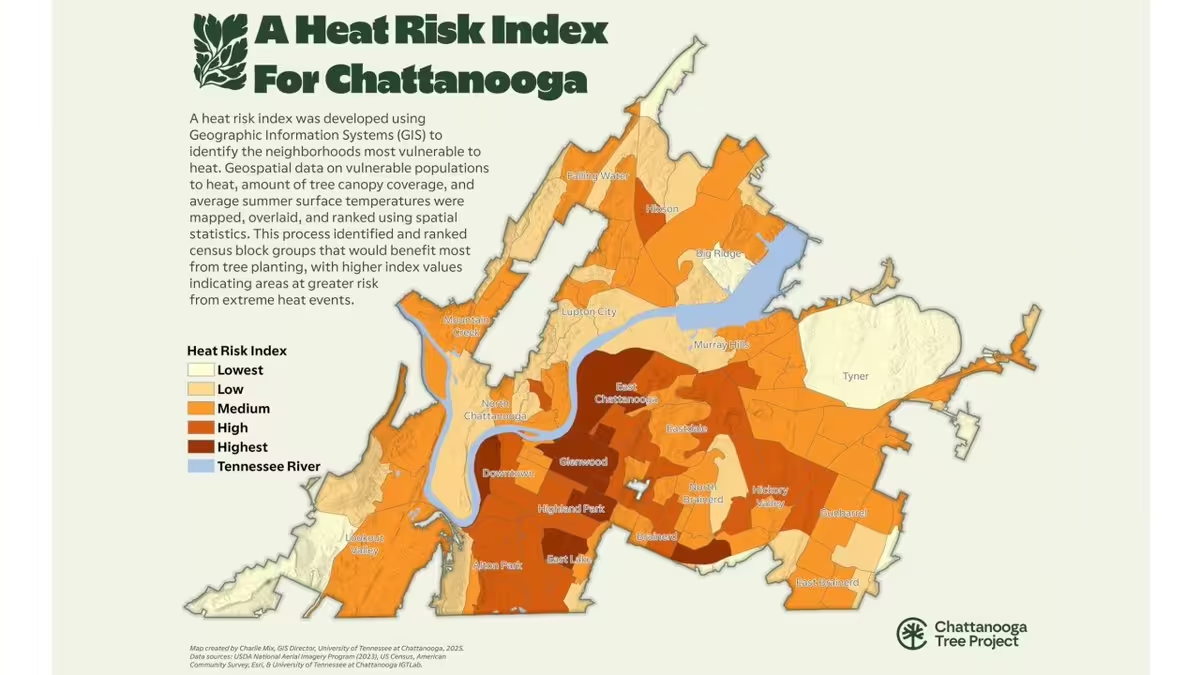
🌳 AI meets urban forestry.🌳
See how the City of Chattanooga, TN (@Chattanooga_gov) is using GIS and AI to reach a new level of cool. www.esri.com/about/newsroom/blog/gis-ai-urban-forestry-he… -
Esri
@Esri
The picks for the 2025 @ArcGISStoryMaps Competition finalists are in! Which story is your favorite?
Cast your vote for our Community Choice winner:🏅2025-arcgis-storymaps-competition-story.hub.arcgis.com?ad…
#storymaps -
Esri
@Esri
The world doesn’t stop and neither should maps. 🗺️ Jack Dangermond discusses how living digital twins deliver real‑time visibility into operations for faster, more strategic decisions. www.forbes.com/sites/esri/2026/02/09/building-a-geospatia…
-
Esri
@Esri
Discover demographic and lifestyle patterns with ease! 🙌🏽
The new ArcGIS Tapestry Segment Infographics Dashboard offers a clear, visual overview of each ArcGIS Tapestry segment, making it easier to understand demographic and lifestyle trends. www.esri.com/arcgis-blog/products/esri-demographics/annou… -
Esri
@Esri
It's no secret. Trees help communities stay cool. 🌲 Also no secret — trees and green space aren't always distributed equally across neighborhoods.
Here's how the City of Austin (@austintexasgov) maps it's tree canopy for maximum impact. storymaps.arcgis.com/stories/d9ba0b99c60b4b8395414a09c453… -
Esri
@Esri
Cased lines for clarity!💡Give your maps depth and hierarchy with simple symbology tricks in @ArcGISPro.
Here's how: 👉🏽 www.esri.com/arcgis-blog/products/arcgis-pro/mapping/make… -
Esri
@Esri
Discover the 20 must-have skills for advanced imagery analysis workflows. 🤩
Learn essential techniques to visualize, process, analyze, and manage imagery and raster products. www.esri.com/en-us/esri-press/browse/top-20-essential-ski… -
Esri
@Esri
💥I need a hero!
Did you know...character-driven stories trigger the production of oxytocin, a neurochemical that makes people feel more cooperative. Learn how to engage—and persuade—your readers with a memorable hero. storyscape-esriwhere.hub.arcgis.com/pages/february-2026-n…
#storyscape -
Esri
@Esri
How will freshwater availability change in 50 years? The Aqueduct 4.0 Global Water Risk dataset from @WorldResources helps us prepare for future needs. Available in ArcGIS Living Atlas: www.esri.com/arcgis-blog/products/arcgis-living-atlas/wat…
#hydrology #conservation -
Esri
@Esri
A 3D digital twin of Easter Island is helping researchers study the giant moai statues and has provided evidence that debunks the Easter Island collapse myth. www.esri.com/about/newsroom/blog/drone-imagery-and-gis-re…
-
Esri
@Esri
“Geographer” is one of the top 40 occupations that will be most affected by AI, according to a well-known Washington state tech company.
But geographer Dr. Trisalyn Nelson, Director of the Center for Spatial Science at UCSB, remains optimistic. See why: www.esri.com/about/newsroom/arcnews/geographers-arent-goi… -
Esri
@Esri
With advances in reality capture, AI, and cloud integration converging to solve global challenges like climate resilience and urbanization, the geospatial industry is transforming like never before. 🌍 Here's Jack Dangermond's vision for the future of GIS: www.esri.com/about/newsroom/arcnews/building-the-geospati…
-
Esri
@Esri
Featuring exaggerated shaded relief and natural landscape colors, this map of Utah brings to life the diverse beauty spread across Utah's 84,900 square miles. 😍 mapgallery.esri.com/submission-detail/39939?adusf=twitter…
Fun fact! 34,375 of those square miles are managed for multiple uses by @BLMNational. -
Esri reposted
Esri Training
@EsriTraining
Your favorite and longest running MOOC opens TODAY! 🤩🌏
Register and join to play the role of an analyst and learn new workflows in ArcGIS Online (for FREE!): link.esri.com/7015x000000j5IFAAY/g9v2rY8?adusf=twitter&ad… -
Esri
@Esri
40 years of @USGS land-cover data is available in ArcGIS Living Atlas! 🙌🏾
The new Annual NLCD Collection features six products and uses the full Landsat data record to provide land-cover information from 1985 to today. www.esri.com/about/newsroom/arcnews/40-years-of-usgs-land… -
Esri
@Esri
Time plays a role in every geospatial story, from transit patterns to citywide change.
This month’s #storyscape explores how tools like timelines, swipe comparisons, and animations help add depth and context to maps. storyscape-esriwhere.hub.arcgis.com/pages/january-2026-ab…
#storymaps -
Esri
@Esri
Big areas, bigger insights!
Discover how drone imagery and ArcGIS Reality Studio are redefining large area reality mapping, from city scale to countrywide coverage with stunning 2D and 3D results. www.esri.com/arcgis-blog/products/arcgisrealitystudio/map…
#digitaltwin #drones -
Esri
@Esri
Your next GIS milestone starts here! 🙌
Get certified and get noticed with our exams for professionals at every level - from newbies to seasoned ArcGIS users.
🔸Find the exam for you: www.esri.com/en-us/training/certification/exams?adusf=twi… -
Esri
@Esri
The Mediterranean Sea is home to 17,000 species, but many are under threat. Now, a team of independent scientists is using GIS to shine a light on these endangered species and help shape smarter policies that safeguard the Mediterranean’s sea life.🪸 www.esri.com/about/newsroom/arcwatch/supporting-mediterra…
-
Esri
@Esri
Join us at Esri FedGIS! 🌎 Engage with leaders who are shaping the future of geospatial technology in government. Discover innovative products and solutions and enhance your skills with technical sessions.
🔸Register: www.esri.com/en-us/about/events/fedgis/registration?rsour…
#fedgis2026 -
Esri
@Esri
Nottingham, England is embracing the future of city planning with a digital twin. Using visualization tech, data analysis, and collaboration, they're transforming the cityscape for urban development. 🏙️ www.esri.com/about/newsroom/arcuser/nottinghams-digital-t…
-
Esri
@Esri
The seemingly impossible made possible! 🗺️ Create a map inspired by AI that uses real geographic data. Put your artistic skills to the test with this how-to tutorial. www.esri.com/arcgis-blog/products/arcgis-living-atlas/map…
-
Esri
@Esri
Congratulations, storytellers.👏🏽
The 2025 @ArcGISStoryMaps Competition challenged you to create stories about people, infrastructure, and the environment. And you delivered!
Meet the finalists on Feb 10. 🏆 Then cast your vote for the community favorite: www.esri.com/en-us/arcgis/products/arcgis-storymaps/conte… -
Esri
@Esri
Make 2026 your year to master ArcGIS Enterprise! 🤩 𝘎𝘦𝘵𝘵𝘪𝘯𝘨 𝘵𝘰 𝘒𝘯𝘰𝘸 𝘈𝘳𝘤𝘎𝘐𝘚 𝘌𝘯𝘵𝘦𝘳𝘱𝘳𝘪𝘴𝘦 is your essential guide for keeping your organization agile, collaborative, and responsive. www.esri.com/en-us/esri-press/browse/getting-to-know-arcg…
-
Esri
@Esri
Need help designing, building or operating your organizations ArcGIS system? We've got you! 😉
Start the new year with The Systems Approach to ArcGIS, a four-course learning plan to guide you from planning to operation. www.esri.com/en-us/training/catalog/6761cd154ba545001a746… -
Esri
@Esri
To deliver accessible GIS training, @theGICHD partnered with Esri Training Services to develop custom e-Learning courses for its global demining teams, helping communities take action for a safer future.
🔸Read the full story: www.esri.com/about/newsroom/arcnews/custom-e-learning-cle… -
Esri
@Esri
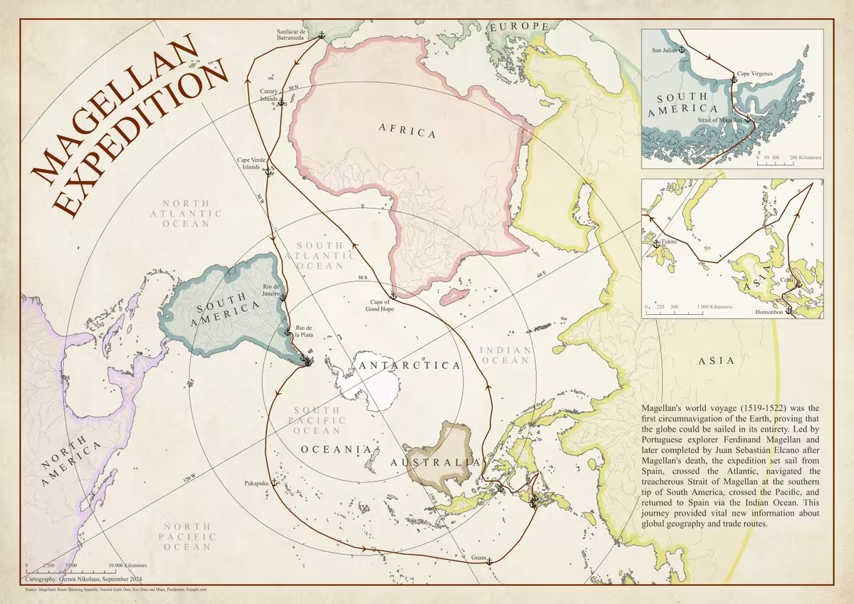
This map traces the historic voyage of Ferdinand Magellan and Juan Sebastián Elcano, known as the first successful circumnavigation of the globe, and shows key stops along the way in a vintage-style map design. 🗺️
Learn more: mapgallery.esri.com/submission-detail/38850?adusf=twitter…
🔸Map by: Gernot Nikolaus -
Esri
@Esri
Elevate your policy maps with these six cartographic tips! 🗺️ www.esri.com/arcgis-blog/products/arcgis-living-atlas/loc…
-
Esri
@Esri
Wishing you a very mappy holiday season and a wonderful new year!🎄🎁
This media couldn't be displayed. See it on the original post. -
Esri
@Esri
Each year, over 25 million Christmas trees are harvested in the U.S.🎄This map illustrates the number of trees sold by commercial tree farms in each county, as well as the national forests that offer permits for cutting your own tree.
🔸Explore the map: www.maps.com/where-christmas-trees-grow/?adusf=twitter&ad… -
Esri
@Esri
The holiday season is peak for fleet & delivery operations, facing challenges like cross-city moves & last-minute orders. See how two operations of the ArcGIS Routing service boosts delivery efficiency for retail & logistics organizations. 🛍️ 🚚 www.esri.com/arcgis-blog/products/developers/decision-sup…
-
Esri
@Esri
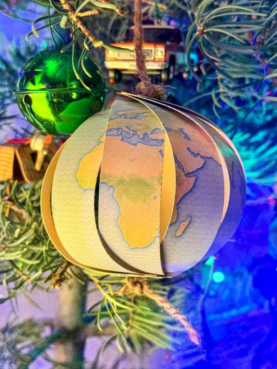
Dive into holiday crafting - geographer-style! 🌎 @John_M_Nelson guides you step-by-step in creating this festive globe ornament to brighten your holiday season. ✨ www.esri.com/arcgis-blog/products/arcgis-pro/mapping/make…
-
Esri
@Esri
✨The 2025 picks are in!
The @ArcGISStoryMaps community created 460,000+ new stories, collections, and briefings this year. Explore eight that stood out and learn the geospatial storytelling techniques that made them our favorites. storyscape-esriwhere.hub.arcgis.com/pages/2025-state-of-s…
#storyscape -
Esri
@Esri
For the geogeek 🤓 who loves resource materials, "A to Z GIS" is a must-have illustrated dictionary. With almost 3,000 terms, it's the definition of a perfect gift.🎁
Use code HOLIDAYS2025 for 30% off #esripress orders in the US and Canada through Dec 31: indiepubs.com/products/a-to-z-gis-9781589488113 -
Esri
@Esri
Ocean currents are vital to life on Earth, regulating climate and transporting nutrients and organisms. This animated map from @NASA’s Scientific Visualization Studio (SVS) highlights ocean currents at different depths. 🌊 www.maps.com/animated-ocean-currents-map-shows-currents-a…
This media couldn't be displayed. See it on the original post. -
Esri
@Esri
Treat yourself (or a friend) the gift of maps! 🎁🗺️ ArcGIS for Personal Use comes with everything you need to advance your career in GIS for just $100 a year. www.esri.com/en-us/arcgis/products/arcgis-for-personal-us…
-
Esri
@Esri
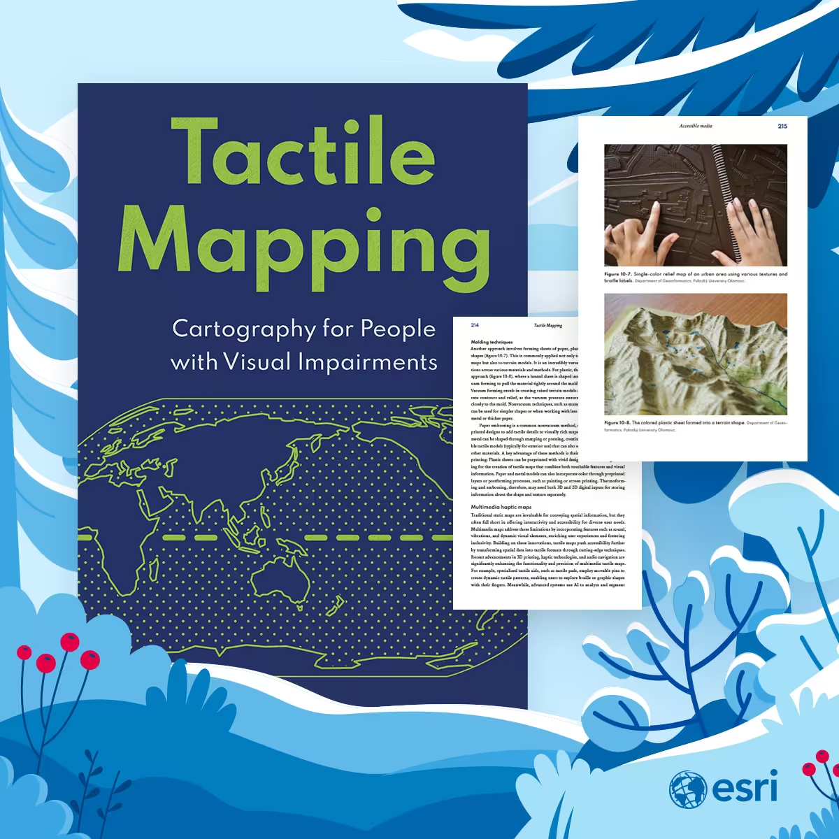
This holiday season, celebrate the inspiring stories of those driving inclusive map design. 🗺️ Discover the individuals who benefit from it with "Tactile Mapping".
Use code HOLIDAYS2025 for 30% off #esripress orders within the US & Canada through Dec 31: indiepubs.com/products/tactile-mapping-9781589488359 -
Esri
@Esri
Unlock the power of your geospatial data at Esri FedGIS! 🌎 Discover cutting-edge capabilities, grow your ArcGIS skills, and connect with your peers.
🔸Plan your agenda here: registration.esri.com/flow/esri/26fedgis/eventportal/page…
#fedgis2026 -
Esri
@Esri
Turnagain Pass, located in the beautiful Chugach National Forest on Alaska's Kenai Peninsula, is a popular winter destination for skiing and snowboarding enthusiasts. ⛷️
Explore the area's names and locations: mapgallery.esri.com/submission-detail/26410?adusf=twitter…
🗺️ Scott M. Norton -
Esri
@Esri
Give the gift of storytelling! 🎁 𝘛𝘦𝘭𝘭𝘪𝘯𝘨 𝘚𝘵𝘰𝘳𝘪𝘦𝘴 𝘸𝘪𝘵𝘩 𝘔𝘢𝘱𝘴 is essential for anyone interested in the powerful storytelling potential of maps.
Use code HOLIDAYS2025 for 30% off #esripress orders within the US & Canada through Dec 31: indiepubs.com/products/telling-stories-with-maps-97815894… -
Esri
@Esri
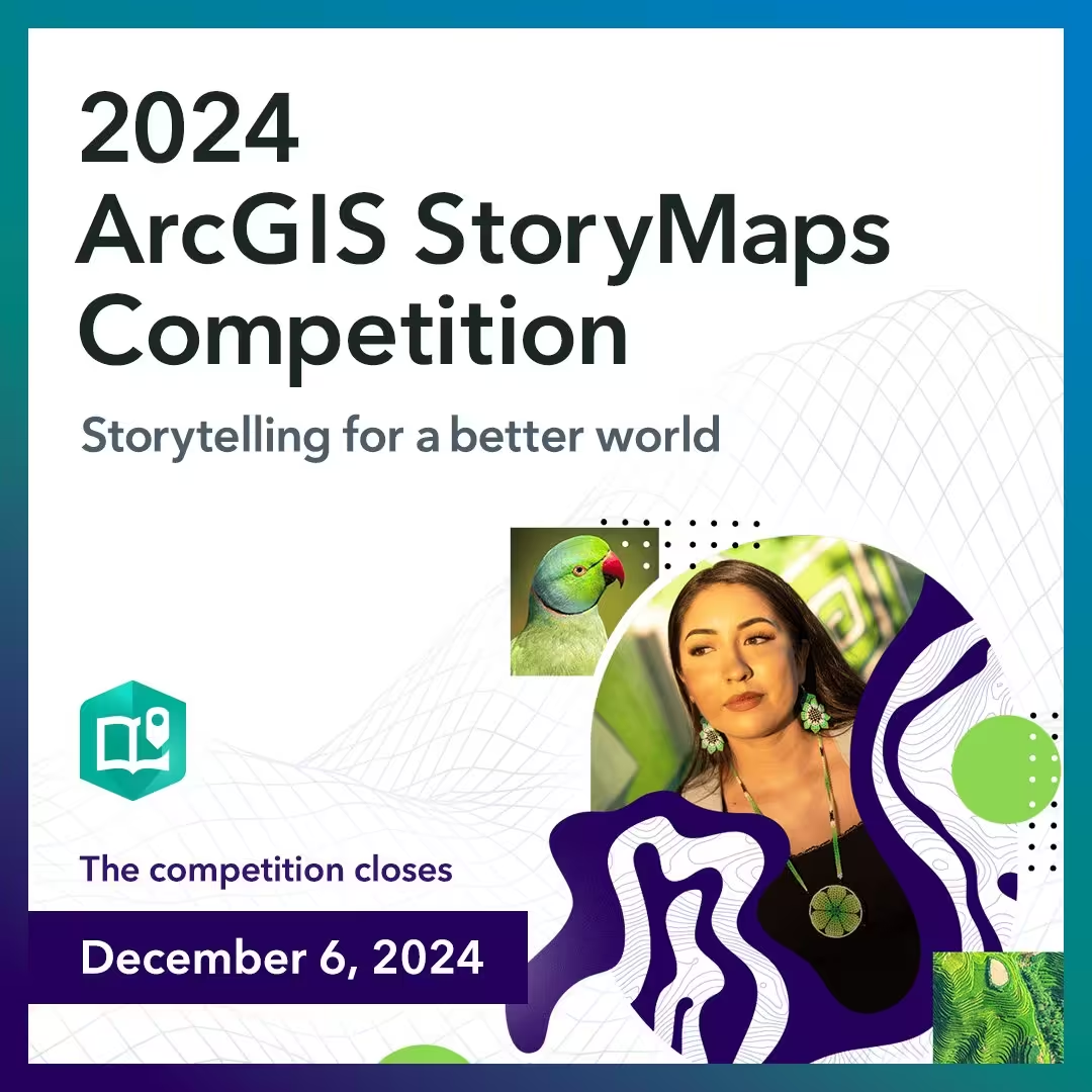
The countdown has begun! ⏰ The 2025 ArcGIS StoryMaps Competition closes in just FOUR days on Dec 12, at esri.com/storymaps/contest?adusf=twitter&aduc=esri&adut=d….
Add the final polish to your story with twelve team tips. www.esri.com/arcgis-blog/products/story-maps/constituent-…
#storymaps -
Esri
@Esri
How do you make a car-centric city cycle-friendly? 🚲 Here’s how the @CityofOstrava, Czech Republic, is gearing up their infrastructure to become bikeable with the help of GIS insights from MAPPA. www.esri.com/about/newsroom/arcnews/seeking-to-make-cycli…
-
Esri
@Esri
Inspire your favorite map nerd 365 days a year! 🗓️ This wall calendar shares 13 gorgeous maps that will inspire and delight year-round.
Use code HOLIDAYS2025 for 30% off Esri Press orders within the US and Canada through Dec 31: indiepubs.com/collections/esri-press/products/2026-esri-p…
#esripress -
Esri
@Esri
Dive into a world of innovation at the 2026 Esri Developer & Technology Summit! Engage with peers, learn best practices, and gain insights into the latest ArcGIS releases.
🔹Register: www.esri.com/en-us/about/events/devtech/registration?aduc…
#esridevtech2026 -
Esri
@Esri
Free flowing rivers of South America, part of @nature_org’s Annual Report & Map Book. The book features stories that illustrate The Nature Conservancy's use of geospatial technology for conservation.
🗺️ View the map and explore the book: mapgallery.esri.com/submission-detail/32608?adusf=twitter… -
Esri reposted
Esri Training
@EsriTraining
Our longest-running MOOC is 50 days away! 🥳
Join the free course in January to get free access to the latest @ArcGISOnline spatial analysis tools + grow your GIS skills.
Register: link.esri.com/7015x000000j5IFAAY/K6Kww5O?adusf=twitter&ad… -
Esri
@Esri
Transforming connections, one station at a time! 🚆 Italy’s rail network is evolving through location intelligence, reconnecting stations with their neighborhoods and strengthening sustainable mobility. www.esri.com/about/newsroom/blog/italian-rail-mobility-tr…
-
Esri
@Esri
Give the gift of hygge-ography this season!🧣☕️
Get cozy with a few of our favorite reads. Use code HOLIDAYS2025 for 30% off Esri Press orders within the US and Canada through Dec 31: indiepubs.com/collections/esri-press
#esripress -
Esri
@Esri
"The American Revolution is complicated. Maps make it easier to understand." 🗺️ Mike Welt from Florentine Films explains how cartography shaped @KenBurns’ @PBS docuseries, The American Revolution.
🔹Watch the live stream: www.youtube.com/watch?v=wv4PGbCPmOU&adusf=twitter&aduc=es…
#americanrevolutionpbsThis media couldn't be displayed. See it on the original post. -
Esri reposted
Fast Company
@FastCompany
Most African countries lack accurate local base maps, stalling all sorts of government and business decisions. A new project aims to create this vital resource. f-st.co/UQ0QQC6
-
Esri
@Esri
The Great State of Alaska by Greg Fiske. 🏔
Sentinel-2 mosaic with an added TopoBathy layer from ArcGIS Living Atlas. Learn about the special multiscale hillshade technique used for this map here: www.esri.com/arcgis-blog/products/arcgis-pro/mapping/mult… -
Esri
@Esri
Mappy Thanksgiving! We are so thankful for our amazing GIS professionals worldwide. 🫶🌎
This media couldn't be displayed. See it on the original post. -
Esri
@Esri
Norway’s grid just got a glow-up.⚡
Discover how Nordic grid operator @Tensionett upgraded their GIS infrastructure with Geodata to achieve reliable energy services, data sovereignty, and ongoing innovation. www.esri.com/en-us/arcgis/products/arcgis-enterprise/over… -
Esri
@Esri
Stumped on finding the right visual vibe for your map? 🌳 Get inspired by taking a virtual walk in the park with this map of tree symbology from Cindy Prostak. storymaps.arcgis.com/stories/a1272ed5c85642518222c543315a…
Which style did you fall for? 🍂
#30daymapchallenge -
Esri
@Esri
Take your drone mapping workflows to the next level! 🤩 Drone2Map now supports Gaussian Splats, a new 3D layer that adds highly realistic detail to your 3D maps.
🔹See what's new: www.esri.com/arcgis-blog/products/drone2map/imagery/whats… -
Esri
@Esri
Connect with your peers, discover the latest in GIS technology, attend workshops, and more! Join us at the 2026 Esri FedGIS, the premier geospatial professional development event for government.
🔸Register: www.esri.com/en-us/about/events/fedgis/registration?rsour… #fedgis2026 -
Esri
@Esri
This map shows the flow direction of major rivers in the contiguous US, overlaid with federally regulated dams, highlighting where significant water quantities are being dammed in relation to river flow. mapgallery.esri.com/submission-detail/34089?adusf=twitter…
🗺️ Adam Thomas, Johns Hopkins University -
Esri
@Esri
ArcGIS Maps for Microsoft Fabric is in public preview! 🙌🏽 Create interactive maps to visualize your data and enhance your analytics workflows with adaptive and intelligent mapping capabilities within @Microsoft Fabric.
🔸Learn more: www.esri.com/arcgis-blog/products/arcgis/analytics/whats-…
#msignite -
Esri
@Esri
From first jobs to dream careers! 🌍✨
To celebrate GIS Day, we asked GIS professionals to share their journey—from bagging groceries to mapping the world. Thank YOU for being a part of this wonderful community of changemakers.
#gisday2025This media couldn't be displayed. See it on the original post. -
Esri
@Esri
Wishing you a mappy GIS Day from all of us at Esri! 🌎
Today, we celebrate you—our dedicated GIS professionals—and the remarkable impact your work has on the world every day. How are you using GIS? We'd love to know! ❤️
#gisday2025 -
Esri
@Esri
Feeling nostalgic? 🧡
Try this groovy 1970s-inspired basemap, featuring ornate fonts and a burnt-orange and avocado green palette. www.esri.com/arcgis-blog/products/arcgis-living-atlas/map… -
Esri
@Esri
Get mapping + career advice from the experts! 🌎
Join a worldwide discussion on November 20 with the guest judges of the 2025 @ArcGISStoryMaps Competition.
🔹Register for the webinar: storymaps.arcgis.com/frames/d85117cad9274a1392bbf7b18be83…
#geographyweek #gisday2025 -
Esri
@Esri
Celebrate @GISDay! 🌎 Enjoy 30% off any available Esri Press book by using the code GISDAY30 here: publisher.indiepubs.com/esri-press?adusf=twitter&aduc=esr…
*Available for purchases in the US and Canada.
#gisday2025 -
Esri
@Esri
The latest in @ArcGISOnline is here! 🙌🏽 This update introduces exciting new capabilities in Map Viewer, AI assistants for Arcade, new labeling options, and other improvements.
🔸See what's new: www.esri.com/arcgis-blog/products/arcgis-online/announcem… -
Esri
@Esri
CalHeatScore is the first-of-its-kind system that ranks heat risk on a scale from 0 to 4 like ratings used for hurricanes. The cool part? Scores are given at the ZIP code level, helping people know when temperatures are too hot to handle. 🥵 www.esri.com/about/newsroom/arcnews/california-leads-the-…
-
Esri
@Esri
Get ready for @GISday on November 19! 🌎
Celebrate a day dedicated to exploring, learning, and sharing our passion for GIS. Here's a message from Jack Dangermond on why you should be a part of this special day. www.gisday.com/en-us/overview?adusf=twitter&aduc=esri&adu…
#gisday2025This media couldn't be displayed. See it on the original post. -
Esri
@Esri
45 years since its closure, Berlin’s Siemensbahn light-rail link is getting back on track with the help of 3D and GIS. 🚆 www.esri.com/about/newsroom/arcnews/3d-models-and-arcgis-…
#geobim -
Esri
@Esri
Dive into the mesmerizing river💧network of South America. Explore the intricate web of waterways, each with a catchment area exceeding 2000 square kilometers.
🔸Source: HydroRivers (www.hydrosheds.org?adusf=twitter&aduc=esri&adut=f0f5bc75-…)
🔸Map by: @Esri_de -
Esri
@Esri
Is your business strategy misaligned? See how this nationwide chiropractic provider cracked the code on growth. www.forbes.com/sites/esri/2025/10/31/how-mapping-and-anal…
-
Esri
@Esri
What insights can modern cartography reveal on 18th-century American history? 🗺️ Join Esri's Charlie Frye and Florentine Films for a live discussion on their map creation for @KenBurns' @PBS documentary, The American Revolution: www.linkedin.com/uas/login?session_redirect=https%3A%2F%2…
#americanrevolutionpbs -
Esri
@Esri
In November, we make maps. 🗺️💚
Each year, the coordinates align as mappers worldwide come together for GIS Day, geography week, and the 30-Day Map Challenge. And we're celebrating with 30 days of maps and the people who make them. storyscape-esriwhere.hub.arcgis.com/pages/2025-30-day-map…
#30daymapchallenge -
Esri
@Esri
A posh East Coast hideaway is plagued by a tiny pest that’s changing consumer behavior. How can geographic thinking solve this “ticky” situation? www.esri.com/about/newsroom/publications/wherenext/tick-t…
-
Esri
@Esri
You've heard of skeletons in the closet, but what about your maps? Here's how to make a haunting or "humerus" addition to your map. ☠️ www.esri.com/arcgis-blog/products/arcgis/mapping/shades-i…
-
Esri
@Esri
🦇 The famed bats of Austin migrate and so did the city's technology department. But rather than winging it, the City of Austin (@austintexasgov) took this strategic approach to going Pro. www.esri.com/en-us/lg/industry/government/stories/austin-…
-
Esri
@Esri
Gourd big or go home! 🎃 We're giving Globie's costume a 10/10. Mappy Halloween!
This media couldn't be displayed. See it on the original post. -
Esri
@Esri
Explore the eerie cemeteries of America's most visited national park, the Great Smoky Mountains. 🗻
Winner of "Best Cartography" at the 2020 Esri UC, this map takes you on a historical journey full of mystery and intrigue. mapgallery.esri.com/submission-detail/28607?adusf=twitter…
🗺️ Aaron Koelker -
Esri
@Esri
Dive into a spine-chilling adventure of cosmic proportions to map a Planet Eater (also known as an Octoplanet)! 🌎🦑
Hurry, or it may be your last mapping adventure. 👻 www.esri.com/arcgis-blog/products/arcgis/mapping/planet-e… -
Esri
@Esri
What can we learn from GIS professionals at innovative companies like @Google, @TJoesOfficial, and Crescent Energy? Get valuable insights on mentorship and learning in our WhereNext webcast on November 13.
🔹Register to watch: www.esri.com/en-us/webinars/publications/wherenext-webcas… -
Esri
@Esri
Indulge your inner geogeek for @GISDay with 30% off available Esri Press books! 📚 Use GISDAY30 here: publisher.indiepubs.com/esri-press?adusf=twitter&aduc=esr…
*Available for purchases in the US and Canada.
#gisday2025 -
Esri
@Esri
👋 Are you a new #arcgisenterprise admin?
Need to quickly learn how to plan, deploy, use, and maintain Enterprise?
This one's for you! "Getting to Know ArcGIS Enterprise" written by Esri experts, covers essential workflows you need: www.esri.com/en-us/esri-press/browse/getting-to-know-arcg… -
Esri
@Esri
Get mapping + career advice from the experts! 🗺️ 🙌🏽 Join our worldwide webinar to meet the guest judges of the 2025 @ArcGISStoryMaps Competition.
🔹Learn more: www.esri.com/arcgis-blog/products/arcgis-storymaps/sharin…
#storymaps #livingatlas -
Esri
@Esri
Discover how ArcGIS Geocoding can validate and standardize addresses, leading to better decision-making and smoother workflows. 📖 Ideal for logistics, customer data, or field operations.
🔸Learn more: www.esri.com/arcgis-blog/products/arcgis/decision-support… -
Esri
@Esri
What does it take to map American history? 📜 Join us for a discussion with Esri cartographer Charlie Frye to learn about insights from the maps developed for the @KenBurns @PBS documentary, The American Revolution. www.linkedin.com/uas/login?session_redirect=https%3A%2F%2…
#americanrevolutionpbs -
Esri
@Esri
Want to create ✨STUNNING✨ maps? Say less!
@John_M_Nelson shows how he created these Imhof-inspired maps in ArcGIS Online using Imagery and Terrain layers available in ArcGIS Living Atlas. www.esri.com/arcgis-blog/products/arcgis-living-atlas/map… -
Esri
@Esri
The mappiest day of the year is November 19! 🌎 How will you celebrate? Register your event and receive three free ArcGIS for Personal Use licenses: www.gisday.com/en-us/overview?adusf=twitter&aduc=esri&adu…
*𝘊𝘰𝘥𝘦𝘴 𝘧𝘰𝘳 𝘧𝘳𝘦𝘦 𝘭𝘪𝘤𝘦𝘯𝘴𝘦𝘴 𝘸𝘪𝘭𝘭 𝘣𝘦 𝘴𝘦𝘯𝘵 𝘪𝘯 𝘕𝘰𝘷𝘦𝘮𝘣𝘦𝘳.
#gisday2025 -
Esri
@Esri
It’s about as close as you can get to a real-life magic school bus! 🚌 @AU_Geo’s mobile science lab is bringing #stem to K-12 students across Alabama. www.esri.com/about/newsroom/arcwatch/science-on-the-move-…
-
Esri
@Esri
Want to create a more user-friendly web map? 🗺️ Here are five tips and tricks for customizing your layers and maps that don't take much time. www.esri.com/arcgis-blog/products/arcgis-online/mapping/t…
-
Esri
@Esri
GIS + Imagery
Learn how to drive smarter decisions and transform static images into dynamic digital representations! The free course opens October 22.
🔹Register here: www.esri.com/en-us/training/catalog/68250ef99d321b7e769b5… -
Esri
@Esri
Introducing basemap sessions for ArcGIS Location Platform! 🙌🏼 A new way to optimize usage costs when building mapping applications that use a high volume of basemap tiles.
🔹Learn more: www.esri.com/arcgis-blog/products/platform/announcements/… -
Esri
@Esri
🦦 Protect river otters.
🛣️ Plan roadways.
🎨 Support local artists.
The 2025 @ArcGISStoryMaps Competition opened 1 month ago—and already, we've received inspiring stories from 14 countries! Find resources to build your story and submit by Dec. 12: storymaps.arcgis.com/stories/16664ea10d654dcb9b548611e303… -
Esri
@Esri
Want to know how your maps can benefit from ArcGIS geocoding capabilities? Esri's Jeff Rogers explores the numerous ways geocoding can transform your maps. 🗺️ www.esri.com/arcgis-blog/products/arcgis/decision-support…
-
Esri
@Esri
Thinking about going electric? 🚙⚡️Utilities in Ontario are using spatial analysis to help you decide if an EV fits your lifestyle. Listen how in our latest podcast episode. www.esri.com/about/newsroom/podcast/ensuring-infrastructu…
-
Esri
@Esri
Spooky season is upon us! 🎃 Looking for a basemap that radiates spooky autumnal energy? Check out this Halloween-themed basemap, perfect for all your fall adventures. www.arcgis.com/home/item.html?id=ffc0267907224943840e3815…
-
Esri
@Esri
Explore the synergy between artificial intelligence and GIS! 🌎
Find out how organizations are using GIS and AI to improve sustainability, efficiency, and growth across various sectors. www.esri.com/en-us/esri-press/browse/geoai-artificial-int… -
Esri
@Esri
A story can inform, advocate, and inspire—but only when it reaches its audience.
See how different authors deliver bilingual or multilingual stories in ArcGIS #storymaps. storyscape-esriwhere.hub.arcgis.com/pages/stories-in-tran…
#storyscape -
Esri
@Esri
Dr. Jane Goodall was an extraordinary champion for nature. We’re grateful for her lifelong commitment to make the world better. She holds a special place at Esri as a friend and advocate for using technology to protect our world. Her inspiration will always remain in our hearts.
-
Esri
@Esri
How does a digital twin transform an airport? ✈️ Explore how @flySFO geospatial approach keeps flights on time and travelers happy. www.esri.com/about/newsroom/podcast/how-san-francisco-int…
#sfo #bim #digitaltwinThis media couldn't be displayed. See it on the original post. -
Esri
@Esri
Free, customizable and reliable data. 🙌
The new American Survey layers in Living Atlas will be updated in just a few months — and we want your input! Take our quick survey to help shape the future: survey123.arcgis.com/share/cbedf1181290409f9c8a01423ac85125 -
Esri
@Esri
Big changes can come with big rewards. Here’s how the @TNCOT got 72 counties on board with ArcGIS Pro for better collaboration, communication, and productivity. www.esri.com/about/newsroom/arcnews/tennessee-migrates-72…
#arcgispro -
Esri
@Esri
Elevate your policy maps with these six cartographic tips! 🗺️ www.esri.com/arcgis-blog/products/arcgis-living-atlas/loc…
-
Esri
@Esri
How one major retailer predicted what to stock during the 2024 total solar eclipse 🌒 before the first shadow fell: www.forbes.com/sites/esri/2025/09/24/because-where-matter…
#gis #solareclipse -
Esri
@Esri
Ebro Delta, Catalonia - the Iberian Peninsula's second longest river at 930 km! The Ebro River Delta is shown in infrared using Sentinel 2A bands: vibrant orange & red for vegetation, dark blue for clear water, & cyan for turbid water. mapgallery.esri.com/submission-detail/40047?adusf=twitter…
🗺️ Andrea Cappai -
Esri
@Esri
Discover the beauty of geography and maps with the 2026 wall calendar from Esri Press! 😍 Each month features a beautiful map, insights from the cartographers, fun facts, and more:
www.esri.com/en-us/esri-press/browse/2026-esri-press-wall… -
Esri
@Esri
In Germany, the city of Stuttgart's Smart City Concept aims to improve urban planning with a cutting-edge 3D city model with help from aerial mapping company, GeoFly GmbH. www.esri.com/arcgis-blog/products/arcgisrealitystudio/ima…
-
Esri
@Esri
Spatial digital twins are essential for urban planning, infrastructure, and sustainability, providing real-time insights and fostering innovation.💡See how the Digital Twin of Zürich in Switzerland was created and how it can be used across applications. storymaps.arcgis.com/stories/b43b415b07ff4f858f8091e9bbca…
This media couldn't be displayed. See it on the original post. -
Esri
@Esri
Learn GIS for good. 🌍💚
We use maps daily for weather, directions, and finding the best pumpkin spice latte spots.
Go beyond the digital maps in your pocket and use GIS to address our biggest challenges. Start with the basics: storyscape-esriwhere.hub.arcgis.com/pages/back-to-school-…
#storyscape -
Esri
@Esri
Justice for penguins. 🐧⚖️ When a rancher bulldozed more than 175 penguin nests in Argentina, maps and satellite imagery helped prosecutors win the case and expand wildlife protection by 8x. www.esri.com/about/newsroom/blog/penguin-environmental-ju…
-
Esri
@Esri
Discover the vast landscape of commercial tree crops across Australia.🌳 This map gives area stats by state or local government area with functionalities including zooming-in for more details like crop type & location info. mapgallery.esri.com/submission-detail/28972?adusf=twitter…
🗺️ University of England, AARSC -
Esri
@Esri
It’s here—the 2025 ArcGIS StoryMaps Competition! 🎉
Use ArcGIS Living Atlas and @ArcGISStoryMaps to tell YOUR story—about people, the infrastructure we build, and the impacts on our natural world.
🔹Get the details: www.esri.com/arcgis-blog/products/arcgis-storymaps/announ…This media couldn't be displayed. See it on the original post. -
Esri
@Esri
The seemingly impossible made possible! 🗺️ Create a map inspired by AI that uses real geographic data. Put your artistic skills to the test with this how-to tutorial. www.esri.com/arcgis-blog/products/arcgis-living-atlas/map…
-
Esri
@Esri
Curious about deep learning? Interested in statistics and Python? Our Spatial Data Science MOOC has something for everyone!
🔸Sign up: www.esri.com/en-us/training/catalog/5d76dcf7e9ccda09bef61… -
Esri
@Esri
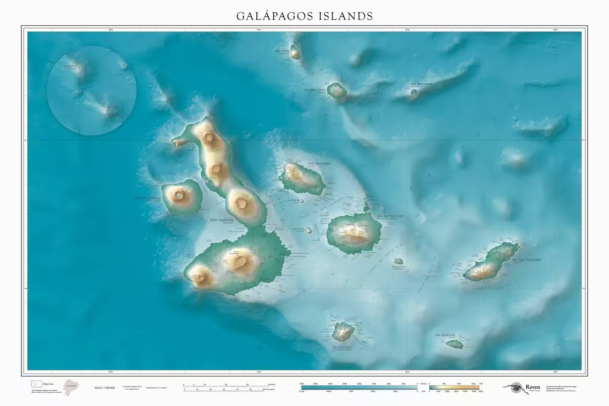
This incredible map by Raven Maps & Images presents the geography of the Galápagos Islands like never before, using hypsometric tinting and intricate shaded relief to highlight the topography of each island. 🏝️
🔹See the full map: mapgallery.esri.com/submission-detail/39822?adusf=twitter… -
Esri
@Esri
How can mapmakers make maps more accessible? 🗺️ How can new media like web, mobile apps, and 3D printing be used?
Discover the fascinating work behind tailoring geographic info for people with visual impairments in 𝘛𝘢𝘤𝘵𝘪𝘭𝘦 𝘔𝘢𝘱𝘱𝘪𝘯𝘨. www.esri.com/en-us/esri-press/browse/tactile-mapping-cart… -
Esri
@Esri
From wildfires to wellness — GIS is changing the game. See how organizations like @CVSHealth and @CAL_FIRE are leading the way. www.esri.com/about/newsroom/arcwatch/gis-success-stories-…
-
Esri
@Esri
High-quality data is vital for business success. ✨
Get insight into the work involved in developing Esri Demographics, and the significance of top-notch data driving impactful decisions. www.esri.com/arcgis-blog/products/esri-demographics/decis… -
Esri
@Esri
Embrace the charm of a good vignette! 📸 Enhance your @ArcGISPro map with this old photographer's darkroom trick that draws the eye in and frames your composition beautifully. www.esri.com/arcgis-blog/products/arcgis-pro/mapping/vign…
-
Esri
@Esri
Did you know? The U.S. has over 618,000 motor-vehicle-carrying bridges. 🌉 While most aren’t as iconic as the Golden Gate or Brooklyn, they’re vital to the nation's transportation network. storymaps.arcgis.com/stories/92b2ae1a9f11492189d6e9b5fa8a…
-
Esri
@Esri
Explore how GeoAI is helping organizations better address business and societal issues effectively. Delve into real-life stories for inspiration and insights to kickstart your journey into the world of GeoAI. ✨ www.esri.com/en-us/esri-press/browse/geoai-artificial-int…
-
Esri
@Esri
⚽️ "Less than a mile from the center of town, a famous old stadium's *no longer* crumbling down."
See how @Wrexham_AFC is teaming up with ArcGIS GeoBIM technology to transform their historic stadium into a modern masterpiece. www.forbes.com/sites/esri/2025/08/19/wrexham-how-one-stad… -
Esri
@Esri
Exploring journeys of the Arctic Fox! 🦊
Using Argos satellite tracking data, this map depicts foxes traveling away from Bylot Island, Nunavut, Canada, or 'long distance dispersal'. Explore the full map: mapgallery.esri.com/submission-detail/33094?adusf=twitter…
🗺️ Amanda Robinson, @GISCI_GISP -
Esri
@Esri
Love vintage maps? 🗺️ Create your own vintage-style basemap in ArcGIS Pro using layers from Living Atlas. www.esri.com/arcgis-blog/products/arcgis-living-atlas/map…
-
Esri
@Esri
Good things come in threes! Our fall MOOC lineup is here. Save your spot for these free courses:
🗺️ Cartography.
Aug 27–Oct 8
www.esri.com/en-us/training/catalog/596e584bb826875993ba4…
📈 Spatial Data Science
Sept 17–Oct 29
www.esri.com/training/catalog/5d76dcf7e9ccda09bef61294/sp…
🌎 The ArcGIS Imagery MOOC
Oct 22–Dec 3
www.esri.com/en-us/training/catalog/68250ef99d321b7e769b5… -
Esri
@Esri
Discover the magic of 𝘛𝘦𝘭𝘭𝘪𝘯𝘨 𝘚𝘵𝘰𝘳𝘪𝘦𝘴 𝘸𝘪𝘵𝘩 𝘔𝘢𝘱𝘴, your essential guide to unlocking the storytelling potential of maps. 🌍📖
Learn more: www.esri.com/en-us/esri-press/browse/telling-stories-with…This media couldn't be displayed. See it on the original post. -
Esri
@Esri
The Global Mangrove Layer is now available in ArcGIS Living Atlas! 🌎
Developed by the @NASA Carbon Monitoring System, it provides a detailed view of mangroves to help you map, monitor, and understand mangrove coverage globally. www.esri.com/arcgis-blog/products/arcgis-living-atlas/ima… -
Esri
@Esri
Sentinel-2 Explorer will show you the world in screaming color! 🫶🏼 Experience unprecedented ease of use and accessibility to the full archive of Sentinel-2 Level-2A science products.
🔸Discover all the modes of Sentinel-2 Explorer: www.esri.com/arcgis-blog/products/arcgis-living-atlas/ima… -
Esri
@Esri
How do you use GIS tools and geospatial data? 🌎
Use #arcgislivingatlas content to tell a story—about people, the infrastructure we build, and the impacts on our natural world.
Then submit it to the 2025 ArcGIS #storymaps Competition! storymaps.arcgis.com/stories/16664ea10d654dcb9b548611e303… -
Esri
@Esri
This beautiful map features global tide ranges - illustrating the difference between the lowest low tide and highest high tide. 🌊 It uses the Spilhaus projection to focus on the oceans.
Learn more: mapgallery.esri.com/submission-detail/40100?adusf=twitter…
🗺️ Dave Taylor, Pathfinder Geospatial -
Esri
@Esri
How can mapmakers make maps more accessible? 🗺️ 𝘛𝘢𝘤𝘵𝘪𝘭𝘦 𝘔𝘢𝘱𝘱𝘪𝘯𝘨 provides expert insights, case studies, and personal stories on improving map accessibility for visually impaired individuals. www.esri.com/en-us/esri-press/browse/tactile-mapping-cart…
-
Esri
@Esri
🐟🌊 Explore the hidden lives of marine species — from baby fish in surface slicks to migrating turtles and iconic predators.
And discover how mapping and GIS tools help us safeguard these vital ocean ecosystems. storyscape-esriwhere.hub.arcgis.com/pages/mapping-marine-…
#storyscape #storymaps -
Esri
@Esri
Captivate your audience with a charming cross stitched style map! 🗺️✨Here's how you can make it in ArcGIS Pro: www.esri.com/arcgis-blog/products/arcgis-pro/mapping/make…
-
Esri
@Esri
Could a career in remote sensing be your calling? 📡
Get career insights and advice on breaking into the field in this expert Q&A with Sheridan Moore: www.esri.com/about/newsroom/arcwatch/careers-in-remote-se… -
Esri
@Esri
Coastal earthquakes can cause tsunamis. @NOAA's Pacific Tsunami Warning Center models show how tsunamis focus energy in directional "beams," leading to maximum sea-level rise and potential damage.
Learn more: storymaps.arcgis.com/stories/0d38da09a47e42729ddbd86a6910…
🇨🇱 Chile (Valdivia), M9.5, May 22, 1960 -
Esri
@Esri
From precision agriculture to life-saving organ transplants, drones continue to play a critical role in mapping and beyond. Hear more in the latest episode of Esri + The Science of Where podcast. 🎧 www.esri.com/about/newsroom/podcast/how-geospatial-techno…
-
Esri
@Esri
Try our pretrained deep learning models: livingatlas.arcgis.com/en/browse/?q=dlpk+detection&adusf=…. There are more than 50 to choose from, including:
🏠 Building footprint extraction
🚗 Road extraction
🏊♀️ Swimming pool detection
🌴 Palm tree detection
🦭 Arctic seal detection (yeah, it’s real!) -
Esri
@Esri
𝘛𝘰𝘱 20 𝘌𝘴𝘴𝘦𝘯𝘵𝘪𝘢𝘭 𝘚𝘬𝘪𝘭𝘭𝘴 𝘧𝘰𝘳 𝘈𝘳𝘤𝘎𝘐𝘚 𝘌𝘹𝘱𝘦𝘳𝘪𝘦𝘯𝘤𝘦 𝘉𝘶𝘪𝘭𝘥𝘦𝘳 is now available in paperback and ebook format! Learn how to design and create visually stunning and highly functional map apps.
🔸Explore the book: www.esri.com/en-us/esri-press/browse/top-20-essential-ski… -
Esri
@Esri
Ready to take your indoor mapping game to the next level? With reality capture, creating your own GIS app has never been easier! 🤩 Learn how to transform your space into a fully interactive experience in four steps. www.esri.com/about/newsroom/arcuser/building-indoor-gis-w…
-
Esri
@Esri
High-quality data is vital for business success. ✨
Kyle Cassal discusses the creation of Esri Demographics and highlights the significance of top-notch data driving impactful decisions. www.esri.com/arcgis-blog/products/esri-demographics/decis… -
Esri
@Esri
Discover the beauty of geography and maps with this 2026 wall calendar! 😍 Each month features a beautiful map, insights from the cartographers, fun facts, and more. www.esri.com/en-us/esri-press/browse?rsource=https%3A%2F%…
#esripress -
Esri
@Esri
How do you manage a college campus the size of a small city? 🏢 @UCSanDiego is optimizing campus management and development with location intelligence. www.esri.com/about/newsroom/arcwatch/university-manages-c…
-
Esri reposted
Esri Chile
@EsriChile
La semana pasada fue la #esriuc2025, el evento más grande del mundo dedicado a los SIG, y nuestra delegación de Esri Chile fue parte de esta gran instancia 🌎🌐
Nuestro equipo pudo conocer los últimos avances en ArcGIS, innovaciones en IA, casos globales de uso real y más 💡🌟 -
Esri
@Esri
The Grand Paris Express is Europe’s largest infrastructure project. 🚆 What’s keeping this megaproject on track and on time? GEOBIM.
🔹Read our latest in @Forbes: www.forbes.com/sites/esri/2025/07/04/the-tech-solving-inf… -
Esri reposted
Esri User Conference
@EsriUC
What an incredible week! 🌎 Thank you for making this another memorable and mappy UC. Your work truly inspires us. ✨ We'll see you in 2026!
#esriuc2025This media couldn't be displayed. See it on the original post. -
Esri reposted
Esri User Conference
@EsriUC
Jack and Laura thank you for making this a truly unforgettable Esri UC! 🌎 We’re inspired to see the impactful and innovative ways you’re using GIS to integrate everything, everywhere for a better future.
#esriuc2025 -
Esri
@Esri
Collaboration goals unlocked. 🔓 🙌🏽 Make a layer editable for you and your team in just 10 minutes with these steps: www.esri.com/about/newsroom/arcwatch/make-a-layer-editabl…
-
Esri
@Esri
The @EsriUC Plenary Session videos are available! 🗺️ See the latest in ArcGIS technology, cool demos, and be inspired by the amazing stories showcasing the remarkable work of our user community. mediaspace.esri.com/channel/2025%2BEsri%2BUser%2BConferen…
#esriuc2025This media couldn't be displayed. See it on the original post. -
Esri reposted
Esri User Conference
@EsriUC
We are truly inspired by the remarkable work you're accomplishing with GIS. 🌎 Let's continue to fuel this inspiration. Like what you saw in the Plenary? Add these sessions to your agenda: www.esri.com/arcgis-blog/products/arcgis/announcements/re…
#esriuc2025 -
Esri
@Esri
It’s here—the 2025 ArcGIS StoryMaps Competition! 🙌🏽
This year, Esri’s #storymaps and #livingatlas are teaming up as your cohosts.
Join the fun, learn dataviz skills, and share your story. www.esri.com/en-us/arcgis/products/arcgis-storymaps/conte… -
Esri
@Esri
Today is the big day! 🙌🏼 Don't miss the @EsriUC Plenary Session live stream at 8:30 AM PDT. See the latest advancements in ArcGIS technology, cool demos, and hear incredible stories from global innovators using GIS.
🔹Watch here: uc2025.esri.com/flow/esri/25uc/eventportal/page/live?aduc…
#esriuc2025 -
Esri
@Esri
Want to learn ArcGIS Experience Builder from Esri experts? No prior experience needed. 😎
"Top 20 Essential Skills for ArcGIS Experience Builder" guides readers step-by-step through the process of creating visually stunning, highly functional apps. www.esri.com/en-us/esri-press/browse/top-20-essential-ski… -
Esri
@Esri
Explore mapping hacks! 🗺️ Esri's Lauren Tierney prepares to map future snowstorms efficiently by testing data processing and design decisions in a whole new location. The result? Mapping an event in a timely manner.
Follow her process and tips here: www.esri.com/arcgis-blog/products/arcgis-pro/mapping/mapp… -
Esri
@Esri
The Esri UC is a few days away! 🙌🏽 Hear incredible stories from global innovators using GIS, amazing demos, and the latest advancements in ArcGIS. Watch the Plenary Session live stream on Monday, July 14 at 8:30 AM PDT.
🔹Sign up: uc2025.esri.com/flow/esri/25uc/reglandingPlenaryOnly/logi…
#esriuc2025 -
Esri reposted
GitHub
@github
Wildfires have become a year-round threat. But technology and collaboration are making a difference.
Watch how @SBCOUNTYFIRE, @Esri, and the open source community on GitHub use real-time data to help firefighters stay ahead of the blaze and protect our communities.This media couldn't be displayed. See it on the original post. -
Esri
@Esri
Nottingham, England is embracing the future of city planning with a digital twin. Using visualization tech, data analysis, and collaboration, they're transforming the cityscape for urban development. 🏙️ www.esri.com/about/newsroom/arcuser/nottinghams-digital-t…
-
Esri
@Esri
Get a detailed understanding of U.S. neighborhoods with the third generation of #arcgistapestry. 🏘️ You'll also get a chance to download and print the brand-new 2025 ArcGIS Tapestry poster! www.esri.com/arcgis-blog/products/esri-demographics/annou…
-
Esri
@Esri
Got an hour? Learn how to navigate the @uscensusbureau website to find demographic data and visualize it in ArcGIS Online. learn.arcgis.com/en/projects/download-census-data/?adusf=…
-
Esri
@Esri
Check out this great resource for the latest in ArcGIS technology and much more. 😉
Esri User Conference
@EsriUC
The Esri UC Q&A is available! 🙌🏽 Explore this fantastic resource for answers to your questions, insights into the newest Esri tech, emerging GIS trends, and what's coming next. www.esri.com/en-us/about/events/uc/plan/q-a?aduc=Social&s…
#esriuc2025 -
Esri
@Esri
How do you get the largest wind energy project in the Western Hemisphere off the ground? For Pattern Energy's SunZia project, the answer was GIS. www.esri.com/about/newsroom/arcuser/location-intelligence…
#drones #renewableenergy -
Esri
@Esri
The latest @ArcGISOnline update is here! 🙌🏽
🔸Enhanced user types to better fit your needs & roles.
🔸Streamlined Analysis Workflows
🔸Dive deeper into imagery with the powerful tools in ArcGIS Excalibur.
🔹Learn more: www.esri.com/arcgis-blog/products/arcgis-online/announcem… -
Esri
@Esri
Now available! 🙌🏼 ArcGIS for Autodesk Forma.
Enhance your pre-design and design workflows in @Autodesk Forma by seamlessly integrating maps, layers, and other spatial data from ArcGIS—all within a single design environment.
🔸Learn more: www.esri.com/en-us/arcgis/products/arcgis-for-autodesk-fo…
#autodeskforma -
Esri
@Esri
Newly released! 🙌🏽
Designed for experienced GIS professionals, 𝘌𝘴𝘳𝘪 𝘈𝘥𝘷𝘢𝘯𝘤𝘦𝘥 𝘎𝘶𝘪𝘥𝘦 𝘵𝘰 𝘗𝘺𝘵𝘩𝘰𝘯 𝘪𝘯 𝘈𝘳𝘤𝘎𝘐𝘚, covers topics like #arcpy, object-oriented programming, data engineering, and more.
Curious? See sample pages: www.esri.com/en-us/esri-press/browse/esri-advanced-guide-… -
Esri
@Esri
Sharpen your GIS skills at this year's @EsriUC! 🌎
🔸Choose from hundreds of sessions
🔸See the latest ArcGIS technology
🔸Get expert advise
🔸Discover techniques & tools to enhance your GIS work
Register: www.esri.com/en-us/about/events/uc/registration?aduc=Soci…
#esriuc2025This media couldn't be displayed. See it on the original post. -
Esri
@Esri
It's World Hydrography Day! 🌎🌊 A day to recognize the vital role of hydrography in understanding and managing our ocean. Discover how ArcGIS empowers smarter seabed mapping and sustainable ocean action.
www.esri.com/arcgis-blog/products/arcgis/announcements/ce…
#worldhydrographyday -
Esri
@Esri
👀 Searching for a single, comprehensive resource for ArcGIS Utility Network?
Look no further, "Top 20 Essential Skills for ArcGIS Utility Network" is here! With topics based on user input and questions, this is your go-to guide.
👉🏽 www.esri.com/en-us/esri-press/browse/top-20-essential-ski… -
Esri
@Esri
Friends don’t let friends fall behind in technology. We’ll be there for you when ArcGIS Desktop (ArcMap) retires. www.esri.com/en-us/arcgis/products/arcgis-desktop/overvie…
-
Esri
@Esri
Choosing the right spot for your business can make or break your success. By tapping into mapping and analytics tools, companies can foresee risks, fine-tune supply chains, and pick prime locations smartly.
🔸Learn more: www.forbes.com/sites/esri/2025/06/06/the-missing-piece-in… -
Esri
@Esri
🐕🦺 Sniffing out mines is all in a day’s work for dogs of the APOPO (@herorats). These highly trained heroes are safely unleashed with the help of GIS to support recovery and development efforts in war-affected areas. www.esri.com/about/newsroom/arcuser/canines-clear-minefie…
-
Esri
@Esri
Prepare for takeoff! 🪂
Catch all the action from @RedBullXAlps adventure race beginning June 15. Tune in using the 3D Live Tracking App powered by ArcGIS to watch the action live: www.redbullxalps.com/int-en/3d-live-tracking
#poweredbyesri #redbullxalps2025 -
Esri
@Esri
Grenada uses ArcGIS Image for ArcGIS Online to host imagery, make 3D basemaps, and perform AI-based feature extraction and land clover classification.
🏝️ See how Grenada’s digital twin was made: www.esri.com/arcgis-blog/products/arcgis-online/imagery/e… -
Esri
@Esri
Spatial digital twins are essential for urban planning, infrastructure, & sustainability, providing real-time insights & fostering innovation.💡
See how the Digital Twin of Zürich in Switzerland was created and how it can be used across applications. storymaps.arcgis.com/stories/b43b415b07ff4f858f8091e9bbca…This media couldn't be displayed. See it on the original post. -
Esri
@Esri
We've mapped nations and planets. But only one-fifth of the seabed 🌊 has been mapped in high-resolution. Dr. Dawn Wright (@deepseadawn) explains why mapping the world's ocean is key to keeping it healthy.
🎧Listen to the podcast: www.esri.com/about/newsroom/podcast/mapping-the-deep-an-o…
#worldoceanday -
Esri
@Esri
The countdown is on! ⏰ @EsriUC is a few weeks away and we can't wait to see you in San Diego. Dive into the world of maps, data, and all things GIS.
🔹Register: www.esri.com/en-us/about/events/uc/overview?aduc=Social&s…
#esriuc2025This media couldn't be displayed. See it on the original post. -
Esri
@Esri
When mudslides from heavy rain blocked Oahu's Pali Highway, Dudek deployed GIS powered drones to quickly clear the vital route linking Honolulu to Kailua. www.esri.com/about/newsroom/arcuser/gis-and-drones-bring-…
-
Esri
@Esri
Take your Python skills to the next level with 𝘌𝘴𝘳𝘪 𝘈𝘥𝘷𝘢𝘯𝘤𝘦𝘥 𝘎𝘶𝘪𝘥𝘦 𝘵𝘰 𝘗𝘺𝘵𝘩𝘰𝘯 𝘪𝘯 𝘈𝘳𝘤𝘎𝘐𝘚. 😎
This new guide tailored for professionals will quickly help you advance your Python skills for geospatial solutions. www.esri.com/en-us/esri-press/browse/esri-advanced-guide-… -
Esri
@Esri
Ready to hit the road? 🚘
Celebrate the joy of summer vacation with award-winning stories about road trips and adventures in the great outdoors. Start your journey with national parks: storyscape-esriwhere.hub.arcgis.com/pages/hitting-the-roa…
📸 Lauren Tierney (@tierneyl), Esri -
Esri
@Esri
Check out the Sentinel-2 Explorer in ArcGIS Living Atlas! It provides unprecedented ease of use and accessibility to the full archive of Sentinel-2 Level-2A science products.
🔹Explore the various modes of Sentinel-2 Explorer: www.esri.com/arcgis-blog/products/arcgis-living-atlas/ima… -
Esri
@Esri
Dive into fascinating anecdotes about mapmaking at @NatGeo & the beginnings of @ArcGISStoryMaps while understanding the theory & practice of in 𝘛𝘦𝘭𝘭𝘪𝘯𝘨 𝘚𝘵𝘰𝘳𝘪𝘦𝘴 𝘸𝘪𝘵𝘩 𝘔𝘢𝘱𝘴.
🔸Check out sample pages: www.esri.com/en-us/esri-press/browse/telling-stories-with… -
Esri
@Esri
Before they could protect their vital wetlands, @TNEnvironment first needed to find all of them with GeoAI. www.esri.com/about/newsroom/arcnews/tennessee-pioneers-ge…
-
Esri
@Esri
Captivate your audience with a charming cross stitched style map! 🗺️✨Here's how you can make it in ArcGIS Pro: www.esri.com/arcgis-blog/products/arcgis-pro/mapping/make…
-
Esri
@Esri
What sort of species live in your area? It's a valid question on #biodiversityday. Learn how the Map of Life project is using high tech methods to create a global map of biodiversity.
-
Esri
@Esri
⚡️America's 54 nuclear power plants generate nearly 1/5 of its total electricity.
This story visualizes the geography of the U.S. nuclear sector and the role it may play in country’s energy future. arcg.is/0jKmTC0
#storymapsThis media couldn't be displayed. See it on the original post. -
Esri
@Esri
Imagine walking through a new building before it's been built. 🤯
Here's how digital twins are giving planners the edge to experiment and perfect projects before ever breaking ground. www.forbes.com/sites/esri/2025/05/20/the-invisible-techno…
#aec #urbanplanning -
Esri
@Esri
𝘛𝘦𝘭𝘭𝘪𝘯𝘨 𝘚𝘵𝘰𝘳𝘪𝘦𝘴 𝘸𝘪𝘵𝘩 𝘔𝘢𝘱𝘴 uses Allen Carroll’s unique experiences working at @NatGeo and Esri to explain the theory and practice of creating compelling, engaging place-based narratives.
🔸See sample pages: www.esri.com/en-us/esri-press/browse/telling-stories-with… -
Esri
@Esri
Get ready for the biggest GIS event of the year! 🌎
Enhance your ArcGIS skills at this year's @EsriUC. Dive into a week filled with technical sessions, networking, and of course...maps!
🔸Register: www.esri.com/en-us/about/events/uc/overview?aduc=Social&s…
#esriuc2025This media couldn't be displayed. See it on the original post. -
Esri
@Esri
Ready to go Pro? 🙌🏼
𝘎𝘐𝘚 𝘛𝘶𝘵𝘰𝘳𝘪𝘢𝘭 𝘧𝘰𝘳 𝘈𝘳𝘤𝘎𝘐𝘚 𝘗𝘳𝘰 3.4 is THE book you need to master the powerful desktop app step-by-step. www.esri.com/en-us/esri-press/browse/gis-tutorial-for-arc… -
Esri
@Esri
Little details have a big impact.
Here's five simple ways to make your web maps and ArcGIS apps more accessible to everyone. www.esri.com/arcgis-blog/products/instant-apps/mapping/ac…
#gaad #accessibility -
Esri
@Esri
The seemingly impossible made possible! 🗺️ Create a map inspired by AI that uses real geographic data. Put your artistic skills to the test with this how-to tutorial. www.esri.com/arcgis-blog/products/arcgis-living-atlas/map…
-
Esri
@Esri
DeepWalk Research, Inc. is revolutionizing urban mobility with innovative sidewalk inspection solutions for safer, more inclusive environments.🚶🏽♀️See how they're empowering communities through accessible sidewalks. www.esri.com/about/newsroom/arcnews/startup-partner-impro…
-
Esri
@Esri
🦅 Let the birdwatching begin—
As birds make their annual journey north, learn to make your own migration maps - of birds and beyond - with John Nelson and Warren Davison. storyscape-esriwhere.hub.arcgis.com/pages/april-2025-anim…
#worldmigratorybirddayThis media couldn't be displayed. See it on the original post. -
Esri
@Esri
This map shows the 2023 All-sky Light pollution Ration (ALR) model of North America with the NPS units overlaid in purple. Can you find the parks with the lowest ALR modeled values?
See how @NatlParkService uses science & #gis to combat light pollution.🌌 storymaps.arcgis.com/stories/f219d5f1829a4c80b4207cda21a8… -
Esri
@Esri
Get the new, essential guide to storytelling with maps from @ArcGISStoryMaps‘s Allen Carroll. "Telling Stories with Maps: Lessons from a Lifetime of Creating Place-Based Narratives" publishes this June in print and ebook.
🔸Explore more: www.esri.com/en-us/esri-press/browse/telling-stories-with… -
Esri
@Esri
ArcGIS Desktop (ArcMap) is retiring. Get ready to experience the next chapter of your geospatial journey. We’ll help you migrate to updated user types and @ArcGISPro. www.esri.com/en-us/arcgis/products/arcgis-desktop/overvie…
-
Esri
@Esri
🦌 Animals on the move—
From aerial odysseys to underwater voyages, each animal journey tells a story of survival, adaptation, and resilience.
Learn how GPS data + migration maps help us support their journeys: storyscape-esriwhere.hub.arcgis.com/pages/april-2025-anim…
#storyscapeThis media couldn't be displayed. See it on the original post. -
Esri
@Esri
Elevate your analysis to new heights! The Esri Store now offers a range of information-rich databases, including Tapestry Segmentation, Consumer Spending, and more.
🔸Explore here: www.esri.com/arcgis-blog/products/esri-demographics/annou…
#esridemographics -
Esri
@Esri
Unleash your inner artist! 🎨
Add some artistic flair to your maps with a van Gogh-like creation using the Global Average Wind Speeds layer and imagery.
🔹Here's how to make it: www.esri.com/arcgis-blog/products/arcgis-living-atlas/map… -
Esri
@Esri
Meet EuclidHL, the expert in AI and GIS for city planning. 🏠 Discover how @HousealLavigne's creation enhances smart cities as a 24-hour AI-powered planning and zoning assistant. www.esri.com/about/newsroom/arcnews/gis-based-large-langu…
-
Esri
@Esri
Discover how urban canids like coyotes and red foxes in Madison, Wisconsin thrive in the cityscape.🐺🦊 See how the Lakeshore Nature Preserve Urban Canid Project is creating an understanding into the relationship and adaptability of this wildlife. storymaps.arcgis.com/stories/2b97488155a940ae81fc15e70c3c…
-
Esri
@Esri
Urban forestry is vital for preserving trees and natural landscapes as cities expand. 🌳 See how GIS technology helps city planners protect and improve urban forests. www.esri.com/about/newsroom/blog/valuing-trees-urban-fore…
#arborday -
Esri
@Esri
Do you remember when software came in a box? Now it's time to map outside of it. As we say goodbye to ArcGIS Desktop, switch to updated user types and get all the tools you need, including @ArcGISPro. www.esri.com/en-us/arcgis/products/arcgis-desktop/overvie…
-
Esri
@Esri
Celebrate #earthweek with amazing stories from GIS users like you! 🌍
We're inspired by this award-winning story of @RewildingChile creating wildlife corridors for species like the huemul deer - an essential part in the Patagonian ecosystem.🦌 storymaps.arcgis.com/stories/560cb4a7199d41fd9b50ec5e4786… -
Esri
@Esri
Enhance your map design. 🗺️🤩
Make better maps with this edition from the best-selling series, updated with a smart layout and fresh concepts in cartographic design. www.esri.com/en-us/esri-press/browse/designing-better-map…
#worldbookday -
Esri
@Esri
Congratulations to the 2024 @ArcGISStoryMaps Competition winners! 👏🏽🏆 Check out their incredible stories.
ArcGIS StoryMaps
@ArcGISStoryMaps
Monitor elephant habitat. Map landslide damage with drones. And explore the seascapes of San Juan Island with the 2024 ArcGIS #storymaps Competition winners.
Celebrate the planet 🌏 and #gis for good 💚 with the 12 winning stories: www.esri.com/arcgis-blog/products/arcgis-storymaps/announ…
#earthdayThis media couldn't be displayed. See it on the original post. -
Esri
@Esri
Happy Earth Day! 🌎 A special thanks to our Esri users worldwide for their incredible work to protect our planet for future generations.
#earthday2025 -
Esri
@Esri
Enhance your maps with a portrait mode effect using @ArcGISOnline! 🗺️ Elevate your map visuals by focusing on key elements and blurring the background for a professional touch. www.esri.com/arcgis-blog/products/arcgis-online/mapping/h…
-
Esri
@Esri
Immerse yourself in Africa's enchanting river network created by @Esri_de and explore the intricate web of waterways, each with a catchment area exceeding 2000 square kilometers.
🔸Source: HydroRivers (hydrosheds.org) -
Esri
@Esri
Meet Globie, your trusty sidekick for all things geography and fun! When there's mapping to do, he's right there with you. Don't leave home without him. 🌎 😎
*Batteries not included (Powered by Esri) -
Esri
@Esri
U.S. infrastructure connects communities across airways, roadways, waterways, & beyond. The Report Card for America’s Infrastructure spotlights the successful infrastructure in local communities & areas for improvement.
🔹See the distribution in 18 maps: storyscape-esriwhere.hub.arcgis.com/pages/april-2025-infr… -
Esri
@Esri
Dive into the fascinating world of Sentinel-2 imagery! 🛰️ Discover the art of exploring Sentinel-2 imagery with the Sentinel-2 Explorer, an ArcGIS Living Atlas app designed to unveil the rich tapestry of information offered by #sentinel2 satellites. www.esri.com/arcgis-blog/products/arcgis-living-atlas/map…
-
Esri
@Esri
Times have changed and so should your software. We’re ready to help you make the move from ArcGIS Desktop (ArcMap) to updated ArcGIS user types. www.esri.com/en-us/arcgis/products/arcgis-desktop/overvie…
-
Esri
@Esri
✔️Wetsuit 🏄🏽♂️
✔️Goggles 🤿
✔️Podcast 🎧
Tune in to @DeepSeaDawn on The Science of Where podcast talking about the importance of high-resolution mapping in the health of the ocean and her latest book, 𝘔𝘢𝘱𝘱𝘪𝘯𝘨 𝘵𝘩𝘦 𝘋𝘦𝘦𝘱.
Listen here: 👉🏼 www.esri.com/about/newsroom/podcast/mapping-the-deep-an-o… -
Esri
@Esri
Geek out over all things geography! 🤓🗺️ Dive into skill-building sessions, uncover cutting-edge tech trends, and mingle with fellow map enthusiasts.
🔹Register here: www.esri.com/en-us/about/events/uc/registration?aduc=Soci…
#esriuc2025 #gis -
Esri
@Esri
Unlocking the ecological potential of Tennessee's wetlands through cutting-edge GIS technology! 🌐🌿 See how @TNEnvironment and @skytecllc are revolutionizing wetland management with the Wetland Identification Model (WIM) and #arcgisonline. www.esri.com/about/newsroom/arcnews/tennessee-pioneers-ge…
-
Esri
@Esri
Spatial digital twins are essential for urban planning, infrastructure, & sustainability, providing real-time insights & fostering innovation.💡
See how the Digital Twin of Zürich in Switzerland was created and how it can be used across applications. storymaps.arcgis.com/stories/b43b415b07ff4f858f8091e9bbca…This media couldn't be displayed. See it on the original post. -
Esri
@Esri
ArcGIS for Microsoft seamlessly integrates geospatial capabilities into your @Microsoft tools. In this webinar, you'll learn how to enhance your data with location intelligence and effortlessly share it across your organization.
🔹Register: www.esri.com/en-us/webinars/product/arcgis-for-microsoft-… -
Esri reposted
Esri Training
@EsriTraining
It's the final countdown⌛ until our newest MOOC opens again! Have you registered yet? Don't miss out on geo app learning🌏! Sign up so you are ready for April 9: link.esri.com/7015x000000j185AAA/EsBIisK?adusf=twitter&ad…
-
Esri
@Esri
Exploring the depths of creativity with a map inspired by geologist Marie Tharp and Heinrich Berann. 🗺️
Thanks to ArcGIS Pro and @gebcobathymetry data, @John_M_Nelson is teaching us how to blend art and science seamlessly! www.esri.com/arcgis-blog/products/arcgis-pro/mapping/make… -
Esri
@Esri
It's no secret. Trees help communities stay cool. 🌲 Also no secret — trees and green space aren't always distributed equally across neighborhoods.
Here's how the City of Austin (@austintexasgov) maps it's tree canopy for maximum impact. storymaps.arcgis.com/stories/d9ba0b99c60b4b8395414a09c453… -
Esri
@Esri
Under the sea…cables! 🐚🐙 This map shows the more than 885,000 km of undersea fiber optic cables that connect our world.
🔸Explore the animated map: mediaspace.esri.com/media/t/1_1nnbimrp?adusf=twitter&aduc… -
Esri
@Esri
Give your maps some flair! ✨ Learn how to give your area of interest a peeled edge effect using @ArcGISPro. www.esri.com/arcgis-blog/products/arcgis-pro/mapping/how-…
-
Esri
@Esri
Spring is springing!🌷We're kicking off the season with a story of glacial gardens created by author @AaronKoelker. Check out his story map to learn how to recreate this field journal vibe.🌿 aaronkoelker.com/glacial-gardens/?adusf=twitter&aduc=esri…
🔻Ice extent since the last glacial maximum. -
Esri
@Esri
A true game changer! Proud to be working with @WatchDuty 🔥 to make their critical information available in ArcGIS to support wildfire awareness, response and prevention.
Watch Duty
@watchdutyapp
Our prescribed fire data is now publicly available outside of Watch Duty through @Esri's ArcGIS Online, providing valuable information to the public, fire services, and the research community.... watchduty.maps.arcgis.com/home/item.html?id=1784011a31104…
By making this data openly accessible, we hope to support efforts to normalize prescribed fire as a critical tool for land management and wildfire prevention. This initiative will also help reduce false alarms and unnecessary dispatches, allowing emergency services to focus on real threats.
Additionally, researchers and scientists can now use this data for a wide range of applications, from improving air quality models to training AI for wildfire detection and enhancing fire behavior predictions.
This is an important lead forward in improving wildfire awareness, response, and prevention. Explore the dataset and see how it can support a safer, more informed future: watchduty.maps.arcgis.com/home/item.html?id=1784011a31104… -
Esri
@Esri
Nostalgia’s great but cutting-edge technology’s better. We’re here to help you make the move to a modern geospatial platform when ArcGIS Desktop (ArcMap) retires. www.esri.com/en-us/arcgis/products/arcgis-desktop/overvie…
-
Esri
@Esri
Sometimes throwing shade can be a good thing. 😉 Create tinted terrain that doubles as art with this hillshade tutorial from cARTograpgher, @John_M_Nelson. www.esri.com/arcgis-blog/products/arcgis-pro/mapping/mega…
-
Esri
@Esri
The future of app building is here! 🙌🏽
See how you can easily re-create existing apps or build new ones with ArcGIS Experience Builder and ArcGIS Instant Apps. www.esri.com/about/newsroom/arcnews/a-new-era-for-creatin… -
Esri
@Esri
What a fantastic week at the Esri Developer & Technology Summit! 🤩 Whether you were there soaking up the knowledge or couldn't make it, the excitement doesn’t have to end.
🔹Watch the plenary and keynote session videos here: mediaspace.esri.com/channel/2025%2BEsri%2BDeveloper%2B%26…
#esridevtech2025This media couldn't be displayed. See it on the original post. -
Esri
@Esri
Eyes to the sky—
This morning, a total lunar eclipse transformed the Moon to a deep red as it moved into the Earth's shadow. 🌓
Celebrate the beauty of the cosmos with this interactive exploration of images captured by the James Webb Space Telescope.🔭 storyscape-esriwhere.hub.arcgis.com/pages/charting-the-he… -
Esri
@Esri
ArcGIS GeoAnalytics for @Microsoft Fabric is now available! 🙌🏽 Uncover where things happen, how they relate, and what actions to take with geospatial analytics tools directly in the Fabric environment.
🔹Try it here: www.esri.com/arcgis-blog/products/product/announcement/ar…
#mspartnerThis media couldn't be displayed. See it on the original post. -
Esri
@Esri
See live demos of the latest ArcGIS technology! Don't miss the live streams starting today. 🙌🏽
🔹Mar 11: Plenary Day 1 | 8:30 AM–12 PM PT
🔹Mar 12: Plenary Day 2 | 8:30 AM–10:30 AM PT
🔹Mar 13: Keynote | 8:30 AM–10 AM PT
🔸Watch here: devtechsummit2025.esri.com/flow/esri/25epcdev/deveventpor…
#esridevtech2025 -
Esri
@Esri
Digital twins rock–literally! 🪨
World-class concert venue, Red Rocks Amphitheater in Colorado is at the forefront of innovation in public safety thanks to drone imagery and a 3D digital twin. storyscape-esriwhere.hub.arcgis.com/pages/march-2025-dron…
#storyscapeThis media couldn't be displayed. See it on the original post. -
Esri
@Esri
Did you know there's an estimated 350 million people in the world who are colorblind? Here are tips for creating maps that are accessible for everyone. 🗺️ www.esri.com/arcgis-blog/products/arcgis-pro/mapping/desi…
#arcgispro -
Esri
@Esri
Hear from Esri experts, top developers, & see live demos of the latest ArcGIS technology!
🔸Mar 11: Plenary Day 1 | 8:30 AM–12 PM PT
🔸Mar 12: Plenary Day 2 | 8:30 AM–10:30 AM PT
🔸Mar 13: Keynote | 8:30 AM–10 AM PT
💻Register to watch: www.esri.com/en-us/about/events/devtech/registration?aduc…
#esridevtech2025 -
Esri
@Esri
New GIS technology means new terms. Are you up to date?
Explore 1,400+ new terms and 400+ illustrations in the newly updated and expanded edition of A to Z GIS: An Illustrated Dictionary of Geographic Information Systems. 📖
🔸Get your copy: www.esri.com/en-us/esri-press/browse/a-to-z-gis-an-illust… -
Esri
@Esri
Howler monkeys are known for its loud howl and its long tail that's capable of grasping.🐒
See how Hammerhead Technology used GIS to prevent power-line electrocutions and safeguard howler monkeys in Costa Rica. www.esri.com/about/newsroom/arcwatch/saving-costa-rican-h…
#worldwildlifeday -
Esri
@Esri
Get the dirt on soil like you’ve never seen before!
The World Soils 250m layers in ArcGIS Living Atlas are the best available medium scale world soils data and maps from the International Soil Reference and Information Centre (ISRIC).
🔸Learn more: www.esri.com/arcgis-blog/products/arcgis-online/mapping/d… -
Esri
@Esri
Join us at the Esri Developer & Technology Summit, newly renamed to reflect the remarkable evolution of Esri technology. 💻 Dive into expert-led workshops, sessions, managing GIS systems, and more!
🔸Register: www.esri.com/en-us/about/events/devtech/registration?aduc…
#esridevtech2025 -
Esri
@Esri
Coloring the world with data! 🎨 Choropleth maps transform numbers into shades, but normalization is the secret sauce. Get expert advice, examples, and analogies on mastering normalization in choropleth mapping. www.esri.com/arcgis-blog/products/arcgis-online/mapping/n…
#arcgis #cartography -
Esri
@Esri
Sentinel-2 Explorer is now available in ArcGIS Living Atlas of the World! 🙌🏽 It provides unprecedented ease of use and accessibility to the full archive of Sentinel-2 Level-2A science products.
🔹Explore the various modes of Sentinel-2 Explorer: www.esri.com/arcgis-blog/products/arcgis-living-atlas/ima… -
Esri
@Esri
We're looking forward to seeing you at Esri FedGIS next week! Dive into the agenda and make the most of your experience.
🔹Plan your schedule here: registration.esri.com/flow/esri/25fedgis/eventportal/page…
#fedgis2025 -
Esri
@Esri
Meet the smokejumpers. ✈️🪂
Learn the history of U.S. wildland firefighters and the lands they protect. Discover the planning, equipment, and training that supports their work. And spend a little time behind the scenes with the crew. storyscape-esriwhere.hub.arcgis.com/pages/february-2025-e…
#storyscapeThis media couldn't be displayed. See it on the original post. -
Esri
@Esri
Learn how new technologies like #vr, #ai, and #ar work with mobile GIS technologies. Using a no-code, low-code approach, "Getting to Know Mobile GIS" makes Mobile GIS easy and fun to learn!
🔹Get the details: mediaspace.esri.com/media/t/1_1yzs295f?aduc=Social&sf_id=… -
Esri
@Esri
Who's getting hitched? 💍 This map uses updated demographic data to show where lovebirds have tied the knot across the U.S. 💕
Learn more: www.esri.com/arcgis-blog/products/esri-demographics/mappi…
#valentinesday -
Esri
@Esri
Congratulations to the 2024 ArcGIS #storymaps Competition finalists! 👏🏽 Check out their amazing stories.
ArcGIS StoryMaps

@ArcGISStoryMaps
Meet the finalists. 🏆
570+ storytellers from 58 countries entered the 2024 ArcGIS #storymaps Competition. Explore the stories that stood out: www.esri.com/arcgis-blog/products/arcgis-storymaps/announ… -
Esri
@Esri
Developing sustainable transportation networks starts with a map. 🗺️
See how transportation planners in the U.S. use GIS technology to promote walking and cycling, creating safer, more connected pathways, and a greener future. 🚶🏼♀️🚴🏼 www.esri.com/about/newsroom/blog/active-transportation-cy… -
Esri
@Esri
Learn how to use the power of geospatial technology to drive positive environmental change. 🍃 Don't miss our free MOOC starting February 19.
🔸Register: www.esri.com/en-us/training/catalog/645d6a07eb82fb767bb0c…
#gis #climate -
Esri
@Esri
Experience 3 days of training and learning! Uncover the empowering capabilities of #arcgis for government leaders, see how agencies use geography for enhanced planning and societal influence, and enhance your technical expertise.
🔹Register: www.esri.com/en-us/about/events/fedgis/registration?rsour… #fedgis2025 -
Esri
@Esri
Nottingham, England is embracing the future of city planning! 🌆 Using visualization tech, data analysis, and collaboration, they're transforming the cityscape for urban development.
Explore their innovative process here: www.esri.com/about/newsroom/blog/nottingham-3d-planning-e…
#digitaltwin -
Esri
@Esri
Where does your fish come from? 🐟
The Global Fish Intensity layers in #arcgislivingatlas provides a summary of vessel activity worldwide from AIS tracking data. These new 1km resolution multidimensional datasets are the product of @GlobalFishWatch. www.esri.com/arcgis-blog/products/arcgis-living-atlas/map…This media couldn't be displayed. See it on the original post. -
Esri
@Esri
This map shows the 2023 All-sky Light pollution Ration (ALR) model of North America with the NPS units overlaid in purple. Can you find the parks with the lowest ALR modeled values?
See how @NatlParkService uses science & #gis to combat light pollution. 🌌storymaps.arcgis.com/stories/f219d5f1829a4c80b4207cda21a8… -
Esri
@Esri
Try our pretrained deep learning models: livingatlas.arcgis.com/en/browse/?q=dlpk+detection&adusf=… There are more than 50 to choose from, including:
🏠 Building footprint extraction
🚗 Road extraction
🏊♀️ Swimming pool detection
🌴 Palm tree detection
🦭 Arctic seal detection (yeah, it’s real!) -
Esri
@Esri
Introducing the Global Wind Atlas.💨 Harness the power of wind potential worldwide with multidimensional imagery layers, a partnership with @DtuWind and the World Bank Group. Now available in #arcgislivingatlas. www.esri.com/arcgis-blog/products/arcgis-living-atlas/map…
-
Esri
@Esri
In agriculture, cover crops (typically legumes & cereal grains) are planted to restore the soil, prevent erosion, & reduce runoff. This 3D analysis helps farmers understand where cover crops are needed most. 🌱
🔸See the full map: mapgallery.esri.com/submission-detail/64792316ad25b5fc01a…
Author: Hannah Price -
Esri
@Esri
Embrace the charm of a good vignette! 📸 Enhance your @ArcGISPro map with this old photographer's darkroom trick that draws the eye in and frames your composition beautifully.
Here's how: www.esri.com/arcgis-blog/products/arcgis-pro/mapping/vign… -
Esri
@Esri
Through the power of GIS technology, scientists are leading the way in the South Bay Salt Pond Restoration Project, a 50-year endeavor to convert 15,100 acres of salt ponds into vibrant tidal marshes to boost biodiversity and combat climate change. www.esri.com/about/newsroom/blog/san-francisco-salt-marsh…
-
Esri
@Esri
Want to create a more user-friendly web map? 🗺️ Here are five tips and tricks for customizing your layers and maps that don't take much time. esri.social/qxJU50UEFqH
#arcgisonline #arcgispro -
Esri
@Esri
Enhance your skills at Esri #fedgis2025 and discover the latest in GIS technology! 🌎💻 See how agencies are using a geographic approach to enhance planning, support operations, and benefit society.
Register: www.esri.com/en-us/about/events/fedgis/registration?rsour…
#arcgis #government -
Esri
@Esri
Did you miss our Python training seminar? Don't be rattled! 🐍 We recorded it for you. Check it out to review Python and scripting basics: esri.social/fWGZ50UCbLp
#python #arcgis -
Esri
@Esri
With an unwavering focus on AI and risk, WhereNext readers explored ways to improve their businesses at the cutting edge of technology. Our most popular stories of 2024 show how the answers often overlap: esri.social/qpsq50UvaL8
-
Esri
@Esri
𝘔𝘢𝘱𝘱𝘪𝘯𝘨 𝘵𝘩𝘦 𝘋𝘦𝘦𝘱 by @deepseadawn is now available in audiobook! 🔊📘
Embark on an extraordinary journey into the depths of the ocean to #challengerdeep - the deepest and most unexplored place on Earth. www.esri.com/en-us/esri-press/browse/mapping-the-deep?adu… -
Esri
@Esri
Love LEGO? ❤️ Here's a fun Map of Wisconsin made with LEGOS and designed in @ArcGISPro (1 brick=10 sq mi). The terrain is represented at different levels in elevation, with lakes and cities displayed.
Full map: esri.social/eBrZ50UoJwC
🗺️ 𝐴𝑢𝑡ℎ𝑜𝑟: 𝐴𝑡𝑙𝑎𝑠 𝐺𝑢𝑜 -
Esri
@Esri
ChatGPT but for maps.💡Here's a first look at our work on a Smart Mapping Assistant prototype that combines the power of GIS with generative AI. esri.social/HoLQ50UtM2L
#ai #gisThis media couldn't be displayed. See it on the original post. -
Esri
@Esri
Mappy New Year! 🎉 Wishing you a fantastic 2025. ✨
-
Esri
@Esri
Set yourself up for success in the new year! 🎉
Join our free spatial analysis MOOC starting January 29. Learn how the special capabilities of spatial data analysis provide deeper understanding.
🔸Register: esri.social/jvOy50UcUYb -
Esri
@Esri
Dive into the data, create maps, and perform in-depth analyses with the 2019-2023 American Community Survey (ACS) five-year estimates. 📊✨ These ready-to-use layers are now available in ArcGIS Living Atlas!
🔹Learn more: esri.social/7GUb50UtNST -
Esri
@Esri
Did you know? There are more than 618,000 motor-vehicle-carrying bridges in the US. 🌉
While many bridges aren’t as iconic as the Golden Gate or Brooklyn, they’re all a critical component of the nation's expansive ground transportation infrastructure. esri.social/TM0w50UnQS3 -
Esri
@Esri
Immerse yourself in Africa's enchanting river network created by @Esri_de and explore the intricate web of waterways, each with a catchment area exceeding 2000 square kilometers.
🔸Source: HydroRivers (hydrosheds.org) -
Esri
@Esri
Wishing you a mappy, merry and bright holiday season! 🎄🌎✨
-
Esri
@Esri
Experience the Earth’s changing water balance!💧❄️ Witness the changes firsthand with interactive tools like the Sea Ice Aware App. Explore important local and global information through simple map interactions.
🔹See the latest #storyscape: esri.social/bqOw50UoM2OThis media couldn't be displayed. See it on the original post. -
Esri
@Esri
Need a last minute gift for the holidays?🎄❄️ Get the gift of maps! ArcGIS for Personal Use comes with everything you need to advance your career in GIS for just $100 a year. esri.social/ipVM50Um6ey
#arcgis #gis -
Esri
@Esri
Get ready to be blown away! Pattern Energy's SunZia - the biggest wind energy project in the Western Hemisphere, will provide 3,000 MW of clean energy from 916 turbines. See how our partner, Aegean Energy Group uses #gis technology to track this project. esri.social/Srg650UutW4
-
Esri
@Esri
Be inspired by powerful stories about how GIS is making a difference in the world. 🌎 Join us at the 2025 Esri Federal GIS Conference. Learn about the latest GIS technology, attend sessions, network, and more.
🔹Register: www.esri.com/en-us/about/events/fedgis/registration?rsour…
#fedgis2025 #government -
Esri
@Esri
Jack Dangermond has made @TIME Magazine’s TIME100 Climate List! esri.social/Qw4N50UckVT We’re proud to help realize his mission: supporting our users who drive sustainable solutions one map at a time. esri.social/UJhG50UckVU
#time100climate -
Esri
@Esri
India 🇮🇳, the world's 2nd most populous country after China, has 1.4 billion people. Its diversity in culture, language, & religion makes it a captivating land of traditions & lifestyles.
🔸Source text: countrymeters.info
🔸Source map: kontur.io
🔸By: @Esri_de -
Esri
@Esri
Maps are powerful. 🗺️ They can spark curiosity, entertain, provide insight, and even drive people to take action that unites our world.
🔸Explore a gallery of inspiring maps: esri.social/MALE50Uclr5
#gis -
Esri
@Esri
The @audubonsociety Bird Migration Explorer is your guide to the heroic journeys made by over 450 bird species, and the challenges they face along the way. 🐦
🔸Explore the map: explorer.audubon.org/home -
Esri
@Esri
People make billions of maps everyday using GIS. 🗺️ Join Jack Dangermond on a fascinating journey through the history and evolution of GIS in this episode of SHIFT.
🎧 Listen here: esri.social/CJvh50Uqi5Z
#gis #podcast -
Esri
@Esri
Dive into the mesmerizing river💧network of South America. Explore the intricate web of waterways, each with a catchment area exceeding 2000 square kilometers.
🔸Source: HydroRivers (hydrosheds.org)
🔸Map by: @Esri_de -
Esri
@Esri
𝘛𝘩𝘦 𝘎𝘦𝘰𝘨𝘳𝘢𝘱𝘩𝘺 𝘰𝘧 𝘏𝘰𝘱𝘦 by @david_yarnold shares compelling stories of people who are changing the world using GIS. 🌎 Now through Dec 31, use code HOLIDAYS2024 to enjoy 30% off Esri Press books: esri.social/4x6M50Um7ly
*Limited to orders within the US & Canada -
Esri
@Esri
In map design, the choice of color scheme is dependent on the basemap. 🗺️ Esri cartographer, Heather Smith shares examples of designing with light and dark color schemes in #arcgisonline and #arcgispro. esri.social/peHG50UjxSi
-
Esri
@Esri
Mapping in a winter wonderland. ❄️⛄🗺️
It's a magical moment when you see the first flakes of the year. Make snowflake maps and crafty globe ornaments to celebrate the season! esri.social/BOpl50UkpTf -
Esri
@Esri
Vroom, vroom! 🏎️ ArcGIS Enterprise users start your engines. 🏁 ArcGIS @CityEngine has arrived. The latest release is packed with features to elevate your designs: create intricate models, navigate materials, and more.
🔹See what's new: esri.social/cPJW50UkgQB
#3d @ArcGISXprise -
Esri
@Esri
There's never a wrong time to stay informed about drought conditions.💧
Explore the depths of drought intensities with the enhanced Drought Aware App in #arcgislivingatlas. Get insights on population effects, and agricultural impacts across the U.S. esri.social/pVr250Um6AF -
Esri
@Esri
Jack Dangermond discusses how modern maps are shaping our understanding and ability to solve some of the world’s most complex challenges. 🌎 esri.social/Qpf250Ugo38
🔸Via @Forbes -
Esri
@Esri
What's better than a sweater? Geography! 🗺️🎁
Share the "where" this holiday season with readers on your gift list. Now through Dec 31, 2024, use code HOLIDAYS2024 at the link to enjoy 30% off Esri Press books: esri.social/BeCF50Um6y6
*Limited to orders within the US and Canada -
Esri
@Esri
Repetitive workflows really bite. 🐍 Join us on December 12 for an hour of Python demos, live Q&A, and time-saving tips and tricks to automate your ArcGIS workflows: esri.social/OQMa50UlkwQ
#python #arcgis @EsriTrainingThis media couldn't be displayed. See it on the original post. -
Esri
@Esri
You're looking at earthquakes from inside the Earth. 🌏 Created by Raluca Nicola with the ArcGIS Maps SDK for JavaScript.
🔸Explore the app here: esri.social/BmH650UlkeR
#arcgis #javascriptThis media couldn't be displayed. See it on the original post. -
Esri
@Esri
Scientists are revolutionizing fossil tracking by utilizing RFID tags and GIS mapping to create a shared map that will document dinosaur fossils discovered worldwide.🦕 esri.social/OwGo50T8WuF
#gis #fossils -
Esri
@Esri
We invite you and storytellers globally to join the 2024 ArcGIS #storymaps Competition. 🌎 This year we're teaming up with five amazing organizations to select the competition winners.
🔹Meet the judges and get the competition details: esri.social/FZVK50Ubb2t
#gis -
Esri
@Esri
From urban expansion to the shrinking of lakes, the Landsat Explorer app in ArcGIS Living Atlas of the World provides an easy way for users to access and interpret #landsat satellite data. 🛰️
🔹Learn more: esri.social/OzBu50Uc3rv
#arcgislivingatlas -
Esri
@Esri
For a greener future, we must grow together. 🌳 Collaborating with and learning from others who are working to protect and increase #biodiversity is key to creating more climate resilient communities.
🔸Watch the full conversation: esri.social/gs1F50U5F6e
#cop16 #cop29This media couldn't be displayed. See it on the original post. -
Esri
@Esri
Enjoying pumpkin pie this Thanksgiving? 🥧 Chances are that its filling originated in Illinois. Discover the origins of the vegetables, turkey, and sweets we pass around the dinner table. esri.social/gcA650Ufg0Y
🔸Data: @USDA Census of Agriculture -
Esri
@Esri
If your holiday travel plans feel hectic, consider the itineraries of migrating birds. 🦅 This map by @Esri_de shows five species who travel great distances to winter or breed.
🔹Data: Movebank
#cartography #birding -
Esri
@Esri
Happy National Espresso Day! ☕
See how @Nespresso uses maps to determine the best locations for new coffee pod recycling drop-offs by analyzing the locations of coffee pod machine owners and their commute times. esri.social/RhtQ50UbqBG
#nationalespressodayThis media couldn't be displayed. See it on the original post. -
Esri
@Esri
What an amazing geography awareness week! 🌎
One last thing, share this video about the history of GIS with your friends who don't know what GIS is.
🔸Full video: esri.social/rhEU50Uck0Z
#geographyawarenessweekThis media couldn't be displayed. See it on the original post. -
Esri
@Esri
Nature is critical infrastructure. 🍃 Nature-positive actions like #biodiversitynetgain will be important to halt and reverse nature loss while making cities more resilient to #climatechange.
🔹Learn more with @KHayhoe: esri.social/KNTO50U5EXB -
Esri
@Esri
In time for the new year! We’re integrating our spatial analytics within @Microsoft Fabric. Generate insights from your own location data using ArcGIS tools and libraries in Fabric.
🔸Sign up to learn more: esri.social/rZCN50SPH1U
#arcgis #msignite #mspartner -
Esri reposted
ArcGIS StoryMaps
@ArcGISStoryMaps
Happy GIS Day! 🥳🌍
Our #gisday2024 countdown ends with @Esri President Jack Dangermond who attended the first #gis Day event in 1999.
25 years later, what inspires Jack? The power of real-time geography. Explore and share his story pick: esri.social/2Y0050UaNSa -
Esri
@Esri
Happy 25 years of GIS Day! 🌎✨
Celebrate how GIS technology transforms our world, reveals hidden insights, and empowers us to make smarter decisions. Let's share the magic of location data for a better tomorrow! esri.social/fg3k50U7z82
Where are you celebrating?
#gisday2024 -
Esri
@Esri
Get ready to map like a boss with Smart Mapping Assistants. Preview our prototypes to see how we’re putting GIS and generative AI to work. 💼
esri.social/PKWB50U1zcy
#ai #gisThis media couldn't be displayed. See it on the original post. -
Esri
@Esri
Celebrate 25 years of GIS Day—
With the people who celebrate geography and GIS every day. 🥳
The GIS community shares the inspiration and fun behind their impactful work. Find it in the #gisday2024 issue of #storyscape: esri.social/hQCu50U7vUz -
Esri
@Esri
Jack Dangermond has made @TIME Magazine’s TIME100 Climate List! esri.social/ZIHG50U7xsc We’re proud to help realize his mission: supporting our users who drive sustainable solutions one map at a time. esri.social/7zEQ50U7xse
#time100climate -
Esri
@Esri
Nature doesn’t need us to survive, we need it. 🌿🦋 See @khayhoe’s discussion with @EsriUK and Oxygen Conservation on using ArcGIS to support #biodiversitynetgain, which aims to increase biodiversity with every development: esri.social/CpyW50U5EOv
#cop16 #cop29This media couldn't be displayed. See it on the original post. -
Esri
@Esri
We're excited to celebrate 25 years of @GISDay on November 20th! 🌎
Here's a special message from Jack Dangermond as we get ready to honor YOU - GIS professionals and the incredible work you do. 🙌🏽
🔸Get free resources for your event here: esri.social/goLU50U0X6t
#gisday2024This media couldn't be displayed. See it on the original post. -
Esri
@Esri
We’re proud to power the people and organizations highlighted by @JamesFallows in @WIRED who are driving innovation and change in California and worldwide.
🔸Read the full article if you’re a WIRED subscriber: www.wired.com/story/california-will-keep-moving-the-world… -
Esri
@Esri
Enhance your map design. 🗺️🤩
Make better maps with this new edition from the best-selling series, updated with a smart layout and fresh concepts in cartographic design. www.esri.com/en-us/esri-press/browse/designing-better-map…
#gis #cartography -
Esri
@Esri
This haunted map house is living rent-free in our minds. These booo-tiful maps aren't just a bunch of Hocus “Pro”-cus. Witch one put a spell on you? 🧙♀️🔮
#poweredbyesriThis media couldn't be displayed. See it on the original post.Post not available here, view on X
Esri
@Esri
6. Horror Movie Locations, Michael Bowen
7. Texas Haunts, Evan Emmerich
8. Haunted Historical Sites of West Bengal, India, Pallavi Roy
9. Zombie Safe Zones, Kazandra Esperanza Zelaya
10. Godzilla Destroys, Karen Zeeb from the Esri Map Gallery
Esri
@Esri
11. Discovering the Black Seadevil Anglerfish in California, Jeremy Huey
12. Proximity to Graveyards in Hong Kong, rational_cartographic on Instagram
13. Haunted Thailand, Parinda Pannoon -
Esri
@Esri
This is one event you won’t want to ghost. 👻
Tune in today at 8:15 AM PT for a live fireside chat with climate scientist, @KHayhoe, Oxygen Conservation and @EsriUK. esri.social/vBIz50TXfRS
#biodiversitynetgain #cop16 -
Esri
@Esri
📞 *ring, ring* …“What’s your favorite scary movie?” 😱
If you’re in to films that fright, you’re not alone! Here’s where and how your fellow horror film enthusiasts will be soaking in their scares this spooky season. 🎃 esri.social/6CFa50TVTql -
Esri
@Esri
Our planet's future is defined by the choices we make today. 🌏 See what strides in sustainable development are being made to improve biodiversity.
🔹Learn more: esri.social/z02B50TTLZM
#biodiversitynetgain -
Esri
@Esri
Welcome to the World Wide Web. . . literally! 🕸️ Embrace and explore the spooky season by traveling the world and meeting some of the most terrifying arachnids!🕷️ esri.social/Rh3b50TULsb
This media couldn't be displayed. See it on the original post. -
Esri
@Esri
Want to watch a spooky movie this weekend? 🧟♂️
Get into the #halloween spirit by taking a worldwide tour of the most successful horror movie franchises of all time in this animated map. Sound on if you dare! 👻
🔸Watch the full video: esri.social/kw2S50TBx6A
#animatedmapsThis media couldn't be displayed. See it on the original post. -
Esri
@Esri
Discover extraordinary stories of hope – with #geography at the center of them all.
From Prague to Berkeley to Nairobi to Kyiv, "The Geography of Hope" tells the stories of optimists who map the world and make it a better place. 🗺️
🔸Learn more: www.esri.com/en-us/esri-press/browse/the-geography-of-hop… -
Esri
@Esri
💡Fun fact: roughly half of the world’s GDP ($44 Trillion) is dependent on nature and its services.
Learn more about natural biodiversity on our upcoming livestream discussion! Register here: esri.social/xZc750TQfj7
#biodiversitynetgain #cop16This media couldn't be displayed. See it on the original post. -
Esri
@Esri
Have a map that’s scary-good? Start coffin ⚰️ them up! Share your creepy cartography with us for a chance to be featured in Globie’s Haunted Map House. The deadline to submit has been extended to Oct 28.
🔸Tag us in your post and use #poweredbyesri in the caption. -
Esri
@Esri
GIS Day is five weeks away! Do you have plans to celebrate? 🥳 Register your event at gisday.com and get 5 free ArcGIS for Personal Use licenses.
#gisday2024 -
Esri
@Esri
Do you have your copy of Jack Dangermond's book, 𝘛𝘩𝘦 𝘗𝘰𝘸𝘦𝘳 𝘰𝘧 𝘞𝘩𝘦𝘳𝘦? 📘
Take a visual and narrative journey into the world of modern GIS. Discover its growing potential to address humanity’s big challenges. www.esri.com/en-us/c/brand/the-power-of-where?aduc=Social…
#thepowerofwhere #gis -
Esri
@Esri
Globie is brewing-up some creepy cartography for Halloween and he needs your help! Share your spookiest maps with us by Oct 25 for a chance to be featured. 🎃
Tag us and use #poweredbyesri in your post. -
Esri
@Esri
Oxygen Conservation is using #gis to map the future of biodiversity. Join our host, @KHayhoe, to explore how biodiversity and climate resiliency go hand-in-hand. 🤝 esri.social/g8SK50TJ3CC
#cop16 #biodiversitynetgainThis media couldn't be displayed. See it on the original post. -
Esri
@Esri
How do we optimize our use of resources in the ocean? 🌊🐠
See how Esri and @NOAA are teaming up to develop a unique open data platform for sustainable ocean management. esri.social/ipBQ50TJjMn
#gis #ocean -
Esri
@Esri
Build a story about the world you want to see! 🌍
Enter the 2024 @ArcGISStoryMaps Competition to showcase your skills and innovative ideas for improving the world — from green cities to education to disaster response.
🔸Get started: esri.social/Jqbe50TCvTP
#storymaps #gis -
Esri
@Esri
What’s scarier than error 999999? Globie’s Haunted Map House! 🏚️🦇 Share your spookiest maps with us for a chance to be featured on our social accounts this Halloween.
Tag us and use #poweredbyesri in your post by Oct 25. Don’t ghost us! 👻 -
Esri
@Esri
Go on the dive of a lifetime! 🌊
Journey to the deepest point on the planet with @deepseadawn in 𝘔𝘢𝘱𝘱𝘪𝘯𝘨 𝘵𝘩𝘦 𝘋𝘦𝘦𝘱. Dive into the companion website to learn more about ocean #mapping while exploring interactive resources. esri.social/yFw750TH7iN
#challengerdeep -
Esri
@Esri
Prairie dogs are small, but they play a pivotal role in maintaining North America's grasslands thriving. 🌱 Explore a map of the prairie dog's range, based on @iNaturalist data, & discover this little critter’s impact as a keystone species. esri.social/SY7t50TGgby
#biodiversity -
Esri
@Esri
Sustainable development is the blueprint for building stronger biodiversity. 🌿🦋 Join @EsriUK, Oxygen Conservation, and host @KHayhoe, for a live panel discussion on how GIS can support conservation and restoration efforts. esri.social/O0tN50TCKmU
#cop16 #biodiversitynetgain -
Esri
@Esri
This map shows the prime growing regions for the ingredients of America's favorite sandwich - peanut butter and jelly! 🥪 See where these essential components come from and how they make this iconic dish so delicious. esri.social/Xqe550TxGhv
🗺️ Author: William A. Koelker -
Esri
@Esri
Enhance your #python scripting skills for #arcgispro with the new editions of the popular Python Scripting for ArcGIS Pro books from Esri Press. 📗
📘Learn more: www.esri.com/en-us/esri-press/browse?subjects=programming… -
Esri
@Esri
Make your maps pop! 🗺️ Learn how to give your World Imagery basemap an elevated embossed effect in #arcgisonline. esri.social/yx0f50TeRRF
-
Esri
@Esri
Technology, geography, and the power of storytelling. ✨
Jill Tiefenthaler explains how @NatGeo's iconic visual narratives deepen our understanding of how to address the world’s biggest challenges. esri.social/ZEVh50T2v30
#mapping #storytelling -
Esri
@Esri
Hurricanes, fires, floods and GIS heroes. See how brilliant emergency teams tackle catastrophic events and guide first responders to those in need. 🚁 esri.social/6NB850T2uXs
#gis #disasterresponse @EsriDRP -
Esri
@Esri
Want to create a more user-friendly web map? Here are five tips and tricks for customizing your layers and maps that don't take much time. 😉 esri.social/Za3z50T4zy6
#arcgisonline #arcgispro -
Esri
@Esri
Discover 13 incredible maps that reveal the depth and diversity of the Grand Canyon's natural beauty. 🌎🏞️ From landforms to biodiversity, explore this national treasure. esri.social/OB7U50SOp5S
#cartography #storymaps -
Esri
@Esri
GIS pros! 📣 Do you want to build modern geo apps? Join our brand-new MOOC and learn how. Register for free.
🔹Sign up: esri.social/LJx050SOvxx
PS: The course includes access to four popular #arcgis apps and a certificate of completion. Don't miss out! -
Esri reposted
NOAA Technology Partnerships Office
@NOAAinnovate
A partnership between @NOAA and @Esri aims to make #oceandata more accessible and actionable. www.noaa.gov/news-release/noaa-esri-team-up-to-make-ocean… @NOAAResearch
-
Esri
@Esri
Digital twins rock–literally! World-class concert venue, Red Rocks Amphitheater in Colorado is at the forefront of innovation in public safety thanks to it's 3D digital twin. esri.social/VUjj50SOoN9
#digitaltwin #3d @RedRocksCOThis media couldn't be displayed. See it on the original post. -
Esri
@Esri
Tour America through time *and* space with the USGS Historical Topo Map Explorer. Browse and download more than 180,000 georeferenced historic @USGS topo maps from across the U.S. 🗺️ esri.social/Yg6F50SY40R
#arcgislivingatlas #maps -
Esri
@Esri
What do you get when you combine big data, satellite imagery, and AI? High-quality land-cover models in ArcGIS Living Atlas of the World.
🔸Learn more: esri.social/xAb850TgZKW
#livingatlas #ai #deeplearning -
Esri
@Esri
If range anxiety has you stressed, relief is on the way! A federal grant will put 500,000 new EV charging stations in place by 2030. #gis can help locate the best charging sites, but this is just the beginning. esri.social/jV7Z50T8WsP
#evchargingday -
Esri
@Esri
Want to learn more about the geographic approach? 🌎 𝘛𝘩𝘦 𝘗𝘰𝘸𝘦𝘳 𝘰𝘧 𝘞𝘩𝘦𝘳𝘦 by Jack Dangermond explores its history, power and application through personal stories, web maps, illustrations and more. www.esri.com/en-us/c/brand/the-power-of-where?aduc=Social…
#thepowerofwhere #gis -
Esri
@Esri
We live in a digital storytelling era, yet capturing the look of tactile objects is still desirable. Apply mapping styles by @John_M_Nelson to your work to evoke the nostalgic experience of flipping through an old atlas. esri.social/tiZq50TeSXZ #storyscape
🔸Pen and Ink Style -
Esri
@Esri
California knows how to party, and today we're joining in to celebrate it's 174th birthday! 🎉 This collection of maps enables decision-makers to monitor current conditions in the Golden State.
Check out more maps of California or any U.S. state here: esri.social/wpQJ50ThR3LThis media couldn't be displayed. See it on the original post. -
Esri
@Esri
How do you build a sustainable business? 🍃
Jack Dangermond discusses #gis software and his leadership in fostering a sustainable approach. Read the full @Inc Magazine article here: esri.social/zizR50TgYIW -
Esri
@Esri
We are celebrating the work of @Scripps_Ocean to understand coral reef ecology with the help of #arcgispro.
🔸Read more about their #100islandchallenge here: esri.social/oyoJ50TgKQnThis media couldn't be displayed. See it on the original post. -
Esri reposted
ArcGIS StoryMaps
@ArcGISStoryMaps
Are you an @Esri Storyteller of the Year?
Enter the 2024 ArcGIS #storymaps Competition to showcase your skills and innovative ideas for improving the world — from green cities to education to disaster response.
Get started with a few simple tips: esri.social/anjc50TfNe2 -
Esri
@Esri
Embark on a marvelous journey to the depths of the ocean with @deepseadawn to Challenger Deep, and learn the importance of ocean mapping. 🌊 Available now in paperback and ebook! www.esri.com/en-us/esri-press/browse/mapping-the-deep?adu…
#challengerdeep #mapping -
Esri
@Esri
In Germany, the city of Stuttgart's Smart City Concept aims to improve urban planning with a cutting-edge 3D city model with help from GeoFly GmbH. esri.social/MIfw50T5jUt
#3d #arcgisreality
🔸𝘋𝘪𝘨𝘪𝘵𝘢𝘭 𝘚𝘶𝘳𝘧𝘢𝘤𝘦 𝘔𝘰𝘥𝘦𝘭 𝘧𝘰𝘳 𝘚𝘵𝘶𝘵𝘵𝘨𝘢𝘳𝘵 -
Esri
@Esri
See how this map of @NatlParkService lands lets you visualize multiple variables at once. 🗺️ Very demure, very mindful.
Learn how to use the new “quantity by category” capability in ArcGIS Pro. esri.social/Gn5J50T8Qsp
#cartocreativity #arcgispro -
Esri
@Esri
You don't need to be a superhero to have superpowers. 🦸🏻♀️ The Sentinel-1 Explorer lets you see Earth in incredible detail through clouds and wildfire smoke. So hang up your cape and let's get started. esri.social/SfpZ50T3qZO
#imagery #remotesensingThis media couldn't be displayed. See it on the original post. -
Esri reposted
Overture Maps Foundation
@OvertureMaps
By integrating GERS, @Esri joined FEMA's USA Structures with Overture Buildings.
This enabled detailed visualization of building occupancy and 3D representations, unlocking new use cases in thematic mapping and 3D analysis.
Read the case study: overturemaps.org/how-esri-enhanced-gis-capabilities-with-… -
Esri
@Esri
Explore a collection of beautiful 3D animated maps showcasing how The Power of Where can tackle the why, when, how, and who of many a major challenge - from finding the ideal place for a pet hotel to saving the world. 🌎 esri.social/B2Un50T2vtA
#gis #maps -
Esri
@Esri
Love vintage maps? 🗺️ Create your own vintage-style basemap in ArcGIS Pro using layers from Living Atlas. esri.social/JZzc50T1iUA
#arcgispro #livingatlas -
Esri
@Esri
Join millions of scientists & naturalists worldwide in utilizing the powerful iNaturalist network to share detailed information about the biodiversity & species around them. 🌱 Now available in Beta within ArcGIS Living Atlas. esri.social/ZBiV50SZBlz
#livingatlas #biodiversityThis media couldn't be displayed. See it on the original post. -
Esri
@Esri
Discover how digital twin and 3D modeling technology reveals insights about life in the ancient city of Pompeii. Archaeologists Allison Emerson and Alex Elvis Badillo explain in the Esri & The Science of Where Podcast.
🎧 Listen: esri.social/jhYs50SU7j4
#digitaltwin #podcast -
Esri
@Esri
Discover the unique world of endemic species! 🐾 From tiny caves to vast continents, these creatures are essential for maintaining biodiversity. esri.social/750l50SU48z
#storymaps @ArcGISStoryMapsThis media couldn't be displayed. See it on the original post. -
Esri
@Esri
Explore the Great Barrier Reef, Papua New Guinea, and more with the Locators! 🌴Join them on an adventure in Oceania as they solve real-world problems using maps, technology, and spatial thinking.
🔸Get the book: esri.social/9Huu50STsVK
#spatialthinking #geography @GISEd -
Esri
@Esri
GIS Day is 100 days away! 🌎 Celebrate 25 years of this special day on November 20. Get all the details you need to plan your event here: esri.social/nBye50SUebW
#gisday -
Esri
@Esri
Give your maps some flair! ✨ Learn how to give your area of interest a peeled edge effect using ArcGIS Pro. esri.social/X3k450SQqHm
#arcgispro #cartography -
Esri
@Esri
Did you know? 🤔 The median age of Americans is at an all-time high. Updated age data gives new insight on the increase of the U.S. population older than 65+. esri.social/xbaF50SQetO
#demographics #census -
Esri reposted
ArcGIS StoryMaps
@ArcGISStoryMaps
Approximately 570 million farms are scattered across the world's croplands and rangelands.
How are those farms and commodities distributed? And what are their impacts?
Explore #agriculture by the numbers, and beyond, in the August 2024 #storyscape: esri.social/3Cof50SRei9 -
Esri
@Esri
Explore the application of spatial data science to uncover hidden patterns and improve predictive modeling. Join our free spatial data science MOOC starting August 28.
🔹Register here: esri.social/Zj7B50SPGTU
#deeplearning #gis @EsriTrainingThis media couldn't be displayed. See it on the original post. -
Esri
@Esri
Maps are powerful. They can spark curiosity, entertain, provide insight, and even drive people to take action that unites our world. Explore a gallery of inspiring maps. esri.social/GBQt50SOITh
⏰ 𝘛𝘩𝘦 𝘞𝘰𝘳𝘭𝘥 𝘊𝘭𝘰𝘤𝘬, 𝘎𝘦𝘦 𝘍𝘦𝘳𝘯𝘢𝘯𝘥𝘰
#maps #esriuc2024 -
Esri
@Esri
Want to make art with ArcGIS? Learn how to make a woodcut print (or linocut), using ArcGIS Pro. Esri cartographer Heather Smith shows you how. esri.social/lgvT50SMo1m
#arcgispro #maps -
Esri reposted
mapsdotcom
@mapsdotcom
The 2024 Olympics in Paris, France, marks the 33rd edition of the Summer Olympic Games.
See which countries have racked up the most medals in the summer Olympics from 1896-2020 in our latest animated map: www.maps.com/which-countries-have-won-the-most-medals-at-…
#maps #dataviz #olympics2024 -
Esri
@Esri
Introducing the beta release of the new Environment Basemap. 🗺️ A new basemap of the world designed to support environment, landscape, natural resources, hydrologic and physical geography content.
Learn more: esri.social/jQv250SIKaJ
#arcgislivingatlas #environment -
Esri
@Esri
The US Parcel Boundary tile layer is now available in ArcGIS Living Atlas. Made in collaboration with our partner @regridapp, this layer provides a complete view of land parcel distribution. 🗺️
Learn how to gain access here: esri.social/wjW150SKj5n
#livingatlas #maps -
Esri
@Esri
GIS and wine - the perfect pairing. 🍇🍷
@SymingtonFamily Estates in Portugal uses #gis technology to track grape development and refine their processes to produce top port wines despite changing climate conditions. esri.social/1cGB50SzbJS
#nationalwineandcheeseday -
Esri
@Esri
Curious about the future of Earth’s ecosystems in 2050? 🌍
We've developed a set of global layers at 1 km resolution for projections of terrestrial ecosystems in 2050 and compared them to today’s ecosystems to learn what could change. esri.social/21tt50SIlgb
#climatechange -
Esri
@Esri
The U.S. electric grid is the backbone of the nation’s electricity system, and it must adapt to maintain reliability and resiliency. This map explores the challenges and steps we can take to transition the grid to renewable energies.🔌 esri.social/1aPJ50SyTXl
#renewableenergy -
Esri
@Esri
NatureServe's Map of Biodiversity Importance (MoBI) is now nine times more precise. 🦋🌿 Find new biodiversity hotspots and data to aid conservation efforts via ArcGIS Living Atlas and @natureserve’s open data portal. esri.social/fmq150SHpW2
#conservation #biodiversity -
Esri reposted
Esri User Conference
@EsriUC
Thousands of attendees, hundreds of maps, incredible stories - you truly inspire us! ✨ Thank you for making this another amazing UC. We can't wait to see you again next year! 🌎
#esriuc2024This media couldn't be displayed. See it on the original post. -
Esri reposted
Esri User Conference
@EsriUC
Another amazing conference in the books! Jack and Laura thank you for making this another memorable and inspiring Esri UC. With GIS, you are helping unite our world. 🌎
#esriuc2024 -
Esri reposted
UN Biodiversity
@UNBiodiversity
Introducing #act30 A new initiative from @Esri, @IIFB_indigenous, @IUCN to help conserve 30% of the planet’s land and water by 2030, guided by #indigenouspeoples, in partnership with governments & local communities.
Learn more: act30.org
via @IPBES -
Esri
@Esri
Save the date! 📅
The 2024 @ArcGISStoryMaps Competition opens on Sept. 4. Use your talents — from cartography to photography — to build a story about the world you want to see.
🔸Get the details and storytelling resources: esri.social/NvXG50SA2Wm
#storymaps #cartography -
Esri reposted
ArcGIS StoryMaps
@ArcGISStoryMaps
To relive @JTKerby’s #esriuc2024 talk on Arctic greening, check out the new story by @Esri and @InsideNatGeo.
Dive deeper into maps, photography, and drone imagery that show how scientists are measuring climate change impacts in the Arctic. esri.social/KlFW50SBNhY
MODIS/Kerby -
Esri
@Esri
Missed the @EsriUC Plenary Session? Don't worry, the videos are now available! 🙌🏽 Catch up on all of the inspiring moments and exciting product announcements.
🔹Watch here: esri.social/Px6c50SCPmm
#esriuc2024This media couldn't be displayed. See it on the original post. -
Esri reposted
Esri User Conference
@EsriUC
Congratulations to our winner of the President's Award, United States Agency for International Development – GeoCenter (USAID)! 🏆 We are so proud of you.
@USAID #esriuc2024 -
Esri reposted
Esri User Conference
@EsriUC
Congratulations to the City of Raleigh for receiving the Enterprise GIS Award! 🏆
@RaleighGov #esriuc2024 -
Esri reposted
Esri User Conference
@EsriUC
Congratulations to @NGA_GEOINT for winning the Making a Difference Award! 🏆
#esriuc2024 -
Esri reposted
Esri User Conference
@EsriUC
GIS - Uniting our World. 🌍 #esriuc2024
-
Esri
@Esri
Exciting news! ✨The Power of Where, written by Jack Dangermond, Esri, and the GIS community is available. Explore the latest web maps, illustrations, and real-life stories from a vibrant global community of #gis users.
🔹Get your copy: www.powerofwhere.com
#esriuc2024This media couldn't be displayed. See it on the original post. -
Esri
@Esri
Don't miss the @EsriUC Plenary Session live stream today at 8:30 AM PT! ✨ See the latest advancements in #arcgis, exciting demos, and hear impactful stories from our global user community.
🔹Sign in to watch: uc2024.esri.com/flow/esri/24uc/reglandingPlenaryOnly/form…
#esriuc2024 -
Esri
@Esri
Transit data has arrived in #arcgis. 🚎 Transit systems are crucial for economic development, equity, and community revitalization. We're excited to announce that the Community Maps program now accepts transit data submissions. esri.social/GoJo50Sz8WF
#transportation -
Esri reposted
NatureServe
@natureserve
✨ Excited to launch the NatureServe’s Conservation Data Portal for the Western U.S! Explore powerful tools and maps to protect biodiversity of the American West. Join us in making informed conservation decisions.
storymaps.arcgis.com/stories/6303cf0272744f1aaab2679a4a10… -
Esri
@Esri
How close do you live to areas prone to wildfire?🔥 Find out with the new Global Wildland-Urban Interface (WUI) in ArcGIS Living Atlas of the World. This dataset #maps the areas around the world where human activity intermixes with wildland vegetation. esri.social/yolU50Sxtgt
-
Esri
@Esri
Whether you're attending UC or not, the Esri UC Q&A is a great resource. 🙌🏼 It provides answers to some of your questions about #arcgis products and capabilities.
Esri User Conference
@EsriUC
Here's a great resource to help you prepare for UC. 🙌🏽 The Esri UC Q&A has answers to some of your questions about the conference, our products and capabilities.
🔸Take a look: www.esri.com/en-us/about/events/uc/plan/q-a?rsource=https…
#esriuc2024 #arcgis -
Esri
@Esri
Catch the excitement of the @EsriUC Plenary Session! ✨ Hear impactful stories from our global user community, discover the latest advancements in #arcgis, and see exciting demos. Sign up to watch: uc2024.esri.com/flow/esri/24uc/reglandingPlenaryOnly/form…
🔹Date: Monday, July 15
🔹Time: 8:30 AM PT
#esriuc2024 -
Esri
@Esri
Chardonnay from the UK? It's possible. Climate change is threatening wine regions in Spain, Italy, California, and beyond. Here's how #gis is being used to monitor changing growing conditions that could shift the wine region. 🍇🍷 esri.social/9tCt50St2jl
#climatechange -
Esri
@Esri
The @ArcGISOnline June update is here! 🙌🏽 Check out the latest features including:
🔹 Expanded Capabilities with User Type Updates
🔹 Enhanced Reporting for Admins
🔹 Data Editing Made Easy
🔹 Much more!
Get the details: esri.social/WXI950Sr3Re
#arcgisonline #maps -
Esri
@Esri
Digital twins rock–literally! World-class concert venue, Red Rocks Amphitheater in Colorado is at the forefront of innovation in public safety thanks to it's 3D digital twin. esri.social/1eSu50Sjk65
#digitaltwin #3d @RedRocksCOThis media couldn't be displayed. See it on the original post. -
Esri
@Esri
We can't wait to see you at #esriuc2024! 🙌🏼 What part of the conference are you looking forward to?
Esri User Conference
@EsriUC
Want to know why you can't miss UC? Come along with Globie as he chats with our staff and discovers the amazing benefits of attending the mappiest conference in the world! 🌎
🔸Join us: www.esri.com/en-us/about/events/uc/overview?aduc=Social&s…
#esriuc2024 #gisThis media couldn't be displayed. See it on the original post. -
Esri
@Esri
Coming in July! 📘
𝘔𝘢𝘱𝘱𝘪𝘯𝘨 𝘸𝘪𝘵𝘩 𝘈𝘭𝘵𝘪𝘵𝘶𝘥𝘦: 𝘋𝘦𝘴𝘪𝘨𝘯𝘪𝘯𝘨 3𝘋 𝘔𝘢𝘱𝘴 by @NathanCShephard explores concepts, challenges, and opportunities in 3D cartography using easy-to-follow workflows. esri.social/aXuA50S95Fb
#3dmapping #cartography -
Esri
@Esri
Journey into the depths of the ocean with @deepseadawn, Chief Scientist of Esri. 🌊 Explore the Mapping the Deep hub, and experience her incredible journey into Challenger Deep, showcasing the innovation needed for ocean exploration. esri.social/CHa450Sks11
#worldoceanmonthThis media couldn't be displayed. See it on the original post. -
Esri
@Esri
Jack Dangermond discusses how modern maps are shaping our understanding and ability to solve some of the world’s most complex challenges. 🌎 esri.social/9mzS50SkrMY via @Forbes
#gis #maps -
Esri
@Esri
Tour America through time *and* space with the USGS Historical Topo Map Explorer. Browse and download more than 180,000 georeferenced historic @USGS topo maps from across the U.S. 🗺️ esri.social/vwsq50ShxaY
#arcgislivingatlas #maps -
Esri reposted
Esri User Conference
@EsriUC
The countdown begins. ⏰ We are one month away!
Get specialized training on Esri's products and services, connect with #gis experts, geek out in the Map Gallery, and so much more.
🔸Register: www.esri.com/en-us/about/events/uc/overview?aduc=Social&s…
#esriuc2024 -
Esri
@Esri
Discover 13 incredible maps that reveal the depth and diversity of the Grand Canyon's natural beauty. 🌎🏞️ From landforms to biodiversity, explore this national treasure. esri.social/bSWF50SeP2j
#greatoutdoorsmonth #cartography -
Esri
@Esri
Introducing Sponge City! 🌳💧
Created by Kongjiang Yu, this concept brings together art and science to store stormwater rather than channel it away - improving ecological health and aesthetic appeal in urban areas. esri.social/oPjN50S96Ex
#gis #stormwater -
Esri
@Esri
Making interactive web maps has never been easier. 🗺️
Top 20 Essential Skills for ArcGIS Online guides readers step-by-step through the process of creating maps that simplify location data and unlock spatial insights. www.esri.com/en-us/esri-press/browse/top-20-essential-ski…
#arcgisonline #maps -
Esri
@Esri
The new Central Asia and Caucasus Geoportal combines ArcGIS Living Atlas of the World, and regional open data with the latest geospatial tools.
🔹Get free access to geospatial resources: esri.social/1jse50S9Zmj
#datavisualization #opendata -
Esri
@Esri
Did you know 70% of Earth's surface is hidden under water, yet we've only mapped 25% of the ocean floor? 🌊The latest issue of StoryScape explores how and why we map the ocean floor.
🔹Dive in: esri.social/C4QY50SaaT7
#worldoceandayThis media couldn't be displayed. See it on the original post. -
Esri
@Esri
At this year’s TEDxMidAtlantic, National Geographic Explorer @ClintonGJohnson is driving the urgent call to melanate mapping by embracing Black map makers and ensuring that every map advances racial justice up front.
🔹Find resources: esri.social/QE6r50Sa9KY
#racialjustice -
Esri
@Esri
Unleash your inner explorer. 🛰️ Access and analyze over 40 years of stunning #landsat satellite imagery with Landsat Explorer. esri.social/qIKF50S7FYN
#arcgislivingatlas -
Esri
@Esri
This map of London's underground transit 🚇 by @kennethfield demonstrates what a redesigned schematic layout, from his previous design, might look like. It simplifies the organization of lines, & station intersections, creating a user-friendly experience. esri.social/UY4G50S4Ct2
-
Esri
@Esri
In honor of #worldreefday, dive into the @Scripps_Ocean #100islandchallenge! They use #arcgispro to monitor reef health over time to identify ways we can keep coral colonies around the world thriving for the years to come. 🪸
🔹Watch the full video: esri.social/Y1xC50S4sf7This media couldn't be displayed. See it on the original post.
Esri
@Esri
🔹 Fieldwork/drone imagery provided with help from @WaittInstitute
-
Esri
@Esri
Learn how to explore, manage, and analyze @NASA's Earth Surface Mineral Dust Source Investigation (EMIT) hyperspectral imagery using ArcGIS Pro. esri.social/aZZy50RQ4c0
#arcgispro #imagery -
Esri
@Esri
Are you the Monet of maps? The da Vinci of data? Share your map-masterpiece with us for a chance to be part of a special exhibit at #esriuc2024! Use #poweredbyesri and tag us in your maps. Ready set Gogh! 🖼️
-
Esri
@Esri
Now available! 📘 Learn how to build a geodatabase, use 3D GIS, create maps for presentations, and more in the latest edition of 𝘎𝘦𝘵𝘵𝘪𝘯𝘨 𝘵𝘰 𝘒𝘯𝘰𝘸 𝘈𝘳𝘤𝘎𝘐𝘚 𝘗𝘳𝘰 3.2.
🔸Learn more: esri.social/erIl50RowNa
#arcgispro #gis -
Esri
@Esri
Mapping underground to keep our water clean.💧See how the @EPA is using GIS technology to protect water resources in the U.S. esri.social/2MC450RPl2v
#3d #gis -
Esri
@Esri
We’re proud to announce that we're integrating our spatial analytics within @Microsoft Fabric. Soon, customers can generate insights from their own location data using ArcGIS tools and libraries in Fabric.
🔹Learn more: esri.social/esLL50RPS15
#msbuild #arcgis #ai -
Esri
@Esri
In our location intelligence era. ✨🫶🏼
Taylor Swift's Eras tour and other live events challenge businesses to connect with customers in new ways. See how #gis technology helps companies understand fan demographics and geography. esri.social/YHwH50RJ4Yv
#locationintelligence -
Esri
@Esri
In map design, the choice of color scheme is dependent on the basemap. 🗺️ Esri cartographer, Heather Smith shares examples of designing with light and dark color schemes in #arcgisonline and #arcgispro. esri.social/T6ke50RB0k9
-
Esri
@Esri
Technology, geography, and the power of storytelling. ✨
Jill Tiefenthaler explains how @NatGeo's iconic visual narratives deepen our understanding of how to address the world’s biggest challenges. esri.social/6Rpc50RBSkI
#mapping #storytelling -
Esri
@Esri
From urban expansion to the shrinking of lakes, the Landsat Explorer app in ArcGIS Living Atlas of the World provides an easy way for users to access and interpret #landsat satellite data. 🛰️
🔹Learn more: esri.social/3sTi50RGu8K
#arcgislivingatlas -
Esri
@Esri
Scientists are revolutionizing fossil tracking by utilizing RFID tags and GIS mapping to create a shared map that will document dinosaur fossils discovered worldwide.🦕 esri.social/GQ3E50RC7j1
#gis #fossils -
Esri
@Esri
Discover how location insight is empowering companies to positively impact nature. 🌱 Register to watch the webcast: esri.social/hkob50RAGAc
Featured panelists:
🔸@Holcim
🔸Land O'Lakes
🔸Natura &Co
#business -
Esri
@Esri
Happy Mother's Day to all the amazing moms!🌷In honor of this special day, we asked animal kids from around the world to share some adorable and hilarious reasons why they love their moms. esri.social/e5kI50Rveq4
#mothersday #storymap -
Esri
@Esri
Finding the data you need for your maps isn't always easy. That's where ArcGIS Living Atlas of the World comes in. 🌍 Here's how to get started and how you can nominate your own data and maps to Living Atlas. esri.social/rRiM50RzT08
#arcgis #livingatlas -
Esri
@Esri
Every day, motorists make some 5 billion trips across America’s bridges. 🚘 With so much wear and tear, can this vital infrastructure keep up?
🔹Find out in the latest #storyscape: esri.social/IFLz50RzSai
#transportation -
Esri
@Esri
As a proud member of the @OvertureMaps Foundation, we're thrilled to announce the beta release of Overture's global open map dataset.
🔹Join the beta test: esri.social/irve50Rz47p
#openmapdata #opendata -
Esri
@Esri
Thank you for supporting Dr. Jane Goodall and Esri with your votes! ❤️ We're honored to have "An Interview with Jane Goodall" selected as @TheWebbyAwards People's Voice winner. esri.social/NLGZ50RyALv
#conservation #webbys -
Esri
@Esri
Join us at @EsriUC - the mappiest week of the year! 🗺️ Choose from over 500 sessions, see the latest tech, explore the Map Gallery, and much more. Here's a special invitation from Jack.
🔸Register: www.esri.com/en-us/about/events/uc/overview?aduc=Social&s…
#esriuc2024 #gisThis media couldn't be displayed. See it on the original post. -
Esri
@Esri
May the fourth be with you as you explore these stunning images of the @NASAWebb Space Telescope of galaxies far, far away! 🪐🔭⭐ esri.social/SasM50RueRl
#maythefourth #starwarsday -
Esri
@Esri
ChatGPT but for maps.💡Here's a first look at our work on a Smart Mapping Assistant prototype that combines the power of GIS with generative AI. esri.social/Sezi50RixSO
#aiinmapping #geospatialaiThis media couldn't be displayed. See it on the original post. -
Esri
@Esri
If range anxiety has you stressed, relief is on the way. A federal grant will put 500,000 new EV charging stations in place by 2030. GIS can help locate the best charging sites, but this is just the beginning. Find out why. esri.social/pH1050RoycM
#ev #gis -
Esri
@Esri
What can you do to turn climate change around? 🌱 Use GIS! Register for our free course and learn how. We'll provide all the ArcGIS software you need: esri.social/KRuf50Rowo8
#climateaction #gis -
Esri
@Esri
Global brands are building sustainable futures with geospatial technology. Learn how: esri.social/2m6T50Rp6ng
#sustainability #gis -
Esri
@Esri
In agriculture, cover crops (typically legumes & cereal grains) are planted to restore the soil, prevent erosion, & reduce runoff. This 3D analysis helps farmers understand where cover crops are needed most. 🌱
🔸See the full map: esri.social/9zn150Rjb3N
Author: Hannah Price -
Esri
@Esri
We're proud to support conservation.gov, a new website from the @WhiteHouse that helps connect people with resources to conserve and restore U.S. lands, waters, and wildlife. www.conservation.gov
#conservation #30x30 -
Esri
@Esri
It's National Park Week! 🏞️ Can you guess the location of this giant rainbow hot spring? Hint: it's one of many thermal formations in this iconic national park.
🔸Find the answer and test your knowledge here: esri.social/JHHR50Rk3Pk
#nationalparkweek -
Esri
@Esri
Missed the deadline to sign up for our free Cartography. MOOC? Don't worry, registration has reopened! 🙌🏽
Esri Training
@EsriTraining
BIG NEWS!📣 Registration for our Cartography. MOOC has reopened! 🗺️🎉 Sign up now: esri.social/GEXk50RkeIh
Join the free course and @Esri experts will teach you how to make beautiful maps using ArcGIS Pro.
🔹Registration will *officially* close on April 23 at 11:59 PM PT. -
Esri
@Esri
Since the first Earth Day in 1970, progress has been dramatic. But there's more to be done. Fortunately, we now have the tools to help us map a better future. Jack Dangermond shares his thoughts on creating the world we want to live in. esri.social/TE1U50RjtiN
#earthday🌏 #geoai -
Esri
@Esri
Want to learn how to make a spinning globe? 🌏 Follow these easy steps using ArcGIS Online and ArcGIS Living Atlas. esri.social/eH5W50RgJKR
#arcgisonline #livingatlasThis media couldn't be displayed. See it on the original post. -
Esri
@Esri
Cartographic conventions are common and typical ways that things are depicted on maps. 🗺️ Esri cartographer Heather Smith explains how they can help make your maps easier to understand. esri.social/pnky50R7Qlt
#arcgispro #cartography -
Esri
@Esri
We are thrilled to announce that "An Interview with Jane Goodall" has been nominated for a Webby People's Voice Award! 🏆 Vote for this inspiring video in the Corporate Social Responsibility category by April 18.
🔹Vote: esri.social/eL4g50Rhhsy
#gis #environmentThis media couldn't be displayed. See it on the original post. -
Esri
@Esri
Your favorite cartography course is back! 🗺️ Learn from experts and make beautiful maps using #arcgispro. Registration closes on April 17.
🔸Register: esri.social/8Q8450R8Pn6 -
Esri
@Esri
Illuminate your maps! ✨ Learn how to make point features in @ArcGISOnline look like they’re illuminating your map. esri.social/MPSH50R8TJV
#cartography #arcgis -
Esri
@Esri
It’s been nearly 18 years since Nigeria conducted an official census. For the first time in its history, the country plans to use digital tools to prepare an accurate population count. esri.social/8wqQ50RbUi7
#census #gis -
Esri
@Esri
Maximize your mapping potential. 🗺️ Here are 10 ways to get the most out of ArcGIS Living Atlas. esri.social/lcev50R8TyW
#mapping #livingatlas -
Esri
@Esri
Are you in the path of totality or just getting a glimpse? A total solar eclipse will darken parts of North America today as the Moon covers the Sun. 🌕🌑
Find out the timing, type of eclipse, and tips for better viewing. 🕶️ esri.social/eR6k50R9EeG
#eclipse2024 #storymaps -
Esri reposted
ArcGIS StoryMaps
@ArcGISStoryMaps
Not your ordinary job—
During the 2017 #eclipse, bats emerged and prairie dogs chattered. This @nationalparkservice scientist was there to record it.
Meet Sharolyn Anderson and discover the science behind your nighttime view: esri.social/3m5M50R6vk8
#gis #darkskies #idsw2024 -
Esri
@Esri
We're excited to collaborate with @autodesk to integrate ArcGIS Basemaps into Autodesk AutoCAD and Civil 3D - bringing rich, authoritative geospatial data and mapping capabilities to #aec projects.
🔸Learn more: esri.social/Ks9S50R7ZX2
#civil3d2025 -
Esri
@Esri
It's never too early to start planning your summer activities! 😉Join your fellow geogeeks at this year's @EsriUC in San Diego, California.
🔹Register: www.esri.com/en-us/about/events/uc/overview?aduc=Social&s…
#esriuc2024 -
Esri
@Esri
Get ready for an epic show in the sky! Parts of the U.S. will witness a total solar eclipse on April 8. 🌑🌕 This map illustrates what you will expect to see - assuming cloud-free cover. esri.social/eeaY50R69yZ
#eclipse2024 #maps -
Esri
@Esri
From Dubai, UAE to Morrisville, North Carolina, @HousealLavigne is using #gis and game engines to empower cities to make informed decisions for a greener future.
🔹Check out our #sxsw 2024 panel to learn more: esri.social/PIEW50R4FYnThis media couldn't be displayed. See it on the original post. -
Esri reposted
Esri Training
@EsriTraining
Visual storytelling made easy. 🤓 If you want to share information in a more engaging way, this course is a must. In two days, learn to create compelling stories using ArcGIS StoryMaps.
Sign Up: esri.social/sSFE50R2L4K -
Esri
@Esri
SFO maintains close to 11,000 lights on the airfield that are critical to the safe operations of aircraft both airborne and on the ground. ✈️ This map depicts the @flySFO airfield and landside lights.
🔹See the full map: esri.social/bAvy50R4pww
#cartography #arcgispro -
Esri
@Esri
Want to make art with ArcGIS? Learn how to make a woodcut print (or linocut), using ArcGIS Pro. Esri cartographer Heather Smith shows you how. esri.social/RUPk50QQH1t
#arcgispro #maps -
Esri
@Esri
It's #tolkien Reading Day! 📚✨ Dive into the world of Middle Earth by creating your own fantasy-style map using real geographic data. esri.social/8HZZ50QZXKj
#lotr #arcgispro -
Esri
@Esri
Protecting the environment starts with understanding our impact. The Coastal Eutrophication App maps water quality trends globally, empowering change for a sustainable future. 🌏🌊 esri.social/GXFk50QYWfE
#worldwaterdayThis media couldn't be displayed. See it on the original post. -
Esri
@Esri
Discover how @treesforlifeuk uses a 300-year-old map and GIS to see the past and plan the future, rewilding the Scottish Highlands to the rich ecosystems and former glory of centuries ago.🌲🗺️ esri.social/6apb50QRPaH
#rewilding #conservation -
Esri
@Esri
Policymakers & the public can monitor trade disruptions from space thanks to @IMFNews & the @UniofOxford. They created PortWatch, an open platform that uses satellite-based vessel data & #gis to monitor & simulate disruptions to #maritime trade flows. 🚢 esri.social/1zbI50QW0Qc
This media couldn't be displayed. See it on the original post. -
Esri
@Esri
Thank you to everyone who joined us at Esri Dev Summit! Last week was amazing. 😎 Missed out on the Plenary Session? Don't worry, we got you covered.
🔹Watch the playlist here: esri.social/4GER50QWSmP
#esridevsummit2024 #developersThis media couldn't be displayed. See it on the original post. -
Esri
@Esri
Want to design a perfect choropleth map? We’ve got tips and tricks to make your maps ✨POP!✨ esri.social/HUaB50QN8fo
#arcgisonline #mapsThis media couldn't be displayed. See it on the original post. -
Esri
@Esri
We are extremely proud to partner with @IUCN and @IIFB_indigenous to introduce #act30. 🌎x.com/IUCN/status/1767823135967990108
#indigenouspeoples #30x30
IUCN
@IUCN
Introducing #act30 🌎
A new initiative to help conserve 30% of the planet’s land and water by 2030, guided by #indigenouspeoples, in partnership with governments & local communities.
Now is the time to act30.org
#30x30 @Esri @IIFB_indigenousThis media couldn't be displayed. See it on the original post. -
Esri
@Esri
Congratulations Dr. Dawn Wright (@deepseadawn)! 🙌🏽 We are so proud of you. x.com/SciDiplomacyUSA/status/1767972371149840392
#usscienceenvoy -
Esri
@Esri
Celebrate the beauty of symmetry with these stunning natural and man-made circles scattered around the world.🌀🌏 esri.social/QGvn50QSNRk
1. Eye of the Desert, Mauritania
2. Canberra, Australia
3. Nardò Ring, Italy
#piday -
Esri
@Esri
Congratulations to Dr. Dawn Wright (@deepseadawn), Chief Scientist of Esri for being selected as a U.S. Science Envoy in 2024 by the U.S. @StateDept.👏🏼 As one of four distinguished scientists, Dawn is part of the first all-female cohort in the program’s history!
#usscienceenvoy -
Esri
@Esri
Only have five minutes to make a map? 🗺️ We've got you covered! Here are some tips on transforming your average map into something spectacular. esri.social/4Liu50QL9Aw
#arcgislivingatlas #cartography -
Esri reposted
Esri Developer Events
@EsriDevEvents
Are you getting excited for the 19th annual #esridevsummit2024? We can't wait to see you when the conference kicks off on Tuesday, March 12th! If you still haven't registered, be sure to do so today! esri.social/Ta1c50QPJ06
-
Esri
@Esri
Unleash your inner explorer. 🛰️ Access and analyze over 40 years of stunning Landsat satellite imagery with Landsat Explorer. esri.social/Vapm50QLTA6
#arcgislivingatlas #landsat -
Esri
@Esri
Celebrating strong, inspiring women everywhere on #internationalwomensday! We are proud to support this year's Inspire Inclusion campaign by striking the 🫶 pose! Together we are paving the way for a more inclusive world.
#iwd2024 #inspireinclusion -
Esri reposted
Esri Training
@EsriTraining
Map enthusiasts, rejoice! 🗺️ In less than 1 month, @Esri's free cartography MOOC returns. Save your spot + join the fun → esri.social/GING50QN9RQ
#cartography #maps #gis @John_M_Nelson @kennethfield -
Esri
@Esri
The County of Kaua'i is leveling up their sea level rise resiliency work with the help of game engines. Watch how structures can be relocated and elevated to make sure they are being built sustainably.
🔹Attending #sxsw? Come see us! esri.social/sp8j50QJExj
#esriclimateseriesThis media couldn't be displayed. See it on the original post. -
Esri
@Esri
Get ready to have your mind blown! 🤩 Grab a virtual front-row seat to the #esridevsummit2024 Plenary Sessions. See the latest cutting-edge app development using advanced mapping tech, and much more.
🔹Register to watch: www.esri.com/en-us/about/events/devtech/registration?rsou…
#developers -
Esri
@Esri
Make your work in the field more efficient and productive! 𝘍𝘪𝘦𝘭𝘥𝘸𝘰𝘳𝘬 𝘏𝘢𝘯𝘥𝘣𝘰𝘰𝘬 gives you tips, best practices and activities for using location intelligence in the field.
📗Get the book: www.esri.com/en-us/esri-press/browse/fieldwork-handbook?a…
#fieldapps #locationintelligenceThis media couldn't be displayed. See it on the original post. -
Esri reposted
Esri Developer Events
@EsriDevEvents
The 2024 Esri Developer Summit is coming in a week 🌴🧑💻! #esridevsummit2024
Check out #webdeveloper's guide to plan your week, including session recommendation based on popular topics like web components, visualization, and a lot more! 🗺️ 🖥️ 🤳
esri.social/Nqih50QLhy4 -
Esri
@Esri
Need a little help convincing your Data Science coworkers to lean into GIS? 🤔 Here are some tips to get everyone on the same page. esri.social/xOFb50Qx0Xj
#datascience #gis -
Esri
@Esri
We're celebrating 145 years of @USGS! 🥳 Explore more than a century of their topographic maps with the USGS Historical Topographic Map Explorer. 🗺️ esri.social/JXCm50QJCaP
Check out the app: esri.social/NgSs50QJCcP
#cartography #cartocreativity -
Esri
@Esri
In Germany, the city of Stuttgart's Smart City Concept aims to improve urban planning with a cutting-edge 3D city model with help from GeoFly GmbH. esri.social/R0np50QJ00J
#3d #arcgisreality
🔸𝘋𝘪𝘨𝘪𝘵𝘢𝘭 𝘚𝘶𝘳𝘧𝘢𝘤𝘦 𝘔𝘰𝘥𝘦𝘭 𝘧𝘰𝘳 𝘚𝘵𝘶𝘵𝘵𝘨𝘢𝘳𝘵 -
Esri
@Esri
Create urban designs in a realistic and dynamic way! 🌇🌳 Learn how to make high-quality image renderings and videos using ArcGIS CityEngine and @Twinmotion. esri.social/IE5H50QGW4L
#3d #cityengineThis media couldn't be displayed. See it on the original post. -
Esri
@Esri
Where the Water Flows - A map depicting the flow direction for major rivers in the contiguous United States during 2022, overlaid with federally regulated dams.
🔹Explore the full map: esri.social/X3Q450QGuLx
🗺️ Adam Thomas - Graduate Student at @JohnsHopkins University -
Esri
@Esri
We have free GIS and ArcGIS training for all! 🌟 Find a course (or two) that's right for you: esri.social/rVCp50QFLGI
#gis #arcgis -
Esri
@Esri
By using 3D maps powered by #gameengines, @ODU can alter their mitigation strategies in a virtual environment to reduce the impact of sea level rise. Join us at #sxsw to learn more: esri.social/e1H050QGhAo
🔹2075 sea level rise & storm surge in Norfolk. Imagery by @nearmapThis media couldn't be displayed. See it on the original post. -
Esri
@Esri
An eclipse? It's like a pie in the sky! ☀️🌑 Or at least that's what we call it when using multi-part moonpie charts/maps. Use this technique to create other maps of solar eclipses and other astronomical phenomena. esri.social/2PaP50QAQPS
#arcgispro #cartocreativity -
Esri
@Esri
Captivate your audience and tell your story like never before with Briefings in @ArcGISStoryMaps.
Create elegant and interactive slide-based presentations for storytelling and offline sharing. No design or coding skills needed!
🔸Learn more: esri.social/n5xb50QAltb #storymapsThis media couldn't be displayed. See it on the original post. -
Esri
@Esri
🎵We built this city!...on a game engine. 🎵
We’ll be joining hundreds of thought leaders on March 9 at @SXSW 2024 to talk about the power of game engines and #gis in creating sustainable cities of the future. Stop by: esri.social/I2Pb50QEbeG
#esriclimateseries #sxsw -
Esri
@Esri
Couldn't make it to Esri FedGIS this year? Don't worry, the plenary session videos are now available! 🙌🏽
🔹Watch here: www.esri.com/en-us/about/events/federal-gis-conference/pl…
#fedgis2024 #gis -
Esri
@Esri
It was wonderful having Tonya P. Wilkerson, Deputy Director, National Geospatial-Intelligence Agency (@NGA_GEOINT) join us at Esri #fedgis2024 as a keynote speaker! 🙌🏻
NGA
@NGA_GEOINT
We had a great time at the 2024 @Esri Fed GIS Conference!
NGA Deputy Director Tonya Wilkerson gave the keynote and joined Esri CEO Jack Dangermond in a fireside chat where she focused on the future of #geoint and its workforce. 🤝🌎 -
Esri
@Esri
Calling all developers! 📣😎 The Esri Developer Summit is the place to be. Explore hundreds of hours of technical workshops & sessions, & learn how to build cutting-edge apps using advanced mapping technology.
🔹Join us: www.esri.com/en-us/about/events/devtech/registration?rsou…
#esridevsummit2024 #developersThis media couldn't be displayed. See it on the original post. -
Esri
@Esri
It was an honor having @johnpodesta, Senior Adviser to the President for International Climate Policy, The White House join us as a keynote speaker at this year's Esri #fedgis2024.
Maxine Joselow
@maxinejoselow
“I guess I have two full-time jobs,” @johnpodesta says at @Esri conference, referring to domestic and international #climate work.
-
Esri
@Esri
Forget to grab your sweetheart a Valentine's Day card? What better way to share your love than with maps! 🗺️ Send this dino-mite #storymap to your valentine. 💕 esri.social/vYbV50QAic3
❤️Featured: Digging Up Dinosaurs
#valentinesdayThis media couldn't be displayed. See it on the original post. -
Esri reposted
NatGeoLearning
@ExploreInside
Our team is proud to work side-by-side with our colleagues at @Esri, the pioneers of ArcGIS, a powerful mapping and analytics software found in National Geographic Learning curriculum! Together we are developing the next generation of professionals.
#fedgis2024 -
Esri
@Esri
Insider advice for bringing spatial insights from the GIS department to the boardroom. esri.social/ntH750Qyt4v
#gis #locationintelligence #esribizcommunity -
Esri
@Esri
There's still time to register! 🙌🏽 Join us at the Esri Federal GIS Conference in Washington, DC next week. See the latest GIS tech, connect and collaborate with experts like you, and be inspired.
🔹Register: www.esri.com/en-us/about/events/fedgis/registration?rsour…
#fedgis2024 #government -
Esri
@Esri
The Colorado River flows nearly 1,500 miles through 7 US states, 30 Tribal nations, 2 countries, and iconic landscapes like the Grand Canyon.
🔹Discover the downstream impacts of this endangered river in the latest #storyscape: esri.social/IY5t50QyyYz
🎥: @ASULibrariesThis media couldn't be displayed. See it on the original post. -
Esri
@Esri
At the Dangermond Preserve, @nature_org has created a digital twin using GIS to help advance the protection of California's pristine coastline in Santa Barbara County. esri.social/C1bp50Qy8xO
#digitaltwin #gis -
Esri
@Esri
What if the urban utopia was something we could actually build? 🏙️
@vrbnio and @Ideal_Spaces_ teamed up to create the ideal contemporary utopian city with the help of 3D modeling tools and GIS technology. esri.social/FRem50Qxt7P
#3d #gis #digitaltwin -
Esri
@Esri
Executives are turning to GIS technology to model storm impacts and understand how weather events could affect buildings, people, and operations. Using location intelligence, they ensure resources are focused on the most at-risk areas. esri.social/5cl150QvEI4
#climate #gis -
Esri
@Esri
What if today we flipped the world map upside down? 🗺️ Sometimes we need to look at the world from a different perspective to inspire innovation & creativity. What discoveries have you found when approaching data from the other way around?
#nationalbackwardday #cartocreativity -
Esri
@Esri
Explore 125 years of @USGS topographic maps and create beautiful mashups of old and new maps with the USGS Historical Topographic Map Explorer (beta). 🗺️ esri.social/nZqH50Qu4uL
#maps #arcgislivingatlas -
Esri
@Esri
GIS and drones soared to speed up flood relief efforts in Vermont in July 2023. This technology enabled state agencies and the @uvmvermont Spatial Analysis Laboratory to bring hope and help faster to those in need. esri.social/69eb50Qu4Gb
#gis #disasterreponse -
Esri
@Esri
Cartographic conventions are common and typical ways that things are depicted on maps. 🗺️ Esri cartographer Heather Smith explains how they can help make your maps easier to understand. esri.social/Y0W850QtP6R
#arcgispro #cartography -
Esri
@Esri
You've heard of a digital twin, but what about a digital twin of nature to identify areas for conservation? 🌳 Watch this segment presented by Esri on Washington @PostLive as Jack Dangermond discusses how maps can help protect people and the planet. esri.social/aaNw50Qsew6
This media couldn't be displayed. See it on the original post. -
Esri
@Esri
Did you know? You can create an inspection workspace for any project in ArcGIS Drone2Map and use the new inspection workflow to view multiple images for any object or region of interest in your project area.
🔹Learn more: esri.social/r2Bp50QtJgt
#arcgis #drones -
Esri
@Esri
Discover how GIS is empowering the federal government to tackle complex issues. Join us at the Esri Federal GIS Conference, February 13-14. Attend workshops, see the latest GIS tech, and connect with experts.
🔹Register: www.esri.com/en-us/about/events/federal-gis-conference/re…
#fedgis2024 #governmentThis media couldn't be displayed. See it on the original post. -
Esri
@Esri
Make your maps pop! 🗺️ Learn how to give your World Imagery basemap an elevated embossed effect in #arcgisonline. esri.social/rG1450QqAwI
-
Esri
@Esri
Gain a deeper understanding of spatial data analysis. Join our free MOOC starting next week! 🙌🏽
Esri Training
@EsriTraining
It's the final countdown!🌟 Our FREE #spatialanalysis MOOC starts in one week. #retweet if you're one of the 15,000 people registered.
💚Join the fun → esri.social/9To550QrTni -
Esri
@Esri
Climate resilience has become more urgent to businesses. Discover why more companies are using location technology to help them maintain their competitive edge while protecting the planet. 🌎 esri.social/O39F50Qrr0Z
#climate #gis -
Esri
@Esri
As hosts of the Intertribal Canoe Journey, the Muckleshoot Tribe created digital maps to help route more than 130 canoes 🛶 safely along the Salish Sea and unite 10,000 tribal members in celebration. esri.social/BhG750QqtG2
#maps #gis -
Esri
@Esri
Have you seen the latest pretrained deep learning models in ArcGIS Living Atlas of the World? Learn more: esri.social/2T9E50QpLQt
#arcgis #ai
🔸𝑃𝑎𝑟𝑘𝑖𝑛𝑔 𝐿𝑜𝑡 𝐶𝑙𝑎𝑠𝑠𝑖𝑓𝑖𝑐𝑎𝑡𝑖𝑜𝑛 𝑢𝑠𝑖𝑛𝑔 𝐻𝑖𝑔ℎ 𝑅𝑒𝑠𝑜𝑙𝑢𝑡𝑖𝑜𝑛 𝐼𝑚𝑎𝑔𝑒𝑟𝑦 -
Esri
@Esri
Where's that noise coming from? 🔊Noise models can be essential to land-use planning, helping decision-makers consider noise levels when siting residential or school areas. Here's a transportation noise map from @USDOT in #arcgislivingatlas. esri.social/86Mr50QpFki
-
Esri
@Esri
What helps lower temperatures, filters pollutants from the air, AND promotes biodiversity of birds? Trees. 🌳 Sadly, many city dwellers don’t have access to tree cover. Hear how the @CityofSydney is creating a forest for all. esri.social/XtJN50QnWvs
#climate #esriclimateseriesThis media couldn't be displayed. See it on the original post. -
Esri reposted
ArcGIS StoryMaps
@ArcGISStoryMaps
Elevate your storytelling this year with fresh #dataviz.
The Jan 2024 #storyscape magazine features creative and engaging uses of illustration plus a few simple design tips for your stories.
Get inspired 🎨 esri.social/X3St50QnqwX -
Esri
@Esri
The seemingly impossible made possible! 🗺️ @John_M_Nelson takes AI-generated map art and uses real geographic data to replicate it. esri.social/KkZ750QneWi
#arcgis #ai -
Esri
@Esri
Mappy New Year! 🥳 Wishing you the very best in 2024.
-
Esri
@Esri
Make beautiful Earth art with the Vector Tile Style Editor. 😍 Here's how: esri.social/LNtS50PfIGh #arcgis
-
Esri
@Esri
Join us at the 2024 Esri Federal GIS Conference! 🙌🏼 Connect with your peers across government agencies, discover the latest GIS technology, attend workshops, and more.
🔸Register: www.esri.com/en-us/about/events/fedgis/registration?rsour…
#fedgis2024 #government -
Esri
@Esri
Capturing drone imagery of unique structures like Empower Field at Mile High stadium can make for epic aerial views, but you can’t just wing it.
🔹Here’s how to plan your next big drone flight: esri.social/cL9P50QfebB
#lidar #drones -
Esri
@Esri
Wishing you a mappy and wonderful holiday season! 🎄☃️✨
-
Esri
@Esri
Maps are revolutionizing environmental conservation, revealing where our actions will have the greatest impact. Join Washington @PostLive for a segment presented by Esri as Jack Dangermond discusses how maps can help protect people and the planet. Watch: esri.social/LKTV50QkLZz
-
Esri
@Esri
Make your maps look stunning! 😍 Customize colors, labels, and vector tiles for amazing results. esri.social/5SZX50Q9yIl
#arcgis #cartography -
Esri
@Esri
Cartography. gives you a deep dive into the world of maps, your ultimate go-to guide. Offering a modern approach to map-making, this book is a wonder for professionals and novices alike.
🔹Get the book: esri.social/1F2C50Qkllo
#arcgis #cartographyThis media couldn't be displayed. See it on the original post. -
Esri
@Esri
How does Santa rein in his team? 🎅 🦌 We've herd he uses deep learning. Sleigh your next deep learning project with this tutorial: esri.social/7q5l50QjRmv
#arcgispro #deeplearning -
Esri
@Esri
Walk-time maps show where and how far pedestrians can travel in a certain amount of time.🚶🏾♀️Learn how to make a walk-time map with @ArcGISOnline. esri.social/Ps5r50Pqaa9
-
Esri reposted
Esri Young Professionals Network
@EsriYPN
Ebook alert! How to Leverage Social Media to Enhance Your Geospatial Career 🚀 esri.social/Rzu050QiwxK
.
This gem was a collaboration between @URISAVC and #esriypn
.
#giscareers #ypn #geospatialcareers -
Esri
@Esri
Spread the cheer with this very mappy holiday collection!🎄✨ Check out these stories by Esri's StoryMaps team and the storytelling community. esri.social/jAS550Qgxfe
This media couldn't be displayed. See it on the original post. -
Esri
@Esri
We have free GIS and ArcGIS training for all! 🌟 Find a course (or two) that's right for you: www.esri.com/en-us/training/catalog/search/options/2?aduc…
#gis #arcgis @EsriTraining -
Esri
@Esri
Mark your calendar! 🗓 Join our ️live discussion with the @CityofSydney about greening and urban heat. Register: esri.social/IkiV50Qi2wF
#cop28 #growinggreencities #climategoalsThis media couldn't be displayed. See it on the original post. -
Esri
@Esri
Catch up on the latest issue of @ArcUser Magazine.
🔹Our Future and Water
🔹Seven Practical Tips for Driving Tech Adoption
🔹Teaching Deep Learning Using Esri Resources
And much more! esri.social/ggnQ50QhyRl
#arcgis #gis -
Esri
@Esri
Get the gift of maps for the holidays!🎄❄️ ArcGIS for Personal Use comes with everything you need to advance your career in GIS for just $100 a year. esri.social/Fgs650QgxiA
#arcgis #gis -
Esri
@Esri
A global climate strategy must be rooted in geography. 🌎 By combining maps with other technologies, we can identify geographic locations where we face the greatest climate risks. esri.social/Ok0k50Qgzv3
#cop28 #gis -
Esri
@Esri
Congratulations to all the winners! 🏆👏🏼
ArcGIS StoryMaps
@ArcGISStoryMaps
🥁 Drumroll please...
@Esri and @IUCN are honored to announce the winners and runners-up of the 2023 ArcGIS #storymaps Competition. esri.social/6fkx50Qgpux
A sincere thank you to all competition participants for your commitment to #conservation! 💚 -
Esri
@Esri
This lithophane globe ornament is tree-mendous!🎄Here's how you can make your own: esri.social/PGni50QfMAJ. We can't wait to see what you make. Share photos of your work and tag us.
#3d #arcgis -
Esri
@Esri
Built with #gis technology, see how Brazil’s National Wildfire Information System (Sisfogo), makes it simple for firefighters to collect wildfire information and incident details. x.com/EsriBlog/status/1732425951668039691
#cop28 -
Esri
@Esri
𝘚𝘱𝘢𝘵𝘪𝘢𝘭 𝘚𝘵𝘢𝘵𝘪𝘴𝘵𝘪𝘤𝘴 𝘐𝘭𝘭𝘶𝘴𝘵𝘳𝘢𝘵𝘦𝘥 gives you a broad understanding of some of the most widely used ArcGIS spatial statistics tools, how they work, and when to use them. 📖
🔹Get the book: esri.social/1h9J50QfMkK
#arcgis #spatialstatisticsThis media couldn't be displayed. See it on the original post. -
Esri reposted
Esri Conservation
@Esri_Conserv
The @UN Climate Change Conference #cop28 is underway. This is a crucial time to recognize the importance of protecting & preserving our planet through #climateaction.
View @Esri's #climate resources that can help: esri.social/cjfK50Qeulj
#geography #climateresilience -
Esri
@Esri
This map shows six years of Columbia Glacier's retreat. 🏔️ Learn how to make it in #arcgispro: esri.social/wEek50QcIz8
🔸Data sourced from the Sentinel-2 Land Cover ExplorerThis media couldn't be displayed. See it on the original post. -
Esri
@Esri
We're proud to support this ground-breaking conservation initiative with the @IUCN to help governments conserve their countries' biodiverse areas. Let's get started!🌍
#act30 #cop28uae
IUCN Protected and Conserved Areas
@IUCN_PA
#cop28uae
🤝@IUCN, @IIFB_indigenous and @Esri announce #act30 committing to effective, equitable conservation supported through world class geospatial data.
👉shorturl.at/bfBFT
@IucnOcean @IUCNsos @IUCN_GovRights @iucn_rowa @IUCN_WCPA -
Esri
@Esri
What if you could help your organization thrive in the face of climate change? You can with #gis. 🌏 Here’s your gameplan to get started: esri.social/5VY650QetuN
🔹 Find more ways to take action: esri.social/cAe550QetuOThis media couldn't be displayed. See it on the original post. -
Esri
@Esri
The latest ArcGIS Drone2Map is here! 🙌 Now, you can create an inspection workspace for any project and use the new inspection workflow to view multiple images for any object or region of interest in your project area.
🔹See what's new: esri.social/PT7x50Q9GYU -
Esri reposted
United Nations Foundation
@unfoundation
When we come together, we can tackle our shared challenges.
That's what the UN is all about.
It was our honor to recognize @Esri Co-Founders Jack and Laura Dangermond with the Goal 17 Innovation in Partnership Award at #wethepeoples.
#wtpawards -
Esri
@Esri
Join us at the 2024 Esri Federal GIS Conference! 🙌🏼 Here's a special invite from Jack Dangermond. Register here: www.esri.com/en-us/about/events/federal-gis-conference/re…
#fedgis2024 #governmentThis media couldn't be displayed. See it on the original post. -
Esri
@Esri
Mappy Thanksgiving! 🍂🦃
-
Esri
@Esri
Turkeys, potatoes, green beans, oh my! 🦃 What's your favorite dish? 🍽️ Find out where the U.S. #thanksgiving dinner comes from in this story map. esri.social/GezC50Q8zLW
Data: @USDA Census of Agriculture -
Esri
@Esri
Exciting news! 🙌🏽 We're collaborating with @autodesk to integrate ArcGIS Basemaps and ArcGIS Living Atlas of the World layers into Autodesk’s products - bringing rich, authoritative geospatial reference data to #aec projects.
🔸Learn more: www.esri.com/en-us/about/partners/our-partners/strategic-… -
Esri
@Esri
How will climate change affect your community? 🌎🌡️☔ Explore over 60 maps in the 5th National Climate Assessment (NCA5) showing how different temperature and precipitation patterns may change for each county in the U.S. esri.social/J8xU50Q9F2j
#nca5 #arcgislivingatlas -
Esri
@Esri
When it comes to global warming, throwing shade is a good thing. For the @cityofsydney, Australia, the solution to urban heat is rooted in trees.🌳 Watch live to hear how they're making “The Emerald City” greener, one tree at a time. esri.social/YLXe50Q77Aj
#climategoals #cop28
Esri
@Esri
Learn more about the @cityofsydney's work here: storymaps.arcgis.com/collections/b54feecc4e344e8f8e47e0d6…
-
Esri
@Esri
Maps are revolutionizing environmental conservation, revealing where our actions will have the greatest impact. Join Washington @PostLive on a segment presented by Esri as Jack Dangermond discusses how maps can help protect people and the planet. Register: esri.social/z2PU50Q8z1o
-
Esri
@Esri
Congratulations Jack and Laura Dangermond, on this great achievement! You make us proud.
United Nations Foundation
@unfoundation
Together, they’ve helped us map our way toward:
Health.
Knowledge.
Conservation.
We’re honored to present @Esri Co-Founders Jack and Laura Dangermond with the Goal 17 Partnership in Innovation Award for their #globalleadership.
#wethepeoples #wtpawardsThis media couldn't be displayed. See it on the original post. -
Esri
@Esri
Congratulations to Jack and Laura Dangermond for receiving the Goal 17 Innovation in Partnership Award from the @unfoundation! 🏆
#wtpawards #wethepeoples -
Esri
@Esri
We're excited about joining forces with @Microsoft to transform decision-making by integrating spatial insights into #microsoftfabric. 🙌🏽 twitter.com/EsriPartners/status/1725210332828696976
Esri Partners
@EsriPartners
Esri Founder Jack Dangermond joins VP of Azure Data Dipti Borkar at #msignite to share how #microsoftfabric customers will benefit from spatial insights. #esripartner @dborkar
Read how Esri and Microsoft are reshaping how everyone works with data 👇
esri.social/tbGp50Q8psK -
Esri
@Esri
Esri and @Microsoft are reshaping how everyone works with data. Reveal unexplored patterns and trends with spatial analytics in #microsoftfabric. www.esri.com/en-us/arcgis/products/arcgis-for-microsoft/a…
#msignite -
Esri reposted
ArcGIS StoryMaps
@ArcGISStoryMaps
Congratulations to the 2023 ArcGIS #storymaps Competition finalists. 🏆
This year @Esri & @IUCN challenged storytellers globally to create stories about conserving our planet. 💚🌎🌊
Explore the stories that really stood out to us: esri.social/mNZY50Q82sw
#gisday2023 -
Esri reposted
Esri Rwanda Ltd
@esrirwanda
We would like to extend our appreciation to
@AUCA_Rwanda for celebrating #gisday with us!
Great job to @RwandaSpace and Esri team on engaging presentations on the applications of ArcGIS to address global challenges!
#gisday2023 #arcgis #technology -
Esri reposted
Jonathan Fletcher
@Geo_Fletch
Happy #gisday2023! At home recovering from hip resurfacing surgery (youtu.be/iEqTTrsvwrI) last Friday. Celebrating today doing @EsriTraining MOOC on Climate Change! Here are some pics from #gisday2022, @esricanada UC 2019, & one with Jack @EsriUC 2022! #gisday
-
Esri
@Esri
Happy GIS Day from all of us at Esri! 🌏 Today, we celebrate you, GIS professionals, and the important work you do each day. Show us and tell us how you're celebrating today in the comments below.
#gisday2023 -
Esri reposted
ArcGIS StoryMaps
@ArcGISStoryMaps
Celebrate #geographyawarenessweek by exploring the 🌍 around you.
See how @RossDonihue searched the woods for mushrooms & documented his findings w/ @ArcQuickCapture + #storymaps. esri.social/MFEa50Q7GuB
May your passion for geography grow faster than a fungus in a forest.🍄 -
Esri
@Esri
We're so excited for @gisday! 🙌🏽 What are your plans for the mappiest day of the year? Join us tomorrow at gisday.com for a special broadcast to celebrate the incredible work of geospatial professionals across the globe. 🌎
#gisday2023 #gisThis media couldn't be displayed. See it on the original post. -
Esri
@Esri
Which jobs will #ai affect most?
A computer scientist and business professors teamed up to study which occupations—and geographies—are most exposed to AI technology.
🔸Learn more: esri.social/Z59C50Q7cSc -
Esri
@Esri
GIS Day is November 15! 🌍 A day to celebrate your accomplishments and incredible work using #gis technology. Explore GIS Day events worldwide: esri.social/bzcN50Q6baP
🔸Here's a special message from Jack.
#gisday2023This media couldn't be displayed. See it on the original post. -
Esri
@Esri
Lidar is helping archaeologists from @Tulane University uncover lost cities from the Maya civilization. Check out this incredible story here: esri.social/aOme50Q5L2m
#lidar #archeology -
Esri reposted
Esri Conservation
@Esri_Conserv
Stories are an excellent tool for communicating science and excitement.
Learn about the @NatGeo Okavango Wilderness Project partnering with The Wild Bird Trust and EarthViews, who are sharing the mission to #conserve the Okavango: esri.social/uwme50Q59Hk -
Esri
@Esri
Celebrate GIS Day in style with free downloadable posters. 😎🌎 Visit esri.social/cysF50Q5hYg and get the resources you need to host the best event ever!
#gisday2023 #gis -
Esri
@Esri
Geography + technology does more than make climate action possible—it compels it. Join Washington @PostLive with Jack Dangermond on how modern maps reveal solutions to #climate hazards in a segment presented by Esri.
🔹Watch here: esri.social/3rqv50Q4K05This media couldn't be displayed. See it on the original post. -
Esri reposted
Esri Developers
@EsriDevs
The latest ArcGIS Platform releases bring seamless upgrades to your mapping workflow!
Use our Places 📍, Data Hosting, & Basemap Styles 🎨 services to make powerful location-aware applications! 💡
Learn more: esri.social/WyGa50Q3FJ8
#developers #gis #mapping -
Esri
@Esri
GIS Day is almost here, and we can't wait! 🙌🏽 Join us for a special broadcast on November 15 at gisday.com for a series of videos highlighting the incredible work of geospatial professionals across the globe.
#gisday2023 #gis -
Esri reposted
ArcGIS StoryMaps
@ArcGISStoryMaps
GIS Day is just two weeks away — November 15th.
And the theme this year is Celebrating the GIS Professional.
Celebrate #gis and the people behind the maps with @Esri’s featured storytellers 🥳 esri.social/SR0550Q3101
#storyscape #gisday2023 -
Esri
@Esri
Mappy Halloween! 🎃 From fiendishly named locations to cultural customs and traditions of the holiday, check out this spooky collection of stories and monster maps. 🧟 esri.social/BIJ950Q1h0p
-
Esri
@Esri
Where's that noise coming from? 🔊Noise models can be essential to land-use planning, helping decision-makers consider noise levels when siting residential or school areas. Here's the newest @USDOT transportation noise map in #arcgislivingatlas. esri.social/OWCe50Q1fPa
-
Esri
@Esri
Halloween is creeping up! 🎃 Feel like watching a spooky movie this weekend? 👻 Take a worldwide tour of the most successful horror movie franchises of all time.
🔸Watch the full video: esri.social/ISrK50Q1iKL
#halloween #mapsThis media couldn't be displayed. See it on the original post. -
Esri reposted
Esri Training
@EsriTraining
It's #climatemooc opening day! And we couldn't be more excited.🤩
Today, we take action for a better tomorrow. 🌱🌷
Join the (free) course and do your part to actively address #climatechange.
Sign up → esri.social/QfE350Q0oMl -
Esri
@Esri
Learn how to make this stunning globe animation 🌏🤩 in @ArcGISPro using ArcGIS @LivingAtlas content. esri.social/aN6b50PZP0U
This media couldn't be displayed. See it on the original post. -
Esri
@Esri
Get an inside look at what spatial thinking brings to some of the world’s biggest brands like @amazon, @FedEx, and @Marriott.
🔹Register for our WhereNext Webcast: esri.social/oQRA50PYKMx
#spatialanalytics #business -
Esri
@Esri
Discover how @crasar collected aerial imagery to create vital #gis maps of Hurricane Ian’s aftermath to guide emergency responders in finding those in need of rescue.
🔹Watch the full video: esri.social/r9k450PZ5jt
#disasterresponse @EsriDRPThis media couldn't be displayed. See it on the original post. -
Esri
@Esri
My Pit Bull is Family is helping end breed discrimination by providing a web map of pet-inclusive housing locations - making it easier to find pet-friendly homes and supporting fair policies for all pet owners. 🐶🏡 esri.social/IGHg50PXhpY
#pitbullawarenessmonthThis media couldn't be displayed. See it on the original post. -
Esri
@Esri
We can't wait for you to see this year's #gisday2023 posters! 🤗
GIS Day
@gisday
🤫 2023 GIS Day posters are coming soon
This media couldn't be displayed. See it on the original post. -
Esri
@Esri
GIS Day is a month away! 🌍 How will you be celebrating? Register your event and get five free ArcGIS for Personal Use licenses to give away. esri.social/Rmxf50PVlr6
#gisday -
Esri
@Esri
Today, we celebrate Dr. Dawn Wright, Chief Scientist of Esri, for being honored with the 2023 WINGS Women of Discovery Lifetime Achievement Award. 🏆 Congratulations, Dawn! Your work inspires us every day. esri.social/NOib50PWxuU
#wingsworldquest #wodgala2023 @deepseadawn -
Esri
@Esri
To understand the future impacts of climate change, you need to see it. @ODU, the County of Kaua'i, and Taisha Fabricius discuss how they use GIS with 2D and 3D visualizations to bring their climate data to life. esri.social/E7MN50PWxoU
#gis #climate #sealevelriseThis media couldn't be displayed. See it on the original post. -
Esri reposted
Esri State & Local Gov
@EsriSLGov
The County of Kauai is one of the first places in the U.S. to include GIS-based visualizations in its planning policy around sea level rise. Find out how it’s being used: esri.social/gIh550PVnHE
#sealevelrise #climateaction #climatepolicy -
Esri reposted
Esri Training
@EsriTraining
Still using #arcmap? It's time to make the move to @ArcGISPro. This course will help you with the migration → esri.social/6b0150PSaLN
-
Esri
@Esri
The Half-Earth Project's map shows global patterns of biodiversity, human impact, and existing protected areas. These data layers are essential to identify areas where conservation efforts are needed to preserve global diversity. 🌎 esri.social/GNfy50PVPOR
#halfearthday2023 -
Esri reposted
Esri State & Local Gov
@EsriSLGov
Visualizing data to understand climate impact is critical to creating policies for a sustainable future. Learn how @ODU accomplishes this with GIS: esri.social/Hx4B50PUTR8
🔹 Learn more about their climate work here: esri.social/CHzl50PUTR7
#gis #climateaction #climatepolicy -
Esri
@Esri
Mapping risk factors related to mental health can help us understand where resources can make an impact. Learn about America's mental health crisis and where the need is greatest.
🔸Story map: esri.social/wlgj50PUPoX
🔸Living Atlas: esri.social/3SoX50PUPoY
#worldmentalhealthday -
Esri
@Esri
Make your maps look stunning! 😍 Customize colors, labels, and vector tiles for amazing results. esri.social/ioNA50PUMMm
#arcgis #cartography -
Esri reposted
ArcGIS StoryMaps
@ArcGISStoryMaps
Only one month left!
The 2023 ArcGIS #storymaps Competition closes on Oct 27th. Enter to become our Storyteller of the Year.
Add a little polish to your story with our Meet the Judges webinar recap for submission tips, resources + the webinar video. esri.social/aYSy50PR8Xr -
Esri
@Esri
Want to learn how to make a spinning globe? 🌏 Follow these easy steps using ArcGIS Online and ArcGIS Living Atlas. esri.social/hsgf50PQpiV
#arcgisonline #livingatlasThis media couldn't be displayed. See it on the original post. -
Esri reposted
Esri Training
@EsriTraining
October is a great month to take climate action.💚 esri.social/2GkW50PPpZz
Free MOOC | Oct 25 - Dec 6 -
Esri
@Esri
Maps aren't just a tool for visualizing the present; they're a powerful technology for predicting the future. Jack Dangermond explores how predictive mapping is revolutionizing our approach to sustainability. esri.social/E4uK50PN1e4 Via @Forbes
#climate -
Esri
@Esri
It's #internationalpodcastday!🎙️Explore the world of modern GIS technology and how it enables digital transformation. Listen to the Esri and The Science of Where Podcast here: esri.social/L18C50PQVKi
This media couldn't be displayed. See it on the original post. -
Esri
@Esri
From sea level rise to heat islands, learn more about these four cities & the user-friendly GIS tools enabling local leaders to build #sustainable & resilient communities. #growinggreencities
ArcGIS StoryMaps
@ArcGISStoryMaps
Over ½ of the world’s population will live in cities by 2050.
Learn how 4 cities are using a geographic approach and @Esri tools to address #climate challenges and create resilient, sustainable communities.
Explore the #growinggreencities collection 🏙️ esri.social/wZjv50PQ7fFThis media couldn't be displayed. See it on the original post. -
Esri
@Esri
To prepare for sea level rise, you need to know what areas will flood first. Hear how Kaua'i uses policy and maps to plan for the island’s future. Join us to hear their story during our live stream on Sept 28.
🔹Register to watch: esri.social/5Tfi50PKS8s #climateweeknyc
Esri
@Esri
🔹Learn more about the County of Kaua'i Sea Level Rise Constraint District Viewer: www.youtube.com/watch?v=NKTRzIdmD6s
-
Esri
@Esri
What if rivers stood straight up? Let’s look at 3D visualizations of some major rivers around the world. Try this app here: esri.social/ovyM50POM8I
#worldriversdayThis media couldn't be displayed. See it on the original post. -
Esri reposted
-
Esri
@Esri
What if you could help your organization thrive in the face of climate change? You can with GIS. 🌏 Here’s your gameplan to get started: esri.social/FCTi50PNxL4
🔹 Find more ways to take action: esri.social/4Ah750PNxL5
#climateweeknyc #gisThis media couldn't be displayed. See it on the original post. -
Esri
@Esri
Want to learn #arcgispro, but unsure how? 🤔 This book by @EsriPress provides easy entry into learning Pro - no prior #gis experience is needed.
🔹Learn more: esri.social/C4Zg50PFa5N -
Esri
@Esri
Maps aren't just a tool for visualizing the present; they're a powerful technology for predicting the future. Jack Dangermond explores how predictive mapping is revolutionizing our approach to sustainability. esri.social/77lO50PMcTe @Forbes #climateweeknyc
-
Esri
@Esri
The air is crisp, the leaves are changing color, and the smell of freshly made maps is in the air. It's #gisday season! 🍂🗺️ Register your event and get 5 free ArcGIS for Personal Use licenses to give away. esri.social/NLOs50PMhhn
-
Esri
@Esri
Whales are constantly on the move. 🐋 This animated map shows the seasonal migration of blue whales in the Pacific Ocean. esri.social/7EXf50PIzYi #arcgispro
-
Esri
@Esri
Geography + technology does more than make climate action possible—it compels it. Join Washington @PostLive to hear from Esri President Jack Dangermond on how modern maps reveal solutions to climate hazards in a segment presented by Esri. esri.social/wBAQ50PLGw0
#postlive -
Esri
@Esri
Visit any city in the world 🌎 in 2D and 3D with National Geographic MapMaker. Watch the full video: esri.social/NH0k50PLl2g
@NatGeo #2d #3dThis media couldn't be displayed. See it on the original post. -
Esri
@Esri
3D VR shows what sea level rise could look like in Norfolk, Virginia in 2100. It helps cities take effective climate action. Learn more from Esri user @ODU in our live stream.
🔹Register: esri.social/3kyc50PJ3rJ
#climateaction #climateweeknycThis media couldn't be displayed. See it on the original post. -
Esri reposted
Esri Training
@EsriTraining
Last call!📢 Registration for @Esri's free Spatial #datascience MOOC closes tonight (Sept 13) at 11:59 p.m. (PT).
Join and discover how the spatial approach can help you make a bigger impact with #analytics.
✨Register: esri.social/Oftu50PKKjR -
Esri
@Esri
Maps are powering disaster resilience around the world. Watch this @PostLive program to hear @RyanLanclos in a segment presented by Esri discuss how communities prepare for, respond to, and recover from climate disasters and other crises. esri.social/7TEz50PIzsz
-
Esri
@Esri
Luminosity as elevation, by Jacob Wasilkowski. Do you wonder if your data is best for a #2d or #3d map? Click here to find the answers: esri.social/4m8K50PEvbe
-
Esri
@Esri
Ready to get into the world of #spatialstatistics? "Spatial Statistics Illustrated" is an approachable book with easy-to-follow text and illustrations suitable for seasoned users of #arcgis and supplemental readings for courses. www.esri.com/en-us/esri-press/browse/spatial-statistics-i…
-
Esri
@Esri
Cartography choreography! Synchronize your maps faster than ever, from any angle, with the new and improved Map widget in #arcgis Experience Builder. esri.social/t24s50PGal7
-
Esri
@Esri
Perform powerful analysis and increase productivity with the latest #cartography features in @ArcGISPro.
🔹Watch the full video here: esri.social/pJyF50PGTOjThis media couldn't be displayed. See it on the original post. -
Esri
@Esri
Our Spatial Data Science free MOOC starts tomorrow! Gain hands-on experience performing suitability analysis, predictive modeling, and more.
🔹Register: esri.social/nVfr50PCA0P #spatialanalytics -
Esri
@Esri
Happy 107th Birthday to the US @NatlParkService! 🥳 Join the celebration by exploring this fascinating collection of story maps National Park Service staff and partners created. esri.social/rk1y50PE8pq
#npsbirthday -
Esri
@Esri
New! Check out the latest spatial analysis tools in @ArcGISPro. See the full video here: esri.social/bHvE50PCGxl
This media couldn't be displayed. See it on the original post. -
Esri
@Esri
This week, we were delighted to host @CAgovernor @GavinNewsom and demonstrate how Esri technology supports climate resilience, disaster response, and 30x30 conservation efforts.
-
Esri
@Esri
Microplastics create big problems for the ocean. 🌊 @NOAA affiliate Dr. Ebenezer Nyadjro of @msstate explains why putting microplastics on a map is a vital starting point for saving the oceans from this pervasive pollutant.
🔹Full video: esri.social/u0qU50PAab6 @NOAANCEIThis media couldn't be displayed. See it on the original post. -
Esri
@Esri
Voting ends today for our #sxsw 2024 panel! Your vote on the #panelpicker gets us closer to promoting actionable solutions that will prepare our future to be more resilient to climate change.
🔹Vote here: esri.social/x5Zg50Pz9wQ -
Esri
@Esri
Get the latest information on #hurricanehilary.
Explore live interactive maps and find resources from @EsriDRP to support your response efforts. esri.social/gF7k50PACgp -
Esri reposted
ArcGIS StoryMaps
@ArcGISStoryMaps
ArcGIS StoryMaps briefings (beta) is available in ArcGIS Online!
You can use ArcGIS #storymaps to create a story, a collection, and now—a horizontal presentation style called briefings.
Get the details + test out the initial capabilities: esri.social/q24p50PAn1q -
Esri
@Esri
It’s never too early to start planning for #gisday! 🌍 Find the resources you need for hosting an event. www.gisday.com/en-us/resources
GIS Day
@gisday
The countdown is on! Now is the best time to start planning your GIS Day event. Find resources for hosting at gisday.com
-
Esri
@Esri
Through self-serve or full-serve #gis, @JLL equips its advisers with data to meet clients’ changing needs. esri.social/KCF850PufvU
-
Esri
@Esri
Every day children across the world are victims of exploitation. @MissingKids uses GIS to find and return the missing and understand patterns of exploitation. Learn how law enforcement uses real-time maps and dashboards to bring them home. esri.social/hrq050PxVgq
-
Esri
@Esri
A literal glow-up for your data. ✨ Learn how to illuminate features and the underlying basemap in @ArcGISPro. esri.social/VeXF50Pueb1 #cartography
-
Esri
@Esri
Vote for our #sxsw 2024 panel! Your #panelpicker vote will help promote resources that prepare communities to face the challenges of #climatechange.
🔹Learn about our panel and cast your vote: esri.social/TkSo50Pvp0q -
Esri
@Esri
Marine Microplastics are a growing issue for the ocean. 🌊 @NOAA scientist Dr. Jennifer Webster reveals the sources of microplastic pollution in the ocean and beyond. Find out how mapping this pervasive problem can help.
🔹Watch the full video: esri.social/Gyf450Pqh1s @NOAANCEIThis media couldn't be displayed. See it on the original post. -
Esri
@Esri
More than 100,000 seafaring vessels travel the earth's oceans at any time. 🚢 Ships don’t last forever, though.
The August #storyscape starts at the end of the nautical life cycle and investigates what happens when ships have outlived their usefulness. esri.social/IVTF50Pte1T -
Esri
@Esri
Here's how to take your map right to the edge...and then over! Bust through the neatline with these tips from cartographer @John_M_Nelson. esri.social/iJFA50Po0Vr #arcgispro
-
Esri
@Esri
When disaster strikes, volunteer aviators take to the sky to collect imagery for recovery efforts. Meet Capt. Scott Kaplan, a volunteer with @CivilAirPatrol, an organization that’s helping millions. esri.social/hJSh50Ofc7H
#disasterresponse @WPCreativeGroup -
Esri
@Esri
Discover how #gis technology was combined with #ai to leverage disaster response after the events of Hurricane Ian, allowing emergency responders to connect with those in need of help. www.forbes.com/sites/esri/2023/06/28/using-ai-for-rescue-…
-
Esri
@Esri
How can we create a better future for species and ecosystems?🌱 Explore @natureserve's interactive Biodiversity in Focus story map to learn how we can help protect the US's most imperiled species and ecosystems. esri.social/ULaM50PmfAC
#worldnatureconservationdayThis media couldn't be displayed. See it on the original post. -
Esri
@Esri
Applying effects and blend modes to Media Layers is another way to customize your webmaps and apps. Here's how: esri.social/2ifk50PjOk6 #arcgisonline
-
Esri reposted
Esri Training
@EsriTraining
"Where is the best location for <fill in the blank>?" 🧐
Esri's (free) Spatial Data Science course begins August 30! Gain hands-on experience performing suitability analysis, predictive modeling, and more. Save your spot: esri.social/lqIp50PixZz. #datascience #gis -
Esri
@Esri
How do you maximize conservation resources? Dr. Alex Killion from @EOWilsonFndtn explains how we can use data and maps to deliver aid to areas important for #biodiversity and reducing emissions.
🔹Watch the full video: esri.social/obMp50OVkQ0This media couldn't be displayed. See it on the original post. -
Esri
@Esri
Learn how to make this stunning globe animation 🌏🤩 in @ArcGISPro using ArcGIS @LivingAtlas content. esri.social/Yrt350PiCT7
This media couldn't be displayed. See it on the original post. -
Esri
@Esri
Lake Tahoe has been facing increased algae growth in the nearshore. Learn how the @UCDavisTahoe Environmental Research Center uses #gis and drones to monitor the environmental health and water quality at the famously clear lake. esri.social/OOtP50PfliB
#drones -
Esri reposted
Esri Training
@EsriTraining
100 DAYS AWAY! @Esri's brand-new (free) GIS for #climateaction MOOC launches this October.
Join us to explore how #gis is uniquely suited to address our changing planet. @deepseadawn will guide us through the course. 🌊🐙☀️
Register → esri.social/fL5F50Pc7ci -
Esri reposted
ArcGIS StoryMaps
@ArcGISStoryMaps
.@Esri + @IUCN Announcement! 📢
The 2023 ArcGIS #storymaps Competition is now OPEN. esri.social/IqIP50P7LEN
Who? Storytellers globally
What? Build stories about conserving our planet
When? June 10 - Oct 27
Where? esri.social/ec7W50P7Sb0
Why? 💚🌎🌊
#esriuc2023 -
Esri
@Esri
Conservationist Jennifer Norris (@jmpnorris) from @CalNatResources explains California's success in protecting biodiversity and how #gis technology, data science, and high-tech maps are fundamental to achieving the objectives of the #30x30 initiative. 🌎 esri.social/6CqW50P0y8G
-
Esri reposted
Esri User Conference
@EsriUC
Another fantastic conference! 🙌🏽 Thank you for making this year's Esri UC amazing. We'll see you next year. 🌎 #esriuc2023
This media couldn't be displayed. See it on the original post. -
Esri
@Esri
The countdown begins! ⏰ Join the worldwide celebration of @gisday on November 15. 🌎 Here are three ways to get involved and share your passion for #gis. esri.social/QaeE50P6MUr
#gisday #esriuc2023 -
Esri
@Esri
The @EsriUC Plenary Session videos are available! 🙌🏽 Catch up on all of the inspiring moments and exciting product announcements from the Plenary here: esri.social/5QpH50P953M #esriuc2023
This media couldn't be displayed. See it on the original post. -
Esri
@Esri
Today is the day! 🙌 Don't miss the @EsriUC Plenary Session today at 8:30 AM PT. See the latest GIS technology in action, and hear amazing stories from our users and keynote speakers.
🔹Sign in to watch the live stream: www.arcgis.com/sharing/rest/oauth2/authorize?showSignupOp… #esriuc2023 -
Esri reposted
ArcGIS StoryMaps
@ArcGISStoryMaps
ArcGIS #storymaps turns 4 y/o next week—just in time for #esriuc2023. 🥳🎂
We're celebrating with a new digital magazine featuring you, our global storytelling community.
Explore #storyscape. Read innovative stories, meet storytellers & learn together.
esri.social/WcFu50P5qvT -
Esri
@Esri
What is greenwashing, and how do you detect it? Dr. @stevenpbrumby from @ImpactObserv explains.
🔸Watch the full video: esri.social/l1kK50P4yR8
#ai #mapsThis media couldn't be displayed. See it on the original post. -
Esri
@Esri
Walk-time maps show where and how far pedestrians can travel in a certain amount of time.🚶🏾♀️Learn how to make a walk-time map with @ArcGISOnline. esri.social/hQr050P4clI
-
Esri reposted
Esri User Conference
@EsriUC
Don't miss the Plenary Session live stream on Monday, July 10 at 8:30 AM PT!
🔸Register to watch: registration.esri.com/flow/esri/23uc/reglandingPlenaryOnl… #esriuc2023 -
Esri
@Esri
Introducing Atlas (Beta)! A new way to curate and explore content in 2D and 3D. esri.social/1tcg50OW5ie #arcgis
Pictured: Global Shipping Routes 🛥️ -
Esri
@Esri
Hundreds of #wildfires continue to rage throughout #canada, sending dense smoke across North America. This real-time smoke drift forecast from FireSmoke Canada estimates when and where wildfire smoke events may occur over the next two days. esri.social/pNZf50P1Qo0
This media couldn't be displayed. See it on the original post. -
Esri
@Esri
Discover how organizations can be better stewards of the environment while also seeing economic benefits. 🌎esri.social/EfWX50P0zEu #biodiversity
🔸This map displays the 431 classes of the World Terrestrial Ecosystem dataset developed by @USGS, @nature_org, and Esri. -
Esri
@Esri
The latest release of ArcGIS @CityEngine 2023.0 is jam-packed with amazing new features and updates! 🤩 Create clipping planes using Bookmarks - now you see it; now you don't.
🔹See what's new: esri.social/pBje50P11jH -
Esri
@Esri
A fresh new look for pop-ups. Check out the latest design enhancements to the pop-up in @ArcGISOnline and ArcGIS Maps SDK for JavaScript for an even better user experience! esri.social/roa850OVhXp
#arcgis #javascript -
Esri
@Esri
Geospatial technology transforms how communities prepare for, respond to, and recover from global climate disasters. In a segment presented by Esri, join @RyanLanclos for a @PostLive program to learn how maps power disaster resilience.
🔹Register: esri.social/6XUm50OUjSF -
Esri
@Esri
Modern maps built with #gis technology pull in climate data from every imaginable source. See how maps enable a more precise and accurate understanding of solving the toughest challenges for building a more sustainable world. esri.social/LsxT50OUr8T via @Forbes
#climate -
Esri reposted
Esri User Conference
@EsriUC
Is this your first time attending? ☀️🌎 Here are some great tips from our staff to help you prepare for the mappiest week of the year! 👟 #esriuc2023
-
Esri
@Esri
Dr. Alex Killion from the @EOWilsonFndtn discusses how to aggregate #climate disruption impacts globally and offers some practical examples of how we can use maps locally.
🔸Watch the full video: esri.social/cHY650OTjFxThis media couldn't be displayed. See it on the original post. -
Esri
@Esri
Make beautiful Earth art with the Vector Tile Style Editor. 😍 Here's how: esri.social/2GS850OQX6K #arcgis
-
Esri
@Esri
Jamal Watkins from @NAACP maps inequities to show where federal funding should go. Hear him and other change-makers in the Esri Federal GIS Conference recap. esri.social/zg4050OfbH5
#gis @WPCreativeGroup -
Esri
@Esri
Over 100 wildfires are burning across the Canadian border. Learn about current and predicted smoke conditions and air quality, and follow these steps to make a Canadian #wildfires smoke map. esri.social/UfI850OJeYF
-
Esri
@Esri
How can we combat the issues of #permafrost depletion and rising sea levels? 🌊 Dr. Sue Natali from @WoodwellClimate Research Center reveals her favorite #climatechange mitigation, adaptation and resiliency methods.
🔸Watch the full video: esri.social/jPcN50OGfsbThis media couldn't be displayed. See it on the original post. -
Esri
@Esri
Did you know that parts of the sea floor are over 12 million years old? 🌊 This map is a compilation of five different layers that can help you visualize and understand the different areas of the seafloor.
🔸Learn more: esri.social/Wrz450OJvFQ #worldoceanday -
Esri
@Esri
Plastic is everywhere, and a lot of it ends up in our ocean. 🌊 This map shows where the ocean's currents carry and concentrate microplastics across the globe. esri.social/hLel50OIvBh
#worldoceanday #microplasticsThis media couldn't be displayed. See it on the original post. -
Esri
@Esri
Jack Dangermond explains how maps enable a more precise and accurate understanding of solving the toughest challenges for building a more sustainable world. esri.social/7v1h50OIwge
#climate #gis @Forbes -
Esri
@Esri
Microplastics are tiny but create a BIG problem for the ocean.🐬 On #worldoceanday, join @deepseadawn Chief Scientist of Esri, Dr. Jennifer Webster of @NOAA & Dr. Eben Nyadjro of @msstate for a live chat on ocean health & mitigating microplastics. esri.social/OVkc50OExeP #nesdis
-
Esri
@Esri
The countdown is on! ⏰ Find innovation, inspiration, and motivation as you explore all things #gis at this year's #esriuc2023. Join us July 10-14 in San Diego, California.🌴
Register: www.esri.com/en-us/about/events/uc/overview?aduc=Social&a…This media couldn't be displayed. See it on the original post. -
Esri
@Esri
Susan Straight, author and professor at @UCRiverside, set out to read and map 1001 novels of American life. Explore the ArcGIS #storymaps collection + find your favorite book: storymaps.arcgis.com/collections/997b82273a12417798362d43…
Los Angeles Times
@latimes
A map of 1,001 novels to show us where to find the real America (via @latimesopinion ) www.latimes.com/opinion/story/2023-05-28/american-novels-…
-
Esri
@Esri
Microplastics are tiny but create a BIG problem for the ocean.🐬 On #worldoceanday, join @deepseadawn Chief Scientist of Esri, Dr. Jennifer Webster of @NOAA & Dr. Eben Nyadjro of @msstate for a live chat on ocean health & mitigating microplastics. esri.social/8Z6x50OwQCp #nesdis
-
Esri
@Esri
Dr. @stevenpbrumby from @ImpactObserv discusses how and why we should use new technology (like artificial intelligence) to democratize map-making.
🔹Watch the full video: esri.social/aLbx50Ov0bL
#maps #aiThis media couldn't be displayed. See it on the original post. -
Esri
@Esri
Learn how to produce a monthly elevation dataset for the Greenland Ice Sheet using Trajectory Dataset in #arcgispro. esri.social/g1Nq50OzVjU
-
Esri
@Esri
As climate events intensify, they affect business assets and operations. Discover how companies like @CBRE analyze real estate portfolios using mapping technology and AI to become more sustainable.
esri.social/n1g350Oy3L1
#gis #business -
Esri reposted
Esri Training
@EsriTraining
Save the Date: This October, a brand-new @Esri MOOC opens for learning. It's going to be EPIC—join us! Six weeks, free as always.🌱
Register → esri.social/sHN150OuZbe
#climateaction #sustainability #climatechange -
Esri
@Esri
Join your fellow geogeeks at this year's @EsriUC July 10-14 in San Diego, California! 🌴 Here's a personal invite from Jack. www.esri.com/en-us/about/events/uc/overview?aduc=Social&a…
#esriuc2023This media couldn't be displayed. See it on the original post. -
Esri
@Esri
This map shows six years of Columbia Glacier's retreat. 🏔️ Learn how to make it in #arcgispro: esri.social/w7wr50OpCle
🔸Data sourced from the Sentinel-2 Land Cover Explorer.This media couldn't be displayed. See it on the original post. -
Esri reposted
NatureServe
@natureserve
Happy #biodiversityday! 🌎🌳 Learn about the biodiversity of the #unitedstates—what species exist, where they live, & which are most threatened below!
➡️ www.natureserve.org/biodiversity-in-focus/story
Visit the link in our bio to start exploring! @Esri @UNBiodiversity #buildbackbiodiversity -
Esri
@Esri
How do you help rhinos thrive in the wild? 🦏 Give rangers a data collection app. Discover how geospatial apps provide a framework for black rhino conservation management at @Imire_Zimbabwe. esri.social/rp4750OrBp8
#endangeredspeciesday -
Esri
@Esri
Did you know #ai can be used alongside satellite data to map ground collapses from permafrost thaw? Dr. Sue Natali from @WoodwellClimate explains.
🔹Watch the full video: esri.social/SY6i50Om0ljThis media couldn't be displayed. See it on the original post. -
Esri
@Esri
How does the safest city in the US become safer? Find out how Frisco, Texas, Situational Awareness for Emergency Response (SAFER) platform lives up to its name. esri.social/UM3750OofEp
#digitaltwin #publicsafety -
Esri
@Esri
How was this beautiful map of Alaska made? 😍 Created by @g_fiske from @WoodwellClimate, he uses various cartographic techniques to achieve stunning results.
See his process here: esri.social/Uy3q50OiU7J -
Esri
@Esri
Using #arcgis and a community-based approach to digitizing fields, the Freshwater Trust (@fresH2Otrust) is increasing the pace and scale of #conservation.
🔸Here's their story: esri.social/AvmS50OlFXm -
Esri
@Esri
Learn how to make a sea level rise map in a minute (maybe less) using #arcgisonline and ArcGIS #livingatlas. 🌊 esri.social/tvVP50OimXN
This media couldn't be displayed. See it on the original post. -
Esri
@Esri
You can now use Uber’s H3 geospatial indexing system to create multi-resolution hexagon grids in #arcgispro. esri.social/LVEt50OaUXy
-
Esri
@Esri
What can real-time vessel traffic tell us about the future? Listen to Serkan Arslanalp, an economist with the IMF who’s using location data to forecast economic trends in the Pacific islands. esri.social/H1Zo50OglbH
@IMFNews #gis -
Esri
@Esri
See how @VodafoneGroup and the busiest seaport in Europe are demonstrating that location technology is a critical foundation for a successful digital twin. esri.social/fpKY50OgloG via @Forbes
#digitaltwins #aec -
Esri reposted
ArcGIS StoryMaps
@ArcGISStoryMaps
Ready to join the rebellion against the limits of human knowledge?
Embark on a journey to galaxies far, far away with this interactive exploration of images captured by the James Webb Space Telescope. #maythe4thbewithyou esri.social/8ZVA50OfuGg
🛰️📷: @NASAWebb -
Esri
@Esri
Meet our GIS hero, Dr. Christiane Schmullius! 🙌 Discover how she uses radar remote sensing to explore land surface changes around the world. esri.social/Wwyc50OeBEB
#gis #remotesensing -
Esri
@Esri
The Smithsonian @NMNH will soon feature a reality-based digital experience. To achieve a deeper connection, Director Kirk Johnson believes in the integrative power of maps.
🔸Learn more: esri.social/nxUR50O6Rha #gis -
Esri
@Esri
Make your maps pop! 🗺️ Learn how to give your World Imagery basemap an elevated embossed effect in #arcgisonline. esri.social/xJMH50NYOoQ
-
Esri
@Esri
Tree-lovers unite! 🌳 It's #arborday. Take a tour of 10 extraordinary trees around the world. esri.social/byn350NYU5r
This media couldn't be displayed. See it on the original post. -
Esri reposted
ArcGIS StoryMaps
@ArcGISStoryMaps
Human-wildlife conflicts are increasing globally due to agricultural expansion, #climatechange and other factors driving habitat loss.
#natgeoexplorer @donovan_ronan combines photography with #maps to communicate this complex story in ArcGIS #storymaps: esri.social/FT0o50NWTxN -
Esri
@Esri
Mapping America's National Parks takes you on a journey through our most treasured locations and shows how #gis helps the U.S. @NatlParkService balance park enjoyment and preservation. 🏞️ esri.social/WE5i50NVK6I #nationalparkweek
-
Esri
@Esri
The @audubonsociety's Bird Migration Explorer utilizes millions of geographic data points to visualize the incredible annual journeys made by over 450 bird species across the hemisphere. 🦅
Learn more: esri.social/cW6B50NQATY #audubondayThis media couldn't be displayed. See it on the original post. -
Esri
@Esri
Have you seen the latest in #arcgis Maps SDK for #javascript? Here's a look at some of the new 2D and 3D web capabilities and features that have been added. esri.social/1RVF50NR1he
This media couldn't be displayed. See it on the original post. -
Esri
@Esri
New! Foundation models are coming to #arcgis. Meta's Segment Anything Model (SAM) is now available as a Deep Learning Package in ArcGIS Living Atlas, along with 50 other #geoai models for various feature extraction tasks.
🔹Learn more: esri.social/TKzS50NR1Hs -
Esri reposted
Digital Earth Africa
@DEarthAfrica
Today is the start of the #newspaceafricaconference in #abidjan, Côte d'Ivoire.
The #deafrica and @Esri leadership teams are ready to engage with delegates & host live demos at our exhibition booth. Follow the conversation on the hashtags #newspaceconference #newspaceafrica2023 -
Esri reposted
WP Creative Group
@WPCreativeGroup
Explore how the value of maps extends well beyond navigation: www.washingtonpost.com/creativegroup/esri/solutions-start… via @Esri
-
Esri
@Esri
For #nationalparkweek, find the nearest U.S. National Park with this handy Thiessen polygon map by @emilymeriam. 🏞 Learn how to make this map and download a poster-sized version for your wall. esri.social/I3WM50NOfa4
-
Esri
@Esri
Get tips on stopping the impacts of climate change on our environment and health. 🍃🌎
Join WildSTEM pioneers and champions, @deepseadawn, Christian Cooper, @BenJealous, Reece Tremagalio, and @MikailasBees in this webinar: esri.social/hpTU50NPqtW #earthday -
Esri
@Esri
Some inspiring words on #earthday. 🌍🪴
Esri Conservation
@Esri_Conserv
JUST PUBLISHED FOR EARTH 🌎 DAY!
👉 esri.social/kEyI50NPIQo
#earthday #conservation #investinourplanet -
Esri reposted
ArcGIS StoryMaps
@ArcGISStoryMaps
The 2023 ArcGIS #storymaps Competition is here, storytellers!
Build a story + save the planet. 🌍💚 #earthweek
@Esri invites you to create stories about—
-#conservation
-Sustainable agriculture
-Science & indigenous knowledge
-Parks
+more
Get started: esri.social/Uusk50NOXgq -
Esri
@Esri
Jaguars have preceded humans for around 850,000 years but must rely on fragmented biological corridors for survival. 🐆 See how @TompkinsRewild, @RewildingChile, and @RewildingArg work together to protect imperiled species. esri.social/BIQo50NO9SX #earthweek
This media couldn't be displayed. See it on the original post. -
Esri reposted
The Nature Conservancy in California
@Conserve_CA
The Nature Conservancy is working with @Esri and a community of more than 70 research partners to create a digital twin of Point Conception. #dangermondpreserve #pointconceptioninstitute
-
Esri
@Esri
“One day, I realized that all I was doing was writing the obituary of the ocean.” Meet @Enric_Sala, @NatGeo's 2022 Explorer in Residence, and his quest to save the ocean through the Pristine Seas project: esri.social/BcP450NJKTR 🌊
#earthweek -
Esri
@Esri
For California, conservation is geospatial by nature, literally. See how the state created CA Nature, a geospatial infrastructure to support its ambitious conservation goals. 🌼 esri.social/CfCz50NJKvS #earthweek
-
Esri
@Esri
See why Jack Dangermond believes prosperity and preservation coexist and how #gis helps us find the balance between human-made systems and the natural world. esri.social/BKLi50NLSY9 #earthweek
🔹Via @Forbes -
Esri
@Esri
Today we recognize the important work of the @EOWilsonFndtn and #thehalfearthproject. Their commitment to conserving half of the land and sea can help safeguard the bulk of biodiversity. 🌍
Explore the interactive maps: esri.social/S4Pf50NKSWo #earthweek -
Esri reposted
UP42
@UP42_
Ready for a deep dive into "everything #infrastructure"? We are! 🙌 Today till Wed, meet our team at the @Esri International Infrastructure Management and #gis Conference in Frankfurt and learn all about the power of #geospatial data for your business.
-
Esri
@Esri
To protect biodiversity, we first need to know where to start. @natureserve's Map of Biodiversity Importance (MoBI) shows the critical areas that are currently not protected.
🔸Explore the maps: esri.social/lw1T50NJLpg #earthweek -
Esri
@Esri
For more than 70 years, The Nature Conservancy (@nature_org) has strived to make lasting and impactful contributions to the health of our planet. 🌏 Guiding their efforts is a robust geospatial portal open to everyone: esri.social/axbt50NJoz1 #earthweek
-
Esri
@Esri
For #earthweek, we're highlighting some standout organizations and people who are working tirelessly to create a more sustainable, livable, and just planet. 🌎 Join us as we celebrate these heroes.
🔹Animation by @John_M_Nelson -
Esri
@Esri
Discover how Eletrobas Chesf, a Brazilian electric utility went from mapping networks and assets to solving information flow across departments with a #digitaltwin. esri.social/vzxH50NILUp
-
Esri
@Esri
.@EarthDay.org reminds us, it’s not a day—it’s a movement! 🌎 Find #earthday events near you with this interactive map: www.earthday.org/earth-day-2023/
EARTHDAY.ORG
@EarthDay
We are proud to announce our first-ever 'Earth Week'
From April 14th to April 22nd, we'll be hosting a series of #earthdaylive events that cover a wide range of topics under our 5 Pillars of Action
Join us in celebrating 🌿🌎💚
www.earthday.org/press-release/earthday-org-to-host-monum…
#investinourplanet -
Esri
@Esri
Goals, goals, and more goals. #conservation targets sound great on paper, but how do we hit these targets in a way that makes an actual impact? That’s where data science comes in.
🔹Watch to learn more: esri.social/4CiL50NEqHQThis media couldn't be displayed. See it on the original post. -
Esri
@Esri
As foot traffic rebounds, executives are turning to retail digital twins to reveal the geography inside stores and uncover new ways to engage customers. 🛍️ www.esri.com/about/newsroom/publications/wherenext/retail… #digitaltwin
-
Esri
@Esri
Luminosity as elevation, by Jacob Wasilkowski. Do you wonder if your data is best for a 2D or 3D map? Click here to find the answers: esri.social/cjwH50NBIKe #datavisualization
-
Esri
@Esri
Discover how Tippecanoe County, Indiana, improved transparency and increased revenue by using #gis technology. esri.social/4TvW50NEpCL
🔸Via @GovLoop -
Esri
@Esri
How was this beautiful map of Alaska made? 😍 Created by @g_fiske from @WoodwellClimate, he uses various cartographic techniques to achieve stunning results.
See his process here: esri.social/5pc850NBJak -
Esri reposted
Esri Conservation
@Esri_Conserv
Land Use/Land Cover (LULC) maps are essential for decision-makers to help inform policy & land management decisions.
The Sentinel-2 Land Cover Explorer provides various ways of detecting and reporting changes, trends, and more: esri.social/7nMp50NA5kW -
Esri
@Esri
Discover how mapping and data are helping LA Metro tackle transportation inequality in America’s second-largest metropolitan region. 🚇 esri.social/LV3x50NClU3 @metrolosangeles
-
Esri
@Esri
ArcGIS Reality performs block adjustment and creates digital surface models, true orthomosiacs, point clouds and 3D meshes from imagery.
🔸Learn more: esri.social/bEsY50NAqSl #arcgisThis media couldn't be displayed. See it on the original post. -
Esri
@Esri
Get inspired with stories from the change makers using maps to tackle governments biggest challenges like climate, racial equity, disasters, and the economy. 🗺️ esri.social/aGA250NwAR2
@WPCreativeGroup #gis -
Esri
@Esri
Here's how to take your map right to the edge...and then over! Bust through the neatline with these tips from cartographer @John_M_Nelson. esri.social/lyt550NsYuG #arcgispro
-
Esri
@Esri
The new Esri Technical Support experience is live! Along with an updated look, you’ll see improvements for:
✅ Navigational elements
✅ Bug details page
✅ Support services
✅ Site accessibility
All the information available previously is still there. esri.social/gi7s50Nwi66 -
Esri
@Esri
Game engine development has been a game changer for GIS application #developers. Here's a look into some of the benefits that game engine offers to bring your scene to life. esri.social/PYie50Nvpqt #arcgis
🔸Pictured: ArcGIS Maps SDK for @UnrealEngineThis media couldn't be displayed. See it on the original post. -
Esri
@Esri
Applying effects and blend modes to Media Layers is one of the latest ways to customize your webmaps and apps. Here's how: esri.social/iV8F50Ntbuh #arcgisonline
-
Esri
@Esri
Meet our GIS hero Joe Lemeris, the GIS and data manager for @SCDNR s Heritage Trust Program. Discover how he uses #gis to manage habitat restoration and monitor endangered species. esri.social/GYcx50NnhVp
-
Esri
@Esri
It's never too early to start planning! Join your fellow geogeeks at the @EsriUC to learn, reconnect, and take a deep dive into the latest advances in #gis technology.
🔹Register: www.esri.com/en-us/about/events/uc/registration?aduc=Soci… #esriuc2023This media couldn't be displayed. See it on the original post. -
Esri
@Esri
We have the best employees! The future looks bright. ☀️😎
Comparably
@Comparably
@esri Congrats on being named on @Comparably's Top 100 list for Best Outlook in 2023, as rated by your employees. #comparablyawards www.comparably.com/awards/winners/top-rated-outlook-of-20…
-
Esri
@Esri
Explore an array of real-time maps and data feeds, including regularly-updated information about precipitation, earthquakes, temperature, wildfires, and more in ArcGIS #livingatlas. esri.social/J7hM50Nn3mb
-
Esri
@Esri
Our high-contrast accessible dark basemap is out of beta. Try it here: esri.social/LaZU50NirEn #livingatlas
-
Esri
@Esri
New! ArcGIS Reality is a suite of photogrammetry software products designed to enable reality capture workflows for sites, cities, and countries.
🔸Learn more: esri.social/c5bu50Nn20v #imagery
Esri
@Esri
Image of 3D mesh processed with ArcGIS Reality using imagery data provided by @Bluesky_int Ltd.
-
Esri
@Esri
Where does Calgary's drinking water come from? This beautiful map shows you the glaciers contributing to Calgary's drinking water.💧Learn more: esri.social/i5SN50NiquB #worldwaterday
🔸Author: Ian Ladd - EN Creative -
Esri
@Esri
The U.S. is taking a multi-agency approach with the Climate Mapping for Resilience Adaptation (CMRA) portal to provide data that helps communities protect people and infrastructure.
🔹Learn more: esri.social/9Ytr50NlxFi @NOAA -
Esri
@Esri
Blarney Castle, located near Cork, Ireland, is home to the legendary Blarney Stone, said to give the "gift of the gab" to those who kiss it. See more stunning images of Earth with the @esriuk Worldview Chrome extension.
🍀Download here: esri.social/EQmU50Nlscq -
Esri
@Esri
We had a great time at the #esridevsummit last week! 🌴In case you missed it, don't worry. You can watch the Plenary Session videos here: esri.social/WqQM50NkrXM
This media couldn't be displayed. See it on the original post. -
Esri reposted
GIS and Science
@GISandScience
A map seen around the world.
The @JohnsHopkins University COVID-19 Dashboard has undergone its final update. This map received 14.8 billion views on its biggest day, March 20, 2020. Please join us in thanking @JohnsHopkins for their work. @EsteGeraghty
esri.social/PXUW50Nhmry -
Esri
@Esri
Turn your next map app project into a success. 𝘋𝘦𝘴𝘪𝘨𝘯𝘪𝘯𝘨 𝘔𝘢𝘱 𝘐𝘯𝘵𝘦𝘳𝘧𝘢𝘤𝘦𝘴 by @MichaelGaigg will guide you toward assembling a meaningful #ui and developing more useful and usable apps.
🔹Learn more: esri.social/oGPG50NjlSj @EsriPressThis media couldn't be displayed. See it on the original post. -
Esri
@Esri
Happy #piday!
1. Crater Lake, Oregon
2. Eye of the Desert, Mauritania
3. Kattenbroek, Netherlands
4. University of Victoria, British Columbia
5. Egmont National Park, New Zealand
6. Las Ventas, Madrid
🟢 Explore circles in the world here: esri.social/jeGR50NfN1y -
Esri
@Esri
A warming ocean means big changes in precipitation globally and locally. Discover map resources in ArcGIS Living Atlas of the World that helps us understand climate events like atmospheric rivers, flooding, and drought. esri.social/eSIo50NfyTP #livingatlas
-
Esri
@Esri
The new feature drawing order setting in #arcgispro 3.1 allows you to set drawing priority, based on attributes, to bring forward the data you want to highlight.
🔹See all the latest updates here: esri.social/gikL50MYny4 -
Esri
@Esri
The @JaneGoodallInst empowers communities to safeguard their natural resources—or risk losing them forever. The new book, Local Voices, Local Choices shows you the power and potential of using GIS for community-led conservation. esri.social/INwH50Kc5bx
-
Esri
@Esri
Discover the role location technology is playing in the sweeping overhaul of infrastructure taking place in the US and around the world. Natalie Stirrat, Technical Director at @ArcadisGlobal explains in this podcast.
🎧 Listen here: esri.social/YepZ50Ji90e -
Esri
@Esri
GIS Day is next week! Here's a list of 99 ways you can take part in this global celebration of GIS. 🌍 www.esri.com/about/newsroom/arcwatch/99-ways-to-celebrate… #gisday
-
Esri
@Esri
In our latest #podcast, Teri Takai, VP of the Center for Digital Government and former CIO for the states of Michigan and California, describes the rise of geospatial technology and #locationintelligence in governance.
🔊Listen: www.esri.com/about/newsroom/podcast/technology-priorities…
@eRepublic @EsriSLGov -
Post not available here, view on XPost not available here, view on X
Esri
@Esri
The Pristine Seas project aims to help save the last wild places in the ocean where marine life thrives. But which areas must we protect? Less than 3% of the ocean is protected from damaging activities. Learn more: storymaps.arcgis.com/stories/1df8f5f67a2a441bae987e83622b… @Enric_Sala @NG_PristineSeas #esriuc
-
Post not available here, view on X
Esri
@Esri
We're proud to present the Making a Difference Award to @Nespresso for their work using GIS to support environmental, social and economic #sustainability in coffee sourcing. www.sustainability.nespresso.com #esriuc #positivecup
-
Esri
@Esri
𝑊𝑜𝑚𝑒𝑛 𝑎𝑛𝑑 𝐺𝐼𝑆, 𝑉𝑜𝑙. 3: 𝐶ℎ𝑎𝑚𝑝𝑖𝑜𝑛𝑠 𝑜𝑓 𝑎 𝑆𝑢𝑠𝑡𝑎𝑖𝑛𝑎𝑏𝑙𝑒 𝑊𝑜𝑟𝑙𝑑 features 31 stories of women and individuals in #stem using #gis to create sustainable solutions for the world.
📘Get the e-book: www.esri.com/en-us/esri-press/browse/women-and-gis-volume… #womenandgis -
Esri
@Esri
We're proud to announce that Jack Dangermond has been awarded the Planet and Humanity Medal by the International Geographical Union (IGU) for his contributions to global sustainability. Our sincere congratulations! igu-online.org/announcement-of-igu-awards-2021/
-
Esri
@Esri
We’re excited to announce that now through August 31, 2020, university & college students ages 18 & over can have free access to ArcGIS for their continued #education during #coronavirus closures.
Final day to join is June 30, 2020. Sign up: www.esri.com/en-us/arcgis/access-options?rsource=https%3A… @LearnArcGIS -
Esri
@Esri
Paleogeography—it’s a thing. These 41 paleo-elevation models (#dem) show Earth’s evolution from #pangea to the Holocene. Try the prototype #app here: p.ctx.ly/r/93v7
-
Esri
@Esri
ArcGIS API for JavaScript Version 3.15: Vector tiles, predominance rendering & more arcg.is/1PtijcW
-
Esri
@Esri
Happy World Oceans Day. Great post by Dawn Wright on the Esri Insider blog about our Ocean GIS Initiative. www.esri.com/about/newsroom/overview/?rmedium=NewsFallbac…...