🌀 Could a major storm like the 1926 Great Miami Hurricane strike South Florida again? Yes.
NHC’s Jack Beven discusses South Florida’s continued vulnerability and why hurricanes still pose a major threat today.
More info: www.weather.gov/news/260915-great-miami-hurricane @NWS
National Hurricane Center
The National Hurricane Center (NHC) is the division of the United States' NOAA/National Weather Service responsible for tracking and predicting tropical weather systems between the Prime Meridian westward to the International Dateline and poleward to the 30th parallel north in the northeast Pacific Ocean and the 31st parallel north in the northern Atlantic Ocean. The agency, which is co-located with the Miami branch of the National Weather Service, is situated on the campus of Florida International University in University Park, Miami, Florida. More on Wikipedia
-
National Hurricane Center
@NWSNHC

This media couldn't be displayed. See it on the original post. -
National Hurricane Center
@NWSNHC
🌀 100 years ago, South Florida had little warning for the Great Miami Hurricane. Today, advanced satellites and models give us days to prepare.
NHC’s Heather Nepaul & Dr. George (@MuseumofMiami) explore a century of forecasting progress. More info: www.weather.gov/news/260915-great-miami-hurricane @NWSThis media couldn't be displayed. See it on the original post. -
National Hurricane Center
@NWSNHC
🌀 100 years ago, the Great Miami Hurricane hit South Florida.
As we mark its 100th anniversary, @NWSMiami Meteorologist-in-Charge Robert Molleda looks back at the historic Cat 4 storm and a century of progress in hurricane forecasting.
More info: www.weather.gov/news/260915-great-miami-hurricane @NWSThis media couldn't be displayed. See it on the original post. -
National Hurricane Center
@NWSNHC
The National Hurricane Center Director Michael Brennan will provide the last LIVE update on Hurricane #lowell around 7:00 AM HST/1:00 PM EDT today Tuesday September 8, 2026. Please join us on Facebook Live and the NHC YouTube Page at: youtube.com/user/NWSNHC
-
National Hurricane Center
@NWSNHC
The National Hurricane Center Director Michael Brennan will provide a LIVE update on Hurricane #lowell around 11:00 AM HST/5:00 PM EDT today Monday September 7, 2026. Please join us on Facebook Live and the NHC YouTube Page at: youtube.com/user/NWSNHC
hurricanes.gov -
National Hurricane Center
@NWSNHC
The National Hurricane Center Director Michael Brennan will provide a LIVE update on Hurricane #lowell around 8:00 AM HST/2:00 PM EDT today Monday September 7, 2026. Please join us on Facebook Live and the NHC YouTube Page at: youtube.com/user/NWSNHC
hurricanes.gov -
National Hurricane Center
@NWSNHC
Ever wonder who's working behind the scenes when a hurricane threatens? 🌀
It takes a full team to keep you safe:
1️⃣ @NWSNHC tracks the big picture
2️⃣ Local @NWS offices pinpoint community risks
3️⃣ Emergency managers turn science into action
Different teams. One mission.👇 -
National Hurricane Center
@NWSNHC
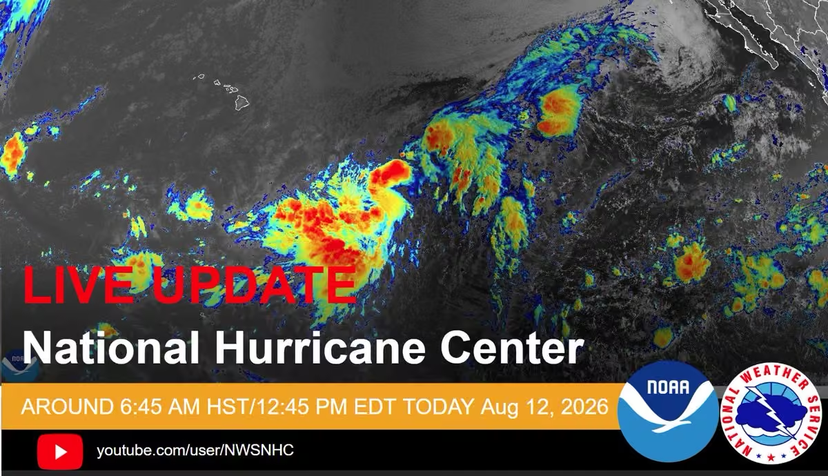
The National Hurricane Center Director Michael Brennan will provide a LIVE update on Potential Tropical Cyclone One-C around 6:45 AM HST/12:45 PM EDT today Wednesday August 12, 2026. Please join us on Facebook Live and the NHC YouTube Page at: youtube.com/user/NWSNHC
-
National Hurricane Center
@NWSNHC
Ever wonder how we know what's happening inside a hurricane? It all comes down to teamwork!
#noaas #nhc and #aoc join forces, from flying directly into storms to analyze data in real time and deliver the critical info that keeps communities informed and prepared.This media couldn't be displayed. See it on the original post. -
National Hurricane Center
@NWSNHC
Next week (July 27-30), the Florida @NWS offices are hosting Florida Tropical Training Week. While this free training is tailored to Florida residents, all are welcome!
Visit this link for more info and to register for each day's training: www.weather.gov/jax/FTTW2026 -
National Hurricane Center
@NWSNHC
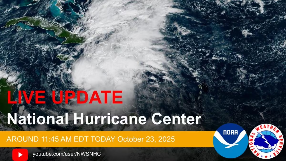
July 21: NHC Deputy Director Jamie Rhome will provide a LIVE update on Tropical Storm #bertha around 11:45 AM EDT today Tuesday July 21, 2026. Please join us on Facebook Live and the NHC YouTube Page at: youtube.com/user/NWSNHC
hurricanes.gov -
National Hurricane Center
@NWSNHC
July 20: Here is the latest updated from the National Hurricane Center on #td2.
Watch the full broadcast here: www.youtube.com/live/K0tBxUrTaNw
Latest forecast visit: hurricanes.gov -
National Hurricane Center
@NWSNHC
July 20: NHC Deputy Director Jamie Rhome will provide a LIVE update on #td2 in the northeastern Gulf around 11:45 AM EDT today July 20, 2026. Please join us on Facebook Live and the NHC YouTube Page at: youtube.com/user/NWSNHC
hurricanes.gov -
National Hurricane Center
@NWSNHC
Sunday, July 19 2026: Here is the latest from the National Hurricane Center on Tropical Depression TWO - For the latest forecast, visit hurricanes.gov
This media couldn't be displayed. See it on the original post. -
National Hurricane Center
@NWSNHC
The NHC Deputy Director Jamie Rhome will provide a LIVE update on Tropical Depression Two located in the northeastern Gulf around 11:45 AM EDT today July 19, 2026. Please join us on Facebook Live and the NHC YouTube Page at: youtube.com/user/NWSNHC
-
National Hurricane Center
@NWSNHC
Thursday, July 2, 2026: Tropical Weather Outlook Update for the 4th of July weekend
For the latest forecast, visit hurricanes.gov -
National Hurricane Center
@NWSNHC
Jun 17: Dr. Michael Brennan provides the LIVE update on Tropical Storm Arthur from the National Hurricane Center: www.youtube.com/live/ScNR1ei-Hz8
For more detailed forecasts and written text updates, visit: hurricanes.gov -
National Hurricane Center
@NWSNHC
The National Hurricane Center Director Dr. Michael Brennan will provide the LIVE update on Potential Tropical Cyclone One around 11:15 AM EDT today June 17, 2026. Please join us on Facebook Live and NHC YouTube Page at: youtube.com/user/NWSNHC
hurricanes.gov -
National Hurricane Center
@NWSNHC
June 16: Tropical Update on Potential Tropical Cyclone One. For more information visit: hurricanes.gov #ptcone
-
National Hurricane Center
@NWSNHC
Jun 16: Dr. Michael Brennan provides the LIVE update on PTC One from the National Hurricane Center: www.youtube.com/live/XmHkKgS4GKA
For more detailed forecasts and written text updates, visit: hurricanes.gov -
National Hurricane Center
@NWSNHC
The National Hurricane Center Director Dr. Michael Brennan will provide the LIVE update on Potential Tropical Cyclone One in the Gulf around 11:15 AM EDT today June 16, 2026. Please join us on Facebook Live and the NHC YouTube Page at: youtube.com/user/NWSNHC
-
National Hurricane Center
@NWSNHC
Join us today for a Reddit "Ask Me Anything". We'll be answering your questions about hurricanes, forecasts, preparedness, and more.
📅 Thursday, June 4, 10-11 am ET
📍 r/storms
Submit your questions and join the discussion here: www.reddit.com/r/storms/comments/1twm2cz/im_robbie_berg_t…
#hurricaneseason #ama -
National Hurricane Center
@NWSNHC
Have you ever wondered how and why hurricanes and tropical storms get names? @NWSNHC Hurricane Specialist Elizabeth Adams talks about the history of naming hurricanes, how hurricanes names are used today, and what happens when a name is retired.
This media couldn't be displayed. See it on the original post. -
National Hurricane Center
@NWSNHC
Mark your calendars! @NWS meteorologists from Florida are providing free, virtual training from July 27-30 to help you be ready for hurricane season.
For more information and to register for sessions, visit www.weather.gov/jax/FTTW2026
NWS Jacksonville
@NWSJacksonville
New to Florida? Need a refresher on tropical cyclone impacts & safety?
Your local National Weather Service meteorologists are providing free, virtual tropical training 3x daily from July 27th-30th on Google Meet.
Register and learn more at: www.weather.gov/jax/FTTW2026 -
National Hurricane Center
@NWSNHC
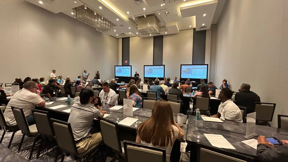
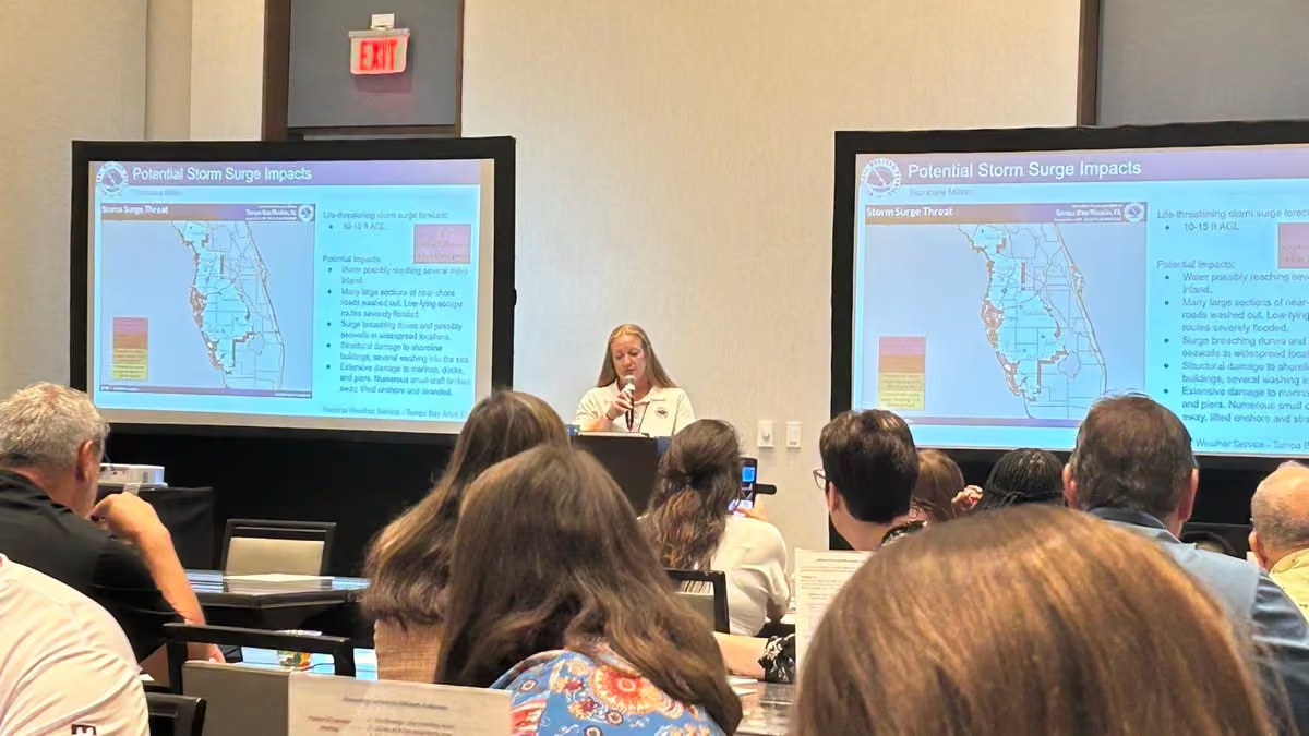
It was an all-Florida @NWS team effort today at @FloridaGHC, leading a workshop on effective hurricane messaging for our partners in emergency management.
@NWSKeyWest @NWSMiami @NWSTampaBay @NWSMelbourne @NWSJacksonville @NWSTallahassee @NWSMobile @NWSNHC -
National Hurricane Center
@NWSNHC
Thank you for inviting us to participate this week! We encourage all of our friends in North Carolina to prepare for this hurricane season like you would any other and follow the advice of local officials in your state.
NC Emergency Management
@NCEmergency
This week, 75 first responders attended “The Voices in the Storm Symposium” in New Hanover County, focusing on hurricane preparedness, coordination, and communication. The event emphasized lessons learned and practical strategies for emergency management.
#readync -
National Hurricane Center
@NWSNHC
Thank you to @NWSLakeCharles and @ChennaultCWF for hosting an excellent event for the Hurricane Awareness Tour in Lake Charles, Louisiana! As always, we couldn’t do it without our partners and friends at @NOAA_HurrHunter and @53rdWRS.
-
National Hurricane Center
@NWSNHC
Check out our discussion about storm surge with @NWSNHC Storm Surge Specialist Cody Fritz, and Lt. Nico Osborn from @NOAA_HurrHunter about aerial surveying of the damage in Jamaica from last year’s Hurricane Melissa with the King Air aircraft.
www.youtube.com/live/rOg58VIjbOw -
National Hurricane Center
@NWSNHC
All lined up for today’s event at the Hurricane Awareness Tour @ChennaultCWF with @NWSLakeCharles, @NOAA_HurrHunter , and @53rdWRS.
Public tours start at 1 pm. More info: www.weather.gov/lch/hat -
National Hurricane Center
@NWSNHC
What a great showing for the Mobile stop of the Hurricane Awareness Tour! Thank you to @NWSMobile for hosting today’s event! Next stop: Lake Charles, Louisiana, with @NWSLakeCharles on Wednesday.
-
National Hurricane Center
@NWSNHC
How do data from the @53rdWRS help @NWSNHC hurricane specialists make a hurricane forecast, and meteorologists at @NWSWPC make rainfall forecasts?
www.youtube.com/live/Y0RBoe-GWTE -
National Hurricane Center
@NWSNHC
A 9-foot storm surge is no joke! @NWSMobile built their own storm surge pole to show how high storm surge can get, and how much surge some hurricanes have caused in the area. The colors match those used in NHC’s storm surge products. Nice work!
-
National Hurricane Center
@NWSNHC
We’ve got some show offs this morning! Today is day 2 of the Hurricane Awareness Tour with @NWSMobile, @53rdWRS, @NOAA_HurrHunter, and @FederalAlliance.
Public tours are this afternoon at Mobile International Airport. More info: www.weather.gov/mob/2026HAT. -
National Hurricane Center
@NWSNHC
Great day today in Sarasota for the Hurricane Awareness Tour! Thank you to @NWSTampaBay, @scgovEOC, @MCGPublicSafety, & @SRQAirport for hosting!
Now off to Mobile, AL, for the tour on Tuesday with @NWSMobile. More info: www.weather.gov/mob/2026HAT. -
National Hurricane Center
@NWSNHC
Good morning from Sarasota, FL for the first stop of the 2026 Hurricane Awareness Tour with @NWSTampaBay, @NOAA_HurrHunter, and @53rdWRS!
Public tours start at 1:30, gates close at 3 pm. More info:
www.weather.gov/tbw/2026hat! -
National Hurricane Center
@NWSNHC
The NOAA WP-3D Orion, NOAA’s Gulfstream IV-SP (G-IV) jet and the Air Force WC-130J, all play a significant role collecting data for tropical cyclone forecasting throughout the hurricane season. Want to learn more about each of these incredible aircraft? Come join us! HAT May 4-6
-
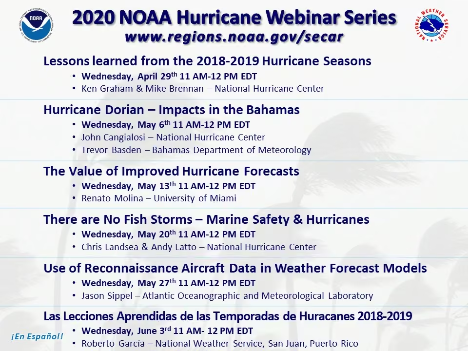
National Hurricane Center
@NWSNHC
Reminder that @NOAA Hurricane Awareness Webinars begin this Wednesday, April 29 at 2 pm ET.
Registration for the first webinar can be found here: attendee.gotowebinar.com/register/5574399063027023195
More info: www.noaa.gov/regional-collaboration-network/regions-south…
National Hurricane Center
@NWSNHC
Hurricane season is coming! Join the 2026 Hurricane Awareness Webinar Series starting next Wednesday, April 29 at 2 PM ET.
Hosted by @NOAA SECART & GoARCT, with sessions through May 26.
🔗 www.noaa.gov/regional-collaboration-network/regions-south… -
National Hurricane Center
@NWSNHC
Hurricane season is coming! Join the 2026 Hurricane Awareness Webinar Series starting next Wednesday, April 29 at 2 PM ET.
Hosted by @NOAA SECART & GoARCT, with sessions through May 26.
🔗 www.noaa.gov/regional-collaboration-network/regions-south… -
National Hurricane Center
@NWSNHC
We expected nothing less—Puerto Rico showed up today for the Caribbean Hurricane Awareness Tour in San Juan! Thank you to @53rdWRS, @NWSSanJuan, and all our partners in Puerto Rico for a successful event to get everyone ready for hurricane season!
Credits: NHC and @403rdWing -
National Hurricane Center
@NWSNHC
Live at the Caribbean Hurricane Awareness Tour in San Juan, PR, with @NWSWPC Meteorologist Jay Alamo and @NHC_TAFB Meteorologist Sandy Delgado.
www.youtube.com/live/hB_y3QUqGEg -
National Hurricane Center
@NWSNHC
Live from the Caribbean Hurricane Awareness Tour in Belize City, Belize.
www.youtube.com/live/LaUyCB-qmSM -
National Hurricane Center
@NWSNHC
NHC Director Dr. Michael Brennan goes live on the flight deck of the @53rdWRS C130 aircraft with Lt. Col. Dave Gentile during the Marathon stop of the Caribbean Hurricane Awareness Tour.
www.youtube.com/live/hhicWWKNfw8 -
National Hurricane Center
@NWSNHC
Today is Day 1 of the 2026 Caribbean Hurricane Awareness Tour with @53rdWRS, and our first stop is in Marathon, FL, with @NWSKeyWest! Now is a good time to begin thinking about how you will prepare for hurricane season!
-
National Hurricane Center
@NWSNHC
If you’re in the Florida Keys, reminder that public tours for the Caribbean Hurricane Awareness Tour are today (Apr. 14) from 1-4 pm at Marathon Airport!
NWS Key West
@NWSKeyWest
Tomorrow is the day! Another friendly reminder that the Caribbean Hurricane Awareness Tour will be in Marathon tomorrow, April 14th. Public tours of the Hurricane Hunter Aircraft will be available from 1:00 PM to 4:00 PM.
#flwx #keywest #marathonfl #keylargo -
National Hurricane Center
@NWSNHC
Next week, @NWSNHC, @53rdWRS & @flynoaa will join the Caribbean Hurricane Awareness Tour, in Marathon; Roatan; Belize City; & San Juan to promote hurricane preparedness ahead of the season.
For local event info, visit @NWSKeyWest, @CopecoHN, @NationalBelize, and @NWSSanJuan. -
National Hurricane Center
@NWSNHC
Where’s your safe place in a hurricane? For us, it’s our own building — built with strong walls to handle high winds and located outside any storm surge evacuation zone. Know your risk, have a plan, and stay safe. #safeplaceselfie
For more info, visit www.noaa.gov/hurricane-prep -
National Hurricane Center
@NWSNHC
Tomorrow, April 8, is #safeplaceselfieday. Do you know your safe place to ride out extreme weather? Take a picture from your safe place and share it tomorrow with #safeplaceselfie to inspire others. To learn more visit www.noaa.gov/safeplaceselfie
-
National Hurricane Center reposted
National Hurricane Center
@NHC_Atlantic
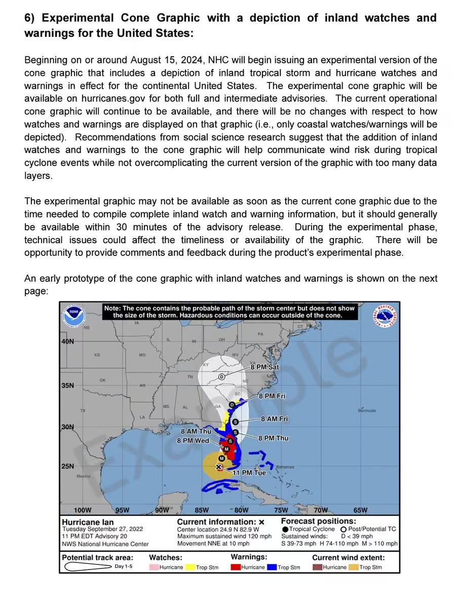
The National Hurricane Center is debuting an updated tropical cyclone forecast track cone for the 2026 hurricane, which includes U.S. inland watches and warnings and uses a single transparent shade for the entire 5-day forecast. In this video, NHC Warning Coordination Meteorologist Robbie Berg and Senior Hurricane Specialist John Cangialosi explain how the cone is created, and what it can and cannot tell you about a hurricane forecast.
For more information on the forecast track cone and other 2026 product updates, please visit www.noaa.gov/news-release/national-hurricane-center-to-is…
Video credits: Lisa Bucci, Cassandra Mora, and Maria TorresThis media couldn't be displayed. See it on the original post. -
National Hurricane Center reposted
National Hurricane Center
@NHC_Atlantic
NHC has announced its new products and services for the 2026 hurricane season: www.nhc.noaa.gov/pdf/2026NHCNewProductsAndServices.pdf
Highlights include an operational forecast track cone with inland U.S. watches and warnings, new storm surge products for Hawaii, a more user-friendly version of NHC's mobile website, and an experimental forecast track cone that uses directional and speed forecast errors. -
National Hurricane Center
@NWSNHC
The 2025 Atlantic hurricane season officially ends on November 30. Here is a recap from NHC. For the full report, visit: www.noaa.gov/news-release/2025-atlantic-hurricane-season-…
This media couldn't be displayed. See it on the original post. -
National Hurricane Center
@NWSNHC
Preliminary findings on NHC's 2025 forecast performance for the Atlantic basin are now available! The complete report will be released this spring, but check out this brief summary. Full report here: www.nhc.noaa.gov/pdf/NHC_Verification_Report_2025_Preview…
#nhc #atlanticseason2025 #forecastverification #noaaThis media couldn't be displayed. See it on the original post. -
National Hurricane Center
@NWSNHC
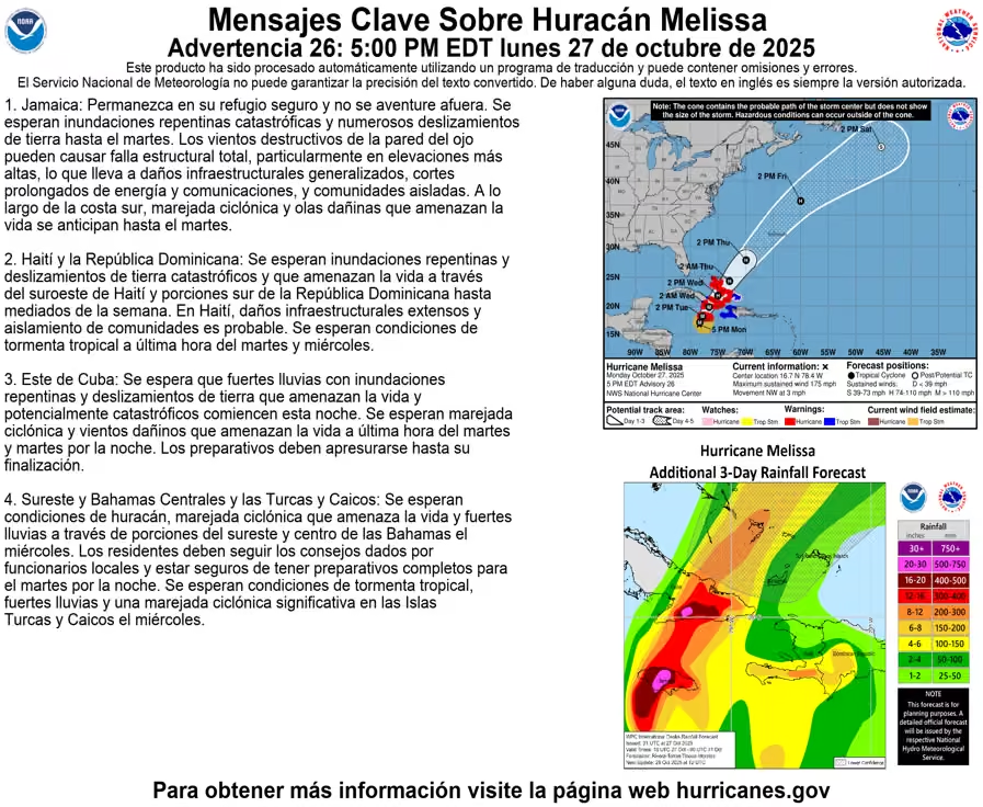
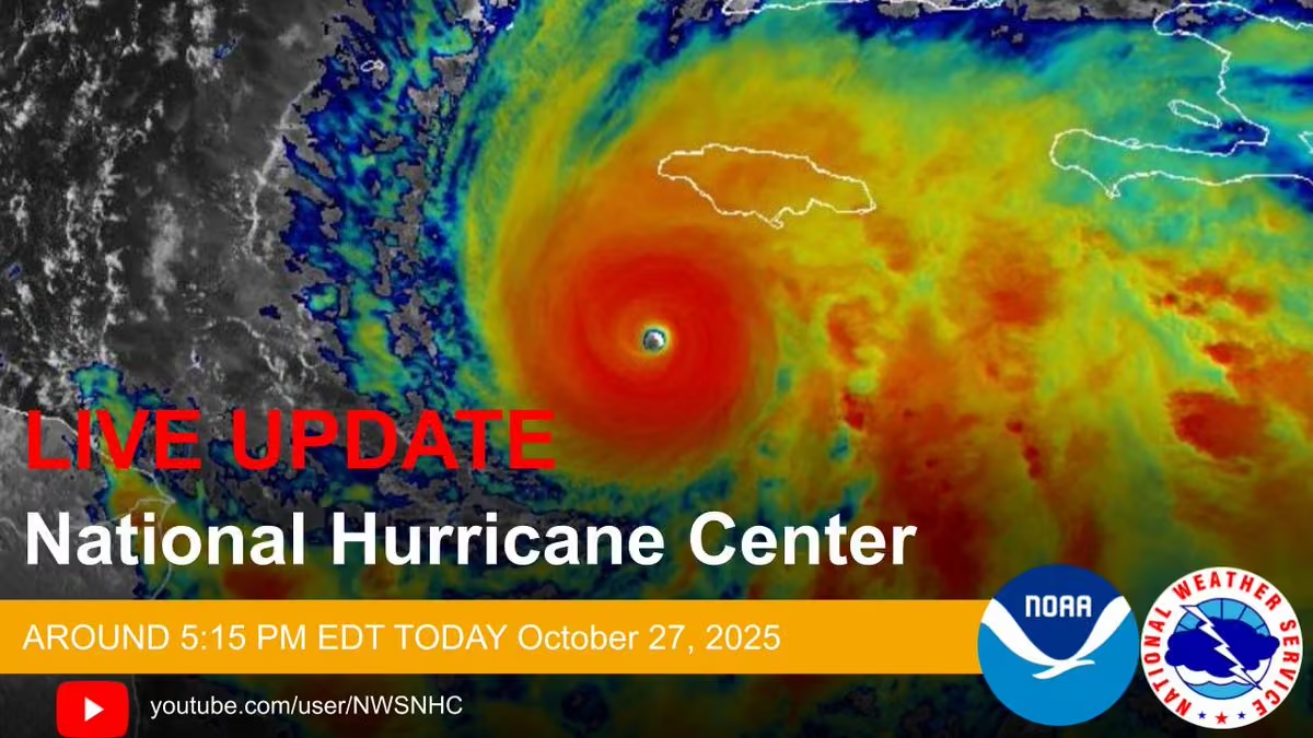
The National Hurricane Center Director Dr. Michael Brennan will provide a LIVE update on Hurricane #melissa around 5:00 PM EDT today October 29, 2025.
Please join us on Facebook Live and the NHC YouTube Page at: youtube.com/user/NWSNHC
Latest forecast at: hurricanes.gov -
National Hurricane Center
@NWSNHC
The NHC Deputy Director Jamie Rhome will provide a LIVE update on Tropical Storm #imelda around 5:15 PM EDT today September 28, 2025. Please join us on Facebook Live and the NHC YouTube Page at: youtube.com/user/NWSNHC
Full details of the latest forecast: hurricanes.gov -
National Hurricane Center
@NWSNHC
SEP 28 - PM: Dr. Michael Brennan provides a LIVE update on Tropical Depression Nine from the National Hurricane Center: www.youtube.com/live/ybyP-Bt0y3w
For more detailed forecasts and written text updates, visit: hurricanes.gov -
National Hurricane Center
@NWSNHC
The National Hurricane Center Director Dr. Michael Brennan will provide a LIVE update on Tropical Depression Nine around 11:00 AM EDT today September 28, 2025. Please join us on Facebook Live and the NHC YouTube Page at: youtube.com/user/NWSNHC
hurricanes.gov -
National Hurricane Center
@NWSNHC
SEP 27 - PM: Dr. Michael Brennan provides the latest updates on Tropical Depression Nine from the National Hurricane Center: www.youtube.com/live/etPxbkCKdbM
For more detailed forecasts and written text updates, visit: hurricanes.gov -
National Hurricane Center
@NWSNHC
The NHC Director Dr. Michael Brennan will provide a LIVE update on Tropical Depression Nine around 5:15 PM EDT today September 27, 2025. Please join us on Facebook Live and the NHC YouTube Page at: youtube.com/user/NWSNHC
Full details of the forecast at: hurricanes.gov -
National Hurricane Center
@NWSNHC
SEP 27 - PM: Dr. Michael Brennan provides a LIVE update on the tropics from the National Hurricane Center: www.youtube.com/live/MKTAV5Nwddg
For more detailed forecasts and written text updates, visit: hurricanes.gov -
National Hurricane Center
@NWSNHC
The National Hurricane Center Director Dr. Michael Brennan will provide a LIVE update on the tropics around 11:00 AM EDT today September 27, 2025. Please join us on Facebook Live and the NHC YouTube Page at: youtube.com/user/NWSNHC
Latest forecast at: hurricanes.gov -
National Hurricane Center
@NWSNHC
SEP 26 - PM: Dr. Michael Brennan provides a LIVE update on the tropics from the National Hurricane Center: www.youtube.com/live/BmsujT-nvY0
For more detailed forecasts and written text updates, visit: hurricanes.gov -
National Hurricane Center
@NWSNHC
SEP 25 - PM: Dr. Michael Brennan provides a LIVE update on the tropics from the National Hurricane Center: www.youtube.com/live/5dRYLKlVuxQ
For more detailed forecasts and written text updates, visit: hurricanes.gov -
National Hurricane Center
@NWSNHC
The National Hurricane Center Director Dr. Michael Brennan will provide a LIVE update on the tropics around 2:30 PM EDT today September 25, 2025. Please join us on Facebook Live and the NHC YouTube Page at: youtube.com/user/NWSNHC
The latest forecast at: hurricanes.gov -
National Hurricane Center
@NWSNHC
SEP 24 - PM: Dr. Michael Brennan provides a LIVE update on the tropics from the National Hurricane Center: www.youtube.com/live/6qupGE8cV9s
For more detailed forecasts and written text updates, visit: hurricanes.gov -
National Hurricane Center
@NWSNHC
The National Hurricane Center Director Dr. Michael Brennan will provide a LIVE update on the tropics around 2:30 PM EDT today September 24, 2025. Please join us on Facebook Live and the NHC YouTube Page at: youtube.com/user/NWSNHC
Latest forecast at: hurricanes.gov -
National Hurricane Center
@NWSNHC
Septiembre 10 2025 - Actualizacion desde el Centro Nacional de Huracanes sobre las condiciones tropicales en el Pacífico Norte oriental. Para mas informacion, visite hurricanes.gov
-
National Hurricane Center
@NWSNHC
September 10th 2025 - Latest update on the tropics in the East Pacific basin from the National Hurricane Center. For the latest information, please visit hurricanes.gov
-
National Hurricane Center
@NWSNHC
Artificial intelligence (AI) is making waves in hurricane forecasting. 🌊🤖 NHC’s Science and Operations Officer Dr. Wallace Hogsett explains how forecasters use their expertise to guide & apply AI to make forecasts even better. Watch here 👇 🎥
-
National Hurricane Center
@NWSNHC
September 3 2025 - Latest update on the tropics in the #atlantic basin from the National Hurricane Center. For the latest information, please visit hurricanes.gov
-
National Hurricane Center
@NWSNHC
August 21, 2025 - Latest update on the tropics from the National Hurricane Center. For the latest information, please visit hurricanes.gov
-
National Hurricane Center
@NWSNHC
AUG 21 - AM: Dr. Michael Brennan provides a LIVE update on Hurricane #erin from the National Hurricane Center: www.youtube.com/live/Ewq4a4x1kjI
For the latest forecasts, visit: hurricanes.gov -
National Hurricane Center
@NWSNHC
The National Hurricane Center Director Dr. Michael Brennan will provide a LIVE update on Hurricane #erin around 11:15 AM EDT today August 20, 2025. Please join us on Facebook Live and the NHC YouTube Page at: youtube.com/user/NWSNHC
Latest forecast at: hurricanes.gov -
National Hurricane Center
@NWSNHC
The National Hurricane Center Director Dr. Michael Brennan will provide a LIVE update on Hurricane #erin around 5:05 PM EDT today August 19, 2025. Please join us on Facebook Live and the NHC YouTube Page at: youtube.com/user/NWSNHC
Latest forecast: hurricanes.gov -
National Hurricane Center
@NWSNHC
The National Hurricane Center Director Dr. Michael Brennan will provide a LIVE update on Major Hurricane #erin around 11:15 AM EDT today August 19, 2025. Please join us on Facebook Live and the NHC YouTube Page at: youtube.com/user/NWSNHCLatest forecast: hurricanes.gov
-
National Hurricane Center
@NWSNHC
The NHC Director Dr. Michael Brennan will provide a LIVE update on Major Hurricane #erin around 5:05 PM EDT today August 18, 2025. Please join us on FB Live and the NHC YouTube Page at: youtube.com/user/NWSNHC
Full details of the latest forecast at: hurricanes.gov -
National Hurricane Center
@NWSNHC
The National Hurricane Center Director Michael Brennan will provide a LIVE update on Major Hurricane #erin around 11:15 AM EDT today August 18, 2025. Please join us on Facebook Live and the NHC YouTube Page at: youtube.com/user/NWSNHC
Latest forecast: hurricanes.gov -
National Hurricane Center
@NWSNHC
The National Hurricane Center Director Mike Brennan will provide a LIVE update on Hurricane Erin around 11:15 AM EDT today August 16, 2025. Please join us on Facebook Live and the NHC YouTube Page at: youtube.com/user/NWSNHC
Latest forecast visit: hurricanes.gov -
National Hurricane Center
@NWSNHC
Have you ever wondered how NHC determines how strong a tropical cyclone is? In this video, NHC meteorologist Elizabeth Adams explains the Dvorak Technique, which NHC uses extensively to help estimate a tropical cyclone's intensity.
-
National Hurricane Center
@NWSNHC
Thursday, July 3 - Update on the tropics for the Fourth of July weekend. You can always find the latest forecast at hurricanes.gov or weather.gov
-
National Hurricane Center
@NWSNHC
June 24: ANDREA BECOMES THE FIRST TROPICAL STORM OF THE SEASON IN THE ATLANTIC...
For the latest forecast, visit hurricanes.gov and ocean.weather.gov -
National Hurricane Center
@NWSNHC
...SE ESPERA QUE ERICK TRAIGA VIENTOS POTENCIALMENTE DESTRUCTIVOS Y
INUNDACIONES REPENTINAS QUE AMENAZAN LA VIDA A PORCIONES DEL SUR DE
MÉXICO ESTA NOCHE Y EL JUEVES...
For the latest forecast, visit hurricanes.gov
#mexico #oaxaca #erick #acapulco #hurricane #pacific -
National Hurricane Center
@NWSNHC
ERICK EXPECTED TO BRING DAMAGING WINDS AND LIFE-THREATENING FLASH FLOODS TO PORTIONS OF SOUTHERN MEXICO LATE TONIGHT AND THURSDAY...
For the latest forecast, visit hurricanes.gov
#mexico #oaxaca #acapulco #hurricaneerick #easternpacific #pacific #stormsurge #flooding -
National Hurricane Center
@NWSNHC
Jun 18 - AM: Dr. Michael Brennan provides a LIVE update on Hurricane #erick from the National Hurricane Center: www.youtube.com/live/ZaT42PdzjMY
-
National Hurricane Center
@NWSNHC
The National Hurricane Center Director Dr. Michael Brennan will provide a LIVE update on Hurricane #erick around 11:00 AM EDT/9:00 AM CST. Please join us on Facebook Live, Instagram and the NHC YouTube Page. youtube.com/user/NWSNHC
hurricanes.gov -
National Hurricane Center
@NWSNHC
June 17: ERICK FORECAST TO RAPIDLY INTENSIFY...
HURRICANE WARNINGS ISSUED FOR PORTIONS OF THE OAXACA COAST…
For the latest forecast, visit hurricanes.gov
#mexico #oaxaca #acapulco #tropicalstormerick #hurricane #easternpacific #pacific #stormsurge #flooding #puertoangel -
National Hurricane Center
@NWSNHC
🦺 It’s #wearyourlifejacketatworkday, and yes... we’re wearing them all day.
Coffee? Life jacket.
Meetings? Life jacket.
Forecast discussions? Still life jacket.
Good thing safety never goes out of style.
#safeboating #hurricaneprep #fashionforwardfloatation @BoatingCampaign -
National Hurricane Center reposted
National Hurricane Center
@NHC_Atlantic
🚨 Yes, we know Hurricane Preparedness Week was last week...
But if you’re anything like us, your emergency kit is still half full and your flashlight batteries are still... somewhere. 😅
Hurricane season starts June 1, and we’ve still got time to get our act together. Let’s get prepped together—starting now.
🗓️ Your Week-by-Week Prep Countdown:
✅ May 12-18:
– Make or review your emergency plan
– Check/update your insurance coverage
– Know your evacuation zone & route
✅ May 19-25:
– Restock your emergency kit (water, canned goods, meds, pet supplies!)
– Buy extra batteries, phone chargers, and a weather radio
– Store important documents digitally & physically
✅ May 26-31:
– Trim trees & clear gutters
– Fill extra gas tanks and test generators
– Test your hurricane shutters
Hurricane prep shouldn't just be for one week. Let’s be ready before hurricane season begins. 🌀
#hurricaneprep #betterlatethannever #june1countdown -
National Hurricane Center
@NWSNHC
Did you know that rip currents are the 3rd-highest cause of fatalities in the U.S. from tropical cyclones? NHC has a new post on our blog "Inside the Eye" about rip currents being the hidden hurricane hazard:
noaanhc.wordpress.com/2025/04/30/rip-currents-the-hidden-…
National Hurricane Center
@NWSNHC
We also have a new video available with NHC Meteorologist Cassandra Mora discussing what rip currents are, how to escape them if you get caught in one, and how to be safe at the beach:
www.youtube.com/watch?v=igdewaNzTog
National Hurricane Center
@NWSNHC
NHC's website also now has a page dedicated to rip currents, providing important information for people to stay safe when there might be a hurricane well offshore but still producing dangerous beach conditions:
www.nhc.noaa.gov/rip-currents/
National Hurricane Center
@NWSNHC
Lastly, NHC will be providing a U.S. rip current risk viewer this hurricane season whenever there is an active tropical cyclone. For more information, please see our new products and services guide: www.nhc.noaa.gov/pdf/NHC_New_Products_Updates_2025.pdf
Please stay safe at the beach this hurricane season! -
National Hurricane Center reposted
National Weather Service
@NWS
.@NWSNHC unveils upgrades to its services for the 2025 hurricane season! Depiction of inland wind warnings and rip current risk, and earlier alerts for developing tropical systems, will help us prepare smarter and stay safer in 2025 and beyond. Check out what’s new by visiting nhc.noaa.gov/pdf/NHC_New_Products_Updates_2025.pdf! @NOAA
This media couldn't be displayed. See it on the original post. -
National Hurricane Center
@NWSNHC
If you missed yesterday's @NOAA hurricane awareness webinar or are interested in seeing the materials again, the recording and slide deck are now available online.
Webinar recording: www.youtube.com/watch?v=2-qkSBnFnOI
Slides: www.nhc.noaa.gov/outreach/presentations/2025_SECART.pdf -
National Hurricane Center
@NWSNHC
Reminder about tomorrow's @NOAA hurricane awareness webinar at 2:30 pm ET with NHC Warning Coordination Meteorologist Robbie Berg.
Register here: attendee.gotowebinar.com/register/6747787968528480341
Info on the entire webinar series can be found here: www.noaa.gov/regional-collaboration-network/regions-south…
National Hurricane Center
@NWSNHC
Please join us on Tuesday, April 22 at 2:30 pm ET for a @NOAA SECART webinar on lessons learned from the 2024 hurricane season and what's new from @NWSNHC for the 2025 hurricane season.
Register here: register.gotowebinar.com/register/6747787968528480341 -
National Hurricane Center
@NWSNHC
Please join us on Tuesday, April 22 at 2:30 pm ET for a @NOAA SECART webinar on lessons learned from the 2024 hurricane season and what's new from @NWSNHC for the 2025 hurricane season.
Register here: register.gotowebinar.com/register/6747787968528480341 -
National Hurricane Center
@NWSNHC
The @WMO has replaced Beryl with Brianna, Helene with Holly, Milton with Miguel, and John with Jake from the Atlantic and eastern Pacific basin name lists.
World Meteorological Organization
@WMO
The WMO Hurricane Committee has retired the names Beryl, Helene and Milton from its Atlantic basin name list and John from the eastern Pacific basin name list because of the death and destruction these storms caused in 2024.
wmo.int/news/media-centre/wmo-hurricane-committee-retires… -
National Hurricane Center reposted
National Hurricane Center
@NHC_Atlantic
The Tropical Cyclone Report for Hurricane #helene (September 24-27, 2024) has been posted on the NHC website. Helene made landfall in the Florida Big Bend region as a Category 4 Hurricane (on the Saffir-Simpson Hurricane Wind Scale). The storm brought historic catastrophic inland flooding and landslides, extreme winds, deadly storm surge, and numerous tornadoes that devastated portions of the southeastern United States and southern Appalachians. Helene was the deadliest hurricane for the contiguous U.S. since Katrina in 2005, with at least 248 fatalities (including at least 175 direct deaths), and produced an estimated $78.7 billion in damage in the United States.
www.nhc.noaa.gov/data/tcr/AL092024_Helene.pdf -
National Hurricane Center
@NWSNHC
As we do around this time each year, we've just released an update on the new products and services that will be available from NHC for the 2025 hurricane season.
You can find the full listing here: www.nhc.noaa.gov/pdf/NHC_New_Products_Updates_2025.pdf -
National Hurricane Center reposted
National Hurricane Center
@NHC_Atlantic
NHC has released preliminary highlights of our forecast performance in the Atlantic basin for 2024's tropical cyclones. We are still in the process of finalizing analyses of the storms, and the full verification report will be available later this spring.
www.nhc.noaa.gov/pdf/NHC_Verification_Report_Preview.pdf -
National Hurricane Center
@NWSNHC
Tropical Storm #sara Advisory 12:
10:00 AM EST/9:00 AM CST Saturday November 16, 2024
Full forecast details at: hurricanes.gov -
National Hurricane Center
@NWSNHC
NOV 16 - AM: Dr. Michael Brennan provides the final LIVE update on Tropical Storm #sara from the National Hurricane Center: www.youtube.com/watch?v=ojEFcTQCggk&t=1s
For more detailed forecasts and written text updates, visit: hurricanes.gov -
National Hurricane Center
@NWSNHC
The NHC Director Dr. Michael Brennan will provide the final LIVE update on Tropical Storm #sara around 10:15 AM EST/9:15 AM CST. Please join us on Facebook Live and the NHC YouTube Page at: youtube.com/user/NWSNHC
Full details of the latest forecast at: hurricanes.gov -
National Hurricane Center
@NWSNHC
Tropical Storm #sara Advisory 9:
4:00 PM EST/3:00 PM CST Friday November 15, 2024
Full forecast details at: hurricanes.gov -
National Hurricane Center
@NWSNHC
NOV 15 - PM: Dr. Michael Brennan provides the latest updates on Tropical Storm #sara from the National Hurricane Center: www.youtube.com/watch?v=5ZUbFueJO9k
For more detailed forecasts and written text updates, visit: hurricanes.gov -
National Hurricane Center
@NWSNHC
The NHC Director Dr. Michael Brennan will provide a LIVE update on Tropical Storm #sara around 4:00 PM EST/3:00 PM CST. Please join us on Facebook Live and the NHC YouTube Page at: youtube.com/user/NWSNHC
Full details of the latest forecast at: hurricanes.gov -
National Hurricane Center
@NWSNHC
NOV 15 - AM: Dr. Michael Brennan provides the latest updates on Tropical Storm #sara from the National Hurricane Center: www.youtube.com/watch?v=JHZMUFowaiI
For more detailed forecasts and written text updates, visit: hurricanes.gov -
National Hurricane Center
@NWSNHC
Tropical Storm #sara Advisory 8:
10:00AM EST/9:00 AM CST Friday November 15, 2024
Full forecast details at: hurricanes.gov -
National Hurricane Center
@NWSNHC
The NHC Director Dr. Michael Brennan will provide a LIVE update on Tropical Storm #sara around 10:45 AM EST/9:45 AM CST. Please join us on Facebook Live and the NHC YouTube Page at: youtube.com/user/NWSNHC
Full details of the latest forecast at: hurricanes.gov -
National Hurricane Center
@NWSNHC
Tropical Storm #sara Intermediate Advisory 7A:
7:15AM EST/6:15 AM CST Friday November 15, 2024
Full forecast details at: hurricanes.gov -
National Hurricane Center
@NWSNHC
Tropical Storm #sara Advisory 5:
4:00 PM EST Thursday November 14, 2024
Full forecast details at: hurricanes.gov -
National Hurricane Center
@NWSNHC
NOV 14 - PM: Dr. Michael Brennan provides the latest updates on Tropical Storm #sara from the National Hurricane Center:
www.youtube.com/watch?v=YdAwMRrN1ZQ
For more detailed forecasts and written text updates, visit: hurricanes.gov -
National Hurricane Center
@NWSNHC
The NHC Director Dr. Michael Brennan will provide a LIVE update on Tropical Storm #sara around 4:15 PM EST. Please join us on Facebook Live and the NHC YouTube Page at: youtube.com/user/NWSNHC
Full details of the latest tropical forecast at: hurricanes.gov -
National Hurricane Center
@NWSNHC
Advisory 4A: 1:00 PM EST Thursday November 14, 2024
...DEPRESSION STRENGTHENS INTO TROPICAL STORM #sara...
...LIFE-THREATENING AND POTENTIALLY CATASTROPHIC FLASH FLOODING AND MUDSLIDES EXPECTED IN HONDURAS THROUGH THE WEEKEND...
Latest forecast at: hurricanes.gov -
National Hurricane Center
@NWSNHC
Tropical Depression #nineteen Advisory 4:
10:00 AM EST Thursday November 14, 2024
Full forecast details at: hurricanes.gov -
National Hurricane Center
@NWSNHC
NOV 14 - AM: Dr. Michael Brennan provides a LIVE update on Tropical Depression #nineteen from the National Hurricane Center: www.youtube.com/watch?v=Bj-S1G-aUVI&t=3s
For more detailed forecasts and written text updates, visit: hurricanes.gov -
National Hurricane Center
@NWSNHC
The NHC Director Dr. Michael Brennan will provide a LIVE update on Tropical Depression #nineteen around 10:15 AM EST. Please join us on Facebook Live and the NHC YouTube Page at: youtube.com/user/NWSNHC
Full details of the latest tropical forecast at: hurricanes.gov -
National Hurricane Center
@NWSNHC
NOV 13 - PM: Dr. Michael Brennan provides the latest updates on the tropics from the National Hurricane Center: www.youtube.com/watch?v=mqUuDKvoAco&t=1s
For more detailed forecasts and written text updates, visit hurricanes.gov -
National Hurricane Center
@NWSNHC
Potential Tropical Cyclone #nineteen
Advisory 1: 4:00 PM EST Wednesday November 13, 2024
Full forecast details at: hurricanes.gov -
National Hurricane Center
@NWSNHC
The NHC Director Dr. Michael Brennan will provide a LIVE update on the tropics around 4:15 PM EST. Please join us on Facebook Live and the NHC YouTube Page at: youtube.com/user/NWSNHC
Full details of the latest tropical forecast at: hurricanes.gov -
National Hurricane Center
@NWSNHC
Latest Tropical Weather Outlook:
7:00 PM EST Tuesday November 12, 2024
For more details, visit: hurricanes.gov
En Español: nhc.noaa.gov/text/MIATWOSAT.shtml
For the latest marine forecast, visit: hurricanes.gov/marine -
National Hurricane Center
@NWSNHC
Latest Tropical Weather Outlook:
1:00 PM EST Tuesday November 12, 2024
For more details, visit: hurricanes.gov
En Español: nhc.noaa.gov/text/MIATWOSAT.shtml
For the latest marine forecast, visit: hurricanes.gov/marine -
National Hurricane Center
@NWSNHC
Latest Tropical Weather Outlook:
7:00 AM EST Tuesday November 12, 2024
For more details, visit: hurricanes.gov
En Español: www.nhc.noaa.gov/text/MIATWOSAT.shtml
For the latest marine forecast, visit: hurricanes.gov/marine -
National Hurricane Center
@NWSNHC
Tropical Storm #rafael Advisory 25: 10:00 AM EST/9:00 AM CST Saturday November 9, 2024
Full forecast details at: hurricanes.gov -
National Hurricane Center
@NWSNHC
NOV 9 - AM: Dr. Michael Brennan provides the final LIVE update on Tropical Storm #rafael from the National Hurricane Center: www.youtube.com/watch?v=iyCIfuA0aDk&t=3s
For more detailed forecasts and written text updates, visit hurricanes.gov -
National Hurricane Center
@NWSNHC
The NHC Director Dr. Michael Brennan will provide a LIVE update on Tropical Storm #rafael around 10:15 AM EST/9:15 AM CST. Please join us on Facebook Live and the NHC YouTube Page at: youtube.com/user/NWSNHC
Full details of the latest forecast at: hurricanes.gov -
National Hurricane Center
@NWSNHC
NOV 8 - AM: Dr. Michael Brennan provides a LIVE update on Hurricane #rafael from the National Hurricane Center: www.youtube.com/watch?v=4wt1IuxrvUM
For more detailed forecasts and written text updates, visit hurricanes.gov -
National Hurricane Center
@NWSNHC
Hurricane #rafael Advisory 21: 10:00 AM EST/9:00 AM CST Friday November 8, 2024
Full forecast details at: hurricanes.gov -
National Hurricane Center
@NWSNHC
The NHC Director Dr. Michael Brennan will provide a LIVE update on Hurricane #rafael around 10:30 AM EST/9:30 AM CST. Please join us on Facebook Live and the NHC YouTube Page at: youtube.com/user/NWSNHC
Full details of the latest forecast at: hurricanes.gov -
National Hurricane Center
@NWSNHC
Hurricane #rafael Advisory 17: 4:00 PM EST/3:00 PM CST Thursday November 7, 2024
Full forecast details at: hurricanes.gov -
National Hurricane Center
@NWSNHC
NOV 7 - PM: Dr. Michael Brennan provides the latest updates on Hurricane #rafael from the National Hurricane Center: www.youtube.com/watch?v=jTbgOSq8WUc&t=1s
For more detailed forecasts and written text updates, visit hurricanes.gov -
National Hurricane Center
@NWSNHC
The NHC Director Dr. Michael Brennan will provide a LIVE update on Hurricane #rafael around 4:00 PM EST/3:00 PM CST. Please join us on Facebook Live and the NHC YouTube Page at: youtube.com/user/NWSNHC
Full details of the latest forecast at: hurricanes.gov -
National Hurricane Center
@NWSNHC
Hurricane #rafael Advisory 16: 10:00 AM EST/9:00 AM CST Thursday November 7, 2024
Full forecast details at: hurricanes.gov -
National Hurricane Center
@NWSNHC
NOV 7 - AM: Dr. Michael Brennan provides a LIVE update on Hurricane #rafael from the National Hurricane Center: www.youtube.com/watch?v=5Lc7PIA26Pw&t=1s
For more detailed forecasts and written text updates, visit hurricanes.gov -
National Hurricane Center
@NWSNHC
The NHC Director Dr. Michael Brennan will provide a LIVE update on Hurricane #rafael around 10:15 AM EST. Please join us on Facebook Live and the NHC YouTube Page at: youtube.com/user/NWSNHC
Full details of the latest forecast at: hurricanes.gov -
National Hurricane Center
@NWSNHC
...RAFAEL MAKES LANDFALL IN THE CUBAN PROVINCE OF ARTEMISA at 4:15 PM EST...
Major Hurricane #rafael Advisory 13: 4:00 PM EST Wednesday November 6, 2024
Full forecast details at: hurricanes.gov -
National Hurricane Center
@NWSNHC
NOV 6 - PM: Dr. Michael Brennan provides the latest updates on Major Hurricane #rafael from the National Hurricane Center: www.youtube.com/watch?v=NPQSad5iUeM&t=61s
For more detailed forecasts and written text updates, visit hurricanes.gov -
National Hurricane Center
@NWSNHC
The NHC Director Dr. Michael Brennan will provide a LIVE update on Major Hurricane #rafael around 4:00 PM EST. Please join us on Facebook Live and the NHC YouTube Page at: youtube.com/user/NWSNHC
Full details of the latest forecast at: hurricanes.gov -
National Hurricane Center
@NWSNHC
Major Cat 3 Hurricane #rafael 3:00 PM EST update:
...EYEWALL OF RAFAEL APPROACHING THE SOUTH COAST OF WESTERN CUBA...
Rafael is nearing western Cuba and is expected to make landfall within the next couple hours. The next update will be provided in the full advisory at 4 PM EST. -
National Hurricane Center
@NWSNHC
Hurricane #rafael Advisory 12: 10:00 AM EST Wednesday November 6, 2024
Full forecast details at: hurricanes.gov -
National Hurricane Center
@NWSNHC
NOV 6 AM: Dr. Michael Brennan provides a LIVE update on Hurricane #rafael from the National Hurricane Center: www.youtube.com/watch?v=i4HdlK7YgQo
For more detailed forecasts and written text updates, visit hurricanes.gov -
National Hurricane Center
@NWSNHC
The NHC Director Dr. Michael Brennan will provide a LIVE update on Hurricane #rafael around 10:15 AM EST. Please join us on Facebook Live and the NHC YouTube Page at: youtube.com/user/NWSNHC
Full details of the latest forecast at: hurricanes.gov -
National Hurricane Center
@NWSNHC
Tropical Storm #rafael Advisory 9: 4:00 PM EST Tuesday November 5, 2024
Full forecast details at: hurricanes.gov -
National Hurricane Center
@NWSNHC
NOV 5 PM: Dr. Michael Brennan provides the latest updates on Tropical Storm #rafael from the National Hurricane Center: www.youtube.com/watch?v=HJaLawLvovA&t=1s
For more detailed forecasts and written text updates, visit hurricanes.gov -
National Hurricane Center
@NWSNHC
The NHC Director Dr. Michael Brennan will provide a LIVE update on Tropical Storm #rafael around 4:00 PM EST. Please join us on Facebook Live and the NHC YouTube Page at: youtube.com/user/NWSNHC
Full details of the latest forecast at: hurricanes.gov -
National Hurricane Center
@NWSNHC
Tropical Storm #rafael Advisory 8: 10:00 AM EST Tuesday November 5, 2024
Full forecast details at: hurricanes.gov -
National Hurricane Center
@NWSNHC
NOV 5 AM: Dr. Michael Brennan provides a LIVE update on Tropical Storm #rafael from the National Hurricane Center: www.youtube.com/watch?v=zD5v6OIwOIQ&t=1s
For more detailed forecasts and written text updates, visit hurricanes.gov -
National Hurricane Center
@NWSNHC
The NHC Director Dr. Michael Brennan will provide a LIVE update on Tropical Storm #rafael around 10:15 AM EST. Please join us on Facebook Live and the NHC YouTube Page at: youtube.com/user/NWSNHC
Full details of the latest forecast at: hurricanes.gov -
National Hurricane Center
@NWSNHC
Tropical Storm #rafael Advisory 5: 4:00 PM EST Monday November 4, 2024
Full forecast details at: hurricanes.gov -
National Hurricane Center
@NWSNHC
NOV 4 PM: Dr. Michael Brennan provides the latest updates on newly upgraded Tropical Storm #rafael from the National Hurricane Center: www.youtube.com/watch?v=CGESPJ864Jk&t=66s
For more detailed forecasts and written text updates, visit hurricanes.gov -
National Hurricane Center
@NWSNHC
The NHC Director Dr. Michael Brennan will provide a LIVE update on Tropical Depression #eighteen around 4:00 PM EST. Please join us on Facebook Live and the NHC YouTube Page at: youtube.com/user/NWSNHC
Full details of the latest forecast at: hurricanes.gov -
National Hurricane Center
@NWSNHC
Tropical Depression #eighteen Advisory 4: 10:00 AM EST Monday November 4, 2024
Full forecast details at: hurricanes.gov -
National Hurricane Center
@NWSNHC
The NHC Director Dr. Michael Brennan will provide a LIVE update on newly upgraded Tropical Depression #eighteen around 10:15 AM EST. Please join us on Facebook Live and the NHC YouTube Page at: youtube.com/user/NWSNHC
Full details of the latest forecast: hurricanes.gov -
National Hurricane Center reposted
NOAA
@NOAA
FACT CHECK: Debunking weather modification claims.
No one creates or steers hurricanes; the technology does not exist.
Details: noaa.gov/news/fact-check-debunking-weather-modification-c…
@NWS @NOAAResearch -
National Hurricane Center
@NWSNHC
In part 3 of our tropical cyclone video series, Senior Hurricane Specialist John Cangialosi discusses NHC's tropical cyclone track forecasts, and compares their accuracy and consistency to the models we use to make those forecasts.
Watch here: youtu.be/RB1mTkgkI5E -
National Hurricane Center
@NWSNHC
If you don't need to be outside, please stay indoors and let the local officials due their clean up. Stay safe! #hurricanemilton2024 #sarasota #fortmyers #tampa #orlando
-
National Hurricane Center
@NWSNHC
OCT 10 AM: Dr. Michael Brennan provides the final LIVE update on Hurricane #milton from the National Hurricane Center:www.youtube.com/watch?v=05Y4F5efN38&t=31s
For more detailed forecasts and written text updates, visit hurricanes.gov -
National Hurricane Center
@NWSNHC
The National Hurricane Center Director Dr. Michael Brennan will provide the last LIVE update on Hurricane #milton around 11:00 AM EDT. Please join us on Facebook Live and the NHC YouTube Page at: youtube.com/user/NWSNHC
Full the latest forecast visit: hurricanes.gov -
National Hurricane Center
@NWSNHC
...CENTER OF #milton PULLING AWAY FROM THE EAST COAST OF FLORIDA...
...STRONG GUSTY WINDS AND HEAVY RAINFALL STILL OCCURRING NEAR THE SPACE COAST...
Next complete advisory is at 11:00 AM EDT.
Follow hurricanes.gov for the latest information. -
National Hurricane Center
@NWSNHC
...#milton MOVING OFF THE FLORIDA EAST COAST...
...STILL PRODUCING DAMAGING HURRICANE-FORCE WINDS AND HEAVY RAINFALL IN EAST-CENTRAL FLORIDA...
Follow hurricanes.gov for the latest forecast changes. -
National Hurricane Center reposted
-
National Hurricane Center
@NWSNHC
OCT 9 PM: Dr. Michael Brennan provides the latest updates on #milton from the National Hurricane Center:
www.youtube.com/live/SuywMeVvI-A
For more detailed forecasts and written text updates, visit hurricanes.gov -
National Hurricane Center
@NWSNHC
The National Hurricane Center Director Dr. Michael Brennan will provide a LIVE update on Major Hurricane #milton around 5:50 PM EDT. Please join us on Facebook Live and the NHC YouTube Page at: youtube.com/user/NWSNHC
Full details at: hurricanes.gov -
National Hurricane Center
@NWSNHC
Oct 9 5:00 PM update:
...MILTON APPROACHING THE COAST OF WEST-CENTRAL FLORIDA...
...LIFE-THREATENING STORM SURGE, DAMAGING WINDS, AND FLOODING RAINS EXPECTED ACROSS PORTIONS OF CENTRAL AND SOUTHWESTERN FLORIDA...
hurricanes.gov -
National Hurricane Center
@NWSNHC
200 PM EDT Wed Oct 09 2024
...#milton GROWING IN SIZE AS IT MOVES CLOSER TO THE WEST COAST OF #florida...
...LIFE-THREATENING STORM SURGE, DAMAGING WINDS, AND FLOODING RAINS EXPECTED ACROSS PORTIONS OF CENTRAL AND SOUTHWESTERN FLORIDA
For more information: hurricanes.gov -
National Hurricane Center reposted
Hurricane Hunters
@53rdWRS
The 👁️ of #hurricanemilton2024🌀 during a mission Oct. 8.
Listen to local officials, evacuate if told to do so, and stay #weatherready -
National Hurricane Center
@NWSNHC
#hurricanemilton will be making landfall late today, but that doesn't mean #florida won't start seeing the effects until then. Be READY and prepared. For more information: hurricanes.gov #fl #hurricane #milton
youtube.com/shorts/KB9xbVVFtHE -
National Hurricane Center
@NWSNHC
OCT 9 AM: Dr. Michael Brennan provides a LIVE update on Major Hurricane #milton from the National Hurricane Center: www.youtube.com/watch?v=2GTpK5CgOMU&t=44s
For more detailed forecasts and written text updates, visit hurricanes.gov -
National Hurricane Center
@NWSNHC
1100 AM EDT Wed Oct 09 2024
...TORNADIC SUPERCELLS FROM #milton BEGINNING TO SWEEP ACROSS THE
SOUTHERN #florida PENINSULA...
...THE TIME TO PREPARE, INCLUDING #evacuate IF TOLD DO SO, IS
QUICKLY COMING TO AN END ALONG THE FLORIDA WEST COAST...
#fl #hurricane #hurricanemilton -
National Hurricane Center
@NWSNHC
The NHC Director Dr. Michael Brennan will provide a LIVE update on Major Hurricane #milton around 11:05 AM EDT. Please join us on Facebook Live and the NHC YouTube Page at: youtube.com/user/NWSNHC
Full details of the latest forecast at: hurricanes.gov -
National Hurricane Center
@NWSNHC
...WINDS WILL BEGIN TO INCREASE ALONG THE WEST COAST OF FLORIDA BY THIS AFTERNOON AS #milton APPROACHES...
...PREPARATIONS, INCLUDING EVACUATION IF TOLD TO DO SO, SHOULD BE RUSHED TO COMPLETION THIS MORNING...
Follow hurricanes.gov for the latest information. -
National Hurricane Center
@NWSNHC
...#milton REMAINS A CATASTROPHIC CATEGORY 5 HURRICANE...
...FORECAST TO MAKE LANDFALL ON THE FLORIDA GULF COAST LATE TONIGHT AS A DANGEROUS MAJOR HURRICANE...
Follow hurricanes.gov for the latest advisories. -
National Hurricane Center
@NWSNHC
OCT 8 PM: Dr. Michael Brennan provides the latest updates on Major Hurricane #milton from the National Hurricane Center: www.youtube.com/live/cvl05XN10qA
For more detailed forecasts and written text updates, visit hurricanes.gov -
National Hurricane Center
@NWSNHC
The National Hurricane Center Director Dr. Michael Brennan will provide a LIVE update on Major Hurricane #milton around 5:45 PM EDT/4:45 PM CDT. Please join us on Facebook Live and the NHC YouTube Page at: youtube.com/user/NWSNHC Latest forecast at: hurricanes.gov
-
National Hurricane Center reposted
-
National Hurricane Center
@NWSNHC
With #hurricanemilton almost here, TODAY is the LAST DAY to #evacuate. When the storm hits areas will be #flooded and will be extremely dangerous to drive through. Be safe and stay updated at hurricanes.gov
#fl #florida
youtube.com/shorts/LlClOpSg0nQ -
National Hurricane Center
@NWSNHC
Update 1400 AIR FORCE RESERVE #hurricane HUNTERS FIND THAT MILTON'S INTENSITY
HAS REBOUNDED...
...TODAY IS THE LAST FULL DAY FOR #florida RESIDENTS TO GET THEIR
FAMILIES AND HOMES READY AND #evacuate IF TOLD TO DO SO...
For more information visit hurricanes.gov -
National Hurricane Center reposted
NOAA Aircraft Operations Center
@NOAA_HurrHunter
Bumpy ride into Hurricane #milton on @NOAA WP-3D Orion #noaa43 "Miss Piggy" to collect data to help improve the forecast and support hurricane research.
Visit hurricanes.gov for the latest forecasts and advisories
Visit noaa.gov/milton for information that you can use before, during, and after the storm
🎥Credit: Nick Underwood, NOAAThis media couldn't be displayed. See it on the original post. -
National Hurricane Center
@NWSNHC
With #hurricanemilton on its way, today is the LAST day to evacuate. The #stormsurge from the #hurricane will make it impossible for some to leave their area. Please stay safe and check out floridadisaster.org/know for #evacuation updates.
youtube.com/shorts/eIX21K16CKs -
National Hurricane Center
@NWSNHC
OCT 8 AM: Dr. Michael Brennan provides a LIVE update on Major Hurricane #milton from the National Hurricane Center: www.youtube.com/watch?v=sdQQi3-8Q3k&t=12s
For more detailed forecasts and written text updates, visit hurricanes.gov -
National Hurricane Center
@NWSNHC
Update 1100 #milton FORECAST TO RETAIN MAJOR #hurricane STATUS AND EXPAND IN
SIZE WHILE IT APPROACHES THE WEST COAST OF #florida...
...TODAY IS THE LAST FULL DAY FOR FLORIDA RESIDENTS TO GET THEIR
FAMILIES AND HOMES READY AND EVACUATE IF TOLD TO DO SO BY LOCAL
OFFICIALS #fl -
National Hurricane Center
@NWSNHC
The NHC Director Dr. Michael Brennan will provide a LIVE update on Major Hurricane #milton around 11:05 AM EDT/10:05 AM CDT. Please join us on Facebook Live and the NHC YouTube Page at: youtube.com/user/NWSNHC
Full details of the latest forecast at: hurricanes.gov -
National Hurricane Center
@NWSNHC
OCT 7 PM: Jamie Rhome provides the latest updates on Major Hurricane #milton from the National Hurricane Center: www.youtube.com/watch?v=V_K5KuBHKoo&t=1s
For more detailed forecasts and written text updates, visit hurricanes.gov -
National Hurricane Center
@NWSNHC
The NHC Deputy Director Jamie Rhome will provide a LIVE update on Major Hurricane #milton around 5:45 PM EDT/4:45 PM CDT. Please join us on Facebook Live and the NHC YouTube Page at: youtube.com/user/NWSNHC
Full details of the latest forecast at: hurricanes.gov -
National Hurricane Center
@NWSNHC
Some counties in #florida have already ordered a mandatory #evacuation for when #hurricanemilton hits the west coast. Be sure to know your zone at floridadisaster.org/know and to remain updated about the #hurricane got to hurricanes.gov
#fl #cat5
youtube.com/shorts/8nltXtoRNck -
National Hurricane Center
@NWSNHC
#hurricanemilton #milton EXPLOSIVELY INTENSIFIES WITH 175-MPH WINDS...
...RESIDENTS IN #florida ARE URGED TO FOLLOW THE ADVICE OF LOCAL
OFFICIALS
#hurricane #noaa #fl -
National Hurricane Center
@NWSNHC
With #hurricanemilton on it's way to #florida it's important to understand the storm will grow in size. Don’t focus on the category. The storm will cross the state as a hurricane. hurricanes.gov #fl #hurricane #cat5 #noaa #hurricanecenter #nhc
youtube.com/shorts/iQ6k-pcc-VY -
National Hurricane Center
@NWSNHC
...MILTON RAPIDLY INTENSIFIES INTO A CATEGORY 5 HURRICANE...
Data from an Air Force Reserve Hurricane Hunter aircraft indicate that Milton has strengthened to a category 5. The max sustained winds are estimated to be 160 mph with higher gusts. hurricanes.gov -
National Hurricane Center
@NWSNHC
For those of you in #florida as #hurricanemilton approaches please be sure to check if your county has evacuation orders here: www.floridadisaster.org/evacuation-orders/ @fema
-
National Hurricane Center reposted
FEMA
@fema
If you’re in the path of Hurricane #milton, the time to act is NOW. If evacuation orders are given, DO NOT DELAY—leave immediately. Staying could mean risking your life and the lives of those you care about.
Check out @NHC_Atlantic's key messages for important information. ⤵️
National Hurricane Center
@NHC_Atlantic
Here are the Key Messages for rapidly intensifying category 4 Hurricane #milton for Monday late morning. The latest advisory is at hurricanes.gov
-
National Hurricane Center
@NWSNHC
OCT 7 AM: Dr. Michael Brennan provides a LIVE update on Major Hurricane #milton from the National Hurricane Center: www.youtube.com/watch?v=uGBkm6eQCLo
For more detailed forecasts and written text updates, visit hurricanes.gov -
National Hurricane Center
@NWSNHC
1100 Update Damaging hurricane-force winds are expected across portions of the northern coast of the Yucatan Peninsula. A life-threatening storm surge with damaging waves is also likely along portions of the northern coast of the Yucatan Peninsula
www.nhc.noaa.gov/text/refresh/MIATCDAT4+shtml/071455.shtml -
National Hurricane Center reposted
-
National Hurricane Center
@NWSNHC
The NHC Director Dr. Michael Brennan will provide a LIVE update on Major Hurricane #milton around 11:10 AM EDT/10:10 AM CDT. Please join us on Facebook Live and the NHC YouTube Page at: youtube.com/user/NWSNHC
Full details of the latest forecast at: hurricanes.gov -
National Hurricane Center reposted
National Hurricane Center
@NHC_Atlantic
8:05 AM CDT Monday Update: Milton rapidly intensifies into a category 4 hurricane. The maximum sustained winds have now increased to 150 mph (240 km/h) and the minimum pressure has fallen to 940 mb.
-
National Hurricane Center
@NWSNHC
0800 UPDATE -Milton has rapidly intensified into a Major Category 4 Hurricane. Data from both Hurricane Hunter aircraft indicate maximum winds are estimated to be 150 mph with a pressure fallen to 940 mb. Changes will will be reflected in the normal 10 AM CDT advisory products.
-
National Hurricane Center reposted
NHC Storm Surge
@NHC_Surge
10/7 4am CDT: There is an increasing risk of life-threatening storm surge from #milton for portions of the west coast of the Florida Peninsula beginning Tuesday night or early Wednesday. Residents should follow any advice given by local officials and evacuate if told to do so.
-
National Hurricane Center
@NWSNHC
OCT 6 PM: Dr. Michael Brennan provides a LIVE update on Hurricane #milton from the National Hurricane Center: www.youtube.com/live/jWGepfzHtRI
For more detailed forecasts and written text updates, visit hurricanes.gov -
National Hurricane Center
@NWSNHC
The NHC Director Dr. Michael Brennan will provide a LIVE update on now Hurricane #milton around 5:45 PM EDT/4:45 PM CDT. Please join us on Facebook Live and the NHC YouTube Page at: youtube.com/user/NWSNHC
Full details of the latest forecast at: hurricanes.gov -
National Hurricane Center
@NWSNHC
Residents along the west coast of #florida need to get ready! #milton is now a hurricane & expected to rapidly intensify. Visit floridadisaster.org/know to find evacuation zones including pet friendly shelters. Follow hurricanes.gov for the latest!
www.youtube.com/shorts/sK02VQ2dYoY -
National Hurricane Center
@NWSNHC
OCT 6 AM: Dr. Michael Brennan provides a LIVE update on Tropical Storm #milton from the National Hurricane Center: www.youtube.com/watch?v=pSvBVRmxbGQ&t=60s
For more detailed forecasts and written text updates, visit hurricanes.gov -
National Hurricane Center
@NWSNHC
The NHC Director Dr. Michael Brennan will provide a LIVE update on Tropical Storm #milton around 11:45 AM EDT/10:45 AM CDT. Please join us on Facebook Live and the NHC YouTube Page at: youtube.com/user/NWSNHC
Full details of the latest forecast at: hurricanes.gov -
National Hurricane Center
@NWSNHC
Now is the time to prepare for #milton if you live in #florida! Get your supplies replenished & remember to include your pets! Visit floridadisaster.org/know to find your evacuation zone. For information on the latest forecast, visit hurricanes.gov www.youtube.com/watch?v=B8TQ3o-8Amw
-
National Hurricane Center
@NWSNHC
OCT 5 PM: Jamie Rhome provides a LIVE update on newly upgraded Tropical Storm #milton from the National Hurricane Center: www.youtube.com/watch?v=fCpvJX5ITZw&t=32s
For more detailed forecasts and written text updates, visit hurricanes.gov -
National Hurricane Center
@NWSNHC
The NHC Deputy Director Jamie Rhome will provide a LIVE update on newly upgraded Tropical Storm #milton around 1:45 PM EDT/12:45 PM CDT. Please join us on Facebook Live and the NHC YouTube Page at: youtube.com/user/NWSNHC
Full details of the forecast at: hurricanes.gov -
National Hurricane Center
@NWSNHC
#florida There is another area in the #gulfofmexico that we are closely monitoring. It has a medium chance of development in the next 7 days. This is the time to prepare. For more info throughout the weekend, visit hurricanes.gov #noaa
youtube.com/shorts/hYe77ROXev0 -
National Hurricane Center
@NWSNHC
SEP 27 AM: Dr. Michael Brennan provides the final LIVE update on now Tropical Storm #helene from the National Hurricane Center: www.youtube.com/watch?v=yBfk-tYtJnA&t=1s
For more detailed forecasts and written text updates, visit hurricanes.gov -
National Hurricane Center
@NWSNHC
...#helene PRODUCING HISTORIC AND CATASTROPHIC FLOODING OVER PORTIONS OF THE SOUTHEAST AND SOUTHERN APPALACHIANS...
...FLASH FLOOD EMERGENCIES IN EFFECT FOR METROPOLITAN ATLANTA, AND MUCH OF UPSTATE SOUTH CAROLINA AND WESTERN NORTH CAROLINA...
hurricanes.gov -
National Hurricane Center
@NWSNHC
The NHC Director Dr. Michael Brennan will provide a LIVE update on now Tropical Storm #helene around 11:30 AM EDT. Please join us on Facebook Live and the NHC YouTube Page at: youtube.com/user/NWSNHC
Full details of the latest forecast at: hurricanes.gov -
National Hurricane Center reposted
National Hurricane Center
@NHC_Atlantic
11:20pm EDT 26th September -- #hurricane #helene has made landfall in the Florida Big Bend region at around 11:10pm EDT just E of the mouth of the Aucilla
River.
Max sustained winds at landfall were estimated at 140 mph & a min pressure of 938 mb.
Info: www.nhc.noaa.gov/text/refresh/MIATCUAT4+shtml/DDHHMM.shtml -
National Hurricane Center
@NWSNHC
...#helene SLIGHTLY STRONGER AND INTENSIFYING AS ITS EYE APPROACHES COAST OF THE FLORIDA BIG BEND...
9:00 PM EDT - Tower located on Cedar Key reported a sustained wind of 55 mph & wind gust of 73 mph. A NOAA tide gauge at Clearwater Beach reported water level of 5.07 feet. -
National Hurricane Center
@NWSNHC
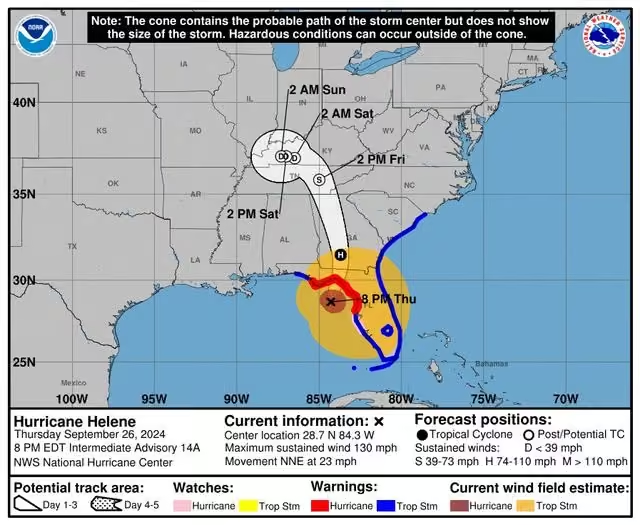
...EXTREMELY DANGEROUS HURRICANE #helene NEARING THE NORTHEAST GULF COAST...
...CATASTROPHIC STORM SURGE AND LIFE-THREATENING WINDS EXPECTED IN THE FLORIDA BIG BEND AREA...
For the latest update, visit: hurricanes.gov -
National Hurricane Center
@NWSNHC
As Major Hurricane #helene approaches the #florida Big Bend, our specialists are working around the clock to provide you with the best forecast. Conditions will continue to deteriorate overnight. Please stay indoors, don't venture out, and heed all warnings. Stay safe!
-
National Hurricane Center reposted
-
National Hurricane Center
@NWSNHC
6:20 PM EDT - NOAA Hurricane Hunter aircraft found that the max sustained winds have increased to 130 mph (215 km/h). The minimum central pressure has also decreased to 947 mb (27.96 inches) based on dropsonde data. This makes #helene an EXTREMELY DANGEROUS Category 4 Hurricane.
-
National Hurricane Center
@NWSNHC
SEP 26 PM: Dr. Michael Brennan provides the latest updates on Major Hurricane #helene from the National Hurricane Center: www.youtube.com/watch?v=tOoIkI6Ggsg&t=44s
For more detailed forecasts and written text updates, visit hurricanes.gov -
National Hurricane Center
@NWSNHC
The NHC Director Dr. Michael Brennan will provide a LIVE update on Major Hurricane #helene around 5:30 PM EDT. Please join us on Facebook Live and the NHC YouTube Page at: youtube.com/user/NWSNHC
Full details of the latest forecast at: hurricanes.gov -
National Hurricane Center
@NWSNHC
Hurricane #helene is a powerful #hurricane that will be making landfall today. Warning Coordination Meteorologist Robbie Berg covers what’s most important if you lose power. For more information, be sure to visit us at hurricanes.gov
www.youtube.com/shorts/_L9-XJ5JpQw -
National Hurricane Center
@NWSNHC
2:25 PM EDT - Air Force Hurricane Hunters found that the max sustained winds have increased to near 120 mph (195 km/h). This makes #helene a dangerous Category 3 MAJOR hurricane. Additional strengthening is expected before #helene makes landfall in the FL Big Bend this evening.
-
National Hurricane Center
@NWSNHC
SEP 26 AM: Dr. Michael Brennan provides the latest updates on Hurricane #helene from the National Hurricane Center: www.youtube.com/watch?v=GFL-nbFs2Xs&t=312s
For more detailed forecasts and written text updates, visit hurricanes.gov -
National Hurricane Center
@NWSNHC
The National Hurricane Center Director Dr. Michael Brennan will provide a LIVE update on Hurricane #helene around 11:05 AM EDT. Please join us on Facebook Live and the NHC YouTube Page at: youtube.com/user/NWSNHC
Full details of the latest forecast at: hurricanes.gov -
National Hurricane Center
@NWSNHC
Dan Brown, NHC Hurricane Specialist Branch Chief talks about Hurricane #helene and the impacts affecting #florida and #georgia
For more information and updates, go to hurricanes.gov #noaa #nhc #hurricane #fl #ga #evacuate #stormsurge
www.youtube.com/shorts/VMiiI-uAZUQ -
National Hurricane Center
@NWSNHC
SEP 25 PM: Jamie Rhome provides the latest updates on Hurricane #helene from the National Hurricane Center: www.youtube.com/watch?v=VpIRR4ASElw&t=57s
For more detailed forecasts and written text updates, visit hurricanes.gov -
National Hurricane Center
@NWSNHC
The National Hurricane Center Deputy Director Jamie Rhome will provide a LIVE update on Hurricane #helene around 5:30 PM EDT. Please join us on Facebook Live and the NHC YouTube Page at: youtube.com/user/NWSNHC
Full details of the latest forecast at: hurricanes.gov -
National Hurricane Center
@NWSNHC
Storm Surge Team Lead Dr. Cody Fritz discusses just how intense the storm surge for Hurricane #helene is going to be for Florida.
www.youtube.com/shorts/Lg-HDxdDZGc
Please listen to local authorities for any updates and evacuation orders. #noaa #nhc #hurricane #fl #ga -
National Hurricane Center
@NWSNHC
SEP 25 AM: Jamie Rhome provides the latest updates on newly upgraded Hurricane #helene from the National Hurricane Center: www.youtube.com/watch?v=vaGXiF2HXWc
For more detailed forecasts and written text updates, visit hurricanes.gov -
National Hurricane Center
@NWSNHC
The NHC Deputy Director Jamie Rhome will provide a LIVE update on newly upgraded Hurricane #helene around 11:30 AM EDT. Please join us on Facebook Live and the NHC YouTube Page at: youtube.com/user/NWSNHC
Full details of the latest forecast at: hurricanes.gov -
National Hurricane Center
@NWSNHC
NHC Deputy Director Jamie Rhome explains what evacuation orders are & why they are in effect. Visit floridadisaster.org to see your evacuation zone & orders today! #helene #noaa #nhc #fl #florida #evacuation #evacuationorder #knowyourzone #knowyourrisk
www.youtube.com/shorts/mJTKhY-fuEE -
National Hurricane Center
@NWSNHC
SEP 24 PM: Jamie Rhome provides the latest updates on Tropical Storm #helene from the National Hurricane Center: www.youtube.com/watch?v=fzd6plQiA1s&t=1s
For more detailed forecasts and written text updates, visit hurricanes.gov -
National Hurricane Center
@NWSNHC
The National Hurricane Center Deputy Director Jamie Rhome will provide a LIVE update on Tropical Storm #helene around 5:30 PM EDT. Please join us on Facebook Live and the NHC YouTube Page at: youtube.com/user/NWSNHC
Full details of the latest forecast at: hurricanes.gov -
National Hurricane Center
@NWSNHC
SEP 24 AM: Jamie Rhome provides the latest updates on now Tropical Storm #helene from the National Hurricane Center: www.youtube.com/watch?v=ThHqMfTqyT0&t=2s
For more detailed forecasts and written text updates, visit hurricanes.gov -
National Hurricane Center
@NWSNHC
The NHC Deputy Director Jamie Rhome will provide a LIVE update on now Tropical Storm #helene around 11:30 AM EDT. Please join us on Facebook Live and the NHC YouTube Page at: youtube.com/user/NWSNHC
Full details of the latest forecast at: hurricanes.gov -
National Hurricane Center
@NWSNHC
SEP 23 PM: Jamie Rhome provides an update on Potential Tropical Cyclone #nine from the National Hurricane Center: www.youtube.com/watch?v=jKCweMdhouU
For more detailed forecasts and written text updates, visit hurricanes.gov -
National Hurricane Center
@NWSNHC
The NHC Deputy Director Jamie Rhome will provide a LIVE update on Potential Tropical Cyclone #nine around 5:30 PM EDT. Please join us on Facebook Live and the NHC YouTube Page at: youtube.com/user/NWSNHC
Full details of the latest forecast at: hurricanes.gov -
National Hurricane Center
@NWSNHC
Stay ready! NHC Deputy Director Jamie Rhome shares safety tips on how you can prepare now for an approaching hurricane. For the latest info on Potential Tropical Cyclone #nine, visit hurricanes.gov #noaa #nhc #fl #florida
www.youtube.com/shorts/mr3ybGlTslY -
National Hurricane Center
@NWSNHC
SEP 23 AM: Jamie Rhome provides an update on Potential Tropical Cyclone #nine from the National Hurricane Center: www.youtube.com/watch?v=9FzwPh64Fs8
For more detailed forecasts and written text updates, visit hurricanes.gov -
National Hurricane Center
@NWSNHC
The NHC Deputy Director Jamie Rhome will provide a LIVE update on Potential Tropical Cyclone #nine around 11:30 AM EDT. Please join us on Facebook Live and the NHC YouTube Page at: youtube.com/user/NWSNHC
Full details of the latest forecast at: hurricanes.gov -
National Hurricane Center
@NWSNHC
SEP 16: Dr. Michael Brennan provides an update on Potential Tropical Cyclone #eight from the National Hurricane Center: www.youtube.com/watch?v=VZA7n5gheeQ&t=1s
For more detailed forecasts and written text updates, visit hurricanes.gov -
National Hurricane Center
@NWSNHC
The NHC Director Dr. Michael Brennan will provide a LIVE update on Potential Tropical Cyclone #eight around 11:00 AM EDT. Please join us on Facebook Live and the NHC YouTube Page at: youtube.com/user/NWSNHC
Full details of the latest forecast at: hurricanes.gov -
National Hurricane Center
@NWSNHC
SEP 11 PM: Jamie Rhome provides the latest update on Hurricane #francine from the National Hurricane Center: www.youtube.com/watch?v=3fKaqiDyGg8
For more detailed forecasts and written text updates, visit hurricanes.gov -
National Hurricane Center
@NWSNHC
NHC Deputy Director Jamie Rhome will provide a LIVE update on Hurricane #francine around 5:40 PM EDT/4:40 PM CDT. Please join us on FB Live and the NHC YouTube Page at: youtube.com/user/NWSNHC
Latest forecast: hurricanes.gov
One stop event page: noaa.gov/Francine -
National Hurricane Center
@NWSNHC
#francine is about to make landfall in #louisiana coastline. Here Jamie Rhome shares some safety tips after the storm. Stay safe and for more information on Francine visit hurricanes.gov #hurricanefrancine
-
National Hurricane Center
@NWSNHC
SEP 11 AM: Dr. Michael Brennan provides the latest updates on Hurricane #francine from the National Hurricane Center: www.youtube.com/watch?v=nMRm2A_uOMw
For more detailed forecasts and written text updates, visit hurricanes.gov -
National Hurricane Center
@NWSNHC
NHC Director Dr. Michael Brennan will provide a LIVE update on Hurricane #francine around 11:20 AM EDT/10:20 AM CDT. Please join us on FB Live and the NHC YouTube Page: youtube.com/user/NWSNHC
Latest forecast: hurricanes.gov
One stop event page: noaa.gov/Francine -
National Hurricane Center
@NWSNHC
SEP 10: Deputy Director Jamie Rhome provides an update on Tropical Storm #francine from the National Hurricane Center: www.youtube.com/live/sO8Vdla1zBc
For more detailed forecasts and written text updates, visit hurricanes.gov -
National Hurricane Center
@NWSNHC
#francine is making its way to the upper #texas, #louisiana, and #mississippi coastlines; the most impactful damage will be the #stormsurge. Director Michael Brennan explains how storm surges affect these areas, especially those along the coast of these states. #tropicalstorm
-
National Hurricane Center
@NWSNHC
SEP 10 AM: Dr. Michael Brennan provides an update on Tropical Storm #francine from the National Hurricane Center: www.youtube.com/watch?v=Ht8xU40siDg&t=46s
For more detailed forecasts and written text updates, visit hurricanes.gov -
National Hurricane Center
@NWSNHC
NHC Director Dr. Michael Brennan will provide a LIVE update on Tropical Storm #francine around 11:10 AM EDT/10:10 AM CDT. Please join us on FB Live and the NHC YouTube Page at: youtube.com/user/NWSNHC
Latest forecast at: hurricanes.gov
One stop: noaa.gov/Francine -
National Hurricane Center
@NWSNHC
SEP 9 5PM: Dr. Michael Brennan provides an update on Tropical Storm #francine from the National Hurricane Center: www.youtube.com/live/bpvUYvq2bu8
For more detailed forecasts and written text updates, visit hurricanes.gov -
National Hurricane Center
@NWSNHC
Sept 9: The National Hurricane Center Director Dr. Michael Brennan will provide a LIVE update on Tropical Storm #francine around 5:00 PM EDT/4:00 PM CDT.
Please join us on Facebook Live and the NHC YouTube Page at: youtube.com/user/NWSNHC
hurricanes.gov -
National Hurricane Center
@NWSNHC
SEP 9 AM: Dr. Michael Brennan provides an update on newly upgraded Tropical Storm #francine from the National Hurricane Center: www.youtube.com/watch?v=P44oRHB1EBs
For more detailed forecasts and written text updates, visit: hurricanes.gov -
National Hurricane Center
@NWSNHC
The NHC Director Dr. Michael Brennan will provide a LIVE update on newly upgraded Tropical Storm #francine around 11:10 AM EDT/10:10 AM CDT. Please join us on Facebook Live and the NHC YouTube Page at: youtube.com/user/NWSNHC
Latest forecast at: hurricanes.gov -
National Hurricane Center
@NWSNHC
Have you ever wondered where tropical cyclones tend to form and move during different times of the year? Good news! We've just updated our historical "Points of Origin and Tracks" maps, which are available in the Climatology section of the NHC webpage at www.nhc.noaa.gov/climo/
-
National Hurricane Center
@NWSNHC
Are you #weatherready for the fall, including being prepared for hurricane season, which runs through November? Check out our latest fall weather safety graphics, videos, social media posts, and more at: weather.gov/wrn/fall-safety
-
National Hurricane Center
@NWSNHC
Good morning from the National Hurricane Center!
-
National Hurricane Center
@NWSNHC
AUG 17: Dr. Michael Brennan provides the last update on Hurricane #ernesto from the National Hurricane Center: www.youtube.com/live/m09CdZN1nyg For more detailed forecasts and text updates continue to visit hurricanes.gov
-
National Hurricane Center
@NWSNHC
The National Hurricane Center Director Dr. Michael Brennan will provide the last LIVE update on Hurricane #ernesto around 11:00 AM EDT. Please join us on Facebook Live and the NHC YouTube Page at: youtube.com/user/NWSNHC
Latest forecast at: hurricanes.gov -
National Hurricane Center
@NWSNHC
AUG 16: Dr. Michael Brennan provides the morning update on Hurricane #ernesto from the National Hurricane Center: www.youtube.com/watch?v=q0a2ZgJnnk4&t=2s
For more detailed forecasts and text updates, visit hurricanes.gov -
National Hurricane Center
@NWSNHC
The NHC Director Dr. Michael Brennan will provide a LIVE update on Hurricane #ernesto around 11:00 AM EDT. Please join us on Facebook Live and the NHC YouTube Page at: youtube.com/user/NWSNHC
Full details of the latest forecast at: hurricanes.gov -
National Hurricane Center
@NWSNHC
As the threat for rip currents increases across most of the East Coast due to #ernesto, NHC Meteorologist Cassie Mora explains what a rip current means and some safety tips in case you get caught in a rip current. weather.gov/beaches #noaa
#ripcurrents @noaaocean -
National Hurricane Center
@NWSNHC
AUG 15: Dr. Michael Brenan provides the morning update on Hurricane #ernesto from the National Hurricane Center: www.youtube.com/watch?v=hDcl69qX9j4
For more detailed forecasts and text updates, visit hurricanes.gov -
National Hurricane Center
@NWSNHC
The NHC Director Dr. Michael Brennan will provide a LIVE update on Hurricane #ernesto around 11:00 AM EDT. Please join us on Facebook Live and the NHC YouTube Page at: youtube.com/user/NWSNHC
Full details of the latest forecast at: hurricanes.gov -
National Hurricane Center
@NWSNHC
AUG 14: Dr. Michael Brenan provides the morning update on now Hurricane #ernesto from the National Hurricane Center: www.youtube.com/watch?v=V_8pLCIVMN8&t=1s
For more detailed forecasts and text updates, visit hurricanes.gov -
National Hurricane Center
@NWSNHC
...ERNESTO BECOMES A HURRICANE NORTH OF PUERTO RICO...
...SIGNIFICANT FLOODING LIKELY ACROSS PUERTO RICO AND THE VIRGIN ISLANDS AS HEAVY RAINS PERSIST...
For the latest forecast, visit: hurricanes.gov -
National Hurricane Center
@NWSNHC
The National Hurricane Center Director Michael Brennan will provide a LIVE update on Hurricane #ernesto around 11:00 AM EDT. Please join us on Facebook Live and the NHC YouTube Page at: youtube.com/user/NWSNHC
For the latest forecast visit: hurricanes.gov -
National Hurricane Center
@NWSNHC
AUG 13: Jamie Rhome provides the afternoon update on Tropical Storm #ernesto from the National Hurricane Center: www.youtube.com/watch?v=sj23RBQReGA&t=59s
For more detailed forecasts and text updates, visit hurricanes.gov -
National Hurricane Center
@NWSNHC
The NHC Deputy Director Jamie Rhome will provide a LIVE update on Tropical Storm #ernesto around 5:20 PM EDT. Please join us on Facebook Live and the NHC YouTube Page at: youtube.com/user/NWSNHC
Full details of the latest forecast at: hurricanes.gov -
National Hurricane Center
@NWSNHC
NHC Deputy Director Jamie Rhome talks about the importance of staying safe from #ripcurrents from #tropicalstorm #ernesto in the East Coast. For the latest forecast visit: hurricanes.gov #noaa #nhc #fl #ga #sc
-
National Hurricane Center
@NWSNHC
AUG 13: Jamie Rhome provides the morning update on Tropical Storm #ernesto from the National Hurricane Center: www.youtube.com/watch?v=oeMJBD0hLRQ&t=1s
For more detailed forecasts and text updates, visit hurricanes.gov -
National Hurricane Center
@NWSNHC
The NHC Director Dr. Michael Brennan will provide a LIVE update on Tropical Storm #ernesto around 11:00 AM EDT. Please join us on Facebook Live and our NHC YouTube Page at: youtube.com/user/NWSNHC
For the latest forecast, visit: hurricanes.gov -
National Hurricane Center
@NWSNHC
AUG 12 5PM: Dr. Michael Brennan provides the afternoon update on Tropical Storm #ernesto from the National Hurricane Center: www.youtube.com/live/hDwdSsseqyE
For more detailed forecasts and text updates, visit hurricanes.gov -
National Hurricane Center
@NWSNHC
The National Hurricane Center Director Dr. Michael Brennan will provide a LIVE update on PTC #five around 5:00 PM EDT. Please join us on Facebook Live and our NHC YouTube Page at: youtube.com/user/NWSNHC
Full details of the latest forecast at: hurricanes.gov -
National Hurricane Center
@NWSNHC
In our new blog post "NHC Cone Heads in a New Direction," we discuss NHC's new experimental cone of uncertainty, which will include inland tropical storm and hurricane watches and warnings in effect for the continental United States.
Read more here: noaanhc.wordpress.com/2024/08/12/nhc-cone-heads-in-a-new-… -
National Hurricane Center
@NWSNHC
AUG 12: Dr. Michael Brennan provides the morning update on Potential Tropical Cyclone #five from the National Hurricane Center: www.youtube.com/live/dyTdPQZFh-g
For more detailed forecasts and text updates, visit hurricanes.gov -
National Hurricane Center
@NWSNHC
The National Hurricane Center Director Dr. Michael Brennan will provide a LIVE update on Potential Tropical Cyclone #five around 11:00 AM EDT.
Please join us on Facebook Live and our NHC YouTube Page at: youtube.com/user/NWSNHC
Latest forecast visit: hurricanes.gov -
National Hurricane Center
@NWSNHC
Aug 8 4PM: The NHC Director Dr. Michael Brennan will provide a LIVE update on Tropical Storm #debby around 4:40 PM EDT. Please join us on Facebook Live and our NHC YouTube Page at: youtube.com/user/NWSNHC
Full details of the latest forecast at: hurricanes.gov #debby2024 -
National Hurricane Center
@NWSNHC
AUG 8: Dr. Michael Brennan provides the morning update on Tropical Storm #debby from the National Hurricane Center: www.youtube.com/live/BMkzXyfMbyY
For more detailed forecasts and text updates, visit hurricanes.gov -
National Hurricane Center reposted
National Hurricane Center
@NWSNHC
Aug 8: The National Hurricane Center Director Dr. Michael Brennan will provide a LIVE update on Tropical Storm #debby around 11:30 AM EDT. Please join us on Facebook Live and our NHC YouTube Page at: youtube.com/user/NWSNHC
-
National Hurricane Center
@NWSNHC
Aug 8: The National Hurricane Center Director Dr. Michael Brennan will provide a LIVE update on Tropical Storm #debby around 11:30 AM EDT. Please join us on Facebook Live and our NHC YouTube Page at: youtube.com/user/NWSNHC
-
National Hurricane Center
@NWSNHC
AUG 7: Dr. Michael Brennan provides the afternoon update on Tropical Storm #debby from the National Hurricane Center: www.youtube.com/watch?v=YxNTCSt0Wuk&t=382s
For more detailed forecasts and text updates, visit hurricanes.gov -
National Hurricane Center
@NWSNHC
The NHC Director Dr. Michael Brennan will provide a LIVE update on Tropical Storm #debby around 5:00 PM EDT. Please join us on Facebook Live and our NHC YouTube Page at: youtube.com/user/NWSNHC
Full details of the latest forecast at: hurricanes.gov -
National Hurricane Center
@NWSNHC
AUG 7: Dr. Michael Brennan provides the morning update on Tropical Storm #debby from the National Hurricane Center: www.youtube.com/watch?v=k22IH0CDEZU
For more detailed forecasts and text updates, visit hurricanes.gov -
National Hurricane Center
@NWSNHC
* UPDATE - Dr. Michael Brennan will provide the latest updates on Tropical Storm #debby at 11:30 AM EDT. Please join us on Facebook Live and our NHC YouTube Page at: youtube.com/user/NWSNHC
You can find full forecast details at: hurricanes.gov -
National Hurricane Center
@NWSNHC
The National Hurricane Center Director Dr. Michael Brennan will provide a LIVE update on Tropical Storm #debby today around 11:00 AM EDT. Please join us on Facebook Live and our National Hurricane Center YouTube Page at: youtube.com/user/NWSNHC
hurricanes.gov #debby2024 -
National Hurricane Center
@NWSNHC
AUG 6: Dr. Michael Brennan provides the afternoon update on Tropical Storm #debby from the National Hurricane Center: www.youtube.com/watch?v=e1gE40_djzM
For more detailed forecasts and text updates, visit hurricanes.gov -
National Hurricane Center
@NWSNHC
The NHC Director Dr. Michael Brennan will provide a LIVE update on Tropical Storm #debby around 5:00 PM EDT. Please join us on Facebook Live and our NHC YouTube Page at: youtube.com/user/NWSNHC
Full details of the latest forecast at: hurricanes.gov -
National Hurricane Center
@NWSNHC
AUG 6: Dr. Michael Brennan provides the morning update on Tropical Storm #debby from the National Hurricane Center: www.youtube.com/watch?v=NbOPDee3XFU&t=205s
For more detailed forecasts and text updates, visit hurricanes.gov -
National Hurricane Center
@NWSNHC
The National Hurricane Center Director Dr. Michael Brennan will provide a LIVE update on Tropical Storm #debby today around 11:00 AM EDT. Please join us on Facebook Live and our National Hurricane Center YouTube Page at: youtube.com/user/NWSNHC
-
National Hurricane Center
@NWSNHC
AUG 5: Dr. Michael Brennan provides the afternoon update on Tropical Storm #debby from the National Hurricane Center: www.youtube.com/watch?v=YIJTLfW8d3Y
For more detailed forecasts and text updates, visit hurricanes.gov -
National Hurricane Center
@NWSNHC
The NHC Director Dr. Michael Brennan will provide a LIVE update on Tropical Storm #debby around 5:30 PM EDT. Please join us on Facebook Live and our NHC YouTube Page at: youtube.com/user/NWSNHC
Full details of the latest forecast at: hurricanes.gov -
National Hurricane Center
@NWSNHC
Attention #georgia and #southcarolina National Hurricane Center Dr. Michael Brennan provides an update on the multiday flash flood threat for southeast region. For the latest forecast, visit hurricanes.gov #sc #ga #georgia #tropicalstorm #nationalnurricanecenter #noaa
-
National Hurricane Center
@NWSNHC
AUG 5: Dr. Michael Brennan provides the morning update on Tropical Storm #debby from the National Hurricane Center: www.youtube.com/watch?v=BT_uRWAt_WA&t=28s
For more detailed forecasts and text updates, visit hurricanes.gov -
National Hurricane Center
@NWSNHC
Join NHC Director Dr. Michael Brennan for a LIVE update on Hurricane Debby today at 11:00 AM EDT via Facebook Live and the NHC YouTube Page: youtube.com/user/NWSNHC
For the latest forecast, visit: hurricanes.gov -
National Hurricane Center
@NWSNHC
AUG 4: Jamie Rhome provides the afternoon update on Tropical Storm #debby from the National Hurricane Center: www.youtube.com/watch?v=FheIx2g9wGI&t=1s
For more detailed forecasts and text updates, visit hurricanes.gov -
National Hurricane Center
@NWSNHC
The NHC Deputy Director Jamie Rhome will provide a LIVE update on Tropical Storm #debby around 5:20 PM EDT. Please join us on Facebook Live and our NHC YouTube Page at: youtube.com/user/NWSNHC
Full details of the latest forecast at: hurricanes.gov -
National Hurricane Center
@NWSNHC
Aug 4: Attention #florida, #georgia and #southcarolina! Here is a quick overview from the NHC on #debby. Heed the advice of your local emergency officials and complete your preparations today. hurricanes.gov
#sc #fl #ga #tropicalstorm #nationalhurricanecenter #noaa -
National Hurricane Center
@NWSNHC
Attention #florida, #georgia and #southcarolina! Here is a quick overview from the NHC on #debby. Please heed the advice of your local emergency officials and complete your preparations today. hurricanes.gov
#sc #fl #ga #tropicalstorm #nationalhurricanecenter #noaa -
National Hurricane Center
@NWSNHC
AUG 4: Dr. Michael Brennan provides the morning update on Tropical Storm #debby from the National Hurricane Center: www.youtube.com/watch?v=U95QOBJFwv8&t=1s
For more detailed forecasts and text updates, visit hurricanes.gov -
National Hurricane Center
@NWSNHC
NHC Director Dr. Michael Brennan will provide a live update on Tropical Storm Debby today around 11:00 AM EDT. Please join us on Facebook Live and our National Hurricane Center YouTube Page at: youtube.com/user/NWSNHC
-
National Hurricane Center
@NWSNHC
AUG 3: Jamie Rhome provides the afternoon update on now Tropical Storm #debby from the National Hurricane Center: www.youtube.com/watch?v=WmjFyCWXar8
For more detailed forecasts and text updates, visit hurricanes.gov -
National Hurricane Center
@NWSNHC
The NHC Deputy Director Jamie Rhome will provide a live update on now Tropical Storm #debby around 5:00 PM EDT. Please join us on Facebook Live and our NHC YouTube Page at: youtube.com/user/NWSNHC
Full details of the latest forecast at: hurricanes.gov -
National Hurricane Center
@NWSNHC
AUG 3: Dr. Michael Brennan provides the morning update on Tropical Depression Four from the National Hurricane Center: www.youtube.com/watch?v=grkmCZM0900&t=141s
For more detailed forecasts and text updates, visit hurricanes.gov -
National Hurricane Center
@NWSNHC
NHC Director Dr. Michael Brennan will provide a live update on Tropical Depression Four today around 11:00 a.m. EDT.
Please join us on Facebook Live and our National Hurricane Center YouTube Page at: youtube.com/user/NWSNHC -
National Hurricane Center
@NWSNHC
AUG 2: Dr. Michael Brennan provides the afternoon update on the tropics on Potential Tropical Cyclone #four from the National Hurricane Center: www.youtube.com/live/UmqBCl7B7o8
For a more detailed graphic forecast and text products, visit hurricanes.gov -
National Hurricane Center
@NWSNHC
NHC Director Dr. Michael Brennan will provide a live update on Potential Tropical Cyclone #four today around 5:00 p.m. EDT. Join us on Facebook Live and our National Hurricane Center YouTube Page at: youtube.com/user/NWSNHC For the latest advisory, visit: hurricanes.gov
-
National Hurricane Center
@NWSNHC
NHC will initiate advisories on Potential Tropical Cyclone #four, located over Eastern Cuba, at 1100 AM EDT (1500 UTC). NHC Director Dr. Michael Brennan will provide a live update today around 11:00 a.m. EDT.
Please join us on Facebook Live & on YouTube youtube.com/user/NWSNHC -
National Hurricane Center
@NWSNHC
AUG 1: Dr. Michael Brennan provides the latest update on the tropics and Invest 97L from the National Hurricane Center: www.youtube.com/watch?v=AIn2CQHcSas&t=4s
For more detailed forecasts and text updates, visit hurricanes.gov -
National Hurricane Center
@NWSNHC
National Hurricane Center Director Dr. Michael Brennan will provide a live update around 4:00 p.m. EDT. on the area of interest (Invest 97L) currently in the Caribbean Sea. Please join us on Facebook Live and our National Hurricane Center YouTube Page at: youtube.com/user/NWSNHC
-
National Hurricane Center
@NWSNHC
JUL 8: Dr. Michael Brennan provides the final update on Tropical Storm #beryl from the National Hurricane Center: www.youtube.com/watch?v=A5XpscO2S3Q
For more detailed forecasts and text updates, visit: hurricanes.gov -
National Hurricane Center
@NWSNHC
The NHC Director Dr. Michael Brennan will provide a final update on Tropical Storm #beryl around 11:00 AM EDT/10:00 AM CDT. Please join us on Facebook Live and the NHC YouTube Page at: youtube.com/user/NWSNHC
Full details of the latest forecast at: hurricanes.gov -
National Hurricane Center
@NWSNHC
JUL 7: Dr. Michael Brennan provides the latest updates on Tropical Storm #beryl from the National Hurricane Center: www.youtube.com/watch?v=ocDFb6kz6Tg
For more detailed forecasts and text updates, visit: hurricanes.gov -
National Hurricane Center
@NWSNHC
The NHC Director Dr. Michael Brennan will provide a live update on Tropical Storm #beryl around 5:00 PM EDT/4:00 PM CDT. Please join us on Facebook Live and the NHC YouTube Page at: youtube.com/user/NWSNHC
Full details of the latest forecast at: hurricanes.gov -
National Hurricane Center
@NWSNHC
JUL 7: Dr. Michael Brennan provides the latest update on Tropical Storm #beryl from the National Hurricane Center: www.youtube.com/live/K4feli8qJV0
For more detailed forecasts and text updates, visit: hurricanes.gov #texas -
National Hurricane Center
@NWSNHC
July 7: Join NHC Director Dr. Michael Brennan for a LIVE update around 11:00 AM EDT/10:00 AM CDT via Facebook Live and the NHC YouTube Page at: youtube.com/user/NWSNHC
-
National Hurricane Center
@NWSNHC
JUL 6: Dr. Michael Brennan provides the latest updates on Tropical Storm #beryl from the National Hurricane Center: www.youtube.com/watch?v=oFdte8-bLa8
For more detailed forecasts and text updates, visit: hurricanes.gov -
National Hurricane Center
@NWSNHC
The NHC Director Dr. Michael Brennan will provide a live update on Tropical Storm #beryl around 5:00 PM EDT/4:00 PM CDT. Please join us on Facebook Live and the NHC YouTube Page at: youtube.com/user/NWSNHC
Full details of the latest forecast at: hurricanes.gov -
National Hurricane Center
@NWSNHC
Attention #texas! Here is the latest update from the National Hurricane Center on #beryl. Please heed the advice from your local emergency officials and complete your preparation plans today. For the latest advisory visit hurricanes.gov 🌀
#houston #southpadre #crpThis media couldn't be displayed. See it on the original post. -
National Hurricane Center
@NWSNHC
JUL 6: Dr. Michael Brennan provides the latest updates on Tropical Storm #beryl from the National Hurricane Center: www.youtube.com/live/FAyzk8sLG9U
For more detailed forecasts and text updates, visit: hurricanes.gov #beryl2024 -
National Hurricane Center
@NWSNHC
Join NHC Director Dr. Michael Brennan for a LIVE update around 11:00 AM EDT via Facebook Live and the NHC YouTube Page at: youtube.com/user/NWSNHC
-
National Hurricane Center
@NWSNHC
JUL 5: Dr. Michael Brennan provides the latest updates on Tropical Storm #beryl from the National Hurricane Center: www.youtube.com/watch?v=A9ZeQ7pfbP4&t=1s
For more detailed forecasts and text updates, visit: hurricanes.gov #beryl2024 -
National Hurricane Center
@NWSNHC
The NHC Director Dr. Michael Brennan will provide a live update on Tropical Storm #beryl around 5:00 PM EDT/4:00 PM CDT. Please join us on Facebook Live and the NHC YouTube Page at: youtube.com/user/NWSNHC
Full details of the latest forecast at: hurricanes.gov -
National Hurricane Center
@NWSNHC
JUL 5: Dr. Michael Brennan provides the latest update on Hurricane #beryl from the National Hurricane Center: www.youtube.com/live/CgFyT4SZhRE
For more detailed forecasts and text updates, visit: hurricanes.gov #beryl2024 -
National Hurricane Center
@NWSNHC
July 5: Join NHC Director Dr. Michael Brennan for a LIVE update around 11:00 AM EDT via Facebook Live and the NHC YouTube Page at: youtube.com/user/NWSNHC
-
National Hurricane Center
@NWSNHC
JUL 4: Dr. Michael Brennan provides the latest updates on Hurricane #beryl from the National Hurricane Center: www.youtube.com/watch?v=OKZRekD-ZAw&t=3s
For more detailed forecasts and text updates, visit hurricanes.gov -
National Hurricane Center
@NWSNHC
The NHC Director Dr. Michael Brennan will provide a live update on Hurricane #beryl around 2:15 PM EDT. Please join us on Facebook Live and the NHC YouTube Page at: youtube.com/user/NWSNHC
Full details of the latest forecast at: hurricanes.gov -
National Hurricane Center
@NWSNHC
JUL 3: Dr. Michael Brennan provides the latest update on Major Hurricane #beryl from the National Hurricane Center: www.youtube.com/watch?v=3vv5jjKv_1Q&t=1s
For more detailed forecasts and text updates, visit hurricanes.gov -
National Hurricane Center
@NWSNHC
The NHC Director Dr. Michael Brennan will provide a live update on Major Hurricane #beryl around 5:00 PM EDT. Please join us on Facebook Live and our NHC YouTube Page at: youtube.com/user/NWSNHC
Full details of the latest forecast at: hurricanes.gov -
National Hurricane Center
@NWSNHC
June 3: Incredible view from NOAA WP-3D Orion inside the eye of Hurricane #beryl. For the latest advisory, visit: hurricanes.gov
NOAA Aircraft Operations Center
@NOAA_HurrHunter
OVER THE CARIBBEAN - Inside the eye of Category 5 Hurricane #beryl!
NOAA WP-3D Orion #noaa43 “Miss Piggy” continues operations into Hurricane #beryl to collect data for hurricane forecasting and research.
Visit hurricanes.gov for the latest forecast and advisories. #flynoaa
📸: Lt. Cmdr. Kevin Doremus, NOAA Corps -
National Hurricane Center
@NWSNHC
JUL 3: Dr. Michael Brennan provides the latest updates on Major Hurricane #beryl from the National Hurricane Center: www.youtube.com/watch?v=PLIawU2E7j4
For more detailed forecasts and text updates, visit hurricanes.gov -
National Hurricane Center
@NWSNHC
The NHC Director Dr. Michael Brennan will provide a live update on Major Hurricane #beryl around 11:15 AM EDT. Please join us on Facebook Live and our NHC YouTube Page at: youtube.com/user/NWSNHC
Full details of the latest forecast at: hurricanes.gov -
National Hurricane Center
@NWSNHC
JUL 2: Dr. Michael Brennan provides the latest updates on Major Hurricane #beryl from the National Hurricane Center: www.youtube.com/watch?v=APpRFN6Pnkc&t=1s
For more detailed forecasts and text updates, visit hurricanes.gov -
National Hurricane Center
@NWSNHC
The NHC Director Dr. Michael Brennan will provide a live update on Major Hurricane #beryl around 5:00 PM EDT. Please join us on Facebook Live and the NHC YouTube Page at: youtube.com/user/NWSNHC
Full details of the latest forecast at: hurricanes.gov -
National Hurricane Center
@NWSNHC
JUL 2: Dr. Michael Brennan provides the latest updates on Major Hurricane #beryl from the National Hurricane Center: www.youtube.com/watch?v=9Pm-oc6Ws5s&t=7s
For more detailed forecasts and text updates, visit hurricanes.gov -
National Hurricane Center
@NWSNHC
The NHC Director Dr. Michael Brennan will provide the latest updates on Major Hurricane #beryl around 11:00 AM EDT. Please join us on Facebook Live and the NHC YouTube Page at: youtube.com/user/NWSNHC
Full details of the latest forecast at: hurricanes.gov -
National Hurricane Center
@NWSNHC
JUL 1: Dr. Michael Brennan provides the latest update on Major Hurricane #beryl from the National Hurricane Center: www.youtube.com/watch?v=VQCwSE9SNAs&t=1s
For more detailed forecasts and text updates, visit hurricanes.gov -
National Hurricane Center
@NWSNHC
The NHC Director Dr. Michael Brennan will provide a live update on Major Hurricane #beryl around 5:00 PM EDT. Please join us on Facebook Live and the NHC YouTube Page at: youtube.com/user/NWSNHC
Full details of the latest forecast at: hurricanes.gov -
National Hurricane Center
@NWSNHC
JUL 1: Dr. Michael Brennan provides the latest updates on Major #hurricaneberyl from the National Hurricane Center: www.youtube.com/watch?v=ak2iO4R6xF8&t=2s
For more detailed forecasts and text updates, visit hurricanes.gov -
National Hurricane Center
@NWSNHC
The NHC Director Dr. Michael Brennan will provide a live update on Major Hurricane #beryl around 11:10 AM EDT. Please join us on Facebook Live and the NHC YouTube Page at: youtube.com/user/NWSNHC
Full details of the latest forecast at: hurricanes.gov -
National Hurricane Center
@NWSNHC
JUN 30: Dr. Michael Brennan provides the latest updates on Major #hurricaneberyl from the National Hurricane Center: www.youtube.com/watch?v=xqRoJpNppi8&t=1s
For more detailed forecasts and text updates, visit hurricanes.gov -
National Hurricane Center
@NWSNHC
The 5 PM EDT advisory for #hurricaneberyl has been issued by the National Hurricane Center. Full details at: hurricanes.gov
Join NHC Director Dr. Michael Brennan for a LIVE update around 5 PM EDT via Facebook Live and the NHC YouTube Page at: youtube.com/user/NWSNHC -
National Hurricane Center
@NWSNHC
JUN 30: Dr. Michael Brennan provides the latest updates on #hurricaneberyl from the National Hurricane Center: www.youtube.com/live/iCmwGtxkPpU
-
National Hurricane Center
@NWSNHC
June 30: Join NHC Director Dr. Michael Brennan for a LIVE update around 12:00 PM EDT via Facebook Live and the NHC YouTube Page at: youtube.com/user/NWSNHC
-
National Hurricane Center
@NWSNHC
JUN 29: Dr. Michael Brennan provides the latest updates on #hurricaneberyl from the National Hurricane Center: www.youtube.com/watch?v=d7XXlfKd5IU
For more detailed forecasts and text updates, visit hurricanes.gov. -
National Hurricane Center
@NWSNHC
The National Hurricane Center Director Dr. Michael Brennan will provide a live update on newly upgraded #hurricaneberyl around 5:00 PM EDT/4:00 PM CDT. Please join us on Facebook Live and our National Hurricane Center YouTube Page at: youtube.com/user/NWSNHC
-
National Hurricane Center
@NWSNHC
JUN 28: Dr. Michael Brennan provides the latest tropical update from the National Hurricane Center: www.youtube.com/watch?v=fDc9prwzLas&t=6s
For more detailed forecasts and text updates, visit hurricanes.gov. -
National Hurricane Center
@NWSNHC
The National Hurricane Center Director Dr. Michael Brennan will provide a live update on the tropics around 5:00 PM EDT/4:00 PM CDT. Please join us on Facebook Live and our National Hurricane Center YouTube Page at: youtube.com/user/NWSNHC
-
National Hurricane Center
@NWSNHC
National Hurricane Center Director Michael Brennan provides an update on newly upgraded #tropicalstormalberto in the Gulf of Mexico. Take action today to ensure you are prepared for the season. The Atlantic hurricane season runs until November 30th. www.youtube.com/watch?v=PufkS0LHigA&t=4s
-
National Hurricane Center
@NWSNHC
The 11 AM EDT/10 AM CDT advisory for newly upgraded #tropicalstormalberto has been issued by the NHC. Full details at: hurricanes.gov. Join NHC Director Dr. Michael Brennan for a LIVE update around 11:30 AM EDT/10:30 AM CDT. youtube.com/user/NWSNHC
-
National Hurricane Center
@NWSNHC
National Hurricane Center Director Michael Brennan provides an update on #potentialtropicalcycloneone in the Gulf of Mexico. Take action today to ensure you are prepared for the season. The Atlantic hurricane season runs until November 30th.www.youtube.com/watch?v=SMi3wjofEnI
-
National Hurricane Center
@NWSNHC
The National Hurricane Center Director Dr. Michael Brennan will provide a live update on #potentialtropicalcycloneone in the Gulf of Mexico around 5:15 PM EDT/4:15 PM CDT. Please join us on Facebook Live and our National Hurricane Center YouTube Page at: youtube.com/user/NWSNHC
-
National Hurricane Center
@NWSNHC
National Hurricane Center Director Michael Brennan provides an update on #potentialtropicalcycloneone in the Gulf of Mexico. Take action today to ensure you are prepared for the season. The Atlantic hurricane season runs until November 30th.
www.youtube.com/watch?v=nxwuovUOMVU&t=8s -
National Hurricane Center reposted
National Hurricane Center
@NWSNHC
The National Hurricane Center Director Dr. Michael Brennan will provide a live update on #potentialtropicalcycloneone in the Gulf of Mexico around 11:30 AM EDT/10:30 AM CDT. Please join us on Facebook Live and our National Hurricane Center YouTube Page at: youtube.com/user/NWSNHC
-
National Hurricane Center
@NWSNHC
The National Hurricane Center Director Dr. Michael Brennan will provide a live update on #potentialtropicalcycloneone in the Gulf of Mexico around 11:30 AM EDT/10:30 AM CDT. Please join us on Facebook Live and our National Hurricane Center YouTube Page at: youtube.com/user/NWSNHC
-
National Hurricane Center
@NWSNHC
Living and working in Miami, we also get prepared for hurricane season! Recently NHC staff participated in a seminar to refresh ourselves on what supplies to buy, how to safely run a generator, and how to keep our families safe during a local hurricane threat.
National Hurricane Center
@NWSNHC
To learn how to prepare your family for a hurricane and keep them safe, visit www.ready.gov/hurricanes for more information.
-
National Hurricane Center
@NWSNHC
Do you know what a "Potential Tropical Cyclone" is? NHC Hurricane Specialist Brad Reinhart explains in this new video: www.youtube.com/watch?v=VybvpGYrtmQ
You can also read more about Potential Tropical Cyclones on a blog post we published last year: noaanhc.wordpress.com/2023/06/14/an-evaluation-of-nhc-ser… -
National Hurricane Center
@NWSNHC
Today's hurricane season kickoff press conference is now available on our YouTube channel at www.youtube.com/watch?v=RVnQ1MKvycQ
-
National Hurricane Center
@NWSNHC
Join us live at 11 am EDT from the National Hurricane Center for a press conference kicking off the 2024 hurricane season. You can watch on our YouTube channel at www.youtube.com/@nwsnhc/stream or Facebook page at www.facebook.com/NWSNHC/
National Hurricane Center
@NWSNHC
We are having technical difficulties with the YouTube live stream. The stream is available on our Facebook page, and we will post the press conference on our YouTube channel once it's complete. We apologize for the inconvenience.
-
National Hurricane Center
@NWSNHC
NHC has published a new post on its blog Inside the Eye focusing on the importance of a tropical cyclone's size, using Hurricanes Charley (2004) and Ian (2022) for comparison.
Blog: noaanhc.wordpress.com/2024/05/28/why-tropical-cyclone-siz…
Video: www.youtube.com/watch?v=_Jyew-aePzI&t=265s -
National Hurricane Center reposted
NOAA Communications
@NOAAComms
Atlantic #hurricaneseason Outlook 2024: 17-25 named storms of which 8-13 could become hurricanes, including 4-7 major hurricanes:
www.noaa.gov/news-release/noaa-predicts-above-normal-2024…
@NWSCPC #hurricaneoutlook #weatherreadynation -
National Hurricane Center
@NWSNHC
Let's start a new fashion trend and call it safety-chic. Whether there's a hurricane or not, be safe when boating--wear a life jacket!🦺#wearyourlifejacketatworkday National Safe Boating Week is May 18-24. @BoatingCampaign safeboatingcampaign.com/life-jackets/
-
National Hurricane Center reposted
Hurricane Hunters
@53rdWRS
Be #weatherready, know your risks. “Now is the time to prepare,” said Mike Brennan, National Hurricane Center director. “Don’t wait for a storm to threaten – by then it may be too late." To read more about the Hurricane Awareness Tour click the link below. dvidshub.net/r/3trl2a
-
National Hurricane Center reposted
Hurricane Hunters
@53rdWRS
Thank you Sanford, FL! It was a great last day of the NOAA Hurricane Awareness Tour at @SFB_Airport!
@NWSNHC
#hurricanepreparednessweek
#hurricaneprep #hurricanestrong -
National Hurricane Center
@NWSNHC
That's a wrap! Thanks to @53rdWRS, @NOAA_HurrHunter, @NWSMelbourne, @FederalAlliance, and many others for a fantastic day @SFB_Airport, and the entire week of the 2024 @NOAA Hurricane Awareness Tour. Hurricane season is only 22 days away--now is the time to prepare!
-
National Hurricane Center
@NWSNHC
Join us live at 2 pm EDT with NHC Warning Coordination Meteorologist Robbie Berg and Storm Surge Specialist Cody Fritz from the Hurricane Awareness Tour in Sanford, FL.
www.youtube.com/@nwsnhc/stream
National Hurricane Center
@NWSNHC
If you missed the live stream, you can find it here: www.youtube.com/live/8gCgdHcL6x0
-
National Hurricane Center
@NWSNHC
Join us live at 1 pm EDT with NHC Director Michael Brennan and the @53rdWRS from the Hurricane Awareness Tour in Sanford, FL.
www.youtube.com/@nwsnhc/stream
National Hurricane Center
@NWSNHC
If you missed the live stream, you can find it here: www.youtube.com/live/fhDEaNypbtg
-
National Hurricane Center
@NWSNHC
Everyone at @NOAA, @NWS, and @NWSNHC thanks you for your support of the hurricane preparedness mission and for collecting critical data inside a storm to help keep people safe!
Hurricane Hunters
@53rdWRS
Hello Florida!
We are at the Orlando-Sanford Airport today for the NOAA Hurricane Awareness Tour to educate the public about the importance of being prepared for the upcoming season.
WC-130Js carry a basic crew of five: pilot, co-pilot, navigator, flight meteorologist and weather reconnaissance loadmaster. Here are our Air Force Reserve Hurricane Hunters who are taking part in the HAT to inform the public about how we collect data for National Hurricane Center forecasts.
To learn more about our mission and the Air Force Reserve visit www.403wg.afrc.af.mil/About/Fact-Sheets/Display/Article/1…
Stay #hurricanestrong!
#hurricanepreparednessweek2024 #weatherready #airforcereserve #airforcereservecommand -
National Hurricane Center
@NWSNHC
Yeah, this mister is cool (the fan, not @NHC_Surge Specialist Cody Fritz) on the hot tarmac of the Hurricane Awareness Tour @SFB_Airport, but you know what else is cool? Starting your hurricane preparations today before hurricane season begins!
-
National Hurricane Center reposted
NWS Gray
@NWSGray
NWS Gray wants to thank everyone who attended the 2024 Hurricane Awareness Tour in Portland Maine on May 6th. We also want to express our gratitude to the many partnering organizations that contributed their time to make it a success. #mewx #hurricanepreparednessweek
-
National Hurricane Center
@NWSNHC
Good morning from Sanford, Florida! We're getting ready for a great day at @SFB_Airport for the last day of the Hurricane Awareness Tour with @NWSMelbourne and @seminolecounty.
-
National Hurricane Center reposted
NWS Los Angeles
@NWSLosAngeles
@NWSLosAngeles @NWSSanDiego @NHC_Atlantic and our local emergency response partners gathered for our first ever Southern California Tropical Workshop - discussing ways to keep us all safe if a tropical cyclone approaches. Special thank you to our gracious hosts at @LongBeachCity
-
National Hurricane Center reposted
Hurricane Hunters
@53rdWRS
Good morning Charleston!
We are here today as part of the NOAA Hurricane Awareness Tour at the Charleston International Airport in South Carolina.
Our WC-130J is a modified C-130J transport plane that’s equipped with weather instruments to gather information on the size, intensity, and movement of storms, hurricanes, tropical disturbances, and winter storms. The data we collect improves National Hurricane Center forecasts.
To learn more about how to be weather ready for hurricane season visit ready.gov.
#hurricanestrong #hurricaneprep #weatherready #noaa -
National Hurricane Center
@NWSNHC
Getting into position for Day 4 of the Hurricane Awareness Tour at @iflyCHS with @NWSCharlestonSC, @53rdWRS, and @NOAA_HurrHunter.
-
National Hurricane Center
@NWSNHC
Speaking of canines, that reminds us...do you know how to prepare your pets for potential disasters like a hurricane?
www.ready.gov/pets
Hurricane Hunters
@53rdWRS
Thank you Norfolk! We enjoyed hosting students, members of the media and public … and security canines … during the #noaa Hurricane Awareness Tour today. Stay #hurricanestrong! Next stop is Charleston International Airport, S.C. #hurricanepreparednessweek
-
National Hurricane Center
@NWSNHC
Day 3 of the Hurricane Awareness Tour at @NorfolkAirport a wrap, and we want to thank @NWSWakefieldVA, @VDEM, and many others in the Hampton Roads area for putting on a great event. Next stop: Charleston, South Carolina!
-
National Hurricane Center
@NWSNHC
Join us live at 1:30 pm EDT from Norfolk, Virginia, when NHC Director Michael Brennan speaks with @NOAA_HurrHunter Flight Director Nikki Hathaway from on board the P-3 Hurricane Hunter aircraft. www.youtube.com/@nwsnhc/stream
National Hurricane Center
@NWSNHC
If you missed our live stream at 1:30 pm from inside the @NOAA_HurrHunter P3 aircraft in Norfolk, Virginia, you can still watch it now!:
www.youtube.com/live/7RPTGxHIvbo -
National Hurricane Center
@NWSNHC
The 2024 Hurricane Webinar series, hosted by @NOAA's Southeast and Caribbean Regional Collaboration Team, continues on Friday, May 10 at 1 pm.
Registration for all webinars can be found here: www.noaa.gov/regional-collaboration-network/regions-south… -
National Hurricane Center reposted
Hurricane Hunters
@53rdWRS
Good morning Norfolk!
We are at the Norfolk International Airport in Virginia today from 9 to 4 p.m. for the NOAA Hurricane Awareness Tour.
Our WC-130J Super Hercules aircraft and the NOAA WP-3D are on display. Both are configured with meteorological equipment to gather data for NHC to improve their forecasts. Hurricane season starts June 1 and now is the time to prepare. #hurricanestrong #noaa #flynoaa #airforcereserve #airforcereservecommand #hurricaneprep #hurricanepreparednessweek -
National Hurricane Center reposted
NWS Wakefield
@NWSWakefieldVA
Good morning from the @53rdWRS @NWSNHC aircraft! We are out at the Norfolk Airport with so many wonderful partners to bring awareness to the dangers and safety tips of hurricane season. See our pinned tweet for more info if you’d like to visit.
-
National Hurricane Center
@NWSNHC
We're all set to go with @NWSWakefieldVA for the 3rd day of the Hurricane Awareness Tour in Norfolk! Public tours are from 2-4 pm (gates close at 3 pm). Come out and see the @53rdWRS & @NOAA_HurrHunter planes!
www.weather.gov/akq/2024HAT -
National Hurricane Center
@NWSNHC
Thank you to the staff of @NWSAlbany , @NWSBinghamton, @NWSNERFC, & @NWSEastern for putting on a great event today for the Hurricane Awareness Tour at @AlbanyAirport--and ordering up perfect weather! See you soon Norfolk!
-
National Hurricane Center
@NWSNHC
Join us live on YouTube with @NWSWPC Director David Novak, Warning Coordination Meteorologist Alex Lamers, and @NWSNERFC Hydrologist-in-Charge Paula Miano at 2:30 pm EDT.
www.youtube.com/@nwsnhc/stream -
National Hurricane Center
@NWSNHC
NWS Director Ken Graham and NHC Director Michael Brennan will be live from the Hurricane Awareness Tour in Albany, New York, at 12:30 pm EDT on our YouTube channel at www.youtube.com/@nwsnhc/stream
-
National Hurricane Center
@NWSNHC
What a gorgeous morning at @AlbanyAirport for the 2nd day of the Hurricane Awareness Tour with @NWSAlbany. Despite the 🌞 weather, today we're focusing on the inland flood threat that tropical cyclones can pose to places like Upstate New York.
-
National Hurricane Center reposted
Hurricane Hunters
@53rdWRS
It’s the first day of the Hurricane Awareness Tour in Portland, Maine, and it’s National Hurricane Awareness Week.
Take action now to be better prepared for hurricane season. Tomorrow we will be in Albany, New York.
For information on how to prepare visit: www.noaa.gov/hurricane-prep and ready.gov
#hurricanestrong #hurricanestrong #hurricaneprep #weatherready #readynow #hurricanepreparednessweek -
National Hurricane Center
@NWSNHC
Thank you @NWSGray and @NWSCaribou for a great event today on the Hurricane Awareness Tour @portlandjetport. On to tomorrow's event in Albany, NY!
P.S. We appreciated the cool Maine weather--our stops later in the week look 🔥! -
National Hurricane Center
@NWSNHC
NHC Director Michael Brennan will be live from the Hurricane Awareness Tour in Portland, Maine, at 1:45 pm EDT on our YouTube channel at www.youtube.com/@nwsnhc/streams
-
National Hurricane Center
@NWSNHC
Good morning from Portland, Maine! Today is the first day of the 2024 Hurricane Awareness Tour. Join us, @NWSGray, @53rdWRS, and @NOAA_HurrHunter to see the Hurricane Hunter planes at @portlandjetport, with public tours from 1:30-3 pm.
More info: www.weather.gov/gyx/2024hat -
National Hurricane Center
@NWSNHC
In preparation for the upcoming hurricane season, we have updated the NHC Product Description document. This is a great resource if you ever have any questions about how to interpret our text and graphical tropical cyclone-related products.
www.nhc.noaa.gov/pdf/NHC_Product_Description.pdf -
National Hurricane Center
@NWSNHC
There's still time to register for tomorrow's (Wed, Apr. 24) @amswxband webinar at 7 pm EDT with NHC Director Dr. Michael Brennan! Join him as he talks about changes to @NWS hurricane products and preparing for the upcoming hurricane season.
Register: us06web.zoom.us/webinar/register/WN_BZq-9uUtQYmTOHuLREJ32g -
National Hurricane Center
@NWSNHC
Reminder about tomorrow's @NOAA Southeast and Caribbean Regional Team webinar!
Register here: register.gotowebinar.com/register/2025349235366879834
National Hurricane Center
@NWSNHC
Join us online next Tuesday, April 23 from 1-2 pm EDT as the @NOAA Southeast & Caribbean Regional Team (SECART) and NHC host a webinar on lessons learned from the 2023 hurricane season and what's new for 2024 products and services.
Register: register.gotowebinar.com/register/2025349235366879834 -
National Hurricane Center
@NWSNHC
🚨Another webinar opportunity! Join NHC Director Dr. Michael Brennan next Tuesday, April 24 at 7 pm EDT where he'll talk about improvements to @NWS hurricane products and preparing for the upcoming hurricane season.
Register through @amswxband here: us06web.zoom.us/webinar/register/WN_BZq-9uUtQYmTOHuLREJ32g -
National Hurricane Center
@NWSNHC
🇧🇧 In addition to the CHAT, several NHC staff are also in Barbados @CIMHbb this week with @UCAR_News and meteorologists from Caribbean countries to discuss storm surge vulnerability and tools for assessing storm surge risk in the region before a hurricane threat.
-
National Hurricane Center
@NWSNHC
🇧🇸🌀NHC is participating in the 2024 Caribbean Hurricane Awareness Tour (CHAT) this week. Today @53rdWRS, @NOAA_HurrHunter, and NHC are in Nassau, Bahamas, to help get emergency managers, media, and residents of the Bahamas ready for the upcoming hurricane season.
-
National Hurricane Center
@NWSNHC
Join us online next Tuesday, April 23 from 1-2 pm EDT as the @NOAA Southeast & Caribbean Regional Team (SECART) and NHC host a webinar on lessons learned from the 2023 hurricane season and what's new for 2024 products and services.
Register: register.gotowebinar.com/register/2025349235366879834 -
National Hurricane Center
@NWSNHC
🚨REMINDER! We are updating some of our products and services for the upcoming 2024 hurricane season. Please refer to our product update document and familiarize yourself with these updates before the season begins!
www.nhc.noaa.gov/pdf/NHC_Updates_2024.pdf
National Hurricane Center
@NWSNHC
NHC updates for the 2024 hurricane season (continued)
www.nhc.noaa.gov/pdf/NHC_Updates_2024.pdf -
National Hurricane Center
@NWSNHC
The @WMO Hurricane Committee has retired #otis and #dora from the list of eastern Pacific names, replacing them with #otilio and #debora. Note that no names were retired from the Atlantic basin list--the first time since 2014.
World Meteorological Organization
@WMO
WMO #hurricane Committee retired #otis from rotating list of names in eastern North Pacific because of destruction in Acapulco, Mexico, in Oct 2023.
It retired #dora because of indirect links to deadly Hawaii fires.
Otilio and Debora will be used instead.
wmo.int/news/media-centre/wmo-hurricane-committee-retires… -
National Hurricane Center
@NWSNHC
The annual @WMO Hurricane Committee Meeting is underway this week in Panama City, Panama. As part of the meeting, the committee will review the 2023 hurricane season and decide whether to retire and replace any of the names from last year's Atlantic and eastern Pacific lists.
-
National Hurricane Center
@NWSNHC
NHC has announced updates to our products and services for the 2024 hurricane season, including new Spanish text products, issuance of watches/warnings on intermediate advisories, and an experimental cone graphic depicting inland U.S. watches/warnings.
www.nhc.noaa.gov/pdf/NHC_New_Products_Updates_2024.pdf
National Hurricane Center
@NWSNHC
Updates (continued)
-
National Hurricane Center reposted
NHC Pacific
@NHC_Pacific
NHC has released the Tropical Cyclone Report for Hurricane #hilary (August 16-20, 2023). Hilary made landfall as a tropical storm in Baja California, Mexico, and brought tropical storm conditions and catastrophic flooding to portions of the Southwest U.S.
www.nhc.noaa.gov/data/tcr/EP092023_Hilary.pdf -
National Hurricane Center
@NWSNHC
The National Hurricane Center will begin issuing an experimental Tropical Cyclone Forecast Cone Graphic on our around August 15, 2024, that includes inland tropical storm and hurricane watches and warnings for the continental U.S.
Read more here: www.nhc.noaa.gov/pdf/NHC_Cone_Graphic_Change_Announcement… -
National Hurricane Center reposted
NOAA
@NOAA
(2/2) View/download our 2023 Atlantic #hurricaneseason satellite video + images at:
www.noaa.gov/news-release/2023-atlantic-hurricane-season-…
#weatherreadynation @NOAA @NWSThis media couldn't be displayed. See it on the original post. -
National Hurricane Center reposted
NOAA
@NOAA
(1/2) The 2023 Atlantic #hurricaneseason ends on Nov. 30. It was an above-average season w/20 named storms, including 7 hurricanes, of which 3 intensified to be major:
www.noaa.gov/news-release/2023-atlantic-hurricane-season-…
#weatherreadynation @NOAA @NWS -
National Hurricane Center
@NWSNHC
@SecRaimondo visited @NWSNHC and met with NOAA leaders from @NWS, @noaaocean, @noaa_omao & @NOAAResearch today. Our dedicated staff demonstrated the process of creating tropical and marine forecasts and how we analyze complex conditions of the atmosphere & ocean.
-
National Hurricane Center
@NWSNHC
NHC has a new post on its blog "Inside the Eye," authored by Hurricane Specialist Brad Reinhart, about the issuance of advisories on cyclones that become post-tropical but still pose a risk of hazards to land areas (such as Matthew, Dorian, and Fiona).
noaanhc.wordpress.com/2023/09/28/an-evaluation-of-nhc-ser… -
National Hurricane Center
@NWSNHC
SEP 23: Here is the last tropical update on TS #ophelia from the National Hurricane Center:
www.youtube.com/live/RxIBe00_oVU
For the latest forecast, please visit: hurricanes.gov and from your local weather service office at weather.gov -
National Hurricane Center
@NWSNHC
The 11 AM EDT advisory for Tropical Storm Ophelia has been issued by the NHC. Full details at: hurricanes.gov
Join NHC Director Dr. Michael Brennan for a LIVE update around 11:15 AM EDT via Facebook Live and the NHC YouTube Page at: youtube.com/user/NWSNHC -
National Hurricane Center
@NWSNHC
SEP 22: Here is the afternoon update from the 5 PM advisory on Tropical Storm #ophelia from the National Hurricane Center: www.youtube.com/watch?v=bGGh-u4KmIs
For the latest forecast, please visit: hurricanes.gov -
National Hurricane Center
@NWSNHC
The 5 PM EDT advisory for Tropical Storm #ophelia has been issued by the NHC. Full details at: hurricanes.gov
Join NHC Director Dr. Michael Brennan for a LIVE update around 5:15 PM EDT via Facebook Live and the NHC YouTube Page at: youtube.com/user/NWSNHC -
National Hurricane Center
@NWSNHC
SEP 22: Here is the latest tropical update from the National Hurricane Center on PTC #sixteen:
www.youtube.com/live/RZTwQJ2y3K4
For the latest forecast, please visit: hurricanes.gov -
National Hurricane Center
@NWSNHC
The 11 AM advisory for PTC #sixteen has been issued by the National Hurricane Center. Full details at: hurricanes.gov
Join NHC Director Dr. Michael Brennan for a LIVE update around 11:30 AM EDT via Facebook Live and the NHC YouTube Page at: youtube.com/user/NWSNHC -
National Hurricane Center
@NWSNHC
SEP 21: Here are the latest tropical updates from the 5 PM advisory on Post Tropical Cyclone Sixteen from the National Hurricane Center: www.youtube.com/live/SbCQH-GluSY
For the latest forecast, please visit: hurricanes.gov -
National Hurricane Center
@NWSNHC
The NHC Director Dr. Michael Brennan will provide a LIVE update on Potential Tropical Cyclone Sixteen around 5:15 PM EDT. Please join us on Facebook Live and our National Hurricane Center YouTube Page at: youtube.com/user/NWSNHC
Full details at: www.nhc.noaa.gov -
National Hurricane Center
@NWSNHC
SEP 21: Here is the morning tropical update from the National Hurricane Center on PTC #sixteen:
www.youtube.com/live/v7ijrRul6bo
For the latest forecast, please visit: hurricanes.gov -
National Hurricane Center
@NWSNHC
11 AM EDT advisory for Potential Tropical Cyclone Sixteen has been issued. Full details at: hurricanes.gov
Join NHC Director Dr. Michael Brennan for a LIVE update around 11:30 AM EDT via Facebook Live and NHC YouTube: youtube.com/user/NWSNHC -
National Hurricane Center
@NWSNHC
SEP 16: Here is the latest tropical update from the National Hurricane Center: www.youtube.com/live/jITplbZWfwY
For the latest forecast, please visit: hurricanes.gov -
National Hurricane Center
@NWSNHC
The 11 AM EDT advisory for Post-Tropical Cyclone Lee has been issued by the NHC. Full details at: hurricnes.gov
Join NHC Director Dr. Michael Brennan for a LIVE update around 11:30 AM EDT via Facebook Live and the NHC YouTube Page at: youtube.com/user/NWSNHC -
National Hurricane Center
@NWSNHC
SEP 15: Here are the latest tropical updates from the 5 PM advisory on Hurricane Lee from the National Hurricane Center: www.youtube.com/live/Rg5qhQQ7gq8
For the latest forecast, please visit: hurricanes.gov -
National Hurricane Center
@NWSNHC
The 5 PM EDT advisory for Hurricane Lee has been issued by the NHC. Full details at: www.nhc.noaa.gov
Join NHC Deputy Director Jamie Rhome for a LIVE update on Hurricane Lee around 5:30 PM EDT via Facebook Live and the NHC YouTube Page at: youtube.com/user/NWSNHC -
National Hurricane Center
@NWSNHC
SEP 15: Here is the latest tropical update from the 11 AM advisory on Hurricane Lee from the National Hurricane Center: www.youtube.com/live/R6bXlDIvyOo
For the latest forecast, please visit: hurricanes.gov -
National Hurricane Center
@NWSNHC
The 11 AM EDT advisory for Hurricane Lee has been issued by the NHC. Full details at: www.nhc.noaa.gov
Join NHC Director Dr. Michael Brennan for a LIVE update on Hurricane Lee around 11:30 AM EDT via Facebook Live and the NHC YouTube Page at: youtube.com/user/NWSNHC -
National Hurricane Center reposted
-
National Hurricane Center
@NWSNHC
SEP 14: Here is the latest tropical update from the 5 PM advisory on Hurricane Lee from the National Hurricane Center: www.youtube.com/live/D4w6I8kmIvY
For the latest forecast, please visit: hurricanes.gov -
National Hurricane Center
@NWSNHC
The National Hurricane Center is delayed in our livestream due to waiting for important updates to bring you the latest information. Please standby for our updated timeframe of 6:05 PM EDT for our LIVE update with NHC Deputy Director Jamie Rhome.
-
National Hurricane Center
@NWSNHC
The 5 PM EDT advisory for Hurricane Lee has been issued by the NHC. Full details at: www.nhc.noaa.gov
Join NHC Deputy Director Jamie Rhome for a LIVE update on Hurricane Lee around 5:30 PM EDT via Facebook Live and the NHC YouTube Page at: youtube.com/user/NWSNHC -
National Hurricane Center
@NWSNHC
SEP 14: Here are the latest updates from the 11 AM advisory on Hurricane Lee from the National Hurricane Center: www.youtube.com/live/yvU8xftFwRc
For the latest forecast, please visit: hurricanes.gov -
National Hurricane Center
@NWSNHC
The 11 AM EDT advisory for Hurricane Lee has been issued by the NHC. Full details at: www.nhc.noaa.gov
Join NHC Director Dr. Michael Brennan for a LIVE update on Hurricane Lee around 11:30 AM EDT via Facebook Live and the NHC YouTube Page at: youtube.com/user/NWSNHC -
National Hurricane Center
@NWSNHC
SEP 13: Here are the latest updates from the 5 PM advisory on Hurricane Lee from the National Hurricane Center: www.youtube.com/live/b94BkFKJsME
For the latest forecast, please visit: hurricanes.gov -
National Hurricane Center
@NWSNHC
The 5:00 PM EDT advisory for Lee has been issued by the NHC. Full details at:
hurricanes.gov
Join NHC Director Dr. Michael Brennan for a LIVE update on Hurricane Lee around 5:15 PM EDT via Facebook Live and the NHC YouTube Page at: youtube.com/user/NWSNHC -
National Hurricane Center
@NWSNHC
SEP 13: Here is the latest update on Hurricane Lee from the National Hurricane Center: www.youtube.com/live/4SNke7QZz5E
For the latest forecast, please visit: hurricanes.gov -
National Hurricane Center
@NWSNHC
The 11 AM EDT advisory for Hurricane Lee has been issued by the NHC. Full details at: www.nhc.noaa.gov
Join NHC Director Dr. Michael Brennan for a LIVE update on Hurricane Lee around 11:30 AM EDT via Facebook Live and the NHC YouTube Page at: youtube.com/user/NWSNHC -
National Hurricane Center
@NWSNHC
Sept 12: Here is the latest tropical update from the National Hurricane Center: www.youtube.com/live/z8L7OOtgqU0
For the latest forecast, please visit: hurricanes.gov -
National Hurricane Center
@NWSNHC
The 11 AM EDT advisory for Hurricane Lee has been issued by the NHC. Full details at: www.nhc.noaa.gov
Join NHC Director Dr. Michael Brennan for a LIVE update on Hurricane Lee around 11:30 AM EDT via Facebook Live and the NHC YouTube Page at: youtube.com/user/NWSNHC -
National Hurricane Center
@NWSNHC
Recording Available: National Hurricane Center Director Dr. Michael Brennan provides the latest update on Hurricane Lee (recorded live on Sep 11; 12:15pm EDT):
www.youtube.com/live/GlTsH0fKNjI
Full NHC forecast at nhc.noaa.gov -
National Hurricane Center
@NWSNHC
The 11am EDT advisory for Hurricane Lee has been issued by the NHC. Full details at: www.nhc.noaa.gov
Join NHC Director Dr. Michael Brennan for a LIVE update on Hurricane Lee around 12:15 PM EDT via Facebook Live and the NHC YouTube Page at: youtube.com/user/NWSNHC -
National Hurricane Center
@NWSNHC
Sept 8: Here is the latest tropical update from the National Hurricane Center on Hurricane Lee:
www.youtube.com/live/DUWKTPSSSxc
For the latest forecast, please visit: hurricanes.gov -
National Hurricane Center
@NWSNHC
The 11am EDT advisory for Hurricane Lee has been issued by the National Hurricane Center. Full details at: www.nhc.noaa.gov
Join NHC Director Michael Brennan for a LIVE UPDATE on Lee around 11:30am EDT via Facebook Live and the NHC YouTube Page at: youtube.com/user/NWSNHC -
National Hurricane Center
@NWSNHC
Recording Available: National Hurricane Center Director Michael Brennan provides update on Idalia (recorded live on Aug. 31; 11:30 am EDT):
www.youtube.com/live/3lwjiYCuwuU
Full NHC forecast at nhc.noaa.gov -
National Hurricane Center
@NWSNHC
The 11am EDT advisory for Tropical Storm Idalia has been issued by the NHC. Full details at: www.nhc.noaa.gov
Join NHC Director Dr. Michael Brennan for a LIVE UPDATE on Idalia around 11:30am EDT via Facebook Live and the NHC YouTube Page at: youtube.com/user/NWSNHC -
National Hurricane Center
@NWSNHC
Recording Available: National Hurricane Center Deputy Director Jamie Rhome provides update on Idalia (recorded live on Aug. 30; 5:30pm EDT): www.youtube.com/watch?v=_eaMukPN9N8
Full NHC forecast at nhc.noaa.gov -
National Hurricane Center
@NWSNHC
The 5pm EDT advisory for Idalia - now a tropical storm - has been issued. Full details at www.nhc.noaa.gov
Join NHC Deputy Director Jamie Rhome for a live update on Idalia around 5:30pm EDT via Facebook Live and the NHC YouTube Page at: youtube.com/user/NWSNHC -
National Hurricane Center
@NWSNHC
Recording Available: National Hurricane Center Director Michael Brennan provides update on Idalia (recorded live on Aug. 30; 1:40pm EDT): www.youtube.com/watch?v=8OIXZBtAXjU
Full NHC forecast at www.nhc.noaa.gov -
National Hurricane Center
@NWSNHC
Technical difficulties with this morning's Live Update have been resolved. Please join NHC Director Michael Brennan for a Live Update on Idalia at around 1:40pm EDT via Facebook Live and the NHC YouTube Page at: youtube.com/user/NWSNHC
-
National Hurricane Center
@NWSNHC
Idalia still has many communities in its path — but once the storm has passed, keep in mind this important safety information. And share these tips with your family and friends! Check the forecast at hurricanes.gov and weather.gov
-
National Hurricane Center
@NWSNHC
The 11am EDT advisory for Hurricane Idalia has been issued. Full details at: www.nhc.noaa.gov
Join NHC Director Michael Brennan for a LIVE UPDATE on Idalia around 11:30am EDT via Facebook Live and the NHC YouTube Page at: youtube.com/user/NWSNHC -
National Hurricane Center
@NWSNHC
Aug. 29: Here is a briefing on the 5pm EDT update on Hurricane Idalia from the National Hurricane Center: www.youtube.com/watch?v=zJ9VExBjk7Y
For the latest forecast, please visit: hurricanes.gov -
National Hurricane Center
@NWSNHC
The National Hurricane Center Deputy Director Jamie Rhome will provide a live update on Hurricane Idalia around ***5:45 PM EDT****. Please join us on Facebook Live and our National Hurricane Center YouTube Page at: youtube.com/user/NWSNHC
-
National Hurricane Center
@NWSNHC
The National Hurricane Center Deputy Director Jamie Rhome will provide a live update on Hurricane Idalia around 5:30 PM EDT. Please join us on Facebook Live and our National Hurricane Center YouTube Page at: youtube.com/user/NWSNHC
-
National Hurricane Center
@NWSNHC
Aug 29: Here is the latest tropical update from the National Hurricane Center.
www.youtube.com/live/bw9KaAgq0aE
For the latest forecast, please visit: hurricanes.gov -
National Hurricane Center
@NWSNHC
Update 6:00 PM EDT: Here is the latest live stream from NHC:
www.youtube.com/live/7tnQzgDt41U -
National Hurricane Center
@NWSNHC
The National Hurricane Center Deputy Director Jamie Rhome will provide a live update on Tropical Storm Idalia around 5:30 PM EDT. Please join us on Facebook Live and our National Hurricane Center YouTube Page at: youtube.com/user/NWSNHC
-
National Hurricane Center
@NWSNHC
The National Hurricane Center Director Michael Brennan will provide a live update on the tropics at 11:30 am EDT. Please join us on Facebook Live and our National Hurricane Center YouTube Page at: youtube.com/user/NWSNHC
-
National Hurricane Center
@NWSNHC
Aug 27: Here is the latest update on Tropical Storm #idalia from the National Hurricane Center.
➡️www.youtube.com/live/YxhVgpyeS-4
➡️For the latest forecast, please visit: hurricanes.gov -
National Hurricane Center
@NWSNHC
The National Hurricane Center Deputy Director Jamie Rhome will provide a live update on Tropical Storm Idalia around 5:30 PM EDT. Please join us on Facebook Live and our National Hurricane Center YouTube Page at:
youtube.com/user/NWSNHC -
National Hurricane Center
@NWSNHC
Aug 27: Here is the latest tropical update from the National Hurricane Center.
➡️www.youtube.com/live/3lXLjvBPXFI
➡️For the latest forecast, please visit: hurricanes.gov -
National Hurricane Center
@NWSNHC
The National Hurricane Center Deputy Director Jamie Rhome will provide a live update on Hurricane Franklin and Tropical Depression Ten around 11:30 AM EDT. Please join us on Facebook Live and our National Hurricane Center YouTube Page at:
youtube.com/user/NWSNHC -
National Hurricane Center
@NWSNHC
Aug 26: Here is the latest tropical update from the National Hurricane Center.
➡️www.youtube.com/live/wBZIyl1MwuA
➡️For the latest forecast, please visit: hurricanes.gov -
National Hurricane Center
@NWSNHC
The National Hurricane Center Deputy Director Jamie Rhome will provide a live update on the tropics around 5:30 PM EDT. Please join us on Facebook Live and our National Hurricane Center YouTube Page at: youtube.com/user/NWSNHC
-
National Hurricane Center
@NWSNHC
Aug 26: Here is the latest tropical update from the National Hurricane Center.
➡️www.youtube.com/live/30JeBr0swzw
➡️For the latest forecast, please visit: hurricanes.gov -
National Hurricane Center
@NWSNHC
The National Hurricane Center Deputy Director Jamie Rhome will provide a live update on the tropics around 11:30 AM EDT. Please join us on Facebook Live and our National Hurricane Center YouTube Page at: youtube.com/user/NWSNHC
-
National Hurricane Center
@NWSNHC
Aug 25: Here is the latest tropical update from the National Hurricane Center.
www.youtube.com/live/YUvEw4Yy52s
For the latest forecast, please visit: hurricanes.gov -
National Hurricane Center
@NWSNHC
The National Hurricane Center Director Dr. Michael Brennan will provide a live update on Tropical Storm Franklin and the area of possible development in the NW #caribbeansea at 11:30 am EDT. Please join us on Facebook Live and our NHC YouTube Page at: youtube.com/user/NWSNHC
-
National Hurricane Center
@NWSNHC
Aug 23: Here is the latest tropical update from the National Hurricane Center:
www.youtube.com/live/ws_OXUdN2Y8
For the latest forecast, please visit: hurricanes.gov -
National Hurricane Center
@NWSNHC
The National Hurricane Center Deputy Director Jamie Rhome will provide a live update on the tropics around 12:15 PM EDT. Please join us on Facebook Live and our National Hurricane Center YouTube Page at: youtube.com/user/NWSNHC
-
National Hurricane Center
@NWSNHC
Aug 22: Here is the latest tropical update from the National Hurricane Center
➡️www.youtube.com/live/C5O1Dhec75w
➡️For the latest forecast, please visit: hurricanes.gov -
National Hurricane Center
@NWSNHC
The National Hurricane Center Deputy Director Jamie Rhome will provide a live update on the tropics around 10:15 AM EDT/9:15 AM CDT. Please join us on Facebook Live or our National Hurricane Center YouTube Page at: youtube.com/user/NWSNHC
-
National Hurricane Center
@NWSNHC
Aug 21: Here is the latest tropical update from the National Hurricane Center.
➡️www.youtube.com/live/fatFBxEGMJ0
For the latest forecast, please visit hurricanes.gov -
National Hurricane Center
@NWSNHC
Aug 21: The National Hurricane Center Deputy Director Jamie Rhome will provide a live update on the tropics at 11:30 AM EDT from the Hurricane Center. Please join us on Facebook Live and our National Hurricane Center You Tube Page at: youtube.com/user/NWSNHC
-
National Hurricane Center
@NWSNHC
Aug 20 afternoon tropical update on #hilary and Tropical Storm #franklin from the National Hurricane Center.
➡️www.youtube.com/live/LdjkGbtE1EM
For the latest forecast, please visit hurricanes.gov -
National Hurricane Center
@NWSNHC
The National Hurricane Center Deputy Director Jamie Rhome will provide the afternoon update on Hurricane Hilary 5:30 PM EDT/2:30 PM PDT from the Hurricane Center. Please join us on Facebook Live and our National Hurricane Center You Tube Page at: youtube.com/user/NWSNHC
-
National Hurricane Center
@NWSNHC
Aug 20 tropical update on #hurricanehilary and the activity in the #atlantic from the National Hurricane Center.
➡️www.youtube.com/live/EQKq44X03Ns
For the latest forecast, please visit hurricanes.gov -
National Hurricane Center
@NWSNHC
Aug 20: The NHC Director Michael Brennan will provide a live update on Hurricane Hilary and the areas we are monitoring in the Atlantic at 11:15 AM EDT/8:15 AM PDT from the Hurricane Center. Please join us on Facebook Live and our You Tube Page at: youtube.com/user/NWSNHC
-
National Hurricane Center
@NWSNHC
Aug 19 6PM EDT: Afternoon tropical update on #hurricanehilary from the National Hurricane Center.
➡️www.youtube.com/live/1NKZpZy_v4M
For the latest forecast, please visit hurricanes.gov -
National Hurricane Center
@NWSNHC
The National Hurricane Center Deputy Director Jamie Rhome will provide a live update on Hurricane Hilary 5:30 PM EDT/2:30 PM PDT from the Hurricane Center. Please join us on Facebook Live and our National Hurricane Center You Tube Page at: youtube.com/user/NWSNHC
-
National Hurricane Center
@NWSNHC
Aug 19 12PM EDT: Here is the latest tropical update on Hurricane Hilary from the National Hurricane Center. Take action TODAY to be better prepared for the storm.
➡️www.youtube.com/live/cumrYHwblMg
➡️For the latest forecast, please visit hurricanes.gov -
National Hurricane Center
@NWSNHC
Do you know what to do when a storm threatens? Take action TODAY to be better prepared for when the worst happens. Even if you feel ready, there may be additional things you could do or learn. For more information, visit noaa.gov/get-moving-when-storm-threatens #hilary hurricanes.gov
This media couldn't be displayed. See it on the original post. -
National Hurricane Center
@NWSNHC
The National Hurricane Center Director Michael Brennan will provide a live update on Hurricane Hilary around 11:30 AM EDT/8:30 AM PDT. Please join us on Facebook Live or our National Hurricane Center YouTube Page at: youtube.com/user/NWSNHC
-
National Hurricane Center
@NWSNHC
The National Hurricane Center Deputy Director Jamie Rhome will provide a live update on Hurricane Hilary around 5:30 PM EDT/2:30 PM PDT. Please join us on Facebook Live or our National Hurricane Center YouTube Page at: youtube.com/user/NWSNHC
-
National Hurricane Center
@NWSNHC
The National Hurricane Center Director Michael Brennan will provide a live update on Hurricane Hilary 11:30 am EDT/8:30 AM PDT from the Hurricane Center. Please join us on Facebook Live and our National Hurricane Center YouTube Page at: www.youtube.com/@nwsnhc
-
National Hurricane Center
@NWSNHC
The National Hurricane Center Deputy Director Jamie Rhome provides a live update on the tropics. Check it out➡️www.youtube.com/live/sUs0ye4FyEE
-
National Hurricane Center
@NWSNHC
NHC Director Michael Brennan and Warning Coordination Meteorologist Dan Brown authored a post on @ametsoc's blog "The Front Page," looking at the increase in freshwater flood-related tropical cyclone deaths, and "indirect" deaths that often occur after a hurricane has passed.
American Meteorological Society
@ametsoc
Freshwater flooding, rip currents, and "indirect" incidents are increasingly prominent in tropical cyclone deaths, says new @NWS National Hurricane Center 🌀 research. Learn more in a guest post by @NWSNHC staff, based on an @AMSBroadcastcon presentation: headlines.ametsoc.org/2023/08/08/recent-trends-in-tropica…
-
National Hurricane Center
@NWSNHC
We've published a new post on our blog "Inside the Eye," taking a look at some of the service enhancements we've been able to provide the past few years. First up, Hurricane Specialist Brad Reinhart discusses NHC's Potential Tropical Cyclone advisories:
noaanhc.wordpress.com/2023/06/13/an-evaluation-of-nhc-ser… -
National Hurricane Center
@NWSNHC
Several NHC forecasters are in Nassau, Bahamas, this week, for a storm surge workshop organized by @COMETMetEd and hosted by @weather_bahamas. Participants from the Caribbean and Central America are learning how to assess storm surge risk for their countries during hurricanes.
-
National Hurricane Center
@NWSNHC
NHC Deputy Director Jamie Rhome spoke this morning at the @FloridaGHC general session. His message: limit the focus on weather models. On the whole, NHC hurricane forecasts are more accurate and more consistent than any of those models. Listen to trusted sources, including @NWS!
-
National Hurricane Center
@NWSNHC
Hurricane specialists from NHC and forecasters from the Florida @NWS offices are participating in an interactive session on hurricane messaging with emergency managers today at @FloridaGHC. Good time for everyone to hone their communication skills before hurricane season!
-
National Hurricane Center
@NWSNHC
⚠️ IMPORTANT ⚠️: Today's stop of the Hurricane Awareness Tour in Marathon, Florida, has been canceled due to a mechanical issue with the aircraft. We thank everyone for an amazing turnout at the other stops. Get prepared! June 1 is just around the corner.
-
National Hurricane Center
@NWSNHC
⚠️ IMPORTANT ⚠️: Tomorrow's (Friday, May 5) stop of the Hurricane Awareness Tour in Marathon, Florida, has been canceled due to a mechanical issue with the aircraft. We thank everyone for an amazing turnout at the other stops. Get prepared! June 1 is just around the corner.
-
National Hurricane Center
@NWSNHC
That's a wrap in Tallahassee! Thanks @NWSTallahassee and @TLHAirport for a great event. Onward to Marathon in the Florida Keys for the last day of the Hurricane Awareness Tour with @53rdWRS and @NWSKeyWest. Also, a special thanks to @NOAA_HurrHunter for their hard work this week!
-
National Hurricane Center
@NWSNHC
Bird's eye view of today's #hat event in Tallahassee. Those birds on the ground are lookin' good!
Hurricane Hunters
@53rdWRS
We're here at the Hurricane Awareness Tour at the @TLHAirport with the @NWSNHC. Special thanks to the @CityofTLH for the lift.
Stay #weatherready. -
National Hurricane Center
@NWSNHC
We'll be live on our YouTube channel at roughly 1:15 pm ET from inside the @NOAA_HurrHunter P-3 Hurricane Hunter at the Tallahassee stop of the Hurricane Awareness Tour. Join us!
www.youtube.com/nwsnhc
National Hurricane Center
@NWSNHC
For those who missed it, here's the link for the recorded live stream:
www.youtube.com/live/cziBQZNYw7k -
National Hurricane Center reposted
NWS Tallahassee
@NWSTallahassee
Good morning from @TLHAirport! What a beautiful day at the @NOAA/@NWSNHC/@NWS #hurricaneawarenesstour! Public tours begin at 1:30p and last until 4p! Gates close at 3:30pm. We'll have content through the day from our partners and event participants! #flwx #hurricaneprep
-
National Hurricane Center reposted
Hurricane Hunters
@53rdWRS
Good Morning to the Sunshine state!
Come out and see us us and learn how to get #weatherready -
National Hurricane Center
@NWSNHC
May the 4th day of the Hurricane Awareness Tour be a great event in Tallahassee, Florida, @TLHAirport! Public tours begin at 1:30, gates close at 3:30!
-
National Hurricane Center
@NWSNHC
Day 3 of the Hurricane Awareness Tour was a success! Thank you @NWSJacksonMS for making your first HAT event so memorable (and for ordering up perfect weather)! Next stop: Tallahassee, Florida.
-
National Hurricane Center
@NWSNHC
NHC Director Mike Brennan speaks with @53rdWRS Weather Officer
Lt. Col. Tobi Baker and NHC meteorologist Stephanie Stevenson about the types of data that are collected by the Hurricane Hunter aircraft and received by NHC for forecasting hurricanes.
www.youtube.com/live/pOU9TQ5jGrw -
National Hurricane Center
@NWSNHC
We'll be going live shortly on our YouTube channel from the Hurricane Awareness Tour in Jackson, MS, on board the @53rdWRS Hurricane Hunter aircraft. Join us!
youtube.com/@nwsnhc/streams -
National Hurricane Center
@NWSNHC
The @NWSJacksonMS team is ready for the 3rd day of the Hurricane Awareness Tour, and they served up beautiful weather! This is the 1st time the #hat is in Jackson, and we can't wait to meet and talk with the community.
-
National Hurricane Center reposted
NOAA Aircraft Operations Center
@NOAA_HurrHunter
NEW ORLEANS - Thank you New Orleans. Had a great #hurricaneawarenesstour stop with @NHC_Atlantic , @NWSNewOrleans , @53rdWRS, and local EM partners.
#hurricaneprep #hurricanestrong #flynoaa
See you soon @NWSJacksonMS ! -
National Hurricane Center reposted
Hurricane Hunters
@53rdWRS
New Orleans definitely laissez les bon temps rouler for the #2023hurricaneawarenesstour. We hit the ground running here with our partners at @NWSNHC during National Hurricane Preparedness Week. Stay safe and #weatherready
Next stop Jackson, Miss. -
National Hurricane Center
@NWSNHC
NHC Director Mike Brennan speaks with meteorologists Stephen Konarik (@NHC_TAFB), Alex Lamers (@NWSWPC), and Cody Fritz (@NHC_Surge) and @USCG Lt. Comm. Tuo about the water hazards from hurricanes on the Hurricane Awareness Tour in New Orleans:
www.youtube.com/live/u3UZcO6YdVU -
National Hurricane Center
@NWSNHC
What better way to get the word out about hurricane preparedness than to talk to kids!? Parents...listen to your kids when they tell you what they learned about being ready for hurricanes!
-
National Hurricane Center
@NWSNHC
Time for a great day in New Orleans for the 2nd day of the Hurricane Awareness Tour. The @NWSNewOrleans team is ready to host a great event!
-
National Hurricane Center
@NWSNHC
Thank you Houston and @NWSHouston for the great turnout today on the Hurricane Awareness Tour! Time for us, @53rdWRS, @NOAA_HurrHunter, @NWSWPC, and @fema to head to our next stop in New Orleans! Come see us tomorrow at Lakefront Airport, 1:30-3:00 pm.
-
National Hurricane Center reposted
Hurricane Hunters
@53rdWRS
Houston showed up in force!
The #2023hurricaneawarenesstour is underway and we along with NOAA NWS National Hurricane Center talked preparedness at Ellington Field. Catch up with us in New Orleans tomorrow.
#weatherready -
National Hurricane Center
@NWSNHC
Join us live around 11:30 am CT on our YouTube channel (NWSNHC) as we come to you from the first stop of the 2023 Hurricane Awareness Tour at Ellington Field in Houston, Texas. Click the subscribe button to get an alert when we go live!
www.youtube.com/@nwsnhc/streams -
National Hurricane Center
@NWSNHC
Good morning from Houston--our first stop of the 2023 Hurricane Awareness Tour! It's a perfect day to talk about hurricane preparedness with @NWSHouston, @53rdWRS, and @NOAA_HurrHunter!
-
National Hurricane Center
@NWSNHC
Next week is National Hurricane Preparedness Week! Be on the lookout for our social media posts all week about hurricane preparedness, as well as live streams on our YouTube channel from the Hurricane Awareness Tour along the U.S. Gulf coast.
www.youtube.com/watch?v=Id2nMZN9tFw -
National Hurricane Center
@NWSNHC
The 2023 @NOAA Hurricane Awareness Webinar Series begins next week (May 2) and continues through the month of May! Click on the link below to register for each of the webinars.
www.noaa.gov/regional-collaboration-network/regions-south… -
National Hurricane Center reposted
NWS Houston
@NWSHouston
📢Come to the 2023 Hurricane Awareness Tour next Monday, May 1st at Ellington Field!
Tour hurricane hunter aircraft, meet meteorologists & hurricane experts & learn about hurricane prep.
Tours: 12:30-4pm (gates close @ 3pm)
More info: weather.gov/hgx/2023HAT
🌀Don't miss it! -
National Hurricane Center reposted
Hurricane Hunters
@53rdWRS
The #caribbeanhurricaneawarenesstour
has come to an end, it’s time to head home.
Thank you everyone for the support and remember to get prepared and #weatherready now.
¡Hasta la vista! 🇲🇽 🇹🇨🇰🇾🇩🇴🇵🇷
#reservecitizenairmen -
National Hurricane Center
@NWSNHC
Thanks to 🇲🇽 Mexico, 🇰🇾 Cayman Islands, 🇩🇴 Dominican Republic, 🇹🇨 Turks and Caicos Islands, and 🇵🇷 Puerto Rico for helping to bring back the Caribbean Hurricane Awareness Tour. Also a special thanks to our friends @53rdWRS for their hard work this week and welcoming us on board!
-
National Hurricane Center
@NWSNHC
We can never talk enough about being prepared for hurricane season. No matter how many storms this hurricane season throws at us, we all must be vigilant and prepared!
-
National Hurricane Center reposted
NWS San Juan
@NWSSanJuan
¡No se pierdan esta oportunidad de visitar el avión! | Don't miss the opportunity to visit the aircraft! Come and join us! #prwx
Hurricane Hunters
@53rdWRS
Estamos en Aguadilla, 🇵🇷 hasta las dos.
Ven a visitar! -
National Hurricane Center reposted
Hurricane Hunters
@53rdWRS
Here’s the line for our static WC-130J Super Hercules aircraft.
Join us as we wrap up the #caribbeanhurricaneawarenesstourThis media couldn't be displayed. See it on the original post. -
National Hurricane Center
@NWSNHC
Amazing turnout today for the last stop of the 2023 Caribbean Hurricane Awareness Tour in Aguadilla, Puerto Rico, with @53rdWRS, @NWSSanJuan, and @NOAA_HurrHunter! ¡Gracias por su paciencia waiting in line for up to 2 hours!
-
National Hurricane Center reposted
NWS San Juan
@NWSSanJuan
¡Buenos Días! El Caza Huracán está aquí en Puerto Rico, si planea ir al área de Aguadilla, encuentre aquí el pronóstico del día. | Good morning! Hurricane Hunters are here in Puerto Rico, if you are planning to go to the Aguadilla area, check out your forecast for the day. #prwx
-
National Hurricane Center
@NWSNHC
Gracias República Dominicana 🇩🇴 and @ONAMET_RDO for welcoming us and @53rdWRS to your country on the #chat, and for helping to spread the message about being prepared for hurricane season.
-
National Hurricane Center reposted
Hurricane Hunters
@53rdWRS
The #caribbeanhurricaneawarwnesstour continues in the Dominican Republic 🇩🇴
Stop by & meet w/ @NHC_Atlantic deputy director Jamie Rhome, our aircrew, & tour the WC-130J Super Hercules, as we continue promoting hurricane preparedness.
@NWS
#weatherready
#reservecitizenairmen -
National Hurricane Center
@NWSNHC
Thank you to the Cayman Islands 🇰🇾, the Honourable Wayne Panton @OTPCayman, the Cayman Weather Service, and @CINEOC for their wonderful hospitality yesterday at the Caribbean Hurricane Awareness Tour. Great to see your islands taking hurricane preparedness seriously!
-
National Hurricane Center
@NWSNHC
Today NHC’s deputy director Jamie Rhome and several hurricane specialists made it to their first stop of the Caribbean Hurricane Awareness Tour with the USAF WC-130J hurricane hunter. They are visiting residents of Merida, Mexico to discuss hurricane preparedness. @NWS
-
National Hurricane Center reposted
National Weather Service
@NWS
Mike Brennan is the new director of @NWSNHC! As a 14-year veteran at the National Hurricane Center in Miami, Mike is well prepared as we near the 2023 Atlantic Hurricane Season. Congratulations, Mike!
www.noaa.gov/news-release/mike-brennan-selected-as-direct… -
National Hurricane Center
@NWSNHC
With the start of the Atlantic hurricane season only 2 months away, NHC has released its "Update on National Hurricane Center Products and Services for 2023." You can access the document at the following link:
www.nhc.noaa.gov/pdf/NHC_New_Products_Updates_2023.pdf -
National Hurricane Center reposted
World Meteorological Organization
@WMO
WMO's Hurricane Committee retires Fiona and Ian from the list of rotating names because of the death and destruction they caused in 2022.
They will be replaced by Farrah and Idris in 2028.
🔗public.wmo.int/en/media/press-release/wmo’s-hurricane-com… -
National Hurricane Center
@NWSNHC
NHC meteorologist Stephanie Stevenson has been awarded @NOAA's David S. Johnson award for her research on the link between hurricane intensification and lightning using GOES-R satellite data. Congrats Stephanie!
Read more about Stephanie's award here: www.nesdis.noaa.gov/news/national-hurricane-center-meteor… -
National Hurricane Center
@NWSNHC
The Billion-Dollar Disasters report from @NOAA includes US damage estimates for Hurricane Ian ($112.9 billion), Hurricane Fiona ($2.5 billion), and Hurricane Nicole ($1.0 billion). Ian was the costliest event of 2022, and is now the 3rd costliest US hurricane on record.
NOAA
@NOAA
(2 of 6) The U.S. experienced 18 #billiondollardisasters in 2022 totaling more than $165 billion in damage.
122 separate billion-dollar disasters killed at least 5,000 people from 2016–2022.
www.noaa.gov/news/record-drought-gripped-much-of-us-in-2022
@NOAANCEI @ametsoc #stateofclimate #ams2023 -
National Hurricane Center
@NWSNHC
The @NHC_TAFB just published a new edition of the Mariner's Tropical Cyclone Guide. The guide discusses tropical cyclone basics and climatology, how mariners can receive forecasts at sea, and tropical cyclone evasion techniques in port and at sea.
www.nhc.noaa.gov/marinersguide.pdf -
National Hurricane Center
@NWSNHC
It may now be meteorological winter and no longer hurricane season, but there's no hibernating here! @NHC_TAFB will continue issuing tropical and marine forecasts 24/7, and @NHC_Atlantic/@NHC_Pacific will always be watching for any off-season tropical cyclone development.
National Weather Service
@NWS
In time for the kick-off of meteorological winter, we’ve launched our Winter Safety Campaign site! It’s full of great resources like videos, infographics and presentations to help you, your family, and your social media followers stay safe this winter!
weather.gov/wrn/winter_safety -
National Hurricane Center reposted
National Weather Service
@NWS
The hurricane cone sparked lively debate in the aftermath of Hurricane #ian. @NWSNHC Acting Director Jamie Rhome weighs in to dispel myths and answer some of the more pressing questions about the cone’s utility and future.
weather.gov/news/101722-jamie-rhome-cone -
National Hurricane Center
@NWSNHC
NHC is saddened to learn of the passing of Vern Dvorak, who pioneered the development of the Dvorak technique for estimating the intensity of tropical cyclones from satellite images. Developed in the 1970s, the technique is a staple in NHC's operations to this day.
-
National Hurricane Center
@NWSNHC
Happy 50th Anniversary, @FIU! Being located on @FIU's campus strengthens @NWSNHC's opportunities for research collaborations, such as bringing storm surge risk mapping and real-time forecasting capabilities to the Caribbean. #fiunext50.
Learn more: news.fiu.edu/2021/fiu-receives-1m-for-storm-surge-risk-ma… -
National Hurricane Center
@NWSNHC
9/8/22 NHC Live Tropical Update x.com/i/broadcasts/1LyGBqeeLyaKN
-
National Hurricane Center
@NWSNHC
Remembering Hurricane Andrew, this day 30 years ago:
Andrew weakens to a tropical depression over southwestern Mississippi late on the evening of August 26 but continues to pose a threat of heavy rains and flooding, as well as tornadoes, across the southeastern U.S. #andrew30 -
National Hurricane Center
@NWSNHC
Remembering Hurricane Andrew, this day 30 years ago:
Andrew weakens rapidly over land during the day on August 26 and becomes a tropical storm around noon over south-central Louisiana. At the same time, all hurricane warnings are discontinued along the Gulf coast. #andrew30 -
National Hurricane Center
@NWSNHC
Remembering Hurricane Andrew, this day 30 years ago:
Andrew restrengthens over the Gulf of Mexico while moving west-northwestward away from Florida, reaching an intensity of 145 mph by early afternoon on August 25. The central pressure drops to 937 mb by the evening. #andrew30 -
National Hurricane Center
@NWSNHC
Remembering Hurricane Andrew, this day 30 years ago:
Andrew emerges off the southwest coast of Florida by mid-morning Aug. 24 as a Category 4 hurricane. A Hurricane Watch is issued for the northern Gulf coast at 9 am EDT, followed by a Hurricane Warning at 5 pm. #andrew30 -
National Hurricane Center
@NWSNHC
Remembering Hurricane Andrew, this moment 30 years ago:
As Andrew makes landfall, NHC forecasters are busy working on the 5 am advisory. The radar on top of the building fails, and an anemometer at NHC measures a sustained wind of 115 mph and a gust to 163 mph. #andrew30 -
National Hurricane Center
@NWSNHC
Remembering Hurricane Andrew, this moment 30 years ago:
Andrew restrengthens to a Category 5 hurricane and makes landfall on Elliott Key, FL, around 4:40 am EDT August 24 with maximum sustained winds of 165 mph, and then a second landfall near Homestead at 5:05 am. #andrew30 -
National Hurricane Center
@NWSNHC
Remembering Hurricane Andrew, this day 30 years ago:
Late on August 23, Andrew makes landfall on the Berry Islands in the Bahamas as a Category 4 hurricane around 9 pm EDT and then on Bimini around 2 am EDT Monday while continuing to move toward South Florida. #andrew30 -
National Hurricane Center
@NWSNHC
Remembering Hurricane Andrew, this day 30 years ago:
Andrew reaches its peak intensity of 175 mph with a minimum pressure of 922 mb at 2 pm EDT. It makes landfall on Eleuthera Island in the Bahamas around 5 pm, as a Category 5 hurricane with an intensity of 160 mph. #andrew30 -
National Hurricane Center
@NWSNHC
The National Hurricane Center participated in a commemoration of the 30th anniversary of Hurricane Andrew at @Homestead_ARB with @NWSMiami, @FLSERT, @fema, and @MiamiDadeCounty. Remember…1992 was a “slow” season before Andrew hit, so it’s still necessary to prepare now!
-
National Hurricane Center
@NWSNHC
Remembering Hurricane Andrew, this day 30 years ago:
In Andrew's post-analysis, NHC determines that the hurricane rapidly intensified to Category 5 intensity in the early morning hours of August 23. A Hurricane Warning is issued for southeastern Florida at 8 am EDT. #andrew30 -
National Hurricane Center reposted
NOAA
@NOAA
30 years ago this week Hurricane Andrew made landfall.
Learn about the historical significance of this devastating storm, & how NOAA has made incredible advancements to better plan for, predict, & respond to hurricanes since Andrew.
noaa.gov/stories/hurricane-andrew-at-30-where-science-has… #andrew30 -
National Hurricane Center
@NWSNHC
Remembering Hurricane Andrew, this day 30 years ago:
Andrew strengthens to a Category 2 hurricane on the morning of August 22, and NHC forecasters note a westward turn in Andrew’s track. A Hurricane Watch is issued for the northwestern Bahamas at 11 am EDT. #andrew30 -
National Hurricane Center
@NWSNHC
Remembering Hurricane Andrew, this day 30 years ago:
Andrew becomes a hurricane early on August 22 about 800 miles east of Miami, with an eye becoming apparent in satellite imagery. Andrew was in the midst of a period of rapid intensification that had begun overnight. #andrew30 -
National Hurricane Center
@NWSNHC
Remembering Hurricane Andrew, this day 30 years ago:
Andrew survived the hostile environment from the previous day and began to strengthen. For the first time in the official forecasts, NHC forecasters predicted Andrew would become a hurricane in about 2 days. #andrew30 -
National Hurricane Center
@NWSNHC
Remembering Hurricane Andrew, this day 30 years ago:
While passing well to the northeast of Puerto Rico, Tropical Storm Andrew continued to struggle from strong upper-level winds, but NHC forecasters noted that strengthening was possible if Andrew survived the day. #andrew30 -
National Hurricane Center
@NWSNHC
Remembering Hurricane Andrew, this day 30 years ago:
The first @53rdWRS Hurricane Hunter mission into Andrew found winds of 72 mph at 1500 ft, but forecasters weren’t certain the storm was strengthening since the minimum pressure reported by the plane was only 1006 mb. #andrew30 -
National Hurricane Center
@NWSNHC
Remembering Hurricane Andrew, this day 30 years ago:
NHC's 11:30 AM EDT Tropical Weather Outlook indicated that the pre-Andrew tropical wave was becoming better organized and had the first mention that a tropical depression could form later that day or the next day. #andrew30 -
National Hurricane Center
@NWSNHC
Remembering Hurricane Andrew, this day 30 years ago:
At 8 pm EDT, NHC’s TSAF unit analyzed the first signs of organization of the pre-Andrew tropical wave. However, in the 10:30 pm Tropical Weather Outlook, NHC indicated there were no signs of further development. #andrew30 -
National Hurricane Center
@NWSNHC
Remembering Hurricane Andrew, this day 30 years ago:
The tropical wave that would become Andrew first moves off the west coast of Africa and is noted in the 2:05 pm EDT Tropical Weather Discussion from NHC’s Tropical Satellite Analysis and Forecast (TSAF) unit. #andrew30 -
National Hurricane Center reposted
HRD/AOML/NOAA
@HRD_AOML_NOAA
@NOAA_AOML's Hurricane Research Division has tasked the NOAA Hurricane Hunter G-IV jet to fly research missions from Cabo Verde, Africa. This is a historic event as this will be the furthest east our hurricane hunter airplanes have been flown to target a developing storm. [1/4]
-
National Hurricane Center
@NWSNHC
We had a great time this morning hosting staff from the Miami @Marlins organization. The team met with @NWSNHC and @NWSMiami forecasters and learned about our hurricane and weather operations, and both sides discussed how we each participate in outreach and community engagement!
-
National Hurricane Center
@NWSNHC
A short time ago, NHC tested its first simultaneous prototype YouTube and Facebook Live stream.
You can now find the recording here: www.youtube.com/watch?v=xbK5quirotQ
National Hurricane Center
@NWSNHC
Be sure to go to NHC's YouTube account (nwsnhc) at www.youtube.com/nwsnhc and click the bell in the upper right to receive notifications when we go live or post videos.
National Hurricane Center
@NWSNHC
Also, we want your opinion! Feel free to provide comments on this prototype live streaming service, which will run through Nov. 30: www.surveymonkey.com/r/Prototype_YouTube_Streaming_NHC_2022
Full product description: go.usa.gov/xSwGz -
National Hurricane Center
@NWSNHC
NHC is soliciting public comments on prototype YouTube Live streaming capabilities during U.S. tropical cyclone events through Nov. 30.
Public Information Statement: go.usa.gov/xSwGz
Fill out the survey here: www.surveymonkey.com/r/Prototype_YouTube_Streaming_NHC_2022 -
National Hurricane Center
@NWSNHC
As we begin to head into the typically more active part of the hurricane season, now is a good time for all of us to make sure we have our hurricane plans ready to go in case they're needed during the next few months.
NOAA Communications
@NOAAComms
(1/5) Just in: @NOAA forecasters maintain above-average hurricane season outlook for Atlantic Basin, stress importance of preparedness. www.noaa.gov/news-release/noaa-still-expects-above-normal… #hurricaneoutlook @NWS @NWSCPC
-
National Hurricane Center
@NWSNHC
Today, @VP Harris visited @NWSNHC in Miami to meet the NHC staff and learn more about our work in tropical weather forecasting, including the crucial role of watches and warnings. It's all part of our mission to save lives, mitigate property loss and protect the economy.
-
National Hurricane Center
@NWSNHC
Today NHC installed a storm surge pole at the entrance to our building, with the colors on the pole matching the colors that depict storm surge heights in our various forecast products. Many thanks to @DareCountyEM for the great partnership on storm surge awareness and safety!
-
National Hurricane Center
@NWSNHC
Join the NWS Middle Atlantic River Forecast Center (@NWSMARFC) for their virtual panel session on the 50th anniversary of Hurricane #agnes, tonight 7-8:30 pm EDT.
NWS MARFC
@NWSMARFC
Today's the day! Our #agnes50 virtual panel session goes live at 7pm tonight! Join us as experts review the flooding from #hurricane Agnes, the improvements since then, and the lessons we can all learn from it.
Join the discussion at 7pm EDT tonight at: www.facebook.com/events/652058129676775/ -
National Hurricane Center
@NWSNHC
This coming week marks the 50th anniversary of Hurricane #agnes, which caused devastating inland flooding across the U.S. Mid-Atlantic states and took the lives of 128 people. #agnes is a reminder that flooding rains can be a significant hazard from tropical cyclones!
NWS MARFC
@NWSMARFC
The floods of #hurricane Agnes 50 years ago were unprecedented and unforgettable. As we remember #agnes50, read survivor stories, review the improvements since then, and learn what you can do to prepare for the next storm at:
agnes50-noaa.hub.arcgis.com -
National Hurricane Center reposted
NOAA
@NOAA
Celebrate #worldoceanday by taking a virtual trip around our world ocean — and learning some fascinating facts along the way:
oceantoday.noaa.gov/worldoceanday/
#oceanmonthnoaa #nationaloceanmonth #marinelife #oceanfacts @noaaocean @noaaoceantodayThis media couldn't be displayed. See it on the original post. -
National Hurricane Center
@NWSNHC
Thank you, Ken, for your leadership and friendship during the past 4 (busy!) hurricane seasons, and congratulations on your new role as @NWSDirector!
National Weather Service
@NWS
Welcome, Ken Graham, as the new director of the National Weather Service! Follow Ken at @NWSDirector. Get to know Ken and his work throughout his nearly 30 year career at NWS: www.noaa.gov/news-release/kenneth-graham-selected-as-next…
National Hurricane Center
@NWSNHC
NHC Deputy Director Jamie Rhome will now serve as our Acting Director, and HSU Branch Chief Michael Brennan will serve as our Acting Deputy Director until a permanent director is selected.
-
National Hurricane Center
@NWSNHC
It’s a hub of activity at NHC today as we kick off the 2022 Atlantic hurricane season. Lots of media in the building speaking with hurricane forecasters and staff about being prepared for tropical cyclone threats. We’re prepared for the season…we really hope you are too!
-
National Hurricane Center
@NWSNHC
Join us next Thursday, June 2 from 1-2 pm EDT for our final @noaa SECART webinar, when Evan Thompson from @MetserviceJA and Dr. Cody Fritz from @NHC_Surge discuss international forecast coordination and storm surge products.
Register: attendee.gotowebinar.com/register/9147275259339296782 -
National Hurricane Center
@NWSNHC
Today (Thursday, May 26) from 1-2 pm EDT, there will be an offering of a @noaa SECART webinar en Espanol on how NOAA issued forecasts during the pandemic. Be sure to register beforehand!
Register: attendee.gotowebinar.com/register/3360210211307557387 -
National Hurricane Center
@NWSNHC
Quick reminder about today's webinar on @NWS marine forecasts during tropical cyclones at 1 pm EDT.
Be sure to register beforehand at this link:
attendee.gotowebinar.com/register/3615233137277093387
National Hurricane Center
@NWSNHC
The fourth @NOAA SECART hurricane webinar will be next Tuesday, May 24, 1-2 pm EDT, when @NHC_TAFB and @NWSOPC will honor National Safe Boating Week by discussing how @NWS keeps boaters safe during hurricanes.
Register here: attendee.gotowebinar.com/register/3615233137277093387 -
National Hurricane Center
@NWSNHC
We have another student opportunity! The @FEMA National Youth Preparedness Council is offering a free webinar on Wednesday, May 25 from 7-8 pm EDT on emergency preparedness, featuring @NWSNHC Senior Hurricane Specialist John Cangialosi.
Register here: fema.zoomgov.com/webinar/register/WN_q4J2rXVZRrGwZ0jYNK4a1w -
National Hurricane Center
@NWSNHC
The fourth @NOAA SECART hurricane webinar will be next Tuesday, May 24, 1-2 pm EDT, when @NHC_TAFB and @NWSOPC will honor National Safe Boating Week by discussing how @NWS keeps boaters safe during hurricanes.
Register here: attendee.gotowebinar.com/register/3615233137277093387 -
National Hurricane Center
@NWSNHC
Quick reminder about today's webinar on tropical cyclone formation at 1 pm EDT!
Be sure to register beforehand at this link: attendee.gotowebinar.com/register/4742797704691740176
National Hurricane Center
@NWSNHC
The next @NOAA SECART hurricane webinar will be next Tuesday, May 17 from 1-2 pm EDT, when NHC Hurricane Specialists and a forecaster from @NWSCPC will discuss the prediction of tropical cyclone formation.
Register here: attendee.gotowebinar.com/register/4742797704691740176 -
National Hurricane Center
@NWSNHC
Teachers!...Parents!...Kids!...If you missed last week's student webinar live from the Hurricane Awareness Tour in NYC, you're in luck! Click the link below to see the recording on our YouTube channel.
youtu.be/3Fk8N7aR6kM -
National Hurricane Center
@NWSNHC
The next @NOAA SECART hurricane webinar will be next Tuesday, May 17 from 1-2 pm EDT, when NHC Hurricane Specialists and a forecaster from @NWSCPC will discuss the prediction of tropical cyclone formation.
Register here: attendee.gotowebinar.com/register/4742797704691740176 -
National Hurricane Center
@NWSNHC
This morning, NHC Director Ken Graham was one of the keynote speakers at the 2022 @FloridaGHC in West Palm Beach. As Ken says, it has been BUSY for the U.S. since 2017 with hurricane landfalls, and now is the time to be preparing for the 2022 hurricane season!
-
National Hurricane Center
@NWSNHC
At the @FloridaGHC this afternoon, we’re conducting a communications exercise based off a simulation of Hurricane Irma with Florida emergency managers and meteorologists from @NWSKeyWest, @NWSMiami, @NWSMelbourne, @NWSTampaBay, @NWSJacksonville, @NWSTallahassee, and @NWSMobile.
-
National Hurricane Center
@NWSNHC
Many of our staff are split this week between learning and presenting about the latest hurricane science at the @ametsoc #ams35hurr conference in New Orleans or talking about hurricane preparedness with emergency managers and media at the @FloridaGHC in West Palm Beach.
-
National Hurricane Center
@NWSNHC
Reminder about @NOAA's second SECART hurricane webinar tomorrow, Tuesday, May 10 from 1-2 pm EDT. @NOAACleanCoasts will talk about their role during hurricane events, including last year's Hurricane Ida in Louisiana.
Register here: register.gotowebinar.com/register/4113063415031641360 -
National Hurricane Center
@NWSNHC
What a great visit we had today with the staff of @NWSNewYorkNY at their office on Long Island, preparing for the upcoming hurricane season! (We can neither confirm nor deny that some delicious New York pizza was enjoyed by all).
-
National Hurricane Center
@NWSNHC
We want to sincerely thank @NWS_BaltWash, @MWCOG, @NWSNewYorkNY, and @PANYNJ for their hospitality and hard work in planning and organizing the 2022 @noaa Hurricane Awareness Tour events at @Reagan_Airport and @JFKairport! Great job!
-
National Hurricane Center
@NWSNHC
It was a pleasure meeting with the folks at @VDEM yesterday at Reagan National Airport to discuss hurricane preparedness. Thanks for all you do to keep the residents of Virginia safe!
Virginia Department of Emergency Management
@VDEM
📸: VDEM with staff from @NWS_BaltWash and @NHC_Atlantic at the Hurricane Awareness Tour.
It was a great opportunity to discuss hurricane safety and learn from weather experts. We are thankful for our many partnerships! #hurricaneprep #hurricanestrong -
National Hurricane Center
@NWSNHC
We can’t do our job getting the word out about hurricane preparedness without our partners in the media. @NWSNHC and @NWSNewYorkNY staff, @53rdWRS and @NOAA_HurrHunter crews, and @noaa Administrator @rickspinradnoaa are busy with interviews this morning!
-
National Hurricane Center
@NWSNHC
It’s a beautiful, crisp morning at @JFKairport, where we’re getting ready to meet with local officials at the 2nd stop of the @noaa Hurricane Awareness Tour with @NWSNewYorkNY, @NOAA_HurrHunter, and @53rdWRS. Now is the time to start getting ready for hurricane season!
-
National Hurricane Center
@NWSNHC
Listen to the Hurricane Hunters!
Hurricane Hunters
@53rdWRS
#maythe4th-coming hurricane season be something you’re prepared for.
Rely on more than the Force being with you. Have a plan. Don’t know where to start? Here are some helpful links:
www.ready.gov/hurricanes
www.noaa.gov/hurricane-prep
#hurricanepreparednessweek #reserveready -
National Hurricane Center reposted
FEMA
@fema
Our Deputy Associate Administrator for Response and Recovery, David Bibo steps on the @Noaa stage to talk about what people can do to prepare ahead of hurricane season.
#hurricanepreparednessweek -
National Hurricane Center
@NWSNHC
Dr. Spinrad is getting ready for hurricane season. Are you?
-
National Hurricane Center
@NWSNHC
Good morning from the Hurricane Awareness Tour at @Reagan_Airport! @noaa’s WP-3D, G-IV, and King Air, and the @53rdWRS’s C-130 are sitting pretty, ready for tours with local emergency managers. This afternoon we fly up to @JFKairport for tomorrow’s event in New York City.
-
National Hurricane Center
@NWSNHC
First webinar in less than an hour. Register below to attend!
National Hurricane Center
@NHC_Atlantic
Reminder about 2 webinar opportunities next week, when we're live from the @NOAA Hurricane Awareness Tour. Sign up today!
SECART Webinar (Tue, May 3, 1 pm EDT): register.gotowebinar.com/register/3461867757842429968
Webinar for Kids (Thu, May 5, 9 am EDT): hurricane2022.eventbrite.com -
National Hurricane Center
@NWSNHC
We made it to the Nation’s capital! Be sure to follow us here and on Facebook from the 2022 @noaa Hurricane Awareness Tour with @NWS_BaltWash, @NOAA_HurrHunter, and @53rdWRS. More updates to come later today! Photo courtesy Robert Hyatt, @NWS
-
National Hurricane Center reposted
National Hurricane Center
@NHC_Atlantic
Reminder about 2 webinar opportunities next week, when we're live from the @NOAA Hurricane Awareness Tour. Sign up today!
SECART Webinar (Tue, May 3, 1 pm EDT): register.gotowebinar.com/register/3461867757842429968
Webinar for Kids (Thu, May 5, 9 am EDT): hurricane2022.eventbrite.com -
National Hurricane Center reposted
World Meteorological Organization
@WMO
WMO #hurricane Committee has retired #ida from the rotating lists of names because of the death and destruction it caused in USA in Aug/Sept 2021.
Imani will instead be used.
Names are used to communicate storm warnings and to alert people about hazards.
public.wmo.int/en/media/news-from-members/hurricane-commi… -
National Hurricane Center
@NWSNHC
Opportunities like this help @NHC_TAFB and @NHC_Atlantic forecasters better understand the weather elements we forecast and allow us to interact with the partners we serve and coordinate with. Enjoy the trip, Scott!
NHC_TAFB
@NHC_TAFB
TAFB forecaster Scott Stripling crossing the #windwardpassage aboard the NOAA Ship #nancyfoster on her transit from #puertorico to home port of #charleston, SC. Current wind ENE 17 kt, seas 4-5 ft in trailing windsea. 😊 #marinewx
-
National Hurricane Center reposted
Hurricane Hunters
@53rdWRS
First stop of the 2022 Caribbean Hurricane Awareness Tour with @NHC_Atlantic: ✅
Thanks for having us St. Thomas, U.S.V.I.
#reserveready -
National Hurricane Center
@NWSNHC
We’re at the first stop of the 2022 Caribbean Hurricane Awareness Tour in St. Thomas with @NWSSanJuan, @readyusvi, and @53rdWRS, helping the US Virgin Islands get ready for hurricane season. Off to St. Croix this afternoon!
-
National Hurricane Center
@NWSNHC
The @NOAA Southeast and Caribbean Regional Collaboration Team is happy to announce the 2022 Hurricane Awareness Webinar series, starting with "Live from the @NOAA Hurricane Awareness Tour" on Tuesday, May 3!
Click here for registration info: www.noaa.gov/regional-collaboration-network/regions-south… -
National Hurricane Center
@NWSNHC
NHC and @universityofri/@innerspacectr will be hosting a free live webinar for 3rd-8th graders on Thursday, May 5 from 9-10 am EDT. Please join us to learn about hurricanes and ask questions to forecasters!
Register: hurricane2022.eventbrite.com
More info: www.nhc.noaa.gov/pdf/NHC_webinar_4-5-6_2022.pdf -
National Hurricane Center
@NWSNHC
We had a great visit with @NWSCharlestonSC on Tuesday, already getting ready for the upcoming hurricane season. Thanks for the hospitality! If you live in southeast SC or northern portions of southeast GA, be sure to get your local forecast at www.weather.gov/chs/
NWS Charleston, SC
@NWSCharlestonSC
Great visiting w/ @NHC_Atlantic yesterday getting ready for the hurricane season which officially starts June 1. It's never too early to prepare and our local hurricane guide can help you get started: www.weather.gov/media/chs/misc/HurricaneGuide.pdf #scwx #gawx #chswx #savwx
-
National Hurricane Center reposted
NWS Mobile
@NWSMobile
👀 Don't fight the #ripcurrent! It is a natural treadmill traveling as fast as 8 feet per second - faster than an Olympic swimmer.
🏊 For that reason, rip currents are life-threatening to anyone entering the surf!
🏖️ Be #beachsmart. -
National Hurricane Center
@NWSNHC
Hurricanes, even ones that stay well offshore, can cause deadly rip currents along the coast. Now is a good time to read up on rip current safety!
NWS Tallahassee
@NWSTallahassee
🌊Rip Current: Strong, narrow current of water flowing away from shore. #ripcurrents commonly form around breaks in sandbars & near jetties/piers.
💻 Learn here: www.youtube.com/watch?v=jLETOCcUWS8 -
National Hurricane Center
@NWSNHC
The official start of the 2022 Atlantic hurricane season is June 1st, just 100 days away. Will you be ready? ready.gov/hurricane @NOAA @NWS @NHC_Atlantic
-
National Hurricane Center
@NWSNHC
Here at NHC, @NHC_TAFB and @NHC_Atlantic forecasters depend on our marine partners to make our forecasts as accurate as possible! We want you to be weather-ready, and we encourage maritime organizations to become Marine Weather-Ready Nation ambassadors.
www.weather.gov/wrn/wrna-marine
NOAA WRN Ambassadors
@WRNAmbassadors
Exciting news!
A new @WRNAmbassadors network is now available bringing together organizations with marine interests! Help build a “Marine" Weather-Ready Nation by becoming a WRN marine ambassador and collaborating with NOAA. #weatherready
www.weather.gov/wrn/wrna-marine -
National Hurricane Center
@NWSNHC
This morning, NHC Director Ken Graham was named the 2022 National Weatherperson of the Year by @FederalAlliance for his exemplary leadership and contributions to disaster education, safety, and resilience. We're all proud of you, Ken!
www.prnewswire.com/news-releases/federal-alliance-for-saf… -
National Hurricane Center
@NWSNHC
Congratulations to Jamie Rhome, who has been selected to be the National Hurricane Center's new deputy director. Jamie's duties will include developing NHC's long-term strategies to improve our hurricane and marine forecasts and services.
www.nhc.noaa.gov/pdf/Jamie_Rhome_NHC_DD_012622.pdf -
National Hurricane Center
@NWSNHC
The National Hurricane Center recently dedicated the William J. Lapenta Laboratory in our facility. The lab will house a new testbed that will help the transition of research to hurricane and marine forecasting operations.
Read more about the lab here: www.noaa.gov/stories/noaas-national-hurricane-center-dedi… -
National Hurricane Center
@NWSNHC
Stacy R. Stewart, senior hurricane specialist at NHC since 2000 & a 40-year Reservist with the U.S Navy, has retired from federal service. Congratulations to him on an amazing career in service to his country. www.nhc.noaa.gov/pdf/stewart_retirement_010122.pdf @NOAA @NWS @NHC_Atlantic @NHC_Pacific
-
National Hurricane Center
@NWSNHC
All of us at the National Hurricane Center wish to thank you for the continued support of our mission during the 2021 season, including the emergency management and the media. We could not do this without you. www.hurricanes.gov @noaa @NHC_Altantic
-
National Hurricane Center
@NWSNHC
Today marks the official last day of the 2021 hurricane season. In the Atlantic, there were 21 named storms, including 7 hurricanes and 4 major hurricanes. It was the 3rd most active season in terms of the number of named storms.
www.noaa.gov/news-release/active-2021-atlantic-hurricane-… -
National Hurricane Center
@NWSNHC
Following its scheduled launch on March 1, 2022 and on-orbit checkout, GOES-T is expected to become the new GOES-West, the satellite that allows us to monitor tropical cyclones over the eastern Pacific Ocean. Enjoy this video of its journey from Colorado to Florida!
NOAA Satellites
@NOAASatellites
Transporting a satellite is no easy feat!
Last week, @NOAA's new #goest 🛰️ was shipped from @LockheedMartin (where it was built) in Colorado to @NASAKennedy & @AstrotechCorp in Florida to prepare for launch.
See its trip in this week's #earthfromorbit:
go.usa.gov/xeXRAThis media couldn't be displayed. See it on the original post. -
National Hurricane Center
@NWSNHC
NHC has updated what we call our "campfire" charts, which show historical named storm and hurricane activity on each calendar day of the year. The charts, now available for both the Atlantic and eastern Pacific basins, include data through 2020.
www.nhc.noaa.gov/climo/ -
National Hurricane Center
@NWSNHC
NHC has updated (and added!) new monthly climatology maps for named storms and hurricanes, using data through 2020, for both the Atlantic and eastern Pacific basins. These maps show where storms tend to *occur* during each month of the hurricane season.
www.nhc.noaa.gov/climo/ -
National Hurricane Center
@NWSNHC
We are aware of network issues that are causing long load times or issues accessing the NHC website and FTP server. Text advisories for #ida and #nora can also be accessed in the links provided in the following Public Information Statement:
w1.weather.gov/data/NHC/PNSNHC -
National Hurricane Center
@NWSNHC
Was 2020 a record-breaking hurricane season in the Atlantic? Dr. Chris Landsea and Eric Blake answer that question with a "yes, but..." in a new post on NHC's blog "Inside the Eye" and also take a look at what they're calling tropical cyclone "shorties."
noaanhc.wordpress.com/2021/06/30/was-2020-a-record-breaki… -
National Hurricane Center
@NWSNHC
It's the final push! Only 2 days left to vote for NHC Director Ken Graham for the @publicservice 2021 Service to America People's Choice Award (the #sammies). The final voting window closes this Friday, July 2!
servicetoamericamedals.org/peoples-choice-award/ -
National Hurricane Center
@NWSNHC
Summer has arrived, and this week (June 20-26) is Lightning Awareness Week. @NWS and @LtgSafeCouncil have lots of resources to help you be safe when there's lightning around. Remember, When Thunder Roars, Go Indoors!
www.weather.gov/safety/lightning
lightningsafetycouncil.org/LSC-Home.html -
National Hurricane Center
@NWSNHC
A BIG thank you to our followers! With your votes, NHC Director Ken Graham has made it to the Top 6 for the @publicservice 2021 Service to America Award (the #sammies).
Please keep voting--the last round of voting closes on Friday, July 2!
Vote here: servicetoamericamedals.org/peoples-choice-award/ -
National Hurricane Center
@NWSNHC
With the completion of the Tropical Cyclone Reports for each of the 30 named storms (plus one Tropical Depression) in 2020, NHC has released the final track map from that record breaking season. The reports & high-resolution map are at www.nhc.noaa.gov/data/tcr/index.php?season=2020&basin=atl @NWS @NHC_Atlantic
-
National Hurricane Center
@NWSNHC
Time for another push to help us vote for our director, Ken Graham, for the @publicservice 2021 Service to America Award (the #sammies)! The Top 6 will be announced this Monday, June 14!
servicetoamericamedals.org/peoples-choice-award/ -
National Hurricane Center
@NWSNHC
.@NOAAeducation has created a new Hurricane Safety webpage that explains the hazards of a hurricane and what you should do before, during, and after a storm. Now that it's hurricane season, it's a great time to take a look!
www.noaa.gov/education/explainers/hurricane-safety-explained -
National Hurricane Center
@NWSNHC
The last @NOAA SECART Hurricane webinar is on Thursday, June 3 at 1 pm EDT. Join Alex Lamers from @NWSWPC and Paula Cognitore from @nwsnwc as they discuss rainfall forecasts and messaging during hurricane events.
Register here:
attendee.gotowebinar.com/register/7941555197978198544 -
National Hurricane Center
@NWSNHC
NHC has released its Tropical Cyclone Report for 2020's Hurricane #laura, a category 4 hurricane that made landfall near Cameron, LA, with a catastrophic storm surge of up to 18 feet above ground level. @NHC_Atlantic @NWS www.nhc.noaa.gov/data/tcr/AL132020_Laura.pdf
-
National Hurricane Center
@NWSNHC
Great chance to hear about the accuracy of NHC track and intensity predictions. This webinar begins at 1 PM EDT today.
National Hurricane Center
@NWSNHC
The next @NOAA SECART Hurricane webinar is on Thursday, May 27 at 1 PM EDT. Join John Cangialosi from @NHC_Atlantic and Jason Sippel from @HRD_AOML_NOAA as they discuss forecast verification and enhancements to NOAA's weather models.
Register here: attendee.gotowebinar.com/register/5292487539526197520 -
National Hurricane Center
@NWSNHC
Thank you to everyone for joining us today! Please take the time to start planning for hurricane season NOW. Believe us...it's much better than waiting until a storm is threatening your community!
USAGov
@USAGov
👋 Thanks for listening and learning at the #chatbeforethestorm!
Follow #hurricaneprep and today's experts for emergency safety tips and alerts all year long.
@Readygov @CDCemergency @CDCenvironment @NWS @NWSNHC @WRNAmbassadors -
National Hurricane Center reposted
NOAA WRN Ambassadors
@WRNAmbassadors
.@FederalAlliance has lots of advice on how to prepare your home before a storm: www.flash.org/protect.php
#chatbeforethestorm
#weatherready
USAGov
@USAGov
Hurricanes produce strong winds that can damage buildings and knock out power.
What should people do to prepare for the impact on their homes?
#chatbeforethestorm -
National Hurricane Center reposted
CDC Environment
@CDCEnvironment
Prevent #copoisoning. DON’T run a generator or any gas-powered engine inside! Use generators in a dry area, at least 20 feet away from any window, door, or vent. www.cdc.gov/disasters/cofacts.html
#chatbeforethestorm #prepyourhealth -
National Hurricane Center reposted
National Weather Service
@NWS
ready.gov/kit has a lot of great info on what you need to weather a storm, including things like:
✅Battery-powered/hand crank radio
✅Flashlights
✅Extra batteries
✅Manual can opener
✅Cell phone with chargers and a backup battery.
#chatbeforethestorm @Readygov
USAGov
@USAGov
Hurricanes produce strong winds that can damage buildings and knock out power.
What should people do to prepare for the impact on their homes?
#chatbeforethestorm -
National Hurricane Center reposted
NOAA WRN Ambassadors
@WRNAmbassadors
Floodwaters...dangerous.
Downed power lines...dangerous.
Rough surf/power lines...dangerous well before and after the storm.
Dangers increase well ahead of hurricanes and linger even after the storm departs.
#chatbeforethestorm
#weatherready
National Hurricane Center
@NWSNHC
Plan for multiple hazards--not just wind. Flooding, from storm surge & heavy rainfall, is the biggest cause of deaths from hurricanes. Stay out of the water well before or after a hurricane impacts your area, as rip currents and rough surf are very dangerous. #chatbeforethestorm
USAGov
@USAGov
Sometimes, storms move fast or change course, leaving less time to get ready.
What advice do you have for someone sheltering in place?
#chatbeforethestorm -
National Hurricane Center reposted
National Weather Service
@NWS
Planning multiple potential evacuation options before a storm develops, is important to allow your family options when time is critical. You can always get the latest outlooks at @NHC_Atlantic or by following your local NWS office at weather.gov/socialmedia #chatbeforethestorm
USAGov
@USAGov
Sometimes, storms move fast or change course, leaving less time to get ready.
What advice do you have for someone sheltering in place?
#chatbeforethestorm -
National Hurricane Center
@NWSNHC
Plan for multiple hazards--not just wind. Flooding, from storm surge & heavy rainfall, is the biggest cause of deaths from hurricanes. Stay out of the water well before or after a hurricane impacts your area, as rip currents and rough surf are very dangerous. #chatbeforethestorm
USAGov
@USAGov
Sometimes, storms move fast or change course, leaving less time to get ready.
What advice do you have for someone sheltering in place?
#chatbeforethestorm -
National Hurricane Center reposted
CDC Environment
@CDCEnvironment
If you lose power, remember to keep your food at safe temperatures. Learn more about how to keep your food safe before, during, and after a power outage. go.usa.gov/xfXaS. #chatbeforethestorm #prepyourhealth #hurricaneprep
-
National Hurricane Center
@NWSNHC
Portable generators can help provide power to areas without electricity and keep food supplies safe. However, ensure proper operations and never use a generator indoors. Carbon monoxide poisoning takes too many lives! #chatbeforethestorm
USAGov
@USAGov
What can someone do to keep their food supply safe during a hurricane?
#chatbeforethestorm -
National Hurricane Center reposted
CDC_NCBDDD
@CDC_NCBDDD
A4.1: Help kids get prepared for the upcoming hurricane season with Ready Wrigley’s fun activity book, including how to make a family communication plan and an emergency kit: www.cdc.gov/cpr/readywrigley/documents/13_239066_ready_wr… #chatbeforethestorm
USAGov
@USAGov
Family members and caregivers may have to take extra steps to prepare others before a hurricane hits.
How can someone better prepare with kids, seniors and people with disabilities in mind?
#chatbeforethestorm -
National Hurricane Center reposted
National Weather Service
@NWS
Don’t assume things will return back to normal quickly. Hope for the best, plan for the worst by ensuring adequate food, water, and medications are available and any other special services required. #chatbeforethestorm
-
National Hurricane Center reposted
NOAA WRN Ambassadors
@WRNAmbassadors
NWS local offices and the National Hurricane Center rely on various partners in the media and emergency management to help communicate critical hurricane information. Plan how to access the latest information ahead of the storm. #chatbeforethestorm
USAGov
@USAGov
Where can someone get the latest information about hurricanes in their area?
#chatbeforethestorm -
National Hurricane Center reposted
National Weather Service
@NWS
There are 122 local National Weather Service forecast offices across the nation that provide localized forecast and warning information. Find and follow your local @NWS forecast office at weather.gov/socialmedia #chatbeforethestorm
-
National Hurricane Center reposted
NOAA WRN Ambassadors
@WRNAmbassadors
Along with what is recommended by the @CDC, here is a helpful list of emergency kit items. #chatbeforethestorm #weatherready
USAGov
@USAGov
We’ve seen a lot of changes in hurricane prep due to the COVID-19 pandemic.
What should people have in an emergency kit when preparing for storms in a coronavirus world?
#chatbeforethestorm -
National Hurricane Center reposted
NOAA WRN Ambassadors
@WRNAmbassadors
Stick with official sources and trusted sources that relay official emergency information. It is always good to rely on multiple ways to receive information that use different technologies...such as NOAA Weather Radio. #chatbeforethestorm
-
National Hurricane Center reposted
USAGov
@USAGov
Welcome to the #chatbeforethestorm!
Today, we're joined by experts like @Readygov, @NWS, @CDCEnvironment, @NWSNHC @CDCEmergency, and @WRNAmbassadors to keep you safe from this season's storms.
Partners, introduce yourself and why you're chatting with us today! #hurricaneprep -
National Hurricane Center
@NWSNHC
⚠️Reminder!⚠️
Get your questions ready and join us today at 2 pm ET for a Twitter chat on hurricanes, hurricane preparedness, and hurricane safety. Be sure to follow the #chatbeforethestorm hashtag and tag @USAGov with your questions! -
National Hurricane Center
@NWSNHC
The next @NOAA SECART Hurricane webinar is on Thursday, May 27 at 1 PM EDT. Join John Cangialosi from @NHC_Atlantic and Jason Sippel from @HRD_AOML_NOAA as they discuss forecast verification and enhancements to NOAA's weather models.
Register here: attendee.gotowebinar.com/register/5292487539526197520 -
National Hurricane Center
@NWSNHC
Thank you to all of our followers! Because of you, our director, Ken Graham, made it into the Top 12 of the @publicservice Sammies People's Choice nominees! Please continue voting daily--the Top 6 will be announced June 14!
Vote here: servicetoamericamedals.org/peoples-choice-award/ -
National Hurricane Center reposted
National Weather Service
@NWS
The 2021 Atlantic hurricane season starts on June 1. 📅
Are you prepared? 🌬️🌀🌧️
Join the #chatbeforethestorm on Wednesday, May 26 at 2 PM ET to stay safe with tips from
@NWSNHC, @Readygov, @CDCEnvironment, @CDCemergency, and other experts. -
National Hurricane Center
@NWSNHC
The next @NOAA SECART Hurricane webinar is on Monday, May 24 at 1 PM EDT. Join Chris Landsea from @NHC_TAFB and Kyle Ward from @NOAAcharts as they discuss how @NOAA keeps mariners safe during hurricanes.
Register here:
attendee.gotowebinar.com/register/2821012999192429840 -
National Hurricane Center
@NWSNHC
The first round of voting for the @publicservice Sammies awards ends this Friday. Please help us vote our director, Ken Graham, into the Top 12, which will be announced on Monday!
You can vote once every 24 hours at the following link: servicetoamericamedals.org/peoples-choice-award/ -
National Hurricane Center
@NWSNHC
Our last #hurricanesathome webinar for 3rd-8th graders and their families is today from 5-6 pm ET (4-5 pm CT). Participation is free, and you can register at nhcwebinar18.eventbrite.com
We look forward to chatting with everyone about hurricanes (including flying into them)! -
National Hurricane Center
@NWSNHC
Last reminder for today's @NOAA SECART Hurricane Webinar at 1 PM EDT! Join Robbie Berg from @NWSNHC, Jeff Evans from @NWSHouston, and Jeff Lindner from @hcfcd as they discuss storm surge data collection and analyses.
Register here: attendee.gotowebinar.com/register/3270018363603761424
National Hurricane Center
@NWSNHC
Space is limited for today's webinar, but we will post the recording on our YouTube channel (www.youtube.com/user/nwsnhc) in a few days.
-
National Hurricane Center reposted
National Hurricane Center
@NHC_Atlantic
You can play a large role in how your neighbors fare before, during and after a hurricane.
ready.gov/neighbors #hurricaneprep #hurricanestrong -
National Hurricane Center
@NWSNHC
This week, forecasters and scientists from @NWSNHC participated virtually in the @ametsoc's 34th Conference on Hurricanes and Tropical Meteorology.
You can watch some of their talks on our YouTube channel in this playlist: youtu.be/2LUQYNPPUmA -
National Hurricane Center
@NWSNHC
Reminder that @noaa's SECART Hurricane Webinar series continues on Monday (5/17) at 1 PM EDT with Robbie Berg from @NWSNHC, Jeff Evans from @NWSHouston, and Jeff Lindner from @hcfcd discussing storm surge data collection and analyses.
Register here: attendee.gotowebinar.com/register/3270018363603761424 -
National Hurricane Center reposted
National Hurricane Center
@NHC_Atlantic
Can your home withstand a hurricane? Make sure it is up to local hurricane building code specifications. Remember, the garage door is the most vulnerable part of the home, so it must be able to withstand high winds.
flash.org/protect.php -
National Hurricane Center
@NWSNHC
We had a great time yesterday speaking with kids on the #hurricanesathome webinar. Let's do it again today in Spanish and next Tuesday in English! Register below:
Spanish: 4 pm ET Thu, May 13: nhcwebinar13.eventbrite.com
English: 5 pm ET Tue, May 18: nhcwebinar18.eventbrite.com -
National Hurricane Center reposted
National Hurricane Center
@NHC_Atlantic
Just having enough supplies to make it through a hurricane isn’t enough. You need plenty to make it through what could be a long recovery period too. Prepare for AT LEAST three days.
ready.gov/kit
#hurricaneprep #hurricanestrong -
National Hurricane Center
@NWSNHC
The first of 3 #hurricanesathome free webinars is tomorrow! There's still space to register at the links below:
English: 4 pm ET Wed, May 12: nhcwebinar12.eventbrite.com
English: 5 pm ET Tue, May 18: nhcwebinar18.eventbrite.com
Spanish: 4 pm ET Thu, May 13: nhcwebinar13.eventbrite.com -
National Hurricane Center reposted
National Hurricane Center
@NHC_Atlantic
Are you in a hurricane evacuation zone, or in a home that would be otherwise unsafe in a hurricane? If so, think now, about where you’d go and how you’d get there if you're told to evacuate.
hurricanes.gov/prepare #hurricaneprep #hurricanestrong -
National Hurricane Center reposted
National Hurricane Center
@NHC_Atlantic
It only takes one storm to change your life and community. If you live in an area prone to tropical cyclones, you need to be prepared. Learn how during Hurricane Preparedness Week (May 9-15, 2021).
hurricanes.gov/prepare #hurricaneprep #hurricanestrong -
National Hurricane Center
@NWSNHC
Congratulations to Lt. Col. Dena Williams of the @53rdWRS Hurricane Hunters on receiving the Armed Forces Service Medal! Our job forecasting hurricanes is made easier due to the dedication of everyone in the @53rdWRS!
Hurricane Hunters
@53rdWRS
Congrats and thank you to our own Lt. Col. Dena Williams and the rest of the recipients!
-
National Hurricane Center
@NWSNHC
Friendly reminder that free #hurricanesathome webinars start next week! Click the links below to register:
English: 4 pm ET Wed, May 12: nhcwebinar12.eventbrite.com
English: 5 pm ET Tue, May 18: nhcwebinar18.eventbrite.com
Spanish: 4 pm ET Thu, May 13: nhcwebinar13.eventbrite.com -
National Hurricane Center
@NWSNHC
Our director, Ken Graham, is a finalist for the 2021 Service to America Award (the #sammies) for steering the Nation through the challenges of the historic 2020 hurricane season.
Please help us vote for him, which you may do once every 24 hours!
servicetoamericamedals.org/peoples-choice-award/ -
National Hurricane Center
@NWSNHC
NOAA's SECART Hurricane Webinar Series starts today at 1 PM EDT with a discussion of the 2020 hurricane season from @NWSNHC Director Ken Graham, Tim Callaghan from @USAID, & Roger Erickson from @NWS_LCH. Registration: register.gotowebinar.com/register/3745121735962139406 Series info: www.noaa.gov/regions/2021-hurricane-awareness-webinars
-
National Hurricane Center
@NWSNHC
Wishing a happy 150th anniversary to the Meteorological Service of #canada! NHC values and looks forward to continuing our long-standing and unique partnership with @ECCC_CHC on hurricane collaboration.
Learn more at www.canada.ca/MSC150years #eccc50 #msc150 @environmentCA -
National Hurricane Center
@NWSNHC
NOAA's SECART Hurricane Webinar Series kicks off on Monday (5/3) at 1 PM EDT with a presentation from NHC Director Ken Graham. The series continues throughout May with a great line-up of speakers. Additional information & registration can be found at: www.noaa.gov/regions/2021-hurricane-awareness-webinars
-
National Hurricane Center
@NWSNHC
#hurricanesathome is back! Join us for free webinars, geared to 3rd-8th graders and their families, on Wednesday, May 12 and Tuesday, May 18 (English) and Thursday, May 13 (Spanish). Click the link below or scan the QR code on the image to register!
www.nhc.noaa.gov/pdf/Hurricanes_at_Home.pdf -
National Hurricane Center
@NWSNHC
Today is #earthday, and we think one great way to celebrate is to appreciate some of the spectacular images that @NOAA satellites see every day when looking back at our planet!
www.nesdis.noaa.gov/earth-orbit-every-day-earth-day-noaa-…This media couldn't be displayed. See it on the original post. -
National Hurricane Center
@NWSNHC
NOAA's Southeast and Caribbean Regional Team (SECART) announces its 2021 Hurricane Awareness Webinars to take place in May and early June. Great topics! To sign up, use the QR code in the image or go directly to www.noaa.gov/regions/2021-hurricane-awareness-webinars @NWS @NHC_Atlantic @NHC_Pacific @NHC_TAFB
-
National Hurricane Center
@NWSNHC
NOAA’s Climate Prediction Center will use 1991-2020 as the new 30-year period of record starting this year. The averages for the Atlantic hurricane season are now 14 named storms & 7 hurricanes. No change for major hurricanes at 3. www.noaa.gov/media-release/average-atlantic-hurricane-sea… @NHC_Atlantic
-
National Hurricane Center
@NWSNHC
For hurricanes, the old adage goes "run from the water, hide from the wind." For some people, a #safeplaceselfie should NOT be taken at their home. Determine what evacuation zone you live in, and if local officials tell you to evacuate before a hurricane to avoid storm surge, GO!
-
National Hurricane Center reposted
NHC Storm Surge
@NHC_Surge
NHC has created a StoryMap detailing the catastrophic storm surge produced by Hurricane #laura. Laura is estimated to have produced storm surge inundation of 12 to 18 feet above normally dry ground in the areas of Creole and Grand Chenier, Louisiana.
storymaps.arcgis.com/stories/5aeb5edfec4c4f21afdf9f3a7d3a… -
National Hurricane Center
@NWSNHC
NHC has issued its "Update on National Hurricane Center Products and Services for 2021". Topics include the upgrade of the P-Surge model & the size of the track forecast error cone. www.nhc.noaa.gov/pdf/NHC_new_products_services_2021.pdf @NWS @NHC_Atlantic @NHC_Pacific @NHC_Surge @NHC_TAFB
-
National Hurricane Center
@NWSNHC
The NWS "National Hurricane Preparedness" website is updated for the 2021 hurricane season. Included are graphics & messaging for each of the 7 days of National Hurricane Preparedness Week (May 9-15), and much more. @NWS #hurricanestrong www.weather.gov/wrn/hurricane-preparedness
-
National Hurricane Center
@NWSNHC
WMO RA-IV Hurricane Committee retires Dorian (2019) and Laura, Eta & Iota (2020) from the 6-year rotating lists of Atlantic tropical cyclone names & decides that the Greek alphabet will not be used in future. public.wmo.int/en/media/press-release/wmo-hurricane-commi…
-
National Hurricane Center
@NWSNHC
The Mariner's Decision Makers Workshop is underway this week, hosted by NHC's Tropical Analysis & Forecast Branch. The virtual 3-day meetings are attend by representatives of the commercial cruise line and freight industries, energy interests, the USCG & others. @NWS @NOAA
-
National Hurricane Center
@NWSNHC
After 6 years of Atlantic Tropical Cyclones forming prior to the official start of the season, @NWSNHC will now issue routine Tropical Weather Outlooks starting May 15. No changes to the official start of the Atlantic hurricane season in 2021 forecast.weather.gov/product.php?site=NWS&product=PNS&iss… @NHC_Atlantic
-
National Hurricane Center
@NWSNHC
Representatives of the U.S. Coast Guard District 8 in New Orleans and District 7 in Miami participated in a National Hurricane Center All-Hands virtual meeting on Jan. 29, 2021. @NHC_TAFB @NWS @NHC_Atlantic @NHC_Pacific www.nhc.noaa.gov/pdf/nhc-uscg-meeting-2021.pdf
-
National Hurricane Center
@NWSNHC
The official start of the hurricane season is June 1st, just 100 days away. It only takes one storm to make it a bad year for you, and that's the one to prepare for going into the season. @NWS @NOAA @NOAAComms @NHC_Atlantic @NHC_Pacific www.hurricanes.gov
-
National Hurricane Center
@NWSNHC
NHC is now providing new experimental weather forecast elements for mariners that travel the open oceans of the tropical N. Atlantic, the Caribbean Sea, the Gulf of Mexico, and the tropical eastern N. Pacific. @NHC_Atlantic @NHC_Pacific @NWS www.nhc.noaa.gov/news/Whats_New_Marine_Composite_Page.pdf
-
National Hurricane Center
@NWSNHC
A reminder to please help us vote for our director, Ken Graham, as @FederalAlliance's 2021 National Weatherperson of the Year! Voting remains open for one more week through Friday, January 15.
Vote here: poll.app.do/2020-national-weatherperson-of-the-year-final… -
National Hurricane Center
@NWSNHC
Our very own director, Ken Graham, has been nominated for the 2021 National Weatherperson of the Year by the @FederalAlliance. He got us, and the Nation, through a very long and busy hurricane season, and we need your vote to help honor him!
Vote here: poll.app.do/2020-national-weatherperson-of-the-year-final… -
National Hurricane Center
@NWSNHC
The accumulation of all tropical storm & hurricane wind watches & warnings issued for the U.S. mainland, PR & USVI during the 2020 hurricane season show only a few counties in the Fla. panhandle south of Tallahassee escaped. @NWS @NOAA @NHC_Atlantic
-
National Hurricane Center
@NWSNHC
.@NHC_TAFB and @NWSOPC are teaming up to offer webinars on marine winter weather forecasting over the Atlantic and northeastern Pacific oceans. Space is limited. Register at:
12/10-Atlantic webinar register.gotowebinar.com/register/2863141884219653646
12/11-Northeast Pacific webinar register.gotowebinar.com/register/7725906880407849230
NHC_TAFB
@NHC_TAFB
Free Winter Weather Webinars for Blue Water Mariners:
“North Atlantic, Caribbean, and Gulf of Mexico:
Wind and Wave Forecasts and Warnings”
Noon-1 PM EST (1700-1800 UTC), Thursday, December 10th
Register at: attendee.gotowebinar.com/register/2863141884219653646 -
National Hurricane Center
@NWSNHC
The National Hurricane Center is now on #instagram! Along with other @NWS offices, we'll be experimenting with Instagram through next spring, sharing some of our offseason activities and important marine weather events in the tropics.
@nwsnhc_hurricanes
www.instagram.com/nwsnhc_hurricanes/ -
National Hurricane Center
@NWSNHC
NHC congratulates the @WMO on the 40th anniversary of its Tropical Cyclone Programme (TCP). NHC Director Ken Graham & other regional forecast center directors discussed accomplishments & the value of these long-standing international cooperations. More at public.wmo.int/en/our-mandate/focus-areas/natural-hazards…
-
National Hurricane Center
@NWSNHC
The 2020 Atlantic hurricane season officially ended on November 30th. Here's a look at the satellite images of each of the record-breaking 30 named storms. Thanks to NOAA's #nesdis for putting this together. @NHC_Atlantic @NOAA @NWS
-
National Hurricane Center
@NWSNHC
#halloween is just over a week away, and @NOAAeducation wants you to "carve" out some fun time by using one of their #noaa-themed pumpkin-carving templates!
Be sure to tag @NOAAeducation with a photo of your carved pumpkin!
www.noaa.gov/education/news/get-spooky-with-noaa-educatio…
@NHC_Atlantic -
National Hurricane Center
@NWSNHC
We're now in the heart of the hurricane season, and NHC Director Ken Graham has a message for you. It's on the NHC YouTube site (and it's closed-captioned) -
www.youtube.com/watch?v=3yOx1vR0q-0&t=3s
@NHC_Atlantic @NWS @NHC_Pacific @NOAA #hurricanestrong #hurricaneprep -
National Hurricane Center
@NWSNHC
NHC Director Ken Graham has a messaage for residents regarding the hurricane hazards & the importance of having a plan during this very active season. @NHC_Atlantic @NWS #hurricaneprep #hurricanestrong www.youtube.com/watch?v=Bfh1RkrNfGw
-
National Hurricane Center
@NWSNHC
Take a video tour of the NHC facility. There are 8 sections of the facility with a narration of the important work that takes place. Closed-captioning available. The videos are on the NHC YouTube site - www.youtube.com/playlist?list=PLI8zHB9LDq0CyEXH47wzQKTwIO…. @NHC_Atlantic @NWS @hurricaneprep @NHC_Pacific
-
National Hurricane Center
@NWSNHC
Severe or extreme weather might sometimes be caused or intensified by climate change, but other factors play a role too. Here are six things forecasters want you to know about weather & climate www.noaa.gov/stories/6-things-forecasters-want-you-to-kno…
@NHC_Atlantic @NHC_Pacific @NHC_Surge @NHC_TAFB -
National Hurricane Center
@NWSNHC
Reminder to join us today from 1:00-2:30 pm EDT as Jamie Rhome provides an update on the @NHC_Surge program as part of @NatHurricaneCon virtual workshop series. We may even discuss the storm surge forecasts during Tropical Storm #cristobal!
Register here: attendee.gotowebinar.com/register/4500976599819929870 -
National Hurricane Center
@NWSNHC
Tomorrow, June 9, from 1:00-2:30 pm EDT, @NHC_Surge will provide an update on NHC's Storm Surge Program as part of the @NatHurricaneCon virtual workshop series. Join us!
Registration information:
register.gotowebinar.com/register/4500976599819929870 -
National Hurricane Center
@NWSNHC
Ken Graham will provide an update on Tropical Storm #cristobal via a Facebook Live broadcast at 2:30 p.m. EDT. Be sure the volume on your device is turned up & your screen setting is set properly to see the entire view facebook.com/NWSNHC @NWS @NOAA @NOAAComms @NHC_Atlantic
-
National Hurricane Center
@NWSNHC
NHC Director Ken Graham will provide another update on Tropical Storm #cristobal via a Facebook Live broadcast at 11:30 a.m. EDT (10:30 a.m. CDT) Be sure to turn up the volume on your phone or computer - www.facebook.com/NWSNHC @NWS @NOAA @NOAA @NHC_Atlantic
-
National Hurricane Center
@NWSNHC
NHC Director Ken Graham will provide an update on Tropical Storm #cristobal via a Facebook Live broadcast at 8:30 a.m. EDT (7:30 a.m. CDT) www.facebook.com/NWSNHC Be sure to turn up the volume on your phone or computer.
@NWS @NOAA @NOAAComms @NHC_Atlantic -
National Hurricane Center
@NWSNHC
Tomorrow, June 3, from 10:30 am - 12:00 pm EDT, @NWSNHC and @NWSWPC will participate in a
@NatHurricaneCon virtual workshop about forecast and communication successes and challenges during the 2019 hurricane season. Please join us!
Register here: register.gotowebinar.com/register/5879948899004333582 -
National Hurricane Center reposted
National Hurricane Center
@NWSNHC
NHC Director Ken Graham will do a Facebook Live presentation at ~2:10 p.m. EDT today, the first official day of the 2020 hurricane season @NWS @NOAAComms @NOAA www.facebook.com/NWSNHC
-
National Hurricane Center
@NWSNHC
NHC Director Ken Graham will do a Facebook Live presentation at ~2:10 p.m. EDT today, the first official day of the 2020 hurricane season @NWS @NOAAComms @NOAA www.facebook.com/NWSNHC
-
National Hurricane Center
@NWSNHC
NOAA's Climate Prediction Center outlook for the 2020 Atlantic hurricane season indicates a likely busy one. The outlook is for overall seasonal activity & is not a landfall forecast, so be prepared. www.noaa.gov/media-release/busy-atlantic-hurricane-season… @NHC_Atlantic
-
National Hurricane Center
@NWSNHC
We only have 2 more #hurricanesathome webinars: 1 today in Spanish and 1 tomorrow in English. Please join us! Registration links below:
Spanish (Wed, May 20, 11 am EDT): attendee.gotowebinar.com/register/6301430188088009228
English (Thu, May 21, 11 am EDT): attendee.gotowebinar.com/register/7098163801365212684
www.nhc.noaa.gov/pdf/Hurricanes_at_Home.pdf -
National Hurricane Center
@NWSNHC
As part of National Safe Boating Week, tomorrow's NOAA SECART Hurricane Webinar will discuss how forecasts and warnings issued by @NHC_TAFB help keep mariners safe during hazardous marine weather. The webinar starts at 11 am EDT. Registration info here: attendee.gotowebinar.com/register/1954188810565090318
-
National Hurricane Center
@NWSNHC
Join NHC Director Ken Graham Wednesday at 1 PM EDT as he discusses lessons learned from the 2019 hurricane season. The broadcast can be found here: boxcast.tv/view/ntwc-live-771933
Hurricane Conference
@HurricaneCon
Ken Graham, Dir. NHC on NTWC Live, Wednesday at 12 Noon CDT.
Watch here, on Facebook and here: boxcast.tv/view/ntwc-live-771933 @AMSBroadcaster @disastersafety @nwas @AMSBroadcaster @WeatherNation @weatherchannel -
National Hurricane Center
@NWSNHC
It was a @NOAA team effort during the search, rescue, and recovery of the M/V Bourbon Rhode, which sank in Hurricane #lorenzo last September. Read how @NHC_TAFB provided forecast support in our latest "Inside the Eye" blog post: noaanhc.wordpress.com/2020/05/19/lifesaving-noaa-support-…
-
National Hurricane Center
@NWSNHC
This is the last week of our #hurricanesathome webinars, and ALL kids, no matter where you live, are welcome to register and participate! There will be 2 in Spanish (Mon and Wed) and 2 in English (Tue and Thu).
Register here: www.nhc.noaa.gov/pdf/Hurricanes_at_Home.pdf -
National Hurricane Center
@NWSNHC
NHC will initiate advisories on Tropical Depression One, located off the east-central coast of Florida, at 5 pm EDT.
www.hurricanes.gov @NOAAComms -
National Hurricane Center
@NWSNHC
Registration is still open for next week's (May 18-21) #hurricanesathome webinars for 4th-6th graders outside the U.S.. There will be 2 webinars in Spanish (Mon and Wed) and 2 in English (Tue and Thu).
Registration info:
www.nhc.noaa.gov/pdf/Hurricanes_at_Home.pdf -
National Hurricane Center
@NWSNHC
REMINDER! There's still space for today's #hurricanesathome webinar for kids in #newengland at 11 am. Please join us!
Registration link: attendee.gotowebinar.com/register/8430932422771259405
More info: www.nhc.noaa.gov/pdf/Hurricanes_at_Home.pdf -
National Hurricane Center
@NWSNHC
Registration is also still open for this week's #hurricanesathome webinars for kids in New England.
Registration info: www.nhc.noaa.gov/pdf/Hurricanes_at_Home.pdf -
National Hurricane Center
@NWSNHC
Registration is now open for next week's (May 18-21) #hurricanesathome webinars for 4th-6th graders who live in hurricane-prone areas outside the mainland U.S.! There will be 2 webinars in English and 2 in Spanish.
Registration info: www.nhc.noaa.gov/pdf/Hurricanes_at_Home.pdf -
National Hurricane Center
@NWSNHC
#hurricanesathome webinars continue next week for 4th-6th graders in #connecticut, #rhodeisland, #massachusetts, #newhampshire, and #maine! Click here for registration: www.nhc.noaa.gov/pdf/Hurricanes_at_Home.pdf
Thanks to kids from the Mid-Atlantic who joined us this week! -
National Hurricane Center
@NWSNHC
There's still space for 4th-6th graders in the Mid-Atlantic region to register for tomorrow's #hurricanesathome webinar! Come meet meteorologists who forecast and fly into hurricanes!
Register here: attendee.gotowebinar.com/register/2604601615488444685
#vawx, #mdwx, #dcwx, #dewx, #pawx, #njwx, #nywx -
National Hurricane Center
@NWSNHC
Reminder that #hurricanesathome webinars for 4th-6th graders in #newyork, #newjersey, #pennsylvania, #delaware, #maryland, #dc, and #virginia are today and Thursday at 11 am ET. Register here and join us!: www.nhc.noaa.gov/pdf/Hurricanes_at_Home.pdf
-
National Hurricane Center
@NWSNHC
The NOAA Hurricane Webinar series continues this Wednesday at 11 am EDT with a look back at Hurricane Dorian. Registration information and a link to the recording of last week's webinar with NHC Director Ken Graham can be found here: www.regions.noaa.gov/secar/index.php/noaa-secart-2020-hur…
-
National Hurricane Center
@NWSNHC
#hurricanesathome webinar registration is now open for 4th-6th graders in #connecticut, #rhodeisland, #massachusetts, #newhampshire, and #maine on Tue, May 12 and Thu, May 14!
Registration info: www.nhc.noaa.gov/pdf/Hurricanes_at_Home.pdf -
National Hurricane Center
@NWSNHC
NOAA's Regional Collaboration Network is offering a webinar series geared toward grades 2-8. On May 4th, NHC senior hurricane specialist John Cangialosi will discuss "Getting Prepared for Hurricane Season" seagrant.whoi.edu/suggested-educational-resources-for-use…
-
National Hurricane Center
@NWSNHC
The official start of the Atlantic hurricane season is now just one month away. There are several things you can do while at home. While doing so, follow the latest health guidelines from the CDC and your local officials. @NWS @NHC_Atlantic www.weather.gov/wrn/hurricane-preparedness
-
National Hurricane Center
@NWSNHC
#hurricanesathome webinars continue next week for 4th-6th graders in #virginia, #dc, #maryland, #delaware, #pennsylvania, #new Jersey, and #newyork! Click here for registration: www.nhc.noaa.gov/pdf/Hurricanes_at_Home.pdf
Thanks to kids from #nc, #sc, and #ga who joined us this week! -
National Hurricane Center
@NWSNHC
Today we announce the retirement of senior hurricane specialist Dr. Lixion Avila. After 33 years of federal service, all of it at NHC, he's ready to enjoy the next chapter in his life. We will miss our friend and colleague, and wish him well! @NOAA @NWS
www.weather.gov/careers/meteorology-avila-lixion -
National Hurricane Center
@NWSNHC
In addition to our U.S. #hurricanesathome webinars for 4th-6th graders, we're excited to announce that we'll be providing webinars in English and Spanish for our international friends May 18-21. Mark your calendars, and click here for more info: www.nhc.noaa.gov/pdf/Hurricanes_at_Home.pdf
-
National Hurricane Center
@NWSNHC
How do we account for storm surge risk days before a hurricane reaches land? A new post on NHC's blog "Inside the Eye" discusses risk and the "MOM" and "MEOW" products we use to understand storm surge risk. noaanhc.wordpress.com/2020/04/29/storm-surge-planning-for…
-
National Hurricane Center
@NWSNHC
Kids in grades 2-6! Learn about getting ready for hurricane season on Monday, May 4 at 11 am EDT with @NWSNHC Hurricane Specialist John Cangialosi through a NOAA Live! webinar hosted by @WoodsHoleSeaGnt. Register here: attendee.gotowebinar.com/rt/2586095735301690123
National Hurricane Center
@NWSNHC
Other upcoming and recorded @NOAA Live! webinars can be found at seagrant.whoi.edu/suggested-educational-resources-for-use…
-
National Hurricane Center
@NWSNHC
Join NHC Director Ken Graham on Wednesday as he kicks off the 2020 NOAA Hurricane Awareness Webinar series. Registration information for Wednesday webinar is at: attendee.gotowebinar.com/register/7054856237166641166
Information on the entire series is here: www.regions.noaa.gov/secar/index.php/noaa-secart-2020-hur… -
National Hurricane Center
@NWSNHC
#hurricanesathome webinar registration is now open for 4th-6th graders in #newyork, #newjersey, #pennsylvania, #delaware, #maryland, #dc, and #virginia on Tue, May 5 and Thu, May 7!
Webinars for #nc, #sc, and #ga are this week.
Registration info: www.nhc.noaa.gov/pdf/Hurricanes_at_Home.pdf -
National Hurricane Center
@NWSNHC
The Tropical Cyclone Report of 2019's #dorian has been released. It was the strongest hurricane to hit the northwestern Bahamas in modern records, resulting in numerous deaths & causing devastation on Great Abaco & Grand Bahama Islands. @NWS www.nhc.noaa.gov/data/tcr/AL052019_Dorian.pdf
-
National Hurricane Center
@NWSNHC
Thank you to the nearly 1800 kids in #florida, #puertorico, and the #usvirginislands who joined us on our #hurricanesathome webinars this week!
Webinars for #northcarolina, #southcarolina, and #georgia are next week! Click here for registration info: www.nhc.noaa.gov/pdf/Hurricanes_at_Home.pdf
National Hurricane Center
@NWSNHC
We also want to thank the meteorologists from @NWSSanJuan, @NWSTampaBay, @NWSMiami, @NWSJacksonville, @NWSTallahassee, and @NOAA_HurrHunter who helped answer all the kids' great questions!
-
National Hurricane Center
@NWSNHC
We've had such high demand for this week's #hurricanesathome webinars for #florida 4th, 5th, and 6th graders, that we've decided to add another session on Friday, April 24 at 11 am EDT.
Please visit the following link for registration info: www.nhc.noaa.gov/pdf/Hurricanes_at_Home.pdf -
National Hurricane Center
@NWSNHC
Here's a historical look at the NHC hurricane specialists, broken out by decade from the 1950s to present day 2020s. Take a look back at some of the most amazing forecasters in NOAA history. @NWS @NHC_Atlantic @NHC_Pacific
www.nhc.noaa.gov/pdf/NHC_Hurricane_Specialists_1950s-2020… -
National Hurricane Center
@NWSNHC
The 2020 edition of our annual "Update on National Hurricane Center Products and Services" includes a graphical depiction of storm surge inundation values and 60-hour forecast information. @NWS @NHC_Atlantic @NHC_Pacific @NHC_Surge @NHC_TAFB
www.nhc.noaa.gov/pdf/NHC_new_products_services_2020.pdf -
National Hurricane Center
@NWSNHC
NOAA’s Southeast & Caribbean Regional Collaboration Team (SECART) announces the 2020 Hurricane Awareness Webinar Series. The series will cover lessons from the 2018-19 seasons, Hurricane Dorian impacts, marine safety, and more. Information here:
www.regions.noaa.gov/secar/index.php/noaa-secart-2020-hur… -
National Hurricane Center
@NWSNHC
Registration is now open for #hurricanesathome webinars for 4th, 5th, and 6th graders in #northcarolina, #southcarolina, and #georgia on Tue, Apr 28 & Thu, Apr 30!
Webinars for #puertorico, the #usvirginislands, and #florida are this week.
More info: www.nhc.noaa.gov/pdf/Hurricanes_at_Home.pdf -
National Hurricane Center
@NWSNHC
Our #hurricanesathome webinars continue next week for #puertorico and the #usvirginislands (Monday and Wednesday) and #florida (Tuesday and Thursday). Click here for registration info: www.nhc.noaa.gov/pdf/Hurricanes_at_Home.pdf
-
National Hurricane Center
@NWSNHC
We have one more #hurricanesathome webinar for 4th, 5th, and 6th graders in #louisiana, #mississippi, and #alabama tomorrow (Thu, Apr 16)! Thanks to a meteorologist from the @53rdWRS and his family for joining us yesterday, as well as tomorrow!
Register: attendee.gotowebinar.com/register/4928698716453947150 -
National Hurricane Center
@NWSNHC
#hurricanesathome webinars for 4th, 5th, and 6th graders in #louisiana, #mississippi, and #alabama are this week!
Registration is now open for:
#puertorico and #usvirginislands: Mon, Apr 20 & Wed, Apr 22
#florida: Tue, Apr 21 & Thu, Apr 23
More info: www.nhc.noaa.gov/pdf/Hurricanes_at_Home.pdf -
National Hurricane Center
@NWSNHC
We had a great time talking #hurricanesathome with kids from #texas this week! Next up: webinars next Tuesday and Thursday for 4th, 5th, and 6th graders in #louisiana, #mississippi, and #alabama. Click here for registration info: www.nhc.noaa.gov/pdf/Hurricanes_at_Home.pdf
-
National Hurricane Center
@NWSNHC
Who's craving some sports right now? In a new post on NHC's blog "Inside the Eye," we talk about how skill and luck come into play in sports...and in hurricane forecasting! noaanhc.wordpress.com/2020/04/09/skill-or-luck-how-nhcs-h…
-
National Hurricane Center
@NWSNHC
Kids in grades 2-6! Learn about the @NOAA Hurricane Hunters tomorrow, April 8 at 11 am EDT with @NOAA_HurrHunter Cmdr. Jason Mansour through a webinar hosted by @WoodsHoleSeaGnt. Register here: register.gotowebinar.com/register/3826146938852971020 #noaalive4kids #flynoaa
-
National Hurricane Center
@NWSNHC
#hurricanesathome webinars for 4th, 5th, and 6th graders in #texas are this week--there's still room to register, ESPECIALLY for Thursday, April 9!
Registration is now open for students in #louisiana, #mississippi, and #alabama for April 14 and 16!
www.nhc.noaa.gov/pdf/Hurricanes_at_Home_April_6.pdf -
National Hurricane Center
@NWSNHC
A reminder that our #hurricanesathome webinars begin next week for 4th, 5th, and 6th graders in #texas! Webinars for other states and territories will be held according to the schedule shown below!
www.nhc.noaa.gov/pdf/Hurricane_at_Home.pdf
National Hurricane Center
@NWSNHC
ATTENTION 4th, 5th, and 6th GRADERS! Our hurricane forecasters will be hosting a series of #hurricanesathome webinars over the next several weeks. Click the link below for more information on registering and to find the dates for where you live!
www.nhc.noaa.gov/pdf/Hurricane_at_Home.pdf -
National Hurricane Center
@NWSNHC
60 years ago today (April 1,1960), NASA launched TIROS-1, the world’s first successful meteorological satellite. It operated for just 78 days, but sent back more than 19,000 usable images. www.nesdis.noaa.gov/content/celebrating-60-years-world’s-… @NHC_Atlantic @NHC_TAFB
-
National Hurricane Center
@NWSNHC
ATTENTION 4th, 5th, and 6th GRADERS! Our hurricane forecasters will be hosting a series of #hurricanesathome webinars over the next several weeks. Click the link below for more information on registering and to find the dates for where you live!
www.nhc.noaa.gov/pdf/Hurricane_at_Home.pdf -
National Hurricane Center
@NWSNHC
Need help while the kids are at home with you? The National Weather Service has some awesome online educational lessons, games, and videos to keep them engaged in science. Please feel free to use and share them - weather.gov/learning @NWS @NHC_Atlantic
-
National Hurricane Center
@NWSNHC
NHC congratulates the ~3 dozen attendees for completion of the Mariner's Decision Makers Workshop. Each have a critical stake in weather & water conditions at sea, including attending cruise line ship captains, oil company representatives & the U.S. Coast Guard @NHC_TAFB @NWS
-
National Hurricane Center
@NWSNHC
It's breakout session time on Day 2 of the Mariner's Decision Makers Workshop hosted by NHC. Several NHC senior hurricane specialists and TAFB meteorologists take the three dozen workshop attendees through the intricate process of tropical cyclone forecasting. @NHC_TAFB @NWS
-
National Hurricane Center
@NWSNHC
March 1st is the meteorological beginning of spring. Get ready for spring weather hazards by visiting NOAA's Spring Safety website -www.weather.gov/wrn/spring-safety
#weatherready -
National Hurricane Center
@NWSNHC
NHC congratulates the 24 emergency managers & decision makers from the U.S Southeast states for their successful completion today of the FEMA L-0324 "Hurricane Preparedness for Decision Makers" course which took place at NHC all of this week. @FEMA_EMI @FEMAregion3 @femaregion4
-
National Hurricane Center
@NWSNHC
The 24 participants of the FEMA L-0324 "Hurricane Preparedness for Decision Makers" (representing the U.S. Southeast) are doing a tabletop exercise today as a (fictional) Hurricane Mallory is strengthening and aiming at the U.S. East coast. @FEMAregion3 @femaregion4 @FEMA_EMI
-
National Hurricane Center
@NWSNHC
A busy afternoon at the FEMA L-0324 "Hurricane Preparedness for Decision Makers" course. The participants are doing a Hurricane Evacuation Studies exercise & reviewing the NHC products available to them to help them make the right decisions. @FEMA_EMI @femaregion4 @FEMAregion3
-
National Hurricane Center
@NWSNHC
Day 3 of the FEMA L-0324 "Hurricane Preparedness for Decision Makers" course is "breakout session" day. One of the sessions is conducted by FEMA Region IV hurricane program manager Brandon Bolinski, who is discussing hurricane evacuations. @femaregion4
-
National Hurricane Center
@NWSNHC
The FEMA L0324 "Hurricane Preparedness for Decision Makers" course is in "breakout session" today. The 24
emergency managers & decision makers from the Southeast states are in the hurricane ops area to learn how the hurricane is tracked & forecasted. @FEMAregion3 @femaregion4 -
National Hurricane Center
@NWSNHC
NHC is again hosting the FEMA L-0324 course "Hurricane Preparedness for Decision Makers". Two dozen emergency managers & decision makers from the U.S. Southeast states will take part in comprehensive workshops & tabletop exercises this week. @NWS @FEMAregion3 @femaregion4
-
National Hurricane Center
@NWSNHC
It's 100 days to the official start of the Altantic hurricane season (June 1st). During the coming weeks, we'll be adding important information to our hurricane preparedness webpage - www.weather.gov/wrn/hurricane-preparedness - to help you get ready. @NWS @NHC_Atlantic #hurricanestrong
-
National Hurricane Center
@NWSNHC
A significant upgrade to computing capacity, storage space, & interconnect speed of NOAA's Weather & Climate Operational Supercomputing System is coming & keep the agency’s supercomputing capacity on par with other leading weather forecast centers around the world. @NHC_Atlantic
-
National Hurricane Center
@NWSNHC
NHC congratulates the 24 emergency managers & decision makers from the U.S Gulf Coast states for their successful completion today of the FEMA L-0324 "Hurricane Preparedness for Decision Makers" course which took place all of this week at NHC. @FEMARegion6 @femaregion4
-
National Hurricane Center
@NWSNHC
The 24 participants of the FEMA L-0324 "Hurricane Preparedness for Decision Makers" course are doing a tabletop exercise as a fictional Hurricane Mallory moves toward the U.S. coast. They must decide where & when coastal evacuations would take place. @FEMARegion6 @femaregion4
-
National Hurricane Center
@NWSNHC
It's breakout session day of the FEMA L-0324 "Hurricane Preparedness for Decision Makers"course. Two dozen emergency managers & decision makers are in the hurricane operations area, the heartbeat of NHC, to learn how the hurricane is tracked & forecasted.@femaregion4 @FEMARegion6
-
National Hurricane Center
@NWSNHC
NHC this week is hosting the FEMA L-0324 course "Hurricane Preparedness for Decision Makers". Two dozen Emergency managers & decision makers from Texas to Florida will take part in comprehensive workshops & tabletop exercises in the use of NHC products. @FEMARegion6 @femaregion4
-
National Hurricane Center
@NWSNHC
NHC congratulates the 24 emergency managers and decision makers from the Northeast U.S. for their successful completion of the FEMA L-0324 "Hurricane Preparedness for Decision Makers" course which took place all of this week. @femaregion1 @FEMAregion3 @femaregion2
-
National Hurricane Center
@NWSNHC
The 24 participants of the FEMA L0324 "Hurricane Preparedness for Decision Makers" are in a tabletop exercise as (fictional) Hurricane Mallory is aiming at the NE U.S. They must decide where & when coastal evacuations would take place. @femaregion1 @FEMAregion3 @femaregion2
-
National Hurricane Center
@NWSNHC
NHC's Tropical Analysis and Forecast Branch (TAFB) is introducing a new experimental “polygon-based” (shapes) marine warnings via a Marine Graphical Composite Forecast map to help keep mariners safe in hurricane-prone areas. www.nhc.noaa.gov/pdf/WhatsNew-Marine-Polygons.pdf @NWS @NHC_TAFB
-
National Hurricane Center
@NWSNHC
The FEMA L-0324 "Hurricane Preparedness for Decision Makers" course participants from the Northeast U.S. are in the hurricane operations area today to learn how the hurricane is tracked & forecasted, & the advisory is developed. @femaregion1 @FEMAregion3 @femaregion2
-
National Hurricane Center
@NWSNHC
It's Day 2 of the FEMA L-0324 "Hurricane Preparedness for Decision Makers" course at NHC. Today's topics include understanding NHC forecasts, probabilities and storm surge products. And there's a team exercise to wrap up the day. @femaregion1 @FEMAregion3 @femaregion2
-
National Hurricane Center
@NWSNHC
NHC is hosting the FEMA L0324 course "Hurricane Preparedness for Decision Makers". Two dozen emergency managers & decision makers from Maine to Maryland will take part in workshops and tabletop exercises in the use of NHC products all week. @femaregion1 @FEMAregion3 @femaregion2
-
National Hurricane Center
@NWSNHC
The NHC storm surge unit is participating in a joint Caribbean WeatherReady Nations & Coastal Inundation meeting in Barbados this week. Reps. of many Caribbean nations discussed using new coastal inundation mapping to improve resiliency & disaster mitigation. @WMO @NHC_Surge
-
National Hurricane Center
@NWSNHC
You might think the crews of the NOAA & USAF Reserve hurricane hunter aircraft get a break during the hurricane off-season months. Not at all! They fly winter storm missions too. Read the story at www.noaa.gov/stories/wait-hurricane-hunters-fly-winter-mi… @53rdWRS @NOAA_HurrHunter @NHC_Atlantic @NHC_Pacific
-
National Hurricane Center
@NWSNHC
NHC is hosting the 2019 hurricane season aircraft "hotwash" today. Several of the hurricane hunters from NOAA's Aircraft Operations Center & the USAF Reserve are here with members of NOAA's Hurricane Research Division ahead of the 2020 season @NOAA_HurrHunter @53rdWRS
-
National Hurricane Center
@NWSNHC
NOAA, the parent organization of NWS & NHC, reaches a milestone this year - its 50th anniversary! Throughout the year, visit www.noaa.gov/50-years to find features, events, multimedia, & NOAA milestones as we celebrate five decades of science, service, and stewardship.
-
National Hurricane Center
@NWSNHC
The 1961 to 1965 Atlantic hurricane seasons have been reanalyzed as part of the Atlantic Hurricane Database Re-analysis Project, an effort to extend & revise the National Hurricane Center's North Atlantic hurricane database (HURDAT) #nhc_atlantic www.nhc.noaa.gov/pdf/1961_to_1965_Reanalysis_01072020.pdf
-
National Hurricane Center
@NWSNHC
On behalf of all of us at the National Hurricane Center, thanks to our Twitter followers for your partnership during this now-ended active 2019 hurricane season. @NWS @NOAA @NHC_Atlantic @NHC_Pacific #hurricaneprep
www.hurricanes.gov -
National Hurricane Center
@NWSNHC
NHC has issued the Tropical Cyclone Report for 2019's Hurricane #barry, which made landfall as a category 1 hurricane over south-central Louisiana in mid-July and produced a large area of heavy rainfall and flooding. www.nhc.noaa.gov/data/tcr/AL022019_Barry.pdf
@NHC_Atlantic @NOAA @NWS -
National Hurricane Center
@NWSNHC
No active tropical cyclones displayed today on the large tracking map in the NHC hurricane operations area. It's not over yet. There are 6 weeks to go until the official end of the hurricane season on November 30. @NHC_Atlantic @NHC_Pacific @NWS @NOAA www.weather.gov/wrn/hurricane-preparedness
-
National Hurricane Center
@NWSNHC
NHC Director Ken Graham will provide a live briefing regarding Potential Tropical Cyclone Sixteen at 2:30 p.m. EDT (1:30 p.m. CDT) via Facebook Live - www.facebook.com/NWSNHC @NWS @NOAA @NHC_Atlantic @NOAA_HurrHunter @53rdWRS
-
National Hurricane Center reposted
NOAA Communications
@NOAAComms
.@NOAA @NWS storm surge scientist awarded Service to America medal: www.noaa.gov/media-release/noaa-storm-surge-scientist-awa… #sammies2019
-
National Hurricane Center
@NWSNHC
NHC Director Ken Graham will provide a special Facebook Live broadcast at ~ 3 p.m. EDT to discuss the marked increase in tropical cyclone activity, including the immediate impacts of Tropical Storm #imelda along the upper Texas coast. www.facebook.com/NWSNHC @NWS @NOAAComms
-
National Hurricane Center
@NWSNHC
All four workstations in the NHC Operations Area are in full use this morning as NHC hurricane specialists prepare forecasts on current & developing systems over the Atlantic & eastern North Pacific basins. @NWS @NHC_Atlantic @NHC_Pacific www.hurricanes.gov
-
National Hurricane Center
@NWSNHC
Our next Facebook Live broadcast with NHC Director Ken Graham regarding Hurricane #dorian will be at 11:30 a.m. EDT at www.facebook.com/NWSNHC @NWS @NOAA @NOAAComms @NHC_Atlantic
-
National Hurricane Center
@NWSNHC
NHC Director Ken Graham will provide the next Facebook Live update on Hurricane #dorian at 8:30 a.m. EDT at www.facebook.com/NWSNHC@NWS @NOAA @NOAAComms @NHC_Atlantic
-
National Hurricane Center
@NWSNHC
NHC Director Ken Graham will provide a FaceBook Live broadcast regarding Hurricane #dorian at 5:30 p.m. EDT - www.facebook.com/NWSNHC @NWS @NOAA @NOAAComms @NHC_Atlantic
-
National Hurricane Center
@NWSNHC
The next Facebook Live broadcast, with NHC Director Ken Graham discussing Hurricane Dorian, will take place at 11:30 a.m. EDT at www.facebook.com/NWSNHC @NWS @NOAA @NOAAComms @NHC_Atlantic
-
National Hurricane Center
@NWSNHC
NHC Director Ken Graham will provide the next Facebook Live broadcast regarding Hurricane #dorian at 8:30 a.m. EDT www.facebook.com/NWSNHC @NWS @NOAA @NOAAComms @NHC_Atlantic
-
National Hurricane Center
@NWSNHC
NHC Director Ken Graham will provide the next update on Hurricane #dorian via Facebook Live at 5:30 p.m. EDT at www.facebook.com/NWSNHC @NWS @NOAA @NOAAComms @NHC_Atlantic
-
National Hurricane Center
@NWSNHC
The next Facebook Live broadcast update on Hurricane Dorian will take place at 11:30 a.m. with NHC Director Ken Graham. Be sure to turn up the volume on your devices - www.facebook.com/NWSNHC @NWS @NOAA @NOAAComms @NHC_Atlantic
-
National Hurricane Center
@NWSNHC
NHC director Ken Graham will provide the next update regarding Hurricane #dorian via Facebook Live at 8:30 a.m. EDT at www.facebook.com/NWSNHC. Be sure to turn the volume up on your device. @NWS @NOAA @NOAAComms @NHC_Atlantic
-
National Hurricane Center
@NWSNHC
NHC Director Ken Graham will provide a Facebook Live broadcast regarding Hurricane #dorian at 5:30 p.m. EDT. Be sure to turn the volume up on your device. View it at www.facebook.com/NWSNHC @NWS @NOAA @NOAAComms @NHC_Atlantic
-
National Hurricane Center
@NWSNHC
NHC director Ken Graham will provide the next Facebook Live update on Hurricane #dorian at 11:30 a.m. EDT at www.facebook.com/NWSNHC @NWS @NOAA @NOAAComms @NHC_Atlantic
-
National Hurricane Center
@NWSNHC
NHC director Ken Graham will provide the next Facebook Live update on Hurricane #dorian at 8:30 a.m. EDT - www.facebook.com/NWSNHC @NWS @NOAA @NOAAComms @NHC_Atlantic
-
National Hurricane Center
@NWSNHC
NHC Director Ken Graham will provide the next update on Hurricane #dorian via Facebook Live at 5:30 p.m. EDT at www.facebook.com/NWSNHC Closed captioning will be available ~45 minutes after the broadcast. @NWS @NOAA @NOAAComms @NHC_Atlantic
-
National Hurricane Center
@NWSNHC
The next Facebook Live broadcast with NHC director Ken Graham regarding Hurricane #dorian will take place at 11:30 a.m. EDT at www.facebook.com/NWSNHC @NWS @NOAA @NOAAComms @NHC_Atlantic
-
National Hurricane Center
@NWSNHC
NHC Director Ken Graham will provide the next Facebook Live broadcast regarding Hurricane #dorian at 8:30 a.m. EDT at www.facebook.com/NWSNHC (Closed-captioning will be available ~45 minutes after the broadcast.) @NWS @NOAA @NOAAComms @NHC_Atlantic
-
National Hurricane Center
@NWSNHC
NHC Director Ken Graham will provide a Facebook Live broadcast at 5:30 p.m. EDT with the latest advisory on Hurricane #dorian at www.facebook.com (Closed-captioning will be available ~45 minutes after the broadcast.) @NWS @NOAAComms @NOAA @NHC_Atlantic
-
National Hurricane Center
@NWSNHC
NHC Director Ken Graham will provide the next Facebook Live broadcast on Category 5 Hurricane #dorian at 11:30 a.m. EDT. (Closed captioning will be available ~45 minutes after the broadcast) www.facebook.com/NWSNHC
@nws @noaa @NHC_Atlantic -
National Hurricane Center reposted
National Hurricane Center
@NHC_Atlantic
NEW: #dorian is now a category 5 #hurricane with 160 mph sustained winds. The eyewall of this catastrophic hurricane is about to hit the Abaco Islands with devastating winds. Next advisory: hurricanes.gov
-
National Hurricane Center reposted
National Hurricane Center
@NWSNHC
NHC Director Ken Graham will provide the next update on Hurricane #dorian via Facebook Live at 8:30 a.m. EDT at
www.facebook.com/NWSNHC (Close-captioning will be available ~45 minutes after the broadcast.) @NWS @NOAA @NHC_Atlantic -
National Hurricane Center
@NWSNHC
NHC Director Ken Graham will provide the next update on Hurricane #dorian via Facebook Live at 8:30 a.m. EDT at
www.facebook.com/NWSNHC (Close-captioning will be available ~45 minutes after the broadcast.) @NWS @NOAA @NHC_Atlantic -
National Hurricane Center
@NWSNHC
NHC Director Ken Graham will provide the next Facebook Live broadcast regarding Hurricane #dorian at 5:30 p.m. EDT. (Closed-captioning will be available ~45 minutes after the broadcast) at www.facebook.com/NWSNHC @NWS @NOAA @NHC_Atlantic
-
National Hurricane Center
@NWSNHC
NHC Director Ken Graham will provide the next update on Hurricane #dorian via Facebook live at 11:30 a.m. EDT.
(Closed-captioning will be available ~45 minutes after the broadcast.) www.facebook.com/NWSNHC @NWS @NOAA @NHC_Atlantic -
National Hurricane Center
@NWSNHC
NHC Director Ken Graham will provide a Facebook Live broadcast at 8:30 a.m. EDT with the latest information on Hurricane #dorian at www.facebook.com/NWSNHC @NWS @NOAA @NHC_Atlantic
-
National Hurricane Center
@NWSNHC
NHC Director Ken Graham will provide the next Facebook Live update on Hurricane #dorian at 5:30 p.m. EDT/AST at www.facebook.com/NWSNHC @noaa @nws @NHC_Atlantic
-
National Hurricane Center
@NWSNHC
NHC Director Ken Graham will provide a Facebook Live broadcast concerning Hurricane #dorian at 11:30 a.m. AST/EDT at www.facebook.com/NWSNHC @NOAA @NWS @NHC_Atlantic
-
National Hurricane Center
@NWSNHC
NHC Director Ken Graham will provide a Facebook Live broadcast regarding Hurricane #dorian at 8:30 a.m. AST/EDT
at www.facebook.com/NWSNHC @NWS @NOAA @NHC_Atlantic -
National Hurricane Center
@NWSNHC
NHC Director Ken Graham will provide a Facebook Live presentation at 5:30 p.m. EDT discuss the latest advisory on Hurricane #dorian at www.facebook.com/NWSNHC @NWS @NOAA @NHC_Atlantic
-
National Hurricane Center
@NWSNHC
NHC Director Ken Graham will provide the latest information on Hurricane Dorian at 11:30 a.m. AST/EDT via Facebook Live at www.facebook.com/NWSNHC @NHC_Atlantic @NWS @NOAA
-
National Hurricane Center
@NWSNHC
NHC Director Ken Graham will provide the latest information on Hurricane #dorian at 8:30 a.m. AST/EDT www.facebook.com/NWSNHC
@NWS @NOAA @NHC_Atlantic -
National Hurricane Center
@NWSNHC
NHC Director Ken Graham and, for our Spanish language viewers, WFO Miami MIC Dr. Pablo Santos will provide the latest information on Hurricane #dorian at 5:30 p.m. AST/EDT www.facebook.com/NWSNHC @NWS @NHC_Atlantic @NOAA
-
National Hurricane Center
@NWSNHC
NHC Director Ken Graham and, for our Spanish-language viewers, TAFB meteorologist Maria Torres will provide a Facebook Live broadcast at 11:30 a.m. AST/EDT regarding #dorian @NHC_Atlantic @NWS @NOAA facebook.com/NWSNHC
-
National Hurricane Center
@NWSNHC
NHC Director Ken Graham and, for our Spanish-language viewers, TAFB meteorologist Maria Torres will provide a Facebook Live broadcast at 8:30 a.m. AST/EDT regarding Tropical Storm #dorian @NHC_Atlantic @NWS @NOAA
www.facebook.com/NWSNHC -
National Hurricane Center
@NWSNHC
NHC Director Ken Graham will provide a Facebook Live broadcast at 5 p.m. AST/EDT with the new advisory on #dorian. Dr. Pablo Santos, MIC of the NWS Miami forecast office, will provide the information in Spanish www.facebook.com/NWSNHC
@NWS @NOAA @NHC_Atlantic @HurricanePreg -
National Hurricane Center
@NWSNHC
NHC will be conducting a Facebook Live session with NHC Director Ken Graham and @NWSMiami MIC Pablo Santos regarding Tropical Storm #dorian at 8:20 AM AST/EDT in both English and Spanish. www.facebook.com/NWSNHC/
-
National Hurricane Center
@NWSNHC
4 hurricanes in 6 weeks? It happened to one state in 2004.
And the lessons learned then are valuable reminders today.
www.noaa.gov/stories/4-hurricanes-in-6-weeks-it-happened-… @NWS @NHC_Atlantic #hurricaneprep #hurricanestrong -
National Hurricane Center
@NWSNHC
"Semper Paratus" ("Always Ready"): A new post on NHC's blog "Inside the Eye" highlights the decision support services that the Tropical Analysis and Forecast Branch (@NHC_TAFB) provides to the @USCG.
noaanhc.wordpress.com/2019/08/21/national-hurricane-cente… -
National Hurricane Center
@NWSNHC
We've updated our website to include a section regarding the past directors of the National Hurricane Center (1943 to present day). Here's the direct link www.nhc.noaa.gov/pdf/NHC_Directors_1943_to_present.pdf @NWS
-
National Hurricane Center
@NWSNHC
Former U.S Senator Gordon Smith (R, Oregon), and current president & CEO of the National Associations of Broadcasters, stopped by NHC today to meet with NHC Director Ken Graham and get a tour of the facility. We greatly appreciate his support! @NWS @NOAA @nabtweets
-
National Hurricane Center
@NWSNHC
Tomorrow, June 18, is the last day to vote for NHC Storm Surge Specialist Jamie Rhome to be a top 4 finalist for the Sammies People's Choice Award from @RPublicService. Please help us make one last push and vote before the top 4 are revealed on Wednesday! servicetoamericamedals.org/peoples-choice-award/
-
National Hurricane Center
@NWSNHC
We'd like to congratulate Taylor Trogdon from the NHC Storm Surge Unit for being recognized as @NOAA's Team Member of the Month for June. Taylor has played a key role in providing new storm surge risk information for Puerto Rico and the US Virgin Islands. Congratulations Taylor!
-
National Hurricane Center
@NWSNHC
NHC Director Ken Graham is participating in a hurricane preparedness discussion in Orlando today. Moderated by U.S. Sen. Rick Scott (R, FL), the panel includes representatives from FEMA Region IV, EPA Region IV, USDA, US Army Corps; & HUD Region IV Administrator. @NWS
-
National Hurricane Center
@NWSNHC
It's Just a Matter of Time: a new blog post on NHC's "Inside the Eye" shows how our new Time of Arrival graphics are just like the navigation app you use on your smartphone, helping you know when to be prepared for the onset of the winds from a hurricane. noaanhc.wordpress.com/2019/06/05/its-just-a-matter-of-time/
-
National Hurricane Center
@NWSNHC
NHC's hurricane season news conf. included Karen Dunn Kelly, U.S. Commerce Deputy Director; Acting NOAA Administrator Dr. Neil Jacobs; FEMA Deputy Secretary for Resilience Dr. Dan Kaniewski; FEMA Assistant Deputy for Resilience Carlos Castillo, and NHC Director Ken Graham. @NWS
-
National Hurricane Center
@NWSNHC
It's all about preparedness and knowing your risk. That was a key message of the 2019 Caribbean and U.S. East Coast Hurricane Awareness Tours. Here's the photo summary: www.noaa.gov/multimedia/photos-images/getting-ready-for-a… @NWS #hurricanestrong @53rdWRS @NOAA_HurrHunter
-
National Hurricane Center
@NWSNHC
NHC Storm Surge Specialist Jamie Rhome is a TOP 12 FINALIST for a Sammies People's Choice Award from @RPublicService. Voting for the next round is open, with the top 4 being announced June 19. We appreciate your votes! servicetoamericamedals.org/peoples-choice-award/
-
National Hurricane Center
@NWSNHC
It's Day 2 of the 2019 Caribbean Hurricane Awareness Tour. The USAF WC-130J and NOAA P3 aircraft have landed in Cozumel, Mexico to meet with officials, media, and the public. NHC Director Ken Graham provided opening remarks, followed by the media interviews. @NWS #hurricaneprep
-
National Hurricane Center
@NWSNHC
Lots of school children in Galveston learning how NOAA and the Air Force fly into Hurricanes! #hurricanestrong
-
National Hurricane Center
@NWSNHC
1st time in history - 3 major hurricanes simultaneously in Pacific east of Int'l Dateline - Kilo, Ignacio & Jimena.
-
National Hurricane Center
@NHC_Atlantic
11/19 7am EST: A subtropical or tropical storm could form this weekend near the southeast U.S. Coast. Strong winds, dangerous surf & coastal flooding are likely along portions of the southeast and mid-Atlantic
coasts.
See hurricanes.gov for the latest updates. -
National Hurricane Center
@NHC_Atlantic
Nov 18: NHC is monitoring an area with a medium chance for subtropical or tropical development late this week and into the weekend off the southeast coast of the United States. Regardless of development, strong winds, dangerous surf, and coastal flooding are likely along portions of the southeast and mid-Atlantic coasts into early next week. Interests along the eastern U.S. coast should monitor the progress of this system and stay updated at hurricanes.gov.
-
National Hurricane Center
@NHC_Atlantic
NHC has completed the Tropical Cyclone Report and post-analysis for Tropical Storm #arthur (June 17-18, 2026). Arthur was a short-lived tropical storm near the Texas coast. The remnants of Arthur caused widespread heavy rainfall and flooding over the southeastern U.S.
Full report: www.nhc.noaa.gov/data/tcr/AL012026_Arthur.pdf -
National Hurricane Center
@NHC_Atlantic
7am EST Nov 4th -- NHC is watching an area of low pressure that has a medium chance to acquire some subtropical characteristics as it moves generally eastward into the central subtropical Atlantic basin.
Latest Outlook: hurricanes.gov/gtwo.php?basin=atlc&fdays=7 -
National Hurricane Center
@NHC_Atlantic
NHC has completed the Tropical Cyclone Report and post-analysis for Tropical Storm #cristobal (August 12-13, 2026). Cristobal was a short-lived tropical storm over the central subtropical Atlantic that did not affect land.
Full report: www.nhc.noaa.gov/data/tcr/AL032026_Cristobal.pdf -
National Hurricane Center
@NHC_Atlantic
7 am EST Nov 2: An area of low pressure is likely to form along a weakening frontal boundary a few hundred miles northeast of the Bahamas in a couple of days. This system could acquire some subtropical characteristics late this week while it drifts over the western Atlantic. Visit hurricanes.gov for updates.
-
National Hurricane Center
@NHC_Atlantic
NHC has completed the Tropical Cyclone Report and post-analysis for Tropical Storm #bertha (July 19-23, 2026). Bertha brought gusty winds, rough surf, and some coastal flooding to portions of the northern Gulf Coast.
Full report: www.nhc.noaa.gov/data/tcr/AL022026_Bertha.pdf -
National Hurricane Center
@NHC_Atlantic
Post-Tropical Cyclone #josephine Advisory 5 (5 PM AST, Thu Oct 22): Josephine Becomes a Powerful Extratropical Low. hurricanes.gov
-
National Hurricane Center
@NHC_Atlantic
Subtropical Storm #josephine Advisory 4 (11 AM AST, Thu Oct 22): Josephine Moving Northeastward Across the Northwestern Atlantic. Expected to Become a Powerful Extratropical Cyclone This Afternoon or Tonight. hurricanes.gov
-
National Hurricane Center
@NHC_Atlantic
Subtropical Storm #josephine Advisory 3 (5 AM AST, Thu Oct 22): Josephine Accelerating Northeastward Away from the United States. Expected to Become a Powerful Extratropical Cyclone. hurricanes.gov
-
National Hurricane Center
@NHC_Atlantic
Subtropical Storm #josephine Advisory 2 (11 PM AST, Wed Oct 21): Josephine Expected to Move Northeastward Away from the United States on Thursday. Forecast to Become a Powerful Extratropical Cyclone. hurricanes.gov
-
National Hurricane Center
@NHC_Atlantic
Subtropical Storm #josephine Advisory 1 (5 PM AST, Wed Oct 21): Subtropical Storm Josephine Forms. Forecast to Move Northeastward Away from the United States. hurricanes.gov
-
National Hurricane Center
@NHC_Atlantic
NHC will initiate advisories on Subtropical Storm Josephine (formerly AL93), located offshore of the U.S. East Coast, at 500 PM EDT (2100 UTC).
-
National Hurricane Center
@NHC_Atlantic
Oct 21 Wed afternoon: NHC is monitoring 2 systems over the central and NW Atlantic Ocean. The westernmost one (Invest #al93) has a 50% chance to become a subtropical storm, with low chances for the system well E-SE of Bermuda. More: hurricanes.gov
-
National Hurricane Center
@NHC_Atlantic
8am EDT 20 Oct -- NHC continues to monitor a non-tropical low pressure area offshore of the North Carolina Coast (#al93). This system has a medium chance (40%🟠) to develop subtropical characteristics over the next couple of days as it moves gradually northeast.
Regardless of the system status, high winds, coastal
flooding, & dangerous surf are expected along parts of the U.S. East Coast during the next few days.
For more information, please consult statements & warnings from local @NWS offices & @NWSWPC.
hurricanes.gov/gtwo.php?basin=atlc&fdays=7 -
National Hurricane Center
@NHC_Atlantic
8pm EDT Sun 18th Oct: NHC is monitoring a non-tropical low pressure area developing off the SE U.S. coast. This system now has a medium chance (🟠40%) of becoming a subtropical cyclone, primarily during the 2nd half of this week.
Regardless of development, the system will cause high winds, coastal flooding, & dangerous surf along portions of the U.S. East Coast. Please see warnings from your local @NWS offices & @NWSWPC.
hurricanes.gov/gtwo.php?basin=atlc&fdays=7 -
National Hurricane Center
@NHC_Atlantic
A strong non-tropical low pressure area is expected to form during the next day or two off of the eastern coast of the U.S. This low is likely to move slowly and erratically through the middle of next week, and some subtropical development is possible during this time. Regardless of development, this system will cause high winds, coastal flooding, and dangerous surf along portions of the U.S. East Coast. Please consult statements and warnings from local National Weather Service offices and the @NWSWPC for more information.
* Formation chance through 48 hours...low...near 0 percent.
* Formation chance through 7 days...low...20 percent. -
National Hurricane Center
@NHC_Atlantic
11 AM EDT Sun Oct 11 (Advisory 20) Key Messages for Post-Tropical Cyclone #isaias. Latest info: hurricanes.gov
-
National Hurricane Center
@NHC_Atlantic
Post-Tropical Cyclone #isaias Advisory 20 (11 AM EDT, Sun Oct 11): Flash Flood Threat from Isaias is Decreasing but Some Risk Continues Today Across Portions of the Appalachians and Mid-Atlantic. hurricanes.gov
-
National Hurricane Center
@NHC_Atlantic
4 AM CDT Sun Oct 11 (Advisory 19) Key Messages for Post-Tropical Cyclone #isaias. Latest info: hurricanes.gov
-
National Hurricane Center
@NHC_Atlantic
Post-Tropical Cyclone #isaias Advisory 19 (4 AM CDT, Sun Oct 11): Flash Flooding Risk Continues Along Blue Ridge as Isaias Starts Acceleration Northeastward. hurricanes.gov
-
National Hurricane Center
@NHC_Atlantic
10 PM CDT Sat Oct 10 (Advisory 18) Key Messages for Post-Tropical Cyclone #isaias. Latest info: hurricanes.gov
-
National Hurricane Center
@NHC_Atlantic
Post-Tropical Cyclone #isaias Advisory 18 (10 PM CDT, Sat Oct 10): Flash Flooding Risk Continues with Isaias as it Moves Towards Tennessee. hurricanes.gov
-
National Hurricane Center
@NHC_Atlantic
4 PM CDT Sat Oct 10 (Advisory 17) Key Messages for Post-Tropical Cyclone #isaias. Latest info: hurricanes.gov
-
National Hurricane Center
@NHC_Atlantic
Post-Tropical Cyclone #isaias Advisory 17 (4 PM CDT, Sat Oct 10): Flash Flooding Risk Continues with Isaias as it Moves Through the Southeast United States. hurricanes.gov
-
National Hurricane Center
@NHC_Atlantic
10 AM CDT Sat Oct 10 (Advisory 16) Key Messages for Post-Tropical Cyclone #isaias. Latest info: hurricanes.gov
-
National Hurricane Center
@NHC_Atlantic
Post-Tropical Cyclone #isaias Advisory 16 (10 AM CDT, Sat Oct 10): Flash Flooding Risk Continues with Isaias. hurricanes.gov
-
National Hurricane Center
@NHC_Atlantic
4 AM CDT Sat Oct 10 (Advisory 15) Key Messages for Post-Tropical Cyclone #isaias. Latest info: hurricanes.gov
4 AM CDT sábado 10 de octubre (Aviso 15) Mensajes clave sobre el ciclón pos-tropical #isaias. Más información: hurricanes.gov -
National Hurricane Center
@NHC_Atlantic
Post-Tropical Cyclone #isaias Advisory 15 (4 AM CDT, Sat Oct 10): Flash Flooding Risk Continues with Isaias. hurricanes.gov
-
National Hurricane Center
@NHC_Atlantic
Post-Tropical Cyclone #isaias Advisory 14A (1 AM CDT, Sat Oct 10): Isaias Moving Over Southern Alabama. Flash Flooding and Strong Wind Threat Spreads Farther Inland. hurricanes.gov
-
National Hurricane Center
@NHC_Atlantic
10 PM CDT Fri Oct 9 (Advisory 14) Key Messages for Hurricane #isaias. Latest info: hurricanes.gov
10 PM CDT viernes 9 de octubre (Aviso 14) Mensajes clave sobre el huracán #isaias. Más información: hurricanes.gov -
National Hurricane Center
@NHC_Atlantic
Hurricane #isaias Advisory 14 (10 PM CDT, Fri Oct 9): Isaias Moving Over the Western Florida Panhandle. Damaging Winds and Flash Flooding Threat Spreads Inland. hurricanes.gov
-
National Hurricane Center
@NHC_Atlantic
900 PM CDT Friday Oct 9 Update: Isaias moving across the western Florida Panhandle. Life-threatening storm surge and hurricane conditions occurring. Follow the latest on #isaias at hurricanes.gov
-
National Hurricane Center
@NHC_Atlantic
830 PM CDT Friday Oct 9 Update: Isaias makes landfall near Destin, Florida with maximum winds near 105 mph. Follow the latest on #isaias at hurricanes.gov
-
National Hurricane Center
@NHC_Atlantic
Hurricane #isaias Advisory 13A (7 PM CDT, Fri Oct 9): Isaias Nearing Landfall in the Western Florida Panhandle. Hurricane Conditions with Extreme Wind Gusts Spreading Across the Warning Area. hurricanes.gov
-
National Hurricane Center
@NHC_Atlantic
6 PM CDT Friday Oct 9 Update: Eyewall of Isaias approaching the coast. Extreme Wind Warning issued for the western Florida Panhandle. Follow the latest on #isaias at hurricanes.gov
-
National Hurricane Center
@NHC_Atlantic
5 PM CDT Friday Oct 9 Update: Wind gusts approaching hurricane force along the Northern Gulf Coast. Follow the latest on #isaias at hurricanes.gov
-
National Hurricane Center
@NHC_Atlantic
OCT 9: NHC Deputy Director Jamie Rhome provides the latest updates on #isaias from the National Hurricane Center: www.youtube.com/live/ZJgd_27cC3E
For more detailed forecasts and written text updates, visit: hurricanes.gov -
National Hurricane Center
@NHC_Atlantic
4 PM CDT Fri Oct 9 (Advisory 13) Key Messages for Hurricane #isaias. Latest info: hurricanes.gov
4 PM CDT viernes 9 de octubre (Aviso 13) Mensajes clave sobre el huracán #isaias. Más información: hurricanes.gov -
National Hurricane Center
@NHC_Atlantic
Hurricane #isaias Advisory 13 (4 PM CDT, Fri Oct 9): Conditions Deteriorating Quickly Within the Storm Surge and Hurricane Warning Areas. Residents Should Be Seeking Safe Shelter. hurricanes.gov
-
National Hurricane Center
@NHC_Atlantic
3 PM CDT Friday Oct 9 Update: Conditions rapidly deteriorating along the northern Gulf Coast. Follow the latest on #isaias at hurricanes.gov
-
National Hurricane Center
@NHC_Atlantic
2 PM CDT Friday Oct 9 Update: Tropical storm conditions beginning to spread onshore along the northern Gulf Coast. Follow the latest on #isaias at hurricanes.gov
-
National Hurricane Center
@NHC_Atlantic
Hurricane #isaias Advisory 12A (1 PM CDT, Fri Oct 9): Tropical Storm Conditions Beginning Along the Northern Gulf Coast. Preparations Against Life-Threatening Storm Surge and Devastating Winds Should Be Completed in the Next Couple of Hours. hurricanes.gov
-
National Hurricane Center
@NHC_Atlantic
12 pm CDT Tropical Cyclone Update for Hurricane #isaias: www.nhc.noaa.gov/text/refresh/MIATCUAT4+shtml/091555.shtml
-
National Hurricane Center reposted
NWS Storm Prediction Center
@NWSSPC
Here are our Key Messages for Friday (10/9) and Saturday (10/10).
-
National Hurricane Center
@NHC_Atlantic
11 am CDT Tropical Cyclone Update for Hurricane #isaias: www.nhc.noaa.gov/text/refresh/MIATCUAT4+shtml/091555.shtml
-
National Hurricane Center reposted
NHC Storm Surge
@NHC_Surge
10/09 10am CDT: A life-threatening storm surge from #isaias is expected from the Mouth of the Mississippi River to the Suwannee River, Florida, where a Storm Surge Warning is in effect. Conditions will deteriorate throughout the day.
-
National Hurricane Center
@NHC_Atlantic
Oct 9: NHC Director Michael Brennan provides a LIVE update on Hurricane #isaias from the National Hurricane Center: www.youtube.com/live/glPPVhlVo8k
-
National Hurricane Center
@NHC_Atlantic
10 AM CDT Fri Oct 9 (Advisory 12) Key Messages for Hurricane #isaias. Latest info: hurricanes.gov
10 AM CDT viernes 9 de octubre (Aviso 12) Mensajes clave sobre el huracán #isaias. Más información: hurricanes.gov -
National Hurricane Center
@NHC_Atlantic
Hurricane #isaias Advisory 12 (10 AM CDT, Fri Oct 9): Center of Isaias Expected to Reach the Western Florida Panhandle Coast This Evening. hurricanes.gov
-
National Hurricane Center
@NHC_Atlantic
7:20 AM CDT Friday Oct 9 Update: Isaias becomes a major hurricane. Data from an Air Force Reserve hurricane hunter aircraft indicate that the maximum sustained winds have increased to 120 mph. Isaias is now a category 3 hurricane on the Saffir-Simpson Hurricane Wind Scale. Follow the latest at hurricanes.gov
-
National Hurricane Center
@NHC_Atlantic
Hurricane #isaias Advisory 11A (7 AM CDT, Fri Oct 9): Isaias on the Cusp of Major Hurricane Strength. Preparations Within the Storm Surge and Hurricane Warning Areas Should Be Completed Within the Next Few Hours. hurricanes.gov
-
National Hurricane Center
@NHC_Atlantic
4 AM CDT Fri Oct 9 (Advisory 11) Key Messages for Hurricane #isaias. Latest info: hurricanes.gov
4 AM CDT viernes 9 de octubre (Aviso 11) Mensajes clave sobre el huracán #isaias. Más información: hurricanes.gov -
National Hurricane Center
@NHC_Atlantic
Hurricane #isaias Advisory 11 (4 AM CDT, Fri Oct 9): Isaias Strengthening. Preparations Should Be Rushed to Completion as the Weather Will Go Downhill Quickly Today. hurricanes.gov
-
National Hurricane Center
@NHC_Atlantic
Hurricane #isaias Advisory 10A (1 AM CDT, Fri Oct 9): Both NOAA and Air Force Hurricane Hunters Flying Inside Isaias. Storm Surge and Hurricane Warnings Remain in Effect. hurricanes.gov
-
National Hurricane Center
@NHC_Atlantic
10 PM CDT Thu Oct 8 (Advisory 10) Key Messages for Hurricane #isaias. Latest info: hurricanes.gov
10 PM CDT jueves 8 de octubre (Aviso 10) Mensajes clave sobre el huracán #isaias. Más información: hurricanes.gov -
National Hurricane Center
@NHC_Atlantic
Hurricane #isaias Advisory 10 (10 PM CDT, Thu Oct 8): Isaias Expected to Approach the Northern Gulf Coast as a Dangerous Hurricane on Friday. Storm Surge and Hurricane Warnings Remain in Effect. hurricanes.gov
-
National Hurricane Center
@NHC_Atlantic
Hurricane #isaias Advisory 9A (7 PM CDT, Thu Oct 8): Preparations to Protect Life and Property from Storm Surge and Damaging Winds Should Be Rushed to Completion in the Warning Area. hurricanes.gov
-
National Hurricane Center
@NHC_Atlantic
Here is the latest update on #isaias from the National Hurricane Center. For more information, please visit hurricanes.gov
This media couldn't be displayed. See it on the original post. -
National Hurricane Center
@NHC_Atlantic
OCT 8: NHC Deputy Director Jamie Rhome provides the latest updates on #isaias from the National Hurricane Center: www.youtube.com/live/-ekOkw4Di3o
For more detailed forecasts and written text updates, visit: hurricanes.gov -
National Hurricane Center
@NHC_Atlantic
4 PM CDT Thu Oct 8 (Advisory 9) Key Messages for Hurricane #isaias. Latest info: hurricanes.gov
4 PM CDT jueves 8 de octubre (Aviso 9) Mensajes clave sobre el huracán #isaias. Más información: hurricanes.gov -
National Hurricane Center
@NHC_Atlantic
Hurricane #isaias Advisory 9 (4 PM CDT, Thu Oct 8): Hurricane Hunters Find That Isaias Now Has 100 Mph Winds. hurricanes.gov
-
National Hurricane Center
@NHC_Atlantic
Hurricane #isaias Advisory 8A (1 PM CDT, Thu Oct 8): Isaias Expected to Strengthen Further. Preparations to Protect Life and Property from Storm Surge and Damaging Winds in the Warning Area Should Be Rushed to Completion Today. hurricanes.gov
-
National Hurricane Center
@NHC_Atlantic
Hurricane #isaias is likely to produce flash flooding across portions of the southeastern U.S., especially in southern Alabama and the western Florida Panhandle. Visit @NWSWPC and @nwsnwc for the latest rainfall and flooding forecasts.
-
National Hurricane Center reposted
NHC Storm Surge
@NHC_Surge
10/08 10am CDT: A life-threatening storm surge from #isaias is expected along a portion of the northern Gulf Coast from the Mouth of the Mississippi River to the Suwannee River, Florida, where a Storm Surge Warning is in effect.
-
National Hurricane Center
@NHC_Atlantic
Oct 8 11AM Update: NHC Director Michael Brennan provides the LIVE update on Hurricane #isaias from the National Hurricane Center: www.youtube.com/live/5OC65AfdEPU
For more detailed forecasts and written text updates, visit: hurricanes.gov -
National Hurricane Center
@NHC_Atlantic
10 AM CDT Thu Oct 8 (Advisory 8) Key Messages for Hurricane #isaias. Latest info: hurricanes.gov
10 AM CDT jueves 8 de octubre (Aviso 8) Mensajes clave sobre el huracán #isaias. Más información: hurricanes.gov -
National Hurricane Center
@NHC_Atlantic
Hurricane #isaias Advisory 8 (10 AM CDT, Thu Oct 8): Isaias Stronger. Preparations to Protect Life and Property from Storm Surge and Damaging Winds in the Warning Area Should Be Rushed to Completion Today. hurricanes.gov
-
National Hurricane Center
@NHC_Atlantic
🌀Have you noticed the National Hurricane Center is testing a new track cone this season?
The new experimental graphic draws the cone using ovals (instead of circles) that separate forward speed from left-or-right track errors and cover 90% of possible track outcomes (up from the traditional 67%). Look for "EXPERIMENTAL" in red at the bottom left of the map.
What do you think of the new design? Share your feedback: www.surveymonkey.com/r/ProposedChangestotheTropicalCyclon…
Learn more at: www.nhc.noaa.gov/experimental/cone/ -
National Hurricane Center
@NHC_Atlantic
Hurricane #isaias Advisory 7A (7 AM CDT, Thu Oct 8): Hurricane Hunters Currently Investigating Isaias. hurricanes.gov
-
National Hurricane Center
@NHC_Atlantic
4 AM CDT Thu Oct 8 (Advisory 7) Key Messages for Hurricane #isaias. Latest info: hurricanes.gov
4 AM CDT jueves 8 de octubre (Aviso 7) Mensajes clave sobre el huracán #isaias. Más información: hurricanes.gov -
National Hurricane Center
@NHC_Atlantic
Hurricane #isaias Advisory 7 (4 AM CDT, Thu Oct 8): NOAA Hurricane Hunters Indicate That Isaias Continues to Intensify. hurricanes.gov
-
National Hurricane Center
@NHC_Atlantic
Hurricane #isaias Advisory 6A (1 AM CDT, Thu Oct 8): Multiple Hurricane Hunter Aircraft Investigating Isaias as it Moves East-Northeastward. Additional Intensification Expected. hurricanes.gov
-
National Hurricane Center
@NHC_Atlantic
1030 pm CDT -- Air Force Reserve Hurricane Hunter Aircraft indicate that Isaias has become a hurricane with maximum sustained winds of 75 mph. The minimum central pressure is down to 982 mb.
Tropical Cyclone Update: www.nhc.noaa.gov/text/refresh/MIATCUAT4+shtml/080328.shtml -
National Hurricane Center
@NHC_Atlantic
10 PM CDT Wed Oct 7 (Advisory 6) Key Messages for Tropical Storm #isaias. Latest info: hurricanes.gov
10 PM CDT miércoles 7 de octubre (Aviso 6) Mensajes clave sobre la tormenta tropical #isaias. Más información: hurricanes.gov -
National Hurricane Center
@NHC_Atlantic
Tropical Storm #isaias Advisory 6 (10 PM CDT, Wed Oct 7): Isaias Nearing Hurricane Strength. Hurricane and Storm Surge Warnings Issued for Portions of the Northern Gulf Coast. hurricanes.gov
-
National Hurricane Center
@NHC_Atlantic
Tropical Storm #isaias Advisory 5A (7 PM CDT, Wed Oct 7): Air Force Hurricane Hunters Currently Investigating Isaias. Hurricane and Storm Surge Watches in Effect for Portions of the Northern Gulf Coast. hurricanes.gov
-
National Hurricane Center
@NHC_Atlantic
10/7 530pm CDT: Attention Northern Gulf Coast! #isaias is expected to strengthen into a strong hurricane as it approaches the northern Gulf Coast on Friday. Life-threatening storm surge is expected. For the latest forecast, please visit hurricanes.gov
This media couldn't be displayed. See it on the original post. -
National Hurricane Center
@NHC_Atlantic
OCT 7 4PM CDT update: Dr. Michael Brennan provides the latest updates on Tropical Storm #isaias from the National Hurricane Center: youtube.com/live/zKyoy_AKL2k
For more detailed forecasts and written text updates, visit: hurricanes.gov -
National Hurricane Center
@NHC_Atlantic
4 PM CDT Wed Oct 7 (Advisory 5) Key Messages for Tropical Storm #isaias. Latest info: hurricanes.gov
4 PM CDT miércoles 7 de octubre (Aviso 5) Mensajes clave sobre la tormenta tropical #isaias. Más información: hurricanes.gov -
National Hurricane Center
@NHC_Atlantic
Tropical Storm #isaias Advisory 5 (4 PM CDT, Wed Oct 7): Isaias Quickly Intensifying, Forecast to Be a Hurricane by Thursday Morning. hurricanes.gov
-
National Hurricane Center
@NHC_Atlantic
Tropical Storm #isaias Advisory 4A (1 PM CDT, Wed Oct 7): NOAA Hurricane Hunters Find Isaias Gathering Strength. hurricanes.gov
-
National Hurricane Center
@NHC_Atlantic
OCT 7: Dr. Michael Brennan provides the latest updates on Tropical Storm #isaias from the National Hurricane Center: www.youtube.com/watch?v=I7bO2HKculk
For more detailed forecasts and written text updates, visit: hurricanes.gov -
National Hurricane Center
@NHC_Atlantic
10 AM CDT Wed Oct 7 (Advisory 4) Key Messages for Tropical Storm #isaias. Latest info: hurricanes.gov
10 AM CDT miércoles 7 de octubre (Aviso 4) Mensajes clave sobre la tormenta tropical #isaias. Más información: hurricanes.gov -
National Hurricane Center
@NHC_Atlantic
Tropical Storm #isaias Advisory 4 (10 AM CDT, Wed Oct 7): Hurricane and Storm Surge Watches Issued for Portions of the Northern Gulf Coast for Strengthening Isaias. hurricanes.gov
-
National Hurricane Center
@NHC_Atlantic
4 AM CDT Wed Oct 7 (Advisory 3) Key Messages for Tropical Storm #isaias. Latest info: hurricanes.gov
4 AM CDT miércoles 7 de octubre (Aviso 3) Mensajes clave sobre la tormenta tropical #isaias. Más información: hurricanes.gov -
National Hurricane Center
@NHC_Atlantic
Tropical Storm #isaias Advisory 3 (4 AM CDT, Wed Oct 7): Depression Becomes Tropical Storm Isaias. Forecast to Rapidly Strengthen Over the Next Couple of Days. hurricanes.gov
-
National Hurricane Center
@NHC_Atlantic
10 PM CDT Tue Oct 6 (Advisory 2) Key Messages for Tropical Depression #nine. Latest info: hurricanes.gov
10 PM CDT martes 6 de octubre (Aviso 2) Mensajes clave sobre la depresión tropical #nueve. Más información: hurricanes.gov -
National Hurricane Center
@NHC_Atlantic
Tropical Depression #nine Advisory 2 (10 PM CDT, Tue Oct 6): Tropical Depression Forecast to Quickly Strengthen. hurricanes.gov
-
National Hurricane Center
@NHC_Atlantic
Tue Oct 6: Here is the latest update on newly formed Tropical Depression #nine from the National Hurricane Center:
TD #nine in the western Gulf is forecast to strengthen. There is an increasing risk of dangerous wind & storm surge impacts along portions of the northern Gulf Coast. Watches could be required on Wednesday. The system will bring areas of heavy rain to the central U.S. Gulf coast Friday into the weekend, with flooding possible. Residents from Louisiana to the Florida Panhandle should monitor the latest forecast updates & ensure they have their hurricane plan in place.This media couldn't be displayed. See it on the original post. -
National Hurricane Center
@NHC_Atlantic
4 PM CDT Tue Oct 6 (Advisory 1) Key Messages for Tropical Depression #nine. Latest info: hurricanes.gov
4 PM CDT martes 6 de octubre (Aviso 1) Mensajes clave sobre la depresión tropical #nueve. Más información: hurricanes.gov -
National Hurricane Center
@NHC_Atlantic
Tropical Depression #nine Advisory 1 (4 PM CDT, Tue Oct 6): Tropical Depression Forms Over the Gulf of America. Forecast to Strengthen Quickly. hurricanes.gov
-
National Hurricane Center
@NHC_Atlantic
NHC will initiate advisories on Tropical Depression Nine (formerly AL92), located in the southwest Gulf of America, at 400 PM CDT (2100 UTC).
-
National Hurricane Center
@NHC_Atlantic
700AM CDT Oct 6: Here are the Key Messages for Invest #92l located over the southwestern Gulf of America. For the latest updates on this disturbance visit hurricanes.gov
-
National Hurricane Center
@NHC_Atlantic
2 pm EDT - Here is an update on Invest #92l in the Gulf. Visit hurricanes.gov for details.
-
National Hurricane Center
@NHC_Atlantic
100PM CDT: Here are the Key Messages for Invest #92l located over the southwestern Gulf of America. For the latest updates on this disturbance visit hurricanes.gov
-
National Hurricane Center
@NHC_Atlantic
8 am EDT Oct 5 - A trough in the southwestern Gulf of America is producing disorganized showers and thunderstorms. Gradual development is becoming more likely, and a tropical depression is likely to form during the middle or latter portion of the week. This system is expected to drift eastward over the next few days, before it turns northward. Visit hurricanes.gov for updates.
-
National Hurricane Center
@NHC_Atlantic
2 pm EDT Oct 4 --- An area of low pressure is likely to form around the middle of the week over the southwestern Gulf of America. A tropical depression could form late this week while the system drifts northward. Visit hurricanes.gov for updates.
-
National Hurricane Center
@NHC_Atlantic
8 am EDT Oct 4 - A broad area of low pressure could form in a few days over the southwestern Gulf of America. Some slow development is possible while it drifts northward over the southwestern Gulf. For updates, visit hurricanes.gov
-
National Hurricane Center
@NHC_Atlantic
8 am EDT Fri, Oct 2: Significant redevelopment of the remnants of TS Fay, located over the west-central Atlantic, is not expected due to dry air and strong upper-level winds.
Elsewhere across the Atlantic basin, we are not anticipating tropical cyclone development over the next week.
More info: hurricanes.gov -
National Hurricane Center
@NHC_Atlantic
8 pm EDT Sep 30 - As we head into October, the tropics remain quiet across the Atlantic basin. No tropical cyclones are expected during the next week.
-
National Hurricane Center
@NHC_Atlantic
Post-Tropical Cyclone #hanna Advisory 9 (3 PM GMT, Wed Sep 30): Hanna Becomes a Remnant Low Pressure Area. hurricanes.gov
-
National Hurricane Center
@NHC_Atlantic
Tropical Storm #hanna Advisory 8 (9 AM GMT, Wed Sep 30): Hanna Expected to Become a Remnant Low by Tonight. hurricanes.gov
-
National Hurricane Center
@NHC_Atlantic
Tropical Storm #hanna Advisory 7 (3 AM GMT, Wed Sep 30): Hanna Holding Steady While Maintaining a Southeastward Track. hurricanes.gov
-
National Hurricane Center
@NHC_Atlantic
Tropical Storm #hanna Advisory 6 (9 PM GMT, Tue Sep 29): Hanna Still Moving Southeastward with Little Change in Strength. hurricanes.gov
-
National Hurricane Center
@NHC_Atlantic
Post-Tropical Cyclone #fay Advisory 39 (5 PM AST, Tue Sep 29): Fay Becomes a Post-Tropical Cyclone. This is the Last NHC Advisory on This System. hurricanes.gov
-
National Hurricane Center
@NHC_Atlantic
Tropical Storm #hanna Advisory 5 (11 AM AST, Tue Sep 29): Hanna Moving Southeastward and Slightly Weaker. hurricanes.gov
-
National Hurricane Center
@NHC_Atlantic
Tropical Depression #fay Advisory 38 (11 AM AST, Tue Sep 29): Fay Weakens Into a Depression. hurricanes.gov
-
National Hurricane Center
@NHC_Atlantic
Tropical Storm #fay Advisory 37 (5 AM AST, Tue Sep 29): Fay Continues to Move Southwestward Over the Atlantic Ocean. hurricanes.gov
-
National Hurricane Center
@NHC_Atlantic
Tropical Storm #hanna Advisory 4 (5 AM AST, Tue Sep 29): Hanna Holds Steady While Maintaining an East-Southeast Track. hurricanes.gov
-
National Hurricane Center
@NHC_Atlantic
Tropical Storm #hanna Advisory 3 (11 PM AST, Mon Sep 28): Hanna Remains Steady as it Continues East-Southeastward. hurricanes.gov
-
National Hurricane Center
@NHC_Atlantic
Tropical Storm #fay Advisory 36 (11 PM AST, Mon Sep 28): Fay Reaches Tropical Storm Strength Again. hurricanes.gov
-
National Hurricane Center
@NHC_Atlantic
Tropical Storm #hanna Advisory 2 (5 PM AST, Mon Sep 28): Hanna Forecast to Be a Short Lived Tropical Storm as it Moves Eastward Across the Central Subtropical Atlantic. hurricanes.gov
-
National Hurricane Center
@NHC_Atlantic
Tropical Depression #fay Advisory 35 (5 PM AST, Mon Sep 28): Fay Holding Steady. hurricanes.gov
-
National Hurricane Center
@NHC_Atlantic
Tropical Storm #hanna Advisory 1 (11 AM AST, Mon Sep 28): Tropical Storm Hanna Forms in the Central Subtropical Atlantic. hurricanes.gov
-
National Hurricane Center
@NHC_Atlantic
Tropical Depression #fay Advisory 34 (3 PM GMT, Mon Sep 28): Fay Moving South-Southwestward Over the Central Atlantic. hurricanes.gov
-
National Hurricane Center
@NHC_Atlantic
Tropical Depression #fay Advisory 33 (9 AM GMT, Mon Sep 28): Fay Persists in the Central Atlantic. hurricanes.gov
-
National Hurricane Center
@NHC_Atlantic
Tropical Depression #fay Advisory 32 (3 AM GMT, Mon Sep 28): Fay Holding on as a Tropical Cyclone for Now. hurricanes.gov
-
National Hurricane Center
@NHC_Atlantic
8 pm EDT Sep 27: NHC is monitoring a system over the central Atlantic that has a medium chance of becoming a tropical depression over the next few days. This system is not a threat to land. Visit hurricanes.gov for updates.
-
National Hurricane Center
@NHC_Atlantic
Tropical Depression #fay Advisory 31 (9 PM GMT, Sun Sep 27): Fay Barely a Tropical Cyclone. hurricanes.gov
-
National Hurricane Center
@NHC_Atlantic
Tropical Depression #fay Advisory 30 (3 PM GMT, Sun Sep 27): Fay Drifting South-Southeastward. hurricanes.gov
-
National Hurricane Center
@NHC_Atlantic
Tropical Depression #fay Advisory 29 (9 AM GMT, Sun Sep 27): Fay Holding Steady as it Moves Southward. hurricanes.gov
-
National Hurricane Center
@NHC_Atlantic
Tropical Depression #fay Advisory 28 (3 AM GMT, Sun Sep 27): Fay Very Slowly Moving Southward. hurricanes.gov
-
National Hurricane Center
@NHC_Atlantic
Tropical Depression #fay Advisory 27 (9 PM GMT, Sat Sep 26): Fay Slowly Moving Southward. hurricanes.gov
-
National Hurricane Center
@NHC_Atlantic
Post-Tropical Cyclone #gonzalo Advisory 8 (8 PM CVT, Sat Sep 26): Gonzalo No Longer a Tropical Cyclone. This is the Final Advisory. hurricanes.gov
-
National Hurricane Center
@NHC_Atlantic
Tropical Storm #gonzalo Advisory 7 (2 PM CVT, Sat Sep 26): Gonzalo Moving North of the Cabo Verde Islands and Expected to Degenerate Into a Remnant Low by Sunday. hurricanes.gov
-
National Hurricane Center
@NHC_Atlantic
Tropical Depression #fay Advisory 26 (3 PM GMT, Sat Sep 26): Fay Drifts Towards the West-Southwest. hurricanes.gov
-
National Hurricane Center
@NHC_Atlantic
9/26 8am CVT: Tropical Storm #gonzalo will continue moving farther away from the #caboverde Islands today.
See hurricanes.gov for the latest forecast information. -
National Hurricane Center
@NHC_Atlantic
Tropical Storm #gonzalo Advisory 6 (8 AM CVT, Sat Sep 26): Gonzalo Still a Tropical Storm as it Moves Away from the Cabo Verde Islands. hurricanes.gov
-
National Hurricane Center
@NHC_Atlantic
Tropical Depression #fay Advisory 25 (9 AM GMT, Sat Sep 26): Fay Weakens to a Tropical Depression Once Again. hurricanes.gov
-
National Hurricane Center
@NHC_Atlantic
Tropical Storm #fay Advisory 24 (3 AM GMT, Sat Sep 26): Fay Continues to Weaken Over the Atlantic Ocean. hurricanes.gov
-
National Hurricane Center
@NHC_Atlantic
Tropical Storm #gonzalo Advisory 5 (2 AM CVT, Sat Sep 26): Gonzalo Weakens as it Continues Northward. hurricanes.gov
-
National Hurricane Center
@NHC_Atlantic
Tropical Storm #gonzalo Advisory 4A (11 PM CVT, Fri Sep 25): Gonzalo Moving Northward Near the Northeastern Cabo Verde Islands. hurricanes.gov
-
National Hurricane Center
@NHC_Atlantic
8 PM CVT Fri Sep 25 (Advisory 4) Key Messages for Tropical Storm #gonzalo. Latest info: hurricanes.gov
8 PM CVT viernes 25 de septiembre (Aviso 4) Mensajes clave sobre la tormenta tropical #gonzalo. Más información: hurricanes.gov -
National Hurricane Center
@NHC_Atlantic
Tropical Storm #gonzalo Advisory 4 (8 PM CVT, Fri Sep 25): Gonzalo Passing Near the Northeastern Cabo Verde Islands. hurricanes.gov
-
National Hurricane Center
@NHC_Atlantic
Tropical Storm #fay Advisory 23 (9 PM GMT, Fri Sep 25): Fay Weakens Over the Atlantic Ocean. hurricanes.gov
-
National Hurricane Center
@NHC_Atlantic
Tropical Storm #gonzalo Advisory 3A (5 PM CVT, Fri Sep 25): Center of Gonzalo Nearing the Eastern Cabo Verde Islands. hurricanes.gov
-
National Hurricane Center
@NHC_Atlantic
2 PM CVT Fri Sep 25 (Advisory 3) Key Messages for Tropical Storm #gonzalo. Latest info: hurricanes.gov
-
National Hurricane Center
@NHC_Atlantic
Tropical Storm #gonzalo Advisory 3 (2 PM CVT, Fri Sep 25): Gonzalo Spreading Gusty Winds Across the Cabo Verde Islands. hurricanes.gov
-
National Hurricane Center
@NHC_Atlantic
Tropical Storm #fay Advisory 22 (3 PM GMT, Fri Sep 25): hurricanes.gov
-
National Hurricane Center
@NHC_Atlantic
Tropical Storm #gonzalo Advisory 2A (11 AM CVT, Fri Sep 25): Gonzalo Strengthens as Gusty Winds Spread Across the Cabo Verde Islands. hurricanes.gov
-
National Hurricane Center
@NHC_Atlantic
Tropical Storm #fay Advisory 21 (9 AM GMT, Fri Sep 25): Fay Moving Slowly Westward. hurricanes.gov
-
National Hurricane Center
@NHC_Atlantic
8 AM CVT Fri Sep 25 (Advisory 2) Key Messages for Tropical Storm #gonzalo. Latest info: hurricanes.gov
8 AM CVT viernes 25 de septiembre (Aviso 2) Mensajes clave sobre la tormenta tropical #gonzalo. Más información: hurricanes.gov -
National Hurricane Center
@NHC_Atlantic
Tropical Storm #gonzalo Advisory 2 (8 AM CVT, Fri Sep 25): Tropical Storm Conditions Expected in the Cabo Verde Islands Today. hurricanes.gov
-
National Hurricane Center
@NHC_Atlantic
Tropical Storm #gonzalo Advisory 1A (5 AM CVT, Fri Sep 25): Tropical Storm Conditions Expected to Begin in the Cabo Verde Islands Later This Morning. hurricanes.gov
-
National Hurricane Center
@NHC_Atlantic
Tropical Storm #fay Advisory 20 (3 AM GMT, Fri Sep 25): Fay Holding Steady as it Moves Westward. hurricanes.gov
-
National Hurricane Center
@NHC_Atlantic
Tropical Storm #gonzalo Advisory 1 (2 AM CVT, Fri Sep 25): Tropical Storm Gonzalo Forms South-Southeast of the Cabo Verde Islands. Tropical Storm Warning Issued for the Cabo Verde Islands. hurricanes.gov
-
National Hurricane Center
@NHC_Atlantic
Tropical Storm #fay Advisory 19 (9 PM GMT, Thu Sep 24): Fay Continues Moving Westward Over the Central Atlantic. hurricanes.gov
-
National Hurricane Center
@NHC_Atlantic
While web updating issues persist, text products for Atlantic forecasts can be found at the following links:
Tropical Weather Outlook: tgftp.nws.noaa.gov/data/hurricane_products/atlantic/weath…
Fay: tgftp.nws.noaa.gov/data/hurricane_products/atlantic/storm_1/ -
National Hurricane Center
@NHC_Atlantic
Tropical Storm #fay Advisory 18 (3 PM GMT, Thu Sep 24): Fay Strengthens While Moving Westward Over the Central Atlantic. hurricanes.gov
-
National Hurricane Center
@NHC_Atlantic
Tropical Storm #fay Advisory 17 (9 AM GMT, Thu Sep 24): Fay Moving Westward Over the Central Atlantic. hurricanes.gov
-
National Hurricane Center
@NHC_Atlantic
Tropical Storm #fay Advisory 16 (3 AM GMT, Thu Sep 24): Fay Regains Tropical Storm Status. hurricanes.gov
-
National Hurricane Center
@NHC_Atlantic
Tropical Depression #fay Advisory 15 (9 PM GMT, Wed Sep 23): Low Pressure System Re-Develops Into Tropical Depression Fay. hurricanes.gov
-
National Hurricane Center
@NHC_Atlantic
8 am Wed, Sep 23: An area of low pressure is located 600 mi SE of the Cabo Verde Islands. A brief tropical depression could form Thu or Fri before upper-level winds limit development. Gusty winds and heavy rain are possible in the Cabo Verde Islands by late week.
Monitor updates at hurricanes.gov.
National Hurricane Center
@NHC_Atlantic
Elsewhere, a low pressure system associated with former Tropical Storm Fay is located about 800 miles southwest of the Azores. Shower activity associated with the low has increased this morning. However, significant re-development of this system is unlikely while it moves generally westward over the next couple of days.
-
National Hurricane Center
@NHC_Atlantic
Post-Tropical Cyclone #fay Advisory 14 (9 PM GMT, Tue Sep 22): Fay Degenerates to a Remnant Low Pressure Area. hurricanes.gov
-
National Hurricane Center
@NHC_Atlantic
Tropical Depression #fay Advisory 13 (3 PM GMT, Tue Sep 22): Fay Weakens to a Tropical Depression. Forecast to Become a Post-Tropical Cyclone Later Today. hurricanes.gov
-
National Hurricane Center
@NHC_Atlantic
Tropical Storm #fay Advisory 12 (9 AM GMT, Tue Sep 22): Fay Forecast to Become a Post-Tropical Cyclone Later Today. hurricanes.gov
-
National Hurricane Center
@NHC_Atlantic
Tropical Storm #fay Advisory 11 (3 AM GMT, Tue Sep 22): Fay Continues to Weaken. hurricanes.gov
-
National Hurricane Center
@NHC_Atlantic
A tropical wave is forecast to move off western Africa by Wednesday. Environmental conditions may become marginally conducive for slow development (30% chance) while it moves generally NNW near the Cabo Verde Islands later this week. For more information, visit hurricanes.gov.
-
National Hurricane Center
@NHC_Atlantic
Tropical Storm #fay Advisory 10 (9 PM GMT, Mon Sep 21): Fay Gradually Weakening. hurricanes.gov
-
National Hurricane Center
@NHC_Atlantic
Tropical Storm #fay Advisory 9 (3 PM GMT, Mon Sep 21): Fay Moving Slowly Southward. hurricanes.gov
-
National Hurricane Center
@NHC_Atlantic
Tropical Storm #fay Advisory 8 (9 AM GMT, Mon Sep 21): Fay Begins to Weaken. hurricanes.gov
-
National Hurricane Center
@NHC_Atlantic
Tropical Storm #fay Advisory 7 (3 AM GMT, Mon Sep 21): Fay Nearly a Hurricane but Forecast to Weaken on Monday. hurricanes.gov
-
National Hurricane Center
@NHC_Atlantic
Tropical Storm #fay Advisory 6 (9 PM GMT, Sun Sep 20): Fay Continues to Strengthen and Could Reach Hurricane Status. hurricanes.gov
-
National Hurricane Center
@NHC_Atlantic
Tropical Storm #fay Advisory 5 (3 PM GMT, Sun Sep 20): Tropical Storm Fay Strengthens as it Moves Towards the Northeast. hurricanes.gov
-
National Hurricane Center
@NHC_Atlantic
Tropical Storm #fay Advisory 4 (9 AM GMT, Sun Sep 20): Depression Strengthens to Tropical Storm Fay. hurricanes.gov
-
National Hurricane Center
@NHC_Atlantic
Tropical Depression #six Advisory 3 (3 AM GMT, Sun Sep 20): Tropical Depression Has Not Strengthened as it Moves Slowly North-Northeastward. hurricanes.gov
-
National Hurricane Center
@NHC_Atlantic
Tropical Depression #six Advisory 2 (9 PM GMT, Sat Sep 19): Tropical Depression Slowly Drifts Towards the Northeast. hurricanes.gov
-
National Hurricane Center
@NHC_Atlantic
Tropical Depression #six Advisory 1 (3 PM GMT, Sat Sep 19): New Tropical Depression Forms Southwest of the Azores. hurricanes.gov
-
National Hurricane Center
@NHC_Atlantic
NHC will initiate advisories on Tropical Depression Six (formerly AL99), located southwest of the Azores, at 300 PM GMT / 1100 AM EDT (1500 UTC).
-
National Hurricane Center
@NHC_Atlantic
8 am EDT Sat, Sep 19: A short-lived tropical depression or tropical storm is expected to form later today or tonight while moving north-northeastward at about 5 mph, remaining well southwest of the Azores. Conditions will become less favorable for further development beginning late Sunday. #al99
Formation chance through 48 hours: High (90%) Formation chance through 7 days: High (90%)
More details: hurricanes.gov -
National Hurricane Center
@NHC_Atlantic
2pm EDT Sep 18th: NHC continues to monitor a system southwest of the Azores (Invest #99l) which now has a high chance (🔴70%) of becoming a tropical cyclone over the next couple of days before environmental conditions become less favorable early next week.
Latest: -
National Hurricane Center
@NHC_Atlantic
1030am EDT Sep 18th: A Special Tropical Weather Outlook has been issued on the system located SW of the Azores (Invest #99l).
This system now has a medium chance (🟠%60) of becoming a tropical cyclone as soon as this afternoon.
Latest at hurricanes.gov -
National Hurricane Center
@NHC_Atlantic
8am Sep 18th -- NHC is now monitoring a new system to the southwest of the Azores (Invest #99l) which currently has a low chance (🟡 20% 2-day/🟡 30% 7-day) chance of development.
Latest Atlantic Tropical Weather Outlook: hurricanes.gov/gtwo.php?basin=atlc&fdays=7 -
National Hurricane Center
@NHC_Atlantic
Sep 16 8pm EDT: The small area of low pressure located several hundred miles east of Bermuda has a low chance of development over the next couple of days while the system moves slowly westward, and then possibly southward over the subtropical Atlantic.
hurricanes.gov -
National Hurricane Center
@NHC_Atlantic
Sep 16 - No active tropical cyclones in the Atlantic basin today. There is a low chance of development over the subtropical central Atlantic during the next week. Visit hurricanes.gov for updates.
-
National Hurricane Center
@NHC_Atlantic
Sep 15 - There remains a medium chance of development over the subtropical central Atlantic during the next week. Visit hurricanes.gov for updates.
-
National Hurricane Center
@NHC_Atlantic
2 pm EDT Fri, Sep 11: The Atlantic remains quiet, and tropical cyclone formation is not expected during the next 7 days.
As of 8 am EDT this morning (Sep. 11), we officially passed the satellite-era (1966-present) record for the latest formation of the first hurricane during an Atlantic hurricane season, held by Hurricanes Gustav (2002) and Humberto (2013).
It's important to remember that about half of a normal season's activity happens after today. In fact, there has never been a season during the satellite era without the formation of at least 2 hurricanes. Late-starting years can still produce hurricane impacts—so stay prepared! Continue to visit hurricanes.gov for the latest forecast. -
National Hurricane Center
@NHC_Atlantic
8 am EDT Thu, Sep. 10: Tropical cyclone formation is not expected during the next 7 days. Despite the quiet period near the climatological peak of the season, please be sure to check hurricanes.gov at least daily for any changes to the forecast.
-
National Hurricane Center
@NHC_Atlantic
2 pm EDT Sat, Sep. 5: As we inch closer to the climatological peak of the Atlantic hurricane season (Sep. 10), the basin is quiet! Tropical cyclone formation is not expected during the next 7 days.
Despite the current quiet period, please be sure to check hurricanes.gov at least daily for any changes to the forecast. -
National Hurricane Center
@NHC_Atlantic
4 AM CDT Thu Sep 3 (Advisory 12) Key Messages for Remnants of #edouard. Latest info: hurricanes.gov
-
National Hurricane Center
@NHC_Atlantic
Remnants of #edouard Advisory 12 (4 AM CDT, Thu Sep 3): Edouard's Remnants Will Continue to Produce Heavy Rainfall and Flooding Through Thursday. hurricanes.gov
-
National Hurricane Center
@NHC_Atlantic
10 PM CDT Wed Sep 2 (Advisory 11) Key Messages for Tropical Depression #edouard. Latest info: hurricanes.gov
-
National Hurricane Center
@NHC_Atlantic
Remnants of #edouard Advisory 11 (10 PM CDT, Wed Sep 2): Edouard Will Continue to Continue to Add Heavy Rainfall to Flooded Areas Across East Texas Through Midday Thursday. hurricanes.gov
-
National Hurricane Center
@NHC_Atlantic
4 PM CDT Wed Sep 2 (Advisory 10) Key Messages for Tropical Depression #edouard. Latest info: hurricanes.gov
-
National Hurricane Center
@NHC_Atlantic
Tropical Depression #edouard Advisory 10 (4 PM CDT, Wed Sep 2): Edouard Will Continue to Pose a Threat for Locally Extreme Rainfall in East Texas Through Thursday Morning. hurricanes.gov
-
National Hurricane Center
@NHC_Atlantic
10 AM CDT Wed Sep 2 (Advisory 9) Key Messages for Tropical Depression #edouard. Latest info: hurricanes.gov
-
National Hurricane Center
@NHC_Atlantic
Tropical Depression #edouard Advisory 9 (10 AM CDT, Wed Sep 2): Edouard Producing Significant Flash Flooding Across East Texas. hurricanes.gov
-
National Hurricane Center
@NHC_Atlantic
Tropical Depression #edouard Advisory 8 (4 AM CDT, Wed Sep 2): hurricanes.gov
-
National Hurricane Center
@NHC_Atlantic
10 PM CDT Tue Sep 1 (Advisory 7) Key Messages for Tropical Depression #edouard. Latest info: hurricanes.gov
10 PM CDT martes 1 de septiembre (Aviso 7) Mensajes clave sobre la depresión tropical #edouard. Más información: hurricanes.gov -
National Hurricane Center
@NHC_Atlantic
Tropical Depression #edouard Advisory 7 (10 PM CDT, Tue Sep 1): Edouard Weakens to a Depression. Gusty Winds and Heavy Rainfall Continue Spreading Over Southeastern Texas. hurricanes.gov
-
National Hurricane Center
@NHC_Atlantic
Tropical Storm #edouard Advisory 6A (7 PM CDT, Tue Sep 1): Center of Edouard Passing Over Beaumont Metropolitan Area. Gusty Winds and Heavy Rainfall Continue Spreading Over Southeastern Texas. hurricanes.gov
-
National Hurricane Center
@NHC_Atlantic
4 PM CDT Tue Sep 1 (Advisory 6) Key Messages for Tropical Storm #edouard. Latest info: hurricanes.gov
4 PM CDT martes 1 de septiembre (Aviso 6) Mensajes clave sobre la tormenta tropical #edouard. Más información: hurricanes.gov -
National Hurricane Center
@NHC_Atlantic
Tropical Storm #edouard Advisory 6 (4 PM CDT, Tue Sep 1): Edouard Just Inland Along the Northwestern Gulf Coast. Gusty Winds and Heavy Rainfall Continue Spreading Over Southeastern Texas. hurricanes.gov
-
National Hurricane Center
@NHC_Atlantic
3 PM CDT Position Update for Tropical Storm #edouard.
www.nhc.noaa.gov/text/refresh/MIATCUAT5+shtml/011958.shtml -
National Hurricane Center
@NHC_Atlantic
Tropical Storm #edouard makes landfall near Johnson Bayou, Louisiana, at 2:20 PM CDT with estimated maximum sustained winds of 60 mph (95 km/h) and minimum pressure of 996 mb (29.41 in Hg).
www.nhc.noaa.gov/text/refresh/MIATCUAT5+shtml/011925.shtml -
National Hurricane Center
@NHC_Atlantic
2 PM CDT Position and Intensity Update for Tropical Storm #edouard. Edouard a Little Stronger, Expected to Make Landfall Very Soon.
-
National Hurricane Center
@NHC_Atlantic
Tropical Storm #edouard Advisory 5A (1 PM CDT, Tue Sep 1): Edouard Expected to Make Landfall Along the Northwestern Gulf Coast Shortly. Tropical Storm Conditions Spreading Across the Warning Area. hurricanes.gov
-
National Hurricane Center
@NHC_Atlantic
12 PM CDT Position Update for Tropical Storm #edouard.
www.nhc.noaa.gov/text/refresh/MIATCUAT5+shtml/011657.shtml -
National Hurricane Center
@NHC_Atlantic
11 AM CDT Position Update for Tropical Storm #edouard.
www.nhc.noaa.gov/text/refresh/MIATCUAT5+shtml/011557.shtml -
National Hurricane Center
@NHC_Atlantic
10 am CDT - Tropical Storm #eduoard is strengthening and expected to make landfall later today. Here is the latest information.
This media couldn't be displayed. See it on the original post. -
National Hurricane Center
@NHC_Atlantic
10 AM CDT Tue Sep 1 (Advisory 5) Key Messages for Tropical Storm #edouard. Latest info: hurricanes.gov
10 AM CDT martes 1 de septiembre (Aviso 5) Mensajes clave sobre la tormenta tropical #edouard. Más información: hurricanes.gov -
National Hurricane Center
@NHC_Atlantic
Tropical Storm #edouard Advisory 5 (10 AM CDT, Tue Sep 1): Air Force Hurricane Hunters Find Edouard is Strengthening. Continued Intensification is Expected Before Edouard Reaches the Northwestern Gulf Coast Today. hurricanes.gov
-
National Hurricane Center
@NHC_Atlantic
8:55 am CDT Sep 1: Tropical Storm #edouard Strengthening. Maximum sustained winds are up to 50 mph (85 km/h).
www.nhc.noaa.gov/text/refresh/MIATCUAT5+shtml/011353.shtml -
National Hurricane Center
@NHC_Atlantic
🚨 RAINFALL & FLOODING THREAT: Tropical Storm #edouard is expected to produce heavy rains, with @NWSWPC highlighting a risk of flash flooding for SE Texas & extreme SW Louisiana. Flash flooding is likely in low-lying/urban areas, with river flooding also possible.
🌧️ Forecast Totals:
• Upper TX Coast to East-Central TX: 3–6" (isolated max up to 9")
• Far Southwest Louisiana: 2–4"
⚠️ Stay weather-aware, avoid flooded roads, and Turn Around, Don't Drown! -
National Hurricane Center
@NHC_Atlantic
Tropical Storm #edouard Advisory 4A (7 AM CDT, Tue Sep 1): Air Force Hurricane Hunters Investigating Edouard. Significant Strengthening is Forecast Before Edouard Reaches the Northwestern Gulf Coast Later Today. hurricanes.gov
-
National Hurricane Center
@NHC_Atlantic
4 AM CDT Tue Sep 1 (Advisory 4) Key Messages for Tropical Storm #edouard. Latest info: hurricanes.gov
4 AM CDT martes 1 de septiembre (Aviso 4) Mensajes clave sobre la tormenta tropical #edouard. Más información: hurricanes.gov -
National Hurricane Center
@NHC_Atlantic
Tropical Storm #edouard Advisory 4 (4 AM CDT, Tue Sep 1): Edouard Poised to Significantly Strengthen Before Reaching the Northwest Gulf Coast Later Today. hurricanes.gov
-
National Hurricane Center
@NHC_Atlantic
Tropical Storm #edouard Advisory 3A (1 AM CDT, Tue Sep 1): Edouard Expected to Strengthen Before Reaching the Northwest Gulf Coast Later Today. hurricanes.gov
-
National Hurricane Center
@NHC_Atlantic
10 PM CDT Mon Aug 31 (Advisory 3) Key Messages for Tropical Storm #edouard. Latest info: hurricanes.gov
10 PM CDT lunes 31 de agosto (Aviso 3) Mensajes clave sobre la tormenta tropical #edouard. Más información: hurricanes.gov -
National Hurricane Center
@NHC_Atlantic
Tropical Storm #edouard Advisory 3 (10 PM CDT, Mon Aug 31): Edouard Expected to Strengthen Before Reaching the Northwest Gulf Coast on Tuesday. hurricanes.gov
-
National Hurricane Center
@NHC_Atlantic
Here is the latest update from the National Hurricane Center on newly formed Tropical Storm #edouard - Monday, August 31, 2026. For the latest forecast, visit hurricanes.gov.
This media couldn't be displayed. See it on the original post. -
National Hurricane Center
@NHC_Atlantic
Tropical Storm #edouard Advisory 2A (7 PM CDT, Mon Aug 31): Depression Strengthens Into Tropical Storm Edouard. Additional Strengthening is Expected Before the Center Reaches the Northwest Gulf Coast on Tuesday. hurricanes.gov
-
National Hurricane Center reposted
NHC Storm Surge
@NHC_Surge
8/31 4pm CDT: A Storm Surge Watch has been issued along the Upper Texas and southwestern Louisiana coasts, between High Island and the Vermilion/Cameron Parish Line. Peak values of up to 4 ft above ground level are possible within the watch area.
-
National Hurricane Center
@NHC_Atlantic
4 PM CDT Mon Aug 31 (Advisory 2) Key Messages for Tropical Depression #five. Latest info: hurricanes.gov
4 PM CDT lunes 31 de agosto (Aviso 2) Mensajes clave sobre la depresión tropical #cinco. Más información: hurricanes.gov -
National Hurricane Center
@NHC_Atlantic
Tropical Depression #five Advisory 2 (4 PM CDT, Mon Aug 31): Storm Surge Watch Issued for a Portion of the Northwestern Gulf Coast. Tropical Storm Warning Extended Eastward Along the Coast of Southwestern Louisiana. hurricanes.gov
-
National Hurricane Center
@NHC_Atlantic
Tropical Depression #five Advisory 1A (1 PM CDT, Mon Aug 31): Tropical Depression Forms Over the Northern Gulf of America. Tropical Storm Warning in Effect for Portions of the Upper Texas and Southwestern Louisiana Coast. hurricanes.gov
-
National Hurricane Center
@NHC_Atlantic
8/31 11am: Here's the latest on Potential Tropical Cyclone #five in the Gulf. For more information, visit hurricanes.gov
This media couldn't be displayed. See it on the original post. -
National Hurricane Center
@NHC_Atlantic
10 AM CDT Mon Aug 31 (Advisory 1) Key Messages for Potential Tropical Cyclone #five. Latest info: hurricanes.gov
10 AM CDT lunes 31 de agosto (Aviso 1) Mensajes clave sobre el potencial ciclón tropical #cinco. Más información: hurricanes.gov -
National Hurricane Center
@NHC_Atlantic
Potential Tropical Cyclone #five Advisory 1 (10 AM CDT, Mon Aug 31): Tropical Storm Warning Issued for Portions of the Upper Texas and Southwestern Louisiana Coast. hurricanes.gov
-
National Hurricane Center
@NHC_Atlantic
NHC will initiate advisories on Potential Tropical Cyclone Five (formerly AL97) located in the northwestern Gulf of America, at 1100 AM EDT (1500 UTC).
-
National Hurricane Center
@NHC_Atlantic
8 am CDT Aug 31: Here are the latest Key Messages for the tropical disturbance over the northern Gulf (#al97). Tropical storm watches or warnings could be required for a portion of the NW Gulf coast later today.
Visit hurricanes.gov for the latest. -
National Hurricane Center
@NHC_Atlantic
7 pm CDT - Here is an update on #97l. Interests along the southwest Louisiana and Upper Texas coasts should monitor the system. Stay tuned to hurricanes.gov for updates.
This media couldn't be displayed. See it on the original post. -
National Hurricane Center
@NHC_Atlantic
Aug 30 7PM CDT: Here are the latest key messages for the disturbance in the northern Gulf of America #al97 Interests along the southwest Louisiana and Upper Texas coasts should monitor the progress of this system, as tropical storm watches or warnings could be required for portions of the area later tonight or Monday morning. For the latest information visit hurricanes.gov
-
National Hurricane Center
@NHC_Atlantic
[1 pm CDT Aug 30] The area of low pressure over the northern Gulf could become a short-lived tropical depression or storm as it drifts generally west-northwestward over the next couple of days. Regardless of development, locally heavy rainfall is expected across far southern Alabama, southern Mississippi, southern Louisiana, the Upper Texas Coast, and Southeast Texas through the middle of next week. Interests in the Upper Texas and southwestern Louisiana coasts should monitor the progress of this system.
-
National Hurricane Center
@NHC_Atlantic
2 am Aug 30: There are two systems with a low chance of development. Interests along the LA and Upper TX coasts should monitor the Gulf system #97l. The remnants of Dolly could bring heavy rains and gusty winds to portions of the Leeward Islands, the Virgin Islands, and Puerto Rico over the next couple of days. Visit hurricanes.gov for details.
-
National Hurricane Center
@NHC_Atlantic
11 AM AST Fri Aug 28 (Advisory 5) Key Messages for Remnants of #dolly. Latest info: hurricanes.gov
11 AM AST viernes 28 de agosto (Aviso 5) Mensajes clave sobre los remanentes de #dolly. Más información: hurricanes.gov -
National Hurricane Center
@NHC_Atlantic
Remnants of #dolly Advisory 5 (11 AM AST, Fri Aug 28): Dolly is Now an Open Tropical Wave. Interests in the Leeward Islands Should Monitor the Progress of the Remnants. hurricanes.gov
-
National Hurricane Center
@NHC_Atlantic
5 AM AST Fri Aug 28 (Advisory 4) Key Messages for Tropical Storm #dolly. Latest info: hurricanes.gov
-
National Hurricane Center
@NHC_Atlantic
Tropical Storm #dolly Advisory 4 (5 AM AST, Fri Aug 28): Dolly Continues Moving Rapidly Westward. Interests in the Leeward Islands Should Monitor its Progress. hurricanes.gov
-
National Hurricane Center
@NHC_Atlantic
11 PM AST Thu Aug 27 (Advisory 3) Key Messages for Tropical Storm #dolly. Latest info: hurricanes.gov
11 PM AST jueves 27 de agosto (Aviso 3) Mensajes clave sobre la tormenta tropical #dolly. Más información: hurricanes.gov -
National Hurricane Center
@NHC_Atlantic
Tropical Storm #dolly Advisory 3 (11 PM AST, Thu Aug 27): Dolly Continues Moving Rapidly Westward. Interests in the Leeward Islands Should Monitor its Progress. hurricanes.gov
-
National Hurricane Center
@NHC_Atlantic
5 PM AST Thu Aug 27 (Advisory 2) Key Messages for Tropical Storm #dolly. Latest info: hurricanes.gov
5 PM AST jueves 27 de agosto (Aviso 2) Mensajes clave sobre la tormenta tropical #dolly. Más información: hurricanes.gov -
National Hurricane Center
@NHC_Atlantic
Tropical Storm #dolly Advisory 2 (5 PM AST, Thu Aug 27): Dolly Moving Quickly Westward. Interests in the Leeward Islands Should Monitor. hurricanes.gov
-
National Hurricane Center
@NHC_Atlantic
11 AM AST Thu Aug 27 (Advisory 1) Key Messages for Tropical Storm #dolly. Latest info: hurricanes.gov
11 AM AST jueves 27 de agosto (Aviso 1) Mensajes clave sobre la tormenta tropical #dolly. Más información: hurricanes.gov -
National Hurricane Center
@NHC_Atlantic
Tropical Storm #dolly Advisory 1 (11 AM AST, Thu Aug 27): Tropical Storm Dolly Forms Over the Central Tropical Atlantic. Interests in the Leeward Islands Should Monitor. hurricanes.gov
-
National Hurricane Center
@NHC_Atlantic
NHC will initiate advisories on Tropical Storm Dolly (formerly AL96) located in the central Tropical Atlantic, at 1100 AM EDT (1500 UTC).
-
National Hurricane Center
@NHC_Atlantic
Aug 27 8AM EDT: NHC is monitoring an area in the tropical Atlantic that has a high chance (90%) of development. If the current trends continue, advisories could be initiated on a short-lived tropical storm later today. For the latest information visit hurricanes.gov
-
National Hurricane Center
@NHC_Atlantic
2 am Aug 26 - An area of low pressure, located several hundred miles west-southwest of the Cabo Verde Islands has become better organized tonight. If the current trends continue, advisories could be initiated on a short-lived tropical depression or storm later today. However, environmental conditions are expected to become hostile beginning on Friday, likely ending its chances for development. Visit hurricanes.gov for updates.
-
National Hurricane Center
@NHC_Atlantic
Aug 26 8AM EDT: NHC is monitoring one system in the eastern tropical Atlantic #al96 which has a medium chance of development. For more information visit hurricanes.gov
-
National Hurricane Center
@NHC_Atlantic
Aug 25 2pm EDT: NHC is monitoring 2 areas (#al95 & #al96) across the basin. The high-latitude low could become a short-lived tropical cyclone, while the tropical Atlantic system (#al96) is likely to become a tropical depression during the next day or 2. hurricanes.gov
-
National Hurricane Center
@NHC_Atlantic
Aug 24 8AM EDT: NHC is monitoring two areas with a medium chance of development. #al95 is located SE of Bermuda, and a tropical wave in the tropical Atlantic.
-
National Hurricane Center
@NHC_Atlantic
Aug 23 early afternoon- Watching 2 areas that could become tropical depressions (TDs) this week. The system SE of Bermuda (#al95) has a 40% chance of developing into a TD within 2 days, and the tropical Atlantic system has a 50% chance of becoming a TD mid- to-late week.
-
National Hurricane Center
@NHC_Atlantic
[2pm EDT Aug 22] NHC is monitoring two systems in the subtropical Atlantic, which both have a low chance of development through 7 days. In the deep tropics, a tropical wave currently over Africa is expected to emerge over water on Monday, and there is a medium chance this system develops into a tropical depression through the next week.
-
National Hurricane Center
@NHC_Atlantic
August 21 8PM EDT: NHC is monitoring three systems in the Atlantic for tropical development, all of which currently have a low chance of development. Stay up to date with the latest information at hurricanes.gov
-
National Hurricane Center
@NHC_Atlantic
Aug 21 - NHC is monitoring two systems with a low chance of development over the central and northeast Atlantic during the next few days. For more information, visit hurricanes.gov
-
National Hurricane Center
@NHC_Atlantic
The tropics remain quiet over the Atlantic basin, and formation is not expected over the next week. However, we are heading toward the climatological peak of the season, and tropical activity can develop just about anywhere across the Atlantic basin – so now is a great time to review your hurricane plan and make sure you are prepared.
For the latest forecasts and information, visit hurricanes.gov. -
National Hurricane Center
@NHC_Atlantic
AL92 🟡 20%/20%. Development chances are rapidly decreasing as the tropical wave encounters increasingly hostile conditions. Regardless, gusty winds and heavy rain will be possible over the Lesser Antilles this weekend. AL94 🟠 30%/50%. A tropical wave over the central tropical Atlantic has medium chances of development over the next week. Check hurricanes.gov for the latest information.
-
National Hurricane Center
@NHC_Atlantic
Post-Tropical Cyclone #cristobal Advisory 5 (3 PM GMT, Thu Aug 13): Cristobal Degenerates to a Post-Tropical Remnant Low. This is the Final NHC Advisory. hurricanes.gov
-
National Hurricane Center
@NHC_Atlantic
NHC is monitoring two areas in the Atlantic for potential tropical development, #al92 🔴 which has a high chance (80%) of development, and #al94 🟠 which has a medium chance (50%) of development. Check hurricanes.gov for the latest information.
-
National Hurricane Center
@NHC_Atlantic
Tropical Depression #cristobal Advisory 4 (9 AM GMT, Thu Aug 13): Cristobal Becomes a Tropical Depression and is Expected to Dissipate Today. hurricanes.gov
-
National Hurricane Center
@NHC_Atlantic
Tropical Storm #cristobal Advisory 3 (3 AM GMT, Thu Aug 13): Cristobal Forecast to Become a Remnant Low Later Today. hurricanes.gov
-
National Hurricane Center
@NHC_Atlantic
Tropical Storm #cristobal Advisory 2 (9 PM GMT, Wed Aug 12): Cristobal Moving Quickly Eastward. hurricanes.gov
-
National Hurricane Center
@NHC_Atlantic
Tropical Storm Cristobal has formed over the Sub-Tropical Atlantic and is moving quickly toward the east to east-northeast. The current forecast calls for #cristobal to dissipate on Thursday as conditions become increasingly unfavorable. For more information check out
-
National Hurricane Center
@NHC_Atlantic
Tropical Storm #cristobal Advisory 1 (3 PM GMT, Wed Aug 12): Tropical Storm Cristobal Forms Over the Central Subtropical Atlantic. hurricanes.gov
-
National Hurricane Center
@NHC_Atlantic
NHC will initiate advisories on Tropical Storm Cristobal (formerly AL93) located well west-southwest of the Azores, at 1100 AM EDT (1500 UTC).
-
National Hurricane Center
@NHC_Atlantic
Aug 12 8AM EDT: Plenty of activity continues! The central tropical Atlantic system (#al92) is likely to become a trop depression (TD) in a day or two, and a short-lived trop storm could form in the high-latitude central Atlantic (#al93) thru Wed. For more information:
-
National Hurricane Center
@NHC_Atlantic
Aug 11 8p EDT: Busy for early August! The central tropical Atlantic system (#al92) is likely to become a trop depression (TD) in a day or two, and a short-lived TD or trop storm could form in the high-latitude central Atlantic (#al93) thru Wed. More: hurricanes.gov
-
National Hurricane Center
@NHC_Atlantic
8 AM EDT: We are monitoring several areas in the Atlantic basin for tropical development. There is a high (70%) chance of development associated with a tropical wave in the central basin (red area). Elsewhere, a short-lived system may spin up over the next day or so in the subtropics (yellow area). Check hurricanes.gov for the latest information.
-
National Hurricane Center
@NHC_Atlantic
August 10 evening update: NHC is still watching 3 disturbances over the basin. The easternmost system is likely to become a tropical depression during the latter portion of the week. Remember every outlook is at hurricanes.gov
-
National Hurricane Center
@NHC_Atlantic
Aug 9- 8p EDT: NHC is monitoring 3 areas of interest across the basin. The easternmost system could become a tropical depression during the latter portion of the week, though nothing is an immediate land threat. The latest outlook is at hurricanes.gov
-
National Hurricane Center
@NHC_Atlantic
Sat, Aug. 8 UPDATE: We are now following the potential development of 2 systems in the tropical Atlantic during the upcoming week. The development window is tight due to strong upper-level winds nearby, and the chance for tropical cyclone formation is currently low for both systems.
Continue to monitor trends with us at hurricanes.gov. -
National Hurricane Center
@NHC_Atlantic
Saturday, Aug. 8: A tropical wave is expected to move off the west coast of Africa on Tuesday. Some development is possible during the middle to latter part of next week while the system moves westward over the eastern or central tropical Atlantic.
More info: -
National Hurricane Center
@NHC_Atlantic
Tropical update from the National Hurricane Center - Wednesday, August 5, 2026.
For the latest forecast and information, visit: hurricanes.govThis media couldn't be displayed. See it on the original post. -
National Hurricane Center
@NHC_Atlantic
Atlantic tropical cyclone activity remains low as we begin August, with Accumulated Cyclone Energy (ACE) running about 75% below normal for this point in the season.
While no tropical cyclones are expected over the next week, August typically marks a transition toward increasing activity across the basin. A quiet start to the season does not mean we can let our guard down.
Stay informed at hurricanes.gov. -
National Hurricane Center
@NHC_Atlantic
Remnants of #bertha Advisory 19 (10 PM CDT, Thu Jul 23): Bertha Has Degenerated Into a Trough. This is the Last Advisory. hurricanes.gov
-
National Hurricane Center
@NHC_Atlantic
Tropical Depression #bertha Advisory 18A (7 PM CDT, Thu Jul 23): Bertha Weakens to a Depression. Tropical Storm Warnings Discontinued. hurricanes.gov
-
National Hurricane Center
@NHC_Atlantic
Thu, July 23 4 pm CDT Key Messages for Tropical Storm #bertha.
For the latest info on Bertha, visit hurricanes.gov. -
National Hurricane Center
@NHC_Atlantic
Tropical Storm #bertha Advisory 18 (4 PM CDT, Thu Jul 23): Bertha Moving Inland Over Eastern Texas. Heavy Rains Spreading Across Portions of Coastal Texas. hurricanes.gov
-
National Hurricane Center
@NHC_Atlantic
Tropical Storm #bertha Advisory 17A (1 PM CDT, Thu Jul 23): Bertha Inland Near the Texas-Louisiana Border. Heavy Rains Spreading Across Portions of Coastal Texas. hurricanes.gov
-
National Hurricane Center
@NHC_Atlantic
Jul 23 10 AM CDT: Bertha expected to make its final landfall in Texas later today. Here are the latest Key messages for #bertha. For more information visit hurricanes.gov
-
National Hurricane Center
@NHC_Atlantic
Tropical Storm #bertha Advisory 17 (10 AM CDT, Thu Jul 23): Bertha Moving Westward Very Near the Southwestern Louisiana Coast. Expected to Reach the Texas Coast Later Today. hurricanes.gov
-
National Hurricane Center
@NHC_Atlantic
Tropical Storm #bertha Advisory 16A (7 AM CDT, Thu Jul 23): Bertha Moving Westward Very Near the Louisiana Coast. Tropical Storm Warnings Remain in Effect Along the Northwestern Gulf Coast. hurricanes.gov
-
National Hurricane Center
@NHC_Atlantic
Jul 23 4AM CDT: Key messages for #bertha Tropical storm conditions expected to spread westward along the northwestern Gulf coast. For more information visit hurricanes.gov
-
National Hurricane Center
@NHC_Atlantic
Tropical Storm #bertha Advisory 16 (4 AM CDT, Thu Jul 23): Bertha Moving Westward South of the Louisiana Coast. Expected to Make Landfall Along the Northwestern Gulf Coast Today. hurricanes.gov
-
National Hurricane Center
@NHC_Atlantic
Tropical Storm #bertha Advisory 15A (1 AM CDT, Thu Jul 23): Bertha Now South of the Coast of Southern Louisiana. Warnings Discontinued for Portions of the Louisiana and Mississippi Coasts. hurricanes.gov
-
National Hurricane Center
@NHC_Atlantic
7/22 10pm CDT Tropical Storm #bertha Key Messages: Tropical Storm Warnings extended westward to the upper Texas coast. See hurricanes.gov for more detailed information on the latest advisory
-
National Hurricane Center
@NHC_Atlantic
Tropical Storm #bertha Advisory 15 (10 PM CDT, Wed Jul 22): Bertha Near the Southern Louisiana Coast. Tropical Storm Warning Extended Westward to the Upper Texas Coast. hurricanes.gov
-
National Hurricane Center
@NHC_Atlantic
Tropical Storm #bertha Advisory 14A (7 PM CDT, Wed Jul 22): Bertha Moving a Little South of West Over Southeastern Louisiana. hurricanes.gov
-
National Hurricane Center
@NHC_Atlantic
7/22 4pm CDT Tropical Storm #bertha Key Messages: Gusty winds spreading westward along the Gulf Coast.
See hurricanes.gov for more detailed information on the latest advisory -
National Hurricane Center
@NHC_Atlantic
Tropical Storm #bertha Advisory 14 (4 PM CDT, Wed Jul 22): Center of Bertha Moving Westward Over Southeastern Louisiana. Tropical Storm Warning Extended Westward Across Portions of Southwestern Louisiana. hurricanes.gov
-
National Hurricane Center
@NHC_Atlantic
Here's the July 22 update on Tropical Storm #bertha from NHC Deputy Director Jamie Rhome.
Visit hurricanes.gov for the latest forecast.This media couldn't be displayed. See it on the original post. -
National Hurricane Center
@NHC_Atlantic
2 PM CDT Update: Tropical Storm #bertha makes landfall in St. Bernard Parish, Louisiana, with estimated maximum sustained winds of 45 mph. hurricanes.gov
-
National Hurricane Center
@NHC_Atlantic
July 22: NHC Deputy Director Jamie Rhome provides an update on Tropical Storm Bertha from the National Hurricane Center: www.youtube.com/live/-n434RPEjxA
For more detailed forecasts and written text updates, visit: hurricanes.gov -
National Hurricane Center
@NHC_Atlantic
Tropical Storm #bertha Advisory 13A (1 PM CDT, Wed Jul 22): Center of Bertha Approaching the Coast of Southeastern Louisiana. Tropical Storm Conditions Continue to Spread Westward Within the Warning Area. hurricanes.gov
-
National Hurricane Center
@NHC_Atlantic
Wed, July 22 10 am CDT Key Messages for Tropical Storm #bertha.
The latest advisory information on Bertha can be found at hurricanes.gov -
National Hurricane Center
@NHC_Atlantic
Tropical Storm #bertha Advisory 13 (10 AM CDT, Wed Jul 22): Center of Bertha Wobbling South of the Mississippi Coast. Tropical Storm Conditions Expected Within the Warning Area Through Tonight. hurricanes.gov
-
National Hurricane Center
@NHC_Atlantic
Tropical Storm #bertha Advisory 12A (7 AM CDT, Wed Jul 22): Tropical Storm Watches Extended Westward Along the Extreme Southwestern Louisiana and Upper Texas Coasts. hurricanes.gov
-
National Hurricane Center
@NHC_Atlantic
7/22 4am CDT Key Messages for Tropical Storm #bertha:
You can find the latest advisory information at hurricanes.gov -
National Hurricane Center
@NHC_Atlantic
Tropical Storm #bertha Advisory 12 (4 AM CDT, Wed Jul 22): Bertha Continues Westward with Tropical Storm Conditions Expected to Continue Along the Northern Gulf Coast. hurricanes.gov
-
National Hurricane Center
@NHC_Atlantic
Tropical Storm #bertha Advisory 11A (1 AM CDT, Wed Jul 22): Bertha Moving Westward with Tropical Storm Conditions Expected to Continue Along the Northern Gulf Coast. hurricanes.gov
-
National Hurricane Center reposted
NHC Storm Surge
@NHC_Surge
7/21 10pm CDT: A Coastal Flood Warning is in effect for the Mississippi and Louisiana coastlines, where moderate coastal flooding is expected from #bertha.
Water levels are expected to rise up to 4 ft above ground level. For updates, continue to visit hurricanes.gov -
National Hurricane Center
@NHC_Atlantic
7/21 10pm CDT Key Messages for Tropical Storm #bertha:
Tropical Storm conditions are expected to spread westward along the northern Gulf Coast, inclduing Metro New Orleans through tomorrow night.
Latest advisory at hurricanes.gov -
National Hurricane Center
@NHC_Atlantic
Tropical Storm #bertha Advisory 11 (10 PM CDT, Tue Jul 21): Tropical Storm Conditions Expected to Continue Spreading Westward Along the Northern Gulf Coast. hurricanes.gov
-
National Hurricane Center
@NHC_Atlantic
Tropical Storm #bertha Advisory 10A (7 PM CDT, Tue Jul 21): Tropical Storm Conditions Occurring Along Portions of the Northern Gulf Coast. hurricanes.gov
-
National Hurricane Center
@NHC_Atlantic
7/21 4pm CDT Key Messages for Tropical Storm #bertha are below. Tropical storm conditions are currently occurring along portions of the #florida Panhandle beaches, and are forecast to spread westward.
See hurricanes.gov for the latest information. -
National Hurricane Center
@NHC_Atlantic
Tropical Storm #bertha Advisory 10 (4 PM CDT, Tue Jul 21): Tropical Storm Conditions Spreading Westward Along Coastal Portions of the Florida Panhandle. Tropical Storm Watches and Warnings Extended Westward Along the Louisiana Coast. hurricanes.gov
-
National Hurricane Center
@NHC_Atlantic
July 21, 2026- Here is the latest update from the National Hurricane Center on Tropical Storm #bertha. For the full broadcast, visit: youtu.be/Em3WvBP0QWY
This media couldn't be displayed. See it on the original post. -
National Hurricane Center
@NHC_Atlantic
Tropical Storm #bertha Advisory 9A (1 PM CDT, Tue Jul 21): Bertha Beginning to Turn Westward. Tropical Storm Conditions Spreading Over Portions of the Florida Panhandle Within the Warning Area. hurricanes.gov
-
National Hurricane Center
@NHC_Atlantic
Tuesday, July 21: NHC Deputy Director Jamie Rhome provides the LIVE update on Tropical Storm Bertha from the National Hurricane Center: youtu.be/Em3WvBP0QWY
Latest forecast visit: hurricanes.gov -
National Hurricane Center
@NHC_Atlantic
Tropical Storm #bertha Advisory 9 (10 AM CDT, Tue Jul 21): Air Force Hurricane Hunters Find Bertha Has Strengthened. Tropical Storm Watches and Warnings Remain in Effect for Portions of the Northern Gulf Coast. hurricanes.gov
-
National Hurricane Center
@NHC_Atlantic
Tropical Storm #bertha Advisory 8A (7 AM CDT, Tue Jul 21): NOAA Hurricane Hunter Aircraft Currently Investigating Bertha. Tropical Storm Watches and Warnings Remain in Effect for Portions of the Northern Gulf Coast. hurricanes.gov
-
National Hurricane Center reposted
NHC Storm Surge
@NHC_Surge
7/21 4am CDT: Coastal flooding from #bertha is possible along the northern Gulf coast.
A Storm Surge Watch is in effect for the Alabama, Mississippi, and southeastern Louisiana coasts, where a life-threatening storm surge is possible. For more, visit hurricanes.gov. -
National Hurricane Center
@NHC_Atlantic
Here are the 7/21 4am CDT Key Messages for Tropical Storm #bertha.
As always, you can find the latest advisory at hurricanes.gov. -
National Hurricane Center
@NHC_Atlantic
Tropical Storm #bertha Advisory 8 (4 AM CDT, Tue Jul 21): Bertha Resumes a Northwestward Motion. Tropical Storm Watches and Warnings Remain in Effect for Portions of the North Gulf Coast. hurricanes.gov
-
National Hurricane Center
@NHC_Atlantic
Tropical Storm #bertha Advisory 7A (1 AM CDT, Tue Jul 21): Aircraft and Satellite Wind Data Indicate That Bertha is Stronger. hurricanes.gov
-
National Hurricane Center
@NHC_Atlantic
7/20 10pm CDT Key Messages for Tropical Storm #bertha:
A Tropical Storm Warning is now in effect for portions of the Alabama, Mississippi, and Lousiana gulf coast.
Latest advisory at hurricanes.gov -
National Hurricane Center
@NHC_Atlantic
Tropical Storm #bertha Advisory 7 (10 PM CDT, Mon Jul 20): Tropical Storm Warning Issued for a Portion of the Northern Gulf Coast. hurricanes.gov
-
National Hurricane Center
@NHC_Atlantic
7/20 7pm CDT: TD #two has been upgraded to Tropical Storm #bertha . See the latest Key Messages and forecast information at hurricanes.gov
-
National Hurricane Center
@NHC_Atlantic
Tropical Storm #bertha Advisory 6A (7 PM CDT, Mon Jul 20): NOAA Hurricane Hunters Find That the Depression Has Strengthened Into Tropical Storm Bertha. hurricanes.gov
-
National Hurricane Center reposted
National Hurricane Center
@NWSNHC
July 20: Here is the latest updated from the National Hurricane Center on #td2.
Watch the full broadcast here: www.youtube.com/live/K0tBxUrTaNw
Latest forecast visit: hurricanes.gov -
National Hurricane Center
@NHC_Atlantic
7/20 4pm CDT Key Messages on Tropical Depression #two . Tropical Storm Watches and Storm Surge Watches are in effect for portions of the northern Gulf Coast.
See hurricanes.gov for the latest updates -
National Hurricane Center
@NHC_Atlantic
Tropical Depression #two Advisory 6 (4 PM CDT, Mon Jul 20): Depression Continues Drifting Erratically Northwestward. Air Force Reserve and NOAA Aircraft to Investigate it This Evening. hurricanes.gov
-
National Hurricane Center
@NHC_Atlantic
Tropical Depression #two Advisory 5A (1 PM CDT, Mon Jul 20): Depression Drifting Erratically Northwestward. Expected to Become a Tropical Storm This Afternoon or Tonight. hurricanes.gov
-
National Hurricane Center
@NHC_Atlantic
July 20: NHC Deputy Director Jamie Rhome provides the LIVE update on Tropical Depression Two from the National Hurricane Center: www.youtube.com/live/K0tBxUrTaNw
For more detailed forecasts and written text updates, visit: hurricanes.gov -
National Hurricane Center
@NHC_Atlantic
10am CDT Monday July 20th Key Messages for Tropical Depression Two (#td2).
The latest advisory is out at hurricanes.gov. -
National Hurricane Center
@NHC_Atlantic
Tropical Depression #two Advisory 5 (10 AM CDT, Mon Jul 20): Depression Getting Better Organized. New Watches Issued for Portions of the Gulf Coast. hurricanes.gov
-
National Hurricane Center
@NHC_Atlantic
Tropical Depression #two Advisory 4A (7 AM CDT, Mon Jul 20): Depression Expected to Become a Tropical Storm Later Today. Air Force Hurricane Hunter Aircraft Currently Investigating the System. hurricanes.gov
-
National Hurricane Center
@NHC_Atlantic
4am CDT Monday July 20th Key Messages for Tropical Depression Two (#td2).
The latest advisory is out at hurricanes.gov. -
National Hurricane Center
@NHC_Atlantic
Tropical Depression #two Advisory 4 (4 AM CDT, Mon Jul 20): Depression Expected to Become a Tropical Storm Later Today. Tropical Storm Watch Extended to Mississippi/Alabama Border. hurricanes.gov
-
National Hurricane Center
@NHC_Atlantic
Tropical Depression #two Advisory 3A (1 AM CDT, Mon Jul 20): Depression Continues Drifting North-Northwestward. hurricanes.gov
-
National Hurricane Center
@NHC_Atlantic
10pm CDT Sun July 19th Key Messages for #td2.
You can access the full advisory at hurricanes.gov -
National Hurricane Center
@NHC_Atlantic
Tropical Depression #two Advisory 3 (10 PM CDT, Sun Jul 19): Depression Moving Slowly North-Northwestward. Tropical Storm Conditions Possible in the Florida Panhandle by Late Monday. hurricanes.gov
-
National Hurricane Center
@NHC_Atlantic
Tropical Depression #two Advisory 2A (7 PM CDT, Sun Jul 19): Tropical Storm Conditions Possible in the Florida Panhandle by Late Monday. hurricanes.gov
-
National Hurricane Center
@NHC_Atlantic
4p CDT Sunday - Here are the Key Messages for Tropical Depression Two. The full advisory is at hurricanes.gov
-
National Hurricane Center
@NHC_Atlantic
Tropical Depression #two Advisory 2 (4 PM CDT, Sun Jul 19): Tropical Depression Meandering Off the West Coast of Florida. Tropical Storm Conditions Are Possible in the Florida Panhandle by Late Monday. hurricanes.gov
-
National Hurricane Center
@NHC_Atlantic
Tropical Depression #two Advisory 1A (1 PM CDT, Sun Jul 19): Tropical Depression Meandering Off the West Coast of Florida. hurricanes.gov
-
National Hurricane Center
@NHC_Atlantic
July 19: NHC Deputy Director Jamie Rhome provides the LIVE update on Tropical Depression Two from the National Hurricane Center: www.youtube.com/live/l2QZLj9jhSc
For more detailed forecasts and written text updates, visit: hurricanes.gov -
National Hurricane Center
@NHC_Atlantic
11 am EDT - Tropical Depression Two has formed off the west coast of Florida. Here are the Key Messages. Visit hurricanes.gov for details.
-
National Hurricane Center
@NHC_Atlantic
Tropical Depression #two Advisory 1 (10 AM CDT, Sun Jul 19): Tropical Depression Forms Off the West Coast of Florida. Tropical Storm Watch Issued for the Florida Panhandle. hurricanes.gov
-
National Hurricane Center
@NHC_Atlantic
NHC will initiate advisories on Tropical Depression Two (formerly AL91) located over the northeastern Gulf of America, at 1100 AM EDT (1500 UTC).
-
National Hurricane Center
@NHC_Atlantic
8am EDT July 19th - There is a high chance (80%) of a tropical depression forming over the northern Gulf of America. Here are the updated Key Messages on the system (#al91).
-
National Hurricane Center
@NHC_Atlantic
2am EDT July 19th - There continues to be a medium chance (60%🟠) of a tropical depression forming over the northern Gulf of America. Here are the updated Key Messages on the system (#al91).
Latest outlook information avilable at hurricanes.gov -
National Hurricane Center
@NHC_Atlantic
2 pm EDT July 18 - There is now a medium chance of a tropical depression forming over the Gulf of America. Here are the Key Messages about the system. Visit hurricanes.gov for updates.
-
National Hurricane Center
@NHC_Atlantic
8 am EDT July 18 - An upper-level low and surface trough are producing showers and thunderstorms over the eastern Gulf of America. Surface pressures remain high in the area and winds are generally light. However, some gradual development of this system is possible while it moves slowly northward or north-northwestward during the next few days. Visit hurricanes.gov for updates.
-
National Hurricane Center
@NHC_Atlantic
2 pm EDT - NHC is monitoring an upper-level low over the eastern Gulf. This system has a low chance of tropical development as it meanders northward over the next several days. Visit hurricanes.gov for details.
-
National Hurricane Center
@NHC_Atlantic
8 AM EDT Friday July 17: NHC continues to monitor two areas for development. An area in the far eastern Atlantic basin and another in the northeast Gulf of America, both have a low chance of development. For the latest information visit hurricanes.gov
-
National Hurricane Center
@NHC_Atlantic
Jul 16 2PM EDT: NHC is monitoring two areas for development. An area in the far eastern Atlantic basin and another in the northeast Gulf of America/offshore southeast U.S. coast, both have a low chance of development. For the latest information visit hurricanes.gov
-
National Hurricane Center
@NHC_Atlantic
8:00 AM EDT Wed. July 15th. An area of low pressure is expected to form in the northeastern Gulf this weekend, and now has a low chance of becoming a tropical cyclone after that time as it moves northeastward along and off the southeastern US coast.
Latest information at -
National Hurricane Center
@NHC_Atlantic
Wed, July 8: The Atlantic appears to remain quiet as we head into the middle part of July, with tropical cyclone formation not expected during the next 7 days.
Only having one named storm (Arthur) at this point in the season is not entirely abnormal. The average date for the formation of the second named storm is July 17.
Continue to monitor hurricanes.gov for the latest forecast. -
National Hurricane Center
@NHC_Atlantic
6/29 8pm EDT - A weak area of low pressure along a frontal boundary has a small (10% chance) of tropical cyclone formation over the next couple of days.
More details: hurricanes.gov -
National Hurricane Center
@NHC_Atlantic
Monday 8am June 29th -- NHC is monitoring an area of low pressure located along a frontal boundary off the SE U.S coast. This system has a low chance (10%🟡) of tropical cyclone formation over the next couple of days.
Latest: hurricanes.gov/gtwo.php?basin=atlc&fdays=7 -
National Hurricane Center
@NHC_Atlantic
Sunday 6/28 8 pm EDT: NHC continues to monitor a low (10%) chance of tropical cyclone formation off of the southeastern U.S. coast during the next couple of days. Visit hurricanes.gov for the latest updates.
-
National Hurricane Center
@NHC_Atlantic
June 27 - Here is the latest update on the disturbance near the southeast U.S. Visit hurricanes.gov for details.
This media couldn't be displayed. See it on the original post. -
National Hurricane Center
@NHC_Atlantic
Saturday 6/27 8am EDT: NHC is monitoring the potential for a disturbance to slowly develop off the SE US coast next week. Right now, the chance of formation by the end of next week is low (20%) while the system moves slowly westward. Check hurricanes.gov for updates
-
National Hurricane Center
@NHC_Atlantic
Jun 18 8AM EDT: There is a low chance of development offshore the east coast of the United States from the remnants of #arthur late this week. Regardless of development, heavy rainfall with the potential for widespread and life-threatening flash flooding is likely across portions of the Southeast United States during the next day or two. Additional information on the rainfall potential can be found in rainfall forecasts and Excessive Rainfall Outlooks from @NWSWPC at www.wpc.ncep.noaa.gov
-
National Hurricane Center
@NHC_Atlantic
Significant Risk for Excessive Rainfall and flash-flooding across portions of the Central Gulf Coast and Southeast United States today from moisture associated with the Remnants of #arthur
NWS Weather Prediction Center
@NWSWPC
A High Risk for Excessive Rainfall has been issued for portions of the Central Gulf Coast today. High Risks are not issued lightly & indicate the potential for both widespread & life-threatening flash flooding.
🛑NEVER walk or drive into flood waters. Turn around, don't drown! -
National Hurricane Center
@NHC_Atlantic
6/17 10 PM CDT Key Messages: Arthur degenerates to a post-tropical low. Life-threatening flash and urban flooding are likely over portions of the southern and southeastern U.S. through Friday. For more information, visit hurricanes.gov and weather.gov.
-
National Hurricane Center
@NHC_Atlantic
Post-Tropical Cyclone #arthur Advisory 8 (10 PM CDT, Wed Jun 17): Arthur Degenerates to a Low Pressure Area Along the Upper Texas Coast. Life-Threatening Flooding Expected to Continue Across Portions of the Southeastern United States. hurricanes.gov
-
National Hurricane Center
@NHC_Atlantic
Tropical Storm #arthur Advisory 7A (7 PM CDT, Wed Jun 17): Center of Arthur Re-Forms Northeastward Near Galveston Texas. Life-Threatening Flooding Expected Across Portions of the Southeastern United States. hurricanes.gov
-
National Hurricane Center
@NHC_Atlantic
6/17 4 PM CDT Key Messages for Tropical Storm Arthur: Potentially life-threatening flash and urban flooding are likely through Fri across portions of the southeast U.S. Tropical-storm-force winds are expected across the Upper Texas and Louisiana coast today. Visit hurricanes.gov and weather.gov for the latest.
-
National Hurricane Center
@NHC_Atlantic
Tropical Storm #arthur Advisory 7 (4 PM CDT, Wed Jun 17): Life-Threatening Flooding Expected Across Portions of the Southeastern United States. Tropical Storm Warning Remains in Effect for Portions of the Texas and Louisiana Coast. hurricanes.gov
-
National Hurricane Center
@NHC_Atlantic
Tropical Storm #arthur Advisory 6A (1 PM CDT, Wed Jun 17): Tropical Storm Warning Remains in Effect for Portions of the Texas and Louisiana Coast. Life-Threatening Flooding Expected Across Portions of the Southeastern United States. hurricanes.gov
-
National Hurricane Center
@NHC_Atlantic
June 17 1130AM CDT: Tropical Storm Warning extended along upper Texas coastline for Tropical Storm #arthur. Stay up to date with the latest information at hurricanes.gov
-
National Hurricane Center
@NHC_Atlantic
Tropical Storm #arthur Advisory 6 (11:30 AM CDT, Wed Jun 17): Tropical Storm Warning Extended Southward. Life-Threatening Flooding Expected Across Portions of the Southeastern United States. hurricanes.gov
-
National Hurricane Center reposted
NHC Storm Surge
@NHC_Surge
6/17 10am CDT: Minor to moderate coastal flooding from Tropical Storm #arthur is expected along portions of the Upper Texas and Louisiana coastlines today.
For more information, please visit hurricanes.gov. -
National Hurricane Center reposted
National Hurricane Center
@NWSNHC
The National Hurricane Center Director Dr. Michael Brennan will provide the LIVE update on Potential Tropical Cyclone One around 11:15 AM EDT today June 17, 2026. Please join us on Facebook Live and NHC YouTube Page at: youtube.com/user/NWSNHC
hurricanes.gov -
National Hurricane Center
@NHC_Atlantic
Jun 17 10AM CDT: First Tropical Storm of the season forms in the Atlantic Basin. Here are the Key Messages for Tropical Storm #arthur. For the latest information visit hurricanes.gov
-
National Hurricane Center
@NHC_Atlantic
Tropical Storm #arthur Advisory 5 (10 AM CDT, Wed Jun 17): Tropical Storm Arthur Develops Near the Middle Texas Coast. Life-Threatening Flooding Expected Across Portions of the Southeastern United States. hurricanes.gov
-
National Hurricane Center
@NHC_Atlantic
Potential Tropical Cyclone #one Advisory 4A (7 AM CDT, Wed Jun 17): Low Pressure System Moving Northeastward Along the Middle Texas Coast. Expected to Cause Life-Threatening Flooding Across Portions of the Southeastern United States. hurricanes.gov
-
National Hurricane Center
@NHC_Atlantic
6/17 4am CDT Key Messages for Potential Tropical Cyclone #one. The main hazard will be the potential for life-threatening flash flooding from heavy rainfall for portions of the southern and southeastern U.S. Visit hurricanes.gov for the latest updates.
-
National Hurricane Center
@NHC_Atlantic
Potential Tropical Cyclone #one Advisory 4 (4 AM CDT, Wed Jun 17): Low Pressure System Moving Northeastward Along the Middle Texas Coast. Expected to Cause Life-Threatening Flooding Across Portions of the Southeastern United States. hurricanes.gov
-
National Hurricane Center
@NHC_Atlantic
Potential Tropical Cyclone #one Advisory 3A (1 AM CDT, Wed Jun 17): Low Pressure System Moving Northeastward Along the Middle Texas Coast. Expected to Cause Life-Threatening Flooding in Portions of Texas and Louisiana. hurricanes.gov
-
National Hurricane Center
@NHC_Atlantic
6/16 10 PM CDT Key Messages for Potential Tropical Cyclone One. Please visit hurricanes.gov and weather.gov for the latest information.
-
National Hurricane Center
@NHC_Atlantic
Potential Tropical Cyclone #one Advisory 3 (10 PM CDT, Tue Jun 16): System Near the Texas Coast. Expected to Cause Life-Threatening Flooding to Portions of Texas and Louisiana. hurricanes.gov
-
National Hurricane Center
@NHC_Atlantic
Potential Tropical Cyclone #one Advisory 2A (7 PM CDT, Tue Jun 16): Life-Threatening Flooding Likely Over Portions of Texas and Louisiana from Potential Tropical Cyclone One. hurricanes.gov
-
National Hurricane Center
@NHC_Atlantic
6/16 4 PM CDT Key Messages for Potential Tropical Cyclone One. Please visit hurricanes.gov and weather.gov for the latest information.
-
National Hurricane Center
@NHC_Atlantic
Potential Tropical Cyclone #one Advisory 2 (4 PM CDT, Tue Jun 16): Dangerous Flash Flooding Continues Over Portions of Texas and Louisiana from Potential Tropical Cyclone One. hurricanes.gov
-
National Hurricane Center
@NHC_Atlantic
June 16: Tropical Update on Potential Tropical Cyclone One. For more information visit hurricanes.gov
This media couldn't be displayed. See it on the original post. -
National Hurricane Center
@NHC_Atlantic
Potential Tropical Cyclone #one Advisory 1A (1 PM CDT, Tue Jun 16): Dangerous Flash Flooding Occuring Over Portions of Texas and Louisiana from Potential Tropical Cyclone One. hurricanes.gov
-
National Hurricane Center
@NHC_Atlantic
Jun 16 10AM CDT: Key Messages for Potential Tropical Cyclone One. For the latest information visit hurricanes.gov
-
National Hurricane Center
@NHC_Atlantic
Potential Tropical Cyclone #one Advisory 1 (10 AM CDT, Tue Jun 16): Very Heavy Rainfall and Dangerous Flash Flooding Expected from Potential Tropical Cyclone One. hurricanes.gov
-
National Hurricane Center
@NHC_Atlantic
NHC will initiate advisories on Potential Tropical Cyclone One (formerly AL90) located over southern Texas, at 1000 AM CDT (1500 UTC).
-
National Hurricane Center
@NHC_Atlantic
Jun 16 8am EDT: Key Messages for the Disturbance Over the Northwestern Gulf of America. Stay up to date with the latest at hurricanes.gov and weather.gov
-
National Hurricane Center
@NHC_Atlantic
June 15 8pm EDT Key Messages: A disturbance over Mexico is expected to emerge into the NW Gulf around midweek and could become a tropical storm. Regardless of formation, periods of intense rainfall are expected from Texas into the Lower Mississippi Valley this week. Stay up to date with the latest at hurricanes.gov and weather.gov.
-
National Hurricane Center
@NHC_Atlantic
Jun 15 2pm EDT: Key Messages for the Disturbance Over the Northwestern Gulf of America. Stay up to date with the latest at hurricanes.gov and weather.gov
-
National Hurricane Center
@NHC_Atlantic
Jun 15 8am EDT: NHC is monitoring an area for potential tropical development in the northwestern Gulf of America over the next couple of days. Regardless of tropical cyclone formation, heavy rainfall, flash flooding and gusty winds are possible across portions of eastern and southern Texas and Louisiana this week. Stay up to date with the latest information at hurricanes.gov and local National Weather Service Forecast Offices at weather.gov
-
National Hurricane Center
@NHC_Atlantic
Sun 6/14 2 PM EDT: A trough is producing showers and storms over northeastern Mexico, and no development is expected in the next 24-48 h. However, the system could move into the northwestern Gulf by midweek where conditions may become more favorable for development. Heavy rain and flash flooding are possible across parts of Texas and Louisiana this week. Check out hurricanes.gov and weather.gov for the latest information.
-
National Hurricane Center
@NHC_Atlantic
Sat 8 am EDT: We are still watching a broad area of low pressure over the southwestern Gulf with a 20% chance of formation during the next week. For more tropical information, check out hurricanes.gov or your local forecast at weather.gov
-
National Hurricane Center
@NHC_Atlantic
8 am EDT Fri, Jun 12: A broad area of low pressure over the southern Bay of Campeche is producing disorganized showers and thunderstorms. Any development before the system moves inland over eastern Mexico this weekend is expected to be limited. The system could re-emerge over the northwestern Gulf next week, but formation chances remain low (10%) through 7 days.
Monitor hurricanes.gov for the latest forecast. -
National Hurricane Center
@NHC_Atlantic
8pm EDT 11 Jun -- We are continuing to monitor the Bay of Campeche where a broad area of low pressure is likely to form on Friday. The system still only has a low chance (10%🟡) to become a tropical cyclone before it moves inland over eastern Mexico by Sunday.
Latest Outlook: -
National Hurricane Center
@NHC_Atlantic
8 AM Thu, Jun 11: The Bay of Campeche is the only area of interest in the tropics right now. A tropical wave moving west across the Yucatán Peninsula could spawn a broad low-pressure area on Friday, but conditions are only marginally favorable for development before the system moves inland over eastern Mexico this weekend.
📈 Development chances remain low:
• 10% in 48 hours
• 10% in 7 days
Visit hurricanes.gov for the latest info. -
National Hurricane Center
@NHC_Atlantic
8 PM EDT Wed, 6/10: A broad area of low pressure could form over the Bay of Campeche on Friday from a westward-moving tropical wave located over the NW Caribbean Sea. Environmental conditions are forecast to be only marginally conducive (10% chance) for development, and the system should move inland over eastern Mexico by late this weekend. Follow the latest at hurricanes.gov
-
National Hurricane Center
@NHC_Atlantic
8 AM EDT Wednesday, June 10: A broad area of low pressure could form over the Bay of Campeche later this week. The system has a low chance (10%) of formation before it moves inland over eastern Mexico over the weekend. Follow the latest at hurricanes.gov
-
National Hurricane Center
@NHC_Atlantic
As the 2026 Atlantic hurricane season begins, NHC Director Dr. Michael Brennan shares an important message about hurricane preparedness.
Learn more at hurricanes.gov and noaa.gov/hurricane-prep -
National Hurricane Center
@NHC_Atlantic
You probably haven't heard from us much since we began our Tropical Weather Outlooks on May 15--because the Atlantic has so far been quiet!
Tropical cyclone formation is not expected over the next 7 days as approach the first official day of hurricane season on Monday, June 1. Be sure to check hurricanes.gov daily for the latest. -
National Hurricane Center
@NHC_Atlantic
Remember, even if the Atlantic hurricane season ends up being below to near normal, it only takes one storm in your community to make it a bad hurricane season for you. Prepare this year like you would any other!
NOAA Communications
@NOAAComms
Atlantic #hurricaneseason Outlook 2026: 8-14 named storms of which 3-6 could become hurricanes, including 1-3 major hurricanes:
www.noaa.gov/news-release/noaa-predicts-below-normal-2026…
@NWSCPC #hurricaneoutlook #weatherreadynation -
National Hurricane Center
@NHC_Atlantic
Now is the time of year we begin monitoring "tropical waves" that move off the west coast of Africa over the Atlantic Ocean. Tropical waves can develop into tropical cyclones if conditions are just right.
Fortunately, we are not expecting tropical cyclone development over the Atlantic for the next 7 days: hurricanes.govThis media couldn't be displayed. See it on the original post. -
National Hurricane Center
@NHC_Atlantic
The National Hurricane Center is testing its communication systems for the upcoming hurricane season. While we prepare our systems, please take time to prepare your home and family. Determine your risk and develop a plan today: www.noaa.gov/hurricane-prep
-
National Hurricane Center
@NHC_Atlantic
The first Atlantic Tropical Weather Outlook of 2026 is out.
Good news: No tropical cyclone formation is expected over the next 7 days across the Atlantic, Caribbean Sea, or Gulf.
Today (May 15) marks the start of daily Tropical Weather Outlooks, issued through Nov 30 at 2 AM, 8 AM, 2 PM, and 8 PM EDT.
Stay informed all season long: www.hurricanes.gov -
National Hurricane Center
@NHC_Atlantic
Do you know the difference between a Tropical Cyclone Public Advisory, a Tropical Cyclone Discussion, and a Tropical Weather Outlook?
Before hurricane season ramps up, take a few minutes to brush up on the products issued by the National Hurricane Center.
NHC just updated its guide explaining what each product is, who it’s for, and when it’s issued: www.nhc.noaa.gov/pdf/NHC_Product_Description.pdf -
National Hurricane Center
@NHC_Atlantic
Did you know that rip currents are the 3rd-highest cause of fatalities in the U.S. from tropical cyclones? Rip currents are the hidden hurricane hazard. noaanhc.wordpress.com/2025/04/30/rip-currents-the-hidden-…
-
National Hurricane Center
@NHC_Atlantic
As part of Hurricane Preparedness Week, NHC is encouraging you to build your knowledge kit. For day 7 of preparedness week, Lisa Bucci will be discussing the Tropical Weather Outlook. www.youtube.com/shorts/20jOQnagugo
-
National Hurricane Center
@NHC_Atlantic
Hurricanes can produce tornadoes, on average 70% of hurricanes produce at least one tornado. Tornadoes can occur far away from the center of the storm and may occur even a few days after landfall. Below is an example of confirmed tornadoes from Hurricane Milton in 2024.
-
National Hurricane Center
@NHC_Atlantic
Take action TODAY to be better prepared. Even if you’re already well-prepared, there is always more to learn. Understand your risk from water & wind! Find out if you live in a flood-prone area or evacuation zone, and know your home’s structural risks www.youtube.com/watch?v=xmpu_VHst_4
-
National Hurricane Center
@NHC_Atlantic
Are you ready for hurricane season? Take action TODAY to be better prepared for when the worst happens. Even if you feel ready, there may be additional things you could do or learn. #hurricaneprep #hurricanestrong
noaa.gov/take-action-today #hurricaneprep #hurricanestrong -
National Hurricane Center
@NHC_Atlantic
Tropical Cyclone Series Part 3, How does the accuracy and consistency of NHC tropical cyclone track forecasts and compares them with the accuracy and consistency of the models that are used to make those forecasts. www.youtube.com/watch?v=RB1mTkgkI5E
-
National Hurricane Center
@NHC_Atlantic
As part of Hurricane Preparedness Week, NHC is encouraging you to build your Knowledge Kit. For day 6 of preparedness week, Andrew Hagen will be discussing Time of Arrival Graphics. www.youtube.com/shorts/60XSJuYEx8c
-
National Hurricane Center
@NHC_Atlantic
Since 1953, Atlantic tropical storms had been named from lists originated by the National Hurricane Center. They are now maintained and updated by an international committee of the World Meteorological Organization. Here is the full list of names www.nhc.noaa.gov/aboutnames.shtml The image below shows the retired names with Melissa recently retired in 2025.
-
National Hurricane Center
@NHC_Atlantic
Dangers remain even after the skies turn blue. This is NOT the time to put your guard down. Nearly half of hurricane fatalities occur after the storm. Here's a video detailing some dangers after the storm passes: www.youtube.com/watch?v=XY4SfSwU7g4
-
National Hurricane Center
@NHC_Atlantic
You can play a large role in how your neighbors fare before, during and after a hurricane. #hurricaneprep #hurricanestrong
noaa.gov/use-caution-after-storms -
National Hurricane Center
@NHC_Atlantic
Tropical Cyclone Series Part 2, Potential Tropical Cyclone Advisories can be issued by the National Hurricane Center before a weather disturbance becomes a tropical cyclone and to communicate that the system poses a risk of wind or storm surge to land areas. This change has helped provide greater lead time for people to prepare for tropical cyclones that form close to land. youtu.be/VybvpGYrtmQ
-
National Hurricane Center
@NHC_Atlantic
As part of Hurricane Preparedness Week, NHC is encouraging you to build your knowledge kit. For day 5 of preparedness week, Brad Reinhart will be discussing Potential Tropical Cyclones. www.youtube.com/shorts/ts367Kiuv70
-
National Hurricane Center
@NHC_Atlantic
NHC and the Weather Prediction Center (WPC) are planning to highlight areas that are at risk of heat impacts after a storm due to power loss in NHC’s Tropical Cyclone Public Advisory and Key Messages, when appropriate this season. Find out more information here
-
National Hurricane Center
@NHC_Atlantic
Always keep a safe distance from flooded and damaged areas. When you’re at risk from storm surge or flooding, it’s important to get to high ground away from bodies of water and any flood-prone areas. Here's a video about staying protected during storms: www.youtube.com/watch?v=a9jG0Ds_LEE
-
National Hurricane Center
@NHC_Atlantic
Be prepared for hurricane season by knowing what to do during a storm. Whether you’ve evacuated or are sheltering in place, know what to expect from the hazards you may face. #hurricaneprep #hurricanestrong
noaa.gov/stay-protected-during-storms -
National Hurricane Center
@NHC_Atlantic
Over the next 3 evenings we will share the NHC Tropical Cyclone Series. Part 1 is how the size of a tropical cyclone is often important in understanding what areas may be affected by the storm's strong winds, storm surge, and heavy rainfall. www.youtube.com/watch?v=_Jyew-aePzI
-
National Hurricane Center
@NHC_Atlantic
As part of Hurricane Preparedness Week, NHC is encouraging you to build your knowledge kit. For day 4 of preparedness week, John Cangialosi will be discussing Wind Speed Probabilities. www.youtube.com/shorts/2xS-eDLThXs
-
National Hurricane Center
@NHC_Atlantic
Storm surge has historically been a leading cause of direct hurricane fatalities. To better visualize the life-threatening impacts of storm surge, this virtual reality simulation immerses a user inside a home with devastating storm surge. It shows the life-threatening impact of water entering a house and surrounding a user with debris and furniture. For instructions visit www.youtube.com/watch?v=sYNf1xnD4Ms www.nhc.noaa.gov/surge/resources.php
-
National Hurricane Center
@NHC_Atlantic
When a storm is forecast to impact your area, take action immediately to be ready. Here's a video about what steps to take, because when a hurricane threatens, there’s a lot to do to keep your family and property safe. #hurricaneprep www.youtube.com/watch?v=RFVIQgZ8FXw
-
National Hurricane Center
@NHC_Atlantic
Do you know what to do when a storm threatens? Prepare for hurricane season by taking the time now to understand the actions needed when time is of the essence. #hurricaneprep #hurricanestrong
noaa.gov/get-moving-when-storm-threatens -
National Hurricane Center
@NHC_Atlantic
In a hurricane, deadly hazards can occur well outside of the cone. Impacts can be felt far from the storm's center, even well inland and outside the forecast cone. The cone does NOT represent the size of the storm in any way. An example below is Hurricane Irma, which had a wind field that extended well beyond the cone.
-
National Hurricane Center
@NHC_Atlantic
As part of Hurricane Preparedness Week, NHC is encouraging you to build your knowledge kit. For day 3 of preparedness week, John Cangialosi will be discussing the Saffir-Simpson Hurricane Wind Scale. www.youtube.com/shorts/0G9zjdsjDbc
-
National Hurricane Center
@NHC_Atlantic
The operational cone for 2026 will include a depiction of inland tropical storm and hurricane watches and warnings in effect for the continental United States Learn more about the cone: youtu.be/9SiGSvNP-F0
-
National Hurricane Center
@NHC_Atlantic
Rely on official NHC forecasts at hurricanes.gov and information from trusted media partners. Be cautious of sensational headlines and instead look for reliable sources to determine a storm's potential impacts. More tips in the video below: www.youtube.com/watch?v=ZV3R5eR06cY
-
National Hurricane Center
@NHC_Atlantic
Prepare for hurricane season by knowing how to understand forecasts. They can tell you a lot about what is expected, including the storm’s path, rainfall amounts, wind speeds, and more. #hurricaneprep #hurricanestrong
-
National Hurricane Center
@NHC_Atlantic
During the past decade there has been an increase in surf and rip current fatalities in the United States. Many of these fatalities occur when swells from distant hurricanes cause dangerous surf and rip current conditions along the U.S. coastline. NHC will provide rip current risk information that originates from local NWS Weather Forecast Offices (WFOs) in a national rip current risk map when at least one active tropical system is present.
-
National Hurricane Center
@NHC_Atlantic
As part of Hurricane Preparedness Week, NHC is encouraging you to build your knowledge kit. For day 2 of preparedness week, Laura Alaka will be discussing Storm Surge Warning. www.youtube.com/shorts/8hR66PThfm4
-
National Hurricane Center
@NHC_Atlantic
Remember, the best time to prepare is BEFORE hurricane season begins. Get your disaster supplies while the shelves are still stocked. Here's a video showing how to get prepared
www.youtube.com/watch?v=7DOpYD-EiBw -
National Hurricane Center
@NHC_Atlantic
Take the time now to write down your hurricane plan and share it with your family. Determine meeting places, and make sure to include an out-of-town location in case of evacuation. Make a list of emergency contacts and critical services for your plan: ready.gov/plan
-
National Hurricane Center
@NHC_Atlantic
The best time to prepare for hurricanes is BEFORE hurricane season begins. Avoid having to rush through potentially life-saving preparations by waiting until it’s too late. #hurricaneprep #hurricanestrong www.noaa.gov/prepare-before-hurricane-season
-
National Hurricane Center
@NHC_Atlantic
One hurricane preparedness step is to determine if you live in a storm surge evacuation zone. This can tell you about your vulnerability to storm surge and is imperative when developing an evacuation plan. Visit
@FederalAlliance to know your zone: hurricanestrong.org/wp-content/uploads/2021/04/4-28-22-Fi… -
National Hurricane Center
@NHC_Atlantic
As part of Hurricane Preparedness Week, NHC is encouraging you to build your knowledge kit. For day 1 of preparedness week, Laura Alaka will be discussing Storm Surge Watch.
www.youtube.com/shorts/PL4QkJ78EU4 -
National Hurricane Center
@NHC_Atlantic
Anyone living in a flood-prone area is especially vulnerable to hurricane impacts. Find out today the flood risk for your area & plan accordingly. Remember extreme rain from hurricanes can bring water even to areas that aren’t typically prone to floods. msc.fema.gov/portal/home
-
National Hurricane Center
@NHC_Atlantic
Today's Hurricane Preparedness Week theme is Know Your Risk: Water & Wind. This @NOAA @NWS video shows important tips to help keep you and your family safe. youtu.be/9CZxOM-4mjc
-
National Hurricane Center
@NHC_Atlantic
The first step of preparing for hurricanes is to know your risk. Hurricanes are not just a coastal problem, so find out today what types of water and wind hazards could happen where YOU live #hurricaneprep #hurricanestrong
noaa.gov/know-your-risk-water-wind -
National Hurricane Center
@NHC_Atlantic
Tomorrow begins Hurricane Preparedness Week. Stay tuned for daily posts on the best ways to get ready for #hurricane Season. #hurricanestrong #hurricaneprep www.noaa.gov/hurricane-prep
-
National Hurricane Center
@NHC_Atlantic
Every day this week, NHC is posting a series of videos explaining how we make and communicate tropical cyclone forecasts. In this final part 7 of NHC's Forecast Process video series, NHC Hurricane Specialist Elizabeth Adams recaps the forecasts and impacts from the hurricane used in the video series.
This week's videos can also be accessed via our YouTube channel at the following playlist: www.youtube.com/playlist?list=PLI8zHB9LDq0D0Y0sN2JCxHSQgp…This media couldn't be displayed. See it on the original post. -
National Hurricane Center
@NHC_Atlantic
As part of Hurricane Preparedness Week, the National Hurricane Center (NHC) invites you to build your hurricane "Knowledge Kit"—a collection of essential tips and insights to help you stay informed and ready, as shown here by NHC Warning Coordination Meteorologist Robbie Berg. Each evening next week there will be a new topic in our Knowledge Kit series, designed to boost your preparedness one step at a time. www.youtube.com/shorts/nbWokDUxFxo
-
National Hurricane Center
@NHC_Atlantic
Every day this week, NHC is posting a series of videos explaining how we make and communicate tropical cyclone forecasts. In part 6 of NHC's Forecast Process video series, NHC Senior Hurricane Specialist John Cangialosi discusses how NHC internally coordinates tropical cyclone forecasts and communicates forecast information to partners and customers.
This week's videos can also be accessed via our YouTube channel at the following playlist: www.youtube.com/playlist?list=PLI8zHB9LDq0D0Y0sN2JCxHSQgp…This media couldn't be displayed. See it on the original post. -
National Hurricane Center
@NHC_Atlantic
Every day this week, NHC is posting a series of videos explaining how we make and communicate tropical cyclone forecasts. In part 5 of NHC's Forecast Process video series, NHC Hurricane Specialist Elizabeth Adams and Storm Surge Specialist Cassandra Mora discuss how NHC and the National Weather Service provide information on the wind, storm surge, tornado, rainfall, and rip currents hazards from a tropical cyclone.
This week's videos can also be accessed via our YouTube channel at the following playlist: www.youtube.com/playlist?list=PLI8zHB9LDq0D0Y0sN2JCxHSQgp…This media couldn't be displayed. See it on the original post. -
National Hurricane Center
@NHC_Atlantic
Every day this week, NHC is posting a series of videos explaining how we make and communicate tropical cyclone forecasts. In part 4 of NHC's Forecast Process video series, NHC Warning Coordination Meteorologist Robbie Berg show how NHC decides when and where to issue watches and warnings for a tropical cyclone.
This week's videos can also be accessed via our YouTube channel at the following playlist: www.youtube.com/playlist?list=PLI8zHB9LDq0D0Y0sN2JCxHSQgp…This media couldn't be displayed. See it on the original post. -
National Hurricane Center
@NHC_Atlantic
Every day this week, NHC is posting a series of videos explaining how we make and communicate tropical cyclone forecasts. In part 3 of NHC's Forecast Process video series, NHC Senior Hurricane Specialist Philippe Papin and Hurricane Specialist Andrew Hagen show how NHC makes forecasts for a tropical cyclone's intensity and size.
This week's videos can also be accessed via our YouTube channel at the following playlist: www.youtube.com/playlist?list=PLI8zHB9LDq0D0Y0sN2JCxHSQgp…This media couldn't be displayed. See it on the original post. -
National Hurricane Center
@NHC_Atlantic
Every day this week, NHC is posting a series of videos explaining how we make and communicate tropical cyclone forecasts. In part 2 of NHC's Forecast Process video series, NHC Hurricane Specialist Larry Kelly and Senior Hurricane Specialist John Cangialosi show how NHC makes forecasts for a tropical cyclone's track.
This week's videos can also be accessed via our YouTube channel at the following playlist: www.youtube.com/playlist?list=PLI8zHB9LDq0D0Y0sN2JCxHSQgp…This media couldn't be displayed. See it on the original post. -
National Hurricane Center reposted
National Hurricane Center
@NWSNHC
Reminder that @NOAA Hurricane Awareness Webinars begin this Wednesday, April 29 at 2 pm ET.
Registration for the first webinar can be found here: attendee.gotowebinar.com/register/5574399063027023195
More info: www.noaa.gov/regional-collaboration-network/regions-south…
National Hurricane Center
@NWSNHC
Hurricane season is coming! Join the 2026 Hurricane Awareness Webinar Series starting next Wednesday, April 29 at 2 PM ET.
Hosted by @NOAA SECART & GoARCT, with sessions through May 26.
🔗 www.noaa.gov/regional-collaboration-network/regions-south… -
National Hurricane Center
@NHC_Atlantic
Every day this week, NHC is posting a series of videos explaining how we make and communicate tropical cyclone forecasts. In part 1 of NHC's Forecast Process video series, NHC Senior Hurricane Specialist John Cangialosi and Hurricane Specialist Larry Kelly show how NHC analyzes the current position, current intensity, and current size of a tropical cyclone.
This week's videos can also be accessed via our YouTube channel at the following playlist: www.youtube.com/playlist?list=PLI8zHB9LDq0D0Y0sN2JCxHSQgp…This media couldn't be displayed. See it on the original post. -
National Hurricane Center
@NHC_Atlantic
Ever wonder how the National Hurricane Center makes and communicates hurricane forecasts?
Starting Sunday, April 26 through Saturday, May 2, we’ll share a daily video taking you behind the scenes of the forecast process—from the science behind the forecast to how we communicate risk.
Follow along here all week, and watch the full videos on our YouTube channel: www.youtube.com/nwsnhc -
National Hurricane Center reposted
National Hurricane Center
@NWSNHC
Hurricane season is coming! Join the 2026 Hurricane Awareness Webinar Series starting next Wednesday, April 29 at 2 PM ET.
Hosted by @NOAA SECART & GoARCT, with sessions through May 26.
🔗 www.noaa.gov/regional-collaboration-network/regions-south… -
National Hurricane Center
@NHC_Atlantic
How accurate were hurricane forecasts in 2025? 🌀
NHC’s 2025 Forecast Verification Report evaluates the performance of official track, intensity, size, and genesis forecasts for tropical cyclones in the Atlantic and eastern Pacific basins — along with the models used to produce them.
📄 Full report: www.nhc.noaa.gov/verification/pdfs/Verification_2025.pdf -
National Hurricane Center
@NHC_Atlantic
The National Hurricane Center is debuting an updated tropical cyclone forecast track cone for the 2026 hurricane, which includes U.S. inland watches and warnings and uses a single transparent shade for the entire 5-day forecast. In this video, NHC Warning Coordination Meteorologist Robbie Berg and Senior Hurricane Specialist John Cangialosi explain how the cone is created, and what it can and cannot tell you about a hurricane forecast.
For more information on the forecast track cone and other 2026 product updates, please visit www.noaa.gov/news-release/national-hurricane-center-to-is…
Video credits: Lisa Bucci, Cassandra Mora, and Maria TorresThis media couldn't be displayed. See it on the original post. -
National Hurricane Center
@NHC_Atlantic
NHC has announced its new products and services for the 2026 hurricane season: www.nhc.noaa.gov/pdf/2026NHCNewProductsAndServices.pdf
Highlights include an operational forecast track cone with inland U.S. watches and warnings, new storm surge products for Hawaii, a more user-friendly version of NHC's mobile website, and an experimental forecast track cone that uses directional and speed forecast errors. -
National Hurricane Center
@NHC_Atlantic
NHC has completed its post-analysis and Tropical Cyclone Report for Hurricane #melissa.
Melissa, one of the strongest hurricanes on record in the Atlantic basin, reached category 5 intensity (on the Saffir-Simpson Hurricane Wind Scale) with a minimum central pressure of 892 mb and brought catastrophic wind and storm surge impacts to portions of western Jamaica. Melissa’s slow motion also produced heavy rainfall and catastrophic flood impacts across portions of the Greater Antilles. As of the release of the report, Melissa is responsible for 95 fatalities.
The report is available at www.nhc.noaa.gov/data/tcr/AL132025_Melissa.pdf
All reports for the 2025 Atlantic hurricane season can be found at www.nhc.noaa.gov/data/tcr/index.phpThis media couldn't be displayed. See it on the original post. -
National Hurricane Center
@NHC_Atlantic
NHC has completed its post-analysis and Tropical Cyclone Report for Tropical Storm #chantal (July 4-7, 2025). Chantal was the only tropical cyclone to make landfall in the United States last year, moving inland over northeastern SC. Chantal was responsible for 6 direct fatalities in NC, mostly from freshwater flooding.
The report is available at www.nhc.noaa.gov/data/tcr/AL032025_Chantal.pdf -
National Hurricane Center
@NHC_Atlantic
NHC has completed its post-analysis and Tropical Cyclone Report for Hurricane #imelda (September 28-October 2, 2025).
The report is available at www.nhc.noaa.gov/data/tcr/AL092025_Imelda.pdf
Imelda moved through the Bahamas as a tropical storm and passed just south of Bermuda as a category 1 hurricane. Heavy rainfall produced by Imelda and its predecessor tropical wave over the Greater Antilles resulted in 3 fatalities. -
National Hurricane Center
@NHC_Atlantic
NHC has completed its post-analysis and Tropical Cyclone Report for Hurricane #erin (August 11-22, 2025). Erin was a large and long-lived hurricane that reached category 5 intensity. It brought flooding rain impacts to a portion of the Cabo Verde Islands, and wave and rip current impacts along a large stretch of the Atlantic coastline, together causing 13 direct deaths.
The report is available at: www.nhc.noaa.gov/data/tcr/AL052025_Erin.pdf -
National Hurricane Center
@NHC_Atlantic
NHC has completed its post-analysis and Tropical Cyclone Report for Hurricane #gabrielle (September 17-25, 2025). Gabrielle brought hurricane-force wind gusts to the Azores as a post-tropical cyclone.
The report is available at: www.nhc.noaa.gov/data/tcr/AL072025_Gabrielle.pdf -
National Hurricane Center
@NHC_Atlantic
NHC has completed its post-analysis and Tropical Cyclone Report for Tropical Storm #jerry (October 7-11, 2025). Jerry produced significant flooding across portions of the Leeward Islands, resulting in one fatality in Guadeloupe.
The report is available at www.nhc.noaa.gov/data/tcr/AL102025_Jerry.pdf -
National Hurricane Center
@NHC_Atlantic
NHC has completed its post-analysis and Tropical Cyclone Report for Hurricane #humberto (September 24-October 1, 2025). Humberto was one of three category 5 hurricanes in the Atlantic this season, but it did not directly impact land.
The report is available at -
National Hurricane Center
@NHC_Atlantic
NHC has completed its post-analysis and Tropical Cyclone Report for Subtropical Storm #karen (October 9-10, 2025).
The report is available at www.nhc.noaa.gov/data/tcr/AL112025_Karen.pdf -
National Hurricane Center
@NHC_Atlantic
11/30: Today is the last day of the 2025 hurricane season. The month of November has proven to be very quiet this year, with no named storms during the month. There weren't even any disturbances mentioned in the Tropical Weather Outlook the entire month.
See -
National Hurricane Center reposted
National Hurricane Center
@NWSNHC
The 2025 Atlantic hurricane season officially ends on November 30. Here is a recap from NHC. For the full report, visit: www.noaa.gov/news-release/2025-atlantic-hurricane-season-…
This media couldn't be displayed. See it on the original post. -
National Hurricane Center reposted
National Hurricane Center
@NWSNHC
Preliminary findings on NHC's 2025 forecast performance for the Atlantic basin are now available! The complete report will be released this spring, but check out this brief summary. Full report here: www.nhc.noaa.gov/pdf/NHC_Verification_Report_2025_Preview…
#nhc #atlanticseason2025 #forecastverification #noaaThis media couldn't be displayed. See it on the original post. -
National Hurricane Center
@NHC_Atlantic
NHC has completed its post-analysis and Tropical Cyclone Report for Tropical Storm #lorenzo (October 13-15, 2025). Lorenzo was a short-lived tropical storm over the eastern and central tropical Atlantic that did not affect land.
The report is available at: -
National Hurricane Center
@NHC_Atlantic
Nov 14: Tropical cyclone formation is not expected during the next 7 days
-
National Hurricane Center
@NHC_Atlantic
NHC has completed the post-analysis and Tropical Cyclone Reports for Tropical Storm Fernand and Tropical Storm Barry. Barry made landfall in Mexico as a tropical depression and was responsible for 8 direct fatalities in that country. Fernand was a tropical storm over the western Atlantic that did not affect land. The reports can be found here:
www.nhc.noaa.gov/data/tcr/ -
National Hurricane Center
@NHC_Atlantic
10/31 11am EDT Post-Tropical Cyclone #melissa Key Messages are below. Melissa is no longer a tropical cyclone, and the final NHC advisory has been issued. Residents of the Caribbean are urged to use caution during post-storm clean up.
See hurricanes.gov for more information -
National Hurricane Center
@NHC_Atlantic
Post-Tropical Cyclone #melissa Advisory 41: Melissa Becomes a Powerful Post-Tropical Cyclone Over The Northwest Atlantic. This is the Last Nhc Advisory. hurricanes.gov
-
National Hurricane Center
@NHC_Atlantic
NHC has completed the post-analysis and Tropical Cyclone Report for Tropical Storm #dexter (August 3-6, 2025).
The report can be found on the NHC website at www.nhc.noaa.gov/data/tcr/AL042025_Dexter.pdf -
National Hurricane Center
@NHC_Atlantic
10/31 5am EDT Hurricane #melissa Key Messages: Hurricane Warnings for #bermuda were dropped at 5am as Melissa pulls away from the island. Residents of the Caribbean and Bahamas should use caution during post-storm clean up (see Key Message #2 below).
See hurricanes.gov -
National Hurricane Center
@NHC_Atlantic
Hurricane #melissa Advisory 40: Melissa Moving Quickly Away From Bermuda. Expected to Become an Extratropical Cyclone Later Today. hurricanes.gov
-
National Hurricane Center
@NHC_Atlantic
Hurricane #melissa Advisory 39A: Hurricane-Force Wind Gusts Reported On Bermuda as Melissa Makes Its Closest Approach to the Island. hurricanes.gov
-
National Hurricane Center
@NHC_Atlantic
Hurricane #melissa Advisory 39: Melissa Continues Losing Organization as it Moves Rapidly Northeastward. Tropical Storm Conditions Now Occurring On Bermuda. hurricanes.gov
-
National Hurricane Center
@NHC_Atlantic
Hurricane #melissa Advisory 38A: Melissa Becoming Less Organized as it Moves Rapidly Northeastward. Conditions in Bermuda Will Rapidly Deteriorate During the Next Several Hours. hurricanes.gov
-
National Hurricane Center
@NHC_Atlantic
Hurricane #melissa Advisory 38: Melissa Accelerating Northeastward. Conditions in Bermuda Will Rapidly Deteriorate This Evening. hurricanes.gov
-
National Hurricane Center
@NHC_Atlantic
Hurricane #melissa Advisory 37A: Conditions in Bermuda Will Rapidly Deteriorate Late This Afternoon and This Evening. hurricanes.gov
-
National Hurricane Center
@NHC_Atlantic
OCT 30: Dr. Michael Brennan provides the final LIVE update on Hurricane #melissa from the National Hurricane Center: www.youtube.com/live/Po2DpxnXwhc
For more detailed forecasts and written text updates, visit: hurricanes.gov -
National Hurricane Center
@NHC_Atlantic
10/30 11am EDT Hurricane #melissa Key Messages: A hurricane warning is in effect for Bermuda, where conditions will begin to quickly deteriorate late this afternoon and into this evening, with strong winds lasting through much of the night.
-
National Hurricane Center
@NHC_Atlantic
Hurricane #melissa Advisory 37: Melissa Will Be Approaching Bermuda Later Today and Tonight. Hurricane Warning in Effect For Bermuda. hurricanes.gov
-
National Hurricane Center
@NHC_Atlantic
Hurricane #melissa Advisory 36A: Melissa Will Be Approaching Bermuda Later Today and Tonight. Hurricane Warning in Effect For Bermuda. hurricanes.gov
-
National Hurricane Center
@NHC_Atlantic
Here are the 5 AM EDT Thu, Oct 30 Key Messages for Hurricane #melissa. A Hurricane Warning is in effect for Bermuda. Visit hurricanes.gov for the latest updates.
-
National Hurricane Center
@NHC_Atlantic
Hurricane #melissa Advisory 36: Hurricane Warning in Effect For Bermuda as Melissa is Expected To Approach the Island Later Today and Tonight. Air Force Hurricane Hunters to Investigate Melissa This Morning. hurricanes.gov
-
National Hurricane Center
@NHC_Atlantic
Hurricane #melissa Advisory 35A: Heavy Rains and Gusty Winds Continue Over Portions of the Central And Southeastern Bahamas. hurricanes.gov
-
National Hurricane Center
@NHC_Atlantic
Hurricane #melissa Advisory 35: Damaging Winds, Flooding Rains, and Dangerous Storm Surge Ongoing in the Bahamas Due to Melissa. hurricanes.gov
-
National Hurricane Center
@NHC_Atlantic
Hurricane #melissa Advisory 34A: Melissa Producing Damaging Winds, Flooding Rains, and A Dangerous Storm Surge in the Bahamas. hurricanes.gov
-
National Hurricane Center
@NHC_Atlantic
Here are the Oct 29/5 pm EDT Key Messages for dangerous #hurricane #melissa. The latest information is always at hurricanes.gov
-
National Hurricane Center
@NHC_Atlantic
Hurricane #melissa Advisory 34: Melissa Starting to Accelerate Northeastward Over The Bahamas. Damaging Winds, Flooding Rains, and a Dangerous Storm Surge Continuing in the Bahamas Through Tonight. hurricanes.gov
-
National Hurricane Center
@NHC_Atlantic
Hurricane #melissa Advisory 33A: Damaging Winds, Flooding Rains, and a Dangerous Storm Surge Expected in the Bahamas Through Tonight and For the Afternoon in Eastern Cuba. hurricanes.gov
-
National Hurricane Center
@NHC_Atlantic
AM OCT 29: Dr. Michael Brennan provides a LIVE update on Hurricane #melissa from the National Hurricane Center: www.youtube.com/live/6VxdkckkqOo
For more detailed forecasts and written text updates, visit: hurricanes.gov -
National Hurricane Center
@NHC_Atlantic
11am EDT 29 Oct Key Messages for #hurricane #melissa:
Life-threatening conditions continue for #cuba through this afternoon and for the #bahamas through tonight. Hurricane conditions for #bermuda now expected starting late Thursday.
Latest info at hurricanes.gov -
National Hurricane Center
@NHC_Atlantic
Hurricane #melissa Advisory 33: Melissa Now Offshore of East Cuba in the Southwestern Atlantic. Damaging Winds, Flooding Rains Continue For Cuba, Bahamas, and A Dangerous Storm Surge Expected in the Bahamas Today. hurricanes.gov
-
National Hurricane Center
@NHC_Atlantic
The National Hurricane Center Director Dr. Michael Brennan will provide a LIVE update on Hurricane #melissa around 11:15 AM EDT today October 29, 2025. Please join us on Facebook Live and the NHC YouTube Page at: youtube.com/user/NWSNHC
Full details of the latest forecast at: -
National Hurricane Center
@NHC_Atlantic
Hurricane #melissa Advisory 32A: Melissa Continues to Move Over Eastern Cuba and Will Soon Emerge Into the Southwestern Atlantic, Bringing Damaging Winds, Flooding Rains, and Dangerous Storm Surge to Cuba and the Bahamas Today. hurricanes.gov
-
National Hurricane Center
@NHC_Atlantic
5am EDT Oct 29 Key Messages for #hurricane #melissa:
The Major Hurricane is now moving across E #cuba & will affect the #bahamas and the Turks and Caicos today with Hurricane conditions.
Latest info at hurricanes.gov -
National Hurricane Center
@NHC_Atlantic
Hurricane #melissa Advisory 32: Melissa Bringing Damaging Winds, Flooding Rains, and Dangerous Storm Surge as it Moves Over Eastern Cuba. hurricanes.gov
-
National Hurricane Center
@NHC_Atlantic
Hurricane #melissa Advisory 31A: Melissa is Expected to Make Landfall Soon Along the Southern Coast of Eastern Cuba as an Extremely Dangerous Major Hurricane. hurricanes.gov
-
National Hurricane Center
@NHC_Atlantic
Hurricane #melissa Advisory 31: Melissa Re-Strengthening as it Approaches Eastern Cuba. Expected to Make Landfall There as an Extremely Dangerous Major Hurricane in the Next Few Hours. hurricanes.gov
-
National Hurricane Center
@NHC_Atlantic
Hurricane #melissa Advisory 30A: Powerful Melissa Moving Toward Eastern Cuba. Conditions Expected to Deteriorate Rapidly Over the Next Several Hours. hurricanes.gov
-
National Hurricane Center
@NHC_Atlantic
PM OCT 28: Dr. Michael Brennan provides the latest updates on Major Hurricane #melissa from the National Hurricane Center: www.youtube.com/live/WoeEV1lfYRo
For more detailed forecasts and written text updates, visit: hurricanes.gov -
National Hurricane Center
@NHC_Atlantic
5 pm EDT - Extremely powerful Hurricane #melissa beginning to pull away from Jamaica and headed toward eastern Cuba. Here are the Key Messages. Visit hurricanes.gov for updates.
-
National Hurricane Center
@NHC_Atlantic
Hurricane #melissa Advisory 30: Center of Melissa Emerging From the Northern Coast of Western Jamaica. Damaging Winds. Catastrophic Flash Flooding, And Life-Threatening Storm Surge Continues in Jamaica. hurricanes.gov
-
National Hurricane Center
@NHC_Atlantic
4 pm EDT - Extremely dangerous #melissa moving across northwestern Jamaica. This remans an extremely dangerous situation! See below for details, visit hurricanes.gov. Next forecast will be issued by 5 pm EDT.
-
National Hurricane Center
@NHC_Atlantic
The National Hurricane Center Director Dr. Michael Brennan will provide a LIVE update on Major Hurricane #melissa around 5:15 PM EDT today October 28, 2025. Please join us on Facebook Live and the NHC YouTube Page at: youtube.com/user/NWSNHC
Full details of the latest forecast at: hurricanes.gov -
National Hurricane Center
@NHC_Atlantic
3PM EDT #melissa Update: Jamaica remain sheltered in your safe place. For the latest updates visit hurricanes.gov
-
National Hurricane Center
@NHC_Atlantic
Hurricane #melissa Advisory 29A: Extremely Dangerous Category 5 Melissa Crossing Western Jamaica. Catastrophic Winds, Flash Flooding, and Storm Surge Occurring On The Island. hurricanes.gov
-
National Hurricane Center
@NHC_Atlantic
#melissa makes landfall in southwestern Jamaica near New Hope as a powerful category 5 hurricane. For the latest updates visit hurricanes.gov
-
National Hurricane Center
@NHC_Atlantic
12PM Update: The eye of #melissa is approaching the southwestern coast of Jamaica. STAY IN YOUR SHELTER! For the latest visit hurricanes.gov
-
National Hurricane Center
@NHC_Atlantic
AM OCT 28: Dr. Michael Brennan provides a LIVE update on Major Hurricane #melissa from the National Hurricane Center: www.youtube.com/live/dQj_89jOsrY
For more detailed forecasts and written text updates, visit: hurricanes.gov -
National Hurricane Center
@NHC_Atlantic
11AM #melissa Update: #jamaica THIS IS AN EXTREMELY DANGEROUS AND LIFE-THREATENING SITUATION! TAKE COVER NOW!
-
National Hurricane Center
@NHC_Atlantic
Hurricane #melissa Advisory 29: Extremely Dangerous Category 5 Melissa About to Make Landfall In Jamaica. Catastrophic Winds, Flash Flooding, and Storm Surge Occurring On The Island. hurricanes.gov
-
National Hurricane Center
@NHC_Atlantic
The National Hurricane Center Director Dr. Michael Brennan will provide a LIVE update on Major Hurricane #melissa around 11:15 AM EDT today October 28, 2025. Please join us on Facebook Live and the NHC YouTube Page at: youtube.com/user/NWSNHC
Full details of the latest forecast at: hurricanes.gov -
National Hurricane Center
@NHC_Atlantic
10AM #melissa Update: @53rdWRS and @NOAA_HurrHunter Hurricane Hunter aircraft find that Melissa continues to strengthen. Catastrophic winds are moving onshore southern Jamaica. THIS IS THE LAST CHANCE TO PROTECT YOUR LIFE! For more updates visit hurricanes.gov
-
National Hurricane Center
@NHC_Atlantic
Hurricane #melissa 9AM EDT Update: @53rdWRS find Melissa stronger as the northern eyewall is approaching the southern coast of Jamaica. For the latest visit hurricanes.gov
-
National Hurricane Center
@NHC_Atlantic
Hurricane #melissa Advisory 28A: Eye of Extremely Dangerous Category 5 Melissa Approaching Western Jamaica. Catastrophic Winds, Flash Flooding, and Storm Surge Expected On The Island Today. hurricanes.gov
-
National Hurricane Center
@NHC_Atlantic
5AM EDT Oct 28th Key Messages for Hurricane #melissa:
#jamaica: Remain sheltered! Catastrophic flash flooding, landslides, and destructive winds will continue through today, causing widespread infrastructural damage, power and communication outages, and isolated communities. Total structural failure is possible near the path of Melissa’s center. Along the southern coast, life-threatening storm surge and damaging waves are expected through the day. Failure to act may result in serious injury or loss of life.
hurricanes.gov -
National Hurricane Center
@NHC_Atlantic
Hurricane #melissa Advisory 28: Conditions Deteriorating On Jamaica as Extremely Dangerous Category 5 Melissa Slowly Approaches. Catastrophic Winds, Flash Flooding, and Storm Surge Expected On The Island Today. hurricanes.gov
-
National Hurricane Center
@NHC_Atlantic
Hurricane #melissa Advisory 27A: Melissa Expected to Bring Catastrophic Winds, Flooding, and Storm Surge to Jamaica Today. hurricanes.gov
-
National Hurricane Center
@NHC_Atlantic
Hurricane #melissa Advisory 27: Melissa Expected to Bring Catastrophic and Life-Threatening Winds, Flooding, and Storm Surge to Jamaica On Tuesday. hurricanes.gov
-
National Hurricane Center
@NHC_Atlantic
Hurricane #melissa Advisory 26A: Melissa Expected to Bring Catastrophic and Life-Threatening Winds, Flooding, and Storm Surge to Jamaica Later Tonight and On Tuesday. hurricanes.gov
-
National Hurricane Center
@NHC_Atlantic
PM OCT 27: Dr. Michael Brennan provides the latest updates on Major Hurricane #melissa from the National Hurricane Center: www.youtube.com/watch?v=PJZVqzTDhEc
For more detailed forecasts and written text updates, visit: hurricanes.gov -
National Hurricane Center
@NHC_Atlantic
5pm EDT Oct 27th Key Messages for Category 5 #hurricane #melissa:
#jamaica: Remain in your safe shelter & do not venture
outside. Catastrophic, life-threatening flash flooding & numerous landslides through Tuesday as Melissa's core moves ashore.
hruricanes.gov -
National Hurricane Center
@NHC_Atlantic
Hurricane #melissa Advisory 26: Category 5 Melissa Now Moving Northwestward While Warnings Are Issued For the Bahamas and the Turks and Caicos. hurricanes.gov
-
National Hurricane Center
@NHC_Atlantic
The National Hurricane Center Director Dr. Michael Brennan will provide a LIVE update on Major Hurricane #melissa around 5:15 PM EDT today October 27, 2025. Please join us on Facebook Live and the NHC YouTube Page at: youtube.com/user/NWSNHC
Full details of the latest forecast at: hurricanes.gov -
National Hurricane Center
@NHC_Atlantic
NHC Director Dr. Michael Brennan warns on the catastrophic impacts from Major Hurricane #melissa expected to make landfall early Tuesday morning along the south coast of Jamaica.
Keep track of the forecast at hurricanes.govThis media couldn't be displayed. See it on the original post. -
National Hurricane Center
@NHC_Atlantic
Hurricane #melissa Advisory 25A: Category 5 Melissa Moving Slowly West-Northwestward and Expected to Turn Northward Later Today. Catastrophic and Life-Threatening Winds, Flooding, and Storm Surge Expected On Jamaica Tonight and Early Tuesday. hurricanes.gov
-
National Hurricane Center
@NHC_Atlantic
AM OCT 27: Dr. Michael Brennan provides a LIVE update on Major Hurricane #melissa from the National Hurricane Center: www.youtube.com/watch?v=uUNRq6S7jpk&t=1s
Full details at: hurricanes.gov -
National Hurricane Center
@NHC_Atlantic
27 Oct 11AM EDT: @NOAA_HurrHunter @53rdWRS find #melissa Stronger. Catastrophic and life-threatening winds, flooding, and storm surge expected on Jamaica tonight and early Tuesday. Here are the latest Key Messages.
-
National Hurricane Center
@NHC_Atlantic
Hurricane #melissa Advisory 25: Category 5 Melissa Expected to Turn Northward Later Today Or Tonight. Catastrophic and Life-Threatening Winds, Flooding, and Storm Surge Expected On Jamaica Tonight and Early Tuesday. hurricanes.gov
-
National Hurricane Center
@NHC_Atlantic
The National Hurricane Center Director Dr. Michael Brennan will provide a LIVE update on Major Hurricane #melissa around 11:15 AM EDT today October 27, 2025. Please join us on Facebook Live and the NHC YouTube Page at: youtube.com/user/NWSNHC
Full details of the latest forecast at: hurricanes.gov -
National Hurricane Center
@NHC_Atlantic
Hurricane #melissa Advisory 24A: Noaa and Air Force Reserve Hurricane Hunters Investigating Category 5 Melissa. Destructive Winds and Storm Surge and Catastrophic Flooding Will Worsen On Jamaica Through the Day and Into Tonight. hurricanes.gov
-
National Hurricane Center
@NHC_Atlantic
10/27 5am EDT: #melissa has strengthened to a Category 5 hurricane with 160 mph winds and a 917 mb central pressure, confirmed by the Air Force Reserve Hurricane Hunters. Conditions in #jamaica will rapidly deteriorate later today and tonight. Here are the key messages:
See hurricanes.gov for the latest details. -
National Hurricane Center
@NHC_Atlantic
Hurricane #melissa Advisory 24: Melissa Now a Category 5 Hurricane. Destructive Winds and Storm Surge and Catastrophic Flooding Will Worsen On Jamaica Through the Day and Into Tonight. hurricanes.gov
-
National Hurricane Center
@NHC_Atlantic
Hurricane #melissa Advisory 23A: Hurricane Conditions and Destructive Storm Surge Expected On Jamaica By Tonight. Life-Threatening and Catastrophic Flash Flooding and Landslides In Portions of Jamaica and Southern Hispaniola Also Expected. hurricanes.gov
-
National Hurricane Center
@NHC_Atlantic
10/26 11pm EDT Major Hurricane #melissa Key Messages: Still currently a 145 mph category 4. Conditions in Jamaica will continue to get much worse on Monday, peaking Monday night through Tuesday. Hurricane Warnings in effect for #jamaica and eastern #cuba, with TS warnings for #haiti. Catastrophic impacts are expected in Jamaica & Haiti, with potentially catastrophic landslides for eastern Cuba. The hurricane is then forecast to move through the SE Bahamas on Wednesday.
See hurricanes.gov for more info. -
National Hurricane Center
@NHC_Atlantic
Hurricane #melissa Advisory 23: Melissa Likely to Cause Life-Threatening and Catastrophic Flash Flooding and Landslides in Portions of Jamaica and Southern Hispaniola. Hurricane Conditions Expected to Begin By Late Tomorrow In Jamaica. hurricanes.gov
-
National Hurricane Center
@NHC_Atlantic
Hurricane #melissa Advisory 22A: Life-Threatening and Catastrophic Flash Flooding and Landslides Expected in Portions of Jamaica and Southern Hispaniola Through Midweek With Hurricane Force Winds Likely to Begin Tomorrow. hurricanes.gov
-
National Hurricane Center
@NHC_Atlantic
26 October 5PM EDT: Major Hurricane #melissa is forecast to bring Life-threatening and Catastrophic flash flooding and landslides in portions of Jamaica and southern Hispaniola through mid-week. For the latest information visit hurricanes.gov
-
National Hurricane Center
@NHC_Atlantic
Hurricane #melissa Advisory 22: Hurricane Melissa Resumes Intensifying. hurricanes.gov
-
National Hurricane Center
@NHC_Atlantic
NHC Deputy Director Jamie Rhome details the imminent, long-duration, and catastrophic impacts from Major Hurricane #melissa.
Keep track of the forecast at: hurricanes.govThis media couldn't be displayed. See it on the original post. -
National Hurricane Center
@NHC_Atlantic
Hurricane #melissa Advisory 21A: Air Force Reserve Hurricane Hunter Aircraft Investigating Major Hurricane Melissa. Life-Threatening and Catastrophic Flash Flooding and Landslides Expected in Portions of Jamaica and Southern Hispaniola Through Midweek. hurricanes.gov
-
National Hurricane Center
@NHC_Atlantic
OCT 26: Jamie Rhome provides the latest updates on Major Hurricane #melissa from the National Hurricane Center: www.youtube.com/watch?v=pJBCknZgDWE
For more detailed forecasts and written text updates, visit: hurricanes.gov -
National Hurricane Center
@NHC_Atlantic
26 October 11AM EDT: Major Hurricane #melissa is forecast to bring Life-threatening and Catastrophic flash flooding and landslides in portions of Jamaica and southern Hispaniola through mid-week. For the latest information visit hurricanes.gov
-
National Hurricane Center
@NHC_Atlantic
The National Hurricane Center Deputy Director Jamie Rhome will provide a LIVE update on Major Hurricane #melissa around 11:45 AM EDT today October 26, 2025. Please join us on Facebook Live and the NHC YouTube Page at: youtube.com/user/NWSNHC
Full details of the latest forecast at: hurricanes.gov -
National Hurricane Center
@NHC_Atlantic
Hurricane #melissa Advisory 21: Major Hurricane Melissa Continues Slowly Westward With Little Change in Strength. Life-Threatening and Catastrophic Flash Flooding and Landslides Expected in Portions of Jamaica and Southern Hispaniola Through Midweek. hurricanes.gov
-
National Hurricane Center
@NHC_Atlantic
Hurricane #melissa Advisory 20A: Noaa Hurricane Hunters Sampling Melissa. Life-Threatening and Catastrophic Flash Flooding and Landslides Expected in Portions of Jamaica and Southern Hispaniola Through Midweek. hurricanes.gov
-
National Hurricane Center
@NHC_Atlantic
10/26 5am EDT: #melissa is now a Category 4 Hurricane with 140 mph winds. Parts of #jamaica may already be experiencing tropical storm force winds & heavy rains- conditions will get much worse there through Monday and Tuesday. For southern portions of Hispaniola, additional heavy rain will cause flooding to get even worse over the next couple days. A Hurricane Watch is in effect for eastern #cuba. Melissa should steer toward the Southeastern #bahamas and #turksandcaicos after eastern Cuba Tuesday night and Wednesday. Monitor hurricanes.gov for the latest info.
-
National Hurricane Center
@NHC_Atlantic
Hurricane #melissa Advisory 20: Melissa Now a Category 4 Hurricane. Life-Threatening and Catastrophic Flash Flooding and Landslides Expected in Portions of Jamaica and Southern Hispaniola Through Midweek. hurricanes.gov
-
National Hurricane Center
@NHC_Atlantic
Hurricane #melissa Advisory 19A: Melissa Rapidly Intensifying. Life-Threatening and Catastrophic Flash Flooding and Landslides Expected in Portions of Jamaica and Southern Hispaniola Through Midweek. hurricanes.gov
-
National Hurricane Center
@NHC_Atlantic
11pm EDT 10/25: Major Hurricane #melissa Key Messages: Melissa is now a Category 3 hurricane and is expected to continue rapidly intensifying. Residents of #jamaica should seek shelter now and stay inside for the next several days as damaging winds and heavy rain have begun, and will continue to get worse Sunday, Monday & into Tuesday. See hurricanes.gov for more info, including impacts in #haiti, #cuba, and #dominicanrepublic. The #bahamas and #turksandcaicos should monitor the progress of Melissa.
-
National Hurricane Center
@NHC_Atlantic
Hurricane #melissa Advisory 19: Noaa and Air Force Reserve Hurricane Hunter Aircraft Report That Melissa is Now a Major Hurricane. hurricanes.gov
-
National Hurricane Center
@NHC_Atlantic
Hurricane #melissa Advisory 18A: Noaa and Air Force Reserve Hurricane Hunters Report Melissa is Strengthening. Life-Threatening and Catastrophic Flash Flooding and Landslides Expected in Portions of Southern Hispaniola and Jamaica Into Early Next Week. hurricanes.gov
-
National Hurricane Center
@NHC_Atlantic
5PM EDT 25 Oct Key Messages for Hurricane #melissa:
🚨Jamaica🚨: Heavy rain and damaging winds will bring catastrophic flash flooding and landslides. Severe damage and long outages are likely. Finish all preparation immediately.
🚨Haiti🚨: Catastrophic flooding and landslides are expected in the southwestern region. Severe damage is likely.
⛈️Dominican Republic⛈️: Heavy rain may cause catastrophic flooding and landslides in southern areas.
👀E. Cuba, SE Bahamas, Turks & Caicos👀: Monitor #melissa. By midweek, threat is rising for storm surge, damaging winds, and heavy rain. Hurricane watch in effect for E. Cuba. -
National Hurricane Center
@NHC_Atlantic
Hurricane #melissa Advisory 18: Melissa Likely Starting to Rapidly Intensify and Expected To Become a Major Hurricane Tomorrow. hurricanes.gov
-
National Hurricane Center
@NHC_Atlantic
Intensifying Hurricane #melissa is expected to cause catastrophic impacts, including extensive infrastructural damage, long-duration power and communication outages, and isolation of communities.
Visit hurricanes.gov for the latest updates.This media couldn't be displayed. See it on the original post. -
National Hurricane Center
@NHC_Atlantic
2pm EDT 25 Oct Intermediate Advisory:
#melissa has become a #hurricane with maximum sustained winds of 75 mph. Rapid Intensification is expected, and Melissa is forecast to become a major hurricane tomorrow.
Latest info at hurricanes.gov -
National Hurricane Center
@NHC_Atlantic
Hurricane #melissa Advisory 17A: Melissa Becomes a Hurricane and is Expected to Rapidly Intensify Into a Major Hurricane By the End of the Weekend. hurricanes.gov
-
National Hurricane Center
@NHC_Atlantic
11am 25 Oct Key Messages for #melissa:
#jamaica prep should be completed today. Melissa’s slow motion brings multi-day damaging winds+heavy rainfall, catastrophic flash flooding, landslides, damage, long-duration power communication outages, isolation.
hurricanes.gov -
National Hurricane Center
@NHC_Atlantic
OCT 25: Jamie Rhome provides the latest updates on Tropical Storm #melissa from the National Hurricane Center: www.youtube.com/watch?v=_Yw2QQ6KvbY
For more detailed forecasts and written text updates, visit: hurricanes.gov -
National Hurricane Center
@NHC_Atlantic
The National Hurricane Center Deputy Director Jamie Rhome will provide a LIVE update on Tropical Storm #melissa around 11:45 AM EDT today October 25, 2025. Please join us on Facebook Live and the NHC YouTube Page at: youtube.com/user/NWSNHC
Full details of the latest forecast at: hurricanes.gov -
National Hurricane Center
@NHC_Atlantic
Tropical Storm #melissa Advisory 17: Melissa Near Hurricane Strength and Forecast to Rapidly Intensify This Weekend. hurricanes.gov
-
National Hurricane Center
@NHC_Atlantic
Tropical Storm #melissa Advisory 16A: Melissa Near Hurricane Strength and Forecast to Rapidly Intensify This Weekend. hurricanes.gov
-
National Hurricane Center
@NHC_Atlantic
10/25 5am EDT Key Messages for Tropical Storm #melissa, which is forecast to begin rapidly intensifying today. Extremely heavy rain will cause life-threatening catastrophic flash flooding for portions of #haiti, #jamaica, and #dominican Republic. Preparations in Jamaica should be completed by today for potential major hurricane winds and flooding rains.
See hurricanes.gov for the latest updates. -
National Hurricane Center
@NHC_Atlantic
Tropical Storm #melissa Advisory 16: Melissa Forecast to Rapidly Intensify and Become a Hurricane Today. Life-Threatening and Catastrophic Flash Flooding and Landslides Expected in Portions of Southern Hispaniola and Jamaica Through The Weekend. hurricanes.gov
-
National Hurricane Center
@NHC_Atlantic
Tropical Storm #melissa Advisory 15A: Air Force Hurricane Hunter Data Suggest Melissa is Almost a Hurricane. Life-Threatening and Catastrophic Flash Flooding and Landslides Expected in Portions of Southern Hispaniola and Jamaica Through The Weekend. hurricanes.gov
-
National Hurricane Center
@NHC_Atlantic
10/24 11pm EDT Key Messages for TS #melissa: A HURRICANE WARNING has been issued for Jamaica. Extremely heavy rain will cause life-threatening catastrophic flash flooding for portions of #haiti, #jamaica, and #dominicanrepublic.
See hurricanes.gov for more info -
National Hurricane Center
@NHC_Atlantic
Tropical Storm #melissa Advisory 15: Noaa and Air Force Reserve Hurricane Hunters Report Melissa Is Now Drifting Northwestward. hurricanes.gov
-
National Hurricane Center
@NHC_Atlantic
Tropical Storm #melissa Advisory 14A: Noaa and Air Force Reserve Hurricane Hunters Report Little Change in Melissa'S Strength During the Past Few Hours. hurricanes.gov
-
National Hurricane Center
@NHC_Atlantic
5pm EDT 24 Oct #melissa Key Messages:
🚨Jamaica🚨A multi-day period of damaging winds and heavy rainfall resulting in catastrophic flash flooding and numerous landslides is likely to begin late Saturday or Sunday. There is an increasing risk of life-threatening storm surge early next week. Preparations to protect life and property should be rushed to completion.
🚨Haiti🚨Heavy rainfall will result in catastrophic flash flooding and landslides across southwestern Haiti into early next week. Strong winds could also last for a day or more over the Tiburon peninsula.
For more: hurricanes.gov -
National Hurricane Center
@NHC_Atlantic
Tropical Storm #melissa Advisory 14: Melissa Expected to Rapidly Intensify Into a Major Hurricane This Weekend. Life-Threatening and Catastrophic Flash Flooding and Landslides Expected in Portions of Southern Hispaniola and Jamaica Through The Weekend. hurricanes.gov
-
National Hurricane Center
@NHC_Atlantic
Tropical Storm #melissa Advisory 13A: Melissa Reorganizing and Poised to Intensify Substantially Over the Next Few Days. hurricanes.gov
-
National Hurricane Center
@NHC_Atlantic
1230pm EDT 24 Oct: Aircraft data from the @53rdWRS indicates that #melissa is strengthening, with maximum sustained now up to 60 mph with higher gusts. The minimum central pressure is down to 999 mb.
Tropical Cyclone Update: hurricanes.gov/text/refresh/MIATCUAT3+shtml/241630.shtml -
National Hurricane Center
@NHC_Atlantic
OCT 24: Jamie Rhome provides the latest updates on Tropical Storm #melissa from the National Hurricane Center: www.youtube.com/watch?v=wLAs4exxwL4&t=1s
For more detailed forecasts and written text updates, visit: hurricanes.gov -
National Hurricane Center
@NHC_Atlantic
11am EDT Oct 24th Key Messages for #melissa:
Given Melissa's slow motion, a multi-day period of prolonged damaging winds, heavy rainfall, & storm surge is possible for #jamacia.
Catastrophic flash-flodding expected for SW #haiti into early next week.
hurricanes.gov -
National Hurricane Center
@NHC_Atlantic
Tropical Storm #melissa Advisory 13: Aircraft Data Suggest That Melissa Could Be Reforming to The East. Life-Threatening and Catastrophic Flash Flooding and Landslides Expected in Portions of Southern Hispaniola and Jamaica Through The Weekend. hurricanes.gov
-
National Hurricane Center
@NHC_Atlantic
The National Hurricane Center Deputy Director Jamie Rhome will provide a LIVE update on Tropical Storm #melissa around 11:45 AM EDT today October 24, 2025. Please join us on Facebook Live and the NHC YouTube Page at: youtube.com/user/NWSNHC
Full details of the latest forecast at: hurricanes.gov -
National Hurricane Center
@NHC_Atlantic
Tropical Storm #melissa Advisory 12A: Melissa Drifting East-Southeastward as Reconnaissance Investigates This Morning. hurricanes.gov
-
National Hurricane Center
@NHC_Atlantic
5 am EDT Fri, Oct. 24 Key Messages for Tropical Storm #melissa.
English: www.nhc.noaa.gov/refresh/graphics_at3+shtml/240841.shtml?…
Español: www.nhc.noaa.gov/refresh/graphics_at3+shtml/240841.shtml?… -
National Hurricane Center
@NHC_Atlantic
Tropical Storm #melissa Advisory 12: Melissa Nearly Stationary. Life-Threatening and Catastrophic Flash Flooding and Landslides Expected in Portions of Southern Hispaniola and Jamaica Through The Weekend. hurricanes.gov
-
National Hurricane Center
@NHC_Atlantic
Tropical Storm #melissa Advisory 11A: Life-Threatening and Catastrophic Flash Flooding and Landslides Expected in Portions of Southern Hispaniola and Jamaica Through the Weekend. hurricanes.gov
-
National Hurricane Center
@NHC_Atlantic
11 pm EDT Thu, Oct. 23 Key Messages for Tropical Storm #melissa.
English: www.nhc.noaa.gov/refresh/graphics_at3+shtml/240237.shtml?…
Español: www.nhc.noaa.gov/refresh/graphics_at3+shtml/240237.shtml?… -
National Hurricane Center
@NHC_Atlantic
Tropical Storm #melissa Advisory 11: Melissa Moving Slowly Northward Toward Jamaica and The Southwestern Peninsula of Haiti. hurricanes.gov
-
National Hurricane Center
@NHC_Atlantic
Tropical Storm #melissa Advisory 10A: Noaa Hurricane Hunters Report That the Center of Melissa Has Reformed a Little to the North. hurricanes.gov
-
National Hurricane Center
@NHC_Atlantic
Tropical Storm #melissa Advisory 10: Melissa Continues to Drift North-Northwestward With Little Change In Intensity. Heavy Rains and Life-Threatening Flooding Expected and Strong Winds Possible For Portions of Hispaniola and Jamaica Into The Weekend. hurricanes.gov
-
National Hurricane Center
@NHC_Atlantic
Tropical Storm Melissa Update - Thursday, October 23
NHC Director Dr. Michael Brennan provides an update on Tropical Storm Melissa and the risk of heavy rainfall and flooding across portions of Jamaica, Haiti, and the Dominican Republic. -
National Hurricane Center
@NHC_Atlantic
Tropical Storm #melissa Advisory 9A: Melissa Continues to Drift North-Northwest. Tropical Storm Warning Now in Effect For Southwest Coast of Haiti, With Heavy Rains and Life-Threatening Flooding Expected For Hispaniola and Jamaica Through the Weekend. hurricanes.gov
-
National Hurricane Center
@NHC_Atlantic
OCT 23: Dr. Michael Brennan provides a LIVE update on Tropical Storm #melissa from the National Hurricane Center: www.youtube.com/live/I0A1WyKgWwo
Full details at: hurricanes.gov -
National Hurricane Center
@NHC_Atlantic
11am EDT 23 Oct Key Messages for #melissa:
Melissa expected to intensify into a Major #hurricane & the risk of a prolonged multi-day period of damaging winds + inland & coastal flooding continues to increase for #jamaica.
Latest at hurricanes.gov -
National Hurricane Center
@NHC_Atlantic
Tropical Storm #melissa Advisory 9: Melissa Reorganizing and Expected to Begin Intensifying Soon. Heavy Rains and Life-Threatening Flooding Expected For Portions Of Hispaniola and Jamaica Through the Weekend. hurricanes.gov
-
National Hurricane Center
@NHC_Atlantic
The National Hurricane Center Director Dr. Michael Brennan will provide a LIVE update on Tropical Storm #melissa around 11:45 AM EDT today October 23, 2025. Please join us on Facebook Live and the NHC YouTube Page at: youtube.com/user/NWSNHC
Full details of the latest forecast at: hurricanes.gov -
National Hurricane Center
@NHC_Atlantic
Tropical Storm #melissa Advisory 8A: Hurricane Watch Now in Effect For Jamaica. Heavy Rains and Life-Threatening Flooding Expected For Portions Of Hispaniola and Jamaica Through the Weekend. hurricanes.gov
-
National Hurricane Center
@NHC_Atlantic
5 am EDT - Tropical Storm #melissa crawling over the central Caribbean Sea. Expected to become a major hurricane in a few days. Here are the Key Messages. Visit hurricanes.gov for updates.
-
National Hurricane Center
@NHC_Atlantic
Tropical Storm #melissa Advisory 8: Melissa Crawling Over the Central Caribbean Sea. Expected to Bring Heavy Rains and Life-Threatening Flooding To Portions of Hispaniola and Jamaica Into the Weekend. hurricanes.gov
-
National Hurricane Center
@NHC_Atlantic
Tropical Storm #melissa Advisory 7A: Melissa Crawling Over the Central Caribbean Sea. Expected to Bring Heavy Rains and Life-Threatening Flooding to Portions of Hispaniola and Jamaica Into the Weekend. hurricanes.gov
-
National Hurricane Center
@NHC_Atlantic
11 pm EDT - Tropical Storm #melissa stalling over the central Caribbean Sea. Here are the Key Messages. Visit hurricanes.gov for updates.
-
National Hurricane Center
@NHC_Atlantic
Tropical Storm #melissa Advisory 7: Melissa Expected to Bring Heavy Rains and Life-Threatening Flooding to Portions of Hispaniola and Jamaica Into the Weekend. hurricanes.gov
-
National Hurricane Center
@NHC_Atlantic
Tropical Storm #melissa Advisory 6A: Melissa Moving Very Slowly in the Central Caribbean. Heavy Rainfall and Flooding Expected Over Portions of Hispaniola And Jamaica Into the Weekend. hurricanes.gov
-
National Hurricane Center
@NHC_Atlantic
10/22 5pm EDT Tropical Storm #melissa Key Messages: Life threatening flash flooding and numerous landslides for #haiti, #jamaica & portions of the #dominicanrepublic is the most significant potential threat over the next several days.
See hurricanes.gov for more info -
National Hurricane Center
@NHC_Atlantic
Tropical Storm #melissa Advisory 6: Melissa Meandering in the Central Caribbean. Heavy Rainfall and Flooding Expected Over Portions of Hispaniola And Jamaica Into the Weekend. hurricanes.gov
-
National Hurricane Center
@NHC_Atlantic
Tropical Storm #melissa Advisory 5A: Melissa Remains Disorganized and Jogging Slowly Westward. Heavy Rainfall and Flooding Expected Over Portions of Hispaniola And Jamaica Over the Remainder of This Week. hurricanes.gov
-
National Hurricane Center
@NHC_Atlantic
OCT 22: Dr. Michael Brennan provides a LIVE update on Tropical Storm #melissa from the National Hurricane Center: youtu.be/taj_JRUoLSs
Full details of the latest forecast at: hurricanes.gov -
National Hurricane Center
@NHC_Atlantic
11am EDT Key Messages for #melissa in the Central Caribbean:
Heavy rainfall expected across the Dominican Republic, Haiti, & Jamaica through this weekend.
There remains significant uncertainty about the track & intensity forecast, so stay updated at hurricanes.gov. -
National Hurricane Center
@NHC_Atlantic
The National Hurricane Center Director Dr. Michael Brennan will provide a LIVE update on Tropical Storm #melissa around 11:45 AM EDT today October 22, 2025. Please join us on Facebook Live and the NHC YouTube Page at: youtube.com/user/NWSNHC
Full details of the latest forecast at: hurricanes.gov -
National Hurricane Center
@NHC_Atlantic
Tropical Storm #melissa Advisory 5: Melissa Drifting West-Northwestward in the Central Caribbean. Heavy Rainfall and Flooding Expected Over Portions of Hispaniola And Jamaica Over the Remainder of This Week. hurricanes.gov
-
National Hurricane Center
@NHC_Atlantic
Tropical Storm #melissa Advisory 4A: Recon Finds Melissa Moving Very Slowly. Heavy Rainfall and Flooding Expected Over Portions of Hispaniola And Jamaica Over the Remainder of This Week. hurricanes.gov
-
National Hurricane Center
@NHC_Atlantic
Wed 5 am EDT: The Key Messages for Tropical Storm #melissa are below. The latest full NHC forecast is at hurricanes.gov
-
National Hurricane Center
@NHC_Atlantic
Tropical Storm #melissa Advisory 4: Melissa Re-Forms to the Northeast. Heavy Rainfall and Flooding Expected Over Portions of Hispaniola And Jamaica. hurricanes.gov
-
National Hurricane Center
@NHC_Atlantic
Tropical Storm #melissa Advisory 3A: Air Force Reserve Hurricane Hunter Aircraft Currently Investigating Melissa. hurricanes.gov
-
National Hurricane Center
@NHC_Atlantic
The Tuesday evening Key Messages for Tropical Storm #melissa are below - heavy rainfall and flash flooding for portions of the Greater Antilles through the weekend is a significant threat. More: hurricanes.gov
-
National Hurricane Center
@NHC_Atlantic
Tropical Storm #melissa Advisory 3: Heavy Rains and Flooding Expected Over Hispaniola During the Next Couple of Days. hurricanes.gov
-
National Hurricane Center
@NHC_Atlantic
Tropical Storm #melissa Advisory 2A: Heavy Rains Expected to Spread Over Hispaniola During The Next Couple of Days. hurricanes.gov
-
National Hurricane Center
@NHC_Atlantic
10/21 5pm EDT: Tropical Storm #melissa Key Messages: There is a risk of significant flash flooding & mudslides for parts of #haiti and the #dominicanrepublic through the weekend.
For more information, please see hurricanes.gov -
National Hurricane Center
@NHC_Atlantic
Tropical Storm #melissa Advisory 2: Heavy Rains Expected to Spread Over Hispaniola During The Next Couple of Days. hurricanes.gov
-
National Hurricane Center
@NHC_Atlantic
Tropical Storm #melissa Advisory 1A: Air Force Hurricane Hunters Investigating Melissa. Heavy Rains Expected to Spread Toward Hispaniola During the Next Couple of Days. hurricanes.gov
-
National Hurricane Center
@NHC_Atlantic
OCT 21: Dr. Michael Brennan provides a LIVE update on the tropics and newly formed Tropical Storm #melissa from the National Hurricane Center: www.youtube.com/watch?v=QnDHgqHtgas&t=2s
Full details at: hurricanes.gov -
National Hurricane Center
@NHC_Atlantic
11 am EDT - Tropical Storm #melissa forms over the central Caribbean Sea. Here are the Key Messages. Visit hurricanes.gov
-
National Hurricane Center
@NHC_Atlantic
Tropical Storm #melissa Advisory 1: The 13th Tropical Storm of the Season Forms Over the Central Caribbean Sea. Hurricane Watch Issued For Portions of Haiti. hurricanes.gov
-
National Hurricane Center
@NHC_Atlantic
NHC will initiate advisories on Tropical Storm Melissa (formerly AL98), located over the Caribbean Sea, at 1100 AM EDT (1500 UTC).
-
National Hurricane Center
@NHC_Atlantic
8 am EDT - A tropical storm is expected to form later today over the central Caribbean Sea. Interests in Puerto Rico, Hispaniola, Jamaica, and Cuba should monitor the progress of this system as there is a risk
of heavy rain and flooding, strong winds, and rough surf later this week. Visit hurricanes.gov for details. -
National Hurricane Center
@NHC_Atlantic
10/20 8pm EDT: The tropical wave over the #caribbeansea has a 90% chance of becoming a tropical depression or storm within 48 hours. While there is significant uncertainty in the eventual track & intensity of the system, interests in Puerto Rico, Hispaniola, Jamaica, and Cuba should monitor its progress as there is a risk of heavy rain and flooding, strong winds, and rough surf later this week.
See hurricanes.gov for the latest updates. -
National Hurricane Center
@NHC_Atlantic
NHC Tropical Weather Outlook (Monday, October 20, 2025)
NHC Science and Operations Officer Wallace Hogsett provides an update on the tropics.
Visit hurricanes.gov for the latest information. -
National Hurricane Center
@NHC_Atlantic
Here are the 2pm EDT Key Messages for the tropical wave in the Caribbean Sea (#al98).
Likely to become a tropical depression or storm over the next few days. There remains significant track & intensity uncertainty for the system later this week.
Latest: hurricanes.gov -
National Hurricane Center
@NHC_Atlantic
8am EDT 20 Oct -- We continue to monitor a tropical wave (#al98) in the eastern Caribbean which has a high chance (80% 🔴) of tropical cyclone development over the next few days, as it slows down & moves into the central Caribbean.
Latest at hurricanes.gov -
National Hurricane Center
@NHC_Atlantic
8am EDT 19 Oct - NHC is monitoring a tropical wave (#al98) moving over the Windward Islands today. Heavy rainfall & gusty winds anticipated as it moves through, but it's fast motion is forecast to limit development over the next day or two.
The system has a medium chance (60% 🟠) of development in the Caribbean Sea after it slows down.
Latest outlook at hurricanes.gov -
National Hurricane Center
@NHC_Atlantic
10/18 2pm EDT: Invest #al98 will move quickly westward, reaching the Central Caribbean Sea by the middle of next week, before the system slows down significantly. Conditions could become more favorable for development over the central Caribbean starting the middle of next week.
More info: hurricanes.gov -
National Hurricane Center
@NHC_Atlantic
Oct 18 8am EDT - A tropical wave about 800 miles east of the #windwardislands is moving quickly westward and is expected to bring heavy rain and gusty winds to the Windward Islands Sunday-Sunday night. Gradual development is possible in the #caribbean next week.
See hurricanes.gov for the latest updates. -
National Hurricane Center
@NHC_Atlantic
NHC Tropical Weather Outlook (Fri, Oct 17, 2025)
NHC Senior Hurricane Specialist Jack Beven and Meteorologist Matt Onderlinde discuss the development potential of a tropical wave that is expected to move into the Caribbean Sea early next week. Be sure to visit hurricanes.gov for the latest tropical weather info. -
National Hurricane Center
@NHC_Atlantic
8 am EDT - A tropical wave is located over the central tropical Atlantic. Gradual development of this
system is possible over the next several days while it moves generally westward at 15 to 20 mph. Regardless of development, this system is expected to bring heavy rainfall and gusty winds to the Windward Islands late this weekend and then move across the Caribbean Sea much of next week. Visit hurricanes.gov for updates. -
National Hurricane Center
@NHC_Atlantic
2 pm EDT - A tropical wave over the tropical central Atlantic could slowly develop when it reaches the central portion of the Caribbean Sea by the middle part of next week. Visit hurricanes.gov for updates.
-
National Hurricane Center
@NHC_Atlantic
Remnants Of #lorenzo Advisory 11: Lorenzo Dissipates. This is the Final Advisory. hurricanes.gov
-
National Hurricane Center
@NHC_Atlantic
Tropical Storm #lorenzo Advisory 10: Lorenzo Losing Organization Over the Central Atlantic. hurricanes.gov
-
National Hurricane Center
@NHC_Atlantic
Tropical Storm #lorenzo Advisory 9: Lorenzo Still a Tropical Storm But Expected to Dissipate By Thursday. hurricanes.gov
-
National Hurricane Center
@NHC_Atlantic
Tropical Storm #lorenzo Advisory 8: Lorenzo Holding On. hurricanes.gov
-
National Hurricane Center
@NHC_Atlantic
Tropical Storm #lorenzo Advisory 7: Lorenzo Continues to Weaken. Expected to Dissipate Later This Week. hurricanes.gov
-
National Hurricane Center
@NHC_Atlantic
Tropical Storm #lorenzo Advisory 6: Lorenzo Weakens Over the Central Tropical Atlantic. hurricanes.gov
-
National Hurricane Center
@NHC_Atlantic
Tropical Storm #lorenzo Advisory 5: Lorenzo Poorly Organized Over the Central Tropical Atlantic. hurricanes.gov
-
National Hurricane Center
@NHC_Atlantic
10/13 11pm EDT: Tropical Storm #lorenzo has maximum sustained winds of 60 mph. The track forecast continues to keep it out to sea.
See hurricanes.gov for the latest updates. -
National Hurricane Center
@NHC_Atlantic
Tropical Storm #lorenzo Advisory 4: Lorenzo Gaining Strength Over the Tropical Atlantic. hurricanes.gov
-
National Hurricane Center
@NHC_Atlantic
Tropical Storm #lorenzo Advisory 3: Lorenzo Remains Poorly Organized Over the Tropical Atlantic. hurricanes.gov
-
National Hurricane Center
@NHC_Atlantic
11am EDT 10/13: Tropical Storm #lorenzo's winds have increased to 50 mph. It's expected to remain out to sea. See hurricanes.gov for more info.
-
National Hurricane Center
@NHC_Atlantic
Tropical Storm #lorenzo Advisory 2: Tropical Storm Lorenzo Strengthens Slightly Over the Central Tropical Atlantic. hurricanes.gov
-
National Hurricane Center
@NHC_Atlantic
Tropical Storm #lorenzo expected to stay out to sea. Visit hurricanes.gov for updates.
-
National Hurricane Center
@NHC_Atlantic
Tropical Storm #lorenzo Advisory 1: Tropical Storm Lorenzo Forms Out in the Central Tropical Atlantic. hurricanes.gov
-
National Hurricane Center
@NHC_Atlantic
NHC will initiate advisories on Tropical Storm Lorenzo (formerly AL97), located over the central tropical Atlantic, at 500 AM AST (0900 UTC).
-
National Hurricane Center
@NHC_Atlantic
Oct 12 2PM EDT: We are monitoring an area of low pressure over the central Tropical Atlantic that has a medium chance of development over the next 7 days. For the latest updates on this disturbance visit hurricanes.gov
-
National Hurricane Center
@NHC_Atlantic
10/11: Not tropical...but still, significant impacts coming up for the U.S. east coast. Follow @NWSWPC, @NWS, and products from your local National Weather Service office at weather.gov
NWS Weather Prediction Center
@NWSWPC
Here are the latest updated Key Messages for the strong coastal low impacting the U.S. East Coast through early next week. Visit www.weather.gov for local forecasts and additional information.
-
National Hurricane Center
@NHC_Atlantic
10/11 5pm EDT: #jerry has degenerated to a remnant trough and NHC has issued the final advisory. Meanwhile, there's a disturbance in the east Atlantic with a medium chance of formation over the next several days, but it poses no immediate threat to land.
hurricanes.gov -
National Hurricane Center
@NHC_Atlantic
Remnants Of #jerry Advisory 18: Jerry Degenerates Into a Trough. This is the Last Advisory. hurricanes.gov
-
National Hurricane Center
@NHC_Atlantic
Tropical Storm #jerry Advisory 17: Disheveled Jerry May Not Last Much Longer as a Tropical Cyclone. hurricanes.gov
-
National Hurricane Center
@NHC_Atlantic
🌀 Tropical Weather Outlook
8 AM EDT Sat Oct 11 - NHC is issuing advisories on Tropical Storm Jerry, located over the SW Atlantic between the northern Leeward Islands and Bermuda.
A tropical wave south-southwest of the Cabo Verde Islands has a low (30%) chance of formation over the next week while it moves over the eastern and central Atlantic.
Please visit hurricanes.gov for the latest tropical weather information. -
National Hurricane Center
@NHC_Atlantic
Tropical Storm #jerry Advisory 16: Jerry Moving Northward Over the Western Atlantic. hurricanes.gov
-
National Hurricane Center
@NHC_Atlantic
Tropical Storm #jerry Advisory 15: Jerry Pulling Away From Northeastern Caribbean Sea But Heavy Rains Remain Possible Through the Overnight Hours For Northern Leeward and Virgin Islands. hurricanes.gov
-
National Hurricane Center
@NHC_Atlantic
10/10 5pm Tropical Storm #jerry Key Messages: Although Jerry is pulling away, heavy rain is still falling across portions of the #leewardislands, #virginislands and #puertorico where the possibility of flash flooding will continue at least through the overnight hours tonight.
See hurricanes.gov for details. -
National Hurricane Center
@NHC_Atlantic
Tropical Storm #jerry Advisory 14: Jerry'S Trailing Bands Continue to Produce Heavy Rains Over The Leeward Islands. hurricanes.gov
-
National Hurricane Center
@NHC_Atlantic
Post-Tropical Cyclone #karen Advisory 4: Karen Loses Subtropical Characteristics Over the North Atlantic. hurricanes.gov
-
National Hurricane Center
@NHC_Atlantic
11 am AST Fri, Oct. 10 Key Messages on Tropical Storm #jerry.
www.nhc.noaa.gov/refresh/graphics_at5+shtml/101441.shtml?… -
National Hurricane Center
@NHC_Atlantic
Subtropical Storm #karen Advisory 3: Karen Continues Northeastward With No Change in Strength. hurricanes.gov
-
National Hurricane Center
@NHC_Atlantic
Tropical Storm #jerry Advisory 13: Jerry'S Center Pulling Away From the Northern Leeward Islands But Flooding Rains Continue. hurricanes.gov
-
National Hurricane Center
@NHC_Atlantic
Tropical Storm #jerry Advisory 12A: Despite Jerry'S Center Moving North, Flooding Rains Continue Over Portions of the Leeward Islands. hurricanes.gov
-
National Hurricane Center
@NHC_Atlantic
5AM AST Friday October 10 Key Messages for #jerry:
Heavy rainfall could result in flash flooding for areas in the Leeward Islands, British and U.S. Virgin Islands, and Puerto Rico through today. Gusty conditions could still affect portions of the northern Leeward Islands through the morning.
For more, visit hurricanes.gov. -
National Hurricane Center
@NHC_Atlantic
Tropical Storm #jerry Advisory 12: Flash Flooding Threat For the Leeward Islands Continues as Heavy Rainfall From Jerry Spreads Across the Region. hurricanes.gov
-
National Hurricane Center
@NHC_Atlantic
Subtropical Storm #karen Advisory 2: Karen Continues Moving Northeastward Over the North Atlantic. hurricanes.gov
-
National Hurricane Center
@NHC_Atlantic
Tropical Storm #jerry Advisory 11A: Heavy Rainfall From Jerry Continues Across Portions of the Northern Leeward Islands. Tropical Storm Warnings Remain in Effect. hurricanes.gov
-
National Hurricane Center
@NHC_Atlantic
Tropical Storm #jerry Advisory 11: Jerry Now Moving Northwestward as it Passes By Just East Of The Leeward Islands. Tropical Storm Warnings Remain in Effect For Portions of The Northern Leeward Islands. hurricanes.gov
-
National Hurricane Center
@NHC_Atlantic
Subtropical Storm #karen Advisory 1: Subtropical Storm Karen Forms Far Up in the North Atlantic. hurricanes.gov
-
National Hurricane Center
@NHC_Atlantic
Tropical Storm #jerry Advisory 10A: Jerry Passing Just East of Barbuda This Evening. Tropical Storm Warnings Remain in Effect For Portions of the Northern Leeward Islands. hurricanes.gov
-
National Hurricane Center
@NHC_Atlantic
635pm EDT Oct 9th: A Special Tropical Weather Outlook has been issued for the gale-force low located several hundred miles NW of the Azores (#al96).
It now has a medium chance (40%🟠) of subtropical/tropical cyclone formation as soon as tonight.
Latest at -
National Hurricane Center
@NHC_Atlantic
5pm AST Oct 9th Key Messages for #jerry:
Heavy rainfall will impact portions of the Leeward Islands, British Virgin Islands, U.S. Virgin Islands, & Puerto Rico through Friday. Flash flooding possible in urban areas & in steep terrain.
Latest at hurricanes.gov -
National Hurricane Center
@NHC_Atlantic
Tropical Storm #jerry Advisory 10: Jerry Expected to Be Near the Northern Leeward Islands This Evening and Tonight. Tropical Storm Warning Issued For Portions of the Northern Leeward Islands. hurricanes.gov
-
National Hurricane Center
@NHC_Atlantic
Tropical Storm #jerry Advisory 9A: Jerry Expected to Be Near the Northern Leeward Islands This Evening and Tonight. Tropical Storm Warning Issued For Portions of the Northern Leeward Islands. hurricanes.gov
-
National Hurricane Center
@NHC_Atlantic
11 am EDT - Jerry approaching the northern Leeward Islands. Tropical Storm Warning issued for Barbuda. Here are the Key Messages. Visit hurricanes.gov for more.
-
National Hurricane Center
@NHC_Atlantic
Tropical Storm #jerry Advisory 9: Jerry Expected to Be Near the Northern Leeward Islands Later Today. Tropical Storm Warning Issued For Barbuda. hurricanes.gov
-
National Hurricane Center
@NHC_Atlantic
5am EDT Oct 9th Key Messages for Tropical Storm #jerry:
Tropical storm conditions possible in portions of the northern Leeward Islands later today. Heavy rainfall could result in flash flooding in urban areas and steep terrain.
Visit hurricanes.gov for the latest. -
National Hurricane Center
@NHC_Atlantic
Tropical Storm #jerry Advisory 8: Tropical Storm Conditions Possible Later Today Into Friday On Portions of the Northern Leeward Islands as Jerry Passes Nearby. Noaa and Air Force Reserve Hurricane Hunters to Investigate The Storm This Morning. hurricanes.gov
-
National Hurricane Center
@NHC_Atlantic
Tropical Storm #jerry Advisory 7A: Jerry Remains a Sheared Tropical Storm. Tropical Storm Conditions Possible On Portions of the Northern Leeward Islands as Jerry Passes Nearby Later Today Into Friday. hurricanes.gov
-
National Hurricane Center
@NHC_Atlantic
Tropical Storm #jerry Advisory 7: Jerry Still Sheared But Putting Up a Fight. Tropical Storm Conditions Possible On Portions of the Northern Leeward Islands as Jerry Passes Nearby Late Thursday Into Friday. hurricanes.gov
-
National Hurricane Center
@NHC_Atlantic
Tropical Storm #jerry Advisory 6A: Air Force Reserve Reconnaissance Aircraft Finds Jerry a Little Stronger. Tropical Storm Conditions Possible On Portions of the Northern Leeward Islands as Jerry Passes Nearby Late Thursday Into Friday. hurricanes.gov
-
National Hurricane Center
@NHC_Atlantic
5pm EDT Oct 8th Key Messages for Tropical Storm #jerry:
Tropical Storm conditions & heavy rainfall remain possible for parts of the Leeward Islands, British Virgin Islands, & U.S. Virgin Islands as Jerry passes by just to the northeast.
Latest info at hurricanes.gov -
National Hurricane Center
@NHC_Atlantic
Tropical Storm #jerry Advisory 6: Tropical Storm Conditions Possible On Portions of the Northern Leeward Islands When Jerry Passes Nearby Late Thursday and Thursday Night. hurricanes.gov
-
National Hurricane Center
@NHC_Atlantic
2 pm EDT Wed, Oct. 8: Aside from Tropical Storm #jerry, we're also watching a trough of low pressure over the Bay of Campeche. This system is expected to move inland over Mexico by tonight, which will soon end its chances for development. Regardless, heavy rains and gusty winds are likely over portions of southern Mexico.
Visit hurricanes.gov for the latest info. -
National Hurricane Center
@NHC_Atlantic
Tropical Storm #jerry Advisory 5A: Air Force Reserve Hurricane Hunters Investigating Jerry. hurricanes.gov
-
National Hurricane Center
@NHC_Atlantic
11 am AST Wed, Oct. 8 Key Messages for Tropical Storm #jerry.
www.nhc.noaa.gov/refresh/graphics_at5+shtml/081451.shtml?… -
National Hurricane Center
@NHC_Atlantic
Tropical Storm #jerry Advisory 5: Jerry a Little Stronger. Expected to Pass Very Near the Northern Leeward Islands Late Thursday and Thursday Night. hurricanes.gov
-
National Hurricane Center
@NHC_Atlantic
Tropical Storm #jerry Advisory 4A: Noaa Hurricane Hunter Aircraft Investigating Jerry. hurricanes.gov
-
National Hurricane Center
@NHC_Atlantic
Tropical Storm #jerry Advisory 4: Jerry Continues Moving Quickly West-Northwestward. Tropical Storm Watch in Effect For Portions of the Northern Leeward Islands. hurricanes.gov
-
National Hurricane Center
@NHC_Atlantic
Tropical Storm #jerry Advisory 3A: Jerry Racing West-Northwestward Across the Central Atlantic. hurricanes.gov
-
National Hurricane Center
@NHC_Atlantic
Tropical Storm #jerry Advisory 3: Jerry Not Well Organized While Moving Quickly West-Northwestward. hurricanes.gov
-
National Hurricane Center
@NHC_Atlantic
Tropical Storm #jerry Advisory 2A: Additional Tropical Storm Watches Issued For Portions of the Northern Leeward Islands. hurricanes.gov
-
National Hurricane Center
@NHC_Atlantic
NHC Deputy Director Jamie Rhome provides the latest information on Tropical Storm Jerry.
Visit hurricanes.gov for updates.This media couldn't be displayed. See it on the original post. -
National Hurricane Center
@NHC_Atlantic
5pm AST Oct 7th Key Messages for #tropical #storm #jerry:
Jerry forecast to strengthen & tropical storm Watches are now in effect for portions of the northern Leeward Islands where tropical storm conditions could occur later this week.
Latest info at hurricanes.gov -
National Hurricane Center
@NHC_Atlantic
Tropical Storm #jerry Advisory 2: Tropical Storm Watches Issued For Portions of the Northern Leeward Islands. hurricanes.gov
-
National Hurricane Center
@NHC_Atlantic
Tropical Storm #jerry forms over the tropical central Atlantic. Here is the Key Message.
-
National Hurricane Center
@NHC_Atlantic
Tropical Storm #jerry Advisory 1: Tropical Storm Jerry Forms Over the Tropical Central Atlantic. The Tenth Named Storm of the Season. hurricanes.gov
-
National Hurricane Center
@NHC_Atlantic
NHC will initiate advisories on Tropical Storm Jerry (formerly AL95), located over the central tropical Atlantic, at 1100 AM AST (1500 UTC).
-
National Hurricane Center
@NHC_Atlantic
8 am EDT - Showers and thunderstorms are gradually becoming better organized in association with a low pressure area #95l a little more than 1000 miles east of the Windward Islands. If these trends continue,
advisories will likely be initiated on a tropical depression later today. This system is expected to move near or north of the northern Leeward Islands on Thursday and Friday. Interests there should continue to monitor its progress. hurricanes.gov -
National Hurricane Center
@NHC_Atlantic
NHC outlook 8pm EDT Oct 6th:
1) System in C Tropical Atlantic (#al95) has high genesis chance (90%🔴). Northern Leeward Islands should monitor.
2) Trough crossing Yucatan has low genesis chance (10%🟡) in Bay of Campeche before moving into Mexico. Heavy rainfall primary threat. -
National Hurricane Center
@NHC_Atlantic
NHC Tropical Weather Outlook (Monday, October 6, 2025)
NHC Hurricane Specialist Andrew Hagen provides an update on the tropics for Monday, October 6th.
Visit hurricanes.gov for the latest. -
National Hurricane Center
@NHC_Atlantic
8 am EDT - There is a high chance of a tropical depression forming over the tropical central Atlantic #95l during the next few days. Interests in the northern Leeward Islands should monitor the progress of this system. Visit hurricanes.gov for updates.
-
National Hurricane Center
@NHC_Atlantic
8am EDT Oct 5th -- NHC is monitoring an area of low pressure associated with a tropical wave (#al95) which now has a high chance (70% 🔴) of formation over the next week. It is forecast to approach the Leeward Islands by late this week.
Latest outlook: hurricanes.gov/gtwo.php?basin=atlc&basin=atlc&fdays=7 -
National Hurricane Center
@NHC_Atlantic
NHC Tropical Weather Outlook (8 am EDT Sat, Oct. 4)
🌴 Bahamas & South Florida: Weak low drifts across the NW Bahamas toward S FL this weekend. No development expected, but heavy rain may cause flash flooding.
🌊 North-Central Gulf: Weak low drifts toward TX by Mon. Development not expected.
🌧️ Tropical Atlantic: Wave near Africa could gradually strengthen, possibly a depression by mid-late next week as it moves toward the central Atlantic/Leewards.
🔗 hurricanes.gov -
National Hurricane Center
@NHC_Atlantic
🔶 NHC Tropical Weather Outlook (8 AM EDT Fri, Oct 3)
• SW Atlantic: Weak low near the Bahamas will linger near FL/Bahamas. Development not expected, but heavy rain possible thru weekend. 🌧️
Formation chance: 48 h – low (10%), 7 d – low (10%)
• Central Atlantic: Wave moving off Africa may slowly develop. A depression could form near/east of the Lesser Antilles late next week.
Formation chance: 48 h – low (0%), 7 d – medium (40%)
More: hurricanes.gov -
National Hurricane Center
@NHC_Atlantic
Post-Tropical Cyclone #imelda Advisory 24: Imelda Becomes a Strong Extratropical Cyclone Over the Central Atlantic. This is the Final Nhc Advisory. hurricanes.gov
-
National Hurricane Center
@NHC_Atlantic
Hurricane #imelda Advisory 23A: Gusty Winds Continue Over Bermuda as Imelda Moves Quickly Away From the Island. Expected to Become Extratropical Later Today. hurricanes.gov
-
National Hurricane Center
@NHC_Atlantic
Hurricane #imelda Advisory 23: Imelda is Moving Quickly Away From Bermuda and is Expected To Become Extratropical Later Today. hurricanes.gov
-
National Hurricane Center
@NHC_Atlantic
Hurricane #imelda Advisory 22A: Imelda'S Core Now East-Northeast of Bermuda With Conditions On The Island Expected to Improve During the Next Several Hours. hurricanes.gov
-
National Hurricane Center
@NHC_Atlantic
Hurricane #imelda Advisory 22: Imelda'S Core Now Moving Over Bermuda Where Hurricane-Force Winds, Damaging Waves, and Flash Flooding Expected Into The Morning. hurricanes.gov
-
National Hurricane Center
@NHC_Atlantic
Hurricane #imelda Advisory 21A: Imelda Closing in On Bermuda With Hazardous Winds Expected to Increase Tonight. Hurricane-Force Winds, Damaging Waves, and Flash Flooding Expected Over Bermuda Into Early Thursday. hurricanes.gov
-
National Hurricane Center
@NHC_Atlantic
5pm AST October 1st Key Messages for #hurricane #imelda:
Tropical Storm conditions are already occurring in #bermuda. Damaging hurricane-force winds & large destructive waves are expected when Imelda moves over the island tonight into tomorrow morning.
hurricanes.gov -
National Hurricane Center
@NHC_Atlantic
Hurricane #imelda Advisory 21: Conditions Deteriorating On Bermuda as Imelda Approaches. Expected to Bring Hurricane-Force Winds, Damaging Waves, And Flash Flooding to Bermuda Tonight Into Early Thursday. hurricanes.gov
-
National Hurricane Center
@NHC_Atlantic
Hurricane #imelda Advisory 20A: Imelda Expected to Bring Hurricane-Force Winds, Damaging Waves, And Flash Flooding to Bermuda Tonight Into Early Thursday. hurricanes.gov
-
National Hurricane Center
@NHC_Atlantic
Hurricane #imelda Advisory 20: Air Force Hurricane Hunters Find Imelda Has Strengthened. Expected to Bring Hurricane-Force Winds, Damaging Waves, And Flash Flooding to Bermuda Later Today and Tonight. hurricanes.gov
-
National Hurricane Center
@NHC_Atlantic
Remnants Of #humberto Advisory 28: Humberto Has Merged With a Front. This is the Last Advisory. Dangerous Surf and Rip Currents to Continue Across the Western Atlantic Coastline Through the Week. hurricanes.gov
-
National Hurricane Center
@NHC_Atlantic
Hurricane #imelda Advisory 19A: Imelda Expected to Bring Hurricane-Force Winds, Damaging Waves, And Flash Flooding to Bermuda Later Today and Tonight. Air Force Hurricane Hunters Currently Investigating Imelda. hurricanes.gov
-
National Hurricane Center
@NHC_Atlantic
Here the Key Messages for Wednesday early morning for #hurricane #imelda - #bermuda is expected to receive damaging hurricane-force winds late today. More: hurricanes.gov
-
National Hurricane Center
@NHC_Atlantic
Hurricane #humberto Advisory 27: Humberto Likely to Merge With a Frontal Boundary Tonight. Dangerous Surf and Rip Currents to Continue Across the Western Atlantic Coastline Through the Week. hurricanes.gov
-
National Hurricane Center
@NHC_Atlantic
Hurricane #imelda Advisory 19: Imelda Forecast to Bring Hurricane-Force Winds, Damaging Waves and Flash Flooding to Bermuda Late Today. hurricanes.gov
-
National Hurricane Center
@NHC_Atlantic
Hurricane #imelda Advisory 18A: Imelda Expected to Bring Hurricane-Force Winds to Bermuda Late Today. hurricanes.gov
-
National Hurricane Center
@NHC_Atlantic
9/30 11pm AST Hurricane #imelda Key Messages: Damaging hurricane force winds, flash flooding potential, & damaging waves are expected on #bermuda late Wednesday into Thursday. Life-threatening rip currents at U.S. East Coast beaches will continue several more days.
Details: hurricanes.gov -
National Hurricane Center
@NHC_Atlantic
Hurricane #humberto Advisory 26: Humberto Likely to Merge With a Frontal Boundary On Wednesday. Dangerous Surf and Rip Currents to Continue Across the Western Atlantic Coastline Through the Week. hurricanes.gov
-
National Hurricane Center
@NHC_Atlantic
Hurricane #imelda Advisory 18: Imelda Forecast to Accelerate Toward Bermuda. Expected to Bring Hurricane Conditions to the Island Wednesday Evening. hurricanes.gov
-
National Hurricane Center
@NHC_Atlantic
Hurricane #imelda Advisory 17A: Imelda Headed Toward Bermuda. Expected to Bring Hurricane Conditions to the Island By Wednesday Evening. hurricanes.gov
-
National Hurricane Center
@NHC_Atlantic
Here are the 5pm EDT Sep 30th Key Messages for #hurricane #imelda:
Damaging hurricane-force-wind expected for #bermuda on Wed afternoon & evening. Swells & high surf from Humberto & Imelda creating dangerous marine conditions over East U.S. coast next few days. -
National Hurricane Center
@NHC_Atlantic
Hurricane #humberto Advisory 25: Dangerous Surf and Rip Currents Impacting the Western Atlantic Coastline Through the Week. hurricanes.gov
-
National Hurricane Center
@NHC_Atlantic
Hurricane #imelda Advisory 17: Imelda Expected to Bring Hurricane Conditions to Bermuda By Wednesday Evening. hurricanes.gov
-
National Hurricane Center
@NHC_Atlantic
Hurricane #imelda Advisory 16A: Imelda a Little Stronger. hurricanes.gov
-
National Hurricane Center
@NHC_Atlantic
11AM AST Sep 30 Hurricane #imelda Key Messages: A hurricane warning has been issued for Bermuda. #imelda is expected to bring damaging winds, waves, and heavy rainfall Wednesday into Thursday. Life-threatening rip currents will continue to affect the U.S. east coast beaches through the week.
For more please visit hurricanes.gov -
National Hurricane Center
@NHC_Atlantic
Hurricane #imelda Advisory 16: Hurricane Warning Issued For Bermuda. hurricanes.gov
-
National Hurricane Center
@NHC_Atlantic
Hurricane #humberto Advisory 24: Humberto Generating Dangerous Surf and Rip Currents Across The Western Atlantic Through the Week. hurricanes.gov
-
National Hurricane Center
@NHC_Atlantic
Hurricane #imelda Advisory 15A: Imelda Becomes a Hurricane. hurricanes.gov
-
National Hurricane Center
@NHC_Atlantic
9/30 5am AST Hurricane #humberto key messages: Humberto's outer rainbands and gusty winds will impact Bermuda today into Wednesday, in advance of #imelda. The combination of both systems will produce very large swells across the Atlantic Ocean & life-threatening rip currents at U.S. east coast beaches, Bahamas, Bermuda, and northern Caribbean beaches through the end of the week.
See hurricanes.gov for more details -
National Hurricane Center
@NHC_Atlantic
9/30 5am Tropical Storm #imelda key messages: Imelda should strengthen to a hurricane today. A Hurricane Watch is in effect for Bermuda, where conditions should quickly go downhill late Wednesday. Life-threatening rip currents will continue affecting U.S. east coast beaches through the week.
More details: hurricanes.gov -
National Hurricane Center
@NHC_Atlantic
Tropical Storm #imelda Advisory 15: Imelda Likely to Be a Hurricane Near Bermuda Late On Wednesday. hurricanes.gov
-
National Hurricane Center
@NHC_Atlantic
Hurricane #humberto Advisory 23: Dangerous Surf and Rip Currents Expected Across Bermuda, The Northern Caribbean, the Bahamas, and the U. S. East Coast Through The Week. hurricanes.gov
-
National Hurricane Center
@NHC_Atlantic
Tropical Storm #imelda Advisory 14A: Imelda Forecast to Become a Hurricane Later Today. hurricanes.gov
-
National Hurricane Center
@NHC_Atlantic
9/29 11pm EDT Tropical Storm #imelda Key Messages: A Hurricane Watch is in effect for Bermuda, where conditions hurricane conditions are possible Wed night into early Thu. Conditions will start going downhill Tue night. Dangerous surf and life-threatening rip currents will continue impacting the U.S. East Coast beaches during the next several days.
Details: hurricanes.gov -
National Hurricane Center
@NHC_Atlantic
Hurricane #humberto Advisory 22: Dangerous Surf and Rip Currents Expected Across Bermuda, The Northern Caribbean, the Bahamas, and the U. S. East Coast Through The Week. hurricanes.gov
-
National Hurricane Center
@NHC_Atlantic
Tropical Storm #imelda Advisory 14: Imelda Moving Away From the Bahamas. Forecast to Become a Hurricane On Tuesday Or Tuesday Night. hurricanes.gov
-
National Hurricane Center
@NHC_Atlantic
Tropical Storm #imelda Advisory 13A: Imelda Forecast to Become a Hurricane Tomorrow Morning. Tropical Storm Conditions Continue Over the Abacos. hurricanes.gov
-
National Hurricane Center
@NHC_Atlantic
5 pm EDT - Tropical Storm #imelda expected to become a hurricane, and a Hurricane Watch has been issued for Bermuda. Here are the Key Messages. Visit hurricanes.gov
-
National Hurricane Center
@NHC_Atlantic
Hurricane #humberto Advisory 21: Humberto Producing Dangerous Surf and Rip Currents For Bermuda And Most of the U. S. East Coast. Gusty Winds and Heavy Rainfall From Outer Rainbands Are Possible Across Bermuda Tuesday Into Wednesday. hurricanes.gov
-
National Hurricane Center
@NHC_Atlantic
Tropical Storm #imelda Advisory 13: Imelda Forecast to Become a Hurricane Tomorrow Morning. Hurricane Watch Now in Effect For Island of Bermuda. hurricanes.gov
-
National Hurricane Center
@NHC_Atlantic
29 Sept: Here is the latest update on #imelda form NHC Director Dr. Michael Brennan. For the latest forecast visit hurricanes.gov
-
National Hurricane Center
@NHC_Atlantic
Tropical Storm #imelda Advisory 12A: Imelda Starting to Move North of the Bahamas. Tropical Storm Conditions to Continue Over the Northwest Bahamas For a Few More Hours. hurricanes.gov
-
National Hurricane Center
@NHC_Atlantic
Hurricane #humberto Advisory 20A: Humberto Expected to Produce Dangerous Surf and Rip Currents For Bermuda and Most of the U. S. East Coast This Week. Tropical Storm Conditions Possible in Bermuda On Tuesday. hurricanes.gov
-
National Hurricane Center
@NHC_Atlantic
11AM EDT Here are the Key messages for #imelda For the latest information visit hurricanes.gov
-
National Hurricane Center
@NHC_Atlantic
11AM AST: Here are the latest key messages for #humberto For the latest forecast visit hurricanes.gov
-
National Hurricane Center
@NHC_Atlantic
Tropical Storm #imelda Advisory 12: Imelda Strengthening. Tropical Storm Conditions Continue For the Northwest Bahamas and Interests in Bermuda Should Closely Monitor Imelda. hurricanes.gov
-
National Hurricane Center
@NHC_Atlantic
Hurricane #humberto Advisory 20: Humberto Expected to Produce Dangerous Surf and Rip Currents For Bermuda and Most of the U. S. East Coast This Week. Tropical Storm Conditions Possible in Bermuda On Tuesday. hurricanes.gov
-
National Hurricane Center
@NHC_Atlantic
Hurricane #humberto Advisory 19A: Humberto a Little Stronger and Expected to Produce Dangerous Surf For Bermuda and Most of the U. S. East Coast This Week. Tropical Storm Conditions Possible in Bermuda On Tuesday. hurricanes.gov
-
National Hurricane Center
@NHC_Atlantic
Tropical Storm #imelda Advisory 11A: Imelda Continues Northward and a Little Stronger. Tropical Storm Conditions Continue Over the Northwest Bahamas This Morning. hurricanes.gov
-
National Hurricane Center
@NHC_Atlantic
9/29 5am EDT Key Messages for Tropical Storm #imelda: Imelda will continue to affect the northwestern #bahamas today. Imelda is expected to become a hurricane Tuesday, and could threaten #bermuda after #humberto passes to its north.
More details: hurricanes.gov -
National Hurricane Center
@NHC_Atlantic
9/29 5am Hurricane #humberto Key Messages: Category 4 Humberto expected to produce dangerous surf for #bermuda and most of the U.S. East Coast this week. Tropical storm conditions possible in Bermuda beginning Tuesday.
-
National Hurricane Center
@NHC_Atlantic
Hurricane #humberto Advisory 19: Category 4 Humberto Expected to Produce Dangerous Surf For Bermuda and Most of the U. S. East Coast This Week. Tropical Storm Conditions Possible in Bermuda On Tuesday. hurricanes.gov
-
National Hurricane Center
@NHC_Atlantic
Tropical Storm #imelda Advisory 11: Imelda Forecast to Become a Hurricane On Tuesday. hurricanes.gov
-
National Hurricane Center
@NHC_Atlantic
Hurricane #humberto Advisory 18A: Category 4 Humberto Will Produce Dangerous Surf For Bermuda And Most of the U. S. East Coast This Week. hurricanes.gov
-
National Hurricane Center
@NHC_Atlantic
Tropical Storm #imelda Advisory 10A: Imelda Gradually Strengthening. hurricanes.gov
-
National Hurricane Center
@NHC_Atlantic
9/28 11pm EDT Tropical Storm #imelda Key Messages. TS Warnings in effect for portions of the #bahamas. Dangerous swells and life-threatening rip currents expected at U.S. east coast beaches this week due to Imelda and #humberto
More info: hurricanes.gov -
National Hurricane Center
@NHC_Atlantic
Hurricane #humberto Advisory 18: Air Force Hurricane Hunters Indicate Humberto Remains A Category 4 Hurricane. Dangerous Surf Will Affect Bermuda and Most of the U. S. East Coast This Week. hurricanes.gov
-
National Hurricane Center
@NHC_Atlantic
Tropical Storm #imelda Advisory 10: Imelda Expected to Strengthen. hurricanes.gov
-
National Hurricane Center
@NHC_Atlantic
Hurricane #humberto Advisory 17A: Air Force Hurricane Hunters Currently Invstigating Humberto. Dangerous Surf Will Affect Bermuda and Most of the U. S. East Coast This Week. hurricanes.gov
-
National Hurricane Center
@NHC_Atlantic
Tropical Storm #imelda Advisory 9A: Imelda Continues Northward. hurricanes.gov
-
National Hurricane Center
@NHC_Atlantic
5 pm EDT - Tropical Storm #imelda bringing tropical storm conditions and heavy rains to the central and northwestern Bahamas. Here are the Key Messages. Visit hurricanes.gov for updates.
-
National Hurricane Center
@NHC_Atlantic
5 pm EDT - Hurricane #humberto remains a powerful category 4 hurricane. Here are the Key Messages - visit hurricanes.gov
-
National Hurricane Center
@NHC_Atlantic
Tropical Storm #imelda Advisory 9: Imelda Moving Northward With Tropical Storm Conditions Ongoing For the Central and Northwestern Bahamas. hurricanes.gov
-
National Hurricane Center
@NHC_Atlantic
Hurricane #humberto Advisory 17: Humberto Expected to Bring Tropical Storm Conditions To Bermuda On Tuesday. Dangerous Surf Will Affect Bermuda and Most of the U. S. East Coast This Week. hurricanes.gov
-
National Hurricane Center
@NHC_Atlantic
Tropical Storm #imelda Advisory 8A: Depression Becomes Tropical Storm Imelda. Tropical Storm Conditions Expected Over the Central and Northwestern Bahamas This Afternoon and Evening. hurricanes.gov
-
National Hurricane Center
@NHC_Atlantic
Here are the 11am AST September 28th Key Messages for #hurricane #humberto:
There is an increasing risk of tropical-storm-force winds affecting #bermuda by late Tuesday. Dangerous marine conditions, high surf, & rip currents affecting Caribbean, Bahamas, Bermuda & US E coast. -
National Hurricane Center
@NHC_Atlantic
11am EDT 28th September Key Messages for #td9:
TS conditions expected for central & NE Bahamas today & tonight. Risk for sig. winds for SE U.S. coast is decreasing, but swells & high surf from #humberto & #td9 expected for E U.S. coast this week.
hurricanes.gov -
National Hurricane Center
@NHC_Atlantic
Tropical Depression #nine Advisory 8: Depression Now Moving Slowly Northward. Heavy Rains Continue Over Portions of Eastern Cuba and The Bahamas, With Winds Soon Increasing Over the Bahamas. hurricanes.gov
-
National Hurricane Center
@NHC_Atlantic
Hurricane #humberto Advisory 16: Humberto Forecast to Remain a Powerful Major Hurricane For The Next Several Days. Expected to Produce Dangerous Surf Across the Western Atlantic. hurricanes.gov
-
National Hurricane Center
@NHC_Atlantic
Tropical Depression #nine Advisory 7A: Depression Moving Slowly North-Northwestward. Heavy Rains Continue Over Portions of Eastern Cuba and the Bahamas, With Winds Soon Increasing Over the Bahamas. hurricanes.gov
-
National Hurricane Center
@NHC_Atlantic
9/28 5am #td9 Key Messages: Tropical storm conditions are expected across the central and NW #bahamas today and possible along the east coast of central FL Monday. Rainfall can cause flooding for portions of #cuba, Bahamas and portions of the SE U.S.
Details: -
National Hurricane Center
@NHC_Atlantic
Hurricane #humberto Advisory 15: Extremely Dangerous Category 4 Humberto Moving West-Northwestward Over the Southwestern Subtropical Atlantic. Could Bring Hazards to Bermuda in a Few Days. hurricanes.gov
-
National Hurricane Center
@NHC_Atlantic
Tropical Depression #nine Advisory 7: Depression Forecast to Bring Heavy Rains Over Portions of Eastern Cuba and the Bahamas Today, With Winds Increasing Over the Bahamas Later Today. hurricanes.gov
-
National Hurricane Center
@NHC_Atlantic
Tropical Depression #nine Advisory 6A: Heavy Rains Forecast to Continue Over Portions of Eastern Cuba And the Bahamas Today. hurricanes.gov
-
National Hurricane Center
@NHC_Atlantic
11pm EDT Tropical Depression #nine Key Messages: Tropical storm conditions are expected in the central and northwest #bahamas on Sunday. Heavy rain could cause flooding in the Bahamas and portions of the southeastern U.S. coast.
Details: hurricanes.gov -
National Hurricane Center
@NHC_Atlantic
Tropical Depression #nine Advisory 6: Depression Meandering to the South of the Central Bahamas. Heavy Rains Expected to Continue Over Parts of Eastern Cuba And The Bahamas Over the Next Day. hurricanes.gov
-
National Hurricane Center
@NHC_Atlantic
Hurricane #humberto Advisory 14: Category 5 Humberto Now Moving Northwestward Over The Southwestern Subtropical Atlantic. hurricanes.gov
-
National Hurricane Center
@NHC_Atlantic
Tropical Depression #nine Advisory 5A: Depression Continues to Drift Slowly Northwest With Little Change in Strength. Heavy Rains Continue Over Portions of Eastern Cuba and The Bahamas. hurricanes.gov
-
National Hurricane Center
@NHC_Atlantic
Here are the 5pm EDT September 27 Key Messages for #td9:
Tropical Storm Warnings remain in effect for the Bahamas & a Tropical Storm Watch is in effect for a portion of the Atlantic coast of the Florida Peninsula.
For the latest updates, stay tuned at hurricanes.gov -
National Hurricane Center
@NHC_Atlantic
Tropical Depression #nine Advisory 5: Depression Expected to Strengthen Into a Tropical Storm Tonight Or Early Sunday. Heavy Rains Continue Over Portions of Eastern Cuba and The Bahamas. hurricanes.gov
-
National Hurricane Center
@NHC_Atlantic
Hurricane #humberto Advisory 13: Humberto Quickly Strengthens to a Category 5 Hurricane. hurricanes.gov
-
National Hurricane Center
@NHC_Atlantic
Tropical Depression #nine Advisory 4A: Heavy Rains Continue Over Portions of Eastern Cuba and the Bahamas. Air Force Hurricane Hunters En Route to Investigate the System. hurricanes.gov
-
National Hurricane Center
@NHC_Atlantic
11 am EDT - System becomes Tropical Depression Nine just north of eastern Cuba. Tropical Storm Watch issued for portions of the east coast of Florida. Here are the Key Messages. Visit hurricanes.gov for updates.
-
National Hurricane Center
@NHC_Atlantic
Tropical Depression #nine Advisory 4: Disturbance Becomes a Tropical Depression. Expected to Strengthen and Produce Significant Rainfall Over Portions of Eastern Cuba and the Bahamas Through the Weekend. hurricanes.gov
-
National Hurricane Center
@NHC_Atlantic
Hurricane #humberto Advisory 12: Dangerous Surf From Major Hurricane Humberto Expected to Affect Caribbean and Bermuda Shores Later This Weekend. hurricanes.gov
-
National Hurricane Center
@NHC_Atlantic
Potential Tropical Cyclone #nine Advisory 3A: Disturbance Gradually Becoming Better Organized. Expected to Become a Tropical Storm and Produce Significant Rainfall Over Portions of Eastern Cuba and the Bahamas. hurricanes.gov
-
National Hurricane Center
@NHC_Atlantic
5 am EDT Sat, Sep 27 Key Messages for Potential Tropical Cyclone #nine.
A Tropical Storm Warning is in effect for the central and northwestern Bahamas. Visit hurricanes.gov for the latest. -
National Hurricane Center
@NHC_Atlantic
Hurricane #humberto Advisory 11: Humberto Expected to Remain a Powerful Major Hurricane Through Early Next Week. hurricanes.gov
-
National Hurricane Center
@NHC_Atlantic
Potential Tropical Cyclone #nine Advisory 3: Disturbance Has Become a Little Better Organized. Expected to Become a Tropical Storm and Produce Significant Rainfall Over Portions of Eastern Cuba and the Bahamas. hurricanes.gov
-
National Hurricane Center
@NHC_Atlantic
Potential Tropical Cyclone #nine Advisory 2A: Disturbance Meandering Just North of Eastern Cuba. Expected to Become a Tropical Storm and Produce Significant Rainfall Over Portions of Eastern Cuba and the Bahamas. hurricanes.gov
-
National Hurricane Center
@NHC_Atlantic
11 pm EDT Fri, Sep. 26 Key Messages for Potential Tropical Cyclone #nine.
English: www.nhc.noaa.gov/refresh/graphics_at4+shtml/270236.shtml?…
Español: www.nhc.noaa.gov/refresh/graphics_at4+shtml/270236.shtml?… -
National Hurricane Center
@NHC_Atlantic
Hurricane #humberto Advisory 10: Humberto Becomes a Powerful Category 4 Hurricane. Rapid Strengthening Should Continue Over the Central Atlantic. hurricanes.gov
-
National Hurricane Center
@NHC_Atlantic
Potential Tropical Cyclone #nine Advisory 2: Disturbance Expected to Become a Tropical Storm Over The Weekend. Significant Rainfall Expected Over Portions of Eastern Cuba And The Bahamas. hurricanes.gov
-
National Hurricane Center
@NHC_Atlantic
Potential Tropical Cyclone #nine Advisory 1A: Disturbance Located Near the Coast of Holguin Cuba. Significant Rainfall Expected Over Portions of Eastern Cuba and The Bahamas Through the Weekend. hurricanes.gov
-
National Hurricane Center
@NHC_Atlantic
5 pm EDT Fri, Sep. 26 Key Messages for Potential Tropical Cyclone #nine.
English: www.nhc.noaa.gov/refresh/graphics_at4+shtml/262040.shtml?…
Español: www.nhc.noaa.gov/refresh/graphics_at4+shtml/262040.shtml?… -
National Hurricane Center
@NHC_Atlantic
Potential Tropical Cyclone #nine Advisory 1: Tropical Storm Watches and Warnings Issued For Portions of The Bahamas. hurricanes.gov
-
National Hurricane Center
@NHC_Atlantic
Hurricane #humberto Advisory 9: Humberto Rapidly Strengthens to a Major Hurricane. Further Intensification Expected Over the Central Atlantic. hurricanes.gov
-
National Hurricane Center
@NHC_Atlantic
NHC will initiate advisories on Potential Tropical Cyclone Nine (formerly AL94), located near eastern Cuba, at 500 PM EDT (2100 UTC).
-
National Hurricane Center
@NHC_Atlantic
2 pm EDT - A low pressure system #94l appears to be forming near eastern Cuba and the southeastern
Bahamas. Gradual development of this system is expected, and it will likely become a tropical
depression during the next day or so while it moves across the central and northwestern Bahamas. Tropical storm watches or warnings could be required for portions of the Bahamas and advisories on a potential tropical cyclone could be issued as early as later today. Visit hurricanes.gov for more. -
National Hurricane Center
@NHC_Atlantic
Hurricane #humberto Advisory 8: Humberto Rapidly Strengthening Over the Central Atlantic. Expected to Become a Major Hurricane Later Today Or On Saturday. hurricanes.gov
-
National Hurricane Center
@NHC_Atlantic
Post-Tropical Cyclone #gabrielle Advisory 39: Center of Gabrielle Continues Moving Away From the Azores. This is the Final Nhc Advisory. hurricanes.gov
-
National Hurricane Center
@NHC_Atlantic
8 am EDT - Showers and thunderstorms continue to show signs of organization in association with a tropical wave #94l located near Hispaniola and eastern Cuba. This low is expected to become a tropical depression near the central and northwest Bahamas over the weekend.
Heavy rains are likely to spread across the Bahamas and eastern Cuba during the next day or two. While there remains considerable uncertainty in the long-range track and intensity of the system, there is a significant risk of wind, rainfall, and storm surge
impacts for a portion of the southeast U.S. coast early next week. -
National Hurricane Center
@NHC_Atlantic
Post-Tropical Cyclone #gabrielle Advisory 38A: Center of Gabrielle Moving Away From the Azores. hurricanes.gov
-
National Hurricane Center
@NHC_Atlantic
9AM GMT Sep 26 Key Messages for #gabrielle: A hurricane warning is in effect for the Azores. Dangerous storm surge is expected in areas of onshore winds. Please visit hurricanes.gov for more information.
-
National Hurricane Center
@NHC_Atlantic
Hurricane #humberto Advisory 7: Humberto Becomes a Hurricane. hurricanes.gov
-
National Hurricane Center
@NHC_Atlantic
Post-Tropical Cyclone #gabrielle Advisory 38: Center of Gabrielle Continues Moving Through the Azores. Strong Winds Occurring Over the Central and Southeastern Azores. hurricanes.gov
-
National Hurricane Center
@NHC_Atlantic
Post-Tropical Cyclone #gabrielle Advisory 37A: Center of Gabrielle Moving Through the Azores. Strong Winds Occurring Over the Central Azores and Should Soon Increase in the Southeastern Azores. hurricanes.gov
-
National Hurricane Center
@NHC_Atlantic
Post-Tropical Cyclone #gabrielle Advisory 37: Strong Winds Occurring Over the Central Azores as Gabrielle'S Center Approaches. Winds Should Also Pick Up in the Southeastern Azores Very Soon. hurricanes.gov
-
National Hurricane Center
@NHC_Atlantic
Tropical Storm #humberto Advisory 6: Humberto Continues to Strengthen Over the Central Atlantic. Expected to Become a Hurricane Tomorrow. hurricanes.gov
-
National Hurricane Center
@NHC_Atlantic
Post-Tropical Cyclone #gabrielle Advisory 36A: Strong Winds Expected to Begin in the Azores Within the Next Hour Or Two. hurricanes.gov
-
National Hurricane Center
@NHC_Atlantic
Thursday, September 25: NHC Director Dr. Michael Brennan provides an update on Atlantic disturbance AL94.
Be sure to visit hurricanes.gov for the latest forecast. -
National Hurricane Center
@NHC_Atlantic
9 pm GMT Thu, Sep. 25 Key Messages for Post-Tropical Cyclone #gabrielle. NHC advisories on Gabrielle will continue until the threat to the Azores has ended.
www.nhc.noaa.gov/refresh/graphics_at2+shtml/252033.shtml?… -
National Hurricane Center
@NHC_Atlantic
Tropical Storm #humberto Advisory 5: Humberto Continues to Strengthen Over the Central Atlantic. Expected to Become a Hurricane On Friday. hurricanes.gov
-
National Hurricane Center
@NHC_Atlantic
Post-Tropical Cyclone #gabrielle Advisory 36: Hurricane-Force Winds and Hazardous Marine Conditions Expected As Gabrielle Passes Over the Azores Later Tonight and Early Friday. Showers Spreading Across Portions of the Northwestern Azores. hurricanes.gov
-
National Hurricane Center
@NHC_Atlantic
Hurricane #gabrielle Advisory 35A: Gabrielle Will Move Near Or Over the Azores Tonight Into Early Friday. Expected to Bring Hurricane Conditions, a Dangerous Storm Surge, and Large and Destructive Waves. hurricanes.gov
-
National Hurricane Center
@NHC_Atlantic
2 PM Thursday Sep 25 Update: Here are Key Messages associated with the disturbance (#al94) located over the western Atlantic. The system is likely to become a tropical depression in a day or two near the Bahamas. Interests in the Bahamas and along the southeast U.S. coast should monitor the progress of this system. Follow the latest at hurricanes.gov
-
National Hurricane Center
@NHC_Atlantic
Here are the 3 PM GMT Sep 25 Key Messages for Hurricane #gabrielle, which is expected to bring hurricane conditions to the islands of the Azores tonight into early Friday. For the latest info: hurricanes.gov
-
National Hurricane Center
@NHC_Atlantic
Tropical Storm #humberto Advisory 4: Humberto Gaining Strength. Expected to Become a Hurricane in a Day Or So Over the Central Atlantic. hurricanes.gov
-
National Hurricane Center
@NHC_Atlantic
Hurricane #gabrielle Advisory 35: Gabrielle Expected to Move Near Or Over the Azores Tonight Into Early Friday. Expected to Bring Hurricane Conditions, a Dangerous Storm Surge, and Large and Destructive Waves. hurricanes.gov
-
National Hurricane Center
@NHC_Atlantic
8 am EDT - In addition to #humberto and #gabrielle, NHC continues to monitor #94l located near the Dominican Republic. This system has a chance of becoming a tropical depression in the vicinity of the central and northwest Bahamas during the next couple of days. Interests in the southeast U.S., and the Bahamas should monitor its progress. hurricanes.gov
-
National Hurricane Center
@NHC_Atlantic
Hurricane #gabrielle Advisory 34A: Gabrielle Racing Eastward Toward the Azores. Expected to Bring Hurricane Conditions to the Azores Tonight Or Early Friday. hurricanes.gov
-
National Hurricane Center
@NHC_Atlantic
9AM GMT Thurs Sep 25 Key Messages: #gabrielle is forecast to approach the Azores late today as a hurricane. Preparations to protect life and
property should be rushed to completion. For more, please visit hurricanes.gov -
National Hurricane Center
@NHC_Atlantic
Hurricane #gabrielle Advisory 34: Gabrielle Moving Rapidly Eastward Toward the Azores. On Track to Bring Hurricane Conditions to the Azores Tonight Or Early Friday. hurricanes.gov
-
National Hurricane Center
@NHC_Atlantic
Tropical Storm #humberto Advisory 3: Humberto Forecast to Strengthen in the Coming Days. hurricanes.gov
-
National Hurricane Center
@NHC_Atlantic
Hurricane #gabrielle Advisory 33A: Gabrielle Moving Quickly Eastward Toward the Azores. On Track to Bring Hurricane Conditions to the Azores Tonight Or Early Friday. hurricanes.gov
-
National Hurricane Center
@NHC_Atlantic
Tropical Storm #humberto Advisory 2: Humberto Expected to Strengthen During the Coming Days. hurricanes.gov
-
National Hurricane Center
@NHC_Atlantic
Hurricane #gabrielle Advisory 33: Gabrielle On Track to Bring Hurricane Conditions to the Azores Tonight Or Early Friday. hurricanes.gov
-
National Hurricane Center
@NHC_Atlantic
8p Wed 9/24- In addition to #humberto and #gabrielle, we are watching a tropical wave over the NE Caribbean. This system is likely to bring heavy rains near Puerto Rico and the Dominican Republic through tomorrow before likely becoming a tropical depression late this week near the Bahamas. More: hurricanes.gov
-
National Hurricane Center
@NHC_Atlantic
Here are the Key Messages for Wednesday evening for Hurricane Gabrielle- the latest advisory is always at hurricanes.gov
-
National Hurricane Center
@NHC_Atlantic
Hurricane #gabrielle Advisory 32A: Gabrielle Forecast to Bring Hurricane Conditions to the Azores Late Thursday Or Early Friday. hurricanes.gov
-
National Hurricane Center
@NHC_Atlantic
Hurricane #gabrielle Advisory 32: Gabrielle Racing Eastward Across the Subtropical Atlantic. Expected to Bring Hurricane Conditions When it Passes Near Or Over the Azores Late Thursday Or Early Friday. hurricanes.gov
-
National Hurricane Center
@NHC_Atlantic
Tropical Storm #humberto Advisory 1: Tropical Storm Humberto Forms in Central Tropical Atlantic. hurricanes.gov
-
National Hurricane Center
@NHC_Atlantic
NHC Tropical Weather Outlook (Wednesday, September 24, 2025)
NHC Director Dr. Michael Brennan provides an update on two disturbances that have high development chances over the western Atlantic.
Visit hurricanes.gov for the latest.This media couldn't be displayed. See it on the original post. -
National Hurricane Center
@NHC_Atlantic
NHC will initiate advisories on Tropical Storm Humberto, located over the central tropical Atlantic, at 500 PM EDT (2100 UTC).
-
National Hurricane Center
@NHC_Atlantic
2 pm EDT Wed, Sep. 24 Key Messages for disturbances (AL93 and AL94) over the western Atlantic.
Continue to monitor hurricanes.gov for the latest information on these systems. -
National Hurricane Center
@NHC_Atlantic
Hurricane #gabrielle Advisory 31A: Gabrielle Accelerates Eastward Across the Subtropical Atlantic. Expected to Bring Hurricane Conditions When it Passes Near Or Over the Azores Late Thursday Or Early Friday. hurricanes.gov
-
National Hurricane Center
@NHC_Atlantic
Sep 24 11 am AST Key Messages for Hurricane #gabrielle. Significant hurricane-force wind gusts are likely across portions of the #azores Thursday night and Friday even after the center passes. A dangerous storm surge is expected in areas of onshore winds, along with large and destructive waves. For more info, visit hurricanes.gov
-
National Hurricane Center
@NHC_Atlantic
Hurricane #gabrielle Advisory 31: Gabrielle Moving Quickly East-Northeastward Across The Subtropical Atlantic. Hurricane Warning in Effect For the Azores. hurricanes.gov
-
National Hurricane Center
@NHC_Atlantic
8AM Tropical Weather Outlook: We continue to monitor 2 systems with a high chance of development in the next 7 days in the western Atlantic. For more information visit hurricanes.gov
-
National Hurricane Center
@NHC_Atlantic
Hurricane #gabrielle Advisory 30A: Gabrielle Racing East-Northeastward Across the North Atlantic. Hurricane Warning in Effect For the Azores. hurricanes.gov
-
National Hurricane Center
@NHC_Atlantic
Wed Sep 24 5 am AST Key Messages for Hurricane #gabrielle. A Hurricane Warning has been issued for all of the islands of the Azores, where hurricane conditions are likely Thursday night and Friday. Visit hurricanes.gov for the latest updates.
-
National Hurricane Center
@NHC_Atlantic
Hurricane #gabrielle Advisory 30: Hurricane Warning Issued For the Azores. Gabrielle Continues Moving Quickly East-Northeastward Across The North Atlantic. hurricanes.gov
-
National Hurricane Center
@NHC_Atlantic
Hurricane #gabrielle Advisory 29A: Gabrielle Moving Quickly East-Northeastward and Expected to Be Near Or Over the Azores as a Hurricane By Late Thursday Or Early Friday. hurricanes.gov
-
National Hurricane Center
@NHC_Atlantic
11 PM AST - 9/23/25: Here are the Key Messages for Hurricane #gabrielle - A Hurricane Watch remains in effect for the Azores. Catch the latest at hurricanes.gov
-
National Hurricane Center
@NHC_Atlantic
Hurricane #gabrielle Advisory 29: Gabrielle Expected to Be Near Or Over the Azores as a Hurricane By Late Thursday Or Early Friday. hurricanes.gov
-
National Hurricane Center
@NHC_Atlantic
Here are the Key Messages for Hurricane Gabrielle for Tuesday evening- a Hurricane Watch is up for the Azores. Catch the latest at hurricanes.gov
-
National Hurricane Center
@NHC_Atlantic
8p EDT Tues 9/23- We are monitoring 2 disturbances that are likely to become tropical depressions this week. The western one #al94 could form near the Bahamas in a few days, with a heavy rain threat for the Lesser Antilles, Puerto Rico and the Dominican Republic during the next couple of days. The eastern system #al93 is likely to become a depression in a couple of days, but stay north of the Leeward Islands. Finally Hurricane Watches are up for Hurricane Gabrielle in the Azores. For more info, see hurricanes.gov
-
National Hurricane Center
@NHC_Atlantic
Hurricane #gabrielle Advisory 28A: Gabrielle Expected to Move Near the Azores as a Hurricane in a Couple of Days. hurricanes.gov
-
National Hurricane Center
@NHC_Atlantic
Hurricane #gabrielle Advisory 28: Gabrielle Expected to Move Near the Azores as a Hurricane in A Couple of Days. hurricanes.gov
-
National Hurricane Center
@NHC_Atlantic
Hurricane #gabrielle Advisory 27A: Gabrielle Moving East-Northeastward in the Central Subtropical Atlantic. Expected to Move Near the Azores as a Hurricane in a Couple of Days. hurricanes.gov
-
National Hurricane Center
@NHC_Atlantic
Hurricane #gabrielle Advisory 27: Gabrielle Moving East-Northeastward as a Category 4 Hurricane Over the North Atlantic. Hurricane Watch Now in Effect For the Azores. hurricanes.gov
-
National Hurricane Center
@NHC_Atlantic
8 am EDT - There is high chance of a tropical depression forming over the central Atlantic later this week #93l and a medium chance of a tropical depression forming over the southwestern Atlantic in a few days #94l. For more information, visit hurricanes.gov
-
National Hurricane Center
@NHC_Atlantic
Hurricane #gabrielle Advisory 26: Gabrielle Moving Northeastward Into the Open Central Atlantic. Interests in the Azores Should Monitor Its Progress. hurricanes.gov
-
National Hurricane Center
@NHC_Atlantic
Hurricane #gabrielle Advisory 25: Gabrielle Passing East of Bermuda. Interests in the Azores Should Monitor Its Progress. hurricanes.gov
-
National Hurricane Center
@NHC_Atlantic
Hurricane #gabrielle Advisory 24: Gabrielle Now a Category 4 Hurricane. Interests in the Azores Should Monitor. hurricanes.gov
-
National Hurricane Center
@NHC_Atlantic
NHC Tropical Weather Outlook (Monday, September 22, 2025)
Senior Hurricane Specialist John Cangialosi provides an update on the tropics for Monday, September 22, 2025, along with a special guest from the @53rdWRS!
Visit hurricanes.gov for the latest.This media couldn't be displayed. See it on the original post. -
National Hurricane Center
@NHC_Atlantic
Hurricane #gabrielle Advisory 23: Gabrielle Could Further Strengthen as it Passes East of Bermuda Today. hurricanes.gov
-
National Hurricane Center
@NHC_Atlantic
Hurricane #gabrielle Advisory 22: Gabrielle Rapidly Intensifies Into a Major Hurricane Southeast of Bermuda. hurricanes.gov
-
National Hurricane Center
@NHC_Atlantic
8 am EDT - NHC is monitoring two tropical waves. The western one has a medium chance of development late in the week over the southwestern Atlantic. The eastern one has a high chance of development over the central Atlantic in a few days. Visit hurricanes.gov for updates.
-
National Hurricane Center
@NHC_Atlantic
5AM AST: Here are the latest Key Messages for #gabrielle Stay up to date with the forecast at hurricanes.gov
-
National Hurricane Center
@NHC_Atlantic
Hurricane #gabrielle Advisory 21: Gabrielle Strengthens. Forecast to Pass East of Bermuda Tonight. hurricanes.gov
-
National Hurricane Center
@NHC_Atlantic
Hurricane #gabrielle Advisory 20: Gabrielle Forecast to Turn Northward Soon. Forecast to Rapidly Intensify On Monday. hurricanes.gov
-
National Hurricane Center
@NHC_Atlantic
9/21 8pm EDT: A tropical cyclone could form mid-to-late week (more likely the orange one), but both systems need to be watched closely this week. See hurricanes.gov for more info.
-
National Hurricane Center
@NHC_Atlantic
9/21 5pm: #gabrielle has strengthened to the 2nd hurricane of the 2025 Atlantic hurricane season. The most significant threat is hazardous surf and rip currents at the beaches of #bermuda, along the U.S. East coast from North Carolina northward, and Atlantic Canada.
-
National Hurricane Center
@NHC_Atlantic
Hurricane #gabrielle Advisory 19: Gabrielle Becomes a Hurricane. hurricanes.gov
-
National Hurricane Center
@NHC_Atlantic
Tropical Storm #gabrielle Advisory 18: Gabrielle Poised to Become a Hurricane Later Today. hurricanes.gov
-
National Hurricane Center
@NHC_Atlantic
8am EDT Sep 21st: While #gabrielle is forecasted to recurve into the subtropical Atlantic, we are also watching a tropical wave entering the Central Tropical Atlantic, that now has a medium chance (40% 🟠) of formation over the next 7 days.
Latest at hurricanes.gov -
National Hurricane Center
@NHC_Atlantic
5AM AST: Here are the latest key messages for Tropical Storm #gabrielle For the latest forecast visit hurricanes.gov
-
National Hurricane Center
@NHC_Atlantic
Tropical Storm #gabrielle Advisory 17: Gabrielle Expected to Become a Hurricane Today. hurricanes.gov
-
National Hurricane Center
@NHC_Atlantic
Tropical Storm #gabrielle Advisory 16: Gabrielle Expected to Become a Hurricane On Sunday. Forecast to Pass East of Bermuda On Monday. hurricanes.gov
-
National Hurricane Center
@NHC_Atlantic
Here are the 9/20 5pm AST Key Messages for Tropical Storm #gabrielle. Visit hurricanes.gov for the latest updates.
-
National Hurricane Center
@NHC_Atlantic
Tropical Storm #gabrielle Advisory 15: Gabrielle Expected to Become a Hurricane Tonight Or On Sunday. Expected to Pass East of Bermuda Sunday Night Or Monday. hurricanes.gov
-
National Hurricane Center
@NHC_Atlantic
9/20 11am EDT Tropical Storm #gabrielle Key Messages. Gabrielle is forecast to become a hurricane by Sunday & pass east of Bermuda Sunday night & Monday. Swell should reach the U.S. east coast from North Carolina northward, and Atlantic Canada late this weekend into early next week, inducing rip currents at the beaches. See hurricanes.gov for more info
-
National Hurricane Center
@NHC_Atlantic
Tropical Storm #gabrielle Advisory 14: Recon Aircraft to Investigate Gabrielle Today. Expected to Become a Hurricane and Pass East of Bermuda Sunday Night and Monday. hurricanes.gov
-
National Hurricane Center
@NHC_Atlantic
9/20 8am EDT: In addition to #gabrielle, we're still watching a tropical wave in the eastern Atlantic, which should encounter harsh conditions for another few days, but the environment could become a bit more favorable for some slow development mid-to-late next week. See hurricanes.gov for more details.
-
National Hurricane Center
@NHC_Atlantic
5 am AST Sat, Sep. 20 Key Messages for Tropical Storm #gabrielle.
www.nhc.noaa.gov/refresh/graphics_at2+shtml/200836.shtml?… -
National Hurricane Center
@NHC_Atlantic
Tropical Storm #gabrielle Advisory 13: Gabrielle Moving Northwestward. Expected to Become a Hurricane and Pass East of Bermuda Sunday Night and Monday. hurricanes.gov
-
National Hurricane Center
@NHC_Atlantic
11 pm AST Fri, Sep. 19 Key Messages for Tropical Storm #gabrielle.
www.nhc.noaa.gov/refresh/graphics_at2+shtml/200245.shtml?… -
National Hurricane Center
@NHC_Atlantic
Tropical Storm #gabrielle Advisory 12: Gabrielle Forecast to Become a Hurricane By Sunday. hurricanes.gov
-
National Hurricane Center
@NHC_Atlantic
5PM AST Friday, Sept. 19: Key Messages for Tropical Storm #gabrielle
Gabrielle is forecast to become a hurricane by Sunday, passing east of Bermuda late Sun into Mon. It is still too soon to know the exact impacts, but Bermuda should continue to monitor closely. Dangerous swell are expected to reach the island tonight and are likely to cause life-threatening surf and rip current conditions. hurricanes.gov -
National Hurricane Center
@NHC_Atlantic
Tropical Storm #gabrielle Advisory 11: Gabrielle Starting to Get Better Organized. Forecast to Strengthen and Become a Hurricane By Sunday. hurricanes.gov
-
National Hurricane Center
@NHC_Atlantic
Tropical Storm #gabrielle Advisory 10: Gabrielle Forecast to Strengthen and Become a Hurricane By Sunday. hurricanes.gov
-
National Hurricane Center
@NHC_Atlantic
5 am AST Fri, Sep. 19: Key Messages for Tropical Storm #gabrielle.
Gabrielle is forecast to become a hurricane by Sunday, passing east of Bermuda late Sun–Mon. Too soon to know exact impacts, but Bermuda should monitor closely. Dangerous swells will reach the island tonight, bringing life-threatening surf & rip currents.
www.nhc.noaa.gov/refresh/graphics_at2+shtml/190846.shtml?… -
National Hurricane Center
@NHC_Atlantic
Tropical Storm #gabrielle Advisory 9: Gabrielle Forecast to Strengthen and Become a Hurricane By Sunday. hurricanes.gov
-
National Hurricane Center
@NHC_Atlantic
Tropical Storm #gabrielle Advisory 8: Gabrielle Holding Steady Over the Central Atlantic. hurricanes.gov
-
National Hurricane Center
@NHC_Atlantic
Tropical Storm #gabrielle Advisory 7: Gabrielle Forecast to Strengthen This Weekend. hurricanes.gov
-
National Hurricane Center
@NHC_Atlantic
Tropical Storm #gabrielle Advisory 6: Gabrielle Still Struggling Over the Central Atlantic. hurricanes.gov
-
National Hurricane Center
@NHC_Atlantic
Tropical Storm #gabrielle Advisory 5: Gabrielle Struggling Over the Central Atlantic. hurricanes.gov
-
National Hurricane Center
@NHC_Atlantic
Tropical Storm #gabrielle Advisory 4: Poorly Organized Gabrielle Battling Strong Wind Shear as it Jogs Toward the West-Northwest. hurricanes.gov
-
National Hurricane Center
@NHC_Atlantic
9/17 5pm EDT: Tropical Storm #gabrielle has winds up to 50 mph over the central tropical Atlantic. For additional information on the forecast, see hurricanes.gov
-
National Hurricane Center
@NHC_Atlantic
Tropical Storm #gabrielle Advisory 3: Center of Gabrielle Re-Forms North of the Previous Advisory Position. hurricanes.gov
-
National Hurricane Center
@NHC_Atlantic
Tropical Storm #gabrielle Advisory 2: Gabrielle Forms Over the Central Tropical Atlantic. Forecast to Remain Over Open Waters For Several Days. hurricanes.gov
-
National Hurricane Center
@NHC_Atlantic
Tropical Depression Seven has formed over the tropical central Atlantic. This system is not expected to affect land during the next several days. Visit hurricanes.gov for updates.
-
National Hurricane Center
@NHC_Atlantic
Tropical Depression #seven Advisory 1: Tropical Depression Forms Over the Central Atlantic. hurricanes.gov
-
National Hurricane Center
@NHC_Atlantic
NHC will initiate advisories on Tropical Depression Seven, located over the central tropical Atlantic, at 500 AM EDT (0900 UTC).
-
National Hurricane Center
@NHC_Atlantic
9/16 8pm EDT: The disturbance midway between the Cabo Verde Islands and the Lesser Antilles has a 90% chance of becoming a tropical depression or storm within the next 2 days.
See hurricanes.gov for more info. -
National Hurricane Center
@NHC_Atlantic
NHC Tropical Weather Outlook (Tuesday, September 16, 2025)
NHC Warning Coordination Meteorologist Robbie Berg and Senior Hurricane Specialist John Cangialosi provide an update on the tropics for Tuesday, September 16, 2025.
Visit hurricanes.gov for the latest.This media couldn't be displayed. See it on the original post. -
National Hurricane Center
@NHC_Atlantic
2PM Tropical Outlook: We continue to monitor an area in the central Tropical Atlantic with a high chance of development over the next 7 days.
-
National Hurricane Center
@NHC_Atlantic
8am EDT 9/14: A tropical wave currently over the eastern Atlantic has a 70% chance of developing into a tropical depression over the next 7 days as it heads west-northwestward across the tropical Atlantic.
See hurricanes.gov for more details. -
National Hurricane Center
@NHC_Atlantic
2 pm ET Sat, Sep. 13: We are still monitoring a tropical wave located near the Cabo Verde Islands. Development will likely be limited over the next few days due to dry and stable air, but a tropical depression could form by the middle to latter part of next week over the central Atlantic.
Visit hurricanes.gov for the latest. -
National Hurricane Center
@NHC_Atlantic
2 pm ET Fri, Sep. 12: We're monitoring a tropical wave that has moved off the coast of Africa.
Development will likely be limited by dry and stable air over the next few days, but a tropical depression could form (40% chance) by the middle to latter part of next week over the central tropical Atlantic.
Visit hurricanes.gov for the latest. -
National Hurricane Center
@NHC_Atlantic
September 10 is the climatological peak of the Atlantic hurricane season. It's been relatively quiet in the tropics lately, but in this video, Senior Hurricane Specialist Brad Reinhart and Hurricane Specialist Andrew Hagen explain how 60% of activity typically occurs after September 10, and that our attention starts to turn toward the western part of the basin as we head into late September and October.
-
National Hurricane Center
@NHC_Atlantic
2 pm ET Sun, Sep. 7: Tropical cyclone formation is not expected in the Atlantic during the next 7 days.
Yes, you read that correctly, even with the normal peak of the hurricane season just 3 days away! But that doesn't mean things can't change quickly. As always, monitor hurricanes.gov for the latest. -
National Hurricane Center
@NHC_Atlantic
8 AM ET Saturday Sep 6: NHC continues to monitor a tropical wave over the central tropical Atlantic. Environmental conditions have become only marginally conducive for further development, and the chances of this system becoming a tropical depression are decreasing. Follow the latest at hurricanes.gov
-
National Hurricane Center
@NHC_Atlantic
8 pm ET Sep 4: A tropical depression is likely to form over the central tropical Atlantic by this weekend. The system could be near the Lesser Antilles by the middle to latter part of next week.
Formation chances:
Next 2 days:🟠 Medium (60%)
Next 7 days:🔴 High (90%)
Visit hurricanes.gov for the latest on this system. -
National Hurricane Center
@NHC_Atlantic
Sep 4 8AM: NHC continues to monitor a tropical wave over the eastern Atlantic that has a medium chance of development in next 48 h and a high chance of formation during the next 7 days. Stay up to date with the latest at hurricanes.gov
-
National Hurricane Center
@NHC_Atlantic
Wednesday Sep 3 8 AM: NHC continues to monitor a tropical wave located over the eastern Atlantic that has a high chance of formation during the next 7 days. Follow the latest at hurricanes.gov
-
National Hurricane Center
@NHC_Atlantic
9/2 8 AM EDT: A tropical wave over the eastern tropical Atlantic is likely to become a tropical depression later this week or this weekend while it moves westward to west-northwestward across the eastern and central
tropical Atlantic. Follow the latest at -
National Hurricane Center
@NHC_Atlantic
9/1 2pm EDT: A tropical wave over the far eastern Atlantic has a 50% chance of formation over the next 7 days as it moves westward to west-northwestward at around 15 mph across the tropical Atlantic.
See hurricanes.gov for the latest updates. -
National Hurricane Center
@NHC_Atlantic
8 pm ET Aug 31 - NHC is monitoring a tropical wave over the far eastern Atlantic that has a medium chance of developing into a tropical depression during the next week. Visit hurricanes.gov for updates.
-
National Hurricane Center
@NHC_Atlantic
Aug. 30: We are keeping watch of a tropical wave that will move off the coast of Africa on Sunday. Some slow development of this system is possible while it moves across the eastern and central tropical Atlantic next week, and it currently has a low chance of becoming a tropical cyclone through next Saturday.
You can find the latest tropical weather information at hurricanes.gov. -
National Hurricane Center
@NHC_Atlantic
Hurricane Katrina 20th Anniversary: Advancements in Storm Surge Forecasting (Part 5 of 5)
Today, August 29, is the 20th anniversary of Hurricane Katrina making landfall along the U.S. Gulf coast and devastating the coasts of Mississippi and southeastern Louisiana. A lot has changed since 2005.
In this video, Storm Surge Specialist Cassandra Mora talks about the advancements NHC has made since Hurricane Katrina in forecasting and communicating the risk of storm surge from hurricanes and tropical storms.
Filming/Editing Credits: Cassandra Mora and Lisa Bucci
Hurricane Katrina 20th Anniversary Playlist: www.youtube.com/playlist?list=PLI8zHB9LDq0CHuc47T93LUQN-U…This media couldn't be displayed. See it on the original post. -
National Hurricane Center
@NHC_Atlantic
8/28 2pm EDT: The tropics should remain quiet through the weekend. A tropical wave is forecast to emerge off of Africa on Sunday. It has a low (20%) chance of formation next week over the eastern Atlantic. More: hurricanes.gov
-
National Hurricane Center
@NHC_Atlantic
Hurricane Katrina 20th Anniversary: Advancements in Intensity Forecasting (Part 4 of 5)
Friday, August 29 is the 20th anniversary of Hurricane Katrina making landfall along the U.S. Gulf coast and devastating the coasts of Mississippi and southeastern Louisiana. A lot has changed since 2005.
In this video, Hurricane Specialist Lisa Bucci talks about the advancements NHC has made since Hurricane Katrina in forecasting how strong a tropical cyclone will get, including our improvements in forecasting rapid intensification.
Filming/Editing Credits: Lisa Bucci and Cassandra Mora
Hurricane Katrina 20th Anniversary Playlist: www.youtube.com/playlist?list=PLI8zHB9LDq0CHuc47T93LUQN-U…This media couldn't be displayed. See it on the original post. -
National Hurricane Center
@NHC_Atlantic
Post-Tropical Cyclone #fernand Advisory 19: Fernand Becomes a Post-Tropical Cyclone. This is the Final Nhc Advisory. hurricanes.gov
-
National Hurricane Center
@NHC_Atlantic
Tropical Storm #fernand Advisory 18: Fernand Likely to Become a Post-Tropical Cyclone Tomorrow. hurricanes.gov
-
National Hurricane Center
@NHC_Atlantic
Tropical Storm #fernand Advisory 17: Fernand Expected to Become Post-Tropical On Thursday. hurricanes.gov
-
National Hurricane Center
@NHC_Atlantic
2 pm Wed, Aug 27: Aside from Tropical Storm #fernand, the tropics in the Atlantic appear relatively quiet for the next week.
Keep in mind that we're quickly approaching the peak of the hurricane season, and activity can certainly ramp up as we head into September.
Monitor hurricanes.gov for the latest information. -
National Hurricane Center
@NHC_Atlantic
Hurricane Katrina 20th Anniversary: Advancements in Track Forecasting (Part 3 of 5)
Friday, August 29 is the 20th anniversary of Hurricane Katrina making landfall along the U.S. Gulf coast and devastating the coasts of Mississippi and southeastern Louisiana. A lot has changed since 2005.
In this video, Senior Hurricane Specialist John Cangialosi talks about the advancements NHC has made since Hurricane Katrina in forecasting where tropical cyclones will move and how far in advance hurricane and tropical storm watches and warnings are issued.
Filming/Editing Credits: Lisa Bucci and Cassandra Mora
Hurricane Katrina 20th Anniversary Playlist: www.youtube.com/playlist?list=PLI8zHB9LDq0CHuc47T93LUQN-U…This media couldn't be displayed. See it on the original post. -
National Hurricane Center
@NHC_Atlantic
11:50 am AST Wed, Aug. 27 Tropical Storm #fernand Update: Fernand A Little Stronger.
Very recent satellite-derived wind data indicate that Fernand has strengthened slightly, and maximum sustained winds are now near 50 mph (85 km/h) with higher gusts.
www.nhc.noaa.gov/text/refresh/MIATCUAT1+shtml/286012.shtml -
National Hurricane Center
@NHC_Atlantic
Tropical Storm #fernand Advisory 16: Fernand Likely to Become Post-Tropical By Tonight. hurricanes.gov
-
National Hurricane Center
@NHC_Atlantic
Tropical Storm #fernand Advisory 15: Lopsided Fernand Jogging a Little Eastward. Still Forecast to Become Post-Tropical in a Day Or So. hurricanes.gov
-
National Hurricane Center
@NHC_Atlantic
Tropical Storm #fernand Advisory 14: Fernand Strengthens Slightly. Forecast to Become Post-Tropical By Late Wednesday. hurricanes.gov
-
National Hurricane Center
@NHC_Atlantic
Tropical Storm #fernand Advisory 13: Fernand Not Done Quite Yet. Forecast to Become Post-Tropical By Late Wednesday. hurricanes.gov
-
National Hurricane Center
@NHC_Atlantic
Hurricane Katrina 20th Anniversary: Advancements in Genesis Forecasting (Part 2 of 5)
Friday, August 29 is the 20th anniversary of Hurricane Katrina making landfall along the U.S. Gulf coast and devastating the coasts of Mississippi and southeastern Louisiana. A lot has changed since 2005.
In this video, Senior Hurricane Specialist Philippe Papin talks about the advancements NHC has made in forecasting when and where a tropical cyclone could form (genesis), and the introduction of Potential Tropical Cyclone advisories, since Hurricane Katrina.
Filming/Editing Credits: Lisa Bucci and Cassandra Mora
Hurricane Katrina 20th Anniversary Playlist: www.youtube.com/playlist?list=PLI8zHB9LDq0CHuc47T93LUQN-U…This media couldn't be displayed. See it on the original post. -
National Hurricane Center
@NHC_Atlantic
Tropical Storm #fernand Advisory 12: Fernand Weakening But Could Make a Brief Comeback. hurricanes.gov
-
National Hurricane Center
@NHC_Atlantic
Tropical Storm #fernand Advisory 11: Fernand a Little Weaker. hurricanes.gov
-
National Hurricane Center
@NHC_Atlantic
Tropical Storm #fernand Advisory 10: Fernand Begins to Weaken. hurricanes.gov
-
National Hurricane Center
@NHC_Atlantic
Tropical Storm #fernand Advisory 9: Fernand Forecast to Start Weakening Tonight. hurricanes.gov
-
National Hurricane Center
@NHC_Atlantic
2 pm ET Mon, Aug. 25: Good news! Aside from TS #fernand, the tropics across the Atlantic look relatively quiet during the upcoming week.
On another note, some of the eagle-eyed among you might have noticed some new features on our website that became available over the past couple of weeks:
1. Our Tropical Cyclone Report webpages now have continuously updating seasonal track maps, storm tables, and seasonal summaries (www.nhc.noaa.gov/data/tcr/)
2. The "Experimental Cone" thumbnail in each storm box now has an option to display the cone of uncertainty in Spanish (example for Fernand: www.nhc.noaa.gov/refresh/graphics_at1+shtml/251455.shtml?…) -
National Hurricane Center
@NHC_Atlantic
Friday, August 29 is the 20th anniversary of Hurricane Katrina making landfall along the U.S. Gulf coast and devastating the coasts of Mississippi and southeastern Louisiana. A lot has changed since 2005. In this video, NHC Warning Coordination Meteorologist Robbie Berg talks about some of the advancements made in hurricane forecasting and communication from NHC since that time.
Be on the lookout all week as we highlight some of the improvements made in tropical cyclone genesis, track, intensity, and storm surge forecasting since Hurricane Katrina.
Filming/Editing Credit: Cassandra Mora and Lisa BucciThis media couldn't be displayed. See it on the original post. -
National Hurricane Center
@NHC_Atlantic
Tropical Storm #fernand Advisory 8: Fernand Strengthening as it Moves North-Northeastward Over The Open Atlantic Waters. hurricanes.gov
-
National Hurricane Center
@NHC_Atlantic
5am Mon 8/25: Tropical Storm #fernand will remain out over the open Atlantic. More info: hurricanes.gov
-
National Hurricane Center
@NHC_Atlantic
Tropical Storm #fernand Advisory 7: Fernand Moving North-Northeast Over the Open Atlantic With Little Change in Strength. hurricanes.gov
-
National Hurricane Center
@NHC_Atlantic
Tropical Storm #fernand Advisory 6: Fernand a Little Stronger. hurricanes.gov
-
National Hurricane Center
@NHC_Atlantic
Tropical Storm #fernand Advisory 5: Fernand Gradually Strengthening Over the Central Subtropical Atlantic Ocean. hurricanes.gov
-
National Hurricane Center
@NHC_Atlantic
Aug 24 4:20PM EDT: Update on #99l @53rdWRS data indicate that the system located near the Windward Islands does not have a closed low-level circulation. However, the system is still producing a large area of showers and thunderstorms and winds to near gale
force. These conditions are expected to affect the Windward and Leeward Islands tonight and Monday. For updates visit hurricanes.gov -
National Hurricane Center
@NHC_Atlantic
Tropical Storm #fernand Advisory 4: Fernand Passing Well East of Bermuda Headed Toward the Open Atlantic Waters. hurricanes.gov
-
National Hurricane Center
@NHC_Atlantic
8a EDT Aug 24- We are watching a tropical wave near the Windward Islands with a medium (40%) chance of becoming a tropical depression over the next couple of days. It is likely to bring locally heavy rains & gusty winds through Mon for parts of the Windward/Leeward Islands #al99
-
National Hurricane Center
@NHC_Atlantic
Tropical Storm #fernand Advisory 3: Fernand Continuing North-Northeastward Over the Open Atlantic. hurricanes.gov
-
National Hurricane Center
@NHC_Atlantic
Tropical Storm #fernand Advisory 2: Fernand Moving North-Northeastward. hurricanes.gov
-
National Hurricane Center
@NHC_Atlantic
8 pm EDT - NHC is monitoring a tropical wave with a medium chance of development during the next couple of days. This system will likely bring heavy rains and gusty winds to the Leeward and Windward Islands on Sunday and Monday. Visit hurricanes.gov for details.
-
National Hurricane Center
@NHC_Atlantic
Tropical Storm #fernand Advisory 1: New Tropical Storm Forms South-Southeast of Bermuda. Expected to Remain Over the Open Ocean. hurricanes.gov
-
National Hurricane Center
@NHC_Atlantic
NHC will initiate advisories on Tropical Storm Fernand, located in the southwestern Atlantic, at 500 PM EDT (2100 UTC).
-
National Hurricane Center
@NHC_Atlantic
2p Aug 23- A tropical storm is expected to form over the SW Atlantic by tonight (#al90) and move northward. Elsewhere, some development is possible with a tropical wave (#al99), and locally heavy rain & gusty winds are expected Sunday & Monday across the Windward Islands.
-
National Hurricane Center
@NHC_Atlantic
2am 8/23: The system well SSE of #bermuda (#al90) is expected to develop this weekend. There is also a low chance of formation with the system located over 1,000 miles east of the Windward Islands (#al99). More info: hurricanes.gov
-
National Hurricane Center
@NHC_Atlantic
Post-Tropical Cyclone #erin Advisory 46: Erin Becomes Post-Tropical, This is the Last Advisory. Swimming At Many U. S. East Coast Beaches is Likely to Remain Dangerous Through the Weekend. hurricanes.gov
-
National Hurricane Center
@NHC_Atlantic
2p EDT Aug 22 - We are watching 2 areas behind Erin - the first is a system well SSE of Bermuda (#al90) which is very likely to become a tropical storm this weekend. Interests in Bermuda should monitor for any watches/warnings. Over the central Atlantic, a short-lived tropical depression could form from #al99. The latest outlook is at hurricanes.gov
-
National Hurricane Center
@NHC_Atlantic
Aug 22 11 am AST: Here are the Key Messages for #hurricane #erin. Swimming will be dangerous along the East Coast beaches, Atlantic Canada and the Bahamas for a couple of days. More: hurricanes.gov
-
National Hurricane Center
@NHC_Atlantic
8/22 5am Hurricane #erin Key Messages: It will still be very dangerous to swim in the water at most U.S. East Coast beaches through this weekend due to life-threatening rip currents and surf. Beachgoers should heed advice from lifeguards and warning flags. More:
-
National Hurricane Center
@NHC_Atlantic
Hurricane #erin 5am 8/21 Key Messages: Tropical storm conditions are occurring along the NC outer banks & should spread to the coast of southern #virginia this morning. Hazardous beach conditions & life-threatening rip currents will continue at U.S. east coast beaches for the next several days. More: hurricanes.gov
-
National Hurricane Center
@NHC_Atlantic
Aug 20 5PM EDT: Here are the latest Key Messages for #erin For the latest visit hurricanes.gov
-
National Hurricane Center
@NHC_Atlantic
Hurricane #erin Advisory 37: Large Erin Strengthens While Headed North. Beachgoers Are Cautioned Against Swimming At Most U. S. East Coast Beaches Due to Life-Threatening Surf and Rip Currents. hurricanes.gov
-
National Hurricane Center
@NHC_Atlantic
There is a high risk of rip currents from today and on Thursday for most U.S. east coast beaches from South Florida to Massachusetts due to Hurricane #erin.
Beachgoers are urged to follow information from lifeguards, local authorities, and beach warning flags. The best advice? Stay out of the water!
To help you be safe, you can check on the rip current forecast for the next 2 days here: www.hurricanes.gov/graphics_at5.shtml?ripCurrents -
National Hurricane Center
@NHC_Atlantic
Hurricane #erin Advisory 35A: Swimming At Most U. S. East Coast Beaches Will Remain Dangerous Over the Next Few Days Due to Life-Threatening Rip Currents. hurricanes.gov
-
National Hurricane Center
@NHC_Atlantic
5pm Tue Aug 19 - Here are the latest Key Messages for #hurricane #erin. Get the most updated information at hurricanes.gov or weather.gov
-
National Hurricane Center
@NHC_Atlantic
8/18 5pm EDT Hurricane #erin Key Messages: Tropical Storm Watches and Storm Surge Watches issued for the #northcarolina Outer Banks.
See hurricanes.gov for more info. -
National Hurricane Center
@NHC_Atlantic
Hurricane #erin Advisory 30: Tropical Storm and Storm Surge Watches Issued For the North Carolina Outer Banks. hurricanes.gov
-
National Hurricane Center
@NHC_Atlantic
Aug 18 11AM EDT: Key Messages for Hurricane #erin
Make sure to stay up to date with the latest forecast at hurricanes.gov
National Hurricane Center
@NHC_Atlantic
#erin is expected to produce life-threatening surf and rip currents along the beaches of the Bahamas, much of the east coast of the U.S., Bermuda, and Atlantic Canada during the next several days.
-
National Hurricane Center
@NHC_Atlantic
Hurricane #erin Advisory 26A: Life-Threatening Surf and Rip Currents Likely Across the U. S. Eastern Seaboard as Erin Becomes a Very Large Hurricane This Week. hurricanes.gov
-
National Hurricane Center
@NHC_Atlantic
8/17 evening: In addition to #erin, the tropical wave in the eastern Atlantic now has a medium🟠chance of tropical cyclone formation within the next 7 days. The system should approach the NE Caribbean or SW Atlantic by the end of this week. More info: hurricanes.gov
-
National Hurricane Center
@NHC_Atlantic
Aug 17 2PM AST: As we track #erin, we are also monitoring two other areas for possible development including a tropical wave in the eastern tropical Atlantic that has a 30 percent chance of development in the next 7 days. Visit hurricanes.gov for more updates
-
National Hurricane Center
@NHC_Atlantic
Major Hurricane #erin passing to the north of Puerto Rico. Tropical Storm Warning has been issued for the Turks and Caicos Islands. Here are the 5 am AST Key Messages. Visit hurricanes.gov for updates.
-
National Hurricane Center
@NHC_Atlantic
Category 5 Hurricane #erin Key Messages for the 5pm advisory on 8/16: A Tropical Storm Watch has been issued for the Turks and Caicos Islands. Erin is expected to grow in size. Life-threatening surf and rip currents are expected along U.S. east coast beaches beginning Monday and lasting most of next week.
-
National Hurricane Center
@NHC_Atlantic
Hurricane #erin Advisory 22: Category 5 Erin Continuing to Pass North of the Northern Leeward Islands. New Tropical Storm Watch For the Turks and Caicos Islands. hurricanes.gov
-
National Hurricane Center
@NHC_Atlantic
August 16: 11:20AM AST @53rdWRS find #erin is now a Category 5 Hurricane with maximum sustained winds of 160 mph. Visit hurricanes.gov for the latest
-
National Hurricane Center
@NHC_Atlantic
Aug 16: Images from @NOAA_HurrHunter and the @NOAASatellites Ocean Winds team show an intense eyewall in Hurricane #erin This photo shows the ocean surface calm in the eye and roaring in the eyewall. For the latest forecast visit hurricanes.gov
-
National Hurricane Center
@NHC_Atlantic
5pm 8/15: Hurricane #erin is expected to become a large and powerful hurricane as it turns northward in a few days, producing extremely dangerous surf and rip currents for beachgoers in the northern Caribbean islands this weekend, and then the U.S. East Coast by early next week. More: hurricanes.gov
-
National Hurricane Center
@NHC_Atlantic
Hurricane #erin Advisory 17: Erin Becomes the First Hurricane of the 2025 Season. Expected to Pass Near Or North of the Leeward Islands On Saturday. hurricanes.gov
-
National Hurricane Center
@NHC_Atlantic
7AM CDT 8/15: The system off the coast of northeastern Mexico and southern Texas coastline has a medium (50%) chance of becoming a short-lived tropical depression before it moves inland later today.
Regardless of development, locally heavy rainfall is possible over the next couple of days, and interests there should monitor the progress of this system.
An Air Force Reserve Hurricane Hunter aircraft is scheduled to investigate this morning. More: hurricanes.gov -
National Hurricane Center
@NHC_Atlantic
Aug 15 5AM AST: Here are the latest Key Messages from Tropical Storm #erin. Erin is forecast to strengthen into a hurricane later today. Make sure to stay up to date with the latest forecast and potential impacts at hurricanes.gov
-
National Hurricane Center
@NHC_Atlantic
5am AST Aug 14: Locally heavy rainfall, high surf and rip currents, and tropical-storm force winds could occur in portions of the northern Leeward Islands, the Virgin Islands, and Puerto Rico this weekend as the core of #erin passes north of those islands. Interests in these
areas should continue to monitor the progress of Erin. Stay up to date with the latest forecast at hurricanes.gov -
National Hurricane Center
@NHC_Atlantic
Tropical Storm #erin Advisory 9: Erin Continues Generally Westward. Expected to Become a Hurricane in a Couple of Days. hurricanes.gov
-
National Hurricane Center
@NHC_Atlantic
13 Aug 5AM AST: Here are the 5AM AST Key Messages for #erin Make sure to stay up to date with the latest forecast at hurricanes.gov
-
National Hurricane Center
@NHC_Atlantic
11 am Tue Aug 12 Key Messages for Tropical Storm #erin.
www.nhc.noaa.gov/refresh/graphics_at5+shtml/121447.shtml?… -
National Hurricane Center
@NHC_Atlantic
5pm EDT 8/11: Tropical Storm #erin is forecast to gradually intensify as it moves westward across the tropical Atlantic. Please read the key message below, and see hurricanes.gov for more details.
-
National Hurricane Center
@NHC_Atlantic
11am EDT Mon Aug 11th - Tropical Storm #erin has formed in the far eastern tropical Atlantic just west of the Cabo Verde Islands.
Maximum sustained winds are 45 mph & intensification is forecast as it moves westward across the open tropical Atlantic.
hurricanes.gov -
National Hurricane Center
@NHC_Atlantic
8am EDT Monday 11 Aug -- NHC is currently monitoring 3⃣ features in the Atlantic Basin this morning.
Of these, the system just west of the Cabo Verde Islands (#al97) has a high chance (90% 🔴) of becoming a tropical cyclone over the next couple of days.
hurricanes.gov -
National Hurricane Center
@NHC_Atlantic
Now that we've reached August, here's a recap of the 2025 Atlantic hurricane season so far:
There have been 3 relatively short-lived tropical storms, and the Accumulated Cyclone Energy (ACE) index is 85% below normal. www.nhc.noaa.gov/data/tcr/
Despite the low activity so far, stay prepared! August and September are typically the most active months of the season. -
National Hurricane Center
@NHC_Atlantic
2pm 7/16: A low pressure area (Invest #93l) located near the coast of the Florida Panhandle is forecast to move westward to near the southeast coast of Louisiana on Thursday. Environmental conditions are generally favorable for some development, and a tropical depression could form over the next day or two before the system moves fully inland by the end of the week.
Regardless of development, heavy rainfall/flooding is possible along portions of the northern Gulf coast, including Louisiana during the next couple of days.
Follow the latest at hurricanes.gov -
National Hurricane Center
@NHC_Atlantic
8pm EDT July 14: An area of low pressure off the east Florida Peninsula coast (Invest #93l) now has a medium chance (30%🟡2-day / 40%🟠7-day) of becoming a tropical cyclone as it moves westward into northeastern portion of the Gulf.
Regardless of formation, heavy rainfall could produce localized flash flooding over portions of Florida & the north-central Gulf coast through the mid-late part of this week.
Latest Outlook: hurricanes.gov/gtwo.php?basin=atlc&basin=atlc&fdays=7 -
National Hurricane Center
@NHC_Atlantic
July 14 8AM EDT: An area of low pressure located offshore the east coast of Florida is producing disorganized showers and thunderstorms this morning. This disturbance is forecast to move westward across Florida during the next day or so, and into the northeastern Gulf by late Tuesday. Some gradual development of this system is possible while it moves westward to west-northwestward across the northeastern and north-central portions of the Gulf during the middle to latter part of this week. Stay up to date at hurricanes.gov
Regardless of development, heavy rainfall could produce localized flash flooding over portions of Florida and the north-central Gulf coast through the middle to latter portion of this week. Visit weather.gov for your local area forecast. -
National Hurricane Center
@NHC_Atlantic
July 13: A trough of low pressure near the southeastern U.S. coast is expected move westward across Florida during the next day or so, and into the northeastern Gulf by Tuesday. Once it moves into the Gulf, there is a low chance of development (20%🟡) towards the middle to late part of this week.
Regardless of development, heavy rainfall could produce localized flash flooding over portions of Florida and the north-central Gulf coast through the mid to late portion of this week. Visit weather.gov for the latest on the rainfall potential in your area.
Stay up to date with the latest at hurricanes.gov -
National Hurricane Center
@NHC_Atlantic
2pm EDT July 12th - An area of low pressure could develop off the SE U.S. coast & now has a low chance (20%🟡) of TC formation as it moves generally westward across the Florida Peninsula into the north-central portion of the Gulf.
Latest Outlook: hurricanes.gov/gtwo.php?basin=atlc&fdays=7 -
National Hurricane Center
@NHC_Atlantic
Tropical Storm #chantal has formed off the southeast U.S. coast. Tropical storm warning issued for portions of the Carolinas, and tropical storm conditions are expected to begin in that area later today. Latest forecast and hazard info can be found at hurricanes.gov
-
National Hurricane Center
@NHC_Atlantic
NHC will initiate advisories on Tropical Depression Three, located in the Atlantic Ocean offshore of the southeastern United States, at 500 PM EDT (2100 UTC).
-
National Hurricane Center
@NHC_Atlantic
2 pm EDT - Satellite data indicate that the system located about 150 miles off the northeast Florida coast has become better defined today with an area of strong winds located on its east side. A short-lived subtropical or tropical depression could form later today or on Saturday. This low is expected to move inland over the southeastern U.S. by early Sunday. An Air Force Reserve Hurricane Hunter aircraft is currently en route. hurricanes.gov
-
National Hurricane Center
@NHC_Atlantic
8 am EDT - A tropical or subtropical depression could form near the southeast U.S. this weekend or early next week. Heavy rainfall is possible across portions of the southeast U.S., particularly across the west-central Florida coast. Visit hurricanes.gov for more info.
-
National Hurricane Center
@NHC_Atlantic
July 1 8AM EDT: We continue to monitor the potential for tropical or subtropical development over the northeast Gulf and southeast U.S coast which has a low (30% 🟡) chance of development later this week. Stay up to date with the latest information at hurricanes.gov
-
National Hurricane Center
@NHC_Atlantic
Tropical Storm #barry Advisory 5: Barry Nearing the Eastern Gulf Coast of Mexico. Heavy Rains and Flash Flooding Anticipated Over Parts of Eastern Mexico For the Next Several Days. hurricanes.gov
-
National Hurricane Center
@NHC_Atlantic
Tropical Storm #barry Advisory 4: Aircraft Data Indicates Depression Has Become Tropical Storm Barry. Heavy Rains Continuing Over Eastern Mexico For the Next Several Days. hurricanes.gov
-
National Hurricane Center
@NHC_Atlantic
2pm EDT June 28th -- The area of low pressure in the Bay of Campeche (#al91) now has a high chance (70% 🔴) of tropical cyclone formation.
Tropical Storm Watches or Warnings may be required for portions of the Mexican Gulf coast as soon as later today.
hurricanes.gov -
National Hurricane Center
@NHC_Atlantic
6/26 evening: An area of showers and thunderstorms over the northwestern Caribbean Sea and adjacent land areas is expected to move west-northwestward into the Bay of Campeche Saturday or Saturday
night. Gradual development is possible before the system moves into Mexico by the end of the weekend.
See hurricanes.gov for the latest updates -
National Hurricane Center
@NHC_Atlantic
6/24 11am AST: Tropical Storm #andrea has formed in the Atlantic. It is forecast to weaken and dissipate on Wednesday as it remains over the open ocean.
See hurricanes.gov for more info -
National Hurricane Center
@NHC_Atlantic
8 am EDT Tue Jun 3: A non-tropical area of low pressure is forecast to form along a frontal boundary in a couple days off the SE U.S. coast. The low could gradually acquire subtropical or tropical characteristics later this week if it remains offshore.
Stay tuned to hurricanes.gov for the latest on this system. -
National Hurricane Center
@NHC_Atlantic
🚨 Yes, we know Hurricane Preparedness Week was last week...
But if you’re anything like us, your emergency kit is still half full and your flashlight batteries are still... somewhere. 😅
Hurricane season starts June 1, and we’ve still got time to get our act together. Let’s get prepped together—starting now.
🗓️ Your Week-by-Week Prep Countdown:
✅ May 12-18:
– Make or review your emergency plan
– Check/update your insurance coverage
– Know your evacuation zone & route
✅ May 19-25:
– Restock your emergency kit (water, canned goods, meds, pet supplies!)
– Buy extra batteries, phone chargers, and a weather radio
– Store important documents digitally & physically
✅ May 26-31:
– Trim trees & clear gutters
– Fill extra gas tanks and test generators
– Test your hurricane shutters
Hurricane prep shouldn't just be for one week. Let’s be ready before hurricane season begins. 🌀
#hurricaneprep #betterlatethannever #june1countdown -
National Hurricane Center
@NHC_Atlantic
Did you know that rip currents are the 3rd-highest cause of fatalities in the U.S. from tropical cyclones? Rip currents are the hidden hurricane hazard. noaanhc.wordpress.com/2025/04/30/rip-currents-the-hidden-…
-
National Hurricane Center
@NHC_Atlantic
As part of Hurricane Preparedness Week, NHC is encouraging you to build your knowledge kit. For day 7 of preparedness week, Lisa Bucci will be discussing the Tropical Weather Outlook. www.youtube.com/shorts/20jOQnagugo
This media couldn't be displayed. See it on the original post. -
National Hurricane Center
@NHC_Atlantic
Hurricanes can produce tornadoes, on average 70% of hurricanes produce at least one tornado. Tornadoes can occur far away from the center of the storm and may occur even a few days after landfall. Below is an example of the number of tornado warnings and confirmed tornadoes from Hurricane Milton in 2024.
-
National Hurricane Center
@NHC_Atlantic
Take action TODAY to be better prepared. Even if you’re already well-prepared, there is always more to learn. Understand your risk from water & wind! Find out if you live in a flood-prone area or evacuation zone, and know your home’s structural risks youtu.be/xmpu_VHst_4
-
National Hurricane Center
@NHC_Atlantic
Are you ready for hurricane season? Take action TODAY to be better prepared for when the worst happens. Even if you feel ready, there may be additional things you could do or learn. #hurricaneprep #hurricanestrong
noaa.gov/take-action-today #hurricaneprep #hurricanestrong -
National Hurricane Center
@NHC_Atlantic
As part of Hurricane Preparedness Week, NHC is encouraging you to build your Knowledge Kit. For day 6 of preparedness week, Andrew Hagen will be discussing Time of Arrival Graphics. www.youtube.com/shorts/60XSJuYEx8c
-
National Hurricane Center
@NHC_Atlantic
Dangers remain even after the skies turn blue. This is NOT the time to put your guard down. Nearly half of hurricane fatalities occur after the storm. Here's a video detailing some dangers after the storm passes: youtu.be/XY4SfSwU7g4
-
National Hurricane Center
@NHC_Atlantic
You can play a large role in how your neighbors fare before, during and after a hurricane. #hurricaneprep #hurricanestrong
noaa.gov/use-caution-after-storms -
National Hurricane Center
@NHC_Atlantic
As part of Hurricane Preparedness Week, NHC is encouraging you to build your knowledge kit. For day 5 of preparedness week, Brad Reinhart will be discussing Potential Tropical Cyclones. www.youtube.com/shorts/ts367Kiuv70
This media couldn't be displayed. See it on the original post. -
National Hurricane Center
@NHC_Atlantic
Be prepared for hurricane season by knowing what to do during a storm. Whether you’ve evacuated or are sheltering in place, know what to expect from the hazards you may face. #hurricaneprep #hurricanestrong
noaa.gov/stay-protected-during-storms -
National Hurricane Center
@NHC_Atlantic
As part of Hurricane Preparedness Week, NHC is encouraging you to build your knowledge kit. For day 4 of preparedness week, John Cangialosi will be discussing Wind Speed Probabilities. www.youtube.com/shorts/2xS-eDLThXs
This media couldn't be displayed. See it on the original post. -
National Hurricane Center
@NHC_Atlantic
Do you know what to do when a storm threatens? Prepare for hurricane season by taking the time now to understand the actions needed when time is of the essence. #hurricaneprep #hurricanestrong
noaa.gov/get-moving-when-storm-threatens -
National Hurricane Center
@NHC_Atlantic
Prepare for hurricane season by knowing how to understand forecasts. They can tell you a lot about what is expected, including the storm’s path, rainfall amounts, wind speeds, and more. #hurricaneprep #hurricanestrong
noaa.gov/understand-forecast-information -
National Hurricane Center
@NHC_Atlantic
The best time to prepare for hurricanes is BEFORE hurricane season begins. Avoid having to rush through potentially life-saving preparations by waiting until it’s too late. #hurricaneprep #hurricanestrong
noaa.gov/prepare-before-hurricane-season -
National Hurricane Center
@NHC_Atlantic
As part of Hurricane Preparedness Week, NHC is encouraging you to build your knowledge kit. For day 1 of preparedness week, Laura Alaka will be discussing Storm Surge Watch. www.youtube.com/shorts/PL4QkJ78EU4
-
National Hurricane Center
@NHC_Atlantic
Today's Hurricane Preparedness Week theme is Know Your Risk: Water & Wind. This @NOAA @NWS video shows important tips to help keep you and your family safe youtu.be/9CZxOM-4mjc
-
National Hurricane Center
@NHC_Atlantic
The first step of preparing for hurricanes is to know your risk. Hurricanes are not just a coastal problem, so find out today what types of water and wind hazards could happen where YOU live #hurricaneprep #hurricanestrong
noaa.gov/know-your-risk-water-wind -
National Hurricane Center
@NHC_Atlantic
Tomorrow begins Hurricane Preparedness Week. Stay tuned for daily posts on the best ways to get ready for #hurricane Season. #hurricanestrong #hurricaneprep More: www.noaa.gov/hurricane-prep
-
National Hurricane Center
@NHC_Atlantic
The Tropical Cyclone Report for Hurricane #helene (September 24-27, 2024) has been posted on the NHC website. Helene made landfall in the Florida Big Bend region as a Category 4 Hurricane (on the Saffir-Simpson Hurricane Wind Scale). The storm brought historic catastrophic inland flooding and landslides, extreme winds, deadly storm surge, and numerous tornadoes that devastated portions of the southeastern United States and southern Appalachians. Helene was the deadliest hurricane for the contiguous U.S. since Katrina in 2005, with at least 248 fatalities (including at least 175 direct deaths), and produced an estimated $78.7 billion in damage in the United States.
www.nhc.noaa.gov/data/tcr/AL092024_Helene.pdf -
National Hurricane Center
@NHC_Atlantic
NHC has released preliminary highlights of our forecast performance in the Atlantic basin for 2024's tropical cyclones. We are still in the process of finalizing analyses of the storms, and the full verification report will be available later this spring.
www.nhc.noaa.gov/pdf/NHC_Verification_Report_Preview.pdf -
National Hurricane Center
@NHC_Atlantic
The 2024 Atlantic hurricane season officially ended on Saturday (Nov. 30)! Here are a preliminary summary and track map of the season's tropical cyclones. NHC will be working over the coming months on completing the Tropical Cyclone Reports for all of this year's tropical cyclones.
www.nhc.noaa.gov/text/MIATWSAT.shtml -
National Hurricane Center
@NHC_Atlantic
Here are the Tropical Storm #sara Key Messages for Friday afternoon. The latest advisory is at hurricanes.gov
-
National Hurricane Center
@NHC_Atlantic
Tropical Storm #sara Advisory 5: Sara Producing Heavy Rainfall Over Portions of Honduras. Life-Threatening and Potentially Catastrophic Flash Flooding And Mudslides Expected in Honduras Through the Weekend. hurricanes.gov
-
National Hurricane Center
@NHC_Atlantic
Tropical Storm #sara Advisory 4A: Depression Strengthens Into Tropical Storm Sara. Life-Threatening and Potentially Catastrophic Flash Flooding And Mudslides Expected in Honduras Through the Weekend. hurricanes.gov
-
National Hurricane Center
@NHC_Atlantic
Here are the 10 AM EST Thursday (11/14) Key Messages for Tropical Depression #nineteen. The system is forecast to become a tropical storm later today and produce heavy rainfall over portions of Central American for the next several days.
-
National Hurricane Center
@NHC_Atlantic
Tropical Depression #nineteen Advisory 3A: Life-Threatening Flash Flooding Expected in Honduras Through The Weekend. hurricanes.gov
-
National Hurricane Center
@NHC_Atlantic
Here are the 4 PM EST Wednesday Key Messages for Potential Tropical Cyclone #nineteen. The system is forecast to strengthen and produce life-threatening flooding over portions of Central America. Follow the latest at hurricanes.gov
-
National Hurricane Center
@NHC_Atlantic
NHC will initiate advisories on Potential Tropical Cyclone Nineteen, located over the western Caribbean Sea, at 400 PM EST (2100 UTC).
-
National Hurricane Center
@NHC_Atlantic
4AM EST Nov 8: Swells generated by #rafael are likely to cause life-threatening surf and rip current conditions along the Gulf Coast for the next few days.
For the latest rip current risk and beach forecast visit weather.gov/beach
For more information on Rafael visit -
National Hurricane Center
@NHC_Atlantic
4:30pm EST: Here are the 4pm EST Wed Key Messages for Hurricane #rafael, which is now inland over western #cuba
For more info, visit hurricanes.gov -
National Hurricane Center
@NHC_Atlantic
Hurricane #rafael has made landfall in western Cuba as of 415 PM EST, Wednesday 11/6.
See hurricanes.gov for the latest full forecast. -
National Hurricane Center
@NHC_Atlantic
2pm EST update on Category 3 Hurricane #rafael as it closes in on western #cuba
See hurricanes.gov for more information -
National Hurricane Center
@NHC_Atlantic
Here are the 10 AM EST Wednesday Key Messages for Hurricane #rafael. Life-threatening storm surge, damaging hurricane-force winds, and flash flooding expected in portions of western Cuba. Follow the latest at hurricanes.gov
-
National Hurricane Center
@NHC_Atlantic
Hurricane #rafael Advisory 12: Rafael Expected to Become a Major Hurricane Before Landfall In Western Cuba. Life-Threatening Storm Surge, Damaging Hurricane-Force Winds, And Flash Flooding Expected in Portions of Western Cuba. hurricanes.gov
-
National Hurricane Center
@NHC_Atlantic
Here are the Wednesday morning Key Messages on Hurricane #rafael: Rafael expected to be near major hurricane strength at landfall in western Cuba. Follow the latest at hurricanes.gov
-
National Hurricane Center
@NHC_Atlantic
7:20pm EST Tuesday: #rafael has been upgraded to a #hurricane with maximum sustained winds near 75 mph based on recent data from aircraft reconnaissance. The center is located 20 miles SE of Little Cayman in the Caribbean Sea.
For the latest forecast track, see -
National Hurricane Center
@NHC_Atlantic
#rafael 4pm EST Tue Key Messages: Rafael should be a hurricane this evening when it moves near portions of the #caymanislands and over western #cuba on Wednesday. Tropical storm conditions are also expected in the #floridakeys Wed into Wed night
More: hurricanes.gov -
National Hurricane Center
@NHC_Atlantic
4pm EST Key Messages on Tropical Storm #rafael, which is forecast to strengthen to a hurricane before reaching the #caymanislands area, with additional strengthening forecast before reaching western #cuba Wednesday. TS Watches have been issued for the lower and middle FL Keys.
More details: hurricanes.gov -
National Hurricane Center
@NHC_Atlantic
Tropical Storm #rafael Advisory 5: Depression Strengthens Into Tropical Storm Rafael. Tropical Storm Conditions Expected to Begin in Jamaica Late Tonight. hurricanes.gov
-
National Hurricane Center
@NHC_Atlantic
Tropical Depression #eighteen Advisory 4: System Becomes a Tropical Depression. Hurricane Watch Issued For Portions of Cuba. hurricanes.gov
-
National Hurricane Center
@NHC_Atlantic
4pm EDT 11/3 Key Messages on Potential Tropical Cyclone #eighteen. A tropical storm warning has been issued for #jamaica, and a hurricane watch has been issued for the #caymanislands.
See hurricanes.gov for more details. -
National Hurricane Center
@NHC_Atlantic
2pm EDT 10/27: A broad area of low pressure is likely to develop over the SW #caribbean Sea in a few days. Gradual development is possible thereafter, and a tropical depression could form late this week or next weekend when the system begins to drift northward or northeastward
The latest updates can always be found at hurricanes.gov -
National Hurricane Center
@NHC_Atlantic
Update at 550 PM EDT (2150 UTC) Sun Oct 20: Oscar has made landfall over eastern Cuba as a 70 kt hurricane.
For the latest: hurricanes.gov -
National Hurricane Center
@NHC_Atlantic
Post-Tropical Cyclone #milton Advisory 23: Storm Surge and Tropical Storm Warnings For Milton Have Been Discontinued. This is the Last Advisory. hurricanes.gov
-
National Hurricane Center
@NHC_Atlantic
After the storm safety tips: In addition to following these generator safety best practices (image), please make sure to stay far away from any downed powerlines in your area. Sadly, we often lose folks after hurricanes who don't follow these important safety reminders.
-
National Hurricane Center
@NHC_Atlantic
5 am EDT - Hurricane #milton moving off the coast of east-central Florida. Still producing damaging hurricane-force winds and heavy rains. Here are the Key Messages. Go to hurricanes.gov for details.
-
National Hurricane Center
@NHC_Atlantic
[4am EDT Oct 10] Hurricane #milton continues to produce strong winds across the east coast of Florida, as the center of the hurricane nears Cape Canaveral.
hurricanes.gov -
National Hurricane Center
@NHC_Atlantic
Hurricane #milton Advisory 20: Milton Bringing Devastating Rains and Damaging Winds Inland Over Portions of Central Florida. hurricanes.gov
-
National Hurricane Center
@NHC_Atlantic
10pm EDT #hurricane #milton Position Update:
A Flash Flood Emergency is in effect for the Tampa Bay Area as Milton continues to move inland.
A sustained wind of 86 mph & gust of 105 mph was recently reported at a WeatherFlow station at Egmont
Channel.
hurricanes.gov -
National Hurricane Center
@NHC_Atlantic
830pm EDT Oct 9th: Doppler radar data indicates that the eye of #hurricane #milton has made landfall near Siesta Key in Sarasota County on the west coast of Florida.
Max sustained winds at landfall are estimated at 120 mph.
Landfall TCU: www.nhc.noaa.gov/text/refresh/MIATCUAT4+shtml/100030.shtml -
National Hurricane Center
@NHC_Atlantic
Hurricane #milton Advisory 19A: Milton Close to Making Landfall Along the Coast of West-Central Florida. Life-Threatening Storm Surge, Damaging Winds, and Flooding Rains Occurring Across Portions of Central and Southwestern Florida. hurricanes.gov
-
National Hurricane Center
@NHC_Atlantic
6pm EDT #hurricane #milton Position Update:
Hurricane-force wind gusts now beginning to occur along the Florida gulf coast. Multiple hazards continue across the Florida peninsula.
hurricanes.gov -
National Hurricane Center
@NHC_Atlantic
5pm EDT Oct 9th Key Messages for #hurricane #milton:
Many hazards ongoing in association with the hurricane currently, with life-threatening storm surge & hurricane-force winds expected on west FL Peninsula tonight.
hurricanes.gov -
National Hurricane Center
@NHC_Atlantic
Hurricane #milton Advisory 19: Milton Approaching the Coast of West-Central Florida. Life-Threatening Storm Surge, Damaging Winds, and Flooding Rains Expected Across Portions of Central and Southwestern Florida. hurricanes.gov
-
National Hurricane Center
@NHC_Atlantic
4PM EDT #milton Position Update: Tropical-storm-force winds and heavy rainfall spreading inland across the Florida peninsula. Visit hurricanes.gov for the latest
-
National Hurricane Center
@NHC_Atlantic
3PM EDT #milton Position Update: Multiple tornado warnings in effect across Florida peninsula. Tropical-storm-force winds are moving onshore the west coast of Florida. For the latest visit hurricanes.gov
-
National Hurricane Center
@NHC_Atlantic
1PM EDT #milton Position update: Tropical-storm-force winds are just offshore the west coast of Florida. Now is the time to stay inside and away from windows. For the latest information visit hurricanes.gov
-
National Hurricane Center
@NHC_Atlantic
12PM #milton Position update: Have multiple ways to receive weather warnings throughout the event. Visit hurricanes.gov for the latest
-
National Hurricane Center
@NHC_Atlantic
11am EDT Wednesday- The Key Messages for #milton are below. For more information on Milton, see hurricanes.gov, and for your local weather forecast, visit weather.gov.
-
National Hurricane Center
@NHC_Atlantic
Hurricane #milton Advisory 18: Tornadic Supercells From Milton Beginning to Sweep Across The Southern Florida Peninsula. The Time to Prepare, Including Evacuate If Told Do So, Is Quickly Coming to an End Along the Florida West Coast. hurricanes.gov
-
National Hurricane Center
@NHC_Atlantic
10AM EDT #milton Position Update: Ensure you are in your safe location before the onset of strong winds or possible flooding. Stay up to date at hurricanes.gov
-
National Hurricane Center
@NHC_Atlantic
Wed 8am-The @NWSWPC is forecasting a high risk of flash flooding from #milton with rainfall totals up to 18 inches over the Florida Peninsula. This rainfall brings the risk of catastrophic and life-threatening flash and urban flooding, along with moderate to major river flooding
-
National Hurricane Center
@NHC_Atlantic
Here are the Key Messages for #milton for early Wednesday - Preparations to protect life and property, including being ready for long-duration power outages, should be rushed to completion. The full advisory is at hurricanes.gov
-
National Hurricane Center
@NHC_Atlantic
Hurricane #milton Advisory 17A: Winds Will Begin to Increase Along the West Coast of Florida By This Afternoon. Preparations, Including Evacuation If Told to Do So, Should Be Rushed to Completion This Morning. hurricanes.gov
-
National Hurricane Center
@NHC_Atlantic
Hurricane #milton Advisory 17: Milton Remains a Catastrophic Category 5 Hurricane. Forecast to Make Landfall On the Florida Gulf Coast Late Tonight as a Dangerous Major Hurricane. hurricanes.gov
-
National Hurricane Center
@NHC_Atlantic
Hurricane #milton Advisory 16: Milton Expected to Make Landfall On the Gulf Coast of Florida Late Wednesday as a Dangerous Major Hurricane. hurricanes.gov
-
National Hurricane Center
@NHC_Atlantic
4pm CDT Oct 8th Key Messages for #hurricane #milton which has become a Category 5 hurricane again:
Large area of destructive storm surge expected along portion of west-central coast of #florida Peninsula. If you are in a Storm Surge Warning area, please evacuate if told by local officials.
Latest advisory: hurricanes.gov -
National Hurricane Center
@NHC_Atlantic
Hurricane #milton Advisory 15: Milton Back to Category 5 Strength. Florida Residents Should Get Their Families and Homes Ready And Evacuate If Told to Do So. hurricanes.gov
-
National Hurricane Center
@NHC_Atlantic
Hurricane #milton Advisory 14A: Air Force Reserve Hurricane Hunters Find That Milton'S Intensity Has Rebounded. Today is the Last Full Day For Florida Residents to Get Their Families and Homes Ready and Evacuate If Told to Do So. hurricanes.gov
-
National Hurricane Center
@NHC_Atlantic
Here are the Tuesday 10 am CDT #hurricane #milton Key Messages - The latest full advisory is at hurricanes.gov
-
National Hurricane Center
@NHC_Atlantic
Hurricane #milton Advisory 14: Milton Forecast to Retain Major Hurricane Status and Expand In Size While it Approaches the West Coast of Florida. hurricanes.gov
-
National Hurricane Center
@NHC_Atlantic
4 am CDT - Extremely powerful Hurricane #milton is just north of the Yucatan Peninsula. Forecast to remain an extremely dangerous hurricane when it reaches Florida Wednesday night. This is a very serious threat and residents in Florida are urged to listen to local officials.
-
National Hurricane Center
@NHC_Atlantic
Hurricane #milton Advisory 12: Category 5 Hurricane Milton Moving Near the Northern Coast Of The Yucatan Peninsula. Milton Poses an Extremely Serious Threat to Florida And Residents Are Urged to Follow the Orders of Local Officials. hurricanes.gov
-
National Hurricane Center
@NHC_Atlantic
7pm CDT Oct 7th -- #hurricane #milton remains an extremely dangerous Category 5 hurricane with winds of 180 mph.
The minimum center pressure measured by a @NOAA_HurrHunter dropsonde was estimated at 897 mb.
Latest: hurricanes.gov -
National Hurricane Center
@NHC_Atlantic
Hurricane #milton Advisory 11A: Central Pressure in the Eye of Milton Has Fallen to a Near Record Low. Milton Poses an Extremely Serious Threat to Florida And Residents Are Urged to Follow the Orders of Local Officials. hurricanes.gov
-
National Hurricane Center
@NHC_Atlantic
4pm CDT Oct 7th Key Messages for Category 5 #hurricane #milton:
Hurricane Warnings & Storm Surge Warnings in effect for parts of W coast of Florida Peninsula. This is an extremely life-threatening situation. Please follow advice by local officials & evacuate if told so.
hurricanes.gov
National Hurricane Center
@NHC_Atlantic
Here is the 4pm CDT Oct 7th Experimental Cone graphic for #hurricane #milton showing the extend of Inland Watches & Warnings now in effect.
More information on the New Graphic: www.nhc.noaa.gov/experimental/cone/ -
National Hurricane Center
@NHC_Atlantic
Hurricane #milton Advisory 10A: Milton Explosively Intensifies With 175-Mph Winds. Residents in Florida Are Urged to Follow the Advice of Local Officials. hurricanes.gov
-
National Hurricane Center
@NHC_Atlantic
10:55 CDT Monday Update: Milton rapidly intensifies into a category 5 hurricane. Data from a @53rdWRS hurricane hunter aircraft indicate that the maximum sustained winds have increased to 160 mph (250 km/h) with higher gusts. Follow the latest at hurricanes.gov
-
National Hurricane Center
@NHC_Atlantic
Here are the Key Messages for rapidly intensifying category 4 Hurricane #milton for Monday late morning. The latest advisory is at hurricanes.gov
-
National Hurricane Center
@NHC_Atlantic
Hurricane #milton Advisory 10: Milton Continuing to Rapidly Intensify. Forecast to Become a Category 5 Hurricane. hurricanes.gov
-
National Hurricane Center
@NHC_Atlantic
8:05 AM CDT Monday Update: Milton rapidly intensifies into a category 4 hurricane. The maximum sustained winds have now increased to 150 mph (240 km/h) and the minimum pressure has fallen to 940 mb.
-
National Hurricane Center
@NHC_Atlantic
7:00 AM CDT Monday: Here are the latest Key Messages for Hurricane #milton. Milton is now a category three hurricane on the Saffir-Simpson Hurricane Wind Scale with maximum sustained winds of 125 mph. Follow the latest at hurricanes.gov
-
National Hurricane Center
@NHC_Atlantic
6:00 AM CDT Monday Update: NOAA Hurricane Hunters find #milton a major hurricane. The maximum sustained winds have increased to 120 mph (195 km/h). #milton is now a category 3 hurricane on the Saffir-Simpson Hurricane Wind Scale. hurricanes.gov
-
National Hurricane Center
@NHC_Atlantic
4 AM CDT Monday: Here is a look at the watches and warnings in effect for Hurricane #milton. A Hurricane Warning is in effect for portions of the northern coast of the Yucatan Peninsula of Mexico. Hurricane, Storm Surge, and Tropical Storm Watches are in effect for portions of the west coast of Florida and the Florida Keys. Latest at hurricanes.gov
-
National Hurricane Center
@NHC_Atlantic
10pm CDT Oct 6th Key Messages for #hurricane #milton:
Forecast to become a major hurricane on Monday. Hurricane and Storm Surge watches likely to go up early Monday for portions of W coast Florida Peninsula.
Latest: hurricanes.gov -
National Hurricane Center
@NHC_Atlantic
4pm CDT Oct 6th Key Messages for #hurricane #milton:
Forecast to be a major hurricane when it reaches W coast of #florida Peninsula this week. Too soon to specify magnitude & locations of greatest impacts, but risk of life-threatening storm surge & damaging winds increasing.
Latest: hurricanes.gov -
National Hurricane Center
@NHC_Atlantic
1PM CDT Oct 6: @53rdWRS find #milton rapidly intensifying into a hurricane. Stay up to date with the latest forecast at hurricanes.gov
-
National Hurricane Center
@NHC_Atlantic
Here are the Key Messages for Sunday late morning for Tropical Storm #milton - people are encouraged to follow along for the latest updates at hurricanes.gov
-
National Hurricane Center
@NHC_Atlantic
Tropical Storm #milton Advisory 5: Tropical Storm Warning Issued For the North Coast of Yucatan. Risk of Life-Threatening Impacts Increasing For Portions of The Florida West Coast. hurricanes.gov
-
National Hurricane Center
@NHC_Atlantic
Oct 6: Swells from Hurricane #kirk are forecast to reach portions of the east coast of the United States today bringing an increased risk of dangerous surf and rip currents. For the latest beach forecast visit weather.gov/beach
-
National Hurricane Center
@NHC_Atlantic
Tropical Storm #milton Advisory 4A: Noaa Hurricane Hunter Aircraft Finds a Stronger Milton. Risk of Life-Threatening Impacts Increasing For Portions of The Florida West Coast. hurricanes.gov
-
National Hurricane Center
@NHC_Atlantic
Hurricane #kirk Advisory 28: Kirk Accelerating North-Northeastward Over Open Waters. Large Swells Are Producing an Increased Risk of Life-Threatening Rip Currents Along the U. S. East Coast. hurricanes.gov
-
National Hurricane Center
@NHC_Atlantic
Tropical Storm #milton Advisory 4: Noaa Hurricane Hunter Aircraft Enroute to Investigate Milton. Risk of Life-Threatening Impacts Increasing For Portions of The Florida West Coast. hurricanes.gov
-
National Hurricane Center
@NHC_Atlantic
Hurricane #kirk Advisory 27: Kirk Sending Large Swell Towards the U. S. East Coast. Increased Risk of Life-Threatening Rip Currents. hurricanes.gov
-
National Hurricane Center
@NHC_Atlantic
Tropical Storm #milton Advisory 3: Milton Expected to Strengthen Quickly. Risk of Life-Threatening Impacts Increasing For Portions of The Florida West Coast. hurricanes.gov
-
National Hurricane Center
@NHC_Atlantic
4PM CDT Oct 5: Tropical Storm Milton is forecast to strengthen quickly and bring the risk of life-threatening impacts to portions of the west coast of Florida Tuesday or Wednesday. Make sure to check back for updates through the weekend and into next week at
-
National Hurricane Center
@NHC_Atlantic
1225 PM CDT Oct 5: Depression becomes Tropical Storm #milton Stay up to date with the latest forecast at hurricanes.gov
-
National Hurricane Center
@NHC_Atlantic
10AM CDT Oct 5: Tropical Depression Fourteen forms in the southwestern Gulf of Mexico. Forecast to strengthen and bring the risk of Life-Threatening impacts to portions of the west coast of Florida next week. Make sure to check back with updates through the weekend and into next week at hurricanes.gov
-
National Hurricane Center
@NHC_Atlantic
NHC will initiate advisories on Tropical Depression Fourteen, located over the southwestern Gulf of Mexico, at 1000 AM CDT (1500 UTC).
-
National Hurricane Center
@NHC_Atlantic
7AM CDT Oct 5: Here are the key messages for the tropical disturbance in the southwestern Gulf of Mexico (#al92). Make sure to stay up to date through the weekend and into next week at hurricanes.gov
-
National Hurricane Center
@NHC_Atlantic
8 pm - A tropical or subtropical depression/storm will likely form over the Gulf of Mexico late this weekend or early next week. Interests in Florida should monitor its progress. Heavy rainfall could occur over portions of Florida late this weekend into the middle of next week.
-
National Hurricane Center
@NHC_Atlantic
8AM EDT Oct 4: We continue to monitor an area with a medium (40%) chance of tropical or subtropical development in the Gulf of Mexico . Regardless of tropical or subtropical development, locally heavy rains could occur over portions of Mexico during the next few days and over portions of the Florida Peninsula late this weekend into next week. Stay updated at hurricanes.gov
-
National Hurricane Center
@NHC_Atlantic
Post-Tropical Cyclone #helene Advisory 21: Helene Continues to Slowly Spin Down Today Into Tomorrow Across The Tennessee Valley. With the Heavy Rain Lessening, This Will Be The Last Advisory On the System. hurricanes.gov
-
National Hurricane Center
@NHC_Atlantic
Post-Tropical Cyclone #helene Advisory 20: Catastrophic, Historic Flooding Continues Over Portions of The Southern Appalachians, Though the Risk For Additional Heavy Rainfall Continues to Wane. hurricanes.gov
-
National Hurricane Center
@NHC_Atlantic
Tropical Storm #joyce Advisory 2: Joyce Becomes Better Organized and Strengthens. hurricanes.gov
-
National Hurricane Center
@NHC_Atlantic
Hurricane #isaac Advisory 8: Isaac is Intensifying. hurricanes.gov
-
National Hurricane Center
@NHC_Atlantic
Tropical Depression #helene Advisory 17A: Helene Still Producing Historic and Catastrophic Flooding Over Portions of the Southeast and Southern Appalachians. hurricanes.gov
-
National Hurricane Center
@NHC_Atlantic
5am EDT Friday Key Messages for Tropical Storm #helene:
Catastrophic, life-threatening, record-breaking flash & urban flooding. As Helene continues moving inland, damaging wind gusts will continue, particularly over high terrain southern Appalachians.
hurricanes.gov -
National Hurricane Center
@NHC_Atlantic
Tropical Storm #helene Advisory 16: Helene Weakens to a Tropical Storm as it Moves Farther Inland Over Georgia. Life-Threatening Storm Surge, Winds, and Heavy Rains Continue. hurricanes.gov
-
National Hurricane Center
@NHC_Atlantic
11:20pm EDT 26th September -- #hurricane #helene has made landfall in the Florida Big Bend region at around 11:10pm EDT just E of the mouth of the Aucilla
River.
Max sustained winds at landfall were estimated at 140 mph & a min pressure of 938 mb.
Info: www.nhc.noaa.gov/text/refresh/MIATCUAT4+shtml/DDHHMM.shtml -
National Hurricane Center
@NHC_Atlantic
Update 10:00 PM EDT Thurs: Helene's eyewall is beginning to move ashore along the Florida Big Bend region.
Helene is an extremely dangerous Category 4 hurricane. As catastrophic winds spread onshore, please do not leave your shelters and remain in place through the passage of these life-threatening conditions. When the eye comes ashore, do not venture out! Helene is moving quickly, and hazardous winds will return rapidly as the eye passes. -
National Hurricane Center
@NHC_Atlantic
Update 9:00 PM EDT Thurs: Helene slightly stronger as its eye approaches the coast of the Florida Big Bend
Coastal waters are rising along the west coast of Florida as storm conditions spread northward. -
National Hurricane Center
@NHC_Atlantic
Update 6:20 PM EDT Thurs: Helene now an extremely dangerous Category 4 hurricane
A NOAA Hurricane Hunter aircraft currently investigating Helene recently found that the maximum sustained winds have increased to 130 mph (215 km/h). The minimum central pressure has also decreased to 947 mb (27.96 inches) based on dropsonde data. -
National Hurricane Center
@NHC_Atlantic
Hurricane #helene Advisory 14: Helene is a Very Dangerous and Large Major Hurricane. Damaging Hurricane Winds and Catastrophic Storm Surge Expected to Begin in the Florida Big Bend This Evening. hurricanes.gov
-
National Hurricane Center
@NHC_Atlantic
2:25 PM Thursday Update: Air Force hurricane hunters (@53rdWRS) find #helene a dangerous major hurricane. The maximum sustained winds have increased to 120 mph (195 km/h). Follow the latest at hurricanes.gov
-
National Hurricane Center
@NHC_Atlantic
Hurricane #helene Advisory 13A: Helene Almost a Major Hurricane With Additional Strengthening Forecast Before Landfall in the Florida Big Bend. Preparations to Protect Life and Property Should Be Rushed To Completion. hurricanes.gov
-
National Hurricane Center
@NHC_Atlantic
As #helene continues to approach the coast, please do not get overly focused on short-term wobbles in its track, "false" eye locations, or on specific computer model simulations.
EVERYONE along the Florida Big Bend coast is at risk of potentially catastrophic storm surge and damaging hurricane-force winds later this evening, and life-threatening storm surge is already increasing along the west coast of Florida.
Continue to follow hurricanes.gov and weather.gov/socialmedia for the latest forecast. -
National Hurricane Center
@NHC_Atlantic
Very large Hurricane #helene strengthening and expected to make landfall as a major hurricane in the Florida Big Bend region this evening. A catastrophic and deadly storm surge is likely. Preparations should be rushed to completion. Here are the latest Key Messages.
-
National Hurricane Center
@NHC_Atlantic
NHC's experimental forecast cone for 🌀#helene shows the wide expanse of inland areas, beyond the cone itself, that are at risk of hurricane- and tropical-storm-force winds.
What do you think of this new graphic? We want your feedback: www.surveymonkey.com/r/ExpInlandWWonConeGraphics_2024
Additional info on this new product: noaanhc.wordpress.com/2024/08/12/nhc-cone-heads-in-a-new-… -
National Hurricane Center
@NHC_Atlantic
Hurricane #helene Advisory 12A: Helene Becomes a Category 2 Hurricane With Significant Additional Strengthening Expected Before Landfall in Florida. Preparations to Protect Life and Property Should Be Rushed To Completion. hurricanes.gov
-
National Hurricane Center
@NHC_Atlantic
Hurricane #helene Advisory 12: Helene Strengthening and Expected to Bring Catastrophic Winds And Storm Surge to the Northeastern Gulf Coast. Preparations to Protect Life and Property Should Be Rushed To Completion. hurricanes.gov
-
National Hurricane Center
@NHC_Atlantic
Tropical Storm #isaac Advisory 2: Isaac Continues Eastward and Could Become a Hurricane in A Couple of Days. hurricanes.gov
-
National Hurricane Center
@NHC_Atlantic
11AM EDT Sep 25: #helene becomes a Hurricane. Helene is expected to bring life-threatening storm surge, damaging winds, and flooding rains to a large portion of Florida and the southeast U.S. Make sure to stay up to date with the latest forecast as we move throughout the event at
-
National Hurricane Center
@NHC_Atlantic
Hurricane #helene Advisory 9: Helene Becomes a Hurricane. Expected to Bring Life-Threatening Storm Surge, Damaging Winds, And Flooding Rains to a Large Portion of Florida and The Southeastern United States. hurricanes.gov
-
National Hurricane Center
@NHC_Atlantic
Here are the 4am CDT 25th September Key Messages for Tropical Storm #helene.
Forecast to rapidly intensify to a Major Hurricane & grow in size in E Gulf of Mexico. Danger of life-threatening storm surge along entire W Florida coast & Big Bend area.
hurricanes.gov
National Hurricane Center
@NHC_Atlantic
The new NHC experimental cone of #helene at 4am CDT 25th Sep:
Hurricane & Tropical Storm Watches & Warnings extend well outside the cone & inland. Helene is expected to accelerate as it makes landfall, leading to Wind Hazards extending significantly far inland into the SE U.S. -
National Hurricane Center
@NHC_Atlantic
Tropical Storm #helene Advisory 6A: Helene Strengthening. hurricanes.gov
-
National Hurricane Center
@NHC_Atlantic
Tropical Storm #helene Advisory 5A: Helene Organizing Over the Northwestern Caribbean Sea. Hurricane and Storm Surge Watches Remain in Effect For Portions Of the Florida Gulf Coast. hurricanes.gov
-
National Hurricane Center
@NHC_Atlantic
11 am EDT - Tropical Storm #helene forms. Hurricane and Storm Surge Watches in effect for portions of Florida. Here are the Key Messages. hurricanes.gov
-
National Hurricane Center
@NHC_Atlantic
Tropical Storm #helene Advisory 5: Tropical Storm Helene Forms Over the Northwestern Caribbean Sea. Hurricane and Storm Surge Watches Remain in Effect For Portions Of the Florida Gulf Coast. hurricanes.gov
-
National Hurricane Center
@NHC_Atlantic
Here are the Key messages for Tuesday early morning for Potential Tropical Cyclone Nine - Hurricane and Storm Surge Watches have been issued for the Gulf coast of Florida. More: hurricanes.gov
-
National Hurricane Center
@NHC_Atlantic
5PM EDT Sep 23: Potential Tropical Cyclone Nine is forecast to strengthen significantly the next few days. A tropical storm watch has been issued for the Lower Florida Keys and Dry Tortugas. Stay up to date with the latest forecast at hurricanes.gov
-
National Hurricane Center
@NHC_Atlantic
11am EDT Key Messages on Potential Tropical Cyclone #nine: #hurricane Watches and Tropical Storm Warnings issued for portions of western Cuba and the northeastern #yucatan Peninsula of #mexico. Forecast to become a hurricane by Wednesday morning.
-
National Hurricane Center
@NHC_Atlantic
1am CDT Monday 23rd Sep Key Messages for system in NW Caribbean (#al97).
Watches or warnings could be required for portions of the Yucatan Peninsula or Western Cuba later today. Interests in the #florida Panhandle & west Florida coast should monitor closely.
hurricanes.gov -
National Hurricane Center
@NHC_Atlantic
1 PM CDT Sunday Key Messages on the disturbance in the NW Caribbean: Watches or warnings could be required for portions of western #cuba and the #yucatan Peninsula as early as Monday. Interests in the #florida Panhandle and west coast of Florida should monitor the latest updates at hurricanes.gov
-
National Hurricane Center
@NHC_Atlantic
8PM EDT Sep 21: We continue to monitor 3 areas for potential development across the Atlantic basin. A low pressure system is expected to form in the NW Caribbean Sea in a few days and it has a 70% chance of development while it moves generally northward across the Gulf of Mexico next week. Stay up to date with the latest as we move into next week at hurricanes.gov
-
National Hurricane Center
@NHC_Atlantic
8 am EDT Fri, Sep. 20: As we head into next week, we'll be watching for possible development of low pressure over the northwestern Caribbean Sea. This system has a medium (40%) chance of becoming a tropical depression through the end of next week as it moves slowly north or northwest toward the southern Gulf of Mexico.
www.nhc.noaa.gov/gtwo.php?basin=atlc&fdays=7 -
National Hurricane Center
@NHC_Atlantic
Tropical Storm #gordon Advisory 9: Depression Strengthens Into Tropical Storm Gordon. hurricanes.gov
-
National Hurricane Center
@NHC_Atlantic
Tropical Depression #francine Advisory 15A: Francine Weakens to a Tropical Depression Over South Central Mississippi. Heavy Rainfall Spreading Across Mississippi, Alabama, and The Florida Panhandle. hurricanes.gov
-
National Hurricane Center
@NHC_Atlantic
Hurricane #francine Advisory 13A: Life-Threatening Storm Surge, Hurricane-Force Winds, and Heavy Rains Continue to Affect Southern Louisiana. hurricanes.gov
-
National Hurricane Center
@NHC_Atlantic
5pm CDT Sep 11th -- #francine has made landfall in southern Louisiana in the Parish of Terrebonne, about 30 miles south-southwest of Morgan City, as a Category 2 hurricane.
Maximum sustained winds are estimated to be near 100 mph (155 km/h).
TCU: hurricanes.gov -
National Hurricane Center
@NHC_Atlantic
#francine becomes a category 2 hurricane. Landfall is expected in the next couple of hours. Life-threatening storm surge and dangerous winds occurring along the Louisiana coast. Here are the Key Messages. hurricanes.gov
-
National Hurricane Center
@NHC_Atlantic
Hurricane #francine Advisory 13: Francine Becomes a Category 2 Hurricane as the Eye Approaches The Louisiana Coast. Life-Threatening Storm Surge and Hurricane Conditions Spreading Onto the Louisiana Coast. hurricanes.gov
-
National Hurricane Center
@NHC_Atlantic
2PM CDT Position Update: Tropical-Storm-Force winds and heavy rainfall are spreading inland across southern Louisiana. Now is the time to stay inside and away from windows. Have multiple ways to receive warnings and update. Visit hurricanes.gov for the latest on #francine
-
National Hurricane Center
@NHC_Atlantic
Hurricane #francine Advisory 12A: Tropical Storm Conditions Now Reaching the Louisiana Coast. Life-Threatening Storm Surge and Hurricane-Force Winds Expected To Begin in Louisiana During the Next Several Hours. hurricanes.gov
-
National Hurricane Center
@NHC_Atlantic
12PM CDT Position Update: Rainbands from #francine continue to move onshore and spread inland into southern Louisiana. Tropical-storm-force winds are just
offshore, and conditions will continue to deteriorate throughout the afternoon. Ensure you are in a safe location before the onset of these strong winds or possible flooding, and have multiple ways to receive warnings. For the latest visit hurricanes.gov -
National Hurricane Center
@NHC_Atlantic
10AM CDT Sep 11: Danger of life-threatening storm surge, considerable flash and urban flooding, and damaging hurricane-force winds are expected in portions of southern Louisiana later today. Ensure you are in a safe location before the onset of strong winds or possible flooding. Visit hurricanes.gov for the latest information on #francine
-
National Hurricane Center
@NHC_Atlantic
7am CDT Sep 11th -- Here is the latest experimental cone graphic for #hurricane #francine showing all coastal and inland wind watches & warnings.
Blog post on this new product: noaanhc.wordpress.com/2024/08/12/nhc-cone-heads-in-a-new-…
We want your feedback! Fill out the survey: www.surveymonkey.com/r/ExpInlandWWonConeGraphics_2024 -
National Hurricane Center
@NHC_Atlantic
Hurricane #francine Advisory 9A: Francine Becomes a Hurricane. Life-Threatening Storm Surge and Hurricane-Force Winds Expected To Begin in Louisiana On Wednesday. hurricanes.gov
-
National Hurricane Center
@NHC_Atlantic
10am CDT Sep 10th: Latest experimental cone graphic for Tropical Storm #francine showing all coastal watches/warnings & all U.S. Inland watches/warnings.
Blog post on this product: noaanhc.wordpress.com/2024/08/12/nhc-cone-heads-in-a-new-…
We want your feedback! Fill out the survey: www.surveymonkey.com/r/ExpInlandWWonConeGraphics_2024 -
National Hurricane Center
@NHC_Atlantic
7am CDT Sep 10th Update on Tropical Storm #francine.
Coastal Hurricane Warnings have been extended eastward to Grand Isle, LA. A Tropical Storm Warning is now in effect to the mouth of the Pearl River, including metropolitan New Orleans.
Latest update: hurricanes.gov -
National Hurricane Center
@NHC_Atlantic
4am CDT Sep 10th Key Messages for Tropical Storm #francine: Hurricane and Storm Surge Warnings remain in effect for parts of Upper Texas and Louisiana coast.
Preparations to protect life and property should be rushed to completion today as tropical storm conditions are expected to begin on Wednesday.
hurricanes.gov -
National Hurricane Center
@NHC_Atlantic
Tropical Storm #francine Advisory 6A: Strong Winds and a Dangerous Storm Surge Expected Along the Louisiana Coast Tomorrow. hurricanes.gov
-
National Hurricane Center
@NHC_Atlantic
Tropical Storm #francine Advisory 5A: Francine Expected to Become a Hurricane Soon. Storm Surge and Hurricane Warnings Are in Effect For The Louisiana Coast. hurricanes.gov
-
National Hurricane Center
@NHC_Atlantic
4pm CDT: #francine quickly strengthening. Hurricane Warnings and Storm Surge Warnings issued for portions of Gulf Coast. Preparations to protect life and property should be rushed to completion.
See hurricanes.gov for the latest updates -
National Hurricane Center
@NHC_Atlantic
Tropical Storm #francine Advisory 5: Francine Quickly Becoming Better Organized. Storm Surge and Hurricane Warnings Issued For Parts of the Louisiana Coast. hurricanes.gov
-
National Hurricane Center
@NHC_Atlantic
Tropical Storm #francine Advisory 4A: Francine Stronger and Becoming Better Organized. Preparations Along the Louisiana Coast Should Be Underway. hurricanes.gov
-
National Hurricane Center
@NHC_Atlantic
Storm Surge and Hurricane Watches are now in effect for portions of southern Louisiana where there is an increasing likelihood of life-threatening storm surge and damaging hurricane-force winds. Residents in the watch area should follow advice given by local officials. Follow the latest on #francine at hurricanes.gov
-
National Hurricane Center
@NHC_Atlantic
Here are the 10am CDT Sep 9th Key Messages for now Tropical Storm #francine.
Hurricane & Storm Surge Watches are now in effect for portions of the Louisiana Coast where the likelihood of life-threatening storm surge inundation is possible.
Latest: hurricanes.gov -
National Hurricane Center
@NHC_Atlantic
Tropical Storm #francine Advisory 4: Disturbance Becomes Tropical Storm Francine. Expected to Intensify With Storm Surge and Hurricane Watches Issued For the Louisiana Coast. hurricanes.gov
-
National Hurricane Center
@NHC_Atlantic
4AM CDT Sept. 9: Potential Tropical Cyclone #six is expected to become a tropical storm later today. There is an increasing risk of life threatening storm surge, hurricane force winds, and risk of considerable flash along the Louisiana and upper Texas coast by mid-week. For the latest visit hurricanes.gov
-
National Hurricane Center
@NHC_Atlantic
4pm CDT: Potential Tropical Cyclone #six is forecast to strengthen to a hurricane by mid-week. The risk of a life-threatening storm surge and damaging winds is increasing for the Upper #texas and #louisiana coastlines #lawx #txwx
Latest updates: hurricanes.gov -
National Hurricane Center
@NHC_Atlantic
NHC will initiate advisories on Potential Tropical Cyclone Six, located over the southwestern Gulf of Mexico, at 400 PM CDT (2100 UTC).
-
National Hurricane Center
@NHC_Atlantic
1pm CDT Sunday Sep 8th -- Here are Key Messages for the disturbance in the Gulf of Mexico (#al91) which has a high chance of becoming a tropical storm over the next day or so.
Additional strengthening is possible as the system approaches the upper Texas and Louisiana coast, & the potential for strong winds, a dangerous storm surge, & flooding rainfall are increasing for portions of this region beginning late Tuesday.
www.nhc.noaa.gov/news/key_messages.png?202409081812 -
National Hurricane Center
@NHC_Atlantic
Thu Sep 5: A trough of low pressure is producing disorganized showers and thunderstorms across the northwestern Gulf of Mexico, including near the Louisiana and Texas coasts. Although development is unlikely, heavy rainfall is expected across portions of the northern Gulf Coast during the next day or so.
More info: www.nhc.noaa.gov/gtwo.php?basin=atlc&fdays=2 -
National Hurricane Center
@NHC_Atlantic
8am EDT Sat Aug 31: We're keeping an eye on a broad area of low pressure near the upper Texas coast. The chance of development is low, but heavy rains could cause some flash flooding across portions of coastal Louisiana and the upper Texas coast during the next few days.
More info: www.nhc.noaa.gov/gtwo.php?basin=atlc&fdays=7 -
National Hurricane Center
@NHC_Atlantic
2 pm EDT Fri, Aug 30: We'll keep our eye on an area of disturbed weather over the northwestern Gulf of Mexico through the Labor Day weekend. The chance for tropical cyclone formation is currently low, but the system could cause some flash flooding near the coasts of Texas and Louisiana over the next few days.
More info: www.nhc.noaa.gov/gtwo.php?basin=atlc&fdays=7 -
National Hurricane Center
@NHC_Atlantic
8 am EDT Fri, Aug 30: We continue to monitor a tropical wave over the central Atlantic, which has a medium chance of becoming a tropical depression some time next week while moving across the Lesser Antilles and Caribbean Sea.
More info: www.nhc.noaa.gov/gtwo.php?basin=atlc&fdays=7 -
National Hurricane Center
@NHC_Atlantic
8 am EDT Aug. 29 -- NHC is monitoring a tropical wave over the central Tropical Atlantic that has a medium chance (40%) of tropical cyclone formation over the next 7 days.
Latest outlook: www.nhc.noaa.gov/gtwo.php?basin=atlc&fdays=7 -
National Hurricane Center
@NHC_Atlantic
8pm EDT 26th August -- NHC is monitoring the central Tropical Atlantic where an area of low pressure could form over the next few days. This system has a low chance (20% 🟡) of TC formation over the next 7 days.
Latest Outlook: www.nhc.noaa.gov/gtwo.php?basin=atlc&fdays=7 -
National Hurricane Center
@NHC_Atlantic
Tropical Storm #ernesto Advisory 28: Ernesto Forecast to Become a Hurricane Again Today. Dangerous Beach Conditions Along the U. S. East Coast and Atlantic Canada to Continue Over the Next Few Days. hurricanes.gov
-
National Hurricane Center
@NHC_Atlantic
5pm AST August 12th -- Here are the latest Key Messages for now Tropical Storm #ernesto.
Expected to bring tropical storm conditions to portions of Leeward Islands tonight & tomorrow, moving into the Virgin Islands and Puerto Rico by late Tuesday.
Latest: hurricanes.gov -
National Hurricane Center
@NHC_Atlantic
Tropical Storm #ernesto Advisory 5: Disturbance Becomes Tropical Storm Ernesto. Expected to Bring Tropical Storm Force Winds and Heavy Rains To Portions of the Leeward Islands Beginning Late Tonight. hurricanes.gov
-
National Hurricane Center
@NHC_Atlantic
Potential Tropical Cyclone #five Advisory 3A: Tropical Storm Warnings Issued For Portions of the Leeward Islands. Noaa Hurricane Hunters Currently Investigating the Disturbance. hurricanes.gov
-
National Hurricane Center
@NHC_Atlantic
8pm EDT 10th August: A tropical wave currently over the Central Atlantic is likely to become a tropical cyclone, with a 50% 🟠 48-h & 90% 🔴 7-day probability.
Interests in the Lesser Antilles should monitor the progress of this system.
Latest outlook: nhc.noaa.gov/gtwo.php?basin=atlc&fdays=7 -
National Hurricane Center
@NHC_Atlantic
8pm EDT 9th August -- NHC is monitoring the next tropical wave currently moving into the Central Atlantic, which now has a high chance (70% 🔴) of developing into a tropical cyclone over the next 7-days.
Latest outlook: www.nhc.noaa.gov/gtwo.php?basin=atlc&fdays=7 -
National Hurricane Center
@NHC_Atlantic
Post-Tropical Cyclone #debby Advisory 28: Heavy Rainfall and a Significant Flood Threat Gradually Shifts Northward Today From the Northern Mid-Atlantic Into Upstate New York. hurricanes.gov
-
National Hurricane Center
@NHC_Atlantic
11am EDT Tropical Storm #debby Key Messages. The most significant threat with Debby continues to be flash flooding from heavy rainfall...worst today across portions of North Carolina and Virginia, and Friday farther north in the Mid-Atlantic & Northeast U.S.
-
National Hurricane Center
@NHC_Atlantic
Here are the 11 AM EDT, Aug 7 Key Messages for Tropical Storm #debby. Follow the latest at hurricanes.gov
-
National Hurricane Center
@NHC_Atlantic
5 am EDT Wed, Aug. 7 Key Messages for Tropical Storm #debby.
www.nhc.noaa.gov/refresh/graphics_at4+shtml/032134.shtml?… -
National Hurricane Center
@NHC_Atlantic
Tropical Storm #debby Advisory 17A: Debby Moving Very Slowly Near the Coasts of Georgia and South Carolina. Dangerous Flood Threat Over Portions of the Southeastern United States This Week. hurricanes.gov
-
National Hurricane Center
@NHC_Atlantic
Tropical Storm #debby Advisory 16A: Debby Expected to Move Offshore of the Georgia Coast Later Today. Major Flood Threat Over Portions of Georgia, South Carolina, and North Carolina Over the Next Few Days. hurricanes.gov
-
National Hurricane Center
@NHC_Atlantic
5 pm EDT: Tropical Storm #debby centered near the FL/GA border is expected to produce potentially historic flooding for portions of the southeastern U.S. through the next several days. More: hurricanes.gov
-
National Hurricane Center
@NHC_Atlantic
Hurricane #debby Advisory 12: Debby Very Near Landfall in the Florida Big Bend. Expected to Bring Life-Threatening Storm Surge in Portions Of Florida and Major Flooding in the Southeastern United States. hurricanes.gov
-
National Hurricane Center
@NHC_Atlantic
11 pm EDT: #debby becomes a hurricane as it nears landfall in Florida. Debby expected to be a major flood event for the southeast U.S. Here are the Key Messages. Visit hurricanes.gov for details.
-
National Hurricane Center
@NHC_Atlantic
5pm EDT Sunday #debby Key Messages: Debby expected to strengthen to a #hurricane tonight. There is a High Risk of flash #flooding from excessive rainfall in the purple area in the lower graphic (below). Preparations to protect life & property should be rushed to completion.
-
National Hurricane Center
@NHC_Atlantic
Tropical Storm #debby is forecast to become a #hurricane as it approaches Florida's Big Bend Region. Hurricane & Storm Surge Warnings have been issued. Considerable flash flooding is likely for portions of the southeastern U.S. More: hurricanes.gov
-
National Hurricane Center
@NHC_Atlantic
Tropical Storm #debby Advisory 6: Depression Becomes Tropical Storm Debby Over the Southeastern Gulf of Mexico. Hurricane Warnings Issued For Portions of the Gulf Coast Of Florida. hurricanes.gov
-
National Hurricane Center
@NHC_Atlantic
11am EDT August 3rd -- Here are the Key Messages for Tropical Depression Four (#td4).
Storm Surge Warnings now in effect for parts of the west Florida coastline with Hurricane Watches in effect for the Big Bend region.
hurricanes.gov -
National Hurricane Center
@NHC_Atlantic
5 am EDT: Tropical Depression Four expected to strengthen over the southeastern Gulf of Mexico. Hurricane Watch issued for a portion of Florida's Gulf Coast. Here are the Key Messages. Visit hurricanes.gov for details.
-
National Hurricane Center
@NHC_Atlantic
Here are the 5 pm EDT Aug. 2 Key Messages for Potential Tropical Cyclone #four.
www.nhc.noaa.gov/refresh/graphics_at4+shtml/213131.shtml?… -
National Hurricane Center
@NHC_Atlantic
Potential Tropical Cyclone #four Advisory 2: Disturbance Now Passing Over Central Cuba. New Watches and Warnings Issued For Portions of the Florida Peninsula. hurricanes.gov
-
National Hurricane Center
@NHC_Atlantic
11am EDT August 2nd: Here are the initial key messages for Potential Tropical Cyclone Four (#ptc4).
Tropical Storm Watches and Warnings have been issued for the Florida Keys and portions of the west coast of the Florida Peninsula.
hurricanes.gov -
National Hurricane Center
@NHC_Atlantic
Potential Tropical Cyclone #four Advisory 1: Disturbance Located Over Eastern Cuba. Tropical Storm Warnings and Watches Issued For Portions Of Florida. hurricanes.gov
-
National Hurricane Center
@NHC_Atlantic
8 am EDT: A large tropical wave centered several hundred miles east of the Lesser Antilles is producing limited shower activity due to environmental dry air. A tropical depression could form late this week while the system is in the vicinity of the Greater Antilles or the Bahamas. Visit hurricanes.gov for details.
-
National Hurricane Center
@NHC_Atlantic
July 29 8AM EDT: We continue to monitor an area in the tropical Atlantic with a medium chance (50%) of development in the next 7-days. Stay up to date with the latest at hurricanes.gov
-
National Hurricane Center
@NHC_Atlantic
8 am ET Sat, Jul 27: A disturbance over the tropical Atlantic could develop next week while it approaches and moves near the Lesser and Greater Antilles. More info: www.nhc.noaa.gov/gtwo.php?basin=atlc&fdays=7
-
National Hurricane Center
@NHC_Atlantic
2 pm ET Fri, Jul 26: Some development of a disturbance located over the tropical Atlantic is possible next week while it approaches and moves near the Lesser and Greater Antilles. More info: www.nhc.noaa.gov/gtwo.php?basin=atlc&fdays=7
-
National Hurricane Center
@NHC_Atlantic
Post-Tropical Cyclone #beryl Advisory 48: Risk of Flash Flooding and a Few Tornadoes For Portions of The Northern Mid-Atlantic and New England States. hurricanes.gov
-
National Hurricane Center
@NHC_Atlantic
Post-Tropical Cyclone #beryl Advisory 44: Beryl Becomes a Post-Tropical Cyclone. Flash Flooding and a Risk of Tornadoes Remain Possible From Mid Mississippi to Lower Ohio Valley Today. hurricanes.gov
-
National Hurricane Center
@NHC_Atlantic
Remember, historically almost half of all lives lost during a hurricane are AFTER it passes. Use caution and remain vigilant during the clean-up phase of #beryl. More info on the storm: hurricanes.gov
-
National Hurricane Center
@NHC_Atlantic
10am CDT Key Messages for #tropicalstorm #beryl: Life threatening storm surge, damaging wind gusts and considerable flash flooding continue across portions of southeast #texas. See hurricanes.gov and weather.gov for more info and the latest updates
-
National Hurricane Center
@NHC_Atlantic
8am CDT #hurricane #beryl position update. Damaging winds, flooding rainfall and a dangerous storm surge continue for portions of eastern Texas. Numerous Flash Flood Warnings in effect in the greater Houston/Galveston area. More: hurricanes.gov
-
National Hurricane Center
@NHC_Atlantic
6am CDT position update on Hurricane #beryl: Life-threatening Storm Surge, strong winds and torrential rainfall battering eastern Texas. More: hurricanes.gov
-
National Hurricane Center
@NHC_Atlantic
5 AM CDT Position Update on #hurricane #beryl: Life-threatening storm surge, strong winds and heavy rainfall battering eastern Texas. More: hurricanes.gov
-
National Hurricane Center
@NHC_Atlantic
4AM CDT July 8: #beryl makes landfall near Matagorda, Texas with maximum sustained winds of 80 mph. Life-threatening storm surge and strong winds are occurring with considerable flash and urban flooding expected. For more information visit hurricanes.gov
-
National Hurricane Center
@NHC_Atlantic
July 7th 1100PM CDT Update: National Weather Service Doppler radar near Houston, Texas and @53rdWRS aircraft data indicate #beryl has strengthened and is again a hurricane with maximum sustained winds of 75 mph. For the latest visit hurricanes.gov
-
National Hurricane Center
@NHC_Atlantic
#beryl is expected to produce flash and urban flooding tonight through Monday night across portions of the middle and upper Texas Gulf Coast and eastern Texas. Minor to isolated major river flooding is also expected. hurricanes.gov
-
National Hurricane Center
@NHC_Atlantic
4 pm CDT - #beryl forecast to bring dangerous storm surge, flash flooding, and strong winds to Texas overnight. Here are the Key Messages. Visit hurricanes.gov for details.
-
National Hurricane Center
@NHC_Atlantic
We wanted to emphasize the risk of rip currents from #beryl, which will cause life-threatening beach conditions through Monday across much of the Gulf Coast. Beachgoers should heed warning flags and the advice of lifeguards and local officials before venturing into the water.
-
National Hurricane Center
@NHC_Atlantic
Here are the Key Messages for Sunday morning for strengthening Tropical Storm #beryl. Full advisory: hurricanes.gov
-
National Hurricane Center
@NHC_Atlantic
4 pm CDT - #beryl - Hurricane and Storm Surge Warnings issued for portions of the Texas coast. Here are the latest Key Messages. Visit hurricanes.gov for details.
-
National Hurricane Center
@NHC_Atlantic
Tropical Storm #beryl Advisory 33: Hurricane and Storm Surge Warnings Issued For Portions of the Coast of Texas. Hurricane-Force Winds, Life-Threatening Storm Surge, and Heavy Rains Expected in Portions of South Texas. hurricanes.gov
-
National Hurricane Center
@NHC_Atlantic
Here are the 10 AM CDT Saturday Key Messages for Tropical Storm #beryl. Beryl is forecast to strengthen on Sunday & Sunday night and become a hurricane before it reaches the Texas coast on Monday. Follow the latest at hurricanes.gov
-
National Hurricane Center
@NHC_Atlantic
4am CDT July 6th Key Messages for Tropical Storm #beryl:
Forecast to strengthen later this weekend in the Gulf of Mexico & become a #hurricane again before impacting portions of northeastern Mexico and the Texas coast Sunday night into Monday.
Latest: hurricanes.gov -
National Hurricane Center
@NHC_Atlantic
Tropical Storm #beryl Advisory 29: Hurricane and Storm Surge Watches Issued For Portions of the Western Gulf Coast. Center of Beryl Expected to Emerge Over the Gulf of Mexico During the Next Few Hours. hurricanes.gov
-
National Hurricane Center
@NHC_Atlantic
Storm Surge and Hurricane Watches will likely be issued later today for portion of northeast Mexico and lower-middle Texas. This is what those watches (and warnings) mean. The latest forecast info, including warning info, is always available at hurricanes.gov #beryl
-
National Hurricane Center
@NHC_Atlantic
#beryl made landfall this morning and will reach the Gulf of Mexico tonight. As it moves over water, the risk for rip currents along Gulf Coast beaches will increase, even far away from the forecast track. Go to weather.gov/beach for more information in your area.
-
National Hurricane Center
@NHC_Atlantic
Hurricane #beryl Advisory 28: Beryl Weakening as it Moves Farther Inland Over The Northeastern Yucatan Peninsula. Dangerous Hurricane-Force Winds, Storm Surge, and Damaging Waves Expected Over Portions of This Area For a Few More Hours. hurricanes.gov
-
National Hurricane Center
@NHC_Atlantic
5pm EDT July 4 Key Messages for #hurricane #beryl. Beryl is forecast to make landfall in the #yucatan Peninsula of #mexico tonight as a hurricane, where damaging winds, a dangerous storm surge and flooding rainfall are expected. More: hurricanes.gov
-
National Hurricane Center
@NHC_Atlantic
Hurricane #beryl Advisory 24: Center of Beryl Moving Away From the Cayman Islands. Strong Winds, Dangerous Storm Surge, and Damaging Waves Expected On the Coast of the Yucatan Peninsula of Mexico By Early Friday. hurricanes.gov
-
National Hurricane Center
@NHC_Atlantic
5am EDT July 4th Key Messages for #hurricane #beryl: The major hurricane will pass near the Cayman Islands this morning, & Yucatan Peninsula and Belize tonight where strong winds, dangerous storm surge, damaging waves, & flooding are expected to occur.
hurricanes.gov -
National Hurricane Center
@NHC_Atlantic
Hurricane #beryl Advisory 20A: Hurricane Conditions About to Spread Into Jamaica as the Eye of Beryl Approaches. Eye of Beryl Expected to Approach the Cayman Islands Tonight Into Thursday. hurricanes.gov
-
National Hurricane Center
@NHC_Atlantic
Here are the 11 am EDT Wednesday, Jul 3 Key Messages for #hurricane #beryl - Visit hurricanes.gov for the latest forecast updates.
-
National Hurricane Center
@NHC_Atlantic
Hurricane #beryl Advisory 20: Tropical Storm Conditions Spreading Across Jamaica With Hurricane Conditions Expected During the Next Several Hours. Eye of Beryl Expected to Approach the Cayman Islands Tonight Into Thursday. hurricanes.gov
-
National Hurricane Center
@NHC_Atlantic
Hurricane #beryl Advisory 19A: Beryl Expected to Bring Hurricane Conditions to Jamaica By Midday Today With Life-Threatening Winds and Storm Surge. Expected to Approach the Cayman Islands Tonight Into Thursday. hurricanes.gov
-
National Hurricane Center
@NHC_Atlantic
Hurricane #beryl Advisory 17: Eye of Beryl Moving Quickly West-Northwestward to the South Of Hispaniola. Expected to Bring Life-Threatening Winds and Storm Surge To Jamaica On Wednesday and the Cayman Islands Wednesday Night And Thursday. hurricanes.gov
-
National Hurricane Center
@NHC_Atlantic
Hurricane #beryl Advisory 16: Beryl Continues Moving Quickly West-Northwestward Across The Central Caribbean Sea. Expected to Bring Life-Threatening Winds and Storm Surge To Jamaica On Wednesday. hurricanes.gov
-
National Hurricane Center
@NHC_Atlantic
Hurricane #beryl Advisory 15A: Beryl Expected to Bring Life-Threatening Winds and Storm Surge To Jamaica On Wednesday. Hurricane Hunter Aircraft Report Little Change in Strength Over The Past Few Hours. hurricanes.gov
-
National Hurricane Center
@NHC_Atlantic
Here are the 5am EDT Tuesday Key Messages for Category 5 Hurricane #beryl over the eastern Caribbean . New for this advisory is a Hurricane Watch for all of the Cayman Islands. More: hurricanes.gov
-
National Hurricane Center
@NHC_Atlantic
Hurricane #beryl Advisory 13A: Noaa Hurricane Hunters Find Beryl Even Stronger as it Moves Quickly Across the Southeastern Caribbean. Hurricane Warning Issued For Jamaica. hurricanes.gov
-
National Hurricane Center
@NHC_Atlantic
5pm AST July 1st -- Latest Key Messages for Hurricane #beryl. Should remain a powerful hurricane as it moves across the Caribbean Sea this week. A Tropical Storm Warning is in effect for the southern coast of Hispaniola & Hurricane Watch is in effect for Jamaica.
Full advisory details: hurricanes.gov -
National Hurricane Center
@NHC_Atlantic
1200 PM AST Jul 1 Position Update: Extremely dangerous #beryl is producing catastrophic winds and life-threatening storm surge in the southern Windward Islands. For the latest information visit hurricanes.gov
-
National Hurricane Center
@NHC_Atlantic
1110 AM AST Jul 1: The eye of #beryl has made landfall on Carriacou Island at 1110 AM AST. Data from @53rdWRS indicate that Beryl's maximum sustained winds have increased to 150 mph. Visit hurricanes.gov for the latest information.
-
National Hurricane Center
@NHC_Atlantic
Jul 1 10AM AST Position: #beryl is nearing the southern Windward Islands and expected to make landfall within the next hour or two. This is an extremely dangerous and life-threatening situation. Take action now to protect your life! Visit hurricanes.gov for more info
-
National Hurricane Center
@NHC_Atlantic
8AM AST Jul 1: @53rdWRS & @NOAA_HurrHunter aircraft data indicate #beryl has strengthened to an extremely dangerous category 4 hurricane. Life-threatening winds and storm surge expected to begin in the Windward Islands this morning. For more visit hurricanes.gov
-
National Hurricane Center
@NHC_Atlantic
Hurricane #beryl Advisory 11A: Hurricane Hunter Aircraft Data Indicate Beryl Has Strengthened To an Extremely Dangerous Category 4 Hurricane. Life-Threatening Winds and Storm Surge Expected to Begin in the Windward Islands This Morning. hurricanes.gov
-
National Hurricane Center
@NHC_Atlantic
Hurricane #beryl Advisory 10: Beryl Still a Very Dangerous Category 4 Hurricane. Life-Threatening Winds and Storm Surge Expected to Begin Soon For Portions of the Windward Islands. hurricanes.gov
-
National Hurricane Center
@NHC_Atlantic
Hurricane #beryl Advisory 9A: Extremely Dangerous Category 4 Beryl Closing in On the Windward Islands. Life-Threatening Winds and Storm Surge Expected There Beginning Early Monday Morning. hurricanes.gov
-
National Hurricane Center
@NHC_Atlantic
4pm CDT June 30th: Tropical Depression Three (#td3) has formed in the southern Gulf of Mexico. Here are the initial Key Messages. Heavy rainfall is anticipated with the system as it moves inland over Mexico tomorrow. A Tropical Storm Warning is also in effect for parts of Mexico.
-
National Hurricane Center
@NHC_Atlantic
Key Messages for Hurricane #beryl at 5pm AST June 30th:
Extremely dangerous Category 4 hurricane approaching Windward Islands, with highest risk of the core going over St. Vincent & the Grenadines, and Grenada early Monday Morning. All preparations should be rushed to completion today.
hurricanes.gov -
National Hurricane Center
@NHC_Atlantic
Update: 11:35 AM AST Sunday - Reconnaissance aircraft find #beryl has strengthen into an extremely dangerous category 4 hurricane with maximum winds of 130 mph. Life-threatening winds and storm surge expected in the Windward Islands beginning early Monday morning. Latest at
-
National Hurricane Center
@NHC_Atlantic
Hurricane #beryl Advisory 8: Very Dangerous Major Hurricane Beryl Still Strengthening as It Approaches the Windward Islands. Life-Threatening Winds and Storm Surge Expected There Beginning Early Monday Morning. hurricanes.gov
-
National Hurricane Center
@NHC_Atlantic
Hurricane #beryl continues to quickly strengthen this Sunday morning. The storm is now a very dangerous category 3 hurricane with maximum sustained winds of 115 mph. Life-threatening winds and storm surge are expected in portions of the Windward Islands by early Monday. Latest at
-
National Hurricane Center
@NHC_Atlantic
8 am EDT June 28 - #95l - A tropical depression or storm will likely form east of the Lesser Antilles later today or Saturday. Also, there is a low chance of a tropical depression forming over the southwestern Gulf of Mexico and tropical Atlantic. hurricanes.gov
-
National Hurricane Center
@NHC_Atlantic
10:35am ET Update on #al92: Aircraft and satellite data indicate the low 120 mi E of Jacksonville has developed a well-defined center, however the showers and thunderstorms are not quite organized enough for this system to be considered a tropical cyclone. It could still become a short-lived tropical depression before moving into NE FL or GA tonight. More: www.nhc.noaa.gov/gtwo.php?basin=atlc&fdays=7
-
National Hurricane Center
@NHC_Atlantic
8 AM EDT Jun 20: A small area of low pressure east of the northern Bahamas (#al92) could become a tropical depression before it reaches the coast of NE Florida or Georgia on Friday. An Air Force plane is scheduled to investigate this afternoon.
www.nhc.noaa.gov/gtwo.php?basin=atlc&fdays=7 -
National Hurricane Center
@NHC_Atlantic
Tropical Storm #alberto Advisory 11A: Alberto Moving Inland Over Mexico. Heavy Rains and Flash Flooding Continue in Northeastern Mexico. hurricanes.gov
-
National Hurricane Center
@NHC_Atlantic
4am CDT 20 June -- Latest Key Messages for Tropical Storm #alberto.
Coastal flooding threat remains for Texas, with flooding & tropical storm conditions to also continue in northeastern Mexico through the morning as Alberto moves inland.
Latest: hurricanes.gov -
National Hurricane Center
@NHC_Atlantic
Tropical Storm #alberto Advisory 11: Alberto Near the Coast of Mexico. Heavy Rains and Gusty Winds Starting to Subside For the Texas Coast, But Should Continue Through This Morning Along Northeastern Mexico. hurricanes.gov
-
National Hurricane Center
@NHC_Atlantic
10AM CDT June 19: #alberto forms in the western Gulf of Mexico. Tropical storm conditions are expected today within the warning area. Alberto is a very large system with rainfall, coastal flooding, and wind impacts extending far from the center. For more visit
-
National Hurricane Center
@NHC_Atlantic
Potential Tropical Cyclone #one Advisory 5A: Heavy Rainfall, Coastal Flooding and Gusty Winds Expected Along The Coasts of Texas and Northeastern Mexico Through Thursday. hurricanes.gov
-
National Hurricane Center
@NHC_Atlantic
11AM EDT June 18: Potential Tropical Cyclone #one is a very large disturbance with heavy rainfall, coastal flooding, and wind impacts likely to occur far from the center along the coasts of Texas and northeastern Mexico. For more information visit: hurricanes.gov
-
National Hurricane Center
@NHC_Atlantic
The National Hurricane Center Director Dr. Michael Brennan will provide a live update on Potential Tropical Cyclone One in the Gulf of Mexico around 5:30 PM EDT/4:30 PM CDT. Please join us on Facebook Live and our National Hurricane Center YouTube Page at: youtube.com/user/NWSNHC
-
National Hurricane Center
@NHC_Atlantic
Sat pm 6/15: NHC is watching 2 systems for possible development next week. The SW Gulf of Mexico system could become a tropical depression by midweek (60% chance), while the SW Atlantic has a low formation chance later next week. More: hurricanes.gov
-
National Hurricane Center
@NHC_Atlantic
8AM June 15: A broad area of low pressure is forecast to form over the SW Gulf of Mexico early next week. There is a medium (50%) chance of tropical development over the next 7 days. Regardless of development, heavy rainfall is likely over portions of Mexico and Central America.
-
National Hurricane Center
@NHC_Atlantic
8AM June 13: We are monitoring 2 areas for potential development. Offshore the SE US coast there is a low chance (20%) of development the next 48 hours. In the SW Gulf of Mexico there is a medium chance (40% ) of development over the next 7 days. Visit hurricanes.gov
-
National Hurricane Center
@NHC_Atlantic
2PM EDT June 11: A broad area of low pressure over the eastern Gulf of Mexico is producing heavy rainfall across portions of Florida and there is a low chance of tropical development offshore the U.S Southeast coast later this week. For more info, visit hurricanes.gov
-
National Hurricane Center
@NHC_Atlantic
8 am June 11: A trough over the eastern Gulf of Mexico is expected to produce heavy rains across Florida and there is a low chance of a tropical depression forming off the U.S. Southeast Coast later this week. For more information, visit hurricanes.gov
-
National Hurricane Center
@NHC_Atlantic
As we head into the 2024 hurricane season, we always want to be sure we're learning from past hurricane seasons, understand how accurate our forecasts have been, and identify challenging tropical cyclone forecasts!
To that end, the verification report from the 2023 hurricane season is available on the NHC website at www.nhc.noaa.gov/verification/pdfs/Verification_2023.pdf -
National Hurricane Center
@NHC_Atlantic
Today, June 1, is the official start of the 2024 Atlantic hurricane season, which runs through November 30. We're happy to report that the tropics look like they'll stay relatively quiet for at least the next 7 days!
www.nhc.noaa.gov/gtwo.php?basin=atlc&fdays=7
National Hurricane Center
@NHC_Atlantic
In a typical Atlantic hurricane season, the first named storm tends to form in mid to late June, while the first hurricane tends to form in early to mid August. The peak of the hurricane season is on September 10.
www.nhc.noaa.gov/climo/ -
National Hurricane Center
@NHC_Atlantic
Today is the last day of National Hurricane Preparedness Week. If you missed any topics or want more information, all of the daily themes are at: noaa.gov/hurricane-prep #hurricaneprep #hurricanestrong
-
National Hurricane Center
@NHC_Atlantic
Take action TODAY to be better prepared. Even if you’re already well-prepared, there is always more to learn. Understand your risk from water & wind! Find out if you live in a flood-prone area or evacuation zone, and know your home’s structural risks.
This media couldn't be displayed. See it on the original post. -
National Hurricane Center
@NHC_Atlantic
Are you ready for hurricane season? Take action TODAY to be better prepared for when the worst happens. Even if you feel ready, there may be additional things you could do or learn. #hurricaneprep #hurricanestrong
noaa.gov/take-action-today -
National Hurricane Center
@NHC_Atlantic
If you evacuated, only return home only when told to do so
Return home ONLY when officials say it is safe. Check with local officials both where you’re staying and back home before you travel. #hurricanestrong -
National Hurricane Center
@NHC_Atlantic
Dangers remain even after the skies turn blue. This is NOT the time to put your guard down. Nearly half of hurricane fatalities occur after the storm. Here's a video detailing some dangers after the storm passes:
This media couldn't be displayed. See it on the original post. -
National Hurricane Center
@NHC_Atlantic
Today's Hurricane Preparedness Week topic is "Use Caution After Storms". You can play a large role in how your neighbors fare before, during and after a hurricane. #hurricaneprep #hurricanestrong
noaa.gov/use-caution-after-storms -
National Hurricane Center
@NHC_Atlantic
Be prepared for hurricane season by knowing what to do during a storm. Whether you’ve evacuated or are sheltering in place, know what to expect from the hazards you may face. #hurricaneprep #hurricanestrong
noaa.gov/stay-protected-during-storms -
National Hurricane Center
@NHC_Atlantic
When a storm is forecast to impact your area, take action immediately to be ready. Here's a video about what steps to take, because when a hurricane threatens, there’s a lot to do to keep your family and property safe. #hurricaneprep
This media couldn't be displayed. See it on the original post. -
National Hurricane Center
@NHC_Atlantic
Do you know what to do when a storm threatens? Prepare for hurricane season by taking the time now to understand the actions needed when time is of the essence. #hurricaneprep #hurricanestrong
noaa.gov/get-moving-when-storm-threatens -
National Hurricane Center
@NHC_Atlantic
In a hurricane, deadly hazards can occur well outside of the cone. Impacts can be felt far from the storm's center, even well inland and outside the forecast cone. The cone does NOT represent the size of the storm in any way. Here's a video explainer:
youtu.be/04QRN5gUe08 -
National Hurricane Center
@NHC_Atlantic
Rely on official NHC forecasts at hurricanes.gov and information from trusted media partners. Be cautious of sensational headlines and instead look for reliable sources to determine a storm's potential impacts. More tips in the video below:
This media couldn't be displayed. See it on the original post. -
National Hurricane Center
@NHC_Atlantic
Prepare for hurricane season by knowing how to understand forecasts. They can tell you a lot about what is expected, including the storm’s path, rainfall amounts, wind speeds, and more. #hurricaneprep #hurricanestrong
noaa.gov/understand-forecast-information -
National Hurricane Center
@NHC_Atlantic
The best time to prepare for hurricanes is BEFORE hurricane season begins. Avoid having to rush through potentially life-saving preparations by waiting until it’s too late. #hurricaneprep #hurricanestrong
noaa.gov/prepare-before-hurricane-season -
National Hurricane Center
@NHC_Atlantic
Today's Hurricane Preparedness Week theme is Know Your Risk: Water & Wind. This @NOAA @NWS video shows important tips to help keep you and your family safe.
This media couldn't be displayed. See it on the original post. -
National Hurricane Center
@NHC_Atlantic
The first step of preparing for hurricanes is to know your risk. Hurricanes are not just a coastal problem, so find out today what types of water and wind hazards could happen where YOU live. #hurricaneprep #hurricanestrong
noaa.gov/know-your-risk-water-wind -
National Hurricane Center
@NHC_Atlantic
4 pm EDT Apr. 24: We are monitoring an area of low pressure over the east-central Atlantic. The low is forecast to move into an area of stronger upper-level winds tonight and tomorrow, and additional development is not expected.
More info at www.nhc.noaa.gov -
National Hurricane Center
@NHC_Atlantic
1pm EST Nov 16: Invest #98l in the W Caribbean has a high chance (🔴70%) of TC formation in the next 48h, & TS watches/warnings could be necessary for parts of the Greater Antilles this afternoon. A @53rdWRS mission is en route to investigate the system.
www.nhc.noaa.gov/gtwo.php?basin=atlc&fdays=2 -
National Hurricane Center
@NHC_Atlantic
7 am EST Thu, Nov. 16: A broad area of low pressure over the west-central Caribbean Sea (#al98) has become a little better organized, and it could become a tropical depression over the next day or two. Regardless of development, heavy rains are likely across portions of the Greater Antilles and southeastern Bahamas into the weekend.
www.nhc.noaa.gov/gtwo.php?basin=atlc&fdays=7 -
National Hurricane Center
@NHC_Atlantic
Tropical Storm #tammy Advisory 33: Tammy Redevelops Into a Tropical Storm. hurricanes.gov
-
National Hurricane Center
@NHC_Atlantic
Hurricane #tammy just off the coast of Guadeloupe. Hurricane conditions and heavy rain expected in portions of the Leeward Islands through tonight. Here are the Key Messages. Visit hurricanes.gov for details.
-
National Hurricane Center
@NHC_Atlantic
Here are the 5 PM Oct 20 Key Messages for Hurricane #tammy. Tammy is moving closer to the Leeward Islands, with heavy rainfall and flooding likely over the much of the Lesser Antilles. For the latest visit hurricanes.gov
-
National Hurricane Center
@NHC_Atlantic
Hurricane #tammy Advisory 9: Tammy Expected to Bring Hurricane Conditions to Portions of The Leeward Islands Late Tonight and Saturday. Heavy Rainfall and Flooding Likely Over Much of the Lesser Antilles. hurricanes.gov
-
National Hurricane Center
@NHC_Atlantic
Tropical Storm #tammy Advisory 5: New Watches and Warnings Issued For Portions of the Leeward Islands. Tropical Storm Conditions and Heavy Rain Are Possible Beginning Friday. hurricanes.gov
-
National Hurricane Center
@NHC_Atlantic
8am EDT Wed 11th October -- Tropical Storm #sean has formed out in the Eastern Tropical Atlantic from Invest #92l & we are watching another tropical wave located SSE of the Cabo Verde Islands with a low chance (🟡30%) of tropical cyclone development.
www.nhc.noaa.gov/gtwo.php?basin=atlc&fdays=7 -
National Hurricane Center
@NHC_Atlantic
Tropical Storm #philippe Advisory 41A: Philippe Passing By the British Virgin Islands With a Poorly Defined Center. hurricanes.gov
-
National Hurricane Center
@NHC_Atlantic
11AM AST Sep 27: Tropical Storm #philippe is slightly stronger this morning. Interests in the N. Leeward Islands, Virgin Islands and Puerto Rico should monitor the progress of this system at hurricanes.gov
-
National Hurricane Center
@NHC_Atlantic
Tropical Storm #philippe Advisory 9: Philippe Expected to Change Little in Strength. hurricanes.gov
-
National Hurricane Center
@NHC_Atlantic
5 PM EDT Friday, Sept 22 Key Messages for #ophelia. Tropical Storm Warnings, Storm Surge Warnings, and a Hurricane Watch are in effect for portions of the Southeast and Mid-Atlantic States. hurricanes.gov
-
National Hurricane Center
@NHC_Atlantic
Tropical Storm #ophelia Advisory 6: Air Force Hurricane Hunters Find Ophelia Has Strengthened. Hurricane Watch Issued For Portions of Eastern North Carolina. hurricanes.gov
-
National Hurricane Center
@NHC_Atlantic
Tropical Storm #ophelia Advisory 5A: Cyclone Becomes Tropical Storm Ophelia. Tropical Storm Conditions Continuing Across Coastal Portions of North Carolina. hurricanes.gov
-
National Hurricane Center
@NHC_Atlantic
5 am EDT: Low pressure strengthening off the southeast U.S. coast. Here are the Key Messages. Tropical Storm and Storm Surge Warnings in effect for portions of the Southeast and Mid-Atlantic States.
-
National Hurricane Center
@NHC_Atlantic
Hurricane #nigel Advisory 21: Nigel Headed North. hurricanes.gov
-
National Hurricane Center
@NHC_Atlantic
Post-Tropical Cyclone #lee made landfall in Nova Scotia around 4 pm AST. See below for details.
-
National Hurricane Center
@NHC_Atlantic
11 am AST: Hurricane #lee is a large hurricane and approaching New England and Atlantic Canada. Here are the Key Messages. Visit hurricanes.gov for details.
-
National Hurricane Center
@NHC_Atlantic
5PM AST Sep 14: Tropical Storm warnings issued for northeast United States. Dangerous surf and rip current conditions affecting much of the east coast. Stay up to date with the latest on Hurricane #lee at hurricanes.gov
-
National Hurricane Center
@NHC_Atlantic
Hurricane #lee Advisory 38: Tropical Storm Warnings Extended Northeastward Along the Coast Of New England. Dangerous Surf and Rip Current Conditions Affecting Much of The East Coast of the United States. hurricanes.gov
-
National Hurricane Center
@NHC_Atlantic
Here are the 11 AM Thursday Key Messages for Hurricane #lee. Tropical Storm Warning issued for Cape Cod, Martha's Vineyard, and Nantucket. Follow the latest at hurricanes.gov
-
National Hurricane Center
@NHC_Atlantic
Hurricane #lee Advisory 37: Tropical Storm Warning Issued For Cape Cod, Martha'S Vineyard, And Nantucket. Dangerous Surf and Rip Current Conditions Affecting Much of The East Coast of the United States. hurricanes.gov
-
National Hurricane Center
@NHC_Atlantic
5PM AST Sep 13: Tropical storm and hurricane watches have been issued for portions of New England and the northeast U.S. A storm surge watch has been issued for portions of SE Massachusetts. Visit hurricanes.gov for the latest information on #lee
-
National Hurricane Center
@NHC_Atlantic
11 am AST: Hurricane #lee is expected to move toward New England and Atlantic Canada. Here are the Key Messages. Visit hurricanes.gov
-
National Hurricane Center
@NHC_Atlantic
Hurricane #lee Advisory 33: Tropical Storm Conditions Expected On Bermuda Beginning Early Tomorrow. Risk of Wind, Coastal Flooding, and Rain Impacts Increasing For Portions of New England and Atlantic Canada. hurricanes.gov
-
National Hurricane Center
@NHC_Atlantic
5PM AST Sep 12: @53rdWRS find #lee growing in size. Hazardous surf and rip current conditions expected at beaches across the western Atlantic all week. Visit hurricanes.gov for the latest
-
National Hurricane Center
@NHC_Atlantic
Hurricane #lee Advisory 29: Tropical Storm Watch Issued For Bermuda. Hazardous Surf and Rip Current Conditions Expected At Beaches Across the Western Atlantic All Week. hurricanes.gov
-
National Hurricane Center
@NHC_Atlantic
Hurricane #lee Advisory 28: Lee Remains a Large and Powerful Hurricane. Hazardous Surf and Rip Current Conditions Expected At Beaches Across the Western Atlantic All Week. hurricanes.gov
-
National Hurricane Center
@NHC_Atlantic
5pm AST Mon Sep 11th Key Messages for #hurricane #lee.
Dangerous surf & life-threatening rip currents expected for Western Atlantic coastal areas this week. Too soon to know additional impacts for NE U.S. & Atlantic Canada late this week.
Monitor updates at hurricanes.gov -
National Hurricane Center
@NHC_Atlantic
Tropical Storm #margot Advisory 17: Margot Almost a Hurricane While it Moves Northward. hurricanes.gov
-
National Hurricane Center
@NHC_Atlantic
Hurricane #lee Advisory 25: Noaa Hurricane Hunters Indicate That Lee Remains a Major Hurricane. Hazardous Surf and Rip Current Conditions Expected At Beaches Across the Western Atlantic All Week. hurricanes.gov
-
National Hurricane Center
@NHC_Atlantic
Hurricane #lee Advisory 24: Large Lee Remains a Major Hurricane. Hazardous Surf and Rip Current Conditions Expected At Beaches Across the Western Atlantic During the Week. hurricanes.gov
-
National Hurricane Center
@NHC_Atlantic
5pm AST Sun Sep 10th Key Messages for #hurricane #lee.
Hazardous beach conditions to spread across the western Atlantic this week. Too soon to know level of impacts for US East coast or Atlantic Canada late this week, so stay tuned for updates.
hurricanes.gov -
National Hurricane Center
@NHC_Atlantic
Hurricane #lee Advisory 22: Air Force Reserve Hurricane Hunters Find Lee Restrengthening. Hazardous Beach Conditions Expected to Spread Through the Western Atlantic During the Week. hurricanes.gov
-
National Hurricane Center
@NHC_Atlantic
Tropical Storm #margot Advisory 14: Margot Stronger and Better Organized. hurricanes.gov
-
National Hurricane Center
@NHC_Atlantic
11AM AST Sep 10: #lee is passing well north of the northern Leeward Islands. Hazardous beach conditions are forecast to spread across the western Atlantic this week. Stay up to date with the latest at hurricanes.gov
-
National Hurricane Center
@NHC_Atlantic
5pm AST Saturday Sep 9: Here are the latest Key Messages for #hurricane #lee.
Hazardous beach conditions expected around western Atlantic through next week. Still too soon to know level of impacts, if any, on US E Coast, Canada, & Bermuda next week.
hurricanes.gov -
National Hurricane Center
@NHC_Atlantic
11AM AST Sep 9: @NOAA_HurrHunter & @53rdWRS find #lee maintaining strength this morning. Hazardous beach conditions are expected around the western Atlantic through next week. Visit hurricanes.gov for the latest information
-
National Hurricane Center
@NHC_Atlantic
5 pm AST Friday, September 8 Key Messages for Hurricane #lee. It is too soon to know what level of impacts, if any, Lee might have along the U.S. East Coast, Atlantic Canada, or Bermuda late next week. Continue to monitor forecasts at hurricanes.gov for the latest.
-
National Hurricane Center
@NHC_Atlantic
Tropical Storm #margot Advisory 5: Margot Expected to Strengthen. hurricanes.gov
-
National Hurricane Center
@NHC_Atlantic
Hurricane #lee Advisory 13: Lee Expected to Remain a Powerful Hurricane Through Early Next Week. Dangerous Beach Conditions Expected to Develop Around The Western Atlantic Through Early Next Week. hurricanes.gov
-
National Hurricane Center
@NHC_Atlantic
5 am AST - Hurricane #lee is a powerful category 5 hurricane. Here are the Key Messages. Visit hurricanes.gov for details.
-
National Hurricane Center
@NHC_Atlantic
5PM AST Sep 7: #lee becomes a category 4 major hurricane. Dangerous surf and life-threatening rip currents are likely in the Leeward Islands, Puerto Rico, Bahamas and along the east coast of the U.S. Visit hurricanes.gov for the latest
-
National Hurricane Center
@NHC_Atlantic
Hurricane #lee Advisory 10: Lee Now a Category 4 Hurricane. Rip Currents and Hazardous Surf Will Spread Across the Northern Caribbean Friday and Begin Affecting the Mainland U. S. By Sunday. hurricanes.gov
-
National Hurricane Center
@NHC_Atlantic
11AM AST Sep 7: #lee is forecast to become a major hurricane later today. Stay up to date with the latest at hurricanes.gov
-
National Hurricane Center
@NHC_Atlantic
Hurricane #lee Advisory 9: Lee Rapidly Strengthening. Large Swells Likely to Reach the Lesser Antilles, the Virgin Islands, and Puerto Rico This Weekend. hurricanes.gov
-
National Hurricane Center
@NHC_Atlantic
5 am AST: Hurricane #lee expected to rapidly intensify. Here are the latest Key Messages. hurricanes.gov
-
National Hurricane Center
@NHC_Atlantic
Hurricane #lee Advisory 6: Lee Strengthens Into a Hurricane. Likely to Intensify Into an Extremely Dangerous Major Hurricane By Early Saturday. hurricanes.gov
-
National Hurricane Center
@NHC_Atlantic
11AM AST Sep 6: #lee is forecast to become a major hurricane by early Saturday. Swells are likely to cause life-threatening surf and rip currents across portions of the Lesser Antilles late this week. Stay up to date with the latest at hurricanes.gov
-
National Hurricane Center
@NHC_Atlantic
Tropical Storm #lee Advisory 5: Lee Close to Hurricane Strength. Likely to Rapidly Intensify Into an Extremely Dangerous Major Hurricane By Saturday. hurricanes.gov
-
National Hurricane Center
@NHC_Atlantic
5PM AST Sep 5: Tropical Storm #lee expected to rapidly intensify into an extremely dangerous hurricane by the weekend. Stay up to date with the latest at hurricanes.gov
-
National Hurricane Center
@NHC_Atlantic
Tropical Storm #lee Advisory 2: Tropical Storm Lee Expected to Rapidly Intensify Into an Extremely Dangerous Hurricane By the Weekend. hurricanes.gov
-
National Hurricane Center
@NHC_Atlantic
5PM EDT 30 Aug: There is a storm surge warning and a tropical storm warning in effect along the southeastern US coast. Coastal and inland flooding is expected in parts of Georgia and the Carolinas into Thursday. hurricanes.gov
-
National Hurricane Center
@NHC_Atlantic
7:45 AM EDT update: Extremely dangerous Category 3 Hurricane #idalia makes landfall in the Florida Big Bend. Maximum sustained winds were estimated to be 125 mph. Catastrophic storm surge and damaging winds ongoing.
-
National Hurricane Center
@NHC_Atlantic
Here is the 6am EDT Position Update for #hurricane #idalia.
Catastrophic storm surge and destructive winds will begin soon in the Florida Big Bend near where the core of the hurricane makes landfall.
hurricanes.gov -
National Hurricane Center
@NHC_Atlantic
5am EDT 30 Aug: #idalia has become an extremely dangerous Category 4 hurricane, and is nearing landfall in Florida Big Bend region this morning. Catastrophic & life-threatening impacts from Storm Surge & Winds expected as Idalia moves ashore.
hurricanes.gov -
National Hurricane Center
@NHC_Atlantic
Hurricane Hunter data indicate that Hurricane #idalia is still strengthening. Catastrophic storm surge and destructive winds will begin soon in the Florida Big Bend near where the core of the hurricane makes landfall. Latest info available at hurricanes.gov
-
National Hurricane Center
@NHC_Atlantic
11PM EDT 29 Aug: #idalia forecast to become an extremely dangerous Category 4 hurricane at landfall in Florida Big Bend region with catastrophic storm surge inundation. Residents should heed advice & evacuation orders by local officials in these areas.
hurricanes.gov -
National Hurricane Center
@NHC_Atlantic
Hurricane #idalia Advisory 14: Idalia Still Strengthening. Forecast to Be an Extremely Dangerous Category 4 Intensity At Landfall. hurricanes.gov
-
National Hurricane Center
@NHC_Atlantic
5PM EDT 29 Aug: #idalia to bring catastrophic impacts from storm surge inundation . Residents in these areas should follow any advice or evacuation orders given by local officials. Make sure to stay informed with latest updates at hurricanes.gov
National Hurricane Center
@NHC_Atlantic
Catastrophic impacts from storm surge inundation of 10 to 15 feet above ground level and destructive waves are expected somewhere between Aucilla River and Yankeetown, Florida. Life-threatening storm surge inundation is likely elsewhere along portions of the Florida Gulf Coast
National Hurricane Center
@NHC_Atlantic
Areas of flash, urban, and moderate river flooding, with locally considerable impacts, are expected across the Florida Big Bend, central Georgia and South Carolina, through eastern North Carolina
later tonight into Thursday. -
National Hurricane Center
@NHC_Atlantic
Hurricane #idalia Advisory 13: Idalia Now a Category 2 Hurricane. Life-Threatening Storm Surge and Hurricane Conditions Expected Along Portions of the Gulf Coast of Florida Tonight and Wednesday. hurricanes.gov
-
National Hurricane Center
@NHC_Atlantic
11 AM EDT 29 Aug #idalia strengthens, with catastrophic storm surge expected in the Big Bend region. Residents in these areas should follow any advice or evacuation orders given by local officials. Make sure to stay informed with latest updates at hurricanes.gov
National Hurricane Center
@NHC_Atlantic
Areas of flash and urban flooding, some of which may be locally significant, are expected across portions of the west coast of Florida, the Florida Panhandle, and southern Georgia Tuesday into Wednesday, spreading into portions of the eastern Carolinas, Wednesday into Thursday.
-
National Hurricane Center
@NHC_Atlantic
7 AM CDT Tuesday Update: Idalia strengthening as it moves northward over the southeastern Gulf of Mexico. There is a danger of life-threatening storm surge along portions of the Florida Gulf coast. Heavy rainfall has the potential to produce flash and urban flooding across portions of the west coast of Florida, the Florida Panhandle, and southern Georgia. Follow the latest at: hurricanes.gov
-
National Hurricane Center
@NHC_Atlantic
Here are the Key Messages for Hurricane Idalia for the Tuesday am advisory. #idalia is expected to intensify into an extremely dangerous major hurricane before landfall along the west coast or Big Bend region of Florida. More: hurricanes.gov
-
National Hurricane Center
@NHC_Atlantic
Hurricane #idalia Advisory 11: Idalia Now a Hurricane. Expected to Rapidly Intensify Into an Extremely Dangerous Major Hurricane Before Landfall On Wednesday. hurricanes.gov
-
National Hurricane Center
@NHC_Atlantic
4PM CDT 28 Aug: #idalia is forecast to become a hurricane as it enters the Gulf of Mexico. There is a danger of life-threatening storm surge along portions of the Florida coastline. Follow any advice from local officials Visit hurricanes.gov for more information
-
National Hurricane Center
@NHC_Atlantic
Tropical Storm #idalia Advisory 9: Idalia Nearing Hurricane Strength as it Approaches Western Cuba. Life-Threatening Storm Surge and Dangerous Winds Becoming Increasingly Likely For Portions of Florida. hurricanes.gov
-
National Hurricane Center
@NHC_Atlantic
5PM EDT 28 Aug: Major Hurricane #franklin is producing life-threatening surf and rip currents along portions of the southeast coast of the United States. Visit hurricanes.gov and weather.gov/beach for more information
-
National Hurricane Center
@NHC_Atlantic
Hurricane #franklin Advisory 33: Franklin Remains a Powerful Major Hurricane. Life-Threatening Surf and Rip Currents Are Occuring Along The Coast of the Southeast United States. hurricanes.gov
-
National Hurricane Center
@NHC_Atlantic
Tropical Storm #idalia Advisory 8A: Idalia Strengthening as it Nears the Western Tip of Cuba. Life-Threatening Storm Surge and Dangerous Winds Becoming Increasingly Likely For Portions of Florida. hurricanes.gov
-
National Hurricane Center
@NHC_Atlantic
Hurricane #franklin Advisory 32A: Life-Threatening Surf and Rip Currents Are Occuring Along the Coast of the Southeast United States. hurricanes.gov
-
National Hurricane Center
@NHC_Atlantic
10 AM CDT 28Aug: Storm Surge, Hurricane & Tropical Storm warnings for #idalia have been issued for portions of Florida. Residents in these areas should follow any advice given by local officials. Make sure to stay up to date with the latest information at hurricanes.gov
-
National Hurricane Center
@NHC_Atlantic
11AM EDT 28 Aug: Major Hurricane Franklin is producing large swells over the Atlantic. Life-threatening surf and rip currents are occurring along the east coast of the United States. Visit weather.gov/beach and hurricanes.gov for more information
-
National Hurricane Center
@NHC_Atlantic
Hurricane #franklin Advisory 32: Franklin Rapidly Intensifies Into a Category Four Hurricane. Tropical Storm Watch Issued For Bermuda. hurricanes.gov
-
National Hurricane Center
@NHC_Atlantic
Tropical Storm #idalia Advisory 8: Storm Surge and Hurricane Warnings Issued For Portions of The West Coast of Florida. Life-Threatening Storm Surge and Dangerous Winds Becoming Increasingly Likely For Portions of Florida. hurricanes.gov
-
National Hurricane Center
@NHC_Atlantic
730 AM EDT 28 Aug: @53rdWRS Hurricane Hunters find #franklin to be stronger & max sustained winds have increased to 130mph. Life-threatening surf & rip currents are possible along the east coast of the US through mid-week. Get the latest beach forecast at weather.gov/beach
-
National Hurricane Center
@NHC_Atlantic
Here are your Monday am Key Messages for Tropical Storm Idalia. The system is forecast to become a dangerous major hurricane over the NE Gulf of Mexico by early Wednesday. Hurricane warnings could be issued for portions of Florida later today. More: hurricanes.gov
-
National Hurricane Center
@NHC_Atlantic
As #idalia heads toward Florida in the coming days, it's important to remember that hazards often extend beyond the forecast cone. Pay attention to watches and warnings to understand your local risk for these hazards!
More on the forecast cone: www.nhc.noaa.gov/cone_usage.php -
National Hurricane Center
@NHC_Atlantic
4 PM CDT 27 Aug: #idalia is forecast to become a hurricane over the eastern Gulf of Mexico. Storm Surge and Hurricane Watches have been issued for portions of the Florida Gulf Coast. Interests in Florida need to closely monitor the latest forecast updates: hurricanes.gov
-
National Hurricane Center
@NHC_Atlantic
10AM CDT 27 Aug: @NOAA_HurrHunter data shows TD-10 has strengthened to Tropical Storm #idalia Interests in Florida need to stay up to date with the latest at hurricanes.gov Storm Surge and hurricane watches may be need later today. Have your hurricane plan in place!
-
National Hurricane Center
@NHC_Atlantic
Tropical Depression #ten Advisory 4: Depression Could Become a Tropical Storm At Any Time. Expected to Strengthen Into a Hurricane Over the Eastern Gulf of Mexico. hurricanes.gov
-
National Hurricane Center
@NHC_Atlantic
Good Sunday morning to everyone- here are the Key Messages for Tropical Depression Ten. Interests in the southeastern United States, especially Florida, should be monitoring the progress of this system.
-
National Hurricane Center
@NHC_Atlantic
4 pm CDT Saturday, August 26 Key Messages for Tropical Depression #ten. Depression forecast to become a hurricane over the eastern Gulf of Mexico early next week.
www.nhc.noaa.gov/refresh/graphics_at5+shtml/205449.shtml?… -
National Hurricane Center
@NHC_Atlantic
NHC will initiate advisories on Tropical Depression Ten, located near the Yucatan Peninsula of Mexico, at 400 PM CDT (2100 UTC).
-
National Hurricane Center
@NHC_Atlantic
2PM 26 Aug The disturbance near the Yucatan is becoming better organized. Heavy rains are likely over
portions of W Cuba and Yucatan Peninsula. Interest in these areas & Florida need to stay up to date with the latest at hurricanes.gov Have your hurricane plan in place -
National Hurricane Center
@NHC_Atlantic
11AM 26 Aug: Although #franklin is forecast to pass well offshore the east coast of the U.S. Franklin is capable of producing deadly rip currents and waves this weekend into early next week along portions of the east coast. Check the forecast before you go weather.gov/beach
-
National Hurricane Center
@NHC_Atlantic
Hurricane #franklin Advisory 24: Franklin Strengthens Into a Hurricane. hurricanes.gov
-
National Hurricane Center
@NHC_Atlantic
8AM 26 Aug: A disturbance in the Yucatan channel continues to show signs of organization. Interest in the Yucatan, W Cuba and Florida need to continue to monitor the progress of this system through the weekend. Stay up to date with the latest at hurricanes.gov
-
National Hurricane Center
@NHC_Atlantic
2PM EDT Aug 25: Chances are increasing that a tropical depression forms early next week and enters the SE Gulf of Mexico. If you are in the Yucatan, W Cuba or Florida stay informed at hurricanes.gov - Now is a good time to check your plans in case you need to enact them
-
National Hurricane Center
@NHC_Atlantic
Tropical Storm #franklin Advisory 20: Franklin Currently Disorganized But Forecast to Strengthen This Weekend. hurricanes.gov
-
National Hurricane Center
@NHC_Atlantic
Tropical Storm #franklin Advisory 17: Franklin Now Moving East-Northeastward. Forecast to Become a Hurricane By the Weekend. hurricanes.gov
-
National Hurricane Center
@NHC_Atlantic
Tropical Storm #franklin Advisory 16: Franklin Strengthens a Little. Expected to Become a Hurricane in a Couple of Days. hurricanes.gov
-
National Hurricane Center
@NHC_Atlantic
Here are the 11am AST Wed 23 Aug Key Messages for Tropical Storm #franklin, moving inland over the Dominican Republic.
Heavy rainfall producing potentially life-threatening flooding & mudslides remains a major impact as the system moves over Hispaniola.
hurricnaes.gov -
National Hurricane Center
@NHC_Atlantic
Tropical Storm #harold Advisory 5: Harold Makes Landfall On Padre Island Texas. Heavy Rains and Tropical Storm Force Winds Expected During The Next Several Hours. hurricanes.gov
-
National Hurricane Center
@NHC_Atlantic
Tropical Storm #franklin Advisory 5: Franklin Meandering to the South of Hispaniola. Heavy Rain Expected Over the Dominican Republic and Haiti Beginning Tomorrow. hurricanes.gov
-
National Hurricane Center
@NHC_Atlantic
Tropical Depression #nine Advisory 2: Tropical Depression Forecast to Strengthen Before it Reaches South Texas. Tropical-Storm-Force Winds and Heavy Rains Expected to Begin Overnight. hurricanes.gov
-
National Hurricane Center
@NHC_Atlantic
11am EDT Mon 21 Aug Key Messages for Tropical Storm #franklin in the Caribbean Sea.
Heavy rainfall expected for portions of Puerto Rico & Hispaniola with potentially life-threatening flash flooding possible.
hurricanes.gov -
National Hurricane Center
@NHC_Atlantic
10 am CDT: NHC is issuing advisories on Potential Tropical Cyclone Nine. Tropical Storm Warning has been issued for portions of south Texas. Here are the Key Messages. hurricanes.gov
-
National Hurricane Center
@NHC_Atlantic
Potential Tropical Cyclone #nine Advisory 1: Tropical Storm Warning Issued For Portions of South Texas. Flooding Rains and Coastal Flooding Are Possible. hurricanes.gov
-
National Hurricane Center
@NHC_Atlantic
Tropical Storm #franklin Advisory 3A: Franklin Expected to Turn Northward Towards Hispaniola Tomorrow. Tropical Storm Watch Issued For the Turks and Caicos Islands. hurricanes.gov
-
National Hurricane Center
@NHC_Atlantic
Tropical Storm #franklin Advisory 1: Tropical Storm Franklin Forms in the Caribbean Sea. Tropical Storm Watches Issued For the South Coast of Haiti And The Dominican Republic. hurricanes.gov
-
National Hurricane Center
@NHC_Atlantic
Tropical Storm #emily Advisory 2: Emily Expected to Weaken During the Next Couple of Days Over The Central Atlantic. hurricanes.gov
-
National Hurricane Center
@NHC_Atlantic
2pm EDT Sun 20 August: The outlook map this afternoon remains very busy. In addition to #td6 & #emily, three other features are being monitored for tropical cyclone formation.
Of these, both Invest #90l & #91l have potential land impacts.
Latest Outlook:www.nhc.noaa.gov/gtwo.php?basin=atlc&fdays=2 -
National Hurricane Center
@NHC_Atlantic
Tropical Storm #emily Advisory 1: Satellite Wind Data Indicates Tropical Storm Emily Has Formed. hurricanes.gov
-
National Hurricane Center
@NHC_Atlantic
Tropical Depression #six Advisory 1: New Depression Forms. Expected to Be Short-Lived. hurricanes.gov
-
National Hurricane Center
@NHC_Atlantic
335pm EDT Sat 19 August: A Special Tropical Weather Outlook has been issued for Invest #99l, which has become better organized & now has a high chance (🔴 70%) of becoming a short-lived tropical depression this afternoon or evening.
Special Outlook: www.nhc.noaa.gov/gtwo.php?basin=atlc&fdays=2 -
National Hurricane Center
@NHC_Atlantic
Although the Atlantic is currently quiet, we're getting very close to the time of the season when activity typically tends to ramp up quickly. Remember to check the latest NHC Tropical Weather Outlook for updates on tropical activity as we head towards the heart of hurricane season. www.hurricanes.gov
-
National Hurricane Center
@NHC_Atlantic
8 AM Friday Update: NHC is monitoring 3 areas of disturbed weather. A tropical wave over the tropical Atlantic has a medium chance of formation while disturbances near northeastern Florida and the southwestern Caribbean Sea both have a low chance of development. Latest:
-
National Hurricane Center
@NHC_Atlantic
2 pm EDT: There are two systems with a low chance of development during the next 7 days, one in the Caribbean region and another off the southeast U.S. coast. For details, visit hurricanes.gov
-
National Hurricane Center
@NHC_Atlantic
5pm AST July 22 -- #don has intensified into a #hurricane, the 1st of the 2023 Atlantic Hurricane Season, with max winds of 75 mph.
Don is not a threat to land, and is forecast to become post-tropical over the central-north Atlantic early next week.
hurricanes.gov -
National Hurricane Center
@NHC_Atlantic
Hurricane #don Advisory 35: Don Becomes a Hurricane Just Before Reaching Cooler Waters. hurricanes.gov
-
National Hurricane Center
@NHC_Atlantic
2PM EDT 21 July: An area of low pressure over the central tropical Atlantic has a medium (🟠) chance of development through early next week as it moves westward over the tropical Atlantic. Get the latest information at huricanes.gov. #al95
-
National Hurricane Center
@NHC_Atlantic
Subtropical Storm #don Advisory 3: Don Moving Northwestward. Little Change in Intensity Expected During the Next Several Days. hurricanes.gov
-
National Hurricane Center
@NHC_Atlantic
Subtropical Storm #don Advisory 2: Don Weakens a Little While Moving Slowly North-Northwestward Over the Central Atlantic. hurricanes.gov
-
National Hurricane Center
@NHC_Atlantic
8 am EDT Jul 12: Conditions are marginally conducive for a subtropical or tropical depression or storm to form later this week over the central Atlantic Ocean. Development chances decrease over the weekend once the system reaches cooler waters. #al94
www.nhc.noaa.gov/gtwo.php?basin=atlc&fdays=7 -
National Hurricane Center
@NHC_Atlantic
8 am EDT: A subtropical or tropical depression could form (medium chance) later this week over the central Atlantic. For more information visit hurricanes.gov
-
National Hurricane Center
@NHC_Atlantic
The Tropical Cyclone Report for an Unnamed Subtropical Storm (January 16-17, 2023) has been posted on the NHC website. The subtropical storm had both tropical and non-tropical characteristics. making landfall near Louisbourg, Nova Scotia, early on Jan 17.
www.nhc.noaa.gov/data/tcr/AL012023_Unnamed.pdf -
National Hurricane Center
@NHC_Atlantic
11 am AST: Tropical Storm #bret is nearing the Lesser Antilles and is expected to bring strong winds and heavy rains to portions of that area tonight. Here are the Key Messages. Visit hurricanes.gov for details.
-
National Hurricane Center
@NHC_Atlantic
Tropical Storm #bret Advisory 12A: Bret Near Hurricane Strength. Expected to Bring Strong Winds and Heavy Rain to Portions of the Leeward Islands Later Today and Tonight. hurricanes.gov
-
National Hurricane Center
@NHC_Atlantic
5 AM Thursday, June 22 Key Messages for Tropical Storm #bret. Bret strengthens a bit overnight, and is forecast to reach the Lesser Antilles as a strong tropical storm.
www.nhc.noaa.gov/refresh/graphics_at3+shtml/085529.shtml?… -
National Hurricane Center
@NHC_Atlantic
Tropical Depression #four Advisory 1: Tropical Depression Forms in the Central Atlantic. hurricanes.gov
-
National Hurricane Center
@NHC_Atlantic
Jun 21 5PM EDT: @53rdWRS aircraft recon finds #bret slightly stronger this afternoon. Strong winds and heavy rainfall forecast over portions of the Lesser Antilles beginning on Thursday. Visit hurricanes.gov for the latest.
-
National Hurricane Center
@NHC_Atlantic
Tropical Storm #bret Advisory 9: Bret Continues Moving Westward. Air Force Hurricane Hunter Aircraft Scheduled to Investigate This Afternoon. hurricanes.gov
-
National Hurricane Center
@NHC_Atlantic
Tropical Storm #bret Advisory 8: Bret a Little Stronger. hurricanes.gov
-
National Hurricane Center
@NHC_Atlantic
Jun 20 5PM EDT: #bret is a little stronger this afternoon, and is forecast to approach the Lesser Antilles Thursday. For the latest on #bret visit hurricanes.gov
-
National Hurricane Center
@NHC_Atlantic
Tropical Storm #bret Advisory 5: Bret Moving Westward Across the Tropical Atlantic. Tropical Storm Watches May Be Required Later Today Or Tonight For Portions of the Lesser Antilles. hurricanes.gov
-
National Hurricane Center
@NHC_Atlantic
Aside from Tropical Storm Bret, we're watching a tropical wave over the eastern Atlantic that now has a high chance (🔴) of becoming a tropical depression over the next couple of days while moving westward toward the central tropical Atlantic.
www.nhc.noaa.gov/gtwo.php?basin=atlc&fdays=7 -
National Hurricane Center
@NHC_Atlantic
Tropical Storm #bret Advisory 4: Bret Continues Westward and Expected to Strengthen. Interests in the Lesser Antilles Should Monitor Its Progress. hurricanes.gov
-
National Hurricane Center
@NHC_Atlantic
Tropical Storm #bret has formed in the Tropical Central Atlantic with maximum sustained winds of 40mph.
Pictured below is a geocolor satellite image of Bret on the left with the earliest reasonable time of arrival of tropical-storm-force winds along Bret's forecast track on the right. Thursday morning is the earliest projected time for tropical storm force winds for the Lesser Antilles, and Friday morning for Puerto Rico.
Everyone in the Lesser Antilles, Puerto Rico, and the Virgin Islands should closely monitor for updates to the forecast for Bret and have their hurricane plan in place. -
National Hurricane Center
@NHC_Atlantic
Jun 19 8AM EDT: Very busy for mid-June - the central Atlantic wave in red (#al92) is close to becoming a tropical depression, and the E Atlantic system in orange could develop this week. For full details, visit hurricanes.gov
-
National Hurricane Center
@NHC_Atlantic
8pm EDT June 16 2023: We are still monitoring a tropical wave south of the Cabo Verde Islands. A tropical depression is now likely to form by the early to middle portion of next week as it moves westward across the tropical Atlantic.
2-day genesis probability: low (🟡30%)
7-day genesis probability: high (🔴70%)
More Info: www.nhc.noaa.gov/gtwo.php?basin=atlc&fdays=7 -
National Hurricane Center
@NHC_Atlantic
16 June 8AM EDT: NHC is monitoring a tropical wave off the west coast of Africa. A tropical depression could form during the early to middle portions of next week while the system moves westward across the tropical Atlantic. For more: hurricanes.gov
-
National Hurricane Center
@NHC_Atlantic
June 6th 8AM EDT: A non-tropical low pressure area located near the Azores is producing disorganized showers and thunderstorms with winds to gale force over the northeastern Atlantic Ocean. There is a low chance of development (🟡10%) over next 48 hours. hurricanes.gov
-
National Hurricane Center
@NHC_Atlantic
Tropical Storm #arlene Advisory 6: Arlene Moving South-Southeastward Over the Gulf of Mexico. hurricanes.gov
-
National Hurricane Center
@NHC_Atlantic
Tropical Depression Two has been upgraded to Tropical Storm #arlene in the Gulf of Mexico. No change to the forecast and no significant threat to land. See hurricanes.gov for details.
-
National Hurricane Center
@NHC_Atlantic
Tropical Storm #arlene Advisory 5: Air Force Hurricane Hunters Indicate Depression Has Strengthened Into Tropical Storm Arlene. hurricanes.gov
-
National Hurricane Center
@NHC_Atlantic
Tropical Depression #two Advisory 3: Depression Continues to Move Slowly Southward With Little Change In Strength. hurricanes.gov
-
National Hurricane Center
@NHC_Atlantic
Tropical Depression #two Advisory 1: Tropical Depression Forms in the Northeastern Gulf of Mexico. Expected to Remain Offshore and Be Short-Lived. hurricanes.gov
-
National Hurricane Center
@NHC_Atlantic
NHC will initiate advisories on Tropical Depression Two, located over the northeastern Gulf of Mexico, at 400 PM CDT (2100 UTC). No coastal watches or warnings are anticipated.
-
National Hurricane Center
@NHC_Atlantic
2pm EDT 6/1 Update: Recent satellite wind data, along with buoy & ship observations indicate the area of low pressure over the NE Gulf of Mexico has a broad but well-defined circulation with maximum sustained winds of about 35 mph. Shower & thunderstorm activity is also showing signs of organization. If these trends continue, a short-lived tropical depression or storm is likely to form & this system now has a high chance (🔴70%) for development as it meanders offshore over the Gulf of Mexico.
An Air Force Reserve Hurricane Hunter aircraft (@53rdWRS) is scheduled to investigate the system this afternoon.
www.nhc.noaa.gov/gtwo.php?basin=atlc&fdays=2 #al91 -
National Hurricane Center
@NHC_Atlantic
Today (June 1st) is also the official start to the North Atlantic hurricane season. Below is a list of storm names for the 2023 Season in the North Atlantic Basin.
Visit hurricanes.gov for the latest. -
National Hurricane Center
@NHC_Atlantic
Thu 8am 6/1 Update: Showers & thunderstorms have increased and become better organized with an area of low pressure located over the NE Gulf of Mexico. This system now has a medium chance of formation (🟠50%) over the next day or so. However, by this weekend environmental conditions are forecast to become unfavorable for additional development as the system drifts southward, likely remaining offshore over the Gulf of Mexico.
An Air Force Reserve Hurricane Hunter aircraft (@53rdWRS) is scheduled to investigate this system this afternoon.
www.nhc.noaa.gov/gtwo.php?basin=atlc&fdays=2 #al91 -
National Hurricane Center
@NHC_Atlantic
Wednesday 2 PM Update: A non-tropical low is expected to form along a front offshore of the southeastern U.S. coast during the next day or two. The system appears unlikely to become a subtropical
or tropical cyclone since it is forecast to remain frontal while moving generally northward and inland over the Carolinas this weekend. Regardless, the system is likely to produce gusty winds and
dangerous surf and rip current conditions along portions of the southeastern United States coast late this week and into the weekend. -
National Hurricane Center
@NHC_Atlantic
21 May 8AM EDT: NHC is monitoring a large area of disturbed weather in the southwestern Atlantic. The chance of formation in the next 48 hours is low (🟡10%). For the latest information, please visit hurricanes.gov.
-
National Hurricane Center
@NHC_Atlantic
May 15th 8am: Tropical Weather Outlooks for the Atlantic Basin have resumed. Reminder outlooks go out 7 days this year. No tropical cyclones expected during the next 7 days. Visit hurricanes.gov for latest
NHC Tropical Weather Outlooks -
National Hurricane Center
@NHC_Atlantic
Remember, the best time to prepare is before hurricane season begins. Avoid having to rush through potentially life-saving preparations by waiting until it’s too late. Get your disaster supplies while the shelves are still stocked. Here's a video showing how to get prepared:
This media couldn't be displayed. See it on the original post. -
National Hurricane Center
@NHC_Atlantic
Today's Hurricane Preparedness Week theme is Know Your Risk: Water & Wind. This @NOAA @NWS video shows important tips to help keep you and your family safe.
This media couldn't be displayed. See it on the original post. -
National Hurricane Center
@NHC_Atlantic
NHC has updated the name pronunciation guide for Atlantic tropical cyclones for the 2023-2028 hurricane seasons, including adding the pronunciations of Farrah and Idris for 2028.
Storm Names: www.nhc.noaa.gov/aboutnames.shtml
Pronunciation Guide: www.nhc.noaa.gov/pdf/aboutnames_pronounce_atlc.pdf -
National Hurricane Center
@NHC_Atlantic
1pm EST 30 Nov -- Today is the Last Day of the 2022 North Atlantic Hurricane Season.
Happy to report it remains quiet in the tropics today with no tropical cyclones expected during the next 5 days.
hurricanes.gov/gtwo.php -
National Hurricane Center
@NHC_Atlantic
4AM EST November 11 Key Messages for #nicole: Flash, urban, and small stream flooding will be possible today across the southern and central Appalachians. For more information, see hurricanes.gov.
-
National Hurricane Center
@NHC_Atlantic
-
National Hurricane Center
@NHC_Atlantic
10 AM EST November 10 Key Messages for #nicole: Tropical storm conditions, a dangerous storm surge and damaging waves, and heavy rainfall continue over a large area. See hurricanes.gov for more details.
-
National Hurricane Center
@NHC_Atlantic
Tropical Storm #nicole Advisory 14: Nicole Moving Across West Central Florida. Strong Winds, Dangerous Storm Surge and Waves, and Heavy Rains Continue Over a Large Area. hurricanes.gov
-
National Hurricane Center
@NHC_Atlantic
4AM EST November 10 Key Messages for #nicole: Tropical storm conditions, a dangerous storm surge and damaging waves, and heavy rainfall continue over a large area. See hurricanes.gov for more details.
-
National Hurricane Center
@NHC_Atlantic
3 AM EST Update: Hurricane #nicole has made landfall along the east coast of Florida just south of Vero Beach. This will be the last hourly update on Nicole. For the latest info: hurricanes.gov
-
National Hurricane Center
@NHC_Atlantic
2 AM EST Thu, Nov 10 Hurricane #nicole position update. Strong winds, dangerous storm surge and waves, and heavy rains continue as Nicole nears the east coast of Florida. hurricanes.gov
-
National Hurricane Center
@NHC_Atlantic
#nicole become a hurricane as it makes landfall on Grand Bahama Island. See hurricanes.gov
-
National Hurricane Center
@NHC_Atlantic
Tropical Storm #nicole Advisory 11: Nicole Bringing a Dangerous Storm Surge and Strong Winds To Grand Bahama Island. hurricanes.gov
-
National Hurricane Center
@NHC_Atlantic
11:55 AM EST Wednesday Update: Tropical Storm #nicole makes landfall on Great Abaco Island in the northwestern Bahamas with maximum winds of 70 mph (110 km/h). Latest at hurricanes.gov
-
National Hurricane Center
@NHC_Atlantic
Here are the 10 AM EST Wednesday Key Messages for Tropical Storm #nicole. Hurricane & tropical storm conditions and a dangerous storm surge are expected in
portions of the northwestern Bahamas today.
Latest at: hurricanes.gov -
National Hurricane Center
@NHC_Atlantic
4 am EST Wednesday, November 9 Key Messages for Tropical Storm #nicole.
www.nhc.noaa.gov/refresh/graphics_at2+shtml/090048.shtml?… -
National Hurricane Center
@NHC_Atlantic
4 pm EST: #nicole beginning to strengthen and expected to become a hurricane on Wednesday. See Key Messages below and visit hurricanes.gov for details.
-
National Hurricane Center
@NHC_Atlantic
Tropical Storm #nicole Advisory 7: Nicole Intensifying and Expected to Become a Hurricane On Wednesday. New Tropical Storm and Storm Surge Watches Issued. hurricanes.gov
-
National Hurricane Center
@NHC_Atlantic
-
National Hurricane Center
@NHC_Atlantic
10 am EST: #nicole expected to strengthen. Hurricane Warning has been issued for portions of the east coast of Florida. See Key Messages below and visit hurricanes.gov for details.
-
National Hurricane Center
@NHC_Atlantic
Tropical Storm #nicole Advisory 6: Hurricane Warning Issued For Portions of the East Coast Of Florida. hurricanes.gov
-
National Hurricane Center
@NHC_Atlantic
Subtropical Storm #nicole Advisory 5A: Nicole Beginning to Strengthen. Expected to Turn Westward Or West-Southwestward Today. hurricanes.gov
-
National Hurricane Center
@NHC_Atlantic
10PM EST Monday, Nov 7: Here are the Key Messages for Subtropical Storm #nicole. Please see hurricanes.gov for more details.
-
National Hurricane Center
@NHC_Atlantic
Subtropical Storm #nicole Advisory 4: Storm Surge and Tropical Storm Warnings Issued For the Florida East Coast. hurricanes.gov
-
National Hurricane Center
@NHC_Atlantic
4 pm EST: Here are the Key Messages for Subtropical Storm #nicole. See hurricanes.gov for more details.
-
National Hurricane Center
@NHC_Atlantic
-
National Hurricane Center
@NHC_Atlantic
11am AST Monday, November 7 Key Messages for Subtropical Storm #nicole.
Hurricane & Storm Surge Watches have been issued for the east coast of Florida, and the Tropical Storm Watch has been changed to a Hurricane Watch for the NW Bahamas.
Latest: hurricanes.gov -
National Hurricane Center
@NHC_Atlantic
Subtropical Storm #nicole Advisory 1A: Noaa Hurricane Hunters Investigating Subtropical Storm Nicole. Prolonged Period of Hazardous Weather Expected Over The Northwestern Bahamas, Florida, and the Southeastern Coast of The United States This Week. hurricanes.gov
-
National Hurricane Center
@NHC_Atlantic
1pm EST Sunday Nov 6--Key Messages for Area of Low Pressure over the SW Atlantic.
Interests along SE US coast, E Florida, & C-NW Bahamas should monitor closely. Storm Surge, Tropical Storm, & Hurricane Watches could be needed for parts on Monday.
Latest: hurricanes.gov -
National Hurricane Center
@NHC_Atlantic
-
National Hurricane Center
@NHC_Atlantic
8 PM EDT Saturday November 5: Here are latest Key Messages for the disturbance over the southwestern Atlantic. Regardless of development, there is an increasing risk for impacts along the SE U.S. coast and the east coast of Florida. For the latest info: hurricanes.gov
-
National Hurricane Center
@NHC_Atlantic
8 PM EDT Friday November 4: Here are Key Messages for the disturbance over the southwestern Atlantic. Regardless of development, there is increasing risk for impacts along the SE U.S. coast and the east coast of Florida. Follow the latest at hurricanes.gov
-
National Hurricane Center
@NHC_Atlantic
2 PM EDT Friday November 4: Here are Key Messages for the disturbance over the southwestern Atlantic. Regardless of development there is increasing risk for impacts along the SE U.S. coast and the east coast of Florida. Follow the latest at hurricanes.gov
-
National Hurricane Center
@NHC_Atlantic
10am CDT 11/2: #hurricane #lisa is approaching the coast of Belize. Here are the Key Messages for Advisory 12 - the latest advisory is always at hurricanes.gov
-
National Hurricane Center
@NHC_Atlantic
Hurricane #lisa Advisory 11A: Lisa Becomes a Hurricane While Headed For Belize. hurricanes.gov
-
National Hurricane Center
@NHC_Atlantic
Here are the 4am CDT Wednesday 2 November Key Messages for Tropical Storm #lisa.
Latest Advisory: hurricanes.gov -
National Hurricane Center
@NHC_Atlantic
Tropical Storm #lisa Advisory 9A: Air Force and Noaa Aircraft Investigating Lisa This Evening. hurricanes.gov
-
National Hurricane Center
@NHC_Atlantic
Tropical Storm #lisa forecast to rapidly intensify. Here are the 5 pm EDT Key Messages. See hurricanes.gov for details.
-
National Hurricane Center
@NHC_Atlantic
Tropical Storm #lisa Advisory 8A: Hurricane Warning Issued For Entire Coast of Belize. hurricanes.gov
-
National Hurricane Center
@NHC_Atlantic
11a EDT Nov 1: Tropical Storm #lisa is intensifying over the western Caribbean Sea, and a #hurricane Warning has been issued. Here are the Key Messages for Lisa- the latest advisory is at hurricanes.gov
-
National Hurricane Center
@NHC_Atlantic
Tropical Storm #martin Advisory 1: Martin Forms Over the Central North Atlantic. hurricanes.gov
-
National Hurricane Center
@NHC_Atlantic
Tropical Storm #lisa Advisory 8: Hurricane Warning Issued For Strengthening Lisa. hurricanes.gov
-
National Hurricane Center
@NHC_Atlantic
Tropical Storm #lisa Advisory 7A: Lisa Poised to Strengthen Today. Air Force Reserve Hurricane Hunter Aircraft Investigating the Storm. hurricanes.gov
-
National Hurricane Center
@NHC_Atlantic
Here are the 5 AM EDT Tuesday Key Messages for Tropical Storm #lisa. Latest information at hurricanes.gov
-
National Hurricane Center
@NHC_Atlantic
11am EDT Monday 31 October: Here are the Key Messages for recently designated Tropical Storm #lisa in the central Caribbean Sea.
Interests near Belize & the Yucatan Peninsula of Mexico, should continue to monitor the progress of this system.
Latest: hurricanes.gov -
National Hurricane Center
@NHC_Atlantic
Tropical Storm #lisa Advisory 4: Disturbance Becomes Tropical Storm Lisa in the Central Caribbean Sea. Expected to Gradually Strengthen Over the Next Few Days. hurricanes.gov
-
National Hurricane Center
@NHC_Atlantic
Potential Tropical Cyclone #fifteen Advisory 3A: Noaa Hurricane Hunters Investigating the Disturbance. hurricanes.gov
-
National Hurricane Center
@NHC_Atlantic
5PM EDT Sunday 30 October: Here are the Key Messages for Potential Tropical Cyclone Fifteen (#ptc15) located over the central Caribbean Sea.
Tropical Storm Watches have been issued for Jamaica & Grand Cayman Island.
Initial Advisory: hurricanes.gov -
National Hurricane Center
@NHC_Atlantic
8 am Friday update: NHC is monitoring an area of disturbed weather over the eastern Caribbean Sea. Conductions appear conducive for development and a tropical depression is likely to form this weekend or early next week. Follow the latest at hurricanes.gov
-
National Hurricane Center
@NHC_Atlantic
2 PM EDT Wednesday, Oct 26 - We are monitoring a couple of areas in the North Atlantic basin that have a medium (40-60%) chance of tropical or subtropical cyclone formation during the next 5 days.
For the latest, visit: www.nhc.noaa.gov/gtwo.php?basin=atlc&fdays=5 -
National Hurricane Center
@NHC_Atlantic
A Special Outlook has been issued for the low pressure area approaching Bermuda. This system now has a medium chance of becoming a tropical or subtropical cyclone later today or tonight while passing by Bermuda. Interests there should monitor the system. www.nhc.noaa.gov/gtwo.php?basin=atlc&fdays=2
-
National Hurricane Center
@NHC_Atlantic
Tropical Storm #karl Advisory 12A: Air Force Reserve Hurricane Hunters Are Investigating Karl. Expected to Bring Heavy Rainfall and Tropical Storm Conditions to Portions of Southern Mexico. hurricanes.gov
-
National Hurricane Center
@NHC_Atlantic
Forecast information on Tropical Storm #julia is now being issued as eastern Pacific products since Julia is about to emerge off the Pacific coast of Nicaragua. Follow @NHC_Pacific to receive the latest information on #julia. It is also on the web at hurricanes.gov
NHC Pacific
@NHC_Pacific
Tropical Storm #julia Advisory 14: Julia About to Move Off the Pacific Coast of Nicaragua. Risk of Life-Threatening Flash Floods and Mudslides Across Central America and Southern Mexico Continues Through Tuesday. hurricanes.gov
-
National Hurricane Center
@NHC_Atlantic
10 AM CDT Sunday, October 9 Key Messages for Tropical Storm #julia.
www.nhc.noaa.gov/refresh/graphics_at3+shtml/144400.shtml?… -
National Hurricane Center
@NHC_Atlantic
Tropical Storm #julia Advisory 10: Hurricane Conditions Expected On the Coast of Nicaragua Overnight. Life-Threatening Flash Floods and Mudslides Possible From Heavy Rains Over Central America and Southern Mexico Through Early Next Week. hurricanes.gov
-
National Hurricane Center
@NHC_Atlantic
Tropical Storm #julia Advisory 9: Julia a Little Stronger and Expected to Become a Hurricane Later Today. Life-Threatening Flash Floods and Mudslides Possible From Heavy Rains Over Central America Through Early Next Week. hurricanes.gov
-
National Hurricane Center
@NHC_Atlantic
Tropical Storm #julia Advisory 6A: Noaa and Air Force Reserve Hurricane Hunters Report That Julia Has Strengthened a Little. Life-Threatening Flash Floods and Mudslides Possible From Heavy Rains Over Central America Through the Weekend. hurricanes.gov
-
National Hurricane Center
@NHC_Atlantic
Tropical Storm #julia Advisory 6: Hurricane Warning Issued For Portions of the Nicaragua Coast. Life-Threatening Flash Floods and Mudslides Possible From Heavy Rains Over Central America Through the Weekend. hurricanes.gov
-
National Hurricane Center
@NHC_Atlantic
Here are the 11 AM EDT 10/7 Key Messages for Tropical Storm #julia. A Hurricane Warning has been issued for Colombian islands, a Hurricane Watch for a large portion of Nicaragua, and a Tropical Storm Watch for eastern portions of Honduras. More: hurricanes.gov
-
National Hurricane Center
@NHC_Atlantic
Tropical Storm #julia Advisory 5: Tropical Storm Julia Forms Off the Guajira Peninsula. Hurricane Watches and Warnings Issued For Nicaragua and The Offshore Colombian Islands. hurricanes.gov
-
National Hurricane Center
@NHC_Atlantic
Tropical Depression #thirteen Advisory 3A: Tropical Storm Conditions Expected Over the Guajira Peninsula of Colombia This Morning. Heavy Rains Expected Across the Abc Islands and Portions of Northern South America Today. hurricanes.gov
-
National Hurricane Center
@NHC_Atlantic
11 am AST Thursday, Oct. 6 Key Messages for Potential Tropical Cyclone #thirteen.
www.nhc.noaa.gov/refresh/graphics_at3+shtml/145430.shtml?… -
National Hurricane Center
@NHC_Atlantic
4pm EDT 4 October Key Messages for disturbance nearing the Windward Islands.
Regardless of development, heavy rain & localized flooding possible for Windward Islands & N South America. Interests in Central America should monitor progress of this system.
hurricanes.gov -
National Hurricane Center
@NHC_Atlantic
Oct 2, 8 pm EDT: NHC is watching 2 systems tonight -- A tropical wave, the westernmost system in the outlook, could become a tropical depression in a few days, while the easternmost system is likely to become a depression by midweek. More: hurricanes.gov
-
National Hurricane Center
@NHC_Atlantic
Hurricane #ian Advisory 31A: Tropical-Storm-Force Winds Ongoing Across Much of the Coast of The Carolinas. Life-Threatening Storm Surge and Hurricane Conditions Expected By This Afternoon. hurricanes.gov
-
National Hurricane Center
@NHC_Atlantic
5 am EDT Friday, September 30 Key Messages for Hurricane #ian.
www.nhc.noaa.gov/refresh/graphics_at4+shtml/031946.shtml?… -
National Hurricane Center
@NHC_Atlantic
Hurricane #ian Advisory 29A: Ian Taking Aim At the Carolinas and Georgia With Life-Threatening Flooding, Storm Surge and Strong Winds. hurricanes.gov
-
National Hurricane Center
@NHC_Atlantic
Hurricane #ian Advisory 29: Ian Becomes a Hurricane Again. Taking Aim At the Carolinas and Georgia With Life-Threatening Flooding, Storm Surge and Strong Winds. hurricanes.gov
-
National Hurricane Center
@NHC_Atlantic
Many residents in Florida are starting recovery in the aftermath of #ian & many will use Generators to provide power.
We want to stress these Generator safety tips.
Unfortunately, many indirect fatalities in hurricanes have occured after the fact due to improper generator use. -
National Hurricane Center
@NHC_Atlantic
Here are the 11 AM EDT 9/29 Key Messages for Tropical Storm #ian.
A Hurricane Warning has been issued for the entire coastline of South Carolina now that Ian is expected to regain hurricane intensity.
Latest Advisory: hurricanes.gov -
National Hurricane Center
@NHC_Atlantic
Tropical Storm #ian Advisory 28: Hurricane Warning Issued For the Entire Coast of South Carolina With Ian. hurricanes.gov
-
National Hurricane Center
@NHC_Atlantic
Tropical Depression #eleven Advisory 5: Tropical Depression Moving Northwestward and Likely To Dissipate in a Day Or So. hurricanes.gov
-
National Hurricane Center
@NHC_Atlantic
Tropical Storm #ian Advisory 27A: Ian Producing Catastrophic Flooding Over East-Central Florida. Forecast to Produce Life-Threatening Flooding, Storm Surge and Gusty Winds Across Portions of Florida, Georgia, and the Carolinas. hurricanes.gov
-
National Hurricane Center
@NHC_Atlantic
5 AM EDT 9/29 Key Messages for Tropical Storm #ian. More advisory info: hurricanes.gov
-
National Hurricane Center
@NHC_Atlantic
Hurricane #ian Advisory 25: Ian Battering the Florida Peninsula With Catastrophic Storm Surge, Winds, and Flooding. New Watches and Warnings Issued For North and South Carolina. hurricanes.gov
-
National Hurricane Center
@NHC_Atlantic
435 PM EDT 28 Sep -- Hurricane #ian has made mainland Florida landfall just south of Punta Gorda near Pirate Harbor.
Maximum sustained winds at this landfall are estimated at 145 mph.
Latest: hurricanes.gov -
National Hurricane Center
@NHC_Atlantic
305 PM EDT 28 Sep -- Hurricane #ian has made landfall as an extremely dangerous Category 4 hurricane near Cayo Costa, Florida with maximum sustained winds at 150 mph. The minimum pressure from Air Force Reconnaissance Hurricane Hunters was 940 mb.
Latest: hurricanes.gov -
National Hurricane Center
@NHC_Atlantic
2pm EDT 28 Sep -- Hurricane #ian is very near the coast of southwestern Florida Peninsula.
Maximum sustained winds remain near 155 mph with a minimum central pressure of 937 mb found by an Air Force Reserve Hurricane Hunter (@53rdWRS).
Latest: hurricanes.gov -
National Hurricane Center
@NHC_Atlantic
12 PM EDT 9/28 Tropical Cyclone Update for Hurricane #ian.
The eyewall of Ian is now moving onshore at Sanibel & Captiva Islands.
Latest: hurricanes.gov -
National Hurricane Center
@NHC_Atlantic
-
National Hurricane Center
@NHC_Atlantic
11 AM EDT 9/28 Key Messages for Hurricane #ian.
Catastrophic storm surge inundation of 12-18 ft above ground level expected somewhere between Englewood to Bonita Beach, including Charlotte Harbor. Catastrophic wind damage is also beginning.
Latest: hurricanes.gov -
National Hurricane Center
@NHC_Atlantic
The latest Day 1 outlook from @NWSWPC highlights high risk of excessive rainfall across a large portion of the central Florida peninsula from #ian.
Widespread, life-threatening catastrophic flooding is expected across this portion of Florida.
More info: www.wpc.ncep.noaa.gov/qpf/excessive_rainfall_outlook_ero.php -
National Hurricane Center
@NHC_Atlantic
Sep 28 7am EDT -- Here are the key messages from the special advisory issued on Hurricane #ian.
Catastrophic storm surge inundation expected today as Ian moves ashore in the southwest Florida peninsula.
Latest: hurricanes.gov -
National Hurricane Center
@NHC_Atlantic
Hurricane #ian Advisory 23: Rapidly Intensifying Ian Forecast to Cause Catastrophic Storm Surge, Winds, and Flooding in the Florida Peninsula. hurricanes.gov
-
National Hurricane Center
@NHC_Atlantic
635 AM EDT 28 September -- Recent data from a @NOAA_HurrHunter aircraft indicate #ian is rapidly intensifying & max sustained winds are now up to 155 mph.
This information will be reflected in a special advisory to be issued by 7 AM EDT (1100 UTC).
hurricanes.gov -
National Hurricane Center
@NHC_Atlantic
6 AM EDT 9/28 Tropical Cyclone Update for Hurricane #ian: Conditions rapidly deteriorating along the southwest Florida coast.
-
National Hurricane Center
@NHC_Atlantic
Hurricane #ian Advisory 22: Air Force Hurricane Hunters Find Ian Has Strengthened Into An Extremely Dangerous Category 4 Hurricane. Expected to Cause Life-Threatening Storm Surge, Catastrophic Winds and Flooding in the Florida Peninsula. hurricanes.gov
-
National Hurricane Center
@NHC_Atlantic
Hurricane #ian Advisory 20: Ian Expected to Cause Life-Threatening Storm Surge, Catastrophic Winds and Flooding in the Florida Peninsula. hurricanes.gov
-
National Hurricane Center
@NHC_Atlantic
Here are the 5 PM EDT Tue Sep 27 Key Messages for Hurricane #ian. Residents in the Hurricane and Storm Surge Warning areas should listen to advice given by local officials and follow any evacuation orders for your area. For more: hurricanes.gov
-
National Hurricane Center
@NHC_Atlantic
Hurricane #ian Advisory 19: Hurricane Warning Extended Southward in Southwestern Florida. Life-Threatening Storm Surge, Catastrophic Winds and Flooding Expected With Ian in the Florida Peninsula. hurricanes.gov
-
National Hurricane Center
@NHC_Atlantic
3 PM EDT Sep 27 position update of Hurricane #ian. Data from an Air Force Hurricane Hunter aircraft indicate the minimum pressure has decreased to 952 millibars. nhc.noaa.gov
-
National Hurricane Center
@NHC_Atlantic
Hurricane & Tropical Storm Warnings for #ian are in effect for much of the west coast of Florida. Preparations to protect life and property should be rushed to completion. Today is your last day to prepare and follow evacuation orders from local officials. www.nhc.noaa.gov
-
National Hurricane Center
@NHC_Atlantic
Heavy rainfall from Hurricane #ian will spread across Florida during the next couple of days. There is a moderate risk of excessive rainfall across much of the Florida peninsula, and significant flooding impacts are expected. Turn Around, Don't Drown! For more info, see @NWSWPC.
-
National Hurricane Center
@NHC_Atlantic
Here are the 5 AM EDT Key Messages for Major Hurricane #ian. More: hurricanes.gov
-
National Hurricane Center
@NHC_Atlantic
4:30 AM EDT 9/29 Update: Ian continues to strengthen and makes landfall over western Cuba with maximum sustained winds of 125 mph.
-
National Hurricane Center
@NHC_Atlantic
Hurricane #ian Advisory 16: Ian Expected to Become a Major Hurricane Overnight Or Early Tuesday. Significant Wind and Storm Surge Impacts Will Begin In Western Cuba Very Soon. hurricanes.gov
-
National Hurricane Center
@NHC_Atlantic
Here are the 5pm Key Messages on Hurricane #ian. Hurricane and Storm Surge Warnings have been issued for parts of the west coast of Florida. More info at hurricanes.gov. Local info for the US is available at weather.gov
-
National Hurricane Center
@NHC_Atlantic
Here are the 11am EDT Monday 26 September Key Messages for Hurricane #ian.
Latest Advisory: hurricanes.gov -
National Hurricane Center
@NHC_Atlantic
Hurricane #ian Advisory 14: Ian Forecast to Continue Rapidly Strengthening. Conditions in Western Cuba to Deteriorate This Evening And Tonight With Significant Wind and Storm Surge Impacts Expected. hurricanes.gov
-
National Hurricane Center
@NHC_Atlantic
Here are the 5 am Monday Key Messages for Hurricane #ian. Latest information at hurricanes.gov
-
National Hurricane Center
@NHC_Atlantic
Hurricane #ian Advisory 13: Ian Becomes a Hurricane and Additional Rapid Strengthening Is Expected Today. Expected to Produce Significant Wind and Storm Surge Impacts In Western Cuba. hurricanes.gov
-
National Hurricane Center
@NHC_Atlantic
11 pm EDT Sunday Key Messages for #ian: Life-threatening storm surge and hurricane-force winds are expected in portions of western Cuba by late Monday. Follow the latest at: hurricanes.gov
-
National Hurricane Center
@NHC_Atlantic
Tropical Storm #ian Advisory 10A: Ian Forecast to Begin Rapidly Strengthening Tonight. Significant Wind and Storm Surge Impacts Expected in Western Cuba. hurricanes.gov
-
National Hurricane Center
@NHC_Atlantic
Here are the 11am EDT Sunday 25 Sep Key Messages for Tropical Storm #ian.
A Hurricane Warning is now in effect for portions of western Cuba.
Latest Advisory: hurricanes.gov -
National Hurricane Center
@NHC_Atlantic
Here are the 5 am EDT Sunday Key Messages for Tropical Storm #ian. Follow the latest at hurricanes.gov
-
National Hurricane Center
@NHC_Atlantic
Tropical Storm #ian Advisory 8A: Air Force Reserve Reconnaissance Aircraft Currently Investigating Ian. hurricanes.gov
-
National Hurricane Center
@NHC_Atlantic
Tropical Storm #gaston Advisory 19A: Gaston Still Moving Generally Westward. Tropical Storm Conditions Expected to Continue Across the Western Azores For a Few More Hours. hurricanes.gov
-
National Hurricane Center
@NHC_Atlantic
Here are the 11 pm EDT Saturday Key Messages for Tropical Storm #ian. Hurricane and Tropical Storm Watches for western Cuba. Follow the latest at: hurricanes.gov
-
National Hurricane Center
@NHC_Atlantic
5 pm EDT Saturday, September 24 Key Messages for Tropical Storm #ian.
www.nhc.noaa.gov/refresh/graphics_at4+shtml/175322.shtml?… -
National Hurricane Center
@NHC_Atlantic
Tropical Storm #ian Advisory 7: Ian Expected to Rapidly Strengthen During the Next Several Days As it Moves Across the Western Caribbean Sea. hurricanes.gov
-
National Hurricane Center
@NHC_Atlantic
Tropical Storm #ian Advisory 6A: Ian Expected to Rapidly Strengthen Later This Weekend. hurricanes.gov
-
National Hurricane Center
@NHC_Atlantic
Post-Tropical Cyclone #fiona Advisory 40A: Center of Fiona Now Over the Gulf of St. Lawrence. Hurricane-Force Winds, Surge, and Heavy Rains Continue Across Portions of Atlantic Canada. hurricanes.gov
-
National Hurricane Center
@NHC_Atlantic
Here are the 11 pm Friday Key Messages for Tropical Storm #ian. Follow the latest at hurricanes.gov
-
National Hurricane Center
@NHC_Atlantic
Tropical Storm #ian Advisory 4: Tropical Storm Ian Forms Over the Central Caribbean Sea. Hurricane Conditions Possible in the Cayman Islands Early Monday. hurricanes.gov
-
National Hurricane Center
@NHC_Atlantic
5 pm EDT Friday, September 23 Key Messages for Tropical Depression #nine.
www.nhc.noaa.gov/refresh/graphics_at4+shtml/205548.shtml?… -
National Hurricane Center
@NHC_Atlantic
11AM EDT Sep 23 Key Messages for Hurricane #fiona: High winds, storm surge, and heavy rains expected in portions of Atlantic Canada tonight and on Saturday. Life-threatening surf and rip current conditions expected along the eastern Atlantic coastlines. hurricanes.gov
-
National Hurricane Center
@NHC_Atlantic
Here are the 11 AM EDT Sep 23 Key Messages for Tropical Depression Nine. Strengthening is forecast in the coming days, and residents in Cuba and Florida should ensure they have their hurricane plan in place.
For the latest updates: hurricanes.gov -
National Hurricane Center
@NHC_Atlantic
Hurricane #fiona Advisory 37: Powerful Fiona Strengthens Slightly While it Races Toward Atlantic Canada. Hurricane Conditions Expected to Begin There Tonight. hurricanes.gov
-
National Hurricane Center
@NHC_Atlantic
5am AST 23 September--Tropical Depression Nine (#td9) has formed in the central Caribbean this morning.
The Air Force Reserve Hurricane Hunters (@53rdWRS) will be investigating it later this morning to determine its latest structure & intensity.
Latest: hurricanes.gov -
National Hurricane Center
@NHC_Atlantic
Here are the 5am AST 23 Sep Key Messages for newly formed Tropical Depression Nine (#td9) in the central Caribbean Sea.
Interests in Jamaica, Cayman Islands, western Cuba, & eastern U.S. Gulf Coast should closely monitor this system.
Initial Advisory: hurricanes.gov -
National Hurricane Center
@NHC_Atlantic
Hurricane #fiona Advisory 34: Conditions Deteriorating On Bermuda as Fiona Approaches. Risk of Significant Impacts From Wind, Storm Surge, and Heavy Rainfall Increasing For Atlantic Canada. hurricanes.gov
-
National Hurricane Center
@NHC_Atlantic
Here are the 11 am EDT Thu Sep 22 Key Messages for Hurricane #fiona.
Hurricane conditions are expected on Bermuda tonight through Friday morning. Hurricane and Tropical Storm Watches have been issued for much of Atlantic Canada. hurricanes.gov -
National Hurricane Center
@NHC_Atlantic
Hurricane #fiona Advisory 32A: Powerful Fiona Moving North-Northeastward. Weather Conditions Expected to Deteriorate in Bermuda Later Today. hurricanes.gov
-
National Hurricane Center
@NHC_Atlantic
5am EDT Thursday 22 Sep Key Messages for Hurricane #fiona.
A Hurricane Warning has been issued for Bermuda and hurricane conditions are expected on the islands beginning tonight. Preparations should be rushed to completion.
hurricanes.gov -
National Hurricane Center
@NHC_Atlantic
Hurricane #fiona Advisory 29: Powerful Hurricane Fiona Headed Northward. hurricanes.gov
-
National Hurricane Center
@NHC_Atlantic
2am EDT 21 September -- Data from the Air Force Reserve Hurricane Hunters (@53rdWRS) indicate that Hurricane #fiona has become a powerful Category 4 hurricane, with maximum sustained winds of 130 mph.
Latest Advisory: www.nhc.noaa.gov -
National Hurricane Center
@NHC_Atlantic
11AM EDT Tue Key Messages for Hurricane #fiona:
Heavy rainfall and life-threatening flash flooding continue over portions of the Dominican Republic and the Turks and Caicos. -
National Hurricane Center
@NHC_Atlantic
Hurricane #fiona Advisory 25: Major Hurricane Fiona Continues to Batter the Turks and Caicos. hurricanes.gov
-
National Hurricane Center
@NHC_Atlantic
Hurricane #fiona Advisory 24A: Major Hurricane Fiona Bringing Hurricane Conditions to the Turks and Caicos. hurricanes.gov
-
National Hurricane Center
@NHC_Atlantic
5am EDT Tuesday, 20 September Key Messages for Major Hurricane #fiona.
Hurricane conditions expected for Turks & Caicos this morning & tropical storm conditions for southeastern Bahamas.
Interests in Bermuda should continue to monitor Fiona's progress.
hurricanes.gov -
National Hurricane Center
@NHC_Atlantic
2am AST 20 Sep -- Air Force Reserve Hurricane Hunter (@53rdWRS) data indicates that #fiona has become a Category 3 hurricane. Fiona is the 1st Major Hurricane of the 2022 Atlantic Hurricane Season.
Maximum sustained winds are up to 115 mph.
Latest: hurricanes.gov -
National Hurricane Center
@NHC_Atlantic
5pm AST Monday, 9/19 Key Messages for #fiona.
Heavy rains from Fiona's outer bands to continue over #puertorico through this evening, and the E. Dominican Republic overnight. Life-threatening and catastrophic flooding and mudslides possible. More: hurricanes.gov -
National Hurricane Center
@NHC_Atlantic
Hurricane #fiona Advisory 22: Fiona Strengthening. hurricanes.gov
-
National Hurricane Center
@NHC_Atlantic
Hurricane #fiona Advisory 21: Center of Fiona Near the Northern Coast of the Dominican Republic. Catastrophic and Life-Threatening Flooding Continues Across Much Of Puerto Rico. hurricanes.gov
-
National Hurricane Center
@NHC_Atlantic
Here are the 5am AST Monday, September 19 Key Messages for Hurricane #fiona.
Life-threatening & catastrophic flooding continues for #puertorico due to heavy rains from Fiona's outer bands, expected to persist through the afternoon.
Latest Advisory: hurricanes.gov -
National Hurricane Center
@NHC_Atlantic
Hurricane #fiona Advisory 18A: Center of Fiona Heading For the Eastern Dominican Republic. Heavy Rainfall and Catastrophic Flooding Continues Across Much Of Puerto Rico. hurricanes.gov
-
National Hurricane Center
@NHC_Atlantic
Hurricane #fiona may produce 12 to 18 inches with a local maximum of 30 inches in Puerto Rico, particularly across the eastern and southern portions of the island. These rainfall amounts will produce catastrophic
life-threatening flash floods and urban flooding. -
National Hurricane Center
@NHC_Atlantic
Radar data from @NWS indicate that Hurricane #fiona made landfall along the southwestern coast of Puerto Rico near Punta Tocon at 3:20 pm AST. Maximum sustained winds at landfall were 85 mph (140 km/h) with a pressure of 986 mb (29.12 in Hg).
www.nhc.noaa.gov/text/refresh/MIATCUAT2+shtml/181935.shtml -
National Hurricane Center
@NHC_Atlantic
Hurricane #fiona Advisory 17A: Eye of Fiona Very Near the Southwest Coast of Puerto Rico. Catastrophic Flooding Expected Across Puerto Rico and the Dominican Republic. hurricanes.gov
-
National Hurricane Center
@NHC_Atlantic
Hurricane #fiona Advisory 17: Fiona Becomes a Hurricane. Torrential Rains and Mudslides Expected Across Puerto Rico And The Dominican Republic. hurricanes.gov
-
National Hurricane Center
@NHC_Atlantic
Here are the 5 AM AST 9/18 Key Messages for Tropical Storm #fiona. For more information, visit: hurricanes.gov
-
National Hurricane Center
@NHC_Atlantic
Tropical Storm #fiona Advisory 14A: Life-Threatening Flooding and Mudslides Possible Across Puerto Rico From Fiona During the Next Several Days. hurricanes.gov
-
National Hurricane Center
@NHC_Atlantic
Here are the 5 PM AST 9/17 Key Messages for Tropical Storm #fiona. Conditions are expected to deteriorate soon across the U.S. Virgin Islands. More: hurricanes.gov
-
National Hurricane Center
@NHC_Atlantic
Tropical Storm #fiona Advisory 14: Life-Threatening Flooding and Mudslides Possible Across Puerto Rico From Fiona During the Next Several Days. hurricanes.gov
-
National Hurricane Center
@NHC_Atlantic
-
National Hurricane Center
@NHC_Atlantic
Here are the 11 am AST Saturday, Sep. 17 Key Messages for Tropical Storm #fiona.
www.nhc.noaa.gov/refresh/graphics_at2+shtml/145703.shtml?… -
National Hurricane Center
@NHC_Atlantic
Tropical Storm #fiona Advisory 13: Hurricane Warning Issued For Puerto Rico. Heavy Rains Likely to Produce Flooding and Mudslides Across Portions of Puerto Rico. hurricanes.gov
-
National Hurricane Center
@NHC_Atlantic
Tropical Storm #fiona Advisory 12A: Air Force Reserve Hurricane Hunters Find Fiona a Little Farther South. Hurricane Watch Issued For Portions of the Dominican Republic. hurricanes.gov
-
National Hurricane Center
@NHC_Atlantic
5 am AST Saturday, Sep. 17 Key Messages for Tropical Storm #fiona. A Hurricane Watch has been issued for Puerto Rico. See hurricanes.gov for the latest forecast updates.
-
National Hurricane Center
@NHC_Atlantic
Tropical Storm #fiona is now very near the Leeward Islands. Here are the 5 pm AST Key Messages. See hurricanes.gov for more details.
-
National Hurricane Center
@NHC_Atlantic
Tropical Storm #fiona Advisory 10: Tropical Storm Conditions Beginning On Portions of the Leeward Islands. hurricanes.gov
-
National Hurricane Center
@NHC_Atlantic
Tropical Storm #fiona Advisory 9A: Fiona'S Center Approaching Guadeloupe. Tropical Storm Conditions Expected to Begin in Portions of the Leeward Islands During the Next Few Hours. hurricanes.gov
-
National Hurricane Center
@NHC_Atlantic
11 am AST Friday, Sep. 16 Key Messages for Tropical Storm #fiona.
www.nhc.noaa.gov/refresh/graphics_at2+shtml/145158.shtml?… -
National Hurricane Center
@NHC_Atlantic
Tropical Storm #fiona Advisory 8A: Tropical Storm Conditions and Heavy Rains Expected to Reach the Leeward Islands Late This Afternoon and Evening. hurricanes.gov
-
National Hurricane Center
@NHC_Atlantic
5 am AST Fri, Sep 16: Here are the latest Key Messages for Tropical Storm #fiona. Tropical storm conditions and heavy rains are expected to reach the Leeward Islands this evening. hurricanes.gov
-
National Hurricane Center
@NHC_Atlantic
5 pm AST: Here are the Key Messages for Tropical Storm #fiona. See hurricanes.gov for details.
-
National Hurricane Center
@NHC_Atlantic
Tropical Storm #fiona Advisory 6: Tropical Storm Watches Issued For Puerto Rico and the Virgin Islands. hurricanes.gov
-
National Hurricane Center
@NHC_Atlantic
Here are the 11 am AST Thu, Sep. 15 Key Messages for Tropical Storm #fiona.
www.nhc.noaa.gov/refresh/graphics_at2+shtml/145221.shtml?… -
National Hurricane Center
@NHC_Atlantic
Tropical Storm #fiona Advisory 4A: Tropical Storm Conditions Likely to Reach Portions of the Leeward Islands By Friday Night. hurricanes.gov
-
National Hurricane Center
@NHC_Atlantic
Here are the 5 AM AST Thu, Sep 15 Key Messages for Tropical Storm #fiona. For the latest forecast updates, visit hurricanes.gov
-
National Hurricane Center
@NHC_Atlantic
Here are the 5 PM AST Wednesday Key Messages for Tropical Depression #seven. A Tropical Storm Watch will likely be required for portions of the Leeward Islands this evening or overnight. Follow the latest at hurricanes.gov
-
National Hurricane Center
@NHC_Atlantic
Here are the 11 am AST Wednesday Key Messages for newly formed Tropical Depression #seven. A Tropical Storm Watch could be required for portions of the Leeward Islands later today. Follow the latest at hurricanes.gov
-
National Hurricane Center
@NHC_Atlantic
Tropical Depression #seven Advisory 1: Tropical Depression Forms Over the Tropical Atlantic. Interests in the Leeward Islands Should Monitor the Progress Of This System. hurricanes.gov
-
National Hurricane Center
@NHC_Atlantic
8 am EDT Wednesday 14 Sep: A broad area of low pressure located about 800 miles east of the Leeward Islands has become better organized overnight, and a tropical depression is likely to form within the next couple of days as the system moves generally westward.
-
National Hurricane Center
@NHC_Atlantic
Here are the 9/9 11am AST Key Messages on Hurricane Earl. Dangerous rip currents are likely across Bermuda, the U.S. East Coast, and portions of Nova Scotia and Newfoundland through the weekend.
-
National Hurricane Center
@NHC_Atlantic
Hurricane #earl Advisory 27: Earl Forecast to Become a Powerful Post-Tropical Cyclone On Saturday. Rip Current Threat Will Continue Across the Western Atlantic Through the Weekend. hurricanes.gov
-
National Hurricane Center
@NHC_Atlantic
Hurricane #earl Advisory 26: Earl Re-Intensifies a Bit While Pulling Away From Bermuda. Forecast to Strengthen Further Today Before Becoming Extratropical On Saturday. hurricanes.gov
-
National Hurricane Center
@NHC_Atlantic
11 am AST Thursday, September 8 Key Messages for Hurricane #earl.
Tropical Storm conditions are expected to begin for Bermuda later this afternoon, and significant Swells & Rip currents should also reach the U.S. East coast later today.
Latest Info: hurricanes.gov -
National Hurricane Center
@NHC_Atlantic
Hurricane #earl Advisory 23: Earl Now Moving North-Northeast. Tropical Storm Conditions Expected to Begin On Bermuda Later Today. hurricanes.gov
-
National Hurricane Center
@NHC_Atlantic
Hurricane #earl Advisory 22: Earl Continues to Strengthen. Tropical Storm Conditions Expected to Begin On Bermuda This Afternoon. hurricanes.gov
-
National Hurricane Center
@NHC_Atlantic
Hurricane #earl Advisory 20: Earl Poised to Intensify Over the Next Couple of Days. Hurricane Watch Issued For Bermuda. hurricanes.gov
-
National Hurricane Center
@NHC_Atlantic
8am EDT 7 September: A busy Atlantic basin this morning, with Hurricanes #danielle & #earl, plus we are monitoring2⃣other areas in the far East Atlantic for possible development.
None of these systems pose a threat to the United States currently.
Latest→www.nhc.noaa.gov/gtwo.php?basin=atlc&fdays=5 -
National Hurricane Center
@NHC_Atlantic
Hurricane #earl Advisory 16A: Earl Becomes the Second Hurricane of the 2022 Atlantic Season. hurricanes.gov
-
National Hurricane Center
@NHC_Atlantic
Tropical Storm #earl Advisory 16: Hurricane Hunters Find That Earl is a Little Stronger. Tropical Storm Watch Issued For Bermuda. hurricanes.gov
-
National Hurricane Center
@NHC_Atlantic
Here are the 11am AST 5 September Key Messages for Tropical Storm #earl. Interests in Bermuda should continue to closely monitor the progress of this storm.
Latest Advisory→hurricanes.gov -
National Hurricane Center
@NHC_Atlantic
Tropical Storm #earl Advisory 11: Earl Now a 65-Mph Tropical Storm. Forecast to Move Slowly Northward the Next Few Days. hurricanes.gov
-
National Hurricane Center
@NHC_Atlantic
Here are the 5 AM AST Monday Key Messages for Tropical Storm #earl. Follow the latest forecast at hurricanes.gov
-
National Hurricane Center
@NHC_Atlantic
Here are the 11 AM AST Sunday Key Messages for Tropical Storm #earl. Latest information at hurricanes.gov
-
National Hurricane Center
@NHC_Atlantic
Tropical Storm #earl Advisory 7: Earl Meandering North of the Virgin Islands. Heavy Rains Could Cause Some Flooding Impacts in Puerto Rico, The Virgin Islands, and the Northern Leeward Islands Through Tonight. hurricanes.gov
-
National Hurricane Center
@NHC_Atlantic
Tropical Storm #earl Advisory 4: Earl Strengthens to the North of the Leeward Islands. hurricanes.gov
-
National Hurricane Center
@NHC_Atlantic
Tropical Storm #earl Advisory 3: Earl Moving West-Northwestward to the North of the Leeward Islands. hurricanes.gov
-
National Hurricane Center
@NHC_Atlantic
Tropical Storm #earl Advisory 1: Tropical Storm Earl Forms East of the Northern Leeward Islands. Expected to Produce Heavy Rains Over the Leeward Islands, Virgin Islands, and Puerto Rico Through the Weekend. hurricanes.gov
-
National Hurricane Center
@NHC_Atlantic
Tropical Storm #danielle Advisory 4: Danielle Continues to Strengthen. Forecast to Become the Season'S First Hurricane On Friday. hurricanes.gov
-
National Hurricane Center
@NHC_Atlantic
Tropical Storm #danielle Advisory 3: Danielle Intensifying. hurricanes.gov
-
National Hurricane Center
@NHC_Atlantic
Now that we've made it to September 1, here's a recap of (the lack of) tropical cyclone activity in the Atlantic in August, and tropical cyclone activity for the season through August 31, in our Monthly Tropical Weather Summary:
www.nhc.noaa.gov/text/MIATWSAT.shtml -
National Hurricane Center
@NHC_Atlantic
Tropical Storm #danielle is strengthening quickly and now has maximum winds of 60 mph. See hurricanes.gov for more details.
-
National Hurricane Center
@NHC_Atlantic
Tropical Storm #danielle Advisory 2: Tropical Depression Strengthens Into Tropical Storm Danielle. hurricanes.gov
-
National Hurricane Center
@NHC_Atlantic
Tropical Depression #five Advisory 1: New Tropical Depression Forms Over the North Atlantic. hurricanes.gov
-
National Hurricane Center
@NHC_Atlantic
8 PM Wednesday: NHC continues to monitor 3 areas for tropical cyclone development. The system over the central subtropical Atlantic and one several hundred miles east of the Lesser Antilles have high chances of formation over the next 5 days. Latest at hurricanes.gov
-
National Hurricane Center
@NHC_Atlantic
Hurricane season is heating up! NHC is monitoring 3 areas for tropical development during the next 5 days in the Atlantic basin. See here for details: www.nhc.noaa.gov/gtwo.php?basin=atlc&fdays=5
-
National Hurricane Center
@NHC_Atlantic
NHC is monitoring 4 areas for tropical development during the next 5 days in the Atlantic basin. See here for details www.nhc.noaa.gov/gtwo.php?basin=atlc&fdays=5
-
National Hurricane Center
@NHC_Atlantic
8 am EDT Aug 25: A tropical wave is moving across the Windward Islands this morning, and some slow development of this system is possible when it moves across the central and western Caribbean Sea early next week.
www.nhc.noaa.gov/gtwo.php?basin=atlc&fdays=5
National Hurricane Center
@NHC_Atlantic
We're also watching another tropical wave that has just moved off the coast of Africa. It too has the potential for some slow development while it moves westward across the eastern and central tropical Atlantic through early next week.
-
National Hurricane Center
@NHC_Atlantic
Potential Tropical Cyclone #four Advisory 3A: Air Force Hurricane Hunter Aircraft Enroute to Investigate the Disturbance. Heavy Rains Could Cause Flash Floods Across Portions of South Texas and Northeastern Mexico Through Sunday Morning. go.usa.gov/W3H
-
National Hurricane Center
@NHC_Atlantic
Potential Tropical Cyclone #four Advisory 3: Disturbance Heading Toward the Tamaulipas Mexico Coast. Heavy Rains Could Cause Flash Floods Across Portions of South Texas and Northeastern Mexico Through Sunday Morning. go.usa.gov/W3H
-
National Hurricane Center
@NHC_Atlantic
8 pm EDT Aug 18: A tropical wave over SE Mexico will soon emerge over the Bay of Campeche. Environmental conditions appear generally favorable & there is a medium chance (40%) a tropical depression could form as the system moves over the SW Gulf of Mexico.
www.nhc.noaa.gov/gtwo.php?basin=atlc&fdays=2 -
National Hurricane Center
@NHC_Atlantic
8 am EDT Aug 16: NHC is monitoring a tropical wave over the SW Caribbean Sea that is forecast to emerge over the Bay of Campeche on Friday. Some gradual development is possible while the system moves over the southwestern Gulf of Mexico this weekend. hurricanes.gov
-
National Hurricane Center
@NHC_Atlantic
8 am EDT Aug 14: A low pressure area located near the coast of Texas just SSE of Corpus Christi is expected to move inland over southern Texas this morning. Although significant development is not anticipated, heavy rainfall could cause localized flash flooding through Monday.
-
National Hurricane Center
@NHC_Atlantic
A broad area of low pressure over the northern Gulf of Mexico has a low chance of formation before it moves inland over southern Texas on Sunday. Regardless of development, locally heavy rains are possible along portions of the Texas coast this weekend. hurricanes.gov
-
National Hurricane Center
@NHC_Atlantic
2pm EDT Aug 8: We are still monitoring a tropical wave S of the Cabo Verde Islands in the far East Atlantic. This system has a 20%🟡2-day & 40%🟠5-day chance of tropical cyclone formation before conditions become less favorable by this weekend.
Outlook→www.nhc.noaa.gov/gtwo.php?basin=atlc&fdays=5 -
National Hurricane Center
@NHC_Atlantic
8 am EDT Aug 6: A tropical wave is forecast to move off the west coast of Africa this weekend. Some gradual development is possible while the system moves westward across the eastern and central tropical Atlantic through the middle part of next week.
www.nhc.noaa.gov/gtwo.php?basin=atlc&fdays=5 -
National Hurricane Center
@NHC_Atlantic
Tropical Storm #colin Advisory 1A: Center of Colin Remains Inland Over Eastern South Carolina. Heaviest Rains and Strongest Winds Are Along and Off the Carolina Coast. go.usa.gov/W3H
-
National Hurricane Center
@NHC_Atlantic
Here are the 11 am EDT Key Messages on Tropical Storm #bonnie. The storm is expected to make landfall tonight over northern Costa Rica and southern Nicaragua. For more details, visit hurricanes.gov
-
National Hurricane Center
@NHC_Atlantic
5am EDT July 1: Key Messages for Potential Tropical Cyclone #two (#ptc2).
Heavy rainfall & tropical storm conditions expected across southern Nicaragua & northern Costa Rica starting this evening as system approaches the Central American coast.
Latest: hurricanes.gov -
National Hurricane Center
@NHC_Atlantic
Potential Tropical Cyclone #two Advisory 12: Disturbance Over the Southwestern Caribbean Sea Expected To Become a Tropical Storm Later Today. Tropical Storm Warnings Issued For Portions of Nicaragua And Costa Rica. go.usa.gov/W3H
-
National Hurricane Center
@NHC_Atlantic
5 AM EDT Jun 30: Key Messages for Potential Tropical Cyclone #two. Heavy rainfall could cause areas of flash flooding across northern Colombia, Nicaragua, and Costa Rica.
www.nhc.noaa.gov/refresh/graphics_at2+shtml/084837.shtml?… -
National Hurricane Center
@NHC_Atlantic
Here are the 5PM AST 29 June Key Messages for Potential Tropical Cyclone Two (#ptc2).
Latest Advisory: hurricanes.gov -
National Hurricane Center
@NHC_Atlantic
Potential Tropical Cyclone #two Advisory 8A: Disturbance Nearing the Abc Islands. go.usa.gov/W3H
-
National Hurricane Center
@NHC_Atlantic
Here are the 5am AST 29 June Key Messages for Potential Tropical Cyclone Two (#ptc2).
Latest Advisory: hurricanes.gov -
National Hurricane Center
@NHC_Atlantic
Potential Tropical Cyclone #two Advisory 5A: Disturbance Now Moving Through the Southern Windward Islands. go.usa.gov/W3H
-
National Hurricane Center
@NHC_Atlantic
Potential Tropical Cyclone #two Advisory 4: Locally Heavy Rains and Gusty Winds Beginning to Spread Over the Southern Windward Islands. go.usa.gov/W3H
-
National Hurricane Center
@NHC_Atlantic
Here are the Key Messages for Advisory 3 for #ptc2 - The full advisory is at hurricanes.gov
-
National Hurricane Center
@NHC_Atlantic
Potential Tropical Cyclone #two Advisory 1A: Disturbance Moving West-Northwestward Well to the North of French Guiana. go.usa.gov/W3H
-
National Hurricane Center
@NHC_Atlantic
Potential Tropical Cyclone #two Advisory 1: Disturbance Approaching the Southern Windward Islands. Tropical Storm Warnings Issued. go.usa.gov/W3H
-
National Hurricane Center
@NHC_Atlantic
8 AM EDT: A tropical wave over the central Atlantic will likely become a tropical depression during the next couple of days before reaching the Windward Islands or while moving across the southern Caribbean Sea. #al94 hurricanes.gov
-
National Hurricane Center
@NHC_Atlantic
8 pm EDT Jun 26: A tropical depression is likely to form over the next few days while approaching the Windward Islands or moving westward across the southern Caribbean Sea.
Continue to monitor hurricanes.gov for future info on this system. -
National Hurricane Center
@NHC_Atlantic
8 am EDT Jun 25: A tropical depression could form over the tropical Atlantic during the early to middle part of next week while it moves westward, approaching the Windward Islands on Tue and the SE Caribbean by Wed.
Next outlook at 2 pm. Latest updates: hurricanes.gov -
National Hurricane Center
@NHC_Atlantic
8pm EDT 23 June: A tropical wave over the far eastern tropical Atlantic now has a medium chance (40%🟠) to become a tropical depression by early next week as it moves westward across the tropical Atlantic.
Latest outlook - hurricanes.gov/gtwo.php?basin=atlc&fdays=5 -
National Hurricane Center
@NHC_Atlantic
8am 6/23: NHC is monitoring a tropical wave over the far eastern tropical Atlantic. Environmental conditions could become conducive for gradual development early next week.
-
National Hurricane Center
@NHC_Atlantic
8am 6/15: The area of low pressure over the southwest Caribbean Sea is now located along the coast of Nicaragua. Some slow development is still possible if the center moves back over water. The Air Force reconnaissance flight for today has been canceled. hurricanes.gov
-
National Hurricane Center
@NHC_Atlantic
2pm 6/13: An area of disturbed weather over the SW Caribbean Sea could become a tropical depression by late this week, if it remains over water. This system could produce heavy rain for eastern portions of #nicaragua & #honduras late this week.
-
National Hurricane Center
@NHC_Atlantic
The main focus for the Atlantic basin is the western Caribbean, where NHC is monitoring the potential for a system that could form late this week.
-
National Hurricane Center
@NHC_Atlantic
There is a low chance of tropical cyclone formation over the western Caribbean Sea through Friday.
-
National Hurricane Center
@NHC_Atlantic
Just a quick Saturday morning update to say the Atlantic basin is quiet! No tropical cyclones are expected to form during the next 5 days (through Thursday).
Enjoy the weekend, and continue to monitor hurricanes.gov for the latest. -
National Hurricane Center
@NHC_Atlantic
Tropical Storm #alex Advisory 12A: Hurricane Hunter Aircraft Reports Alex is a Little Stronger. Tropical Storm Conditions Expected On Bermuda Starting Late Tonight Or Early Monday. go.usa.gov/W3H
-
National Hurricane Center
@NHC_Atlantic
Tropical Storm #alex Advisory 11A: Alex Moving Quickly Northeastward. Expected to Make Closest Approach to Bermuda On Monday Afternoon. go.usa.gov/W3H
-
National Hurricane Center
@NHC_Atlantic
Here are the Key Messages for Tropical Storm #alex for Advisory 11 on Sunday morning, June 5. The latest forecast is always at hurricanes.gov
-
National Hurricane Center
@NHC_Atlantic
5 PM EDT June 4: Here are the latest Key Messages for Potential Tropical Cyclone #one. See hurricanes.gov for more on #ptc1.
-
National Hurricane Center
@NHC_Atlantic
11 AM EDT June 4 Key Messages for Potential Tropical Cyclone #one: Considerable flash and urban flooding is expected across South Florida. Flash and urban flooding is possible across the Florida Keys and the northwestern Bahamas. See hurricanes.gov for more on #ptc1.
-
National Hurricane Center
@NHC_Atlantic
Here are the 4 PM CDT Jun 3 Key Messages on Potential Tropical Cyclone One (#ptc1) which is forecast to soon become a Tropical Storm.
Heavy rains could lead to considerable flash and urban flooding across South Florida and the Keys. See hurricanes.gov for more info. -
National Hurricane Center
@NHC_Atlantic
Here are the 10 AM CDT Jun 3 Key Messages on Potential Tropical Cyclone One (#ptc1) which is forecast to soon become a Tropical Storm.
Heavy rains could lead to considerable flash and urban flooding across South Florida and the Keys. See hurricanes.gov for more info. -
National Hurricane Center
@NHC_Atlantic
Tropical Storm Warnings are now in effect for much of southern and central Florida, including the Florida Keys. Tropical-storm-force winds are likely to begin in Florida by tonight and early Saturday. See hurricanes.gov for more info.
-
National Hurricane Center
@NHC_Atlantic
4 AM CDT Jun 3 Key Messages on Potential Tropical Cyclone One: Heavy rains could lead to considerable flash and urban flooding across South Florida and the Keys. See hurricanes.gov for more info.
-
National Hurricane Center
@NHC_Atlantic
Heavy rainfall, which could cause flash flooding in Cuba, the Florida Keys, and south Florida is expected to be the main hazard with Potential Tropical Cyclone One. Visit www.wpc.ncep.noaa.gov and hurricanes.gov for details.
-
National Hurricane Center
@NHC_Atlantic
4 pm CDT June 2: NHC is issuing advisories on Potential Tropical Cyclone One near the Yucatan Peninsula. Here are the Key Messages. Visit hurricanes.gov for details.
-
National Hurricane Center
@NHC_Atlantic
2 AM EDT 1 June: Today is the official start of North Atlantic Hurricane Season.
We are monitoring two disturbances:
1) Near the Yucatan Peninsula--50% 🟠 2-day/70% 🔴 5-day TC formation chance.
2) NE of the Bahamas--10% 🟡 2/5-day TC formation chance.
hurricanes.gov -
National Hurricane Center
@NHC_Atlantic
8 PM EDT 31 May: A large area of disturbed weather has formed near the Yucatan Peninsula related to Agatha's remnants interacting with an upper-level trough over the Gulf of Mexico.
This system has a 40% 2-day & 70% 5-day chance of becoming a tropical depression as it moves NE. -
National Hurricane Center
@NHC_Atlantic
8 AM EDT May 30- There is a medium chance of development by late this week from a large and complex low pressure area that is expected to develop over the southwestern Gulf of Mexico, Yucatan Peninsula, and the northwest Caribbean Sea. Follow the latest at hurricanes.gov
-
National Hurricane Center
@NHC_Atlantic
Today marks the first day of routine issuance of Atlantic basin Tropical Weather Outlooks. The Outlooks are issued 4 times daily at 2 AM, 8 AM, 2 PM, and 8 PM EDT through November 30th. They can be found at:
www.nhc.noaa.gov/gtwo.php?basin=atlc&fdays=5
That said, things start out quiet today. -
National Hurricane Center
@NHC_Atlantic
What's new from NHC for this upcoming hurricane season? Check out the updates to our products and services for 2022 at this link:
www.nhc.noaa.gov/pdf/NHC_new_products_services_2022_FINAL… -
National Hurricane Center
@NHC_Atlantic
One way you can help your neighbor is to point them toward trusted sources of information. These 5 tips below can help, along with more information at www.noaa.gov/hurricane-prep
-
National Hurricane Center
@NHC_Atlantic
Todays' Hurricane Preparedness topic is "Help your neighbor" - You can play a large role in how your neighbors fare before, during and after a hurricane. ready.gov/neighbors #hurricaneprep #hurricanestrong
-
National Hurricane Center
@NHC_Atlantic
Make sure your home it is in good repair and up to local hurricane building code specifications to withstand wind impacts. Many retrofits are not as costly or time consuming as you may think. Here are more tips for protecting your home: www.flash.org/protect.php
-
National Hurricane Center
@NHC_Atlantic
Here are 5 tips below about strengthening your home before the next hurricane. More information can also be found at www.noaa.gov/hurricane-prep #hurricaneprep #hurricanestrong
-
National Hurricane Center
@NHC_Atlantic
Interested in knowing more about insurance? This homeowner's guide, courtesy of @FederalAlliance, is a handy resource for those that want to understand personal insurance for natural disasters. flash.org/pdf/ActuarialFoundationInsuranceGuideEnglish.pdf
-
National Hurricane Center
@NHC_Atlantic
An insurance checkup is important before hurricane season. Here are 5 things to know about updating your insurance. More information can be found at www.noaa.gov/hurricane-prep #hurricaneprep #hurricanestrong
-
National Hurricane Center
@NHC_Atlantic
Are you insured for a hurricane? Check in now before #hurricane season begins. Keep in mind that standard homeowners insurance doesn’t cover flooding, and flood insurance requires a 30-day waiting period! Find coverage at floodsmart.gov #hurricaneprep #hurricanestrong
-
National Hurricane Center
@NHC_Atlantic
After an emergency, you may need to survive on your own for several days. Being prepared means having your own food, water and other supplies to last for several days. Here's information on how to make a disaster supplies kit: www.ready.gov/kit
-
National Hurricane Center
@NHC_Atlantic
Today's theme is "Assemble Disaster Supplies" - Just having enough supplies to make it through a hurricane isn’t enough. You need plenty to make it through what could be a long recovery period too. Prepare for AT LEAST three days. ready.gov/kit #hurricaneprep
-
National Hurricane Center
@NHC_Atlantic
Find out if you are in an hurricane evacuation zone, courtesy of FLASH: flash.org/pdf/2020_Hurricane_Evacuation_Zones.pdf
-
National Hurricane Center
@NHC_Atlantic
Today's theme is "Develop an Evacuation Plan" - Are you in a hurricane evacuation zone, or in a home that would be otherwise unsafe in a hurricane? If so, think now about where you’d go and how you’d get there if you're told to evacuate. noaa.gov/hurricane-prep #hurricaneprep
-
National Hurricane Center
@NHC_Atlantic
Welcome to Hurricane Preparedness Week 2022. We will be tweeting out daily information to help you and your family be safe and prepare for this upcoming hurricane season. Today's theme is Determine Your Risk www.noaa.gov/determine-your-risk-hurricane-preparedness
-
National Hurricane Center
@NHC_Atlantic
Reminder about 2 webinar opportunities next week, when we're live from the @NOAA Hurricane Awareness Tour. Sign up today!
SECART Webinar (Tue, May 3, 1 pm EDT): register.gotowebinar.com/register/3461867757842429968
Webinar for Kids (Thu, May 5, 9 am EDT): hurricane2022.eventbrite.com -
National Hurricane Center
@NHC_Atlantic
Tropical Storm #wanda Advisory 8: Wanda Transitions to a Tropical Cyclone Over the North-Central Atlantic Ocean. go.usa.gov/W3H
-
National Hurricane Center
@NHC_Atlantic
Subtropical Storm #wanda Advisory 7: Wanda Wandering Across the North Atlantic West of the Azores. go.usa.gov/W3H
-
National Hurricane Center
@NHC_Atlantic
Subtropical Storm Wanda forms over the central Atlantic. This system is not expected to affect land during the next several days. For more information, visit hurricanes.gov
-
National Hurricane Center
@NHC_Atlantic
Hurricane #sam Advisory 48: Sam Moving Quickly Northeastward. Forecast to Become a Powerful Post-Tropical Cyclone Tonight Or Early Tuesday. go.usa.gov/W3H
-
National Hurricane Center
@NHC_Atlantic
Here are the 11 AM AST Sunday Key Messages for #hurricane #sam. Swells generated by Sam are impacting much of the western Atlantic beaches and could cause life-threatening rip current conditions during the next day or so. hurricanes.gov
-
National Hurricane Center
@NHC_Atlantic
Hurricane #sam Advisory 44: Sam Moving Northeastward Over the Open North Atlantic. Expected to Become a Large and Powerful Post-Tropical Low Pressure System On Monday. go.usa.gov/W3H
-
National Hurricane Center
@NHC_Atlantic
Hurricane #sam Advisory 36A: Air Force Hurricane Hunters Indicate That Sam is Maintaining Category 4 Strength. Core of the Hurricane Expected to Pass Well East of Bermuda Tonight. go.usa.gov/W3H
-
National Hurricane Center
@NHC_Atlantic
Here are the 5 am AST Friday, October 1 Key Messages for Hurricane #sam. Dangerous surf and rip currents expected for the Greater Antilles, Bahamas, Bermuda, U.S. east coast, and Atlantic Canada over the next few days.
www.hurricanes.gov -
National Hurricane Center
@NHC_Atlantic
Hurricane #sam Advisory 35: Sam'S Core to Pass Well to the East of Bermuda. Tropical Storm Conditions Expected On the Island By Tonight Or Early Saturday. go.usa.gov/W3H
-
National Hurricane Center
@NHC_Atlantic
Tropical Storm #victor Advisory 8: Victor Moving Northwestward Over the Eastern Tropical Atlantic. go.usa.gov/W3H
-
National Hurricane Center
@NHC_Atlantic
Hurricane #sam Advisory 34: Sam Still a Powerful 145 Mph Hurricane. Dangerous Surf Expected For a Large Portion of the Western Atlantic Shoreline. go.usa.gov/W3H
-
National Hurricane Center
@NHC_Atlantic
Tropical Storm #victor Advisory 7: Victor Strengthens Over the Tropical Eastern Atlantic. go.usa.gov/W3H
-
National Hurricane Center
@NHC_Atlantic
Here are the 5 AM AST Thursday Key Messages for #hurricane #sam. A Tropical Storm Watch has been issued for Bermuda, and large swells are expected to reach Bermuda + Bahamas in the next day or so, & spread to the US east coast by the weekend. Latest at: hurricanes.gov
-
National Hurricane Center
@NHC_Atlantic
Hurricane #sam Advisory 30: Sam Gaining Strength and Size Over the Western Atlantic. go.usa.gov/W3H
-
National Hurricane Center
@NHC_Atlantic
Tropical Storm #victor Advisory 3: Victor Moving Generally West-Northwestward Across the Far Eastern Atlantic. go.usa.gov/W3H
-
National Hurricane Center
@NHC_Atlantic
Hurricane #sam Advisory 23: Air Force Hurricane Hunters Find Sam Has Strengthened. go.usa.gov/W3H
-
National Hurricane Center
@NHC_Atlantic
Hurricane #sam Advisory 22: Sam Expected to Remain a Powerful Hurricane For Several More Days. go.usa.gov/W3H
-
National Hurricane Center
@NHC_Atlantic
Hurricane #sam Advisory 19: Sam Expected to Remain a Major Hurricane For Several Days. Hurricane Hunter Aircraft to Investigate Sam Later Today. go.usa.gov/W3H
-
National Hurricane Center
@NHC_Atlantic
Hurricane #sam Advisory 17: Small But Ferocious Sam Strengthens Some More. go.usa.gov/W3H
-
National Hurricane Center
@NHC_Atlantic
Hurricane #sam Advisory 16: Sam Continues Moving Slowly West-Northwestward as a Category 4 Hurricane. go.usa.gov/W3H
-
National Hurricane Center
@NHC_Atlantic
#sam becomes a major hurricane. Forecast track and intensity remains unchanged, which should keep the hurricane well NE of the Leeward Islands. However, dangerous surf and rip currents possible across Lesser Antilles beginning in a couple of days. More: hurricanes.gov
-
National Hurricane Center
@NHC_Atlantic
Hurricane #sam Advisory 8: Sam Taking a Momentary Pause in Strengthening. Rapid Intensification Forecast to Resume Soon. go.usa.gov/W3H
-
National Hurricane Center
@NHC_Atlantic
Sam is now a hurricane over the central tropical Atlantic. Expected to continue to rapidly strengthen and become a major hurricane tonight or early Saturday. See hurricanes.gov for details
-
National Hurricane Center
@NHC_Atlantic
Tropical Storm #sam Advisory 5: Sam Continues to Strengthen. Rapid Intensification Possible Over the Next Several Days. go.usa.gov/W3H
-
National Hurricane Center
@NHC_Atlantic
11 AM AST 23 Sep -- #td18 has been upgraded to Tropical Storm #sam in the E ATL with max sustained winds of 50mph. Further intensification is expected. The track forecast has a WNW motion with gradual slowing, remaining E of the Antilles in 5 days.
Latest:www.nhc.noaa.gov -
National Hurricane Center
@NHC_Atlantic
9/20 8am EDT- In addition to TS #peter and #rose, NHC is watching 2 disturbances. The system in the far eastern Atlantic, #98l, will likely become a tropical depression by Friday. The remnants of Odette have a low chance of regeneration this week. More: hurricanes.gov
-
National Hurricane Center
@NHC_Atlantic
Tropical Storm #odette Advisory 1: Tropical Storm Odette Forms Off the U. S. Mid-Atlantic Coast. Forecast to Become Post-Tropical By Saturday Night South Of Atlantic Canada. go.usa.gov/W3H
-
National Hurricane Center
@NHC_Atlantic
A tropical wave over the eastern tropical Atlantic is likely to develop into a tropical depression late this week or this weekend while moving westward across the central tropical Atlantic.
Continue to monitor www.hurricanes.gov for the latest on activity in the tropics. -
National Hurricane Center
@NHC_Atlantic
A broad low pressure area located about 250 miles south-southeast of the Outer Banks is likely to become a tropical depression over the next day or two off the U.S. east coast. A @53rdWRS Hurricane Hunter is scheduled to investigate this afternoon.
www.hurricanes.gov -
National Hurricane Center
@NHC_Atlantic
Here are the 10 AM CDT Tuesday Key Messages for Tropical Storm #nicholas. Latest information at hurricanes.gov
-
National Hurricane Center
@NHC_Atlantic
Tropical Storm #nicholas Advisory 7: Nicholas Now Moving North-Northeastward Toward the Central Texas Coast. Flash Flooding, Storm Surge, and Gusty Winds Occurring Along Portions of the Central and Upper Texas Coasts. go.usa.gov/W3H
-
National Hurricane Center
@NHC_Atlantic
Tropical Storm #nicholas Advisory 6: Nicholas Moving Erratically Northward Just Offshore The Southern Coast of Texas. Flash Flooding, Dangerous Storm Surge, and Gusty Winds Expected Along Portions of the Southern and Middle Texas Coasts Today. go.usa.gov/W3H
-
National Hurricane Center
@NHC_Atlantic
NHC is monitoring two disturbances over the Atlantic with development potential over the next 5 days. A tropical wave over the eastern tropical Atlantic has a high chance of formation and a disturbance over the western Atlantic has a medium chance of development.
-
National Hurricane Center
@NHC_Atlantic
Tropical Storm #nicholas Advisory 1: Tropical Storm Nicholas Forms in the Southwestern Gulf Of Mexico. Tropical Storm Warnings and Watches Issued For the Coasts Of Northeastern Mexico and Texas. go.usa.gov/W3H
-
National Hurricane Center
@NHC_Atlantic
Here are the 8 AM EDT Sunday, September 12 Key Messages for the tropical disturbance over the southwestern Gulf of Mexico. Follow the latest at: hurricanes.gov
-
National Hurricane Center
@NHC_Atlantic
8 AM EDT: As we reach the peak of the Atlantic hurricane season today, NHC is monitoring two systems with a high chance of becoming tropical depressions in the next 5 days hurricanes.gov
-
National Hurricane Center
@NHC_Atlantic
Hurricane #larry Advisory 36: Tropical Storm Conditions Expected On Bermuda Soon While Larry Moves to the East of the Island. go.usa.gov/W3H
-
National Hurricane Center
@NHC_Atlantic
Tropical Depression #mindy Advisory 4: Center of Mindy Moves Offshore the Georgia Coast. Heavy Rainfall Will Continue Across Coastal South Carolina For The Next Few Hours. go.usa.gov/W3H
-
National Hurricane Center
@NHC_Atlantic
Hurricane #larry Advisory 33A: Recon Investigating Large Larry This Evening. go.usa.gov/W3H
-
National Hurricane Center
@NHC_Atlantic
Tropical Storm #mindy Advisory 1: New Tropical Storm Forms in the Northeast Gulf of Mexico. Tropical Storm Warnings Issued For the Florida Panhandle. go.usa.gov/W3H
-
National Hurricane Center
@NHC_Atlantic
Here are the 5 AM AST Wednesday Key Messages for Hurricane #larry. Follow the latest information at hurricanes.gov
-
National Hurricane Center
@NHC_Atlantic
Here are the 5 PM AST Mon, Sep 6 Key Messages for Hurricane #larry. Interests in Bermuda should continue monitoring the latest forecast updates. Dangerous surf and rip currents are expected later this week along the eastern United States coast.
Latest:www.nhc.noaa.gov -
National Hurricane Center
@NHC_Atlantic
Hurricane #larry Advisory 25: Noaa Aircraft Finds Larry Slightly Stronger. Expected to Cause Dangerous Surf and Rip Currents Along Western Atlantic Shores Later This Week. go.usa.gov/W3H
-
National Hurricane Center
@NHC_Atlantic
Here are the 5 PM AST, September 5th Key Messages for Hurricane #larry. Interests in Bermuda should continue to monitor for the latest updates. Dangerous surf and rip currents expected later this week along the east coast of the United States.
Latest: www.nhc.noaa.gov -
National Hurricane Center
@NHC_Atlantic
Hurricane #larry Advisory 21: Larry Remains a Large Major Hurricane. Expected to Cause Dangerous Surf and Rip Currents Along The Western Atlantic Shores Later This Week. go.usa.gov/W3H
-
National Hurricane Center
@NHC_Atlantic
Here are the 5 PM AST Saturday, September 4 Key Messages for Hurricane #larry. Larry could bring a risk of strong winds, heavy rainfall, and coastal flooding to Bermuda by the middle of next week.
www.nhc.noaa.gov/refresh/graphics_at2+shtml/205749.shtml?… -
National Hurricane Center
@NHC_Atlantic
Hurricane #larry Advisory 17: Larry is a Large and Powerful Hurricane. Dangerous Surf and Rip Currents Expected to Develop Along Many Western Atlantic Shores Next Week. go.usa.gov/W3H
-
National Hurricane Center
@NHC_Atlantic
An area of disturbed weather over the Yucatan Peninsula is forecast to move northwestward over the western or central Gulf of Mexico early next week. Conditions could become marginally conducive for some development, and there is a low chance of formation through Wednesday.
-
National Hurricane Center
@NHC_Atlantic
Hurricane #larry Advisory 12: Larry Appears Poised to Intensify Further. Risk of Rip Currents and High Surf From Larry'S Swells Increases For the Lesser Antilles By Sunday. go.usa.gov/W3H
-
National Hurricane Center
@NHC_Atlantic
Tropical Storm #larry has rapidly intensified since this time yesterday and is expected to become a hurricane tonight over the eastern Atlantic. Larry is forecast to move over the waters of the eastern and central tropical Atlantic through Monday.
www.nhc.noaa.gov -
National Hurricane Center
@NHC_Atlantic
Here are the 10 PM CDT August 29 Key Messages for Hurricane #ida. For the latest info go to hurricanes.gov or your local weather office at weather.gov
-
National Hurricane Center
@NHC_Atlantic
Hurricane #ida Advisory 16: Ida Turning Northward Over Southeastern Louisiana. Catastrophic Storm Surge, Extreme Winds, and Flash Flooding Continue in Portions of Southeastern Louisiana. go.usa.gov/W3H
-
National Hurricane Center
@NHC_Atlantic
Hurricane #ida Advisory 15A: Ida Moving Further Inland Over Southeastern Louisiana. Catastrophic Storm Surge, Extreme Winds, and Flash Flooding Continue in Portions of Southeastern Louisiana. go.usa.gov/W3H
-
National Hurricane Center
@NHC_Atlantic
Here are the 4 PM CDT August 29 Key Messages for Hurricane #ida. More info: hurricanes.gov or your local weather office at weather.gov
-
National Hurricane Center
@NHC_Atlantic
Tropical Storm #julian Advisory 4: Julian Strengthens a Little More. Expected to Become Post-Tropical On Monday. go.usa.gov/W3H
-
National Hurricane Center
@NHC_Atlantic
1155 AM CDT: #ida made landfall as an extremely dangerous category 4 hurricane near Port Fourchon, Louisiana, with maximum sustained winds of 150 mph and a minimum central pressure of 930 mb (27.46 inches) hurricanes.gov
-
National Hurricane Center
@NHC_Atlantic
Stunning video taken from inside the eye of #ida this morning by the NESDIS Ocean Winds Research team during a flight on the @NOAA_HurrHunter P3 aircraft @NOAASatellites
-
National Hurricane Center
@NHC_Atlantic
Here are the 10 am CDT Sunday, August 29 Key Messages for Hurricane #ida.
www.nhc.noaa.gov/refresh/graphics_at4+shtml/093339.shtml?… -
National Hurricane Center
@NHC_Atlantic
Tropical Storm #julian Advisory 3: Tropical Storm Julian Forms Over the Central Subtropical Atlantic. Expected to Become Post-Tropical On Monday. go.usa.gov/W3H
-
National Hurricane Center
@NHC_Atlantic
Hurricane #ida Advisory 14: Eye of Extremely Dangerous Category 4 Hurricane Ida Nearing The Southeastern Coast of Louisiana. Catastrophic Storm Surge and Hurricane-Force Winds Moving Onshore. go.usa.gov/W3H
-
National Hurricane Center
@NHC_Atlantic
700 AM CDT Key Messages for #ida: Extremely life-threatening storm surge and catastrophic wind damage are imminent where the core of #ida moves onshore in the next few hours hurricanes.gov
-
National Hurricane Center
@NHC_Atlantic
Hurricane #ida Advisory 13: Life-Threatening Storm Surge and Hurricane-Force Winds Reaching The Coast of Southeastern Louisiana. Extremely Dangerous Category 4 Hurricane Ida Expected to Make Landfall in Southeastern Louisiana in the Next Few Hours. go.usa.gov/W3H
-
National Hurricane Center
@NHC_Atlantic
600 AM CDT Update: #ida continues to strengthen and now has maximum sustained winds of around 150 MPH with higher gusts, and a minimum pressure of 935 mb (27.61 inches) hurricanes.gov
-
National Hurricane Center
@NHC_Atlantic
Damaging winds, especially in gusts, will spread inland near the track of the center of Ida across portions of southeastern Louisiana and southwestern Mississippi today through early Monday. These winds will likely lead to widespread tree damage and power outages #ida
-
National Hurricane Center
@NHC_Atlantic
5 AM CDT August 29 -- Hurricane #ida is still intensifying, with the most recent data from the @NOAA_HurrHunter aircraft indicating maximum sustained winds are up to 145 mph.
Latest Info: hurricanes.gov -
National Hurricane Center
@NHC_Atlantic
Hurricane #ida Advisory 12: Dangerous Category 4 Hurricane Ida Strengthens Some More. Life-Threatening Storm Surge, Potentially Catastrophic Wind Damage, and Flooding Rainfall Will Impact Portions of the Northern Gulf Coast Beginning Later This Morning. go.usa.gov/W3H
-
National Hurricane Center
@NHC_Atlantic
2:00 AM CDT August 29 -- Data from an Air Force Reserve Hurricane Hunter aircraft indicates that #ida continues to rapidly intensify this morning and is now a Category 4 Hurricane, with maximum sustained winds of 130 mph.
Latest at hurricanes.gov -
National Hurricane Center
@NHC_Atlantic
Hurricane #ida is approaching the Louisiana coast and forecast to rapidly intensify into a dangerous major hurricane before landfall. Here are the latest Key Messages. See hurricanes.gov for details.
-
National Hurricane Center
@NHC_Atlantic
Hurricane #ida Advisory 11: Ida Forecast to Strengthen Rapidly Before Landfall. Life-Threatening Storm Surge, Potentially Catastrophic Wind Damage, and Flooding Rainfall Expected to Impact the Northern Gulf Coast Beginning Sunday Morning. go.usa.gov/W3H
-
National Hurricane Center
@NHC_Atlantic
Hurricane #ida Advisory 10A: Ida Forecast to Strengthen Rapidly Before Landfall. Life-Threatening Storm Surge, Potentially Catastrophic Wind Damage, and Flooding Rainfall Expected to Impact the Northern Gulf Coast Beginning Sunday Morning. go.usa.gov/W3H
-
National Hurricane Center
@NHC_Atlantic
Here are the 4 PM CDT August 28 Key Messages for Hurricane #ida. More info: hurricanes.gov
-
National Hurricane Center
@NHC_Atlantic
Hurricane #ida Advisory 10: Ida Rapidly Strengthening Over the Gulf of Mexico. Life-Threatening Storm Surge, Potentially Catastrophic Wind Damage, and Flooding Rainfall Expected to Impact the Northern Gulf Coast Beginning Sunday. go.usa.gov/W3H
-
National Hurricane Center
@NHC_Atlantic
Tropical Depression #ten Advisory 3: Depression Still Struggling While Moving Northward. go.usa.gov/W3H
-
National Hurricane Center
@NHC_Atlantic
Hurricane #ida Advisory 9A: Ida Intensifying Over the Gulf of Mexico. Preparations to Protect Life and Property Should Be Rushed To Completion Today in the Warning Area Along the Northern Gulf Coast. go.usa.gov/W3H
-
National Hurricane Center
@NHC_Atlantic
Here are the 10 AM CDT Saturday Key Messages for Hurricane #ida. Follow the latest at hurricanes.gov
-
National Hurricane Center
@NHC_Atlantic
Hurricane #ida Advisory 9: Ida Expected to Begin Rapidly Intensifying Soon. Preparations to Protect Life and Property Should Be Rushed To Completion Today in the Warning Area Along the Northern Gulf Coast. go.usa.gov/W3H
-
National Hurricane Center
@NHC_Atlantic
Tropical Depression #ten Advisory 2: Poorly Organized Depression Now Heading North. go.usa.gov/W3H
-
National Hurricane Center
@NHC_Atlantic
Tropical-storm conditions are likely to arrive within the hurricane warning area along the coast of Louisiana Sunday morning. Preparations to protect life and property should be rushed to completion today #ida
-
National Hurricane Center
@NHC_Atlantic
Here are the latest Key Messages for Hurricane #ida, which is expected to rapidly intensify as it moves toward the northern Gulf Coast hurricanes.gov
-
National Hurricane Center
@NHC_Atlantic
Hurricane #ida Advisory 8: Ida Continues Moving Northwestward Across the Southeastern Gulf of Mexico. Forecast to Rapidly Intensify Before Reaching the Northern Gulf Coast. go.usa.gov/W3H
-
National Hurricane Center
@NHC_Atlantic
Tropical Depression #ten Advisory 1: New Depression Forms Over the Central Tropical Atlantic. Expected to Become a Tropical Storm Later Today. go.usa.gov/W3H
-
National Hurricane Center
@NHC_Atlantic
Hurricane #ida Advisory 7: Ida Now Entering the Gulf of Mexico. Forecast to Rapidly Intensify Before Reaching the Northern Gulf Coast. go.usa.gov/W3H
-
National Hurricane Center
@NHC_Atlantic
725 PM EDT August 27 Update: Hurricane #ida makes landfall in Pinar Del Rio, Cuba. More info: hurricanes.gov
-
National Hurricane Center
@NHC_Atlantic
Hurricane #ida is approaching western Cuba and forecast to strengthen rapidly. Hurricane and Storm Surge Warnings have been issued for portions of the Gulf Coast. Here are the latest Key Messages. Visit hurricanes.gov for details.
-
National Hurricane Center
@NHC_Atlantic
Hurricane #ida Advisory 6: Center of Ida Approaching Western Cuba. Storm Surge and Hurricane Warnings Issues For Portions of The Northern Gulf Coast. go.usa.gov/W3H
-
National Hurricane Center
@NHC_Atlantic
1:15 PM EDT: Data from an Air Force Reserve Hurricane Hunter aircraft indicate that #ida has strengthened to a hurricane, with maximum sustained winds of 75 mph. Tropical storm conditions are occurring on Cayo Largo, Cuba hurricanes.gov
-
National Hurricane Center
@NHC_Atlantic
Here are the 5 AM EDT August 27th Key Messages for Tropical Storm #ida. Significant intensification to a Major #hurricane is now forecast in the Gulf of Mexico. Hurricane & Storm Surge Watches are in effect for parts of the LA, MS, and AL coast.
Latest: www.nhc.noaa.gov -
National Hurricane Center
@NHC_Atlantic
Tropical Storm #ida Advisory 4: Ida Strengthens as the Center Passes Through the Cayman Islands. Air Force Reserve and Noaa Hurricane Hunter Aircraft Enroute to Investigate the Storm. go.usa.gov/W3H
-
National Hurricane Center
@NHC_Atlantic
Tropical Storm #ida Advisory 3: Hurricane Watches Have Been Issued For Portions of the Northern Gulf Coast. go.usa.gov/W3H
-
National Hurricane Center
@NHC_Atlantic
520 PM EDT Update: Air Force hurricane hunters find depression has strengthened into Tropical Storm #ida. www.nhc.noaa.gov
-
National Hurricane Center
@NHC_Atlantic
Tropical Depression #nine Advisory 1: Tropical Depression Forms Over the West-Central Caribbean Sea. Tropical Storm Warnings Issued For the Cayman Islands And Portions of Western Cuba. go.usa.gov/W3H
-
National Hurricane Center
@NHC_Atlantic
NHC will initiate advisories on Tropical Depression Nine, located over the west-central Caribbean Sea, at 1100 AM EDT (1500 UTC).
-
National Hurricane Center
@NHC_Atlantic
8 AM EDT: Here are the Key Messages for the system located over the west-central Caribbean Sea, which is likely to become a tropical depression or tropical storm later today or tonight #al99 hurricanes.gov
-
National Hurricane Center
@NHC_Atlantic
2 PM EDT: Here are Key Messages on the disturbance currently in the southern Caribbean Sea hurricanes.gov weather.gov
-
National Hurricane Center
@NHC_Atlantic
A tropical wave moving across the central Caribbean Sea is likely to become a tropical depression late this week over the northwestern Caribbean Sea. Additional development is possible when the system is over the Gulf of Mexico early next week.
www.nhc.noaa.gov/gtwo.php?basin=atlc&fdays=5 -
National Hurricane Center
@NHC_Atlantic
Aug 22 11 PM EDT #henri Key Messages: Heavy rainfall will continue to lead to flooding impacts across portions of southern New England and the northern Mid-Atlantic. hurricanes.gov | Next public advisory issued by @NWSWPC at 5 AM EDT. www.wpc.ncep.noaa.gov
-
National Hurricane Center
@NHC_Atlantic
Hurricane #henri Advisory 24A: Henri Moving Quickly to the North-Northeast. A Dangerous Storm Surge, Hurricane Conditions, and Flooding Rainfall Expected in Portions of the Northeast United States Beginning Late Tonight Or Early Sunday. go.usa.gov/W3H
-
National Hurricane Center
@NHC_Atlantic
#henri has strengthened to a hurricane and is headed for Long Island and southern New England. Hurricane and Tropical Storm Warnings have been extended eastward. Here are the 11 am EDT Key Messages. See hurricanes.gov for details.
-
National Hurricane Center
@NHC_Atlantic
Hurricane #henri Advisory 23: Henri is Now a Hurricane. A Dangerous Storm Surge, Hurricane Conditions, and Flooding Rainfall Expected in Portions of the Northeast United States Beginning Late Tonight Or Early Sunday. go.usa.gov/W3H
-
National Hurricane Center
@NHC_Atlantic
Tropical Storm #henri Advisory 19: Air Force Hurricane Hunters Find Henri Steady in Strength. Storm Surge and Hurricane Watches Are in Effect For Portions Of The Northeastern United States. go.usa.gov/W3H
-
National Hurricane Center
@NHC_Atlantic
In addition to Hurricane Watches that have been issued for #henri for portions of Long Island and southern New England, a Storm Surge Watch has been issued for the possibility of storm surge inundation as high as 3 to 5 ft above ground level. Latest at: hurricanes.gov
-
National Hurricane Center
@NHC_Atlantic
Tropical Storm #grace Advisory 28: Grace Expected to Become a Hurricane Again Soon. Preparations to Protect Life and Property Should Be Rushed To Completion in the Hurricane Warning Area. go.usa.gov/W3H
-
National Hurricane Center
@NHC_Atlantic
Here are the 11 pm AST Wednesday, August 18 Key Messages for Tropical Storm #henri.
www.nhc.noaa.gov/refresh/graphics_at3+shtml/030140.shtml?… -
National Hurricane Center
@NHC_Atlantic
Hurricane #grace Advisory 21: Air Force Reserve and Noaa Hurricane Hunters Find That Grace Becomes a Hurricane Just West of Grand Cayman. go.usa.gov/W3H
-
National Hurricane Center
@NHC_Atlantic
Here are the 10 AM CDT, August 16th Key Messages for Tropical Storm #fred.
Latest Info: www.nhc.noaa.gov -
National Hurricane Center
@NHC_Atlantic
Tropical Depression #grace Advisory 12A: Air Force Reserve and Noaa Hurricane Hunters Investigating Grace. Flash Flooding and Mudslides Possible Across the Dominican Republic and Haiti Today. go.usa.gov/W3H
-
National Hurricane Center
@NHC_Atlantic
Tropical Storm #fred Advisory 25A: Air Force Reconnaissance Aircraft Investigating Fred as it Moves North-Northwestward Toward the Northern Gulf Coast. go.usa.gov/W3H
-
National Hurricane Center
@NHC_Atlantic
Remnants Of #fred Advisory 23A: Air Force Reserve Hurricane Hunter Aircraft Investigating the Remnants of Fred. go.usa.gov/W3H
-
National Hurricane Center
@NHC_Atlantic
Remnants Of #fred Advisory 21: Remnants of Fred Moving West-Northwestward Across the Southeast Gulf of Mexico. Forecast to Re-Develop On Sunday Over the Gulf of Mexico. go.usa.gov/W3H
-
National Hurricane Center
@NHC_Atlantic
Tropical Depression #fred is producing heavy rains across Cuba and the Florida Keys. Here are the 5 am EDT Key Messages. For more information, visit hurricanes.gov
-
National Hurricane Center
@NHC_Atlantic
Potential Tropical Cyclone #seven Advisory 1A: Disturbance Producing Winds Just Below Tropical Storm Strength. go.usa.gov/W3H
-
National Hurricane Center
@NHC_Atlantic
Tropical Depression #fred Advisory 12: Hurricane Hunter Aircraft Report Fred Remains Poorly Organized. Heavy Rains Continue Across Portions of Hispaniola. go.usa.gov/W3H
-
National Hurricane Center
@NHC_Atlantic
Here are the 5 AM AST Aug 11 Key Messages for Tropical Storm #fred, which is currently approaching the Dominican Republic. More information: www.nhc.noaa.gov
-
National Hurricane Center
@NHC_Atlantic
Tropical Storm #fred Advisory 6: Tropical Storm Fred Develops Just South of Puerto Rico. go.usa.gov/W3H
-
National Hurricane Center
@NHC_Atlantic
Potential Tropical Cyclone #six Advisory 3: Disturbance Now in the Northeastern Caribbean Sea. Likely to Become a Tropical Storm Today. go.usa.gov/W3H
-
National Hurricane Center
@NHC_Atlantic
NHC will initiate advisories on Potential Tropical Cyclone Six, located just east of the Lesser Antillies, at 500 PM AST (2100 UTC).
-
National Hurricane Center
@NHC_Atlantic
There is now a high chance for the disturbance located 150 miles east of Barbados to develop into a tropical depression within the next couple of days. More info: www.nhc.noaa.gov/gtwo.php?basin=atlc&fdays=2
-
National Hurricane Center
@NHC_Atlantic
Aug 3, 2 pm EDT- NHC is monitoring the E Atlantic for some development during the next several days. While the systems are no immediate threat to the W Atlantic, it is worth a reminder that the peak of hurricane season is coming, and now is a good time to get prepared!
-
National Hurricane Center
@NHC_Atlantic
Here are the 5 AM EDT Key Messages for Tropical Storm #elsa, now racing northeastward toward eastern Long Island and Cape Cod.
-
National Hurricane Center
@NHC_Atlantic
Tropical Storm #elsa made landfall in Taylor County along the North Florida Gulf Coast at around 11am EDT. Maximum sustained winds were estimated at 65 mph at the time of landfall.
Info: www.nhc.noaa.gov -
National Hurricane Center
@NHC_Atlantic
Tropical Storm #elsa Advisory 29A: Elsa Approaching the Northern Florida Gulf Coast. go.usa.gov/W3H
-
National Hurricane Center
@NHC_Atlantic
Hurricane #elsa Advisory 27A: Elsa Regains Hurricane Status Southwest of Tampa Bay. Reconnaissance Aircraft En Route to Investigate the Hurricane. go.usa.gov/W3H
-
National Hurricane Center
@NHC_Atlantic
8am EDT 6 July -- Tropical Storm #elsa continues to produce heavy rainfall, primarily east of the center, over portions of Cuba & the Florida Keys. Flash flooding and mudslides remain an ongoing threat for these areas this morning.
Latest: www.nhc.noaa.gov -
National Hurricane Center
@NHC_Atlantic
Tropical Storm #elsa Advisory 23: Elsa Back Over Water But Still Producing Heavy Rains Over Cuba. Expected to Move Near the Lower Florida Keys and the Dry Tortugas On Tuesday. go.usa.gov/W3H
-
National Hurricane Center
@NHC_Atlantic
Tropical Storm #elsa Advisory 19: Reconnaissance Aircraft Finds Elsa a Little Stronger. Landfall Across Central Cuba Expected By Monday Afternoon. go.usa.gov/W3H
-
National Hurricane Center
@NHC_Atlantic
Here are the 11 AM Sunday July 4 Key Messages for Tropical Storm #elsa. A Tropical Storm Warning has been issued for a portion of the Florida Keys and a Tropical Storm Watch has been issued for a portion of southwest Florida. Latest at: hurricanes.gov
-
National Hurricane Center
@NHC_Atlantic
Tropical Storm #elsa Advisory 17: Tropical Storm Warning Issued For Portions of the Florida Keys. go.usa.gov/W3H
-
National Hurricane Center
@NHC_Atlantic
Tropical Storm #elsa Advisory 15: Reconnaissance Aircraft Finds Elsa a Little Weaker and Moving Slower Between Haiti and Jamaica. go.usa.gov/W3H
-
National Hurricane Center
@NHC_Atlantic
Here are the 5pm EDT Key Messages for Tropical Storm #elsa. Tropical Storm Watches have been issued for portions of the Florida Keys with new additional Watches and Warnings up for Cuba.
More: www.nhc.noaa.gov -
National Hurricane Center
@NHC_Atlantic
Tropical Storm #elsa Advisory 13: Conditions Continue to Deteriorate Over Portions of The Dominican Republic and Haiti. Tropical Storm Warning Issued For Eastern Cuba. go.usa.gov/W3H
-
National Hurricane Center
@NHC_Atlantic
Hurricane #elsa Advisory 12A: Elsa Moving Rapidly Toward the South Coast of Hispaniola. Conditions Expected to Deteriorate There Over the Next Several Hours. go.usa.gov/W3H
-
National Hurricane Center
@NHC_Atlantic
Hurricane #elsa Advisory 11: Reconnaissance Aircraft Finds Elsa a Little Weaker. Hurricane Expected to Restrengthen By Late Saturday. go.usa.gov/W3H
-
National Hurricane Center
@NHC_Atlantic
Hurricane #elsa Advisory 10A: Elsa Moving Quickly West-Northwestward Across the Eastern Caribbean Sea as a Category 1 Hurricane. Air Force Reserve Reconnaissance Aircraft Investigating Elsa. go.usa.gov/W3H
-
National Hurricane Center
@NHC_Atlantic
Here are the 5pm AST Key Message for Hurricane #elsa now located in the eastern Caribbean Sea. New hurricane watches and warnings have been issued for portions of Cuba and Jamaica.
More info: www.nhc.noaa.gov -
National Hurricane Center
@NHC_Atlantic
Hurricane #elsa Advisory 10: Elsa Moving Through the Eastern Caribbean Sea. Hurricane Watch Issued For Eastern Cuba. go.usa.gov/W3H
-
National Hurricane Center
@NHC_Atlantic
Hurricane #elsa Advisory 9A: Elsa Strengthens More as it Moves Into the Eastern Caribbean Sea. go.usa.gov/W3H
-
National Hurricane Center
@NHC_Atlantic
Here are the 830 AM AST Key Messages for the Special Advisory for Hurricane #elsa. Hurricane conditions forecast to spread across portions of the southern Leeward Islands over the next few hours. Next complete advisory at 11 AM AST. More info: hurricanes.gov
-
National Hurricane Center
@NHC_Atlantic
Hurricane #elsa Advisory 8: Elsa Strengthens Into a Hurricane. go.usa.gov/W3H
-
National Hurricane Center
@NHC_Atlantic
Here are the 5 am AST Friday, July 2 Key Messages for Tropical Storm #elsa. Tropical storm warnings and hurricane watches are now in effect for portions of Haiti and the Dominican Republic.
www.nhc.noaa.gov/refresh/graphics_at5+shtml/085943.shtml?… -
National Hurricane Center
@NHC_Atlantic
2 PM EDT: NHC is monitoring a broad low pressure area with a high chance of tropical cyclone formation in the next 48 h. Potential tropical cyclone advisories are likely to be issued later today, and Lesser Antilles interests should monitor this system. hurricanes.gov
-
National Hurricane Center
@NHC_Atlantic
8 AM EDT Jun 30: NHC is monitoring low pressure located midway between the west coast of Africa and the Windward Islands. This system has a medium (60%) chance of tropical cyclone formation during the next 48 h and a high (80%) chance in the next 5 days. hurricanes.gov
-
National Hurricane Center
@NHC_Atlantic
2 PM EDT June 29: NHC is monitoring a couple of fast-moving waves over the tropical #atlantic Ocean that have a low to moderate chance for tropical cyclone formation during the next several days. For the latest updates, visit: hurricanes.gov
-
National Hurricane Center
@NHC_Atlantic
305pm EDT 28 June -- Recent doppler radar data from Charleston, SC & preliminary Air Force recon aircraft data indicates that #td4 has strengthened into Tropical Storm #danny with maximum sustained winds of 40 mph.
More: www.nhc.noaa.gov/text/refresh/MIATCUAT4+shtml/281905.shtml -
National Hurricane Center
@NHC_Atlantic
Tropical Depression #four Advisory 1A: Reconnaissance Aircraft Investigating Tropical Depression Located Just Offshore the Coast of South Carolina. go.usa.gov/W3H
-
National Hurricane Center
@NHC_Atlantic
Tropical Depression #four Advisory 1: New Tropical Depression Forms Off the Coast of South Carolina. Tropical Storm Warning Issued For Portions of the South Carolina Coast. go.usa.gov/W3H
-
National Hurricane Center
@NHC_Atlantic
Today marks the first day of the 2021 Atlantic Hurricane Season. The updated seasonal averages are 14 named storms, 7 hurricanes, and 3 major hurricanes.
One tropical storm, #ana, already formed in May. The next named storm this season will be Bill.
www.nhc.noaa.gov/text/refresh/MIATWOAT+shtml/011130_MIATW… -
National Hurricane Center
@NHC_Atlantic
You can play a large role in how your neighbors fare before, during and after a hurricane.
ready.gov/neighbors #hurricaneprep #hurricanestrong -
National Hurricane Center
@NHC_Atlantic
Can your home withstand a hurricane? Make sure it is up to local hurricane building code specifications. Remember, the garage door is the most vulnerable part of the home, so it must be able to withstand high winds.
flash.org/protect.php -
National Hurricane Center
@NHC_Atlantic
Just having enough supplies to make it through a hurricane isn’t enough. You need plenty to make it through what could be a long recovery period too. Prepare for AT LEAST three days.
ready.gov/kit
#hurricaneprep #hurricanestrong -
National Hurricane Center
@NHC_Atlantic
Are you in a hurricane evacuation zone, or in a home that would be otherwise unsafe in a hurricane? If so, think now, about where you’d go and how you’d get there if you're told to evacuate.
hurricanes.gov/prepare #hurricaneprep #hurricanestrong -
National Hurricane Center
@NHC_Atlantic
It only takes one storm to change your life and community. If you live in an area prone to tropical cyclones, you need to be prepared. Learn how during Hurricane Preparedness Week (May 9-15, 2021).
hurricanes.gov/prepare #hurricaneprep #hurricanestrong -
National Hurricane Center
@NHC_Atlantic
#iota has become a category 5 hurricane and is forecast to bring catastrophic winds, life-threatening storm surge, and torrential rainfall to Central America. hurricanes.gov
-
National Hurricane Center
@NHC_Atlantic
Tropical Storm #eta Advisory 45A: Air Force Reserve Reconnaissance Aircraft Indicates That Eta Has Weakened Back to a Tropical Storm. Heavy Rains and Gusty Winds Occurring Across West-Central Florida. go.usa.gov/W3H
-
National Hurricane Center
@NHC_Atlantic
Tropical Storm #eta is expected to move slowly over the eastern Gulf of Mexico during the upcoming week. Interests along the Gulf coast of #florida should monitor the storm's progress.
www.nhc.noaa.gov -
National Hurricane Center
@NHC_Atlantic
Even as the center of #eta moves farther west over the Gulf of Mexico, trailing rainbands continue to cause flooding issues over South #florida.
Please follow @NWSMiami (www.weather.gov/mfl/) and @NWSKeyWest (www.weather.gov/key/) for more info. -
National Hurricane Center
@NHC_Atlantic
Tropical Storm #eta is located just off the southwest coast of Florida. Here are the 4 am EST Key Messages. For more information, visit hurricanes.gov and weather.gov
-
National Hurricane Center
@NHC_Atlantic
Tropical Storm #eta is now forecast to become a strong category two hurricane near landfall along the coast of Nicaragua. Tropical Storm conditions are forecast to arrive around 2pm EST tomorrow and storm preparations should be rushed to completion in the Hurricane Warning area.
-
National Hurricane Center
@NHC_Atlantic
NHC will initiate advisories on Tropical Depression 29, located over the central Caribbean Sea, at 500 PM EDT (2100 UTC).
-
National Hurricane Center
@NHC_Atlantic
Hurricane #zeta Advisory 18: Zeta Moving Rapidly Through Mississippi and Alabama With Dangerous Storm Surge, Strong Gusty Winds and Heavy Rain. go.usa.gov/W3H
-
National Hurricane Center
@NHC_Atlantic
2 PM CDT Update on Hurricane #zeta: Zeta continues to strengthen. Eyewall expected to reach the coast in an hour or two.
www.nhc.noaa.gov/text/refresh/MIATCUAT3+shtml/DDHHMM.shtml -
National Hurricane Center
@NHC_Atlantic
10 AM CDT Wednesday, October 28 Key Messages for Hurricane #zeta. Strong, damaging wind gusts will spread across much of the southeastern U.S. overnight and on Thursday, potentially causing tree damage and power outages. www.nhc.noaa.gov
-
National Hurricane Center
@NHC_Atlantic
Hurricane #zeta Advisory 15A: Zeta Continuing to Strengthen. Life-Threatening Storm Surge and Strong Winds Expected Along Portions of the Northern Gulf Coast Beginning Around Midday. go.usa.gov/W3H
-
National Hurricane Center
@NHC_Atlantic
Damaging winds, especially in gusts, will spread well inland across portions of southeast Mississippi and southern and central Alabama tonight due to Zeta's fast forward speed. More details about your local weather hazards at weather.gov #zeta
-
National Hurricane Center
@NHC_Atlantic
Here are the 4 AM CDT Tuesday Key Messages for #zeta. Latest at hurricanes.gov
-
National Hurricane Center
@NHC_Atlantic
Storm Surge and Hurricane Warnings have been issued for a portion of the northern Gulf coast for #zeta. Zeta is forecast to approach the northern Gulf coast as a hurricane on Wednesday. Follow the latest forecasts at: hurricanes.gov
-
National Hurricane Center
@NHC_Atlantic
Here are the 10 AM CDT Key Messages for Tropical Depression #delta. Heavy rainfall will lead to flash flooding across portions of the Lower Mississippi and Tennessee Valleys today and into the Southern Appalachians through Sunday. See weather.gov for local hazards.
-
National Hurricane Center
@NHC_Atlantic
5 PM CDT Update: Eyewall of Hurricane #delta moving onshore of the southwestern coast of Louisiana. Follow the latest at hurricanes.gov
-
National Hurricane Center
@NHC_Atlantic
Water levels are quickly rising along the coast of Louisiana as the center of #delta approaches. Here are the forecast peak storm surge amounts above ground level. hurricanes.gov
-
National Hurricane Center
@NHC_Atlantic
#delta is expected to produce heavy rainfall that will lead to significant flash flooding & river flooding in parts of Louisiana through Saturday. Additional flooding is expected across portions of the central Gulf Coast into the Lower Mississippi Valley this weekend.
-
National Hurricane Center
@NHC_Atlantic
3 PM CDT Update: Conditions continue to deteriorate along the southwestern coast of Louisiana and the Upper Texas coast as the center of #delta approaches. Latest at: hurricanes.gov
-
National Hurricane Center
@NHC_Atlantic
Preparations for the arrival of Hurricane #delta need to be rushed to completion, with tropical-storm-force winds expected to reach the coast in the next couple of hours, making preparations dangerous or impossible to complete.
-
National Hurricane Center
@NHC_Atlantic
Hurricane #delta Advisory 16A: Delta Moving Northwestward Across the Western Gulf of Mexico. Hurricane Conditions and Life-Threatening Storm Surge Expected To Begin Along Portions of the Northern Gulf Coast On Friday. go.usa.gov/W3H
-
National Hurricane Center
@NHC_Atlantic
Here are the 4 AM CDT Wednesday Key Messages for #hurricane #delta. Conditions are going downhill fast for northeastern Yucatan, while storm surge and hurricane watches will be issued later today for parts of the United States Gulf Coast. More: hurricanes.gov
-
National Hurricane Center
@NHC_Atlantic
5 PM EDT Tuesday, October 6 Key Messages for Hurricane #delta. There is an increasing likelihood of life-threatening storm surge and hurricane-force winds, especially along the coasts of Louisiana and Mississippi, beginning on Friday. www.nhc.noaa.gov
-
National Hurricane Center
@NHC_Atlantic
1120 AM EDT UPDATE: NOAA Hurricane Hunter aircraft report that Hurricane #delta has rapidly strengthened into a dangerous category 4 hurricane, with maximum sustained winds of 130 mph. More info: hurricanes.gov
-
National Hurricane Center
@NHC_Atlantic
Hurricane #delta Advisory 7A: Noaa Hurricane Hunter Aircraft Reports That Delta Continues to Rapidly Strengthen. Extremely Dangerous Hurricane Conditions Expected For The Northeastern Yucatan Peninsula Starting Early Wednesday. go.usa.gov/W3H
-
National Hurricane Center
@NHC_Atlantic
#delta has continued to rapidly intensify overnight and is now at category-2 strength. Here are the Key Messages for this #hurricane on this early Tuesday morning. The latest NHC forecast is at hurricanes.gov
-
National Hurricane Center
@NHC_Atlantic
11 AM EDT Monday Update: Tropical Storm #delta is strengthening over the northwestern Caribbean Sea. It is forecast to become a hurricane before it moves near or over western Cuba late Tuesday, and a hurricane warning has been issued for western Cuba. hurricanes.gov
-
National Hurricane Center
@NHC_Atlantic
Tropical Storm #delta has formed over the northwestern Caribbean Sea. Additional strengthening is likely and the system is expected to be at or near hurricane strength when it pass near or over western Cuba late Tuesday or early Wednesday. Latest at hurricanes.gov
-
National Hurricane Center
@NHC_Atlantic
Tropical Depression #twenty-Five Advisory 2: Depression Likely to Become a Tropical Storm Tonight. go.usa.gov/W3H
-
National Hurricane Center
@NHC_Atlantic
Here are the 11 AM EDT Key Messages for Tropical Depression Twenty-Five. Expect heavy rainfall with flash flooding possible over portions of the Yucatan Peninsula, southern Mexico, and far western Cuba. More info: hurricanes.gov
-
National Hurricane Center
@NHC_Atlantic
A broad area of low pressure is expected to form over the western Caribbean Sea in a few days, and there is a medium chance that a tropical depression could form during the next 5 days over the NW Caribbean. More info: hurricanes.gov
-
National Hurricane Center
@NHC_Atlantic
Post-Tropical Cyclone #beta Advisory 25: Beta Continues On a Slow Northeastward Track Bringing Heavy Rainfall From the Lower Mississippi Valley to the Tennessee Valley. go.usa.gov/W3H
-
National Hurricane Center
@NHC_Atlantic
Tropical Depression #beta Advisory 20: Beta Weakens to a Tropical Depression Over Texas. Heavy Rains Expected to Continue Over Portions of the Middle And Upper Texas Coast. go.usa.gov/W3H
-
National Hurricane Center
@NHC_Atlantic
The Tropical Storm #beta Key Messages for Sunday morning are below. Your local weather forecast is at weather.gov, and the current NHC advisory is at hurricanes.gov
-
National Hurricane Center
@NHC_Atlantic
Tropical Storm #beta Advisory 12: Beta Trudging Slowly West-Northwestward Toward the Texas Coast. Reconnaissance Aircraft Finds No Change in Strength. go.usa.gov/W3H
-
National Hurricane Center
@NHC_Atlantic
Tropical Storm #beta is now moving west-northwestward toward the Texas coast. Here are the 4 am CDT Key Messages. For more information, visit hurricanes.gov
-
National Hurricane Center
@NHC_Atlantic
A Storm Surge Warning is now in effect for Tropical Storm #beta from Port Aransas, Texas to High Island, Texas, including the intervening bays, where 2-4 ft of inundation above ground level is possible. www.nhc.noaa.gov/refresh/graphics_at2+shtml/210245.shtml?…
-
National Hurricane Center
@NHC_Atlantic
Tropical Storm #beta Advisory 8A: Beta Moving Slowly Over the Northwestern Gulf of Mexico. go.usa.gov/W3H
-
National Hurricane Center
@NHC_Atlantic
4 PM CDT Friday, September 18 Key Messages for Tropical Storm #beta. Interests along the western Gulf of Mexico coast should continue to monitor the progress of Beta. www.nhc.noaa.gov
-
National Hurricane Center
@NHC_Atlantic
Tropical Storm #wilfred Advisory 1: Wilfred Forms in the Eastern Tropical Atlantic. Get Out the Greek Alphabet For the Rest of 2020. go.usa.gov/W3H
-
National Hurricane Center
@NHC_Atlantic
Tropical Depression #twenty-Two Advisory 3: Slow Moving Depression Forecast to Become a Tropical Storm Later Today. go.usa.gov/W3H
-
National Hurricane Center
@NHC_Atlantic
In addition to several active #atlantic tropical cyclones, there are two areas with a high formation chance during the next 5 days. We are monitoring a broad low over the SW Gulf of Mexico, and another low S of the Cabo Verde Islands. www.nhc.noaa.gov/gtwo.php?basin=atlc&fdays=5
-
National Hurricane Center
@NHC_Atlantic
10 AM CDT Hurricane #sally advisory: Catastrophic and life-threatening flooding is occurring over portions of the Florida Panhandle and southern Alabama. #sally will produce 8-12" of additional rainfall through this afternoon. More: hurricanes.gov
-
National Hurricane Center
@NHC_Atlantic
Here is the 6 AM CDT 9/16 update for #sally: Hurricane-force winds spreading inland over southeastern Alabama and the western portion of the Florida Panhandle. Catastrophic and life-threatening flooding likely along portions of the north-central Gulf Coast.
-
National Hurricane Center
@NHC_Atlantic
The #sally Key Messages for late Tuesday evening are below. The headline is historic, life-threatening flash flooding likely through Wednesday across the deep South. The latest advisory is at hurricanes.gov and your local weather forecast is at weather.gov
-
National Hurricane Center
@NHC_Atlantic
Hurricane #sally Advisory 19: Hurricane Conditions Expected to Reach Portions of The North-Central Gulf Coast Late Tonight and Early Wednesday. Historic Life-Threatening Flooding Likely Along Portions Of the Northern Gulf Coast. go.usa.gov/W3H
-
National Hurricane Center
@NHC_Atlantic
4 PM CDT Tuesday, September 15 Key Messages for Hurricane #sally. Visit www.nhc.noaa.gov for the latest on Sally and www.weather.gov for your local forecast. @NWSTallahassee @NWSMobile @NWSNewOrleans @NWSJacksonMS @NWSWPC
-
National Hurricane Center
@NHC_Atlantic
Hurricane #sally Advisory 18: Tropical-Storm-Force Winds Spreading Onshore Along the North-Central Gulf Coast. Historic Life-Threatening Flooding Likely Along Portions Of the Northern Gulf Coast. go.usa.gov/W3H
-
National Hurricane Center
@NHC_Atlantic
Life-threatening storm surge from Hurricane #sally is expected from the Mouth of the Mississippi River to the Okaloosa/Walton County Line in the Florida Panhandle. Highest inundation expected along the Alabama coast, including Mobile Bay. www.nhc.noaa.gov
-
National Hurricane Center
@NHC_Atlantic
Hurricane #sally is likely to produce extreme life-threatening flash flooding through Wed along and just inland of the central Gulf Coast from the western Florida Panhandle to far southeastern Mississippi. @NWSWPC expects 10-20" of rain, isolated 30"- historic flooding possible.
-
National Hurricane Center
@NHC_Atlantic
Hurricane #sally Advisory 14: Sally a Little Stronger, Additional Strengthening Expected Tonight. Life-Threatening Storm Surge, Hurricane-Force Winds, and Flash Flooding Likely Along Portions of the Northern Gulf Coast Starting Tonight and Tuesday. go.usa.gov/W3H
-
National Hurricane Center
@NHC_Atlantic
Tropical Depression 19 has formed just east of the coast of south Florida. Here are the 5 pm EDT Key Messages. For more information, visit hurricanes.gov and weather.gov
-
National Hurricane Center
@NHC_Atlantic
The tropics remain active as NHC is monitoring 4 disturbances that have development potential over the next 5 days. A system in the eastern tropical Atlantic has a high chance of development, while two other systems have a medium chance. Get the latest at hurricanes.gov
-
National Hurricane Center
@NHC_Atlantic
11 PM EDT Tuesday, September 1 Key Messages for Tropical Storm #nana. Strong winds, storm surge, and heavy rainfall are becoming more likely for portions of Central America. www.nhc.noaa.gov
-
National Hurricane Center
@NHC_Atlantic
Here are the 10 AM CDT Key Messages for Hurricane #laura. Damaging winds will continue near the center over portions of northern Louisiana and Arkansas today and this evening. Refer to your local weather office at weather.gov for more details.
-
National Hurricane Center
@NHC_Atlantic
Here are the Key Messages for Thursday morning for Hurricane #laura. Catastrophic storm surge, extreme winds and flash flooding continues in portions of Louisiana. More: hurricanes.gov or your local weather forecast at weather.gov
-
National Hurricane Center
@NHC_Atlantic
Here are the Key Messages for extremely dangerous Hurricane #laura for Thu pm. An unsurvivable storm surge with large and destructive waves is coming soon for Sea Rim State Park TX to Intracoastal City, LA, including Calcasieu and Sabine Lakes & could penetrate 40 miles inland.
-
National Hurricane Center
@NHC_Atlantic
5 PM CDT Position Update for Hurricane #laura. Low tide occurred along the northwestern Gulf coast within the past hour, and water levels are expected to rise quickly this evening and overnight: www.nhc.noaa.gov/text/refresh/MIATCUAT3+shtml/262156.shtml
-
National Hurricane Center
@NHC_Atlantic
4 PM CDT Wednesday, August 26 Key Messages for Hurricane #laura: Catastrophic storm surge, destructive winds, and widespread flash flooding expected over portions of southwestern Louisiana and far southeastern Texas. www.nhc.noaa.gov
-
National Hurricane Center
@NHC_Atlantic
3 PM CDT #laura update: Water levels rising along the coast of southeast Texas and Louisiana hurricanes.gov
-
National Hurricane Center
@NHC_Atlantic
1 PM CDT: #laura is now an extremely dangerous category 4 hurricane with maximum winds of 140 MPH. Little time remains to protect life and property before water levels begin to rise and winds increase in the warning areas hurricanes.gov
-
National Hurricane Center
@NHC_Atlantic
Unsurvivable storm surge with large and destructive waves will cause catastrophic damage from Sea Rim State Park, Texas, to Intracoastal City, Louisiana, including Calcasieu and Sabine Lakes. This surge could penetrate up to 30 miles inland from the immediate coastline. #laura
-
National Hurricane Center
@NHC_Atlantic
Here are the Key Messages for Wednesday morning for Hurricane #laura. The full advisory is at hurricanes.gov and your local weather forecast is at weather.gov
-
National Hurricane Center
@NHC_Atlantic
Hurricane #laura Advisory 26: Laura Expected to Rapidly Strengthen to a Category 4 Hurricane. Forecast to Produce a Life-Threatening Storm Surge, Extreme Winds, and Flash Flooding Over Eastern Texas and Louisiana Later Today. go.usa.gov/W3H
-
National Hurricane Center
@NHC_Atlantic
Update at 7:15 AM CDT: NOAA Hurricane Hunter reports that #laura has become a hurricane.
-
National Hurricane Center
@NHC_Atlantic
#laura is forecast to become a major hurricane over the northwestern Gulf of Mexico on Wednesday. Hurricane and Storm Surge Watches are in effect for portions of the northwestern Gulf coast. Follow the latest information at: hurricanes.gov
-
National Hurricane Center
@NHC_Atlantic
Tropical Storm #marco Advisory 16A: Marco Producing Heavy Rainfall and Gusty Winds Along Portions Of The Northern Gulf Coast. go.usa.gov/W3H
-
National Hurricane Center
@NHC_Atlantic
Tropical Storm #laura Advisory 18A: go.usa.gov/W3H
-
National Hurricane Center
@NHC_Atlantic
#marco has become a hurricane, according to data from the Air Force @403rdWing Hurricane Hunters. Maximum winds are 75 mph (120 km/h) with higher gusts. www.nhc.noaa.gov/text/refresh/MIATCUAT4+shtml/231629.shtml
-
National Hurricane Center
@NHC_Atlantic
9:05 AM EDT: NOAA Hurricane Hunter aircraft finds that TD 13 has strengthened to Tropical Storm #laura
www.nhc.noaa.gov/text/refresh/MIATCUAT3+shtml/211305.shtml -
National Hurricane Center
@NHC_Atlantic
Tropical Depression #thirteen Advisory 5A: Heavy Rains From the Depression Expected Over the Northern Leeward Islands On Friday. go.usa.gov/W3H
-
National Hurricane Center
@NHC_Atlantic
A new tropical depression forms over the west-central Caribbean sea, and is expected to become a tropical storm by tonight. Here are the 11 AM EDT Aug 20 Key Messages. More info: hurricanes.gov #td14
-
National Hurricane Center
@NHC_Atlantic
NHC is monitoring two systems across the tropics that have a high chance of becoming a tropical depression later this week or this weekend. For more information, visit hurricanes.gov
-
National Hurricane Center
@NHC_Atlantic
Tropical Storm #josephine Advisory 8: Depression Becomes Tropical Storm Josephine. go.usa.gov/W3H
-
National Hurricane Center
@NHC_Atlantic
Tropical Storm #isaias Advisory 29A: Center of Isaias Moving Across Southeastern Virginia. Strong Winds. Heavy Rainfall. And the Threat of Tornadoes Will Spread Northward Along the Mid-Atlantic Coast This Morning. go.usa.gov/W3H
-
National Hurricane Center
@NHC_Atlantic
Here are the 5 AM Tuesday, August 4 Key Messages for Tropical Storm #isaias. For the full advisory, visit www.nhc.noaa.gov, and go to www.weather.gov for your local weather forecast.
-
National Hurricane Center
@NHC_Atlantic
Tropical Storm #isaias Advisory 27: Isaias Getting Better Organized and Expected to Make Landfall Tonight as a Hurricane With Dangerous Winds and Storm Surge. go.usa.gov/W3H
-
National Hurricane Center
@NHC_Atlantic
Tropical Storm #isaias Advisory 26A: Isaias Still Expected to Make Landfall Tonight as a Hurricane. Strong Winds and Heavy Rainfall Likely From the Eastern Carolinas to the Mid-Atlantic Coast Tonight and Tuesday. go.usa.gov/W3H
-
National Hurricane Center
@NHC_Atlantic
#isaias is expected to bring heavy rainfall and the risk of flash flooding from the Carolinas to New England during the next couple of days @NWSWPC www.wpc.ncep.noaa.gov
-
National Hurricane Center
@NHC_Atlantic
Tropical storm force winds will spread northward through the Hurricane and Tropical Storm Warning areas this afternoon and tonight in the Carolinas, reach the mid-Atlantic states Tuesday, and arrive in New England late Tuesday and Tuesday night #isaias hurricanes.gov
-
National Hurricane Center
@NHC_Atlantic
Storm surge inundation of 3-5 ft above ground level is expected due to #isaias between South Santee River, SC and Cape Fear, NC. 2-4 ft is expected for other parts of the NC and SC coasts, where Storm Surge Warnings and Watches are in effect. www.nhc.noaa.gov/refresh/graphics_at4+shtml/032201.shtml?…
-
National Hurricane Center
@NHC_Atlantic
There is a moderate risk of flash flooding across portions of the eastern Carolinas and Mid-Atlantic states from #isaias during the next several days, based on rainfall forecasts from @NWSWPC. www.nhc.noaa.gov/refresh/graphics_at4+shtml/032201.shtml?ero
-
National Hurricane Center
@NHC_Atlantic
Here are the 5pm EDT key messages for #isaias. Tropical storm conditions will spread northward across the U.S. east coast through mid-week. Hurricane conditions are possible Monday night for a portion of the South Carolina and North Carolina coasts. hurricanes.gov
-
National Hurricane Center
@NHC_Atlantic
Here are the 11 AM Sunday, August 2 Key Messages for Tropical Storm #isaias. For more information, visit hurricanes.gov, and visit weather.gov for your local forecast.
-
National Hurricane Center
@NHC_Atlantic
Tropical Storm #isaias will pose a flash flood threat to portions of the U.S. eastern seaboard through mid-week, particularly across the eastern Carolinas and southeast Virginia. @NWSWPC is forecasting 4-6" of rain in these areas. www.nhc.noaa.gov/refresh/graphics_at4+shtml/035430.shtml?ero
-
National Hurricane Center
@NHC_Atlantic
Here are the 5 AM Sunday, August 2 Key Messages for Tropical Storm #isaias. For more information, visit hurricanes.gov, and visit weather.gov for your local forecast.
-
National Hurricane Center
@NHC_Atlantic
Here are the Key Messages for 11 am EDT, August 1 for Hurricane #isaias. The latest NHC forecast can be found at hurricanes.gov and US local weather information can be found at weather.gov.
-
National Hurricane Center
@NHC_Atlantic
A Hurricane Warning and Storm Surge Watch have been issued for portions of the Florida east coast. Here are the 5 PM EDT Key Messages for #isaias hurricanes.gov
-
National Hurricane Center
@NHC_Atlantic
#isaias is now a hurricane based on data from the Air Force Hurricane Hunters. The intensity forecast shows a stronger storm than before, but the track forecast is unchanged. Go to hurricanes.gov for details.
-
National Hurricane Center
@NHC_Atlantic
Here are the Key Messages for Potential Tropical Cyclone Nine early on Wednesday morning. The full forecast is at hurricanes.gov
-
National Hurricane Center
@NHC_Atlantic
Hurricane #hanna made landfall on Padre Island, Texas at 5 PM CDT with maximum sustained winds of 90 mph. Visit hurricanes.gov for details.
-
National Hurricane Center
@NHC_Atlantic
7 AM CDT 7/24: TS Hanna is forecast to move westward and impact Texas starting tonight, and Tropical Storm Warnings are up for parts of south Texas. See hurricanes.gov for the full advisory or weather.gov for your local forecast
-
National Hurricane Center
@NHC_Atlantic
Here are the 10 am CDT June 4 Key Messages for Tropical Depression #cristobal. There is a risk of storm surge, tropical storm force winds, and heavy rainfall for portions of the northern Gulf coast beginning this weekend. Visit hurricanes.gov for more info.
-
National Hurricane Center
@NHC_Atlantic
Tropical Depression #three Advisory 1A: Depression Expected to Strengthen and Bring Heavy Rainfall To Portions of Mexico. go.usa.gov/W3H
-
National Hurricane Center
@NHC_Atlantic
Tropical Storm #bertha has formed near the coast of South Carolina this morning. Heavy rainfall will be the biggest threat, along with tropical storm force winds along portions of the South Carolina coast hurricanes.gov
-
National Hurricane Center
@NHC_Atlantic
Here are the #arthur Key Messages for the 5/18/11 am advisory. For more on the advisory see hurricanes.gov or for local conditions go to weather.gov
-
National Hurricane Center
@NHC_Atlantic
An area of disturbed weather over the Straits of Florida has a high chance of becoming a tropical or subtropical depression or storm by late Friday or Saturday when it is located near the northwestern Bahamas. Latest information at: hurricanes.gov
-
National Hurricane Center
@NHC_Atlantic
Here are the 10 am CDT Saturday, October 19 Key Messages for Post-Tropical Cyclone #nestor. Storm surge and tropical storm warnings continue for portions of the Florida Gulf coast. www.nhc.noaa.gov/refresh/graphics_at1+shtml/145218.shtml?…
-
National Hurricane Center
@NHC_Atlantic
Here are the 4 pm CDT Key Messages on Tropical Storm #nestor. See hurricanes.gov for more information
-
National Hurricane Center
@NHC_Atlantic
The disturbance over the Gulf of Mexico is now Tropical Storm #nestor. Storm surge and tropical storm warnings continue for portions of the northern Gulf Coast. Dangerous storm surge and tropical storm force winds are expected later today and tonight. hurricanes.gov
-
National Hurricane Center
@NHC_Atlantic
10 AM CDT: NHC has initiated advisories on Potential Tropical Cyclone Sixteen. Here are the Key Messages for that system, which is expected to bring storm surge and wind hazards to portions of the Gulf Coast hurricanes.gov
-
National Hurricane Center
@NHC_Atlantic
Hurricane #lorenzo Advisory 16: Lorenzo Becomes a Category 4 Hurricane. go.usa.gov/W3H
-
National Hurricane Center
@NHC_Atlantic
Hurricane #jerry Advisory 11: Air Force Hurricane Hunters Find Jerry Stronger. go.usa.gov/W3H
-
National Hurricane Center
@NHC_Atlantic
NHC will initiate advisories on Tropical Depression Eleven located near the Texas coast at 12 PM CDT.
-
National Hurricane Center
@NHC_Atlantic
#humberto barely moving this morning as it strengthens.
A Tropical Storm Warning remains in effect for the northwestern Bahamas. Expected to produce additional rainfall amounts of 1 to 3 inches, with isolated storm totals of 6 inches in the Bahamas. hurricanes.gov -
National Hurricane Center
@NHC_Atlantic
The government of the Bahamas has issued a Tropical Storm Warning for the northwestern Bahamas (excluding Andros Island) and tropical storm conditions are expected within the warning area by late Friday. More hazard information is available at www.nhc.noaa.gov/text/MIATCPAT4.shtml
-
National Hurricane Center
@NHC_Atlantic
9/6 AM #dorian storm surge forecast--The water could reach the following heights above ground in these areas:
Salter Path to Duck NC, including Pamlico & Albemarle
Sounds and the Neuse & Pamlico Rivers: 4-7 ft
Duck NC to Poquoson VA, including Hampton Roads: 2-4 ft -
National Hurricane Center
@NHC_Atlantic
#dorian is located east of Jacksonville, Florida on the 2 pm advisory. Hurricane Warnings continue for the coasts of South and North Carolina. Preparations should be rushed to completion in those areas. More: hurricanes.gov or weather.gov for local weather
-
National Hurricane Center
@NHC_Atlantic
Your local @NWS office is the place to see your hometown forecast for #dorian. Follow these offices for more: @NWSMelbourne @NWSJacksonville @NWSCharlestonSC @NWSWilmingtonNC @NWSMoreheadCity @NWSWakefieldVA @NWSBoston A full list is at: www.nhc.noaa.gov/text/refresh/index_hls5+shtml/041233.shtml
-
National Hurricane Center
@NHC_Atlantic
New Watches and Warnings Issued Along the Southeastern United States Coast. Rain and Wind Threat also Increasing For Portions of Virginia Coast and Southern Chesapeake Bay. Here are the 5 PM Tuesday Key Messages for #dorian. For More Info See: hurricanes.gov
-
National Hurricane Center
@NHC_Atlantic
Here are the most likely times of arrival of tropical-storm-force winds from #dorian in the next 3 days:
-E-Central and NE Florida Coast Tonight
-Georgia Coast Wednesday
-South Carolina Late Wednesday
-North Carolina Thursday
Please prepare accordingly! hurricanes.gov -
National Hurricane Center
@NHC_Atlantic
Hurricane #dorian Advisory 41: Dorian Finally Moving Northwestward and Growing in Size. go.usa.gov/W3H
-
National Hurricane Center
@NHC_Atlantic
The 7 am EDT Tropical Cyclone Update has been released: Southern eyewall of #dorian continues to lash Grand Bahama Island. An intermediate advisory will be issued by 8 am EDT. More: hurricanes.gov
-
National Hurricane Center
@NHC_Atlantic
Current storm surge watches and warnings in effect for #dorian as of 11 PM September 2:
Storm Surge Warning:
- Lantana, FL to Savannah River
Storm Surge Watch:
- Deerfield Beach, FL to Lantana, FL
- Savannah River to South Santee River, SC -
National Hurricane Center
@NHC_Atlantic
Here's the 10 pm EDT Tropical Cyclone Update: Extremely dangerous #dorian remains stationary and continues to thrash Grand Bahama Island. The next full advisory will be released by 11 pm. hurricanes.gov
-
National Hurricane Center
@NHC_Atlantic
Hurricane #dorian Advisory 38A: Now available on the NHC website. go.usa.gov/W3H
-
National Hurricane Center
@NHC_Atlantic
Here's the 6 pm EDT Tropical Cyclone Update: Extremely dangerous #dorian continues to bring life-threatening conditions to Grand Bahama Island. The next intermediate advisory will be released by 8 pm. hurricanes.gov
-
National Hurricane Center
@NHC_Atlantic
Here's is the 5 pm @NHC_Surge forecast for #dorian: Water could reach these heights above ground if peak surge occurs at the time of high tide:
Storm Surge Warning extended N to Altamaha Sound Georgia. Storm Surge Watch extended N to South Santee River South Carolina. -
National Hurricane Center
@NHC_Atlantic
Here are the 5 PM EDT Key Messages for #dorian. Storm Surge and Hurricane Watches and Warnings Have Been Extended Northward. See hurricanes.gov for more details.
-
National Hurricane Center
@NHC_Atlantic
The 2 pm intermediate advisory on #dorian is out: Life-threatening storm surge and catastrophic winds continue over Grand Bahamas Island. More: hurricanes.gov
-
National Hurricane Center
@NHC_Atlantic
Here are the 11 AM EDT Key Messages for #dorian. Interests everywhere from the east coast of Florida northeastward to the Outer Banks of North Carolina should be closely monitoring Dorian.
-
National Hurricane Center
@NHC_Atlantic
Tropical-storm-force winds are mostly likely to start in Georgia early on Wednesday, in South Carolina late Wednesday, and in North Carolina early Thursday. Follow the latest #dorian forecast at hurricanes.gov
-
National Hurricane Center
@NHC_Atlantic
Elsewhere across the Atlantic, things are looking quite active. NHC is monitoring 4 other disturbances, with 2 or 3 of them likely to become tropical cyclones during the next 5 days. Full outlook: hurricanes.gov
-
National Hurricane Center
@NHC_Atlantic
The 8 AM EDT Intermediate Advisory on #dorian has been issued. The hurricane is moving little over Grand Bahama Island, causing catastrophic conditions there. More: hurricanes.gov
-
National Hurricane Center
@NHC_Atlantic
Hurricane Watches Expanded Northward Along the East Coast to the Florida/Georgia Border. Here are the 11 PM EDT 09/01 Key Messages for #dorian. For more info see hurricanes.gov
-
National Hurricane Center
@NHC_Atlantic
9 PM EDT Tropical Cyclone Update on #dorian: Catastrophic Category 5 Dorian Continues to Batter The Abacos. The Western Eyewall is Now Crossing the Eastern portion of Grand Bahama Island. hurricanes.gov
-
National Hurricane Center
@NHC_Atlantic
Here are the 5 PM EDT 09/1 Key Messages on Hurricane #dorian. New Storm Surge and Hurricane Watches and Warnings have been issued for portions of the Florida east coast. The latest full advisory is available at hurricanes.gov
-
National Hurricane Center
@NHC_Atlantic
HURRICANE WARNING ISSUED: From Jupiter, Inlet Florida to the Brevard/Volusia County, Florida Line. HURRICANE WATCH ISSUED: For Volusia County. For more details see hurricanes.gov and refer to your local emergency management. #dorian
-
National Hurricane Center
@NHC_Atlantic
The eye of #dorian has made a second landfall at 2 pm EDT (1800 UTC) on Great Abaco Island near Marsh Harbour. Maximum sustained winds were 185 mph at the time. This is tied for the strongest Atlantic hurricane landfall on record with the 1935 Labor Day hurricane.
-
National Hurricane Center
@NHC_Atlantic
1245pm Update: Hurricane #dorian has made landfall at Elbow Cay, Abacos. Maximum sustained winds have increased to 185 mph with gusts over 220 mph. hurricanes.gov
-
National Hurricane Center
@NHC_Atlantic
Here are the latest Key Messages on Hurricane #dorian. Storm surge and hurricane watches have been issued for portions of the Florida east coast. The latest full advisory is available at hurricanes.gov
-
National Hurricane Center
@NHC_Atlantic
Catastrophic Storm Surge of 18 to 23 feet from #dorian will affect the Abaco Islands during the next several hours. SEEK ELEVATED SHELTER IMMEDIATELY! Take action now to protect your life! hurricanes.gov
-
National Hurricane Center
@NHC_Atlantic
Extreme winds from the eyewall of #dorian in excess of 180 mph will affect the Abaco Islands during the next few hours. TAKE COVER NOW! THIS IS AN EXTREMELY DANGEROUS AND LIFE-THREATENING SITUATION. Move immediately to the safe room in your shelter. hurricanes.gov
-
National Hurricane Center
@NHC_Atlantic
NEW: #dorian is now a category 5 #hurricane with 160 mph sustained winds. The eyewall of this catastrophic hurricane is about to hit the Abaco Islands with devastating winds. Next advisory: hurricanes.gov
-
National Hurricane Center
@NHC_Atlantic
Here are the 5 AM EDT Sunday, September 1 Key Messages for Hurricane #dorian. Conditions will be deteriorating over the Abaco Islands during the next several hours and then Grand Bahama Island later today. For more information, visit hurricanes.gov.
-
National Hurricane Center
@NHC_Atlantic
Here are the 11 PM EDT Saturday, August 31 Key Messages for Hurricane #dorian. Life-threatening storm surge, hurricane-force winds, and heavy rainfall expected over the northwesternmost Bahamas. Visit hurricanes.gov for more info.
-
National Hurricane Center
@NHC_Atlantic
Impressive radar image of Hurricane #dorian from the NOAA Hurricane Hunters from the eye. The NOAA and Air Force Reserve aircraft are both in #dorian collecting critical data. The hurricane remains at category four strength. Latest here: www.nhc.noaa.gov/text/refresh/MIATCPAT5+shtml/312051.shtml?
-
National Hurricane Center
@NHC_Atlantic
High-resolution visible imagery over the eye of #dorian is stunning this morning. This is a special view of 30-second @NOAA high-resolution visible imagery that forecasters use. Catch the latest on this hurricane's forecast at hurricanes.gov
-
National Hurricane Center
@NHC_Atlantic
Here are the Key Messages for 8/31 11 AM EDT/AST for Hurricane #dorian. The next intermediate advisory is at 2 pm, followed by a complete advisory at 5 pm.
-
National Hurricane Center
@NHC_Atlantic
8/31 8 AM EDT: There's been a notable change overnight to the forecast of #dorian after Tuesday. It should be stressed that the new forecast track does not preclude Dorian making landfall on the Florida coast, as large portions of the coast remain in the track cone of uncertainty
National Hurricane Center
@NHC_Atlantic
Significant impacts could also occur even if the center of #dorian stays offshore. With the change in the forecast, the risk of strong winds and life-threatening storm surge is increasing along the coasts of Georgia and South Carolina during the middle of next week.
-
National Hurricane Center
@NHC_Atlantic
Here are the 5 AM EDT Saturday, August 31 Key Messages for Hurricane #dorian. A prolonged period of storm surge and hurricane-force winds are likely over portions of the northwestern Bahamas. Visit hurricanes.gov for more info.
-
National Hurricane Center
@NHC_Atlantic
11 PM EDT: Here are the latest Key Messages for #dorian. For more information see hurricanes.gov
-
National Hurricane Center
@NHC_Atlantic
#dorian has strengthened to an extremely dangerous category 4 hurricane. For details go to:
www.nhc.noaa.gov/text/refresh/MIATCUAT5+shtml/310027.shtml -
National Hurricane Center
@NHC_Atlantic
5 PM EDT: Here are the latest Key Messages for #dorian. For more information see hurricanes.gov
-
National Hurricane Center
@NHC_Atlantic
Tropical-storm-force winds from #dorian could begin in parts of Florida *as early as* Sunday morning. Now is the time to think about what kinds of preparations you might need to make and listen to advice from your local emergency officials weather.gov/wrn/hurricane-preparedness
-
National Hurricane Center
@NHC_Atlantic
11 AM EDT: Here are the latest Key Messages for #dorian. For more information see hurricanes.gov
-
National Hurricane Center
@NHC_Atlantic
Hurricane #dorian Intermediate Advisory 24A: Hurricane Hunters find Dorian a little stronger. www.nhc.noaa.gov/text/refresh/MIATCPAT5+shtml/301147.shtml?
-
National Hurricane Center
@NHC_Atlantic
Tropical-storm-force winds from #dorian could begin in parts of Florida *as early as* Saturday evening or Saturday night. Now is the time to begin thinking about what kinds of preparations you might need to make over the next couple of days. weather.gov/wrn/hurricane-preparedness
-
National Hurricane Center
@NHC_Atlantic
Here are the current watches and warnings for #dorian as of 11 AM 28 August:
Hurricane Warning: US and British Virgin Islands, Vieques, and Culebra
Tropical Storm Warning and Hurricane Watch: Puerto Rico
Tropical Storm Watch: Dominican Republic from Isla Soana to Samana -
National Hurricane Center
@NHC_Atlantic
Tropical Storm #dorian is a little stronger and it is approaching the Virgin Islands and Puerto Rico. Here are the latest Key Messages from NHC. You can always go to hurricanes.gov for details.
-
National Hurricane Center
@NHC_Atlantic
Tropical Storm #dorian continues to move toward the Windward Islands. Here are the 11 am AST Aug 26th Key Messages. For more information visit hurricanes.gov
-
National Hurricane Center
@NHC_Atlantic
Hurricane #barry Advisory 13: Barry Becomes a Hurricane as it is Moving Onto the Louisiana Coast. go.usa.gov/W3H
-
National Hurricane Center
@NHC_Atlantic
UPDATE 10 pm CDT July 10. Here are the Key Messages on Potential Tropical Cyclone Two. See hurricanes.gov or weather.gov for details. #ptc2
-
National Hurricane Center
@NHC_Atlantic
Here are the latest Key Messages on the system that has a high chance of tropical cyclone formation in the northern Gulf of Mexico later this week. For more, see hurricanes.gov and weather.gov #al92
-
National Hurricane Center
@NHC_Atlantic
Update at 8 pm July 8 - Here are Key Messages for the system with a high chance of tropical cyclone formation in the northern Gulf of Mexico later this week. For more information see hurricanes.gov and weather.gov #al92
-
National Hurricane Center
@NHC_Atlantic
The disturbance in the Bay of Campeche is currently disorganized, but still could become a tropical depression during the next day or two while it moves slowly northwestward toward the coast of Mexico. Primary hazard is heavy rain. hurricanes.gov
-
National Hurricane Center
@NHC_Atlantic
NEW: A special outlook has been issued for an area of low pressure that is expected to form several hundred miles S or SW of Bermuda late this weekend. Thereafter, gradual development of this system into a tropical or subtropical cyclone is possible. More: hurricanes.gov
-
National Hurricane Center
@NHC_Atlantic
Today's Hurricane Preparedness topic is on Strengthening Your Home. Here are some things you can do now and before a storm to make your home safer. This website has more tips from @FEMA fema.gov/what-mitigation #hurricanestrong #hurricaneprep
-
National Hurricane Center
@NHC_Atlantic
Are you in a #hurricane evacuation zone, or in a home that would be otherwise unsafe in a hurricane? If so, think now about where you’d go and how you’d get there if you're told to evacuate. hurricanes.gov/prepare #hurricaneprep #hurricanestrong
-
National Hurricane Center
@NHC_Atlantic
Hurricane #michael Advisory 15A: Potentially Catastrophic Hurricane Michael Heading Toward The Florida Panhandle. go.usa.gov/W3H
-
National Hurricane Center
@NHC_Atlantic
October 9 at 5 PM EDT (4 PM CDT): Here are the Key Messages for #hurricane #michael. Full advisory: hurricanes.gov
-
National Hurricane Center
@NHC_Atlantic
#michael continues to strengthen, and Storm Surge and Hurricane Warnings are in effect for portions of the Florida Gulf Coast. Here are the 10 AM CDT Key Messages for #michael hurricanes.gov
-
National Hurricane Center
@NHC_Atlantic
Tropical Storm #michael is strengthening and it is almost a hurricane. Hurricane and tropical storm watches are now in effect for portions of the Gulf Coast. Here are the 4 am CDT October 8th Key Messages. Go to hurricanes.gov for more information.
-
National Hurricane Center
@NHC_Atlantic
Here are the 10 AM CDT Key Messages for Tropical Depression #fourteen. Follow the latest information at: hurricanes.gov
-
National Hurricane Center
@NHC_Atlantic
9/15 5 PM EDT: Here are the Key Messages for Tropical Storm #florence. Life-threatening flash flooding and river flooding are likely across portions of the Carolinas and the southern Appalachians through early next week. www.nhc.noaa.gov/refresh/graphics_at1+shtml/152250.shtml?…
-
National Hurricane Center
@NHC_Atlantic
Here is the 1:00 PM EDT Position Estimate for Hurricane #florence.
-
National Hurricane Center
@NHC_Atlantic
12:55 PM EDT: A number of Flash Flood Warnings are in effect for portions of central and eastern North Carolina in association with #florence. For more information see your local NWS office at weather.gov @NWSMoreheadCity @NWSWilmingtonNC @NWSRaleigh
-
National Hurricane Center
@NHC_Atlantic
9/14 11 AM EDT: Here are the Key Messages for #hurricane #florence. The life-threatening inland flood hazard will continue for days, even after it is no longer a tropical storm. hurricanes.gov
-
National Hurricane Center
@NHC_Atlantic
NEW: #hurricane #florence has made landfall near Wrightsville Beach, North Carolina at 7:15 AM EDT (1115 UTC) with estimated maximum winds of 90 mph (150 km/h), and a minimum central pressure estimate of 958 mb (28.29"). hurricanes.gov
-
National Hurricane Center
@NHC_Atlantic
Tropical Storm #isaac Advisory 25: All Tropical Storm Watches and Warnings For Isaac Have Ended. go.usa.gov/W3H
-
National Hurricane Center
@NHC_Atlantic
Damaging hurricane-force winds are likely along portions of the
coasts of South Carolina and North Carolina as soon as this evening,
and a Hurricane Warning is in effect. Strong winds could also spread
inland into portions of the Carolinas from #florence. -
National Hurricane Center
@NHC_Atlantic
Do not focus on the wind speed category of #hurricane #florence! Life-threatening storm surge flooding, catastrophic flash flooding and prolonged significant river flooding are still expected. More: hurricanes.gov
-
National Hurricane Center
@NHC_Atlantic
Here are the 5 AM EDT Key Messages for Hurricane #florence. Follow the latest at hurricanes.gov
-
National Hurricane Center
@NHC_Atlantic
Hurricane and storm surge warnings for #florence remain in effect from South Santee River, South Carolina, to Duck, North Carolina, including Pamlico and Albemarle Sounds. Tropical storm force winds are likely to start along the NC coast Thursday morning. www.nhc.noaa.gov/text/refresh/MIATCPAT1+shtml/122036.shtml?
-
National Hurricane Center
@NHC_Atlantic
Here are the Key Messages for the 5 AM EDT advisory for Hurricane #florence
-
National Hurricane Center
@NHC_Atlantic
Here are the 5 PM EDT Sep. 11 Key Messages for Hurricane #florence. Hurricane and Storm Surge Warnings now in effect for portions of the North and South Carolina coasts. www.nhc.noaa.gov/refresh/graphics_at1+shtml/152311.shtml?…
-
National Hurricane Center
@NHC_Atlantic
The earliest reasonable time that tropical-storm-force winds could arrive in the United States from #florence is late Wednesday, and the most likely time is Thursday morning. Wednesday should be the last full day to prepare, so plan accordingly. hurricanes.gov
-
National Hurricane Center
@NHC_Atlantic
Hurricane #florence Advisory 48A: Reconnaissance Aircraft Finds Florence Has Weakened Slightly. go.usa.gov/W3H
-
National Hurricane Center
@NHC_Atlantic
Here is the latest 500 AM EDT forecast track and key messages for Hurricane Florence from the @NHC_Atlantic. Hurricane and Storm Surge Watches have been issued in association with major Hurricane Florence. #hurricaneflorence #hurricanepreparedness #hurricaneprep
-
National Hurricane Center
@NHC_Atlantic
NEW: Florence is now a category 4 hurricane. Data from a NOAA Hurricane Hunter indicate that Florence has continued to rapidly strengthen and has maximum sustained winds near 130 mph (195 km/h) and a minimum central pressure of 946 mb (27.93 inches) hurricanes.gov
-
National Hurricane Center
@NHC_Atlantic
9/10 11 AM EDT: The earliest reasonable time that tropical-storm-force winds will reach the coast of the Carolinas is Wednesday night, but the most likely time is Thursday morning. #florence hurricanes.gov
-
National Hurricane Center
@NHC_Atlantic
Here are the key messages on Hurricane #florence as of 5pm EDT. Florence is expected to become a major hurricane tomorrow, and there is an increasing risk of coastal storm surge flooding and freshwater flooding from heavy prolonged rainfall when the hurricane approaches the U.S.
-
National Hurricane Center
@NHC_Atlantic
Here are the 11 AM EDT Key Messages on #florence hurricanes.gov
-
National Hurricane Center
@NHC_Atlantic
A moderate risk of flash flooding from #gordon is forecast by @NWSWPC across the western Florida panhandle, southwestern Alabama, central Mississippi, and southeastern Arkansas through Thursday morning. Visit www.wpc.ncep.noaa.gov and www.weather.gov for more info.
-
National Hurricane Center
@NHC_Atlantic
Hurricane #florence Update: #florence becomes the first major hurricane of the 2018 Atlantic hurricane season. www.nhc.noaa.gov/text/refresh/MIATCUAT1+shtml/051233.shtml
-
National Hurricane Center
@NHC_Atlantic
A moderate risk of flash flooding from #gordon's rainfall is forecast by @NWSWPC across portions of Alabama, Mississippi, Louisiana, and Arkansas. 4-8 inches, with isolated totals of 12 inches, are possible in these areas. www.nhc.noaa.gov/refresh/graphics_at2+shtml/091938.shtml?ero
-
National Hurricane Center
@NHC_Atlantic
A Storm Surge Warning for #gordon remains in effect from Shell Beach Louisiana to Dauphin Island Alabama, where maximum inundations of 3-5 ft on normally dry ground is possible. www.nhc.noaa.gov/refresh/graphics_at2+shtml/091938.shtml?…
-
National Hurricane Center
@NHC_Atlantic
Tropical Storm #gordon Advisory 6A: Gordon Strengthening as it Moves Away From Florida. go.usa.gov/W3H
-
National Hurricane Center
@NHC_Atlantic
A #hurricane Warning has been issued from the mouth of the Pearl River eastward to the Alabama/Florida border for #gordon. See the latest advisory at hurricanes.gov
-
National Hurricane Center
@NHC_Atlantic
Tropical Storm #gordon has formed near the Upper Florida Keys, with maximum winds of 45 mph. Tropical Storm Warnings are coming for portions of south Florida and the Keys in a Special Advisory to be issued by 9 am EDT (1300 UTC). More: hurricanes.gov
-
National Hurricane Center
@NHC_Atlantic
8 pm EDT Sat: There is now a 50% chance of a tropical depression forming in the Gulf of Mexico during the early to middle part of next week. Stay tuned to hurricanes.gov for details.
-
National Hurricane Center
@NHC_Atlantic
Here are the 11 pm EDT / 10 pm CDT key messages for #alberto. Heavy rainfall may produce flooding or flash flooding across portions of the southeastern United States through Tuesday. www.nhc.noaa.gov/refresh/graphics_at1+shtml/024444.shtml?…
-
National Hurricane Center
@NHC_Atlantic
Subtropical Storm #alberto Advisory 9A: Alberto Continues to Move Northward Over the Eastern Gulf Of Mexico. go.usa.gov/W3H
-
National Hurricane Center
@NHC_Atlantic
Subtropical Storm #alberto Advisory 6: Now available on the NHC website. go.usa.gov/W3H
-
National Hurricane Center
@NHC_Atlantic
Subtropical Storm #alberto Advisory 1: Now available on the NHC website. go.usa.gov/W3H
-
National Hurricane Center
@NHC_Atlantic
130 PM: New Special Tropical Weather Outlook issued- There is a high chance (90%) of a subtropical or tropical depression forming in the southeastern Gulf of Mexico this weekend. Heavy rain and rip currents are the main threats for now. Full details: www.nhc.noaa.gov/gtwo.php?basin=atlc&fdays=5
-
National Hurricane Center
@NHC_Atlantic
740 AM: New Special Tropical Weather Outlook issued- There is a high chance (80%) of a subtropical or tropical depression forming in the southeastern Gulf of Mexico this weekend. Heavy rain and rip currents are the main threats for now. Full details: www.nhc.noaa.gov/gtwo.php?basin=atlc&fdays=5
-
National Hurricane Center
@NHC_Atlantic
Tropical storm conditions are most likely to begin this afternoon in SE Louisiana & this evening in MS/AL/FL hurricanes.gov #nate
-
National Hurricane Center
@NHC_Atlantic
Hurricane #nate Update: Air Force Hurricane Hunter finds that Nate has become a hurricane: www.nhc.noaa.gov/text/refresh/MIATCUAT1+shtml/070329.shtml
-
National Hurricane Center
@NHC_Atlantic
Tropical Storm #nate Advisory 10A: Hurricane Hunter Planes Find Nate a Little Stronger. go.usa.gov/W3H
-
National Hurricane Center
@NHC_Atlantic
A #hurricane Warning has been issued from Grand Isle Louisiana eastward to the Alabama/Florida border. More: hurricanes.gov #nate
-
National Hurricane Center
@NHC_Atlantic
NHC will initiate advisories at 11 AM EDT on Tropical Depression Sixteen, currently located over the Southwestern Caribbean Sea.
-
National Hurricane Center
@NHC_Atlantic
#maria is now a category 5 #hurricane with maximum sustained winds of 160 mph (260 km/h)- See the special advisory @ hurricanes.gov
-
National Hurricane Center
@NHC_Atlantic
Hurricane #maria Advisory 7: Maria Forecast to Become a Major Hurricane as it Moves Near The Leeward Islands. go.usa.gov/W3H
-
National Hurricane Center
@NHC_Atlantic
NHC is watching 2 systems over the E Atlantic that have a high chance of formation during the next 5 days hurricanes.gov #96l #97l
-
National Hurricane Center
@NHC_Atlantic
Tropical Storm #irma Advisory 49A: Now available on the NHC website. go.usa.gov/W3H
-
National Hurricane Center
@NHC_Atlantic
Water levels beginning to rise in Naples. Will rise rapidly in Marco Island & Naples after passage of eye. MOVE AWAY FROM THE WATER. #irma
-
National Hurricane Center
@NHC_Atlantic
NORTHERN EYEWALL OF HURRICANE #irma REACHES THE LOWER FLORIDA KEYS. EYE IS 15 MILES SOUTHEAST OF KEY WEST. www.hurricanes.gov
-
National Hurricane Center
@NHC_Atlantic
NEW: A #hurricane and Storm Surge Warning has been issued for all of south #florida & the Florida Keys. More: hurricanes.gov #irma
-
National Hurricane Center
@NHC_Atlantic
A hurricane watch has been issued for South Florida and the Florida Keys. More information available at hurricanes.gov
-
National Hurricane Center
@NHC_Atlantic
Hurricane watches will likely be issued for parts of FL today. TS winds expected to arrive in south FL and the Keys on Saturday #irma
-
National Hurricane Center
@NHC_Atlantic
Due to high traffic on the NHC website, we will post some #irma forecast graphics on Twitter for Advisory 30. Forecast Track:
-
National Hurricane Center
@NHC_Atlantic
8 am Special Advisory: #irma is now a category 5 #hurricane with maximum sustained winds of 175 mph (280 km/h) More: hurricanes.gov
-
National Hurricane Center
@NHC_Atlantic
#irma has continued to strengthen over the eastern Atlantic and is now a major hurricane. Details at hurricanes.gov
-
National Hurricane Center
@NHC_Atlantic
#irma is now a category 2 #hurricane & is forecast to become a category 4 east of the Leeward Islands next week hurricanes.gov
-
National Hurricane Center
@NHC_Atlantic
Potential Tropical Cyclone #ten Advisory 2: Disturbance Expected to Meander Off the Southeast U. S. go.usa.gov/W3H
-
National Hurricane Center
@NHC_Atlantic
TS #harvey is producing catastrophic flooding in SE Texas. Nearly 20 in of rain has already been reported in the Houston area.
-
National Hurricane Center
@NHC_Atlantic
Do not focus on the fact that #harvey is now a tropical storm- a catastrophic flooding event is still unfolding! hurricanes.gov
-
National Hurricane Center
@NHC_Atlantic
Nine of ten people die in hurricanes from water. Heed the advice of local officials and do not drive into flooded roadways. #harvey
-
National Hurricane Center
@NHC_Atlantic
Here are the key messages for #hurricane #harvey for the 10 am CDT advisory. hurricanes.gov
-
National Hurricane Center
@NHC_Atlantic
Hurricane #harvey is steadily weakening over land, but excessive rainfall and storm surge threats remain
-
National Hurricane Center
@NHC_Atlantic
#harvey made landfall at 10 PM CDT as a category 4 hurricane near Rockport, Texas, with max winds of 130 mph and min pressure of 938 mb.
-
National Hurricane Center
@NHC_Atlantic
NEW: #harvey continues to intensify and is now a category 4 #hurricane with maximum sustained winds of 130 mph. hurricanes.gov
-
National Hurricane Center
@NHC_Atlantic
#harvey is now a category 3 #hurricane with 120-mph winds & a pressure of 943 mb (27.85") See the latest advisory at hurricanes.gov
-
National Hurricane Center
@NHC_Atlantic
#harvey will bring catastrophic & life-threatening storm surge & rainfall flooding, as well as strong winds to Texas hurricanes.gov
-
National Hurricane Center
@NHC_Atlantic
Now is the time to complete preparations. Tropical-storm-force wind gust recently reported at the Corpus Christi Naval Air Station. #harvey
-
National Hurricane Center
@NHC_Atlantic
Hurricane #harvey Advisory 19A: Dangerous Hurricane Harvey Strengthening. Winds Reach 105 Mph. go.usa.gov/W3H
-
National Hurricane Center
@NHC_Atlantic
Hurricane Warning expanded northward along Texas coast to include the area from Matagorda to Sargent. #harvey go.usa.gov/xRGQq
-
National Hurricane Center
@NHC_Atlantic
People in #texas should prepare today for #hurricane #harvey as winds could be too strong for preparations on Friday hurricanes.gov
-
National Hurricane Center
@NHC_Atlantic
#harvey is now a #hurricane w/80-mph winds. A special advisory is coming by 1p CDT to update the intensity forecast hurricanes.gov
-
National Hurricane Center
@NHC_Atlantic
#harvey is expected to become a tropical cyclone again on Wed or Thu. Interests in NE Mexico & Texas should monitor hurricanes.gov
-
National Hurricane Center
@NHC_Atlantic
Here are the names for the 2017 #hurricane season. Since Arlene was used in April, the next name is Bret. #hurricaneseason
-
National Hurricane Center
@NHC_Atlantic
November is the last month of hurricane season. Since 1851, more than 100 tropical cyclones have been tracked in the month. #hurricaneprep
-
National Hurricane Center
@NHC_Atlantic
#matthew made landfall near Les Anglais, Haiti at 7 am EDT. This is the first Category 4 #hurricane landfall in Haiti since Cleo in 1964.
-
National Hurricane Center
@NHC_Atlantic
Hurricane #matthew advisory 11 issued. #matthew rapidly strengthens to a powerful category 4 hurricane go.usa.gov/W3H
-
National Hurricane Center
@NHC_Atlantic
Key messages from NHC for Tropical Storm #hermine issued at 5pm EDT Saturday. hurricanes.gov @NHCDirector
-
National Hurricane Center
@NHC_Atlantic
Hurricane #hermine advisory 19 issued. Eye of #hermine should make landfall in the next few hours go.usa.gov/W3H
-
National Hurricane Center
@NHC_Atlantic
Tropical Storm #hermine advisory 13 issued. #hermine headed for the florida gulf coast. go.usa.gov/W3H
-
National Hurricane Center
@NHC_Atlantic
Hurricane #joaquin Intermediate advisory 15A issued. Joaquin becomes an extremely dangerous category 4 hurricane go.usa.gov/W3H
-
National Hurricane Center
@NHC_Atlantic
Tropical Storm #dorian advisory 14 issued. #dorian still moving rapidly westward. go.usa.gov/W3H
-
National Hurricane Center
@NHC_Atlantic
Tropical Storm #dorian advisory 5 issued. #dorian strengthens slightly over the open tropical atlantic. go.usa.gov/W3H