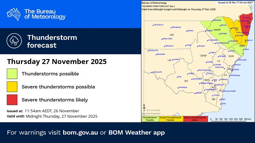
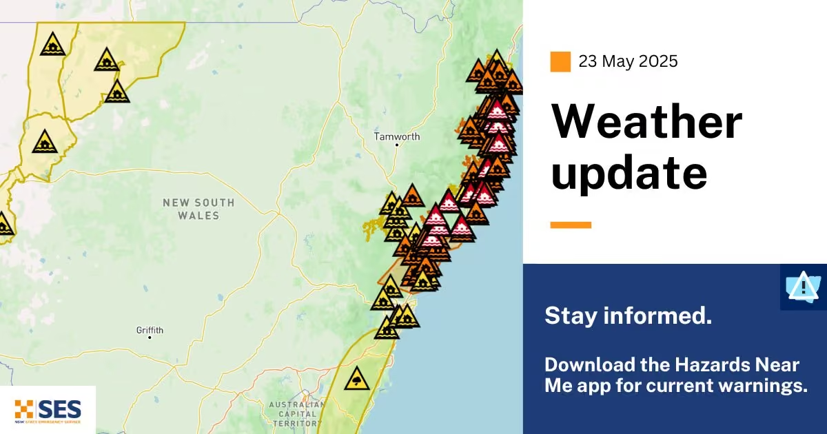
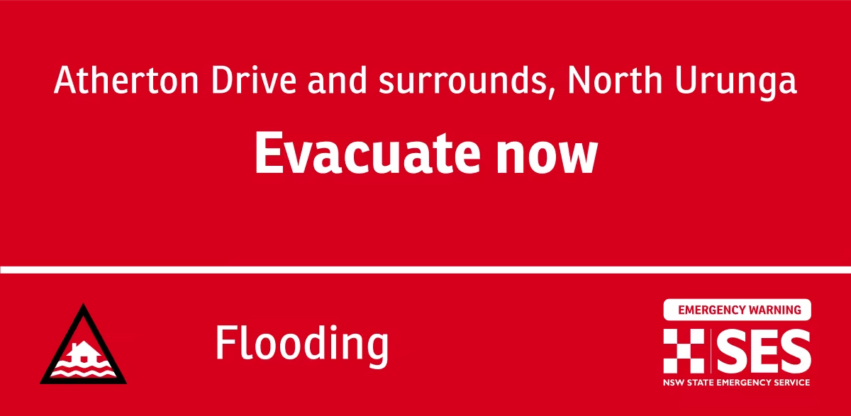
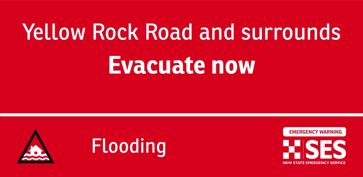
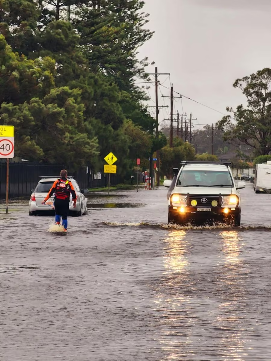
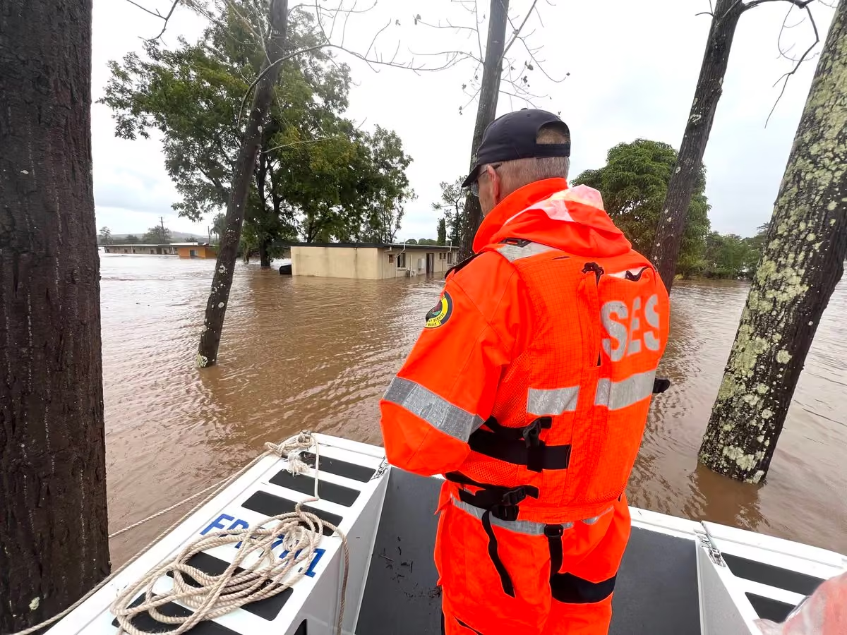
Heads up folks, there’s some unsettled weather forecast across the state this weekend ☔️
Possible widespread heavy rain, damaging winds and thunderstorms are expected in multiple parts of the state, so ensure you’re monitoring the Hazards Near Me app to stay up to date with warnings for your area.
Large hail is a concern for Central and Northern Inland areas.
⚠️ Residents in the Riverina area should be alert for intense rainfall this afternoon and evening, with dangerous and life-threatening flash flooding possible.
🚗 If you come across a flooded road, steer clear and find an alternative route. Flash flooding is unpredictable - stay vigilant.
Ensure your home is prepared and stay ahead of the storm:
🔸Tie down loose items in your yard
🔸Park undercover and away from trees and powerlines
🔸Clear gutters and trim back overhanging branches
☎️ If you require assistance, call us on 132 500. In life-threatening situations, call Triple Zero (000).
New South Wales State Emergency Service
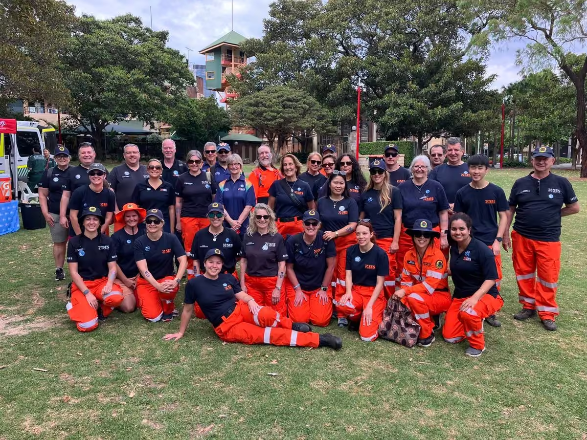
The New South Wales State Emergency Service (NSW SES) is a civil defence organisation under the Government of New South Wales that provides emergency and rescue services to local communities during and after major disasters. The NSW SES is made up almost entirely of volunteer members, numbering over 10,919 as of September 2023. Personnel are easily identified by their distinctive orange overalls. More on Wikipedia
-
NSW SES
@NSWSES
-
NSW SES
@NSWSES
A Severe Thunderstorm warning for DAMAGING WINDS and HEAVY RAINFALL has been issued by the Bureau of Meteorology ☔️
📍Residents in part of Lower Western, Upper Western and Riverina Forecast Districts should monitor condition and follow safety advice.
Severe thunderstorms are likely to produce damaging winds and heavy rainfall that may lead to flash flooding in the warning area over the next several hours. Locations which may be affected include Ivanhoe, Louth, Tilpa and Fords Bridge.
📲 Download Hazards Near Me or visit the NSW SES website to stay up to date with warnings and information.
🚫 Steer clear of flooded roads - if you come across one, turn around and find an alternative route. Remember that flash flooding is dangerous and unpredictable.
📞 If you require assistance in floods and storms, call the NSW SES on 132 500. In life-threatening situations, call Triple Zero (000).
Issued 2:03pm EDT on Thursday 19 November -
NSW SES
@NSWSES
Were you impacted by the storms last night? Our volunteers have been busy responding to 300 calls for assistance across the state, including significant damage impacting South West Rocks and Singleton.
The thunderstorms caused incidents such as multiple lost and leaking roofs, trees down and damage to property 🏚️
Our volunteers have been deployed to Mudgee to assist with clean up after a hail storm damaged buildings.
This weather isn’t unusual for this time of year and there’s very likely more to come, with storm season hanging around until April next year ☔️
📲 Make sure you stay ahead of the storm and monitor the Hazards Near Me app to be prepared for the next one! -
NSW SES
@NSWSES
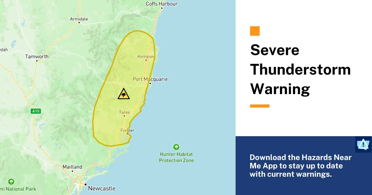
A Severe Thunderstorm Warning for DAMAGING WINDS, LARGE HAILSTONES and HEAVY RAINFALL has been issued by the Bureau of Meteorology 🍃
📍Residents in parts of the Mid North Coast, Hunter, Central Tablelands, North West Slopes and Plains and Northern Tablelands Forecast Districts should monitor conditions and follow safety advice.
A humid airmass combines with a trough and upper disturbance to destabilise the atmosphere, resulting in an area of thunderstorms across the Central Tablelands and upper Hunter, extending to northeast northeastern NSW during the afternoon.
📲 Download Hazards Near Me or visit our website to stay up to date with warnings and information, especially as the weather moves through and may affect other locations.
Stay ahead of the storm:
🔸Move your car under cover or away from trees and powerlines if safe to do so.
🔸Secure or put away loose items around your house, yard and balcony.
🔸Keep clear of creeks and storm drains.
🔸Report fallen power lines to either Ausgrid (131 388), Endeavour Energy (131 003), Essential Energy (132 080) or Evoenergy (131 093) as shown on your power bill.
🚫 Steer clear of flooded roads - if you come across one, turn around and find an alternative route. Remember that flash flooding is dangerous and unpredictable.
📞 If you require assistance in floods and storms, call the NSW SES on 132 500. In life-threatening situations, call Triple Zero (000).
Issued at 12:27 pm EDT on Monday 16 November 2026
Full warning: www.bom.gov.au/warning/severe-thunderstorm-warning/IDN21033
NSW SES
@NSWSES
⚠️ UPDATED at 1:27pm: Warning area now includes parts of the Northern Rivers.
NSW SES
@NSWSES
⚠️ UPDATED at 2:41pm: Warning is now for VERY dangerous thunderstorms with DAMAGING, LOCALLY DESTRUCTIVE WINDS, LARGE, POSSIBLY GIANT HAILSTONES and HEAVY RAINFALL.
-
NSW SES
@NSWSES
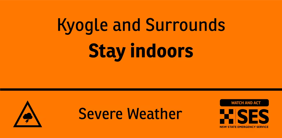
NSW SES is advising people in the following area(s) to STAY INDOORS due to destructive winds, giant hailstones:
- Forster
- Seal Rocks
WATCH AND ACT
Next update: Sunday 15 Nov 5:30 pm
Find out more: hazardwatch.gov.au/a/9T5pzu
#nswses -
NSW SES
@NSWSES
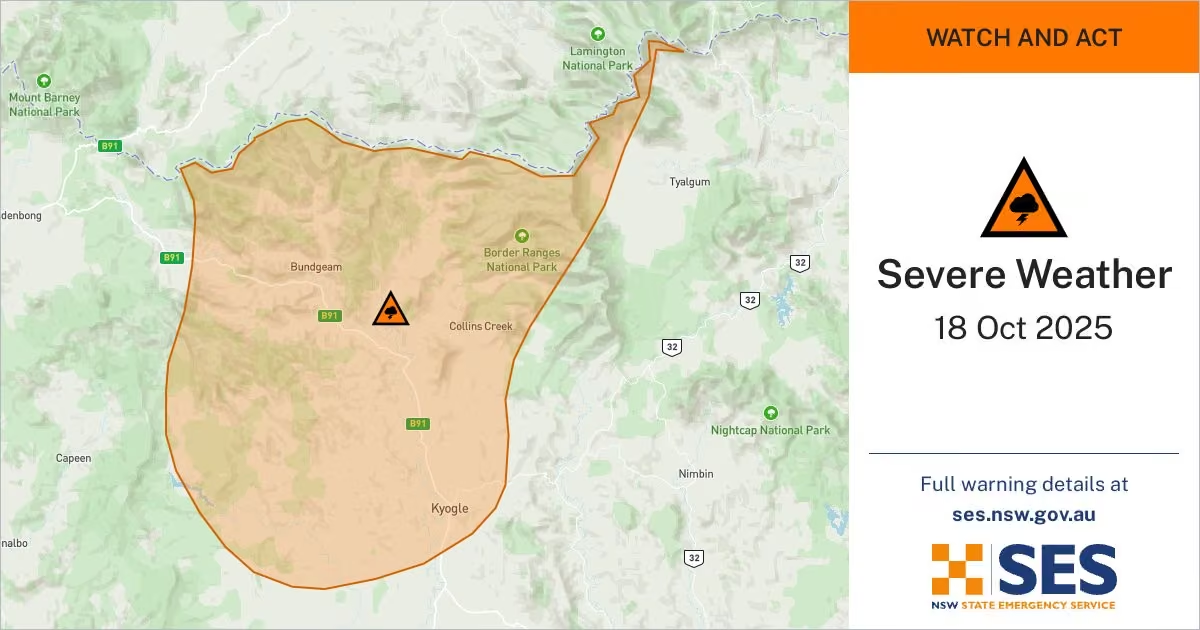
A Severe Thunderstorm Warning for DAMAGING WINDS, LARGE HAILSTONES and HEAVY RAINFALL has been issued by the Bureau of Meteorology 🍃.
📍Residents in Northern Rivers and parts of Mid North Coast and Northern Tablelands Forecast Districts should monitor conditions and follow safety advice.
Severe thunderstorms are likely to produce damaging winds, large hailstones and heavy rainfall that may lead to flash flooding in the warning area over the next several hours. Locations which may be affected include Lismore, Grafton, Kyogle, Tabulam, Urbenville and Jackadgery.
📲 Download Hazards Near Me or visit the NSW SES website to stay up to date with warnings and information.
Stay ahead of the storm:
🔸Move your car under cover or away from trees and powerlines if safe to do so.
🔸Secure or put away loose items around your house, yard and balcony.
🔸Keep clear of creeks and storm drains.
🔸Report fallen power lines to either Ausgrid (131 388), Endeavour Energy (131 003), Essential Energy (132 080) or Evoenergy (131 093) as shown on your power bill.
🚫 Steer clear of flooded roads - if you come across one, turn around and find an alternative route. Remember that flash flooding is dangerous and unpredictable.
📞 If you require assistance in floods and storms, call the NSW SES on 132 500. In life-threatening situations, call Triple Zero (000).
Issued at 1:09 pm EDT on Thursday 12 November 2026.
View Warning: www.bom.gov.au/warning/severe-thunderstorm-warning/IDN21033 -
NSW SES
@NSWSES
NSW SES is advising people in the following area(s) to STAY INDOORS due to heavy rainfall with flash flooding possible, damaging winds, giant hailstones:
- Port Macquarie
- Wauchope
WATCH AND ACT
Find out more: hazardwatch.gov.au/a/5I1rdm
#nswses -
NSW SES
@NSWSES
NSW SES is advising people in the following area(s) to STAY INDOORS due to heavy rainfall with flash flooding possible, damaging winds, giant hailstones:
- Port Macquarie
- Taree
- Comboyne
- Wauchope
- Laurieton
- Harrington
WATCH AND ACT -
NSW SES
@NSWSES
A Severe Thunderstorm Warning for DAMAGING WINDS and LARGE HAILSTONES has been issued by the Bureau of Meteorology 🍃.
📍Residents in Northern Rivers District should monitor conditions and follow safety advice.
Locations which may be affected include Murwillumbah, Numinbah, Tyalgum and Wiangaree.
📲 Download Hazards Near Me or visit the NSW SES website to stay up to date with warnings and information, especially as the weather moves through and may affect other locations.
Stay ahead of the storm:
🔸Move your car under cover or away from trees and powerlines if safe to do so.
🔸Secure or put away loose items around your house, yard and balcony.
🔸Report fallen power lines to either Ausgrid (131 388), Endeavour Energy (131 003), Essential Energy (132 080) or Evoenergy (131 093) as shown on your power bill.
Prepare early. Stay informed. Act safely.
📞 If you require assistance in floods and storms, call the NSW SES on 132 500. In life-threatening situations, call Triple Zero (000).
Issued at 2:13 pm EDT on Wednesday 11 November 2026
Full warning: www.bom.gov.au/warning/severe-thunderstorm-warning/IDN21033 -
NSW SES
@NSWSES
A Severe Thunderstorm Warning for DAMAGING, LOCALLY DESTRUCTIVE WINDS, LARGE, POSSIBLY GIANT HAILSTONES and HEAVY RAINFALL has been issued by the Bureau of Meteorology ☔️
📍 Residents in the Mid North Coast, Hunter, Illawarra, Northern Tablelands and parts of Northern Rivers, Metropolitan, Central Tablelands, Southern Tablelands, North West Slopes and Plains, South West Slopes and South Coast Forecast Districts.
GIANT HAIL AND DESTRUCTIVE WINDS POSSIBLE IN NORTHERN NSW.
A very moist and unstable environment conducive to rapid severe thunderstorm development is set up throughout eastern NSW and southeastern Qld.
📲 Download Hazards Near Me or visit the NSW SES website to stay up to date with warnings and information, especially as the weather moves through and may affect other locations.
Stay ahead of the storm:
🔸 Move your car under cover or away from trees and powerlines if safe to do so.
🔸 Tie down loose items in your yard, if safe to do so.
🔸 Report fallen power lines to either Ausgrid (131 388), Endeavour Energy (131 003), Essential Energy (132 080) or Evoenergy (131 093) as shown on your power bill.
Prepare early. Stay informed. Act safely.
🚫 Steer clear of flooded roads - if you come across one, turn around and find an alternative route.
Remember that flash flooding is dangerous and unpredictable.
📞 If you require assistance in floods and storms, call the NSW SES on 132 500. In life-threatening situations, call Triple Zero (000).
Issued at 3:16 pm Tuesday, 3 November 2026.
View full warning: reg.bom.gov.au/products/IDN21033.shtml -
NSW SES
@NSWSES
A Severe Thunderstorm Warning for DAMAGING WINDS, LARGE HAILSTONES and HEAVY RAINFALL has been issued by the Bureau of Meteorology ☔️
🏡 Residents in parts of the Mid North Coast, Hunter, North West Slopes and Plains, Northern and Central Tablelands Forecast Districts should monitor conditions and follow safety advice.
Severe thunderstorms are beginning to develop through northeastern NSW, which are likely to produce damaging winds, large hailstones and heavy rainfall that may lead to flash flooding in the warning area over the next several hours.
📲 Download Hazards Near Me or visit the NSW SES website to stay up to date with warnings and information, especially as the weather moves through and may affect other locations.
Stay ahead of the storm:
🔸 Move your car under cover or away from trees and powerlines if safe to do so.
🔸 Tie down loose items in your yard, if safe to do so.
🔸 Report fallen power lines to either Ausgrid (131 388), Endeavour Energy (131 003), Essential Energy (132 080) or Evoenergy (131 093) as shown on your power bill.
Prepare early. Stay informed. Act safely.
🚫 Steer clear of flooded roads - if you come across one, turn around and find an alternative route.
Remember that flash flooding is dangerous and unpredictable.
📞 If you require assistance in floods and storms, call the NSW SES on 132 500. In life-threatening situations, call Triple Zero (000).
Issued at 12:48 pm EDT on Tuesday 3 November 2026
NSW SES
@NSWSES
⚠️ UPDATE 2:46PM: This warning is now for people in Hunter, Illawarra, Central Tablelands, Northern Tablelands and parts of Northern Rivers, Mid North Coast, Metropolitan, Southern Tablelands, North West Slopes and Plains and South West Slopes Forecast Districts.
Severe thunderstorms continue to develop through eastern NSW.
A very moist and unstable environment conducive to rapid severe thunderstorm development is set up throughout eastern NSW and southeastern Qld. -
NSW SES reposted
Bureau of Meteorology, New South Wales
@BOM_NSW
⚠️⛈️Severe thunderstorms developing about the northeast, and approaching the southern #riverina.
Locations that could be affected #dorrigo #woodenbong #baryulgil #jackadgery #copmanhurst and #couttscrossing.
Details: www.bom.gov.au/warning/severe-thunderstorm-warning/IDN21033 -
NSW SES reposted
Bureau of Meteorology, New South Wales
@BOM_NSW
⛈️#nsw Thunderstorm forecast 1 Nov
🟢Storms possible across eastern and northern NSW.
🟡Severe storms are possible in the Hunter and northeast. Possible hazards are large hail, damaging winds, and heavy rainfall.
www.bom.gov.au/location/australia/new-south-wales -
NSW SES
@NSWSES
Severe thunderstorms are expected again this afternoon, following a weekend of wild weather 🌪️⛈️
We received 140 incidents across NSW over the past few days, with a supercell thunderstorm near Yass causing significant damage including fallen trees and roof removals.
Our volunteers, alongside our friends at @NSWRFS, have worked tirelessly to complete clean up tasks, welfare checks and roof tarping.
⚠️ For the week ahead, there’s a possibility of severe thunderstorms in the Northeast and Southwest of the state today.
Thunderstorms are possible again in the Northeast tomorrow with severe storms likely as well.
Wednesday is likely to see showers and thunderstorms in southern inland areas.
📲 Ensure you keep across warnings and information with the Hazards Near Me app and make sure you stay ahead of the storm by preparing your home.
☎️ If you require assistance, give us a call on 132 500. In life-threatening emergencies, call Triple Zero (000)
📸 - NSW SES Yass Unit & NSW RFS Southern Tablelands Zone -
NSW SES
@NSWSES
A Severe Thunderstorm Warning for LARGE HAILSTONES, HEAVY RAINFALL and DAMAGING WINDS has been issued by the Bureau of Meteorology ☔️
📍 Residents in parts of the Mid North Coast and parts of Hunter, Northern Tablelands, Northern Rivers and North West Slopes and Plains Forecast Districts should monitor conditions and follow safety advice.
Severe thunderstorms are developing along an inland trough and a southerly change is moving north across the northeast this afternoon.
📲 Download Hazards Near Me or visit the NSW SES website to stay up to date with warnings and information, especially as the weather moves through and may affect other locations.
Stay ahead of the storm:
🔸 Move your car under cover or away from trees and powerlines if safe to do so.
🔸 Tie down loose items in your yard.
🔸 Report fallen power lines to either Ausgrid (131 388), Endeavour Energy (131 003), Essential Energy (132 080) or Evoenergy (131 093) as shown on your power bill.
Prepare early. Stay informed. Act safely.
🚫 Steer clear of flooded roads, if you come across one, turn around and find an alternative route. Remember that flash flooding is dangerous and unpredictable.
📞 If you require assistance in floods and storms, call the NSW SES on 132 500. In life-threatening situations, call Triple Zero (000).
Issued at 1:28 pm EDT on Monday 26 October 2026
Full warning: www.bom.gov.au/warning/severe-thunderstorm-warning/IDN21033 -
NSW SES reposted
Bureau of Meteorology, New South Wales
@BOM_NSW
⛈️ Thunderstorm Forecast, Mon 26th Oct
🔴Severe thunderstorms likely about the coast and ranges north of Kempsey.
🟠Severe storms possible elsewhere across the NE.
Hazard: damaging winds, large hail, heavy rainfall.
🟢Non-severe storms for parts of the Hunter and northern inland. -
NSW SES
@NSWSES
NSW SES is advising people in the following area(s) to STAY INDOORS due to heavy rainfall with flash flooding possible, destructive winds:
- Armidale
- Glen Innes
WATCH AND ACT
Next update: Monday 26 Oct 12:30 am
Find out more: hazardwatch.gov.au/a/In4TUA
#nswses -
NSW SES
@NSWSES
NSW SES is advising people in the following area(s) to STAY INDOORS due to heavy rainfall with flash flooding possible, destructive winds:
- Barraba
- Tingha
- Bundarra
- Boggabri
WATCH AND ACT
Next update: 25 Oct 10:30 pm
Find out more: hazardwatch.gov.au/a/u-3MVM -
NSW SES
@NSWSES
We’re expecting damaging winds, large hail and heavy rainfall on Sunday as severe storms move across the state.
Storms are expected to develop across western NSW on Sunday morning and move east towards Sydney during the afternoon.
Further storms could affect Sydney overnight on Sunday and into Monday, before the severe weather risk shifts to the northeast coast where heavy rainfall could cause flash flooding next week.
Make sure you’re prepared and stay ahead of the storm. 🔸Tie down loose items in your yard
🔸Park undercover and away from trees or powerlines 🔸Clear your gutters of debris
🔸Keep clear of creeks and storm drains
📲 Ensure you monitor the Hazards Near Me app to stay across warnings.
🚫 If you come across a flooded road, turn around and find an alternative route. Flash flooding is dangerous and unpredictable.
☎️ If you need assistance, call us on 132 500. If life-threatening, call Triple Zero (000).
Read more: www.ses.nsw.gov.au/news/nsw-ses-urges-communities-stay-ah… -
NSW SES reposted
Bureau of Meteorology, Australia
@BOM_au
Severe weather forecast: Multi-state weekend severe storm outbreak.
Video current: 12:00pm AEDT 23 October 2026
For the latest forecasts and warnings, go to www.bom.gov.au or the BOM Weather app.This media couldn't be displayed. See it on the original post. -
NSW SES
@NSWSES
There’s another week of unsettled weather ahead across the state! ☔️
🔹 In the North and North East of NSW, we’re expecting showers and thunderstorms with a risk of localised moderate-to-heavy rainfall from today through the rest of the week.
🔹 Today and tomorrow in the Far West, we could see severe thunderstorms.
🔹 The ranges and slopes should prepare for a cold front to arrive on Sunday with the possibility of severe thunderstorms bringing localised heavy rainfall, damaging wind gusts and large hail.
Our teams are prepared and have been monitoring the forecast, but you should too.
📲 Keep across the Hazards Near Me app to stay ahead of the storm.
Prepare early. Stay informed. Act safely.
☎️ If you require assistance, call us on 132 500. If life-threatening, call Triple Zero (000).
Learn more to prepare your home here: www.ses.nsw.gov.au/stormseason -
NSW SES
@NSWSES
More than 220 total incidents, including 2 flood rescues, were received in the last 24 hours from 5am ☔️
Overnight, showery conditions with widespread moderate rainfall were experienced in various parts of the state.
The majority of incidents overnight were for fallen trees and damaged and leaking roofs.
🌧️ Rain is expected to continue across the East for most of the week and there is also the likelihood of thunderstorms for inland areas later this week.
Our volunteers are continuing to respond to calls this morning and are prepared to assist with any further storm-related incidents.
🚫 If you come across a flooded road, ensure you steer clear and find an alternative route.
☎️ If you require assistance, call us on 132 500. In life-threatening situations, call Triple Zero (000).
📸 NSW SES Manly and Mosman Units -
NSW SES
@NSWSES
It’s time to get your property ready - more unstable weather is on the way from tonight into next week!
☔️
Here’s a breakdown of what we’re expecting:
🔹 Thunderstorms are possible across the state from tonight into Saturday morning, possibly becoming severe in Northeastern NSW. Damaging winds and large hail are the main risks, with isolated heavy rainfall possible.
🔹 Saturday and Sunday afternoon, storms are expected to redevelop over Northeastern NSW.
🔹 Monday and Tuesday, widespread showers and severe thunderstorms are possible across much of NSW, including the Hunter, Central Coast, Northern Coast and adjacent slopes and ranges and Northern Inland. Damaging winds, large hail and localised heavy rainfall of 60-70mm is possible.
🔹 From Wednesday, storms are expected to head to Northern ranges and coast, including the Hunter.
Stay ahead of the storm and prepare now:
🔸 Move your vehicle under cover or away from trees and powerlines, if safe to do so.
🔸 Tie down loose items ahead of strong winds.
🔸 Keep clear of creeks and storm drains
🔸 Clear your gutters and trim back overhanging branches.
🚗 If you come across a flooded road, turn around and find an alternative route.
Stay vigilant. Flash flooding is dangerous and unpredictable.
📲 Download Hazards Near Me or visit our website to stay up to date with warnings, especially as the weather moves through and may affect other locations.
☎️ If you require assistance, call us on 132 500. In life-threatening situations, call Triple Zero (000). -
NSW SES
@NSWSES
A Severe Thunderstorm Warning for DAMAGING WINDS, LARGE HAILSTONES and HEAVY RAINFALL has been issued by the Bureau of Meteorology ☔️
Residents in Albury, Corowa and Jerilderie should be prepared and follow safety advice:
🔸Park your car under secure cover and away from trees, powerlines and drains.
🔸Secure or put away loose items around your house, yard and balcony.
🔸Report fallen power lines to either Ausgrid (131 388), Endeavour Energy (131 003), Essential Energy (132 080) or Evoenergy (131 093) as shown on your power bill.
📲 Download Hazards Near Me to stay across warnings and if you’re going away, ensure you check the weather at both your destination and at home.
🚗 Steer clear of flooded roads, if you come across one, turn around and find an alternative route. Remember that flash flooding is dangerous and unpredictable.
If you require assistance, call us on 132 500. In life-threatening situations, call Triple Zero (000).
Issued at 2:57 pm EST on Friday 2 October 2026 -
NSW SES
@NSWSES
This long weekend we’re expecting severe thunderstorms, large hail, heavy rainfall and damaging winds across parts of the state from this evening into Sunday.
Severe thunderstorms are possible across the Central West, South Coast, Illawarra and Sydney from today through to Sunday, before moving northeast early next week.
Thunderstorms could bring flash flooding, damaging winds, and large hail, with heavy rainfall reaching up to 100mm in some areas. Minor flooding is also possible across state river systems.
Residents in the forecast areas should be prepared and follow safety advice:
🔸Clear your drains and gutters
🔸Trim back overhanging trees or branches
🔸Tie down loose items
🔸If you come across a flooded road, steer clear and find an alternative route
📲 Download Hazards Near Me to stay across warnings and if you’re going away, ensure you check the weather at both your destination and at home.
🚗 Remember, double demerits are now in play and the roads may be heavier, so drive to conditions.
If you require assistance, call us on 132 500. In life-threatening situations, call Triple Zero (000). -
NSW SES
@NSWSES
A Severe Thunderstorm Warning for LARGE HAILSTONES, HEAVY RAINFALL and DAMAGING WINDS has been issued by the Bureau of Meteorology ☔️
📍 Residents in parts of Metropolitan, Central Tablelands and Hunter Forecast Districts should monitor conditions and follow safety advice.
A hot and unstable airmass is triggering thunderstorms this afternoon west of Sydney.
Severe thunderstorms are likely to produce large hailstones, heavy rainfall that may lead to flash flooding and damaging winds in the warning area over the next several hours.
📲 Download Hazards Near Me or visit the NSW SES website to stay up to date with warnings and information, especially as the weather moves through and may affect other locations.
Stay ahead of the storm:
🔸 Move your car under cover or away from trees and powerlines if safe to do so.
🔸 Tie down loose items in your yard.
🔸 Report fallen power lines to either Ausgrid (131 388), Endeavour Energy (131 003), Essential Energy (132 080) or Evoenergy (131 093) as shown on your power bill. Prepare early. Stay informed. Act safely.
🚫 Steer clear of flooded roads, if you come across one, turn around and find an alternative route. Remember that flash flooding is dangerous and unpredictable.
📞 If you require assistance in floods and storms, call the NSW SES on 132 500. In life-threatening situations, call Triple Zero (000).
Issued at 3:53 pm EST on Friday 25 September 2026
View all warnings: www.bom.gov.au/weather-and-climate/warnings-and-alerts -
NSW SES reposted
Bureau of Meteorology, New South Wales
@BOM_NSW
Powerful storms have developed around Penrith and Richmond in the west, and parts of the Blue Mountains. Heavy Rain, Damaging Wind and Large Hail possible in the next hour or two.
Full details: www.bom.gov.au/warning/severe-thunderstorm-warning/IDN21035 -
NSW SES
@NSWSES
A Severe Weather Warning for DAMAGING WINDS has been issued by @bom_nsw for early Saturday morning 🍃
📍 Residents in parts of the Illawarra and parts of the South Coast, Central Tablelands, Southern Tablelands, South West Slopes and Snowy Mountains Forecast Districts should monitor conditions and follow safety advice.
A strong west to northwesterly flow will develop during early Saturday morning ahead of a cold front that will sweep over southern parts of the state during the day.
Winds will tend westerly during Saturday evening in the wake of the front.
The NSW National Parks and Wildlife Service recommends that back country travel be postponed until conditions improve.
Winds are expected to ease throughout the warning area late Saturday afternoon or early evening.
📲 Download Hazards Near Me or visit the NSW SES website to stay up to date with warnings and information, especially as the weather moves through and may affect other areas.
Stay ahead of the storm:
🔸 Move your car under cover or away from trees and powerlines if safe to do so.
🔸 Tie down loose items in your yard.
🔸 Report fallen power lines to either Ausgrid (131 388), Endeavour Energy (131 003), Essential Energy (132 080) or Evoenergy (131 093) as shown on your power bill.
Prepare early. Stay informed. Act safely.
📞 If you require assistance in floods and storms, call the NSW SES on 132 500. In life-threatening situations, call Triple Zero (000).
Issued at 9:25 am EST on Friday 4 September 2026 -
NSW SES reposted
Bureau of Meteorology, New South Wales
@BOM_NSW
⚠️🌬️9:25am:Severe Weather Warning for damaging #winds for Illawarra and parts of South Coast, Central Tablelands, Southern Tablelands, South West Slopes, and Snowy Mountains.
Damaging winds developing in the southeast on Saturday.
www.bom.gov.au/warning/severe-weather-warning/IDN21037 -
NSW SES
@NSWSES
It’s a wet start to the week for parts of the state with severe thunderstorms possible ☔️
Widespread moderate rainfall is forecast Monday to Wednesday morning, mainly along the ranges and western slopes on Tuesday.
For inland NSW and the ranges, localised heavy rainfall, flash flooding, damaging winds and large hail are all possible Tuesday before shifting along the northern coast and ranges on Wednesday.
Conditions are expected to settle late Wednesday or Thursday.
⚠️ A minor flood warning has been issued for Tumut River due to rainfall forecast from late Monday night into Tuesday.
🚗 Residents across the state are reminded to steer clear of floodwater. If you come across a flooded road, turn around and find an alternative route. Flash flooding can be dangerous and unpredictable. Stay vigilant.
📲 Stay across warnings using the Hazards Near Me app or head to the NSW SES website.
☎️ If you require assistance, call us on 132 500. In life-threatening situations, call Triple Zero (000). -
NSW SES reposted
Bureau of Meteorology, New South Wales
@BOM_NSW
⚠️🌬️Severe Weather Warning for damaging #winds along #greatdividingrange, extending to coastal areas around #newcastle #wollongong.
May affect #armidale #goulburn #nowra #scone #katoomba #cessnock #maitland #bowral #braidwood #dorrigo #thredbotopstation.
www.bom.gov.au/warning/severe-weather-warning/IDN21037 -
NSW SES reposted
Bureau of Meteorology, New South Wales
@BOM_NSW
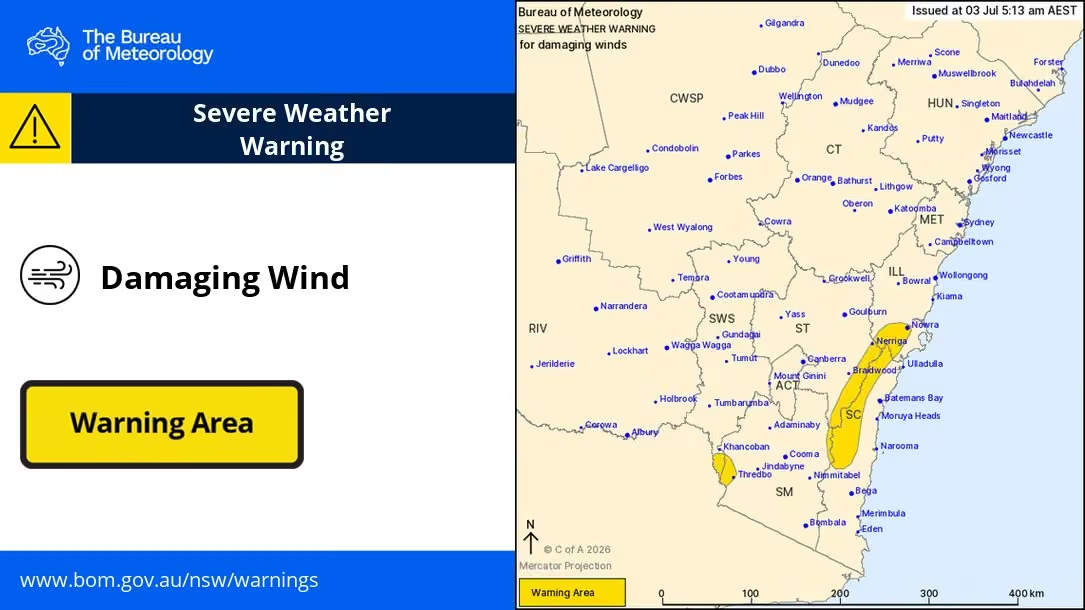
⚠️🌬️ 5:13am: Severe Weather Warning for damaging winds current in #nsw during Friday for:
- Alpine peaks above 1900m (peak gusts of 100km/h likely)
- Inland parts of the #nsw South Coast & Illawarra (peak gusts up to 90km/h possible)
Details: www.bom.gov.au/warning/severe-weather-warning/IDN21037 -
NSW SES
@NSWSES
NSW SES has responded to more than 150 incidents across the state in the last 24 hours to 2pm, as severe thunderstorms and damaging winds impacted southern and western NSW. 🍃
Thunderstorm threats have eased, but saturated ground keeps the risk of falling trees and flash flooding. Damaging winds and blizzards are forecast in alpine areas through Friday, with strong to damaging winds also possible in the southern and central ranges including the Illawarra, Shoalhaven, and parts of the Blue Mountains.
🚗 Steer clear of floodwaters. If you come across a flooded road, stop, turn around, and find an alternative route. You never know the condition of the road surface underneath.
All unsealed roads affected by water in Western NSW are closed, including the Silver City Highway from Broken Hill to the Queensland border.
NSW SES is continuing resupply operations to support isolated communities and properties across the Far West as flooding continues to impact access.
📞 If you need resupply, please call 132 500 to lodge your request.
📲 Stay across the latest warnings and advice by downloading the Hazards Near Me app or visiting the NSW SES website.
☎️ If you need emergency assistance during storms or floods, call the NSW SES on 132 500. In a life-threatening emergency, always call Triple Zero (000). -
NSW SES
@NSWSES
Far West and Southern Inland NSW have been impacted by heavy rainfall this week which has seen roads and highways closed due to floodwater 🚧
Damaging winds are expected to impact the Lower Western and Upper Western Forecast Districts later today and NSW SES asks people to be prepared. Localised heavy rainfall and large hail are also possible.
⚠️ All unsealed roads in the Far West are now closed. Sealed roads remain open, including the Barrier Highway, however the Silver City Highway is closed from Packsaddle to the Queensland border.
Residents are reminded to check their local council pages or Live Traffic NSW for road closures and traffic updates before travelling and to turn around and find an alternative route if they come across a flooded road.
📲 Continue monitoring the Hazards Near Me app for weather updates or visit the NSW SES website.
Our teams are prepared and ready to respond should you need help.
☎️ If you require assistance, call NSW SES on 132 500. If life-threatening, call Triple Zero (000).
Learn more about how to plan and prepare: www.ses.nsw.gov.au/plan-and-prepare -
NSW SES
@NSWSES
Severe Weather Warnings have been issued this morning for HEAVY RAINFALL and DAMAGING WINDS ☔️🍃
🔷 Heavy rainfall is forecast for parts of Lower Western and Upper Western Forecast Districts.
Severe thunderstorms are likely to produce heavy rainfall that may lead to flash flooding in the warning area over the next several hours.
🔷 Damaging winds are forecast for parts of South West Slopes, Snowy Mountains, and Southern Tablelands Forecast Districts.
They have developed over alpine peaks, and will expand to lower elevations this evening. Winds will remain locally strong over the Snowy Mountains into Thursday.
📲 Download Hazards Near Me or visit the NSW SES website to stay up to date with warnings and information, especially as the weather moves through and may affect other areas.
🚗 If you come across a flooded road, turn around and find an alternative route.
Stay safe and prepared:
🔸 Move your car under cover or away from trees and powerlines if safe to do so.
🔸 Tie down loose items ahead of strong winds.
🔸 Keep clear of creeks and storm drains
🔸 If you are trapped by flash flooding, seek refuge in the highest available place and ring Triple Zero (000) if you need rescue
🔸 Stay indoors away from windows, and keep children and pets indoors as well.
☎️ If you require assistance in floods and storms, call the NSW SES on 132 500. In life-threatening situations, call Triple Zero (000). -
NSW SES reposted
Bureau of Meteorology, New South Wales
@BOM_NSW
⚠️Severe Weather Warning for DAMAGING WINDS⚠️
Damaging winds to develop on Wednesday evening for alpine areas.
More: www.bom.gov.au
#mountginini #thredbo #tidbinbilla #perishervalley -
NSW SES reposted
Bureau of Meteorology, New South Wales
@BOM_NSW
⚠️⛈️ 8:25am: Severe Thunderstorm Warning for heavy #rainfall in parts of Lower Western and Upper Western Forecast Districts.
Locations which may be affected include #brokenhill, #wilcannia, #whitecliffs, #menindee and #fowlersgap.
Details: www.bom.gov.au/warning/severe-thunderstorm-warning/IDN21033 -
NSW SES
@NSWSES
Looks like we’re in for a wet and windy week ahead in parts of the state! ☔️🍃
Widespread showers and thunderstorms are likely across inland NSW from today into Thursday.
Keep an eye out for severe thunderstorms during this time with localised heavy rainfall, damaging winds and large hail all on the cards!
Wednesday is forecast to bring wind in the west of the state and severe thunderstorms in the far west with destructive wind and giant hailstones possible. Wind is then expected to head east on Thursday/Friday.
Residents are asked to monitor conditions using the Hazards Near Me app.
⚠️ School holidays are just around the corner and early holiday makers are reminded to drive to conditions and check the weather both at home and at your destination.
🚗 If you come across a flooded road, turn around and find an alternate route.
🪑 Keep your furniture in your backyard by tying down loose items!
☎️ If you require assistance, call us on 132 500. In life-threatening situations, call Triple Zero (000). -
NSW SES reposted
Bureau of Meteorology, New South Wales
@BOM_NSW
⚠️🌬️Severe Weather Warning for Damaging Winds, Thurs 4 June
Damaging wind gusts to 90 km/h or more possible about southern and central ranges today, extending to the #illawarra Coast and northern ranges this evening.
www.bom.gov.au/warning/severe-weather-warning/IDN21037 -
NSW SES
@NSWSES
A Severe Weather Warning for DAMAGING WINDS has been issued by the Bureau of Meteorology.
Residents in parts of the Illawarra and parts of Mid North Coast, South Coast, Central Tablelands, Southern Tablelands, Snowy Mountains, Northern Tablelands and Hunter Forecast Districts should monitor conditions and follow safety advice.
View the full warning here: www.bom.gov.au/warning/severe-weather-warning/IDN21037
📲 Download Hazards Near Me or visit the NSW SES website to stay up to date with warnings and information, especially as the weather moves through and may affect other areas.
Stay safe and prepared:
🔸 Move your car under cover or away from trees and powerlines if safe to do so.
🔸 Tie down loose items in your yard.
🔸 Stay indoors away from windows and keep children and pets indoors as well.
🔸 Report fallen power lines to either Ausgrid (131 388), Endeavour Energy (131 003), Essential Energy (132 080) or Evoenergy (131 093) as shown on your power bill.
🔸 If you require assistance in floods and storms, call the NSW SES on 132 500. In life-threatening situations, call Triple Zero (000).
Issued at 10:59 am EST on Thursday 4 June 2026 -
NSW SES
@NSWSES
The temperature has dropped, and puffer jackets are officially back taking over the streets of NSW! 🧥⛄
If you haven’t already, it’s time to dust off your winter woolies as there’s a chilly week of weather ahead. Here’s what we’re expecting:
🍃 From Tuesday morning to Wednesday DAMAGING WINDS is forecast in parts of the South Coast, Central Tablelands, Southern Tablelands, Snowy Mountains and South West Slopes Forecast Districts.
⛈️ West of the Divide is forecast to have GUSTY THUNDERSTORMS, whilst HEAVY RAINFALL is likely across the Southern/Western Slopes leading into Wednesday.
❄️ From Thursday morning stay vigilant of FROST and potential BLACK ICE in part of the ranges/western slopes.
🚘❗Beware the dangers of black ice when driving or walking on hard surfaces. Reduce your speed and exercise caution.
🏔️⚠️ If you're heading out into alpine areas, ensure you're prepared:
🔶Always check the weather and plan ahead
🔶Carry a personal locator beacon and tell someone your plans
🔶Complete a National Park trip intentions form and bring the right gear
🚘❗With heavy rainfall forecast in some areas, remember to steer clear of floodwaters. If you come across a flooded road, turn around and find an alternative route.
Stay safe and prepared:
🔶Move your car under cover or away from trees and powerlines if safe to do so.
🔶Tie down loose items in your yard.
🔶Trim any over heading branches and clear your gutters
📞If you require assistance, call us on 132 500. In life-threatening situations, call Triple Zero (000) -
NSW SES
@NSWSES
NSW SES has responded to more than 500 incidents as widespread rainfall and thunderstorms impact northern and eastern parts of the state. 🌧️
Flood rescue operators, along with partner emergency service personnel, have completed seven flood rescues across the Central Coast and Mid North Coast. The majority have involved cars that became trapped in floodwater as flash flooding inundated roads quickly.
🚘❗Steer clear of floodwater. If you come across a flooded road, turn around and find an alternative route.
Heavy rainfall is forecast to continue for parts of the Hunter, Mid North Coast and adjacent districts this afternoon, before easing later today.
📲 Stay across the latest warnings and advice by downloading the Hazards Near Me app and setting up a watch zone for your local area.
☎️ If you need assistance during storms or floods, call the NSW SES on 132 500. In a life-threatening emergency, always call Triple Zero (000). -
NSW SES reposted
Bureau of Meteorology, Australia
@BOM_au
Severe Weather Update: More severe storms and heavy rain for the east
Video current: 2pm AEST 28 May 2026
Latest forecasts and warnings: www.bom.gov.au or the BOM Weather app.This media couldn't be displayed. See it on the original post. -
NSW SES
@NSWSES
Communities across northern and eastern NSW are being urged to monitor conditions as NSW SES responds to widespread rainfall and thunderstorms 🌧️
During this rain event so far, we have responded to more than 240 incidents.
Here’s what we’re expecting over the next 48 hours:
🔸 Rainfall is forecast to increase across the Mid North Coast, Upper Hunter and adjacent districts from early Thursday evening.
🔸 The severe weather is expected to spread south through the Mid North Coast, and Hunter on Friday.
🔸Rainfall is expected to ease late Friday afternoon/evening but severe thunderstorms may also bring the risk of damaging winds and large hail until Saturday.
🚘 The risk of localised heavy rainfall brings the possibility of flash flooding. Flash flooding can occur quickly and without much warning. If you come across a flooded road, turn around and find an alternative route.
⚠️ Minor flooding is possible along the Orara, Manning and Gloucester, Bellinger, Hastings, Paterson and William Rivers and parts of the Hunter River from Thursday into Friday.
📲 Keep an eye on all warnings as they go out by downloading the Hazards Near Me app or by visiting the NSW SES website.
🏠 Ensure your home is prepared by tying down loose items, parking away from trees and powerlines, trimming branches and clearing your gutters.
Read more: www.ses.nsw.gov.au/news/nsw-ses-responds-rainfall-increas… -
NSW SES reposted
Bureau of Meteorology, New South Wales
@BOM_NSW
⚠️⛈️Severe Thunderstorm Warning for HEAVY RAINFALL and DAMAGING WINDS
parts of Mid North Coast, Hunter, North West Slopes and Plains, Central Tablelands and Central West Slopes and Plains
Severe storms affecting parts of the central east and northeast
www.bom.gov.au/warning/severe-thunderstorm-warning/IDN21033 -
NSW SES
@NSWSES
A Severe Weather Warning for HEAVY RAINFALL has been issued by the Bureau of Meteorology for parts of Mid North Coast, Hunter, North West Slopes and Plains and Northern Tablelands Forecast District🍃
Full warning: www.bom.gov.au/warning/severe-weather-warning/IDN21037 -
NSW SES
@NSWSES
⚠️An initial Flood Watch for the Hunter and parts of the Mid North Coast has been issued.
Full warning: reg.bom.gov.au/nsw/warnings/flood/floodwatch1.shtml -
NSW SES
@NSWSES
🚘 Steer clear of floodwater. If you come across a flooded road, turn around & find an alternate route. Remember that flash flooding is unpredictable and dangerous. Stay vigilant.
📲 Download the Hazards Near Me app to stay across warnings & information or visit our website.
Bureau of Meteorology, Australia
@BOM_au
Severe Weather Update: Significant rain for eastern Australia
Video current: 11am AEST 25 May 2026
For the latest forecasts and warnings, go to www.bom.gov.au or the BOM Weather app.This media couldn't be displayed. See it on the original post. -
NSW SES reposted
Bureau of Meteorology, New South Wales
@BOM_NSW
Scattered showers about the coast and ranges, extending into the western slopes and plains. Showers and storms about the far west. Chance of a shower elsewhere. Day-time temperatures mostly above average, below in the west. Hazardous surf about the coast.
www.bom.gov.au/location/australia/new-south-wales -
NSW SES reposted
Westpac Life Saver Rescue Helicopters
@Lifesaverhelo
Happy Wear Orange Wednesday (WOW DAY) to our friends from @NSWSES. 🧡🟠🧡
Thanks for all you do. Always a pleasure working with you!
#lifesaverhelo #wowday -
NSW SES
@NSWSES
More than 200 incidents and 3 flood rescues have been responded to by our crews in the past 24 hours throughout the Northern Rivers and Mid North Coast.
All Watch and Act flood warnings were downgraded to Advice level warnings this afternoon.
Read more: shorturl.at/hGVhP -
NSW SES
@NSWSES
Communities in Northeastern NSW should monitor conditions as flash flooding and minor river rises are possible. Read more: www.facebook.com/NSW.SES/posts/pfbid02yMfPpSjWVS7iJKZAaHF…
-
NSW SES
@NSWSES
NSW Coast & ranges: showers & thunderstorms are forecast Sunday-Tuesday. Ensure you monitor conditions. There is a potential for localised moderate to heavy falls which could cause flash flooding.
🚫 If you come across a flooded road, turn around & find an alternative route. -
NSW SES
@NSWSES
Sign our virtual Thank You Wall to celebrate our SES volunteers for WOW Day on May 20: wowday.com.au 🧡
Let's give back to those who give so much to their community! -
NSW SES
@NSWSES
A Severe Weather Warning for DAMAGING WINDS has been issued 🍃
Residents in parts of the Snowy Mountains and parts of South Coast and Southern Tablelands Forecast Districts should monitor conditions and follow safety advice.
Full warning: reg.bom.gov.au/products/IDN21037.shtml -
NSW SES reposted
Bureau of Meteorology, New South Wales
@BOM_NSW
⚠️🌬️ 10:54am AEST: Severe Weather Warning for Damaging Winds for parts of the South Coast, Southern Tablelands & Snowy Mountains of #nsw.
Northwesterly winds with peak gusts around 100km/h are possible later Thurs and into Fri.
Details: www.bom.gov.au/warning/severe-weather-warning/IDN21037 -
NSW SES reposted
Bureau of Meteorology, New South Wales
@BOM_NSW
Thunderstorm FORECAST Thursday (2/4):
🟢Thunderstorms are possible across the southeast coastal ranges, most likely during the afternoon.
Forecasts and warnings: www.bom.gov.au/location/australia/new-south-wales -
NSW SES
@NSWSES
🌊🍃 Damaging winds and large surf are expected to impact much of the NSW coastline into the weekend.
Damaging winds, hazardous surf and coastal erosion are possible tonight along the coast from Forster to the Victorian border.
Read more: www.ses.nsw.gov.au/news/strong-winds-and-dangerous-surf-i… -
NSW SES
@NSWSES
Our volunteers have been busy responding to more than 450 incidents, with the majority occurring in the hardest-hit areas of Dubbo and Northern Sydney.
⚠️ A severe weather warning remains in place today for DAMAGING WINDS.
View the warning here: www.bom.gov.au/warning/severe-weather-warning/IDN21037 -
NSW SES reposted
Bureau of Meteorology, New South Wales
@BOM_NSW
⛈️Thunderstorm FORECAST for FRIDAY 27/3:
🟡Severe storms possible: Illawarra, South coast and parts of the Snowy Mountains
Hazards: Damaging winds
🟢Non-severe storms possible: Hunter coastal fringe through to the southern ranges
Forecast and warnings: www.bom.gov.au/location/australia/new-south-wales -
NSW SES reposted
Bureau of Meteorology, New South Wales
@BOM_NSW
⛈️Thunderstorm FORECAST 26/3:
🔴Severe storms likely: parts of #sydney Metropolitan, #illawarra, Southern and Central Tablelands
🟡Severe storms possible: central and southeast #nsw
Hazards: Damaging winds, large hail and heavy rainfall
Warnings: www.bom.gov.au/weather-and-climate/warnings-and-alerts -
NSW SES reposted
Bureau of Meteorology, New South Wales
@BOM_NSW
⚠️🌬️ 10:53am: Severe Weather Warning for DAMAGING WINDS for the #southcoast, #snowymountains, #act and parts of #metropolitan, #illawarra, #southerntablelands and #southwestslopes.
DAMAGING WIND GUSTS are likely to develop from Friday morning.
Details: www.bom.gov.au/warning/severe-weather-warning/IDN21037 -
NSW SES reposted
Bureau of Meteorology, New South Wales
@BOM_NSW
⛈️Thunderstorm FORECAST for TODAY (25/3):
🟡 Severe storms possible: parts of the #snowymountains and #southcoast
Hazards: Damaging winds, large hail and heavy rainfall
🟢 Non-severe storms possible: southern and eastern #nsw
Warnings if required: www.bom.gov.au/weather-and-climate/warnings-and-alerts -
NSW SES
@NSWSES
A Severe Weather Warning for HEAVY RAINFALL has been issued for people in parts of the Metropolitan and Illawarra Forecast Districts.
View the full warning: www.bom.gov.au/warning/severe-thunderstorm-warning/IDN21033 -
NSW SES
@NSWSES
HEAVY RAINFALL which may lead to FLASH FLOODING is forecast for parts of the Upper Western district from this evening.
Conditions are expected to ease below warning thresholds by late Wednesday.
📲 Download Hazards Near Me to stay up to date with warnings and information. -
NSW SES reposted
Bureau of Meteorology, New South Wales
@BOM_NSW
⚠️⛈️ 7:51am: Severe Thunderstorm Warning for heavy #rainfall in parts of Northern Rivers Forecast District.
Locations which may be affected include #byronbay, #ballina, #mullumbimby, #alstonville and #brunswickheads.
www.bom.gov.au/warning/severe-thunderstorm-warning/IDN21033 -
NSW SES
@NSWSES
Happy International Women’s Day from the incredible women supporting flood operations across Far West NSW this weekend. 💜
Moira Reynolds is on duty at the #brokenhill Air Base, while Sharon Fox (IC) and Helen Slater (PO) are supporting the response from the IMT in #dubbo.🙌 -
NSW SES
@NSWSES
The NSW SES is advising people in the following area(s) to STAY INDOORS due to heavy rainfall, intense rainfall, and possible flash flooding:
- Nowra
- Parkes
- Nerriga
- Forbes
- Cowra
- Araluen
Next update: Sat 7 Mar 6:30 pm
Find out more: hazardwatch.gov.au/a/bGVjSz -
NSW SES
@NSWSES
The NSW SES is advising people in the following area(s) to STAY INDOORS due to intense rainfall, and possible flash flooding:
- Nowra
- Goulburn
- Bowral
- Braidwood
- Crookwell
- Nerriga
Next update: Saturday 7 Mar 7:15 pm
Find out more: hazardwatch.gov.au/a/cPui50 -
NSW SES
@NSWSES
The NSW SES is advising people in the following area(s) to STAY INDOORS due to heavy rainfall, and possible flash flooding:
- Nowra
- Canberra
- Goulburn
- Bowral
- Katoomba
- Yass
Next update: Saturday 7 Mar 4:15 pm
Find out more: hazardwatch.gov.au/a/KWIZuD -
NSW SES
@NSWSES
The NSW SES is advising people in the following area(s) to STAY INDOORS due to heavy rainfall, and possible flash flooding:
- Goulburn
- Bowral
- Braidwood
- Crookwell
- Taralga
- Araluen
Next update: Saturday 7 Mar 4:30 pm
Find out more: hazardwatch.gov.au/a/B7pRmA -
NSW SES
@NSWSES
The NSW SES is advising people in the following area(s) to STAY INDOORS due to heavy rainfall, and possible flash flooding:
- Goulburn
- Bowral
- Braidwood
- Crookwell
- Taralga
- Araluen
Next update: Saturday 7 Mar 4:30 pm
Find out more: hazardwatch.gov.au/a/B7pRmA -
NSW SES
@NSWSES
A few of our members will be out and about this weekend and we'd love to see you there!
Check out the community events happening near you on our website👉 www.ses.nsw.gov.au/events
👩🦽🧍♂️🧍♀️👨🦯➡️🤸🏃♂️➡️ -
NSW SES
@NSWSES
📷Water across Barrier Highway 20km west of Wilcannia, NSW.
Our crews are responding to vehicles entering flooded roads in Broken Hill.
⚠️Road closures are in place for a reason, we urge people in the area to not drive around road closed signs or barriers. -
NSW SES
@NSWSES
Resupply ops are ongoing in Wtn NSW for communities isolated by floodwaters.
Essential groceries & medical supplies are being delivered to ppl still isolated in
📍White Cliffs, Fords Bridge, Tilpa, Wanaaring, Hungerford, Yantabulla
Anyone isolated & needing resupply call 132 500 -
NSW SES
@NSWSES
A Severe Thunderstorm Warning for HEAVY RAINFALL has been issued ☔️
Residents in parts of Illawarra, South Coast, South West Slopes, Riverina, Snowy Mountains, Central Tablelands and Southern Tablelands Forecast Districts should monitor conditions.
www.bom.gov.au/warning/severe-thunderstorm-warning/IDN21033 -
NSW SES
@NSWSES
Severe thunderstorms with heavy rainfall & flash flooding remain a risk across Far West, Central West & Riverina.
Storms possible across the stheast today, then into the central ranges tomorrow.
From Friday, storms likely in the Illawarra, Shoalhaven, Sydney Metro & Hunter.
NSW SES
@NSWSES
Prepare your home ahead of severe weather: www.ses.nsw.gov.au/plan-and-prepare
-
NSW SES
@NSWSES
Timely reminder of the dangers of flash flooding after our crews coordinated a cross-border rescue of a man trapped in floodwaters. NSW SES responded quickly to a request for help from SA SES, rescuing a truck driver stranded on the BarrierHW, near Yunta👉 www.ses.nsw.gov.au/news/remote-outback-rescue-highlights-…
-
NSW SES
@NSWSES
Severe Weather Warning is current across the Sth West Slopes, Riverina, parts of Central Table... 👉 www.bom.gov.au/weather-and-climate/warnings-and-alerts
⚠️ HEAVY RAINFALL TODAY, LOCALLY INTENSE RAINFALL CONTINUING
🚗 Avoid parking or sheltering under trees
📲 Monitor conditions via the Hazards Near Me app -
NSW SES
@NSWSES
The NSW SES advises people in the following area(s) to MONITOR CONDITIONS for forecast heavy rainfall, intense rainfall, Flash flooding:
- Albury
- Deniliquin
- Broken Hill
- Hay
- Wentworth
- Narrandera
Find out more: hazardwatch.gov.au/a/d0YaG4 -
NSW SES
@NSWSES
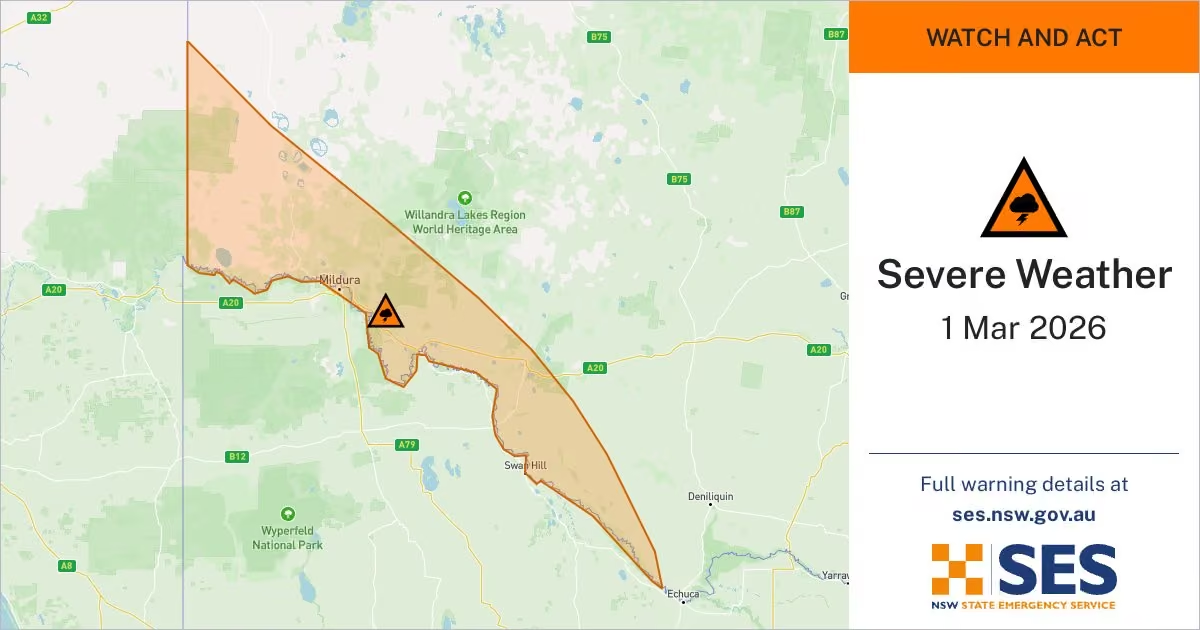
The NSW SES is advising people in the following area(s) to STAY INDOORS due to intense rainfall, and possible flash flooding:
- Wentworth
- Euston
- Barham
WATCH AND ACT
Next update: Monday 2 Mar 5:15 am
Find out more: hazardwatch.gov.au/a/dgE_LD
#nswses -
NSW SES
@NSWSES
The NSW SES advises people in the following area(s) to MONITOR CONDITIONS for forecast heavy rainfall, Flash flooding:
- Albury
- Deniliquin
- Broken Hill
- Hay
- Wentworth
- Menindee
- Griffith
- Narrandera
- Wagga Wagga
Find out more: hazardwatch.gov.au/a/wR1uPE -
NSW SES
@NSWSES
The NSW SES is advising people in the following area(s) to STAY INDOORS due to intense rainfall, and possible flash flooding:
- Wentworth
- Euston
- Barham
WATCH AND ACT
Next update: Sunday 1 Mar 11:15 pm
Find out more: hazardwatch.gov.au/a/aySo-Q
#nswses -
NSW SES
@NSWSES
NSW SES is advising people in the following area(s) to STAY INDOORS due to intense rainfall and flash flooding:
- Tumbarumba
- Mount Ginini
- Jindabyne
- Perisher Valley
- Charlotte Pass
- Thredbo
Next update: Fri 27 Feb 8:30pm
Find out more: hazardwatch.gov.au/a/_BngH2 -
NSW SES
@NSWSES
The NSW SES is advising people in the following area(s) to STAY INDOORS due to intense rainfall, and potential flash flooding:
- Lismore
- Ballina
- Coraki
- Alstonville
- Woodburn
WATCH AND ACT
Next update: Fri 27 Feb 6:30 pm
Find out more: hazardwatch.gov.au/a/Gn1jY8 -
NSW SES
@NSWSES
585 incidents were responded to after heavy rain and flash flooding impacted NSW last night. 523 of those were in the Greater Sydney area.
NSW SES had over 300 volunteers responding to calls for help across Sydney, inluding 44 flood rescues.
Read more: www.ses.nsw.gov.au/news/nsw-ses-works-through-the-night-a… -
NSW SES reposted
Bureau of Meteorology, New South Wales
@BOM_NSW
Today's Thunderstorm FORECAST
Severe thunderstorms are likely in the far northwest.
Severe thunderstorms are possible on the southern and central ranges, southern slopes, and eastern Riverina.
Heavy rainfall is a concern.
More: www.bom.gov.au -
NSW SES
@NSWSES
Severe Thunderstorm Warning for LARGE HAILSTONES, HEAVY RAINFALL and DAMAGING WINDS ☔️
Residents in parts of the South Coast, Southern Tablelands, South West Slopes & Snowy Mountains Forecast Districts should monitor conditions.
Full warning: www.bom.gov.au/warning/severe-thunderstorm-warning/IDN21033 -
NSW SES
@NSWSES
The NSW SES is advising people in the following area(s) to STAY INDOORS due to intense rainfall and possible flash flooding:
- Tibooburra
- Wilcannia
- White Cliffs
- Wanaaring
- Louth
- Tilpa
Next update: Wed 25 Feb 11:15 am
Find out more: hazardwatch.gov.au/a/Pv_cc8 -
NSW SES
@NSWSES
NSW SES is advising people in the following areas to STAY INDOORS due to intense rainfall and possible flash flooding:
- Tibooburra
- Broken Hill
- Wilcannia
- White Cliffs
- Wanaaring
- Menindee
Next update: Wed 25 Feb 5:15 am
Find out more: hazardwatch.gov.au/a/Xo82Mw -
NSW SES
@NSWSES
⚠️ Severe Weather Warning for parts of Lower Western & Upper Western Forecast Districts continues with HEAVY, LOCALLY INTENSE RAINFALL forecast today & into Wednesday.
Periods of heavy rainfall may affect parts of western NSW into Thursday.
Read more: www.bom.gov.au/warning/severe-weather-warning/IDN21037 -
NSW SES
@NSWSES
The NSW SES is advising people in the following area(s) to STAY INDOORS due to intense rainfall, flash flooding:
- Tibooburra
- Broken Hill
- Wilcannia
- White Cliffs
- Wanaaring
- Menindee
Next update: Tuesday 24 Feb 11:00 am
Find out more: hazardwatch.gov.au/a/_RVal8 -
NSW SES
@NSWSES
The NSW SES is advising people in the following area(s) to STAY INDOORS due to heavy rainfall, intense rainfall, flash flooding.
WATCH AND ACT
Next update: Tuesday 24 Feb 5:15 am
Find out more: hazardwatch.gov.au/a/YAm-G3
#nswses -
NSW SES
@NSWSES
‼️ FLOOD WATCH ISSUED: Flooding is possible in the Far North West of NSW from Tuesday.
Catchments likely to be affected include:
🔹 Paroo River (NSW)
🔹 Mount Gunderbooka to Wokabity Lake
🔹 Bynguano-Lower Barrier Ranges
🔹 Cooper Creek
🔹 Lake Frome
🔹 Bulla-Bancannia District
NSW SES
@NSWSES
Learn more: www.bom.gov.au/warning/flood-watch/IDN36503
-
NSW SES reposted
Bureau of Meteorology, New South Wales
@BOM_NSW
⚠️🌧️Severe Weather Warning
Issued at 4:59 am AEDT
Areas of heavy #rainfall persisting about the northwest.
May affect #tibooburra, #whitecliffs, #wanaaring, #louth, #tilpa, #milparinka.
www.bom.gov.au/warning/severe-weather-warning/IDN21037 -
NSW SES
@NSWSES
Conditions are easing in NE NSW after a significant amount of rainfall overnight.
⚠️ Residents are urged to remain vigilant. Flash flooding is unpredictable and can occur at any time.
📲 Continue to monitor the Hazards Near Me app. There are currently 7 WATCH AND ACT warnings. -
NSW SES
@NSWSES
North Eastern NSW is being urged to monitor conditions as we prepare for rainfall and thunderstorms across the Northern Rivers catchements from this evening into the weekend ☔️
This rainfall may cause minor flooding from late Friday.
Read more: www.ses.nsw.gov.au/news/nsw-ses-urges-north-eastern-commu… -
NSW SES
@NSWSES
⚠️ A Severe Thunderstorm Warning for HEAVY RAINFALL, LARGE HAILSTONES and DAMAGING WINDS has been issued.
Parts of South Coast, Southern Tablelands, Central West Slopes and Plains, South West Slopes, Riverina and Snowy Mountains Forecast Districts should monitor warnings. -
NSW SES reposted
Bureau of Meteorology, New South Wales
@BOM_NSW
⚠️Severe Thunderstorm Warning, Tues 10 Feb
Severe thunderstorms are likely to produce damaging wind, large hail and heavy rainfall, that may lead to flash flooding, about the #southwestslopes and #centralwest Slopes and Plains this afternoon.
www.bom.gov.au/warning/severe-thunderstorm-warning/IDN21033 -
NSW SES
@NSWSES
Heads up NSW, start preparing your homes!
Bureau of Meteorology, New South Wales
@BOM_NSW
⛈️Today's storm forecast:
🟢Non severe storms through central areas, on and east of ranges
🟡Severe storms possible central NSW, southern slopes and ranges
🔴Severe storms likely Southern Tablelands
Risks: heavy rainfall, damaging winds and large hail
www.bom.gov.au/location/australia/new-south-wales -
NSW SES reposted
Bureau of Meteorology, New South Wales
@BOM_NSW
⚠️⛈️Severe Thunderstorm Warning for DAMAGING WINDS and LARGE HAILSTONES
A trough is combining with an unstable airmass to produce thunderstorms along the central ranges and slopes this afternoon and early evening.
www.bom.gov.au/warning/severe-thunderstorm-warning/IDN21033 -
NSW SES reposted
Bureau of Meteorology, New South Wales
@BOM_NSW
⚠️⛈️ 2:00pm: Detailed Severe Thunderstorm Warning for damaging #wind and large #hail in parts of #wollondilly #wingecarribee and Greater #wollongong areas.
A severe storms near #mossvale and #robertson is moving towards the northeast.
Details: www.bom.gov.au/warning/severe-thunderstorm-warning/IDN21035 -
NSW SES
@NSWSES
A Severe Thunderstorm Warning for DAMAGING WINDS and LARGE HAILSTONES has been issued by Bureau of Meteorology. If you require assistance in floods and storms, call the NSW SES on 132 500. In life threatening situations, call Triple Zero (000).
View: www.bom.gov.au/warning/severe-thunderstorm-warning/IDN21033 -
NSW SES reposted
Bureau of Meteorology, New South Wales
@BOM_NSW
Thunderstorm forecast, Fri 6th Feb
🟠 Severe thunderstorms possible for the Upper Western and central ranges.
Hazard: heavy rainfall leading to flash flooding, and in addition over the central tablelands: damaging winds and large hail -
NSW SES reposted
Bureau of Meteorology, New South Wales
@BOM_NSW
Thunderstorm forecast 3rd February.
🟠Severe thunderstorms possible over the Upper Western District.
Hazard: locally heavy rainfall leading to flash flooding, large hail, and damaging wind gusts. -
NSW SES
@NSWSES
“I heard there might be storms this weekend.”
★☆☆☆☆
“There might be storms this weekend so I’m going to spend time this afternoon making sure my home is prepared and I’ll download the Hazards Near Me app to stay across warnings.”
★★★★★★★★★★★★★★★★★★★★★★
NSW SES
@NSWSES
After days of hot weather, thunderstorm activity is expected to increase across the state over the coming days. Stay across warnings by using the Hazards Near Me app or the NSW SES website.
-
NSW SES
@NSWSES
Flood update – Narrabeen.📍 An evacuation centre is open at Mona Vale Memorial Hall. Floodwaters at Narrabeen Lagoon may take several days to recede after rapidly rising flash flooding overnight.
More Information about Evacuation Centres: www.ses.nsw.gov.au/during-an-emergency/evacuation-centres…
NSW SES
@NSWSES
This evacuation centre has now closed. View the updated warning on NSW SES website www.ses.nsw.gov.au or hazardwatch.gov.au/a/wlRB4U
-
NSW SES
@NSWSES
The NSW SES advises you may now RETURN WITH CAUTION to the following area(s):
- Narrabeen Lagoon and surrounds, including the BIG4 Sydney Lakeside Holiday Park.
ADVICE
Find out more: hazardwatch.gov.au/a/wlRB4U
#nswses -
NSW SES reposted
Bureau of Meteorology, New South Wales
@BOM_NSW
VERY DANGEROUS THUNDERSTORMS producing intense rainfall leading to dangerous and life-threatening flash flooding near Mona Vale and Calga.
Forecast to affect Terrey Hills, Brooklyn and Spencer by 5:50 pm
71mm at Koolewong in 1 hour
133mm at Pearl beach in 2 hours -
NSW SES
@NSWSES
The NSW SES advises people in the following area(s) to PREPARE TO ISOLATE by 12:00 am Sun 18 Jan for up to 24 - 36 hours due to predictions that the Wyong River & Jilliby Creek
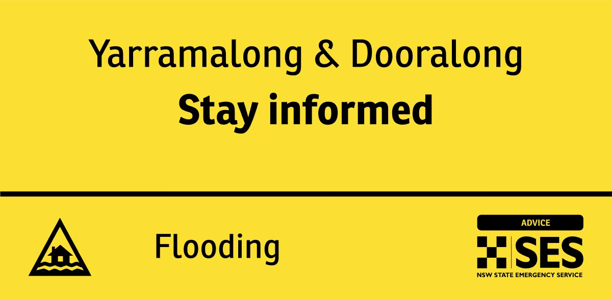
Yarramalong
Dooralong
WATCH AND ACT
Next update: Sunday 18 Jan 12:00 pm -
NSW SES
@NSWSES
NSW SES is directing people to EVACUATE BEFORE 11:30 pm Sat 17 Jan due to localised flooding:
- Narrabeen Lagoon and surrounds, including BIG4 Sydney Lakeside Holiday Park
EMERGENCY WARNING
Next update: Sunday 18 Jan 10:00 am
Find out more: hazardwatch.gov.au/a/asF6E8 -
NSW SES
@NSWSES
The NSW SES advises people in the following area(s) to STAY INFORMED about predicted rising water and possible flash flooding on the Wyong River & Jilliby Creek:
Yarramalong
Dooralong
ADVICE
Next update: Sunday 18 Jan 12:00 pm
Find out more: hazardwatch.gov.au/a/eyoUyb -
NSW SES
@NSWSES
The NSW SES is advising people in the following area(s) to STAY INDOORS due to heavy rainfall, intense rainfall, flash flooding:
- Gosford
- Sydney
- Wollongong
- Campbelltown
WATCH AND ACT
Next update: Saturday 17 Jan 11:45 pm
Find out more: hazardwatch.gov.au/a/jTzY7P -
NSW SES
@NSWSES
The NSW SES advises people in the following area(s) to PREPARE TO EVACUATE due to current localised flooding:
- Narrabeen Lagoon and surrounds
WATCH AND ACT
Next update: Sunday 18 Jan 10:00 am
Find out more: hazardwatch.gov.au/a/Y8bjna
#nswses -
NSW SES
@NSWSES
The NSW SES is advising people in the following area(s) to STAY INDOORS due to intense rainfall, flash flooding:
- Calga
- Woy Woy
- Upper Mangrove
- Botany
- Sutherland
WATCH AND ACT
Next update: Saturday 17 Jan 7:45 pm
Find out more: hazardwatch.gov.au/a/aAsA2M -
NSW SES
@NSWSES
The NSW SES is advising people in the following area(s) to STAY INDOORS due to intense rainfall, flash flooding:
- Sutherland
- Lucas Heights
- Waterfall
- Padstow
- Spencer
WATCH AND ACT
Next update: Saturday 17 Jan 7:00 pm
Find out more: hazardwatch.gov.au/a/wclvnS -
NSW SES
@NSWSES
The NSW SES is advising people in the following area(s) to STAY INDOORS due to intense rainfall, flash flooding:
- Sutherland
- Hurstville
- Menai
- Gosford
- Wyong
- Woy Woy
WATCH AND ACTNext update: Saturday 17 Jan 6:15 pm
Find out more: hazardwatch.gov.au/a/6YTodR -
NSW SES
@NSWSES
The NSW SES is advising people in the following area(s) to STAY INDOORS due to intense rainfall, flash flooding:
- Gosford
- Wyong
- The Entrance
- Woy Woy
WATCH AND ACT
Next update: Saturday 17 Jan 5:15 pm
Find out more: hazardwatch.gov.au/a/UM3MQJ
#nswses -
NSW SES
@NSWSES
The NSW SES is advising people in the following area(s) to STAY INDOORS due to intense rainfall, flash flooding:
- Gosford
- Wyong
- The Entrance
- Woy Woy
WATCH AND ACT
Next update: Saturday 17 Jan 4:30 pm
Find out more: hazardwatch.gov.au/a/DEpRqy
#nswses -
NSW SES
@NSWSES
The NSW SES is advising people in the following area(s) to STAY INDOORS due to intense rainfall, flash flooding:
- Gosford
- Wyong
- Sydney
WATCH AND ACT
Next update: Saturday 17 Jan 4:00 pm
Find out more: hazardwatch.gov.au/a/vXCzAP
#nswses -
NSW SES
@NSWSES
The NSW SES is advising people in the following area(s) to STAY INDOORS due to intense rainfall, flash flooding:
- Gosford
- Wyong
- Sydney
WATCH AND ACT
Next update: Saturday 17 Jan 3:30 pm
Find out more: hazardwatch.gov.au/a/Dj31dP
#nswses -
NSW SES reposted
Bureau of Meteorology, New South Wales
@BOM_NSW
⚠️⛈️ 9:50am: Detailed Severe Thunderstorm Warning for heavy #rainfall in parts of #gosford / #wyong & #sydney areas.
A severe storm is forecast to affect #spencer, #lowermangrove & #mountwhite by 10:20am & #calga by 10:50. It may produce flash #flooding.
www.bom.gov.au/warning/severe-thunderstorm-warning/IDN21035 -
NSW SES
@NSWSES
A Severe Thunderstorm Warning for HEAVY RAINFALL has been issued for Greater Sydney and Gosford/Wyong. ☎️If you require assistance in floods and storms, call the NSW SES on 132 500. In life threatening situations, call Triple Zero (000).
Full Warning: www.bom.gov.au/warning/severe-thunderstorm-warning/IDN21035
NSW SES
@NSWSES
UPDATE Issued at 10:29 am Saturday 17 January 2026:
Severe thunderstorms in the warning area have temporarily eased. However, the redevelopment of severe thunderstorms remains possible.
35mm of rainfall was recorded at North Parramatta in the 30 min to 8:27 am. -
NSW SES reposted
-
NSW SES reposted
Bureau of Meteorology, New South Wales
@BOM_NSW
⚠️⛈️ 1:37pm: Severe Thunderstorm Warning for LARGE HAILSTONES, DAMAGING WINDS and HEAVY RAINFALL parts of Northern Rivers, Mid North Coast and Northern Tablelands Forecast Districts.
Severe thunderstorms in the northeast this afternoon.
Details: www.bom.gov.au/warning/severe-thunderstorm-warning/IDN21033 -
NSW SES
@NSWSES
A Severe Thunderstorm Warning for LARGE HAILSTONES, DAMAGING WINDS and HEAVY RAINFALL has been issued. ☎️If you require assistance in floods and storms, call 132 500 or call Triple Zero (000).
View the full warning here: www.bom.gov.au/warning/severe-thunderstorm-warning/IDN21033 -
NSW SES reposted
Bureau of Meteorology, Australia
@BOM_au
Multiple #weatherwarnings are in place across #nsw, as unsettled conditions extend across the eastern half of the state. More: bom.gov.au
-
NSW SES
@NSWSES
A Severe Weather Warning for HEAVY RAINFALL and DAMAGING WINDS has been issued for parts of Illawarra, South Coast and Southern Tablelands Forecast Districts.
View the full warning here:
www.bom.gov.au/warning/severe-weather-warning/IDN21037 -
NSW SES
@NSWSES
The NSW SES is advising people in the following area(s) to STAY INDOORS due to heavy rainfall, damaging winds, giant hailstones, and possible flash flooding:
- Bundanoon
- Kiama
WATCH AND ACT
Next update: Thursday 15 Jan 8:45pm
Find out more: hazardwatch.gov.au/a/sTS5Ut -
NSW SES
@NSWSES
The NSW SES is advising people in the following area(s) to STAY INDOORS due to heavy rainfall, damaging winds, giant hailstones, flash flooding:
- South of Bowral
WATCH AND ACT
Next update: Thursday 15 Jan 8:00 pm
Find out more: hazardwatch.gov.au/a/J5HIGc
#nswses -
NSW SES
@NSWSES
The NSW SES is advising people in the following area(s) to STAY INDOORS due to intense rainfall, damaging winds, large hailstones, flash flooding:
- Moruya Heads
- Narooma
WATCH AND ACT
Next update: Friday 16 Jan 9:00 pm
Find out more: hazardwatch.gov.au/a/m_-sGd
#nswses -
NSW SES
@NSWSES
A Severe Thunderstorm Warning for DAMAGING WINDS, LARGE HAILSTONES and HEAVY RAINFALL that may lead to flash flooding has been issued. ☎️If you require assistance in floods and storms, call 132 500 or call Triple Zero (000).
View the full warning here: www.bom.gov.au/warning/severe-thunderstorm-warning/IDN21033 -
NSW SES
@NSWSES
A Severe Thunderstorm Warning for DAMAGING WINDS, LARGE HAILSTONES and HEAVY RAINFALL that may lead to flash flooding has been issued. 📍May affect Cooma, Jindabyne, Thredbo, Nimmitabel, Perisher Valley and Charlotte Pass.
View the full warning here: www.bom.gov.au/warning/severe-thunderstorm-warning/IDN21033 -
NSW SES reposted
Bureau of Meteorology, Australia
@BOM_au
Severe Weather Update: Severe storms, rain and wind for the south-east.
Video current: 11:30am AEDT 15 January 2026.
Latest forecasts and warnings: www.bom.gov.au or the BOM Weather app.This media couldn't be displayed. See it on the original post. -
NSW SES
@NSWSES
NSW SES advises south eastern NSW communities should prepare for heavy rain and damaging winds as potential severe thunderstorms are forecast over the coming days and into the weekend.
More: www.ses.nsw.gov.au/news/NSW-SES-urges-se-NSW-communities-… -
NSW SES
@NSWSES
A Severe Weather Warning for HEAVY RAINFALL and DAMAGING WINDS has been issued South Coast and parts of Illawarra, Southern Tablelands and Snowy Mountains Forecast Districts.
View the full warning here: www.bom.gov.au/warning/severe-weather-warning/IDN21037 -
NSW SES reposted
Bureau of Meteorology, New South Wales
@BOM_NSW
Issued 4:45pm
Severe thunderstorms are likely to produce damaging winds, large hailstones and heavy rainfall that may lead to flash flooding in the warning area over the next several hours.
www.bom.gov.au
#orange #goulburn #mudgee #bathurst #wellington #crookwell -
NSW SES
@NSWSES
⚠️ A Severe Weather Warning for for DAMAGING WINDS, LARGE HAILSTONES and HEAVY RAINFALL has been issued by the Bureau of Meteorology.
People should monitor conditions and follow safety advice.
View the full warning here: reg.bom.gov.au/products/IDN21033.shtml
NSW SES
@NSWSES
Severe thunderstorms are no longer occurring in the South Coast and Snowy Mountains districts and the warning for these districts is CANCELLED. This warning was updated 4:45 pm Wednesday, 14 January 2026.
-
NSW SES reposted
Bureau of Meteorology, Australia
@BOM_au
Severe Weather Update: Widespread rain and storms for the south-east
Video current: 11.30am AEDT 14 January 2026
For the latest forecasts and warnings, go to www.bom.gov.au or the BOM Weather app.This media couldn't be displayed. See it on the original post. -
NSW SES
@NSWSES
A Severe Weather Warning for DAMAGING WINDS has been issued for multiple areas across the state.
View the full warning here: reg.bom.gov.au/products/IDN21037.shtml -
NSW SES reposted
Bureau of Meteorology, Australia
@BOM_au
Severe Weather Update: Extreme heat and fire danger for the south
Video current: 1pm AEDT 7 January 2025
For the latest forecasts and warnings, go to www.bom.gov.au or the BOM Weather app.This media couldn't be displayed. See it on the original post. -
NSW SES
@NSWSES
A Severe Thunderstorm Warning for HEAVY RAINFALL, LARGE HAILSTONES and DAMAGING WINDS has been issued for multiple areas across the state.
View warning: www.bom.gov.au/warning/severe-thunderstorm-warning/IDN21033 -
NSW SES
@NSWSES
Can you believe that 2025 was our second-busiest year in 70 years as an agency!?
As we head into 2026, we’re ready for whatever comes next and look forward to the year ahead.
Stay safe, stay storm ready!
Happy New Year! 🎉🥳 -
NSW SES reposted
Bureau of Meteorology, New South Wales
@BOM_NSW
🌩️Thunderstorm Forecast for Tues 30 Dec
🟢Thunderstorms possible about the far northwest, and far southern ranges, this afternoon and evening. Storms are not expected to be severe, and will produce little rainfall. -
NSW SES
@NSWSES
Storms are possible in eastern NSW from tomorrow into the weekend. While it is still uncertain, storms can bring localised heavy rain, damaging winds and hail.
📲 Download Hazards Near Me or visit the NSW SES website to stay up to date with warnings and information. -
NSW SES
@NSWSES
Rain, hail or festive cheer - we’ve got you covered! 🎄
Wishing everyone a safe and happy Christmas from NSW SES. -
NSW SES reposted
Bureau of Meteorology, Australia
@BOM_au
Severe Weather Update: Multiple days of severe thunderstorms forecast for northern and eastern Australia.
Video current: 3:00pm AEDT 23 December 2025.
Latest forecasts and warnings: www.bom.gov.au or the BOM Weather app.This media couldn't be displayed. See it on the original post. -
NSW SES reposted
Bureau of Meteorology, New South Wales
@BOM_NSW
⛈️Thunderstorm Forecast, Tues 23 Dec
🟠Severe storms possible about the NE of #nsw today.
Hazard: large hail, damaging wind gusts, local heavy rainfall leading to flash flooding.
www.bom.gov.au/weather-and-climate/warnings-and-alerts -
NSW SES
@NSWSES
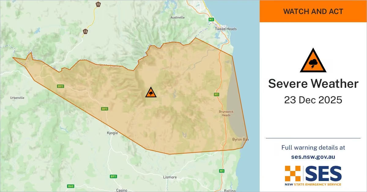
⚠️ A Severe Thunderstorm Warning with HEAVY RAINFALL has been issued by the Bureau of Meteorology.
📍 Residents which may be affected in Inverell, Glen Innes, Tweed Heads, Murwillumbah, Hastings Point and Numinbah.
Full warning: www.bom.gov.au/warning/severe-thunderstorm-warning/IDN21033 -
NSW SES
@NSWSES
The NSW SES is advising people in the following area(s) to STAY INDOORS due to intense rainfall, flash flooding:
- Tweed Heads
- Murwillumbah
- Hastings Point
- Numinbah
Find out more: hazardwatch.gov.au/a/-Or0Tv -
NSW SES
@NSWSES
The NSW SES is advising people in the following area(s) to STAY INDOORS due to intense rainfall, flash flooding:
- Murwillumbah
- Byron Bay
- Mullumbimby
- Brunswick Heads
- Hastings Point
- Numinbah
Find out more: hazardwatch.gov.au/a/dcRAAv -
NSW SES
@NSWSES
School’s out for another year ☀️
Whether you’re travelling locally, heading overseas, or spending time at home, please remember to take steps that help keep you and your loved ones safe.
Learn more: www.ses.nsw.gov.au/plan-and-prepare -
NSW SES
@NSWSES
⚠️ A Severe Thunderstorm Warning for DAMAGING WINDS has been issued by the Bureau of Meteorology.
📍 Residents in parts of the Riverina and Lower Western Forecast Districts should monitor conditions and stay alert.
Full warning: www.bom.gov.au/warning/severe-thunderstorm-warning/IDN21033 -
NSW SES reposted
Bureau of Meteorology, Australia
@BOM_au
Severe Weather Update: Severe storms and heatwaves for south-east Australia
Video current: 12.30pm AEDT 19 December 2025
For the latest forecasts and warnings, go to www.bom.gov.au or the BOM Weather app.This media couldn't be displayed. See it on the original post. -
NSW SES reposted
Bureau of Meteorology, New South Wales
@BOM_NSW
⛈️Thunderstorm FORECAST for TODAY 19/12:
🟡 Severe storms possible: western and southern inland #nsw.
Hazards: Damaging winds
🟢 Non-severe storms possible: across much of the state.
Warnings if required: www.bom.gov.au/weather-and-climate/warnings-and-alerts -
NSW SES
@NSWSES
The NSW SES extends our deepest condolences to the victims, families, friends and loved ones affected by yesterday’s tragic attack at Bondi Beach.
-
NSW SES reposted
NSW Police Force
@nswpolice
***IMPORTANT INFORMATION***
The Register, Find, Reunite website – www.redcross.org.au/emergencies/about-register-find-reunite/ –is a National system managed and operated by Australian Red Cross.
It is a service which registers, finds and reunites family, friends and loved ones after an emergency. It allows people to,
Register to let people know they are safe,
Find people who may be affected by an emergency and know they are safe, and
Reunite through a matching process which enables police – with consent – to share details of family and friends with each other. -
NSW SES reposted
Bureau of Meteorology, New South Wales
@BOM_NSW
⚠️⛈️Severe Thunderstorm Warning 2:59pm: Severe thunderstorms for parts of eastern New South Wales
Severe thunderstorms are likely to produce heavy rainfall that may lead to flash flooding. Large hail also possible in the Central Tablelands.
www.bom.gov.au/warning/severe-thunderstorm-warning/IDN21033 -
NSW SES reposted
Bureau of Meteorology, New South Wales
@BOM_NSW
⛈️Severe Thunderstorm Warning 1:35pm: heavy rainfall over parts of the central east, North West and Central West.
Severe thunderstorms are likely to produce heavy rainfall that may lead to flash flooding over the next several hours.
www.bom.gov.au/warning/severe-thunderstorm-warning/IDN21033 -
NSW SES
@NSWSES
⚠️ A Severe Thunderstorm Warning for HEAVY RAINFALL has been issued.
📍 People in parts Metropolitan, Illawarra and Central Tablelands should monitor conditions and follow safety advice - particularly residents in Sydney, Wollondilly/Wingecarribee and Greater Wollongong areas. -
NSW SES
@NSWSES
⚠️ FLASH FLOODING is a high risk this morning in many parts NSW.
📍 Areas incl. metropolitan Sydney & the Illawarra as well as northern & north east parts of NSW, should STAY ALERT.
Flash flooding is dangerous and unpredictable. It can occur suddenly and without warning. -
NSW SES
@NSWSES
Flash flooding is dangerous & unpredictable. It can occur suddenly & without warning.
Tomorrow morning there is the risk of FLASH FLOODING in many parts of the state, including the metropolitan Sydney area and the Illawarra as well as northern and north east parts of the state.
NSW SES
@NSWSES
Steer clear of floodwaters. If you come across a flooded road, TURN AROUND and find a safer route.
If you don’t need to be travelling in periods of heavy rainfall, we suggest you delay your travel and visit Live Traffic NSW to check road conditions before your journey.
NSW SES
@NSWSES
Be aware that there may be extra traffic on the roads due to the busy holiday period with some schools already finished up for the year.
Stay vigilant by monitoring the rainfall in your area and by monitoring warnings on the Hazards Near Me app. -
NSW SES reposted
Bureau of Meteorology, New South Wales
@BOM_NSW
⚠️⛈️Severe Thunderstorm Warning for LARGE HAILSTONES, HEAVY RAINFALL and DAMAGING WINDS
Severe thunderstorms west of the divide.
Locations which may be affected include #orange, #tamworth, #mudgee, #parkes, #coonabarabran and #nyngan.
www.bom.gov.au/warning/severe-thunderstorm-warning/IDN21033 -
NSW SES
@NSWSES
⚠️ A Severe Thunderstorm Warning for LARGE HAILSTONES, HEAVY RAINFALL and DAMAGING WINDS has been issued.
📍 People in parts of Central Tablelands, North West Slopes and Plains, Central West Slopes and Plains and South West Slopes Forecast Districts should monitor conditions.
NSW SES
@NSWSES
UPDATED at 4:09pm: This warning now also covers parts of the Upper Western and Northern Tablelands Forecast Districts.
-
NSW SES reposted
Bureau of Meteorology, New South Wales
@BOM_NSW
⛈️Thunderstorm FORECAST for TODAY (11/12):
🟡 Severe storms possible: central-west inland, central-east and far northern inland
Hazards: Damaging winds, large hail, and heavy rainfall
🟢 Non-severe storms possible across much of the state
Warnings: www.bom.gov.au/weather-and-climate/warnings-and-alerts -
NSW SES reposted
Bureau of Meteorology, New South Wales
@BOM_NSW
⛈️Severe Thunderstorm Warning for LARGE HAILSTONES and DAMAGING WINDS
parts of Mid North Coast, Hunter, Central Tablelands, North West Slopes and Plains, Central West Slopes and Plains, Upper Western and Northern Tablelands Forecast Districts.
www.bom.gov.au/warning/severe-thunderstorm-warning/IDN21033 -
NSW SES
@NSWSES
⚠️ A Severe Thunderstorm Warning for LARGE HAILSTONES and DAMAGING WINDS has been issued.
📍 People in parts of Mid North Coast, Hunter, Central Tablelands, North West Slopes and Plains, Central West Slopes and Plains, Upper Western and Northern Tablelands Forecast Districts. -
NSW SES
@NSWSES
We’re preparing for the impacts of severe thunderstorms across much of NSW from today through to the weekend.
📷 Download Hazards Near Me or visit our website to stay up to date with warnings and information, especially as the weather moves through and may affect other areas. -
NSW SES reposted
Bureau of Meteorology, Australia
@BOM_au
Severe Weather Update: Heat, fire danger and severe thunderstorms in New South Wales.
Video current: 1:00pm AEDT 9 December 2025.
Latest forecasts and warnings: www.bom.gov.au or the BOM Weather app.This media couldn't be displayed. See it on the original post. -
NSW SES
@NSWSES
With gratitude for a life lived in service to others. Rest in peace 🕯️
-
NSW SES reposted
Bureau of Meteorology, New South Wales
@BOM_NSW
⚠️🌬️ 1:32pm: Severe Weather Warning for damaging winds developing over parts of southeastern #nsw during Saturday.
#snowymountains, #act and parts of #southcoast, #southerntablelands and #southwestslopes forecast districts.
www.bom.gov.au/warning/severe-weather-warning/IDN21037 -
NSW SES
@NSWSES
⚠️ A Severe Weather Warning for DAMAGING WINDS has been issued by the Bureau of Meteorology for Saturday.
📍 People in the Snowy Mountains, parts of the South Coast, Southern Tablelands & South West Slopes Forecast Districts. should monitor conditions and follow safety advice. -
NSW SES
@NSWSES
Last week, SES City of Sydney Unit showcased new tech shaping the future of storm and flood response. Volunteers tested the latest equipment & specialist vehicles, including a mobile incident command centre, Starlink kits, unmanned vessels, flood barriers & high-clearance 4WDs
-
NSW SES
@NSWSES
A Severe Thunderstorm Warning for DAMAGING WINDS has been issued.
📍 People in the South West Slopes and parts of Central Tablelands, Southern Tablelands, Central West Slopes and Plains and Riverina Forecast Districts should monitor conditions and follow safety advice.
NSW SES
@NSWSES
View the warning here: www.bom.gov.au/warning/severe-thunderstorm-warning/IDN21033
-
NSW SES reposted
Bureau of Meteorology, New South Wales
@BOM_NSW
⚠️🌬️ 10:56am: Severe Weather Warning for damaging #winds developing Saturday morning.
For parts of Mid North Coast, Hunter, Illawarra, Central Tablelands, Southern Tablelands, Northern Tablelands and North West Slopes and Plains.
www.bom.gov.au/warning/severe-weather-warning/IDN21037 -
NSW SES reposted
Bureau of Meteorology, New South Wales
@BOM_NSW
Thunderstorm FORECAST (27/11):
🟢 Thunderstorms possible: northeast #nsw
🟡 Severe storms possible: north of #crowdyhead. Large hail, damaging winds
🔴 Severe storms likely: north of #coffsharbour. Possible giant hail, destructive winds
Warnings: www.bom.gov.au/weather-and-climate/warnings-and-alerts -
NSW SES
@NSWSES
More severe weather in the Mid North Coast, Northern Rivers & Northern Tablelands this afternoon. These storms may bring DAMAGING WINDS, LARGE HAIL & HEAVY RAINFALL which may lead to FLASH FLOODING.
Across the rest of NSW, be aware of some gusty winds up to 80km/hr. -
NSW SES
@NSWSES
810 NSW SES volunteers have been busy responding to 2,200+ reported incidents from yesterday’s severe weather that impacted most of NSW.
115,000+ properties were left without power and the majority of calls were made for trees down, hail damage, powerlines down & roof damage. -
NSW SES
@NSWSES
NSW SES has reported over 1145 incidents between midnight last night and 3:30pm today.
Please take the time to prepare your home while it is safe to do so.This media couldn't be displayed. See it on the original post. -
NSW SES reposted
Bureau of Meteorology, New South Wales
@BOM_NSW
⛈️Thunderstorm FORECAST for TOMORROW (27/11):
🔴 Severe storms likely: far northeast
🟡 Severe storms possible: northeast
Hazards: Damaging winds, large hail, heavy rainfall
🟢 Non-severe storms possible: northeast quarter
Forecast and warnings: www.bom.gov.au/location/australia/new-south-wales -
NSW SES reposted
Bureau of Meteorology, Australia
@BOM_au
Severe weather update: Severe thunderstorm outbreak continues over the east.
Video current: 1:30pm AEDT Wednesday 26 November 2025.
Know your weather, know your risk.
For the latest forecasts and warnings, go to our website www.bom.gov.au or the BOM Weather app.This media couldn't be displayed. See it on the original post. -
NSW SES
@NSWSES
The NSW SES is experiencing a high volume of calls due to significant thunderstorms impacting a large geographical part of NSW.
If you are calling the NSW SES on 132 500, please be patient & we will get to your call.
If you’re in a life-threatening situation, please call 000. -
NSW SES reposted
Bureau of Meteorology, New South Wales
@BOM_NSW
⛈️Thunderstorm FORECAST for TODAY (26/11):
🔴 Severe storms likely: northeast #nsw
🟡 Severe storms possible: northeast and far southeast
Hazards: Damaging winds, large hail, heavy rainfall. Potential for giant #hail and destructive #winds.
Warnings: www.bom.gov.au/weather-and-climate/warnings-and-alerts -
NSW SES reposted
Bureau of Meteorology, New South Wales
@BOM_NSW
⚠️⛈️ Severe Thunderstorm Warning for DAMAGING, LOCALLY DESTRUCTIVE WINDS, LARGE HAILSTONES and HEAVY RAINFALL
for parts of northern and central NSW
VERY DANGEROUS STORM HAS DEVELOPED SE OF SCONE TRACKING TO THE NE, DESTRUCTIVE WINDS POSSIBLE
www.bom.gov.au/warning/severe-thunderstorm-warning/IDN21033 -
NSW SES
@NSWSES
The NSW SES is advising people in the following area(s) to STAY INDOORS due to heavy rainfall, destructive winds, large hailstones, Flash Flooding:
- Dungog
WATCH AND ACT
Next update: Wednesday 26 Nov 3:30 pm
Find out more: hazardwatch.gov.au/a/Yi3Ga7
#nswses -
NSW SES
@NSWSES
The NSW SES is advising people in the following area(s) to STAY INDOORS due to damaging winds:
- Orange
- Bathurst
WATCH AND ACT
Next update: Wednesday 26 Nov 2:45 pm
Find out more: hazardwatch.gov.au/a/1LXUaD
#nswses -
NSW SES reposted
Bureau of Meteorology, New South Wales
@BOM_NSW
⚠️⛈️ 12:19am: Detailed Severe Thunderstorm Warning for damaging #wind and large #hail in #sydney and parts of #bluemountains / #hawkesbury, #maitland / #cessnock, #gosford / #wyong, #wollondilly / #wingecarribee and Greater #wollongong areas.
Details: www.bom.gov.au/warning/severe-thunderstorm-warning/IDN21035 -
NSW SES reposted
Bureau of Meteorology, New South Wales
@BOM_NSW
⚠️⛈️ 12:05pm: Severe Thunderstorm Warning for large #hail and damaging #wind in Metropolitan, Central Tablelands and parts of Hunter, Illawarra, Central West Slopes and Plains and Southern Tablelands Districts.
Details: www.bom.gov.au/warning/severe-thunderstorm-warning/IDN21033 -
NSW SES reposted
Bureau of Meteorology, New South Wales
@BOM_NSW
⚠️⛈️ 11:089am: Severe Thunderstorm Warning for large #hail and damaging #wind in parts of Illawarra, Central Tablelands, Southern Tablelands, Central West Slopes and Plains and South West Slopes Forecast Districts.
Details: www.bom.gov.au/warning/severe-thunderstorm-warning/IDN21033 -
NSW SES reposted
Bureau of Meteorology, New South Wales
@BOM_NSW
⚠️⛈️ 11:29am: Severe Thunderstorm Warning for large #hail and damaging #wind in Illawarra, Central Tablelands and parts of Metropolitan, Southern Tablelands, Central West Slopes and Plains, Hunter and South West Slopes Forecast Districts.
Details: www.bom.gov.au/warning/severe-thunderstorm-warning/IDN21033 -
NSW SES reposted
Bureau of Meteorology, New South Wales
@BOM_NSW
⚠️⛈️ 11:35am: Detailed Severe Thunderstorm Warning for large #hail and damaging #wind in parts of Blue Mountains/Hawkesbury, Wollondilly/Wingecarribee, Greater #wollongong and #sydney areas.
Details: www.bom.gov.au/warning/severe-thunderstorm-warning/IDN21035 -
NSW SES reposted
Bureau of Meteorology, Australia
@BOM_au
Severe Weather Update: Gusty storms, damaging winds and extreme fire danger for the south-east.
Video current: 2:30pm AEDT 25 November 2025.
Latest forecasts and warnings: www.bom.gov.au or the BOM Weather app.This media couldn't be displayed. See it on the original post. -
NSW SES reposted
Bureau of Meteorology, New South Wales
@BOM_NSW
⚠️⛈️ 2:38pm: Severe Thunderstorm Warning for damaging #winds and large #hail in parts of Mid North Coast, Hunter, Central Tablelands, North West Slopes and Plains, Central West Slopes and Plains and Northern Tablelands Forecast Districts.
Details: www.bom.gov.au/warning/severe-thunderstorm-warning/IDN21033 -
NSW SES
@NSWSES
Driving into floods puts everyone in danger. Roads under floodwater can collapse without warning. Even a small amount of water can conceal sinkholes, debris, or strong currents. 🚗🚫💧
Before a storm, check Live Traffic NSW and find another way.
👉More www.ses.nsw.gov.au/steer-clear -
NSW SES
@NSWSES
⚠️ A Severe Thunderstorm Warning for DAMAGING WINDS and LARGE HAILSTONES has been issued.
📍 People in the Mid North Coast, Hunter, Central Tablelands, North West Slopes and Plains, Central West Slopes and Plains and Northern Tablelands Forecast Districts should be prepared. -
NSW SES
@NSWSES
A severe weather warning for damaging winds has been issued.
View the warning from the @BOM_NSW here: www.bom.gov.au/warning/severe-weather-warning/IDN21037
Visit our website to learn more about how to prepare your home for severe weather. -
NSW SES
@NSWSES
The NSW SES is advising people in the following area(s) to STAY INDOORS due to heavy rainfall, damaging winds, large hailstones, giant hailstones, Flash flooding:
WATCH AND ACT
Next update: Monday 24 Nov 5:45 pm
Find out more: hazardwatch.gov.au/a/H28Ihh
#nswses -
NSW SES
@NSWSES
Severe thunderstorms are on the way this week for various parts of NSW! ⚡️☔️
NSW SES teams have been briefed and are ready to respond to any calls for assistance.
📲 Download Hazards Near Me or visit the NSW SES website to stay up to date with warnings and information. -
NSW SES
@NSWSES
The NSW SES is advising people in the following area(s) to STAY INDOORS due to intense rainfall, flash flooding:
- Goulburn
- Yass
- Crookwell
- Nerriga
- Taralga
WATCH AND ACT
Next update: Sunday 23 Nov 7:30 am
Find out more: hazardwatch.gov.au/a/2_A6RS
#nswses -
NSW SES
@NSWSES
⚠️Severe thunderstorms about this afternoon over parts of northern NSW.
Bureau is expecting the potential for large hailstones, damaging winds and heavy rainfall across parts of the MNC, Hunter and North West Slopes and Plains.
📲 Download the Hazards Near Me app -
NSW SES
@NSWSES
Floods are part of life in the Northern Rivers. Preparing early can make all the difference.
✅Know your risk.
✅Make a plan.
✅Understand the warnings.
✅And above all, look out for one another.
When we prepare together, we’re stronger than ever. 💕
📲www.ses.nsw.gov.au/northernrivers -
NSW SES
@NSWSES
The NSW SES is advising people in the following area(s) to STAY INDOORS due to heavy rainfall, destructive winds, giant hailstones, flash flooding:
- Moree
- Bellata
WATCH AND ACT
Next update: Saturday 15 Nov 5:30 pm
Find out more: hazardwatch.gov.au/a/HP9ewA
#nswses -
NSW SES
@NSWSES
Severe Thunderstorm Warning for DAMAGING WINDS, LARGE HAILSTONES and HEAVY RAINFALLS has been issued & people in North West Slopes and Plains and Northern Tablelands Forecast Districts should monitor conditions and follow safety advice.
View Warning:
www.bom.gov.au/warning/severe-thunderstorm-warning/IDN21033 -
NSW SES
@NSWSES
Severe Thunderstorms are possible across northern and eastern NSW from Friday through to Sunday. These storms may bring damaging winds, large hail, and heavy rainfall.
Download Hazards Near Me or visit the NSW SES website for warnings and information. -
NSW SES
@NSWSES
Help us improve your online experience!
🎉It’s been 10 months since we launched our NEW website, and now we’d love your feedback.
👉 Take our quick community survey www.surveymonkey.com/r/NSWSES -
NSW SES
@NSWSES
Severe Thunderstorm Warning for DAMAGING WINDS has been issued & people in the Illawarra, South Coast, Southern Tablelands, Snowy Mountains, Goulburn, Cooma, Yass, Braidwood and Araluen should monitor conditions and follow safety advice.
View Warning:
www.bom.gov.au/warning/severe-thunderstorm-warning/IDN21033 -
NSW SES reposted
Bureau of Meteorology, New South Wales
@BOM_NSW
⚠️Severe Thunderstorm Warning for SE parts of NSW and ACT, Tues 11th Nov
Gusty showers and thunderstorms expected this afternoon.
🌬️Possible damaging wind gusts.
Details: www.bom.gov.au/warning/severe-thunderstorm-warning/IDN21033 -
NSW SES
@NSWSES
Over the weekend, more than 150 SES volunteers across the state put their life-saving skills to the test at the inaugural #floodrescue Challenge in Sydney. 🚤💦
This year alone, our members have responded to more than 1,100 flood rescues.
Read more: www.ses.nsw.gov.au/news/nsw-ses-launches-inaugural-flood-…This media couldn't be displayed. See it on the original post. -
NSW SES
@NSWSES
Over the weekend, we proudly launched the Prepare Together – Stronger Than Ever campaign, an initiative empowering communities across the Northern Rivers to better prepare for future floods.
💡For more information and campaign assets, visit www.ses.nsw.gov.au/northernrivers -
NSW SES
@NSWSES
The NSW SES advises people in the following area(s) to MONITOR CONDITIONS for forecast damaging winds, large hailstones:
- Tamworth
- Gunnedah
- Quirindi
- Bendemeer
ADVICE
Next update: Saturday 8 Nov 6:30 pm
Find out more: hazardwatch.gov.au/a/iU4LkW
#nswses -
NSW SES
@NSWSES
The NSW SES is advising people in the following area(s) to STAY INDOORS due to heavy rainfall, destructive winds, giant hailstones, flash flooding:
- Tamworth
- Gunnedah
- Quirindi
- Bendemeer
Next update: Saturday 8 Nov 7:30 pm
Find out more: hazardwatch.gov.au/a/XndR2E -
NSW SES
@NSWSES
A Severe Thunderstorm Warning for DAMAGING, LOCALLY DESTRUCTIVE WINDS, LARGE, POSSIBLY GIANT HAILSTONES & HEAVY RAINFALL has been issued.
📲 Download Hazards Near Me or visit our website for warnings & information, especially as the storm moves through and may affect other areas. -
NSW SES reposted
Bureau of Meteorology, New South Wales
@BOM_NSW
⚠️⛈️Severe Thunderstorm Warning for DAMAGING WINDS and LARGE HAILSTONES
Illawarra and parts of Central Tablelands, Southern Tablelands and North West Slopes and Plains Forecast Districts.
Severe thunderstorms across eastern NSW
www.bom.gov.au/warning/severe-thunderstorm-warning/IDN21033 -
NSW SES reposted
Bureau of Meteorology, New South Wales
@BOM_NSW
⚠️⛈️Detailed Severe Thunderstorm Warning for LARGE HAILSTONES and DAMAGING WINDS
parts of Wollondilly/Wingecarribee and Greater Wollongong areas.
Severe thunderstorms in the warning area have temporarily eased, redevelopment remains possible.
www.bom.gov.au/warning/severe-thunderstorm-warning/IDN21035 -
NSW SES
@NSWSES
The NSW SES is advising people in the following area(s) to STAY INDOORS due to heavy rainfall, destructive winds, giant hailstones, flash flooding:
- Gunnedah
- Mullaley
- Boggabri
- Tambar Springs
WATCH AND ACT
Next update: Saturday 8 Nov 6:30 pm -
NSW SES
@NSWSES
Whilst the ski slopes have shut their doors for another year, our crews had a busy few months with 25 search and rescue taskings by NSW Police this snow season - a significant increase compared to just 4 call-outs last year.
❄️Read more: www.ses.nsw.gov.au/news/bumper-snow-season-leads-busiest-… -
NSW SES
@NSWSES
No shortcut is worth risking your life, or theirs. 💧🚗🚫
Floodwater might look calm, but it hides fast currents and dangers beneath the surface. It's not worth risking the lives of you or your loved ones.
Turn around and #steerclear of floods.
👉 www.ses.nsw.gov.au/steer-clear -
NSW SES
@NSWSES
Sir David lives to play another day.⚽💦
Despite repeated warnings, too many drivers are still risking their lives by driving into floodwaters. No shortcut is worth risking your life, or others.
Turn around and #steerclear of floods. Learn more www.ses.nsw.gov.au/steer-clear -
NSW SES
@NSWSES
Did you know more than 40 tsunamis have impacted the NSW coast in the past 200 years? 🌊
Today, on World Tsunami Awareness Day, we’re reminding everyone that while tsunamis are rare, they can & do happen along the NSW coastline - & their impacts have the potential to be severe. -
NSW SES
@NSWSES
Batten down the hatches, Nowra, Kiama, Ulladulla, and Huskisson! ⚠️Severe Weather Warning for DAMAGING WINDS is current.
GUSTS of 100 km/h are possible this afternoon and early evening, with showers and thunderstorms. Take the time now to secure loose items around your home. -
NSW SES reposted
Bureau of Meteorology, New South Wales
@BOM_NSW
⚠️⛈️Detailed Severe Thunderstorm Warning for DAMAGING WINDS
parts of Sydney, Greater Wollongong, Blue Mountains/Hawkesbury and Wollondilly/Wingecarribee areas.
Severe thunderstorms moving towards the southeast
www.bom.gov.au/warning/severe-thunderstorm-warning/IDN21035 -
NSW SES reposted
Bureau of Meteorology, New South Wales
@BOM_NSW
⚠️⛈️Severe Thunderstorm Warning for DAMAGING WINDS
Illawarra and parts of Hunter, Metropolitan, Central Tablelands and Southern Tablelands Forecast Districts
Severe thunderstorms developing about eastern parts of #nsw in a highly unstable environment
www.bom.gov.au/warning/severe-thunderstorm-warning/IDN21033 -
NSW SES
@NSWSES
Severe thunderstorms are developing in a highly unstable environment & people in the Illawarra & parts of Hunter, Metropolitan, Central Tablelands and Southern Tablelands Forecast Districts should monitor conditions and follow safety advice.
View warning: www.bom.gov.au/warning/severe-thunderstorm-warning/IDN21033 -
NSW SES
@NSWSES
The NSW SES advises people in the following area to STAY INDOORS due to heavy rainfall, damaging winds, giant hailstones, Flash Flooding:
- Jackadgery and Woodenbong.
WATCH AND ACT
Next update: Saturday 1 Nov 11:00 pm
Find out more: hazardwatch.gov.au/a/6-z765
#nswses -
NSW SES
@NSWSES
The NSW SES is advising people in the following area(s) to STAY INDOORS due to intense rainfall, damaging winds, large hailstones, flash flooding:
- Grafton
- Maclean
- Ulmarra
WATCH AND ACT
Find out more: hazardwatch.gov.au/a/pALJZ7
#nswses -
NSW SES
@NSWSES
The NSW SES is advising people in the following area(s) to STAY INDOORS due to heavy rainfall, damaging winds, large hailstones, giant hailstones, flash flooding:
- Grafton
- Nymboida
- Coutts Crossing
- Ulmarra
- Wooli
- Glenreagh
- -
NSW SES
@NSWSES
The NSW SES is advising people in the following area(s) to STAY INDOORS due to heavy rainfall, damaging winds, destructive winds, large hailstones, giant hailstones, flash flooding:
- Urbenville
- Glenreagh
WATCH AND ACT
Find out more: hazardwatch.gov.au/a/RguMal -
NSW SES
@NSWSES
The NSW SES is advising people in the following area(s) to STAY INDOORS due to heavy rainfall, damaging winds, destructive winds, giant hailstones, flash flooding:
- Tabulam
- Nymboida
- Ebor
- Drake
WATCH AND ACT
Find out more: hazardwatch.gov.au/a/Da0InF
#nswses -
NSW SES
@NSWSES
The NSW SES is advising people in the following area(s) to STAY INDOORS due to heavy rainfall, damaging winds, giant hailstones:
- Tenterfield
- Tabulam
- Urbenville
- Ebor
- Dorrigo
- Bonalbo
WATCH AND ACT
Find out more: hazardwatch.gov.au/a/R5WwOa
#nswses -
NSW SES
@NSWSES
The NSW SES is advising people in the following area(s) to STAY INDOORS due to heavy rainfall, damaging winds, giant hailstones:
- Ebor
- Emmaville
WATCH AND ACT
Next update: Saturday 1 Nov 5:15 pm
Find out more: hazardwatch.gov.au/a/hUwB3g
#nswses -
NSW SES
@NSWSES
The NSW SES is advising people in the following area(s) to STAY INDOORS due to damaging winds, giant hailstones:
- Northern Tablelands
- Mid North Coast
WATCH AND ACT
Next update: Saturday 1 Nov 4:45 pm
Find out more: hazardwatch.gov.au/a/TsqMD5
#nswses -
NSW SES
@NSWSES
The NSW SES is advising people in the following area(s) to STAY INDOORS due to damaging winds, giant hailstones:
- Northern Tablelands district between Tenterfield and Jackadgery
WATCH AND ACT
Find out more: hazardwatch.gov.au/a/VELgcl
#nswses -
NSW SES
@NSWSES
Parts of NSW should begin preparing for potential severe thunderstorms from this afternoon and into the weekend. Isolated dangerous thunderstorms are forecast for NW and NE NSW.
📲 Downloaded the Hazards Near Me app to stay across warnings and information. -
NSW SES
@NSWSES
It was an early start, but worth every step. 👣
On Sunday, NSW SES members and friends came together for the Mary’s House Walk, raising funds & awareness for women and children escaping domestic violence. Walking 8.8km our team showed what community spirit looks like. 🧡 -
NSW SES
@NSWSES
A Severe Weather Warning for DAMAGING WINDS has been issued.
A frontal system moving across NSW today will lead to gusty winds across much of the state today. Conditions will ease early Thursday morning.
View the warning: www.bom.gov.au/warning/severe-weather-warning/IDN21037 -
NSW SES
@NSWSES
Your loved ones are counting on you to make it home safe.
In the rush of the moment, it’s easy to think “I’ll be fine.” But floodwater doesn’t give second chances. Turn around, and find another way.
#steerclear of floods.
👉Learn more www.ses.nsw.gov.au/steer-clear -
NSW SES reposted
Bureau of Meteorology, New South Wales
@BOM_NSW
⚠️Severe Weather Warning for Damaging Winds, Wed 22 Oct
Damaging winds developing about the central and southern coasts and ranges of #nsw and #act on Wed, averaging 55 to 75 km/h, with gusts up to 90-110 km/h. Higher winds for alpine peaks.
Full details: www.bom.gov.au/products/IDN21037.shtml -
NSW SES
@NSWSES
A Severe Weather Warning for DAMAGING WINDS has been issued for Wednesday 🍃
The Illawarra, South Coast, Snowy Mountains & parts of the Central Tablelands, Southern Tablelands, South West Slopes Forecast Districts should stay alert.
View warning: reg.bom.gov.au/products/IDN21037.shtml -
NSW SES
@NSWSES
The NSW SES is advising people in the following area(s) to STAY INDOORS due to destructive winds, giant hailstones:
- Kyogle
- Wiangaree
WATCH AND ACT
Next update: Saturday 18 Oct 6:30 pm
Find out more: hazardwatch.gov.au/a/lE-Cuw
#nswses -
NSW SES
@NSWSES
The NSW SES is advising people in the following area(s) to STAY INDOORS due to destructive winds, giant hailstones:
- Kyogle
- Urbenville
- Jackadgery
- Bonalbo
- Woodenbong
- Wiangaree
- Mallanganee
- Baryulgil
- Rappville
Find out more: hazardwatch.gov.au/a/bUwKzH -
NSW SES
@NSWSES
The NSW SES is advising people in the following area(s) to STAY INDOORS due to destructive winds, giant hailstones:
- Grafton
- Nymboida
- Coutts Crossing
- Ulmarra
WATCH AND ACT
Next update: Saturday 18 Oct 4:45 pm
Find out more: hazardwatch.gov.au/a/US7jxr
#nswses -
NSW SES
@NSWSES
Severe thunderstorms are currently impacting parts of NSW 🍃☔️
We’re expecting heavy rainfall, large hailstones and damaging winds across multiple forecast districts.
Monitor conditions. Use the Hazards Near Me app or the NSW SES website to stay across all warnings 📲 -
NSW SES reposted
Bureau of Meteorology, New South Wales
@BOM_NSW
⚠️⛈️ 3:31pm: Severe Thunderstorm Warning for large #hail, damaging #winds and heavy #rain in Metropolitan, CT and parts of MNC, HUN, ILL, NWSP, CWSP and UW Districts.
Severe thunderstorms are expected to develop over #sydney in the coming hours.
Details: www.bom.gov.au/products/IDN21033.shtml -
NSW SES
@NSWSES
⚠️ A Severe Thunderstorm Warning for LARGE, POSSIBLY GIANT HAILSTONES, DAMAGING WINDS & HEAVY RAINFALL: Central Tablelands & parts of Mid North Coast, Hunter, North West Slopes & Plains, Central West Slopes and Plains & Upper Western Forecast Districts.
www.bom.gov.au/products/IDN21033.shtml -
NSW SES
@NSWSES
⚠️ A Severe Thunderstorm Warning has been issued for people in parts of the Mid North Coast & Northern Tablelands Forecast Districts.
LARGE HAILSTONES & DAMAGING WINDS have developed and are likely to impact the warning area over the next several hours.
hazardwatch.gov.au/alert/26436403-14a5-4c30-93c0-283c1fff… -
NSW SES
@NSWSES
Stay safe and be prepared for expected severe weather this afternoon 🍃
Bureau of Meteorology, Australia
@BOM_au
A widespread storm outbreak is expected to develop over central and northern New South Wales this afternoon.
There is a risk of severe storms across the east and north of the state, including Wollongong, Sydney, the Central Coast and Newcastle.
Details: www.bom.gov.au -
NSW SES reposted
Bureau of Meteorology, New South Wales
@BOM_NSW
⛈️Chance of thunderstorms broadly across #nsw Friday.
Severe thunderstorms with damaging winds and large hail possible about the central inland and central east, most likely through #sydney, #hunter, #centralwest and northern #illawarra.
www.bom.gov.au/nsw/ -
NSW SES reposted
Bureau of Meteorology, New South Wales
@BOM_NSW
🌩️Severe thunderstorms possible across the northern inland with damaging wind gusts the primary risk, slight risk of heavy rainfall leading to flash flooding.
There is also a slight risk of severe thunderstorms with large hail for the Mid North Coast.
www.bom.gov.au/nsw/?ref=hdr -
NSW SES reposted
Bureau of Meteorology, Australia
@BOM_au
Severe Weather Update: Heat, wind and storms for South Australia, Victoria, Tasmania and New South Wales
Video current: 11.30 am AEDT 16 October 2025
For the latest forecasts and warnings, go to www.bom.gov.au or the BOM Weather app.This media couldn't be displayed. See it on the original post. -
NSW SES
@NSWSES
Stay alert this afternoon and Friday afternoon for possible severe weather ☔️
📲 Download the Hazards Near Me app or monitor the NSW SES website to stay up to date with warnings (ses.nsw.gov.au)
Read more: shorturl.at/dJvUk -
NSW SES
@NSWSES
The NSW SES advises you the THREAT IS REDUCED in the following area(s):
- Coffs Harbour
- Armidale
- Kempsey
- Glen Innes
- Inverell
- Jackadgery
ADVICE
FINAL UPDATE
Find out more: hazardwatch.gov.au/a/fcrFIo
#nswses -
NSW SES
@NSWSES
The NSW SES is advising people in the following area(s) to STAY INDOORS due to damaging winds, large hailstones:
- Coffs Harbour
- Nymboida
- Bellingen
- Ebor
- Nambucca Heads
- Woolgoolga
WATCH AND ACT
Next update: today 4:00 am
Find out more: hazardwatch.gov.au/a/Lc3aSU -
NSW SES
@NSWSES
The NSW SES is advising people in the following area(s) to STAY INDOORS due to damaging winds, giant hailstones:
- Glen Innes
- Nymboida
- Dorrigo
- Glenreagh
WATCH AND ACT
Next update: Saturday 11 Oct 3:30 am
Find out more: hazardwatch.gov.au/a/oWAaKP
#nswses -
NSW SES reposted
Bureau of Meteorology, Australia
@BOM_au
A thunderstorm outbreak has begun across northern #australia and through parts of the east.
The key areas for severe #thunderstorms for the remainder of Thursday and Friday will be parts of southern #qld and northern #nsw.
Latest: bom.gov.au -
NSW SES
@NSWSES
Help us improve your online experience!
🎉It’s been 10 months since we launched our NEW website, and now we’d love your feedback.
👉 Take our quick community survey www.surveymonkey.com/r/NSWSES -
NSW SES reposted
Bureau of Meteorology, New South Wales
@BOM_NSW
Thunderstorm Forecast, 30 Sept
🟢 Thunderstorms possible about parts of the NW and south of #nsw today.
www.bom.gov.au/nsw/ -
NSW SES reposted
Bureau of Meteorology, New South Wales
@BOM_NSW
⚠️🌬️Severe Weather Warning for DAMAGING WINDS
Issued at 5:01 am Friday, 26 September 2025.
Damaging winds possible about the Snowy Mountains and Southern ACT ranges on Friday.
www.bom.gov.au/products/IDN21037.shtml -
NSW SES
@NSWSES
Are you ready, NSW? 🍃
Windy, showery and stormy conditions are forecast from Friday into the weekend as the next cold front moves through.
Use the next few days to get prepared and stay weather aware. -
NSW SES
@NSWSES
Major makeover for NSW SES Portland Unit complete! 🙌
The NSW SES Portland Unit has unveiled a $330,000 transformation, marking a significant boost to its operational readiness and response capability...
👉 Continue reading www.ses.nsw.gov.au/news/major-makeover-nsw-ses-portland-u… -
NSW SES
@NSWSES
Damaging winds will continue to develop over parts of southern NSW tonight. 🍃
📍Locations affected include Braidwood, Bombala, Thredbo, Selwyn, Adaminaby, Mount Ginini and Nimmitabel.
Secure loose items around your property and move cars undercover.
📲 www.ses.nsw.gov.au -
NSW SES
@NSWSES
Being prepared makes all the difference. This EmergencyRedi Week, take simple steps to get started:
✅ Create your RediPlan with @RedCrossAU
✅Pack an emergency kit
✅Stay connected with your community
For resources and local events near you: url.au.m.mimecastprotect.com/s/bSjoC6XQJ4IG1wrYiLuDt5Mgrf… -
NSW SES
@NSWSES
🚤🪨 “I’m flying, Jack!” … luckily no icebergs at #wyangaladam 🌊
Over 30 NSW SES volunteers spent 2 days in the biggest flood rescue exercise at the dam, testing skills in tough on-water scenarios - with a few lighter moments too!
👉 www.ses.nsw.gov.au/news/nsw-ses-volunteers-make-waves-wya… -
NSW SES reposted
Bureau of Meteorology, Australia
@BOM_au
National Weather Forecast: Wet and windy blast for south-east Australia.
Video current as of 1:00 pm AEST 15 September 2025.
For the latest forecasts and warnings, go to our website www.bom.gov.au or the BOM Weather app.This media couldn't be displayed. See it on the original post. -
NSW SES
@NSWSES
Last Friday at Gov House, SES Chief Superintendent Ashley Sullivan & Local Commander Greg Steele were awarded the prestigious ESM. Congratulations to Ash and Greg for their incredible service & dedication to saving lives rain, hail or shine. 🧡
Read more www.ses.nsw.gov.au/news/dedicated-ses-members-receive-kin… -
NSW SES
@NSWSES
What began as alpine training quickly became real when NSW SES volunteers joined the search for a hiker missing in Kosciuszko NP. After camping out in tough spring snow, the hiker was found safe. 👏 A huge multi-agency effort!
❄️Read more: www.ses.nsw.gov.au/news/alpine-training-turns-real-life-r… -
NSW SES
@NSWSES
Around 1pm yesterday, NSW SES was activated by NSW Police to assist 3 bushwalkers trapped between two rising streams at Wattamolla. A drone was deployed to locate the group, before 3 NSW SES and 2 NSW Ambulance flood rescue operators made their way in.www.ses.nsw.gov.au/news/vision-alert-and-operational-update
-
NSW SES
@NSWSES
Overnight NSW SES responded to +850 calls, 593 incidents and 34 Flood Rescues. Crews were kept busy across Sydney assisting many with flood rescues, even attending a tree lightning strike in Mt Druitt. Images captured across Sydney’s eastern and western suburbs.
-
NSW SES reposted
Bureau of Meteorology, New South Wales
@BOM_NSW
⚠️Minor #floodwarning for the #nepeanriver, #georgesriver, #namoiriver, #cooksriver, #maquarieriver and #stgeorgesbasin:
🟨 Minor #flooding possible at #menanglebridge, #liverpool, #milperra, #goangra, #tempebridge, #bathurst and #sussexinlet.
Details: www.bom.gov.au/nsw/warnings/ -
NSW SES
@NSWSES
In the past 24 hrs, NSW SES has responded to more than 90 incidents, including two flood rescues. Crews assisted NSW Police with the rescue of a motorist at Camden... 👉 www.ses.nsw.gov.au/news/flash-flood-risk-nsw-ses-urges-co…
👉 View all current weather warnings, www.bom.gov.au/nsw/warnings/index.shtml?ref=hdr -
NSW SES
@NSWSES
The NSW SES is advising people in the following area(s) to STAY INDOORS due to heavy rainfall, destructive winds, large hailstones, tornadoes:
- Young and Cowra
WATCH AND ACT
Next update: Wednesday 10 Sep 4:15 pm
Find out more: hazardwatch.gov.au/a/MkbIGz
#nswses -
NSW SES
@NSWSES
Plan and prepare with us at www.ses.nsw.gov.au
Bureau of Meteorology, Australia
@BOM_au
Severe Weather Update: Severe storms, heavy rain for NSW.
Video current as of 12:00 pm AEST 10 September 2025.
For the latest forecasts and warnings, go to our website www.bom.gov.au or the BOM Weather app.This media couldn't be displayed. See it on the original post. -
NSW SES
@NSWSES
People in the impact locations should move cars undercover, away from trees and powerlines. Keep an eye out for flash flooding and never enter floodwater.
Bureau of Meteorology, New South Wales
@BOM_NSW
⛈️⚠️ The risk of thunderstorms is extensive across New South Wales today.
Storms could become severe, with heavy rainfall, damaging wind and large hailstones all possible outcomes. Thunderstorm Warnings will be issued if this happens.
Its a good day to stay up to date. -
NSW SES
@NSWSES
The NSW SES is advising people in the following area(s) to STAY INDOORS due to heavy rainfall, destructive winds, giant hailstones:
- Fowlers Gap
WATCH AND ACT
Next update: Tuesday 9 Sep 9:00 pm
Find out more: hazardwatch.gov.au/a/zqpA70
#nswses -
NSW SES
@NSWSES
Today NSW SES welcomed a delegation - Chungnam Fire Department, Korea.
Discussions focused on emergency management, incident systems & situational awareness, followed by a tour of our HQ & Ops Centres. International partnerships provide the opp to strengthen global EM practices. -
NSW SES
@NSWSES
Wet and windy conditions are expected in many areas across the state today (Tuesday) and on Wednesday.
Stay up to date with official warnings from the @BOM_NSW and NSW SES.
Bureau of Meteorology, Australia
@BOM_au
Severe Weather Update: Severe storms and rain for eastern Australia
Video current: 12:00 pm AEST 9 September 2025.
For the latest forecasts and warnings, go to www.bom.gov.au or the BOM Weather app.This media couldn't be displayed. See it on the original post. -
NSW SES
@NSWSES
NSW SES has officially launched storm season with one clear message: simple steps can make a big difference. By preparing early and following emergency advice, you can protect yourself and your family.
🔗 Learn more: www.ses.nsw.gov.au/news/residents-urged-prepare-more-wet-… -
NSW SES
@NSWSES
After a beautiful start to Spring, we’re now heading into a few days of unsettled weather 🌦️
Read more here: www.facebook.com/NSW.SES/posts/pfbid02HGz2Mw7d1KApDLrxD5N… -
NSW SES reposted
Bureau of Meteorology, New South Wales
@BOM_NSW
Locally damaging winds developing over elevated areas of southern #nsw this morning.
Northwesterly winds are strengthening as a front and trough move slowly across southern NSW today.
More: www.bom.gov.au/weather-and-climate/warnings-and-alerts
#goulburn #braidwood #oberon #crookwell #mountginini #jindabyne -
NSW SES reposted
Bureau of Meteorology, New South Wales
@BOM_NSW
⚠️🌬️Severe Weather Warning for damaging #winds.
#snowymountains #illawarra #bluemoutains and adjacent areas #act, and #lowerwest.
Damaging winds redeveloping across the southeastern ranges and in the far southwest. Blizzards possible for #alpine areas.
www.bom.gov.au/products/IDN21037.shtml -
NSW SES
@NSWSES
WE'RE HIRING: Aboriginal Community Engagement Officers
Two new full-time temporary roles will play a vital role in working alongside Aboriginal communities to prepare for, respond to, and recover from flood.
Learn more and apply now: iworkfor.nsw.gov.au/job/aboriginal-community-engagement-o… -
NSW SES reposted
Bureau of Meteorology, New South Wales
@BOM_NSW
⚠️Severe Weather Warning for Damaging Winds, Tues 26 Aug.
Winds averaging 90km/h about Alpine peaks this afternoon.
Wind gusts to 100km/h developing about other parts of the SE, incl. ACT, and the Blue Mountains this evening or Wed.
Warning details: www.bom.gov.au/nsw/warnings/ -
NSW SES
@NSWSES
Thank you to the community for being prepared over the last week! 👏
⚠️ 28 warnings remain and conditions continue to ease.
Next week, there is the possibility of more unstable weather coming through. Use this weekend to stay ready and stay safe. -
NSW SES
@NSWSES
Stay safe this weekend as some rivers, creeks and roads remain impacted by floodwaters 💧
NSW SES Assistant Commissioner Colin Malone shares an update and key safety advice in the video below, ahead of the weekend.
Read more: www.ses.nsw.gov.au/news/rainfall-easing-nsw-ses-urging-co… -
NSW SES
@NSWSES
Rainfall is expected to ease later today while the impacts of flooding remain ☔️
NSW SES has responded to over 627 incidents across NSW in the last 24 hours from 5am, including 10 flood rescues.
⚠️ 42 warnings remain active.
Read more: www.ses.nsw.gov.au/news/nsw-ses-operational-update-friday… -
NSW SES reposted
Bureau of Meteorology, Australia
@BOM_au
Severe Weather Update 21 August 2025: Final day of widespread rain for New South Wales
Video current as of 2.30pm AEST 21 August 2025.
For the latest forecasts and warnings, go to our website www.bom.gov.au or the BOM Weather app.This media couldn't be displayed. See it on the original post. -
NSW SES
@NSWSES
See below for the latest update on the current weather event 👇
📲 Download the Hazards Near Me app to continue monitoring warnings or visit the NSW SES website.
☎️ If you require assistance, call us on 132 500. In life threatening emergencies, call Triple Zero (000). -
NSW SES
@NSWSES
Over the past 24 hours, NSW SES has responded to over 400 incidents across the state, including 6 flood rescues.
There are 35 warnings active across the state with 5 watch and act warnings in place.
Read more: www.ses.nsw.gov.au/news/nsw-ses-urging-commuters-stay-saf… -
NSW SES
@NSWSES
Stay safe on the roads during wet weather 🚗
With the morning commute in full swing, it’s important to take extra care and drive to the conditions.
Heavy rainfall is expected to continue today & renewed flooding is forecast for the coastal and north west areas of the state. -
NSW SES
@NSWSES
See below for an update on the current weather event 👇
📲 Download the Hazards Near Me app to continue monitoring warnings or visit the NSW SES website.
☎️ If you require assistance, call us on 132 500. In life threatening emergencies, call Triple Zero (000).This media couldn't be displayed. See it on the original post. -
NSW SES
@NSWSES
Need sandbags?
🦺 Check your local council website or your NSW SES Unit’s Facebook page for sandbag info and collection points.
☎️ or call NSW SES on 132 500 to request sandbags.
Sandbags can make a big difference in protecting your property. Stay ready, stay safe! ✅ -
NSW SES
@NSWSES
NSW SES is deploying aviation assets, high-clearance vehicles, and crews to areas in northern and northwestern NSW that are likely to be impacted by the expected heavy rainfall.
As our crews prepare, so should you.
Stay ready, stay safe ✅
Read more: www.ses.nsw.gov.au/news/nsw-ses-crews-standby-widespread-… -
NSW SES reposted
Bureau of Meteorology, Australia
@BOM_au
Severe Weather Update: Flooding possible for northern NSW later this week.
Video current as of 2:30pm AEST Tuesday 19 August 2025.
Know your weather. Know your risk. For the latest forecasts and warnings, go to our website www.bom.gov.au or the BOM Weather app.This media couldn't be displayed. See it on the original post. -
NSW SES
@NSWSES
⚠️ Flood Watch for parts of the Mid North Coast, Hunter and North West Slopes.
🏡 Ensure you know your risk and plan ahead to keep you and your loved ones safe.
Read the flood watch information here: www.bom.gov.au/nsw/warnings/flood/floodwatch1.shtml -
NSW SES
@NSWSES
Widespread rainfall is forecast for Northern NSW this week, bringing an increased risk of flash flooding and rising river levels.
We’re asking residents to stay alert and be ready.
Read more 👉 www.ses.nsw.gov.au/news/nsw-ses-urges-northern-communitie… -
NSW SES
@NSWSES
Storms impact NSW anywhere and anytime. They can bring damaging winds, heavy rainfall, dangerous hail and flash flooding. 👉Plan and prepare now www.ses.nsw.gov.au/plan-and-prepare/storm
Bureau of Meteorology, Australia
@BOM_au
The rain radar shows a line of showers approaching the #newsouthwales coast – forecast to reach #sydney, #wollongong & #newcastle in the next few hours.
Cloudy, wet weather will linger over eastern NSW until the weekend ☂
Latest forecasts & warnings: bom.gov.au -
NSW SES
@NSWSES
Heavy rainfall is causing flash flooding in Nelson Bay⚠️
A warning is current for residents of Corlette, Nelson Bay & Salamander bay due to flash flooding on roads and water entering homes.
NEVER drive, walk or play in floodwaters. -
NSW SES
@NSWSES
All emergency warnings have now deescalated with 23 warnings remaining.
Crews have been busy today carrying out resupply missions, community assistance and rapid damage assessments throughout communities in the North West & Hunter.
Continue monitoring warnings over the weekend.
NSW SES
@NSWSES
Please note: As pictured, NSW SES uses specialised high clearance vehicles, which are specifically designed to withstand up to 1.2metres of floodwaters, to complete resupply tasks.
-
NSW SES
@NSWSES
Warnings are being downgraded in Gunnedah and Narrabri. Wee Waa is isolated by floodwaters. Residents in Walgett should monitor conditions. Flooding on the Namoi River will continue for several weeks as floodwaters move downstream .Crews are responding to resupply requests.
NSW SES
@NSWSES
As seen in this video we're using specialised high clearance vehicles, which are specifically designed to withstand up to 1.2metres of floodwaters, to complete resupply tasks.
-
NSW SES
@NSWSES
Gunnedah emergency warnings have now been downgraded to advice warnings and some parts of Narrabri have been downgraded also.
Most warnings in the Hunter have now been downgraded to advice.
Flood warnings remain in place for the Namoi River.
More: ses.nsw.gov.au -
NSW SES
@NSWSES
🚁Helicopters and boats are being used to deliver essential supplies to isolated residents who may remain cut off until floodwaters recede.
We are also assisting with urgent medical transport.
📦 Need urgent supplies or transport? Call us on 132 500. -
NSW SES
@NSWSES
🚨 20 Emergency warnings are active in parts of NSW.
🔴 16 x Evacuate now
🔴 1 x Evacuate before
🔴 3 x Shelter now
There are also 14 Watch and Act warnings and 4 Advice warnings.
Monitoring warnings on the Hazards Near Me app or the NSW SES website 📲 -
NSW SES
@NSWSES
We are supporting communities impacted by flooding. Narrabri & Wee Waa flooding is expected to impact both towns this afternoon. In Gunnedah the river has peaked, but floodwaters remain for several days.
📞>4,800 calls
🚨2,505 incidents
🚤39 flood rescues
ses.nsw.gov.au -
NSW SES
@NSWSES
Stay across the latest warnings and information via the Hazards Near Me app and the NSW SES website www.ses.nsw.gov.au
Bureau of Meteorology, New South Wales
@BOM_NSW
⚠️Major #floodwarning for the #peelriver and #namoiriver.
🟥 Major #flooding continuing at #gunnedah.
🟥 Major flooding possible at #narrabri from Wednesday afternoon and at #weewaa from Wednesday evening.
Details: www.bom.gov.au/nsw/warnings/flood/peelandnamoirivers.shtml -
NSW SES
@NSWSES
We’re continuing to support communities affected by flooding, with more than 2,500 incidents across NSW. Over 2,300 volunteers are currently on the ground, working closely with flood-impacted communities across the New England, MNC and Hunter regions. www.ses.nsw.gov.au
-
NSW SES
@NSWSES
A resupply run in Gunnedah has been successfully completed to support communities impacted by flooding.
If you are isolated and in need of urgent resupply for items such as food and medication or transport to medical appointments, call NSW SES on 132 500 for a resupply request. -
NSW SES
@NSWSES
⚠️Watch and Act and Emergency Warnings have been issued for flooding in the Narrabri and Wee Waa locations. We are directing people in the areas to act early and follow emergency advice found on the NSW SES website here 👉 www.ses.nsw.gov.au
-
NSW SES
@NSWSES
In the last 24 hours to 5am, NSW SES has reported 250 incidents, bringing the weather event total to 2,345 so far, including 34 flood rescues.
📲 View the 45 warnings - including 4 emergency warnings - on the Hazards Near Me app or on the NSW SES website. -
NSW SES
@NSWSES
Today's community update from Deputy Commissioner Debbie Platz.
🟥 Emergency Warnings in place for major flooding at Gunnedah.
⚠️ Evacuation Warnings current for parts of Raymond Terrace & Singleton.
🚗 We've responded to 11 flood rescues in the past 24hrs.www.ses.nsw.gov.au/news/northern-tablelands-hunter-commun…This media couldn't be displayed. See it on the original post. -
NSW SES
@NSWSES
Happening now - Evacuation efforts are underway in Gunnedah. ses.nsw.gov.au
🟥Gunnedah -Between Bloomfield and Conadilly Street flooding
🟥Gunnedah-Surrounding Wolseley Park flooding
🟥Gunnedah-Talibah Flats flooding
If you need assistance, call NSW SES on 132 500 -
NSW SES
@NSWSES
Our crews continue to respond to the impacts of flooding & widespread rainfall. We have 53 warnings current:
🟥Emergency = 4
🟧Watch and Act = 15
🟨Advice = 34
Stay across the latest warnings via the Hazards Near Me app and the NSW SES website www.ses.nsw.gov.au
Bureau of Meteorology, Australia
@BOM_au
⚠️ Numerous #floodwarnings and #floodwatches are current for parts of #nsw as of Monday 12pm AEST.
Latest NSW warnings: www.bom.gov.au/nsw/warnings/ -
NSW SES
@NSWSES
Over 100 NSW SES volunteers took part in Wellington Wombats — a two-day caving exercise at Wellington Caves, testing rescue skills, rope work and teamwork in underground conditions. 👉Read more www.ses.nsw.gov.au/news/nsw-ses-volunteers-go-underground…
-
NSW SES
@NSWSES
Our volunteers responded to more than 2,000 incidents over the weekend, including 25 flood rescues. Major flooding is ongoing along the Namoi River at Gunnedah, with evacuations in place. Emergency Warnings are also current for parts of Raymond Terrace.
👉www.ses.nsw.gov.au/news/nsw-ses-operational-update-monday… -
NSW SES
@NSWSES
The NSW SES advises people in the following area(s) to PREPARE TO EVACUATE:
-Eastern side of the New England Highway
-White Falls Lane
-Newington Lane
-Haggartys Lane
-Racecourse Lane
-Neotsfield Lane
-Kanoona Lane
Find out more: hazardwatch.gov.au/a/7pVXJZ
#nswses -
NSW SES
@NSWSES
The NSW SES advises people in the following area(s) to PREPARE TO EVACUATE due to current dangerous moderate flooding:
- Properties along Scotts Flat Road from Glendon Road to the river
Find out more: hazardwatch.gov.au/a/BP3bME
#nswses #hunterriver -
NSW SES
@NSWSES
The NSW SES advises people in the following area(s) to PREPARE TO EVACUATE due to moderate flooding:
- Properties along Combo Lane between the Levee and the river
WATCH AND ACT
Next update: Monday 4 Aug 8:30 am
Find out more: hazardwatch.gov.au/a/JbJlIx -
NSW SES
@NSWSES
The NSW SES advises people in the following area(s) to PREPARE TO ISOLATE:
- Hinton township
- Properties along Hinton Road, and including Nulla Nulla Lane and Swanreach Road
Find out more: hazardwatch.gov.au/a/iKd0uz
#nswses #patersonriver #williamsriver -
NSW SES
@NSWSES
While rainfall eased this Sunday afternoon, riverine rises are occurring in the Hunter and New England, with several catchments across the regions under NSW SES flood warnings. Continue reading www.ses.nsw.gov.au/news/flooding-hunter-northern-tablelan…
Bureau of Meteorology, Australia
@BOM_au
Rivers continue to rise across NE #nsw in response to weekend rainfall. Major Flood Warnings are current for Namoi and Hunter Rivers, with further warnings across other catchments. Wet weather will ease on Monday, although flooding will continue.
Latest: www.bom.gov.au -
NSW SES
@NSWSES
NSW SES Dep Commissioner Debbie Platz: our crews have been active across the state. While blue skies have returned in parts of NSW, the risk is not over.
⚠️Major flooding is still affecting the Peel & Namoi Rivers around Tamworth, Manilla & Gunnedah.
📷 ses.nsw.gov.auThis media couldn't be displayed. See it on the original post. -
NSW SES
@NSWSES
The NSW SES is directing people in the following area(s) to EVACUATE BEFORE 4:00 pm Sun 03 Aug due to moderate to major flooding:
- Talibah Flats
EMERGENCY WARNING
Find out more: hazardwatch.gov.au/a/TaZmBH
#nswses #namoiriver #peelriver -
NSW SES
@NSWSES
The NSW SES advises people in the following area(s) to PREPARE TO EVACUATE due to current moderate to major flooding:
- Properties between Bloomfield and Conadilly Street
WATCH AND ACT
Find out more: hazardwatch.gov.au/a/UiZgGi
#nswses #namoiriver #peelriver -
NSW SES
@NSWSES
🟥Major flooding in Peel and Namoi Rivers at Tamworth, Manilla & Gunnedah.
🟧Moderate flooding is expected at the Paterson & Williams Rivers near Gostwyck Bridge, Dungog & Mill Dam Falls.
🟨Minor flooding is forecast - Myall, Severn, Manning, Gloucester, Macleay, Nepean & Gwydir. -
NSW SES
@NSWSES
The NSW SES advises people in the following area(s) to PREPARE TO EVACUATE due to predicted moderate to major flooding:
- between Wolseley Park and Namoi River.
WATCH AND ACT
Find out more: hazardwatch.gov.au/a/cYtgwd
#nswses #namoiriver #peelriver -
NSW SES
@NSWSES
The NSW SES advises people in the following area(s) to PREPARE TO ISOLATE:
- Properties along Windermere Road (north of Lochinvar Creek)
WATCH AND ACT
Next update: Monday 4 Aug 10:00 am
Find out more: hazardwatch.gov.au/a/hVOZ-Q
#nswses #hunterriver -
NSW SES
@NSWSES
Severe weather and widespread flooding across NSW, over 1,455 incidents linked to heavy rain, storms & snow. Emergency Warning for parts of 📷Scone due to major flooding. 📍An Evacuation Centre now open at Basketball Stadium – Cnr Hill & Susan St, Scone.📲 www.ses.nsw.gov.au/news/nsw-ses-operational-update-sunday…
-
NSW SES
@NSWSES
The NSW SES advises people in the following area(s) to PREPARE TO ISOLATE due to predictions that the Hunter River may experience Moderate flooding:
- Rosebrook
WATCH AND ACT
Find out more: hazardwatch.gov.au/a/rAWnK9
#nswses #hunterriver -
NSW SES
@NSWSES
The NSW SES is directing people in the following area(s) to EVACUATE BEFORE 4:00 am Sun 03 Aug due to recent heavy rainfall causing major flooding in western Scone.
EMERGENCY WARNING
Find out more: hazardwatch.gov.au/a/4H3Z3L
#nswses #hunterriver -
NSW SES
@NSWSES
The NSW SES advises people in the following area(s) to PREPARE TO ISOLATE due to predictions that the Hunter River is experiencing Minor flooding:
- Aberdeen and Surrounds
WATCH AND ACT
Next update: Sunday 3 Aug 7:00 am
#nswses #hunterriver -
NSW SES
@NSWSES
The NSW SES advises people in the following area(s) to PREPARE TO ISOLATE due to predictions that the Kingdon Ponds waterway may experience Moderate flooding:
- Satur
- Middle Brook
WATCH AND ACT
Find out more: hazardwatch.gov.au/a/p5g5IW
#nswses #hunterriver -
NSW SES
@NSWSES
The NSW SES advises people in the following area(s) to PREPARE TO EVACUATE due to predicted increased flow from Chichester Dam into the Williams River causing minor flooding:
- Ferndale Caravan Park
WATCH AND ACT
Find out more: hazardwatch.gov.au/a/4keF6I -
NSW SES
@NSWSES
The NSW SES advises people in the following area(s) to PREPARE TO ISOLATE:
- South side of Dora Creek
WATCH AND ACT
Next update: Sunday 3 Aug 5:00 pm
Find out more: hazardwatch.gov.au/a/d6XFnL
#nswses #lakemacquarie -
NSW SES
@NSWSES
The NSW SES advises people in the following area(s) to PREPARE TO ISOLATE:
- North side of Dora Creek
WATCH AND ACT
Next update: Sunday 3 Aug 5:00 pm
Find out more: hazardwatch.gov.au/a/OzEkoB
#nswses #lakemacquarie -
NSW SES
@NSWSES
We have recorded 745 incidents in the last 24 hrs to 4:30pm and 1,000+ volunteers are busy assisting communities impacted by the severe weather.
32 warnings are active with 5 watch and acts. Continue monitoring warnings via the Hazards Near Me app or the NSW SES website. -
NSW SES
@NSWSES
🔸 Latest update: NSW SES is responding to reports of up to 100 vehicles stuck in snow on New England Highway, Waterfall Way, Norris Drive and Grafton Road. Please avoid the area and monitor conditions.
📸 NSW SES Dorrigo Unit -
NSW SES
@NSWSES
It’s a winter wonderland in unexpected parts of the state today! ☃️
Snow is falling in areas not typically used to seeing it - with some spots seeing up to 50cm.
Remember to stay safe in these frosty conditions: hazardwatch.gov.au/alert/f4ebe285-57b1-4015-a804-d7f658f0…
NSW SES
@NSWSES
📸 Image is a file photo and not from current conditions.
-
NSW SES
@NSWSES
A severe weather warning is currently in place for Coastal and Inland areas of NSW ☔️
MONITOR CONDITIONS for forecast heavy rainfall, damaging winds: Coffs Harbour, Port Macquarie, Taree, Newcastle, Scone and Maitland.
Read more: hazardwatch.gov.au/alert/4ae35594-8e4a-4e7a-ae42-b033b8e0… -
NSW SES reposted
Bureau of Meteorology, New South Wales
@BOM_NSW
⚠️Severe Weather Warning for 🌬️damaging #winds and 🌧️heavy #rainfall for parts of #midnorthcoast #hunter #northwestslopesandplains #northerntablelands #centraltablelands.
Damaging winds and heavy rainfall to impact central eastern #nsw this afternoon.
www.bom.gov.au/products/IDN21037.shtml -
NSW SES
@NSWSES
NSW residents are reminded to be aware of flash flooding ⚠️
Flash flooding is dangerous & unpredictable. It can occur suddenly & without warning.
If you come across a flooded road, STOP & TURN AROUND. Find an alternative route and NEVER drive, walk or play in floodwaters. -
NSW SES
@NSWSES
A complex low-pressure system is forecast and we are urging residents to stay informed and act early.
From tonight through the weekend, heavy rain, damaging winds, and large surf are expected across much of the north coast and nearby ranges.
Read more: www.ses.nsw.gov.au/news/weekend-washout-forecast-nsw-ses-… -
NSW SES
@NSWSES
There’s unfavourable weather on the way and those who may be impacted should be prepared ☔️
See below for an update on the heavy rainfall, damaging winds & damaging surf that we’re expecting.
📲 Download the Hazards Near Me app to monitor warnings or visit the NSW SES website. -
NSW SES
@NSWSES
We're currently monitoring forecasts for a developing coastal low-pressure system expected from late Friday & into the weekend. Bringing widespread rainfall, damaging winds, and hazardous surf conditions.
📍Mid North C, Hunter & Sydney.
Have a plan visit www.ses.nsw.gov.au -
NSW SES
@NSWSES
☔️ NSW SES is urging coastal residents to prepare for the impacts of heavy rain and damaging winds later this week. Our crews and assets are on stand-by to respond if required.
📰 Read more: www.ses.nsw.gov.au/news/nsw-ses-calls-coastal-communities… -
NSW SES
@NSWSES
Heavy rain, storms and strong winds are forecast later this week for parts of the Hunter, Mid North Coast & Northern Rivers. Flash flooding and renewed river rises are possible.
📲 Download the Hazards Near Me app for the latest warnings.
🌐 Read more: www.ses.nsw.gov.au/news/nsw-ses-urges-coastal-communities… -
NSW SES
@NSWSES
Our crews responded to more than 500 incidents overnight, with damaging winds keeping teams busy. 🪚🌲
Gusty winds are forecast to affect much of the state today. If you need assistance, call the NSW SES on 132 500.
📷Locations across Sydney area and the Illawarra, South Coast. -
NSW SES
@NSWSES
Damaging wind is currently impacting parts of NSW 🍃
We've had over 300 incidents reported since 1pm and our volunteers are out & about attending to jobs.
☎️ If you need help, call us on 132 500. In life threatening situations, call 000.
Read the warning: hazardwatch.gov.au/alert/3ab17d66-0fb9-496c-bf72-ba6e1a5d… -
NSW SES reposted
Bureau of Meteorology, New South Wales
@BOM_NSW
⚠️🌬️ 10:52am: Severe Weather Warning for damaging #winds in Illawarra and parts of Hunter, South Coast, Central Tablelands, Southern Tablelands, South West Slopes, Snowy Mountains, #australiancapitalterritory and Metropolitan Districts.
Details: www.bom.gov.au/products/IDN21037.shtml -
NSW SES
@NSWSES
That’s a wrap on another wild week of weather across NSW! ⛈️
A huge thank you to everyone who prepared early, stayed informed, and followed our safety advice - your actions help protect not just yourselves, but also our volunteers on the ground.This media couldn't be displayed. See it on the original post. -
NSW SES
@NSWSES
Great news! All warnings have now been downgraded to advice level 🙌
Please continue to follow safety advice and take caution in storm damaged areas.
🧹 Clean up is continuing and damage assessments have commenced on around 200 properties. -
NSW SES
@NSWSES
Over 2,000 volunteers have been busy attending to more than 4,000 calls for help from the community 🦺
As conditions have now eased, our focus has moved toward clean up and damage assessments.
The community is advised to remain vigilant and take care in any hazardous locations. -
NSW SES
@NSWSES
In good news, the weather warning for heavy rain has been cancelled, BUT a severe warning for damaging winds remains in place for parts of NSW.
⚠️ There are currently 31 warnings active:
🔴 4 x Emergency
🟠 5 x Watch and Act
🟡 22 x AdviceThis media couldn't be displayed. See it on the original post. -
NSW SES
@NSWSES
NSW SES has responded to more than 2,400 incidents across the state in the past 24 hours 🦺
Since the start of the event there have been 3,454 incidents reported and 10 flood rescues.
📲 Stay up to date with warnings via the Hazards Near Me app or the NSW SES wesbite. -
NSW SES reposted
Bureau of Meteorology, Australia
@BOM_au
Water vapour imagery shows two circulations for the vigorous #lowpressuresystem off the #nsw coast. One is rotating off the #centralcoast– the primary low pressure system bringing heavy rain and flooding, with a secondary low over the #tasmansea.
Latest: www.bom.gov.au -
NSW SES
@NSWSES
🏠 An evacuation centre has been organised for the St Georges Basin area.
📍 St Georges Basin Country Club
11 Paradise Beach Road, St Georges Basin
From 12:30pm
For more information on evacuation centres and safety advice visit: www.ses.nsw.gov.au/nsw-coastal-low -
NSW SES
@NSWSES
NSW SES advises people in the following areas to PREPARE TO EVACUATE due to rising minor flooding:
River Rd
Wunda Ave
Ellmoos Ave
Jacobs Drive
Poole Ave
Cater Cres
Banksia St
Fairview Cres
Nielson Lane
Christine St
Laguna Lodge
Riviera, Riverside and Seacrest Caravan Parks -
NSW SES reposted
Transport for NSW
@TransportforNSW
These are the conditions on roads across the state this morning captured by @LiveTrafficNSW cameras 🎥 🌧️
Make sure to drive to the conditions and never enter floodwater.
Continue to follow @NSWSES advice & check Live Traffic for road closure info: www.livetraffic.com -
NSW SES
@NSWSES
Our crews have worked around the clock responding to communities impacted by the intense coastal low. From MNC to the Hunter, Central Coast, Syd and Illawa, teams are supporting those affected by damaging winds & heavy rain caused by the vigorous coastal low impacting the state.
-
NSW SES
@NSWSES
As you head out this morning, please avoid damaged buildings, fallen trees and downed powerlines. Rain and strong winds are expected to continue today (Wednesday 2 July), before easing from Thursday as the system moves into the Tasman Sea.
Bureau of Meteorology, New South Wales
@BOM_NSW
⚠️🌬️🌧️Severe Weather Warning for damaging #winds and heavy #rainfall.
Vigorous coastal low to resulting in damaging winds and heavy rainfall to eastern #newsouthwales and southern #act.
#northerntablelands, #alpine, #southcoast, coast south of #sealrocks
www.bom.gov.au/products/IDN21037.shtml -
NSW SES
@NSWSES
Our crews continue to respond to severe weather along the NSW coast, from the Mid North Coast to the Far South Coast. In the past 24 hrs, we responded to over 1,860 incidents in the Hunter, Sydney Metro, Illawarra and South Coast. Flash flooding remains a key concern today.
-
NSW SES
@NSWSES
The NSW SES is advising people in the following area(s) to SHELTER NOW due to dangerous flooding:
- Low lying areas on the north side of Burrill Lake
EMERGENCY WARNING
Next update: Wednesday 2 Jul 2:30 pm
Find out more: hazardwatch.gov.au/a/sQnUg7 -
NSW SES
@NSWSES
**This warning was issued 2 July 2025**
The NSW SES is advising people in the following area to SHELTER NOW due to dangerous flooding:
- Low lying areas on the south side of Burrill Lake
EMERGENCY WARNING
Find out more: hazardwatch.gov.au/a/1q9qUT -
NSW SES
@NSWSES
The NSW SES is advising people in the following area(s) to STAY INDOORS due to heavy rainfall, damaging winds, destructive winds:
- Jervis Bay
- Ulladulla
- Batemans Bay
WATCH AND ACT
Next update: Wed 2 Jul 5:30 am
Find out more: hazardwatch.gov.au/a/zjT-78
#nswses -
NSW SES
@NSWSES
With rain continuing to move south along the NSW coast, worsening weather is expected tonight, bringing heavy rainfall and strong winds. In the past 24 hours, 1,314 incidents have been reported, including 2 flood rescues and 23 active warnings remain across the state
-
NSW SES
@NSWSES
The Central Coast is starting to feel the impacts of the coastal low, with rising incidents and reports of power outages. Stay indoors if safe, avoid unnecessary travel, and never drive through floodwater.
-
NSW SES
@NSWSES
CANCELLATION Severe Weather Warning for Lord Howe Island - DAMAGING WINDS AND SURF HAVE NOW EASED.
View all current weather warnings from the @BOM_NSW here 👇www.bom.gov.au/nsw/warnings/index.shtml?ref=hdr -
NSW SES
@NSWSES
The NSW SES is directing people in the following area(s) to EVACUATE NOW
The following properties along Pacific Street: 15, 17, 19, 23AA, 23A, 25, 29, 31
Find out more: hazardwatch.gov.au/a/g5Nvtd
#nswses -
NSW SES
@NSWSES
The NSW SES is directing people in the following area(s) to EVACUATE NOW
The following properties along Ocean View Drive: 27, 31, 33, 35, 37, 41, 43, 45, 49, 51, 53, 55, 57, 59-61, 65
Find out more: hazardwatch.gov.au/a/p59ORH
#nswses -
NSW SES
@NSWSES
The NSW SES is directing people in the following area(s) to EVACUATE NOW
The following properties along Ocean View Drive: 75, 77, 79, 83, 97
Find out more: hazardwatch.gov.au/a/mbEam_
#nswses -
NSW SES
@NSWSES
The NSW SES is directing people in the following area(s) to EVACUATE NOW
The following properties along Hutton Road: 3-7, 15, 19-21, 21, 21A, 29
Find out more: hazardwatch.gov.au/a/eLPbTN -
NSW SES
@NSWSES
More than 1200 NSW SES volunteers are responding to the impacts of a complex low off the east coast, which is shifting southwards and bringing intense rainfall and damaging winds to Newcastle, Sydney and the Illawarra this afternoon...
DETAILS: www.ses.nsw.gov.au/news/complex-low-moving-south-sydney-a… -
NSW SES reposted
Bureau of Meteorology, Australia
@BOM_au
Severe Weather Update: Increasing impacts from a coastal low off NSW.
Video current as of 1:30pm AEST Tuesday 1 July 2025.
For the latest forecasts and warnings, go to our website www.bom.gov.au or the BOM Weather app.This media couldn't be displayed. See it on the original post. -
NSW SES reposted
Bureau of Meteorology, New South Wales
@BOM_NSW
⚠️🌬️🌧️Severe Weather Warning for damaging, locally destructive #winds and heavy #rainfall.
Vigorous coastal low to bring damaging, locally destructive winds, and heavy rainfall to eastern #newsouthwales, including #sydney.
www.bom.gov.au/products/IDN21037.shtml -
NSW SES
@NSWSES
⚠️Flash flooding is a high risk throughout the east coast where heavy rain could cut roads without warning. If you do need to be on the roads, drive with caution as we are expecting to see flash flooding by the afternoon commute.
Never enter floodwater.
👉www.ses.nsw.gov.au/news/flash-flooding-storm-damage-risk-… -
NSW SES reposted
Transport for NSW
@TransportforNSW
Severe Weather Warnings have been issued for parts of Eastern NSW ⚠️
Heavy rainfall & damaging winds are expected until Thursday, so it's important to drive safely.
Follow @NSWSES for advice, @LiveTrafficNSW for road closure info & @TrainsInfo for service changes. -
NSW SES
@NSWSES
Overnight, crews responded to 480 incidents including storm damage, leaking roofs and sandbag requests. The low is currently impacting the Mid North Coast, with widespread moderate to heavy rainfall, thunderstorms, damaging winds and large powerful surf.
www.ses.nsw.gov.au/nsw-coastal-low -
NSW SES
@NSWSES
Latest weather warnings and advice from the Bureau and NSW SES.
PREPARE NOW for forecast damaging and destructive winds:
📍Taree
📍Newcastle
📍Gosford
📍Sydney
📍Wollongong
📍Port Macquarie
View all current weather warnings from the Bureau here: www.bom.gov.au/nsw/?ref=hdr -
NSW SES
@NSWSES
Communities along NSW coast, inc the South Coast, Illawarra, Sydney, Newcastle, Hunter and MNC are being urged to prepare ahead of the impacts from tonight.
Wind gusts of up to 125 km/h & widespread rainfall totals of 50 to 120mm are forecast...
DETAILS: www.ses.nsw.gov.au/news/nsw-ses-urges-communities-prepare… -
NSW SES reposted
Bureau of Meteorology, Australia
@BOM_au
Severe Weather Update: Damaging winds, powerful surf, rain and flooding for NSW this week
Video current: 11:30 am AEST 30 June 2025.
For the latest forecasts and warnings, go to www.bom.gov.au or the BOM Weather app.This media couldn't be displayed. See it on the original post. -
NSW SES
@NSWSES
STAY INFORMED:
📲Visit the NSW SES website to view warnings and advice about preparing your homes www.ses.nsw.gov.au
⛈️Visit the @BOM_NSW website for more details and current weather conditions www.bom.gov.au
Bureau of Meteorology, Australia
@BOM_au
A vigorous coastal #lowpressuresystem will develop near the #newsouthwales coast today, before rapidly intensifying tomorrow. #severeweatherwarnings are current for parts of #nsw.
Latest warnings: bom.gov.au/nsw/warnings -
NSW SES
@NSWSES
⚠️Severe Weather Warning for Damaging Winds, Tues 1 July.
Wind gusts to 100 km/h will develop across parts of the coast from the Illawarra to Mid North, and about the northern tablelands, as a vigorous low deepens off the coast.
DETAILS: www.bom.gov.au -
NSW SES
@NSWSES
Love it or hate it — social media is here to stay! 📲
On #worldsocialmediaday, we're celebrating the good it can do. These platforms help us share real-time emergency updates & safety info when it matters most.
👉Help us know how you prefer your updates: forms.office.com/r/s08hacZbmi -
NSW SES
@NSWSES
Community update from Deputy Commissioner Operations, Debbie Platz on coastal low forecast to bring impactful weather to the NSW coast between Tues and Thurs (1-3 July).
✔️ Download the Hazards Near Me app for real-time updates
📷 Follow the NSW SES and the Bureau for warnings -
NSW SES
@NSWSES
⚠️Coastal low may bring impactful weather to the NSW coast Tues & Thurs (1-3 July)
From Mon night, severe weather is set to impact parts of NSW coast, including MNC, Hunter, Sydney, Illawa & South Coast.
Weather system is dynamic & should be taken seriously, time to get ready. -
NSW SES
@NSWSES
☔ Stay alert NSW, there’s forecast weather on the way!
This weekend will see mostly settled weather across the state, however from Monday we're closely monitoring a forecast for more severe weather.
For more information, visit our Facebook page: www.facebook.com/login/?next=https%3A%2F%2Fwww.facebook.c… -
NSW SES
@NSWSES
NSW SES received more than 1,400 calls and responded to over 850 incidents across the Illawarra and South Coast, Snowy Mountains, Blue Mountains, Sydney Metro and parts of the Central Coast and Hunter yesterday.
Volunteers responded to 734 incidents across yesterday and today.This media couldn't be displayed. See it on the original post. -
NSW SES
@NSWSES
🍃 NSW SES is currently responding to the impacts of severe weather in parts of the South Coast, Illawarra and Metropolitan Sydney.
Damaging winds are expected to continue throughout the evening until we see an easing trend at approximately 7pm. -
NSW SES
@NSWSES
Since midnight, the NSW SES has responded to 598 incidents with 384 of them occurring in the Illawarra/South Coast regions.
Strong winds are expected to continue throughout the remainder of the day, before easing later this evening.
📲 Monitor warnings via Hazards Near Me. -
NSW SES
@NSWSES
Ensure you follow safety advice:
🚗 Drive to conditions and follow Live Traffic NSW for road and traffic updates
🌳 Secure loose items and don’t park under trees in high winds
📲 Stay informed on weather updates via the Hazards Near Me app
👉 Visit www.ses.nsw.gov.au
Bureau of Meteorology, New South Wales
@BOM_NSW
⚠️Issued 4:34am⚠️
🌬️Damaging winds about the Great Dividing Range and southern coast including #wollongong, extending to southeastern #sydney and #newcastle during this-morning.
Blizzard conditions expected to continue about the ranges.
See: www.bom.gov.au/weather-and-climate/warnings-and-alerts -
NSW SES
@NSWSES
Prepare:
✅ Drive to conditions and follow Live Traffic NSW for road and traffic updates
✅ Secure loose items and don’t park under trees in high winds
✅Stay informed on weather updates via the Hazards Near Me app
For assistance in floods or storms, call 132 500.
Bureau of Meteorology, Australia
@BOM_au
A series of #coldfronts & troughs forecast for south-east #australia this week, bringing winds, #showers & #storms, small #hail & dropping #snow to low levels.
Large #waves for coastal areas across south-east #southaustralia & western #victoria.
Latest: bom.gov.auThis media couldn't be displayed. See it on the original post. -
NSW SES
@NSWSES
Word on the street is there's a BIG NRL game happening...
We'll be there - will you? 🏈
Get your tickets for this weekend's Emergency Services Match here - premier.ticketek.com.au/shows/Show.aspx?sh=ROOCOW25 -
NSW SES
@NSWSES
Damaging winds are forecast for alpine areas >1400m from early Tues, with gusts up to 100 km/h. Stronger winds possible >1900m. Thredbo, Perisher, Cabramurra and surrounds may be impacted. Secure loose items and stay safe if you're travelling. Cold & frosty mornings all week.
-
NSW SES reposted
Bureau of Meteorology, New South Wales
@BOM_NSW
⚠️Severe Weather Warning for Damaging Winds, Tues 17/6.
Strong to gale-force W'ly winds are expected to develop across the Alpine areas tomorrow, averaging up to 70 km/h, or more about the peaks, with gusts of around 100 km/h. Stay up-to-date: www.bom.gov.au/nsw/warnings/ -
NSW SES
@NSWSES
Tomorrow’s set to be a goal-den day! 🏐🧡
Parramatta Unit is excited to be heading to the Emergency Services Match between GIANTS Netball and Sunshine Coast Lightning at Ken Rosewall Arena from 2pm. -
NSW SES
@NSWSES
Today is Thank A First Responder Day! 💪
A special day all about celebrating the incredible first responders in our communities.
Last month, as part of our #70yearsofnswses celebrations, we hit the road to collect messages of thanks from the community!This media couldn't be displayed. See it on the original post. -
NSW SES
@NSWSES
🚨MISSING HIKERS FOUND
Two missing hikers were found safe near Carruthers Peak around 4am Sunday. NSW SES Alpine Search and Rescue Unit assisted NSW Police in a blizzard search after they failed to return from a hike. A strong reminder to always be prepared in alpine conditions. -
NSW SES
@NSWSES
NSW SES Chief Superintendent Ashley Sullivan, and Mid North Coast Volunteer Gregory Phillip Steele have been awarded the Emergency Services Medal (ESM) in the King’s Birthday Honours 🏅
Read about Greg and Ashley’s NSW SES journey here: www.ses.nsw.gov.au/news/dedicated-ses-members-receive-kin… -
NSW SES
@NSWSES
It’s World Ocean’s Day today which gives us a perfect excuse to remind NSW residents about tsunami safety 🌊
Ensure your safety! Learn more about tsunami’s and getting prepared here: www.ses.nsw.gov.au/plan-and-prepare/tsunami -
NSW SES
@NSWSES
We hope you’ve got your winter warmers ready because there’s a chilly long weekend ahead with low temperatures continuing.
A series of strong cold fronts will bring widespread cold, wet & windy conditions across the state. Snow, hail and gusty showers are likely for many areas. -
NSW SES
@NSWSES
The NRL Emergency Services Round is kicking off for another year! 🏈
Hosted by Sydney Roosters, we're set for a great day at the footy while celebrating the contributions of NSW’s emergency services!
📆 June 22
🐔 Sydney Roosters vs North Queensland Cowboys
📍 Allianz Stadium. -
NSW SES
@NSWSES
A cold change is coming, winter is here. 🥶
Bureau of Meteorology, Australia
@BOM_au
Conditions are ideal for widespread #frost to develop tonight across much of inland #victoria, #tasmania and #newsouthwales.
Some places likely to fall well below 0°C tonight into Thursday morning.
Latest forecasts: www.bom.gov.au -
NSW SES
@NSWSES
After weeks of tireless work, NSW SES has concluded its major response to severe weather and flooding on the Mid North Coast and Hunter. Huge thanks to our volunteers and partner agencies for delivering vital support where it was needed most.
Learn more www.nsw.gov.au/ministerial-releases/recovery-continues-fo…This media couldn't be displayed. See it on the original post. -
NSW SES
@NSWSES
Lord Howe Island🏝️
A Severe Weather Warning is in place for damaging winds starting this afternoon and damaging surf from early Thursday. Stay safe and keep an eye on updates from the Bureau.
Secure any loose items around your property and move your car undercover. -
NSW SES
@NSWSES
This morning, Bunnings Taree hosted a breakfast for emergency services crews helping with the flood clean-up.
To make it even more special, local primary school students decorated gift bags and wrote heartfelt poems to thank our volunteers. 🧡📝
📍Taree Rural Fire Brigade -
NSW SES
@NSWSES
Today, hundreds of community members gathered at Taree for the ‘MidCoast Mud Muster’ clean-up.
Organised by 'MidCoast Community Flood Response' and coordinated by our SES teams, volunteers from across the state arrived at 8am, ready to support flood-affected residents. -
NSW SES
@NSWSES
30 warnings active remain across the state with 5 Watch and Act warnings.
We continue to work through requests for resupply & damage assessments as the phased approach to recovery moves forward with NSW Reconstruction Authority.
11,800+ damage assessments have been completed. -
NSW SES reposted
Live Traffic NSW
@LiveTrafficNSW
⚠️MAITLAND: 1 of 2 northbound lanes of the New England Hwy has reopened between High St and Cessnock Rd.
❌ The Hwy remains closed southbound due to flooding.
↪️ Southbound diversions remain in place.
🕖 Allow extra travel time.
👉 More info: www.livetraffic.com/incident-details/236660 -
NSW SES
@NSWSES
Lithium-ion batteries can pose serious risks after being submerged. Learn more from @FRNSW here: www.facebook.com/share/p/15JwY7oL7S/
-
NSW SES
@NSWSES
From @NSWReconAuth: When safe to do so, take footage of property damage. This will help with insurance claims & preparing financial support information.
📰 Read more: www.facebook.com/share/p/16YVLxeFrs/ -
NSW SES
@NSWSES
A quick update from the NSW SES Commissioner Mike Wassing with efforts now centred on recovery coordination and community support 👇
-
NSW SES
@NSWSES
In the midst of devastation, the people of NSW have stepped up with compassion & generosity - offering their boats, hot meals, spare beds, & now, helping hands for the massive clean-up effort.
We are incredibly grateful for the outpouring of support from community volunteers. -
NSW SES
@NSWSES
We are working with NSW Reconstruction Authority to support flood-affected communities along coastal NSW.
✅ So far, over 10,070 damage assessments have been completed.
We're also continuing to resupply isolated communities & respond to remaining requests for help.This media couldn't be displayed. See it on the original post. -
NSW SES
@NSWSES
Support from the community has been incredible.
Across the state & beyond, we've received thousands of messages - online thank-yous, heartfelt words in person, and even some amazing artworks.
To everyone who’s taken a moment to say thank you - your thanks is truly appreciated. -
NSW SES
@NSWSES
Thousands of residents are returning home to assess damage from floodwaters.
Prime Minister Anthony Albanese visited the Mid North Coast to meet with those affected and those working on the ground.
Recovery will take time and the focus now is helping people begin to rebuild 🧡This media couldn't be displayed. See it on the original post. -
NSW SES
@NSWSES
📍Dunmore Bridge, Woodville – May 26, 1PM
A 4WD became stranded after attempting to cross the flooded Paterson River.
NSW SES crews inspected the vehicle to ensure no one was inside. Thankfully, no rescue was required. Reminder:
🚫Never enter floodwaters.
🎞️by Brad Ryan -
NSW SES
@NSWSES
Check loose items such as trampolines, umbrellas and outdoor furniture are safely secured.🍃
Bureau of Meteorology, Australia
@BOM_au
Severe Weather Update: Damaging winds continue for eastern New South Wales.
Video current: 12:00pm AEST 27 May 2025.
Latest forecasts and warnings: www.bom.gov.au or the BOM Weather app.This media couldn't be displayed. See it on the original post. -
NSW SES
@NSWSES
🏢 Recovery Centres now open
From today, the NSW Reconstruction Authority have opened Recovery Centres in areas impacted by the East Coast severe weather event.
📍Locations include Taree, Kempsey, Port Macquarie, Macksville, and Maitland.
Details: www.nsw.gov.au/emergency/floods/recover/flood-recovery-up… -
NSW SES
@NSWSES
🚁 Groceries delivered by air!
Yesterday morning, a helicopter dropped essential supplies to restock the Crescent Head supermarket, while a high-clearance vehicle brought food & medical items to residents across the Hunter region.
📱Flood recovery info: www.nsw.gov.au/emergency/floods/recover/flood-recovery-up…This media couldn't be displayed. See it on the original post. -
NSW SES
@NSWSES
✅ Flooding is easing across NSW, with river levels falling in the MNC and Hunter. There are still 57 warnings.
💨 Strong winds are expected in the coming days, and sodden ground increases the risk of falling trees. Showers are likely tonight & Tue.
📷 Port Mac, Taree & Wauchope -
NSW SES
@NSWSES
NSW, your generosity is amazing — but please don’t drop or send donations to communities impacted by the recent flood event.
Unrequested items can overwhelm recovery efforts.
🎯 The best way to help? Head to GIVIT to see exactly what’s needed: www.givit.org.au/take-action/ways-to-give/give-against-an… -
NSW SES reposted
Bureau of Meteorology, Australia
@BOM_au
#flooding continues to ease across #nsw. #river levels dropping across the #midnorthcoast & northern #hunter. #damagingwinds forecast over the coming days. Sodden grounds pose risk of falling trees. Passing #showers forecast for Mon night & Tues. More: bom.gov.au
-
NSW SES
@NSWSES
NSW SES and MidCoast Community Flood Recovery Group are coordinating volunteer clean-up efforts in the Mid North Coast. If you're helping, wear PPE (gloves, sturdy shoes, long sleeves) and follow all safety directions. Thank you for lending a hand! 💛
-
NSW SES
@NSWSES
NSW is in for a blustery start to the week, with showers & strong westerly winds across the state from later today to Tuesday, as a cold front moves through.
⚠️ Severe Weather Warning for damaging winds remains in place for elevated parts of the Snowy Mountains and ACT ranges. -
NSW SES reposted
Bureau of Meteorology, New South Wales
@BOM_NSW
⚠️4:36 am Monday.
🌬️A Severe Weather Warning continues for damaging #winds for people in parts of #snowymountains, #australiancapitalterritory, and #southwestslopes.
Damaging winds developing about the southeast this morning.
Details www.bom.gov.au/weather-and-climate/warnings-and-alerts -
NSW SES
@NSWSES
Overnight, a resident in Gladstone who was unable to access medical care due to flood isolation was safely transported by our volunteers across floodwaters to a waiting NSW Ambulance team, and then on to hospital, ensuring they received the help they needed.
This media couldn't be displayed. See it on the original post. -
NSW SES reposted
Westpac Life Saver Rescue Helicopters
@Lifesaverhelo
#flood #rescue while the weather has improves we are still locating people, providing supplies and working with @NSWSES and others to assist impacted communities.
#staysafe ⚠️ #lifesaverhelo2 media couldn't be displayed. See them on the original post. -
NSW SES
@NSWSES
In the last 24 hrs from 5am, we have had 328 incidents reported including 16 flood rescues.
🏠 About 32,000 residents are still isolated due to the flood waters which are starting to slowly recede and 305 remain under evacuation orders.
Read more: www.ses.nsw.gov.au/news/interstate-resources-mobilised-su… -
NSW SES
@NSWSES
🚨 NSW SES Drone Delivery Saves the Day for Isolated Cancer Patients 🚁💊
For the first time, a NSW SES drone delivered urgent medical supplies to cancer patients stranded by floodwaters on the Mid North Coast.
👉 Read the full story here: www.ses.nsw.gov.au/news/nsw-ses-drone-makes-history-urgen…This media couldn't be displayed. See it on the original post. -
NSW SES
@NSWSES
Our teams have been working hard to deliver essential supplies to isolated communities affected by the severe weather.
📷 Photos provided by resident Amber Gregoraci -
NSW SES
@NSWSES
In the last 24 hours from 5am, NSW SES has had 1,330 incidents reported including 85 flood rescues.
Affected communities can visit this website for more information on recovery support: www.nsw.gov.au/floodrecoveryupdates
Read more: www.ses.nsw.gov.au/news/clean-and-damage-assessments-unde… -
NSW SES
@NSWSES
The NSW SES is directing people in the following area(s) to EVACUATE NOW due to hazardous moderate flooding:
- Tuggerah Lake, Budgewoi Lake and Lake Munmorah
EMERGENCY WARNING
Next update: Saturday 24 May 12:00 pm
Find out more: hazardwatch.gov.au/a/r-Zw0V -
NSW SES
@NSWSES
The NSW SES is directing people in the following area(s) to EVACUATE NOW due to hazardous major flooding:
- Tuggerah Lake, Budgewoi Lake and Lake Munmorah
EMERGENCY WARNING
Next update: Saturday 24 May 5:00 pm
Find out more: hazardwatch.gov.au/a/4zPXWX -
NSW SES
@NSWSES
The NSW SES is advising people in the following area(s) to MOVE TO HIGHER GROUND due to major flooding:
- Low-lying areas along Geoffrey Rd, Royle St, Henery St and Hyles St
- Low-lying areas around the Ourimbah Creek, Chittaway Bay
hazardwatch.gov.au/a/LI5Y2W -
NSW SES
@NSWSES
The NSW SES is advising people in the following area(s) to MOVE TO HIGHER GROUND due to hazardous major flooding:
- South Tacoma Road
- Kingsland Close
- Raymond Street
EMERGENCY WARNING
Next update: Saturday 24 May 5:30 pm
Find out more: hazardwatch.gov.au/a/fGt4QA -
NSW SES
@NSWSES
The NSW SES advises people in the following area(s) to PREPARE TO EVACUATE due to predicted unsafe flooding:
- Ross Ln
- Trappaud Rd
- Parts of Cultivation Rd
- Parts of Pender Rd
- Parts of Louth Park Rd
WATCH AND ACT
Find out more: hazardwatch.gov.au/a/Mj_gnY
#nswses -
NSW SES
@NSWSES
The NSW SES advises people in the following area(s) to PREPARE TO EVACUATE due to current minor flooding:
- Rickard Road
- Riverside Road
- Arthur Street
WATCH AND ACT
Next update: Saturday 24 May 5:00 pm
Find out more: hazardwatch.gov.au/a/Jy1iM3 -
NSW SES
@NSWSES
The NSW SES advises people in the following area(s) to PREPARE TO EVACUATE due to current rising flooding:
- low-lying properties on Cut Hill Road, Cut Hill
WATCH AND ACT
Next update: Saturday 24 May 12:00 pm
Find out more: hazardwatch.gov.au/a/-f6-5K -
NSW SES
@NSWSES
The NSW SES advises people in the following area(s) to PREPARE TO EVACUATE due to current rising flooding:
- low-lying properties on Cobbitty Road, Cobbitty
WATCH AND ACT
Next update: Saturday 24 May 12:00 pm
Find out more: hazardwatch.gov.au/a/PHchif -
NSW SES
@NSWSES
The NSW SES is advising people in the following area(s) to SHELTER NOW due to rising minor to possible moderate flooding:
- Properties on parts of Windermere rd, Anambah rd, Valley st, Durham st and Maitland Vale rd
EMERGENCY WARNING
hazardwatch.gov.au/a/3-0ef9 -
NSW SES
@NSWSES
NSW Weather Update – Statewide Conditions 🌧️
Alongside the disaster situation of the Mid North Coast and Hunter regions, other areas are also experiencing the impacts of severe weather.
📄 Read more: www.ses.nsw.gov.au/news/resupplies-flood-rescues-continue… -
NSW SES
@NSWSES
☔ In the last 24 hours from 5am, NSW SES has had 1,535 incidents reported including 177 flood rescues.
There are currently 153 warnings in place for areas across the state.
For safety advice and information: www.ses.nsw.gov.au/severe-weather-update -
NSW SES
@NSWSES
NSW SES and emergency partners are continuing to support flood-affected communities 💧
A major focus now will be continuing to support isolated residents.
📦 Need urgent supplies or transport? Call NSW SES on 132 500 to request resupply. -
NSW SES
@NSWSES
The NSW SES is advising people in the following area(s) to STAY INDOORS due to intense rainfall:
- Newcastle
- Gosford
- Lake Macquarie
WATCH AND ACT
Next update: Saturday 24 May 5:15 am
Find out more: hazardwatch.gov.au/a/N5hOKI
#nswses -
NSW SES
@NSWSES
The NSW SES is directing people in the following area(s) to EVACUATE NOW due to rising, unsafe flooding:
- Marina Crescent
- Old Punt Road
EMERGENCY WARNING
Find out more: hazardwatch.gov.au/a/_OWROT
#nswses #bellingerriver #kalangriver -
NSW SES
@NSWSES
The NSW SES is directing people in the following area(s) to EVACUATE NOW due to rising, unsafe flooding:
EMERGENCY WARNING
Next update: Friday 23 May 2:30 pm
Find out more: hazardwatch.gov.au/a/jJ40px
#nswses #bellingerriver #kalangriver -
NSW SES
@NSWSES
The NSW SES is directing people in the following area(s) to EVACUATE NOW due to rising, unsafe flooding:
- Urban areas of Yellow Rock, Urunga
EMERGENCY WARNING
Find out more: hazardwatch.gov.au/a/iDBQaX
#nswses #bellingerriver #kalangriver -
NSW SES
@NSWSES
The NSW SES is directing people in the following area(s) to EVACUATE NOW due to rising, unsafe flooding:
- Urunga Waters Caravan Park and surrounds
EMERGENCY WARNING
Find out more: hazardwatch.gov.au/a/fqfGV2
#nswses #bellingerriver #kalangriver -
NSW SES
@NSWSES
🏡🔌Essential services such as telecommunications are starting to be impacted in the Mid North Coast and Hunter regions.
NSW SES is encouraging people to listen to the national emergency broadcaster for updates.
Learn more: www.ses.nsw.gov.au/plan-and-prepare/electricity-gas-and-w… -
NSW SES
@NSWSES
⚠️ In the past 24 hours , NSW SES has had more than 1023 incidents reported including over 339 flood rescues.
🚩Currently, 140 warnings are active for the state, with multiple communities now isolated.
We urge everyone to stay informed, as the situation is changing rapidly. -
NSW SES
@NSWSES
The NSW SES advises people in the following area(s) to PREPARE TO EVACUATE due to current rising, unsafe flooding:
- Properties along Mylestom Drive
WATCH AND ACT
Next update: Thursday 22 May 12:30 pm
Find out more: hazardwatch.gov.au/a/xV2aLi -
NSW SES
@NSWSES
Know your risk:
🟩Avoid unnecessary travel during heavy rain and flash flooding.
🟩Stay up to date with warnings via the Bureau of Meteorology and NSW SES.
🟩Avoid floodwaters – never walk, ride or drive through them.
🟩Have a plan for what to do if you need to leave your home.
Bureau of Meteorology, Australia
@BOM_au
A #severeweatherwarning remains for widespread heavy to locally intense rainfall across eastern #nsw.
#majorfloodwarnings current for #nambuccariver, #macleayriver & more.
Numerous Moderate & Minor Flood Warnings current across other catchments.
Latest: bom.gov.au -
NSW SES
@NSWSES
The NSW SES is advising people in the following area(s) to SHELTER NOW:
- Properties along in Telegraph Point - The Hatch, Blackmans Point.
EMERGENCY WARNING
Next update: Thursday 22 May 6:00 pm
Find out more: hazardwatch.gov.au/a/9fDvKr
#nswses #hastingsriver -
NSW SES
@NSWSES
The NSW SES is directing people in the following area(s) to EVACUATE NOW due to predicted major flooding:
- All low-lying properties adjacent to the Nambucca River.
EMERGENCY WARNING
Next update: Thursday 22 May 6:00 pm
Find out more: hazardwatch.gov.au/a/0fPMwr -
NSW SES
@NSWSES
⚠️Updated Weather Warning: Heavy to locally intense rainfall continuing about the MNCoast and Northern Rivers. HEAVY RAINFALL/FLASH FLOODING to continue over NE parts of the state for the remainder of today and during Thurs. 📞For emergency assistance call the NSW SES on 132 500.
-
NSW SES
@NSWSES
The NSW SES is directing people in low lying parts of Macksville to EVACUATE NOW due to predicted major flooding:
For more details go to: hazardwatch.gov.au/a/6bf0c6
EMERGENCY WARNING
Next update: Wednesday 21 May 11:30 pm
#nswses #nambuccariver -
NSW SES
@NSWSES
Mid North Coast is facing a dynamic weather system ☔
Evacuation warnings have been issued for the Kempsey, Kinchela and Smithtown areas and residents need to be ready to evacuate.
Other communities of the Mid North Coast should remain vigilant and continue to monitor warnings. -
NSW SES
@NSWSES
The NSW SES is directing people on Hastings River Drive, Hibbard to EVACUATE BEFORE 10:00 pm Wed 21 May on the LOW TIDE due to major flooding.
EMERGENCY WARNING
Next update: Wednesday 21 May 6:30 pm
Find out more: hazardwatch.gov.au/a/U-Ng6x
#nswses #hastingsriver -
NSW SES
@NSWSES
The NSW SES is directing people on Settlement Pt Rd, Girraween Rd & Stevens St to EVACUATE BEFORE 10:00 pm Wed 21 May on the LOW TIDE due to major flooding:
EMERGENCY WARNING
Next update: Wed 21 May 6:30 pm
Find out more: hazardwatch.gov.au/a/C4I-RC
#nswses #hastingsriver -
NSW SES
@NSWSES
The NSW SES advises people in the following area(s) to PREPARE TO EVACUATE due to predicted increased flooding:
- Hastings River Drive, Hibbard
WATCH AND ACT
Next update: Wednesday 21 May 3:30 pm
Find out more: hazardwatch.gov.au/a/0VplM7
#nswses #hastingsriver -
NSW SES
@NSWSES
Keeping safe during power outages ⚡
For more information, visit: www.energy.nsw.gov.au/.../what-power-outage-and...
⚠ For current power outages: www.essentialenergy.com.au/outages.../power-outages -
NSW SES
@NSWSES
The NSW SES is directing people in the following area(s) to EVACUATE NOW due to dangerous major flooding:
- Gladstone
EMERGENCY WARNING
Next update: Wednesday 21 May 4:00 pm
Find out more: hazardwatch.gov.au/a/eg_QX-
#nswses #macleayriver -
NSW SES
@NSWSES
The NSW SES is directing people in the following area(s) to EVACUATE NOW due to Moderate to potential major flooding:
- Kempsey CBD
EMERGENCY WARNING
Next update: Wednesday 21 May 5:00 pm
Find out more: hazardwatch.gov.au/a/z3td_Z
#nswses #macleayriver -
NSW SES
@NSWSES
The NSW SES is directing people in the following area(s) to EVACUATE NOW due to dangerous major flooding:
- Smithtown
EMERGENCY WARNING
Next update: Wednesday 21 May 4:00 pm
Find out more: hazardwatch.gov.au/a/aG691Q
#nswses #macleayriver -
NSW SES
@NSWSES
The NSW SES is directing people in the following area(s) to EVACUATE NOW due to dangerous major flooding:
- Belmore Right Bank
- Kinchela Left Bank
EMERGENCY WARNING
Next update: Wednesday 21 May 4:00 pm
Find out more: hazardwatch.gov.au/a/aIPDZE
#nswses #macleayriver -
NSW SES
@NSWSES
The NSW SES is directing people in the following area(s) to EVACUATE NOW due to minor to moderate flooding:
- Kinchela to Jerseyville
EMERGENCY WARNING
Next update: Wednesday 21 May 4:30 pm
Find out more: hazardwatch.gov.au/a/4vlRU9
#nswses #macleayriver -
NSW SES
@NSWSES
The NSW SES is advising people in the following area(s) to STAY INDOORS due to heavy rainfall, intense rainfall, dangerous and life-threatening flash flooding:
- Elevated inland parts of the Mid North Coast district north of about South West Rocks -
NSW SES
@NSWSES
The NSW SES is advising people in following areas to SHELTER NOW due to Moderate to potential Major flooding:
- North Shore
- Limeburners Creek
- Riverside
EMERGENCY WARNING
Find out more: hazardwatch.gov.au/a/m6dSdo
#nswses #hastingsriver -
NSW SES
@NSWSES
The NSW SES advises people in the following areas to PREPARE TO EVACUATE:
Hunter St
Port Stephens
Swan St
Sturgeon St
Glenelg St
Williams St
King St
Bourke St
Peter Dron St
Kangaroo St
Next update Wed 21 May 12pm
Find out more: hazardwatch.gov.au/a/hDQX0j -
NSW SES
@NSWSES
The NSW SES is directing people in the following area(s) to EVACUATE NOW due to major flooding:
- Properties along Ennis Road
EMERGENCY WARNING
Next update: Wednesday 21 May 3:30 pm
Find out more: hazardwatch.gov.au/a/-HpiPr
#nswses #hastingsriver -
NSW SES
@NSWSES
The NSW SES is directing people in the following area(s) to EVACUATE NOW due to major flooding:
- Properties along Ennis Road
EMERGENCY WARNING
Next update: Wednesday 21 May 3:30 pm
Find out more: hazardwatch.gov.au/a/-HpiPr
#nswses #hastingsriver -
NSW SES
@NSWSES
There are currently 83 warnings active for the state with multiple communities now isolated.
We've had numerous requests for flood rescue in Wingham, Taree, Coffs Harbour and surrounds, and are prioritising people who are isolated and trapped.
Read more: shorturl.at/v5ts6 -
NSW SES
@NSWSES
The NSW SES is advising people to STAY INDOORS due to heavy rainfall, intense rainfall, dangerous and life-threatening flash flooding:
- Elevated inland parts of the Mid North Coast district north of South West Rocks
Find out more: hazardwatch.gov.au/a/qnX0V4
#nswses -
NSW SES
@NSWSES
The NSW SES is advising people to STAY INDOORS due to heavy rainfall, intense rainfall, dangerous and life-threatening flash flooding:
-
- Elevated inland parts of the Mid North Coast
WATCH AND ACT
Find out more: hazardwatch.gov.au/a/g1qqG4
#nswses -
NSW SES
@NSWSES
The NSW SES is directing people in the following area(s) to EVACUATE NOW due to major flooding:
- Properties along Ennis Road
EMERGENCY WARNING
Next update: Wednesday 21 May 9:30 pm
Find out more: hazardwatch.gov.au/a/FFN9vJ
#nswses #hastingsriver -
NSW SES
@NSWSES
The NSW SES is directing people in the following area(s) to EVACUATE NOW due to major flooding:
- Low lying areas of Taree
- Dumaresq Island
EMERGENCY WARNING
Next update: Wed 21 May 1:00 pm
Find out more: hazardwatch.gov.au/a/4PT2an
#nswses #gloucesterriver #manningriver -
NSW SES
@NSWSES
The NSW SES is advising people in the following area(s) to SHELTER NOW due to widespread flooding:
- Croki and Surrounds
- Moto
EMERGENCY WARNING
Next update: Wednesday 21 May 1:00 pm
Find out more: hazardwatch.gov.au/a/LSQHDC
#nswses #gloucesterriver #manningriver -
NSW SES
@NSWSES
The NSW SES advises people in the following area(s) to PREPARE TO EVACUATE due to predicted major flooding:
- Properties along Ennis Road
WATCH AND ACT
Next update: Tuesday 20 May 6:30 pm
Find out more: hazardwatch.gov.au/a/JCPecM
#nswses #hastingsriver -
NSW SES
@NSWSES
🔴 Emergency warnings have been issued with some communities now isolated due to major flooding in Northern NSW.
NSW SES is urging the community to monitor conditions, know their risk and leave early if required.
📰 Read more on our website: www.ses.nsw.gov.au/news/emergency-warnings-issued-communi… -
NSW SES
@NSWSES
The NSW SES is directing people in the following area(s) to EVACUATE BEFORE 5:00 pm Tue 20 May due to dangerous major flooding:
- Low lying areas of Taree
- Dumaresq Island
Find out more: hazardwatch.gov.au/a/IK0hK0
#gloucesterriver #manningriver -
NSW SES
@NSWSES
The NSW SES is directing people in the following area(s) to EVACUATE NOW due to possible major flooding
- Low lying areas of Wingham Peninsula
- Queen Street North
- Primrose Street
- Wingham CBD
Find out more: hazardwatch.gov.au/a/eWIF2q
#gloucesterriver #manningriver -
NSW SES reposted
Bureau of Meteorology, Australia
@BOM_au
Widespread heavy rainfall has led to moderate to major #flooding for parts of the #midnorthcoast and #hunter regions.
#severeweatherwarnings are current for heavy to locally intense rainfall and #damagingwinds.
Latest: www.bom.gov.au -
NSW SES
@NSWSES
Safety message from Dallas Burnes, Senior Manager of State Operations, discussing the significant weather impacting northern NSW from the SES State Operations Centre. Floods move quickly, and so should you – stay across warnings via Hazards Near Me app and the NSW SES website.📲
-
NSW SES
@NSWSES
Road closures and isolations are happening in the Mid North Coast and Hunter regions.
If you NEED to travel, check Live Traffic NSW for road closures - www.livetraffic.com
Only travel if you MUST. It is safest to stay indoors.
🛑 Do NOT drive, walk or play in floodwater. -
NSW SES
@NSWSES
☔ In the last 24 hrs NSW SES has responded to 1,405 incidents including 26 flood rescues.
There are 55 warnings statewide:
🔴 5 Emergency Warnings
🟠 14 Watch & Acts
🟡 36 Advice Warnings
Warnings and evacuation centres can be found on our website here: www.ses.nsw.gov.au/severe-weather-update -
NSW SES
@NSWSES
The NSW SES is directing people in the following area(s) to EVACUATE BEFORE 6:00 am Tue 20 May due to rising minor flooding:
- Properties on parts of Richmond Street, Prince Street and Alexandra Street
Next update: Wednesday 21 May 4:00 am
hazardwatch.gov.au/a/FZeh7Z -
NSW SES
@NSWSES
The NSW SES is advising people to STAY INDOORS due to heavy rainfall, intense rainfall, damaging winds:
- Port Macquarie
- Taree
- Kempsey
- Gloucester
- Forster
- Seal Rocks
- Barrington Tops
- Wingham
- Yarrowitch
Find out more: hazardwatch.gov.au/a/yZGpOP
#nswses -
NSW SES
@NSWSES
Flood and severe weather warnings have been issued for catchments across the Hunter, Mid North Coast and Coffs Coast.
Visit the NSW SES website or the Hazards Near Me app for details.📲
Current warnings across the state:
🟥Emergency: 0
🟧Watch and Act: 8
🟨Advice: 40 -
NSW SES
@NSWSES
People along the NSW North Coast are being warned of flash flooding and rapid river rises we respond to a multi-day severe weather event. NSW SES Northern Zone Commander, Andrew Cribb shares the latest update.
-
NSW SES
@NSWSES
⏩Floods move fast, and so should you.
If you travel through an area prone to flooding in the Hunter & Mid North Coast, you may experience flash flooding & riverine rises in the next 24 hrs. Visit Live Traffic and plan your trip ahead of the afternoon commute & school pick-up. -
NSW SES
@NSWSES
Overnight, our crews responded to seven flood rescue requests around Gosford & Wyong. Heavy rain has caused localised flooding, especially in parts of the Hunter & Mid North Coast.
A Severe Weather Warning is current for heavy rainfall & damaging winds.
www.ses.nsw.gov.au -
NSW SES
@NSWSES
Severe weather is expected to impact the Hunter and Mid North Coast over the coming days. NSW SES Acting Deputy Commissioner Nicole Hogan shares the latest update on the situation.
-
NSW SES
@NSWSES
⚠️Severe Weather Warning for HEAVY RAINFALL & DAMAGING WINDS in parts of Mid North Coast, Hunter, North West Slopes and Plains and Northern Tablelands.
For emergency assistance, call the NSW SES on 132 500. Warning area issued by the Bureau at 10:44 am Sunday, 18 May 2025. -
NSW SES
@NSWSES
Good news for much of NSW — severe weather is now expected to affect a smaller area than originally forecast.
For residents in parts of the Hunter and Mid North Coast, we are still warning the community to prepare for bad weather.
Read more: www.ses.nsw.gov.au/news/flood-watch-issued-heavy-rain-dam… -
NSW SES
@NSWSES
We’re hitting the road with a Truck Load of Thanks! 🚚🧡
To celebrate WOW Day, we're touring NSW, collecting messages of gratitude on our wrapped truck — starting in Sydney and ending in Wollongong!
📍Check out our stops on Facebook & come say hi: shorturl.at/rE1LK -
NSW SES
@NSWSES
⚠️ Heads up, NSW! Severe weather is on the way this weekend.
Severe weather is forecast from Sunday across eastern parts of the state.
NSW SES is closely monitoring the situation and will keep you updated.
Monitor warnings via the NSW SES website or Hazards Near Me app. -
NSW SES
@NSWSES
SPOTTED! We’re currently taking over Sydney with our WOW Day billboards 🧡❤️
We’re busy gearing up for WOW Day next week and our partner AAMI is helping us spread the word!
Have you spotted one of our billboards out and about? Let us know or drop a photo! -
NSW SES
@NSWSES
🚨 NSW SES Hawkesbury Unit celebrates 40 years of rescues!
From car crashes to horse rescues and pastry mishaps, they’ve seen it all. Catch their demos at the Hawkesbury Show this weekend (9–11 May).
🎪 Info & tix to the 2025 Hawkesbury Show, visit www.hawkesburyshowground.com.au/events-and-shows/2025-haw… -
NSW SES
@NSWSES
One of our local legends Roland (with a few clever helpers) from Waverley-Woollahra Unit, created a model house from the ground up – we’re talking steel beams, studs, joists, roof, the lot! It’s going to be a game-changer for teaching storm & flood response. You’ve nailed it! 🛠️
-
NSW SES
@NSWSES
The new NSW Emergency Volunteer of the Year Award is here! 🏆
🗓️ Nominations close at 5pm, Friday 23 May 2025
👉 Find out more and nomination here: www.volunteering.com.au/awards/about-the-awards/ -
NSW SES
@NSWSES
On May 21st. it's Wear Orange Wednesday - a day to celebrate and say a huge THANK YOU to our incredible volunteers 🧡
Every year, businesses, offices, councils, and landmarks go all out with creative ways to show their support – and we love seeing it! -
NSW SES
@NSWSES
Wednesday 21st of May, 2025 is Wear Orange Wednesday or 'WOW Day’ 🧡
Wear orange and thank all SES volunteers across Australia who generously give their time to help communities during flood and storm emergencies.
📆 Mark your calendars for 21 May!
www.wowday.com.au -
NSW SES
@NSWSES
A flood watch has been issued for Mid North Coast catchments, Wollombi Brook and Tuggerah Lake.
Moderate rainfall is possible for the remainder of Saturday - Sunday with locally heavy rainfall possible. There is a chance of flash flooding.
Ensure you're monitoring conditions. -
NSW SES
@NSWSES
NSW SES volunteers joined their communities in solemn reflection at ANZAC Day dawn services and marches.
On this 110th anniversary of the Gallipoli landing, we join Australians in honouring the courage & sacrifice of those who have fought for our country.
Lest we forget. 🇦🇺 -
NSW SES
@NSWSES
This ANZAC Day, we honour the bravery, sacrifice, and spirit of those who served.
We remember them - today and always.
Lest we forget 🇦🇺 -
NSW SES
@NSWSES
As riverine flooding continues in Western NSW, our crews are hard at work supporting communities through the ongoing flood event.
We’re inspired by the resilience of the communities who are experiencing extended isolation due to floodwaters.
Read more: ses.nsw.gov.au/western-nsw-update -
NSW SES
@NSWSES
Heading away this long weekend?
Rain is forecast for NSW, so it’s important to stay informed - not just about the conditions at home, but also at your destination.
If you’re camping near creeks, rivers or large trees, be extra cautious.
Read more: www.ses.nsw.gov.au/news/nsw-ses-urges-vigilance-wet-weath… -
NSW SES
@NSWSES
A big thank you to everyone who stopped by to say hello and joined in the fun at the Sydney Royal Easter Show!
Special shoutout to our incredible NSW SES volunteers who generously gave their time to help the public learn how to stay safe and prepared for storms and floods 🧡 -
NSW SES
@NSWSES
How’s this for a hoppy surprise!? 🐰
On Easter Sunday, some of our amazing SES members - joined by a very special Easter Bunny - hopped through Wanaaring spreading joy (and chocolate) to local kids, adults and local stores 🍫 -
NSW SES
@NSWSES
Wishing everybody a safe and eggs-tra joyful Easter from all of us at NSW SES 🐣🐰
May your long weekend be filled with happiness and plenty of chocolate!
🚗 If you're travelling this weekend, please take extra caution on the roads and always monitor conditions. -
NSW SES
@NSWSES
Looks like someone was feline a little too adventurous.. 🐈
Well done Hawkesbury Unit on getting this kitty back safely on the ground last week - a purr-fect rescue on International Pet's Day. -
NSW SES
@NSWSES
Today, Albury Unit is joining forces with multiple emergency service agencies, taking to the streets and collecting donations in support of the Good Friday Appeal 🧡
Members from both sides of the NSW and VIC border recently came together for a special photo opportunity. -
NSW SES
@NSWSES
Move over, Katy Perry – there’s another exciting space launch to talk about! 🚀
Over the weekend, we saw the official opening of the brand new Goulburn unit state-of-the-art building. -
NSW SES
@NSWSES
It’s that time again! 🧡
Get ready to rock your favourite orange outfit because WOW Day is just around the corner!
📆 Mark your calendars for 21 May and join us in showing support for those who selflessly give their time and effort all year long!
www.wowday.com.au -
NSW SES
@NSWSES
#sillysocks4steve 🧦
How great is this photo of Shellharbour unit yesterday who got behind the amazing 'Silly Socks 4 Steve' - a special day organised by NSW Ambulance to honour the memory of paramedic Steven Tougher.
What a great way to remember and celebrate Steve! 🧡 -
NSW SES
@NSWSES
The school holidays are here! 🏕️
Whether you're heading to the Easter Show or setting off on a road trip, we’re reminding everyone to plan ahead, drive safely, & take care if you're camping near rivers or creeks. A little preparation goes a long way in keeping your holiday safe.This media couldn't be displayed. See it on the original post. -
NSW SES
@NSWSES
NSW SES Sector Commander Leslie Harvey, based in Wanaaring, shares her insights into the ongoing flooding impacts across northwestern NSW. She highlights the challenges faced by local communities, particularly children, and reflects on their growing awareness of the situation.
-
NSW SES
@NSWSES
NSW SES Sector Commander, Leslie Harvey in Wanaaring gives us an insight into how our crews are working with the community to provide support in Northwestern NSW, and how local residents are responding to the impacts. Learn more👉 www.ses.nsw.gov.au/news/flood-waters-peak-wanaaring-focus…
-
NSW SES
@NSWSES
Check out our skilled vertical rescuer from Hawkesbury Unit who was lowered down 46 metres to rescue Rosie the Border Collie Cross yesterday!
Thanks to the team effort with RFS members, Rosie was safely reunited with her family. -
NSW SES
@NSWSES
We’re in the middle of setting up and getting everything ready for this year’s Sydney Royal Easter Show — and we can’t wait to welcome you! 🎡
📍 Home & Lifestyle Pavilion, Sydney Olympic Park
📅 Friday 11 April – Tuesday 22 April -
NSW SES
@NSWSES
It’s Youth Week, and with over 1,400 volunteers under 24 in the NSW SES, we're celebrating the incredible young people shaping our future! 💪
Take Koen and Alannah, for example — two 18-year-olds already making a huge impact on the frontline! -
NSW SES
@NSWSES
The NSW SES response is continuing in Western NSW! 🌧️
Today, members flew from Bourke to Wanaaring to survey flooding, engage with the community, and deliver much-needed supplies 🚁
We’ve also been working closely with @vrarescue and the local council to shore up the levee. -
NSW SES
@NSWSES
Getting prepared just got a whole lot easier!
Say hello to our brand-new Online Emergency Planning Toolkit – your must-have for a safe and organised home or business 🏠
🧰 Don’t wait until it’s too late - start creating your emergency plan today! 👉 www.ses.nsw.gov.au/emergency-planning-tool -
NSW SES
@NSWSES
NSW SES is back at the Sydney Royal Easter Show! ✨
From 11–22 April, meet our volunteers, check out an emergency response vehicle, and learn how to stay safe during floods, storms and tsunamis. We’d love to see you there!
📍 Find us and more info: www.ses.nsw.gov.au/events/nsw-ses-returns-sydney-royal-ea… -
NSW SES
@NSWSES
Major flooding is occurring on the Paroo River, reaching five metres at 3pm this afternoon & still rising. A “prepare to evacuate” warning was issued for Wanaaring and surrounds late yesterday in the event the situation escalates. 👉 www.ses.nsw.gov.au/news/floodwaters-pass-historic-record-…
📷 Wanaaring, 7/04/25 -
NSW SES
@NSWSES
The NSW SES advises people in the following area(s) to PREPARE TO EVACUATE due to current quickly rising major flooding:
- Wanaaring and low-lying areas
WATCH AND ACT
Next update: Monday 7 Apr 10:15 pm
Find out more: hazardwatch.gov.au/a/UiTlzW
#nswses #parooriver -
NSW SES
@NSWSES
The NSW SES advises people in the following area(s) to PREPARE TO EVACUATE due to current quickly rising major flooding:
- Wanaaring and low-lying areas
WATCH AND ACT
Next update: Sunday 6 Apr 5:15 pm
Find out more: hazardwatch.gov.au/a/Z1y16p
#nswses #parooriver -
NSW SES
@NSWSES
As daylight saving ends, we throw back all the way to 1955 - the foundational year of the NSW SES.
💡 In Feb 1955 the highest recorded major flood hit Moree, with a record flood peak of 10.85m. Most of the CBD of the town and 800 homes were flooded.
📸 Mehi River, Moree NSW -
NSW SES
@NSWSES
Helicopters and high clearance vehicles are dropping off essential supplies to isolated communities in Western, North Western and North Eastern NSW as the NSW SES continues to support those impacted by ongoing flooding.
This media couldn't be displayed. See it on the original post. -
NSW SES
@NSWSES
NSW SES is responding to ongoing flooding in Western and Northern NSW following heavy rain and flows from QLD. We have deployed 750+ personnel, rescue assets, high clearance vehicles and flood rescue teams.
🎥 NSW SES and RFS conducting aerial observations in Moree today. -
NSW SES reposted
Bureau of Meteorology, Australia
@BOM_au
National Weather Forecast 3 April 2025: Rain for parts of north-east Australia, cold front approaches the south-east.
Video current: 2:30pm AEDT 3 April 2025.
Latest forecasts and warnings: www.bom.gov.au or the BOM Weather app.This media couldn't be displayed. See it on the original post. -
NSW SES
@NSWSES
📍 Major flooding on the Paroo River, mod flooding on the Warrego River. Some communities could be isolated for at least 6 weeks. Heavy rain has also impacted rds & properties in Walgett & Bourke Shires. If you’re a primary producer needing help with livestock, call 1800 814 647.
-
NSW SES
@NSWSES
We've deployed 750+ personnel, helicopters & high clearance vehicles as impacts of rainfall and floodwaters moving south from QLD are felt across the state.
👉 www.ses.nsw.gov.au/news/nsw-ses-operational-update
📷 Crews capturing flood intel on the way to Mungindi, and pre deployed assets in Grafton. -
NSW SES reposted
Bureau of Meteorology, New South Wales
@BOM_NSW
⚠️2:06pm: Major #floodwarning for the #parooriver.
🟥 Flood levels similar to 1990 and 2010 likely at #willaracrossing from Sunday and at #wanaaring from mid next week, with major #flooding.
Details: www.bom.gov.au/nsw/warnings/flood/parooriver.shtml -
NSW SES
@NSWSES
Flooding continues along many rivers in nrthn NSW, with major flooding on the Paroo River expected to last for days or even weeks. At the Mehi River, Moree conditions remain steady, but rainfall has been consistent. 📷 Update on rainfall & river levels from yesterday & overnight.
-
NSW SES reposted
Bureau of Meteorology, New South Wales
@BOM_NSW
⚠️🌊Flooding continues down many rivers in northern #newsouthwales, including major flooding along the Paroo River, which will likely continue for many more days if not weeks.
All warnings: www.bom.gov.au/nsw/warnings/ -
NSW SES
@NSWSES
CURRENT WARNINGS
🟥Emergency: 0
🟧Watch and Act: 7
🟨Advice: 41
Total: 48
For the latest updates and warnings, visit www.ses.nsw.gov.au
Bureau of Meteorology, Australia
@BOM_au
Heavy rainfall has mostly eased for #qld and #nsw but #flooding impacts are ongoing for large parts of both states.
A low pressure system is deepening off the southern #nsw coast and is generating damaging winds and hazardous coastal conditions.
Latest: www.bom.gov.auThis media couldn't be displayed. See it on the original post. -
NSW SES
@NSWSES
It’s a blustery start to the morning for coastal NSW, with damaging wind gusts expected across parts of southeast and central eastern NSW today. Bureau issued Severe Weather Warning for DAMAGING WINDS affecting areas inc Metro, Illawarra, SW Slopes, Snowy Mtns, & Hunter regions.
-
NSW SES
@NSWSES
Monitor conditions and download the Hazards Near Me App to stay up to date with the latest information and warnings.⚠️
Bureau of Meteorology, Australia
@BOM_au
Rain and wind will increase for eastern #nsw and eastern #vic during Saturday as a surface trough moves over the east coast of #aus.
Heavy rain, damaging winds and hazardous surf conditions are a risk.
Latest: www.bom.gov.au or the BOM Weather app. -
NSW SES
@NSWSES
🌧️☂️Flash flooding is possible across parts of Western NSW, the Central Inland and the North Coast this weekend, with moderate to heavy rain expected from Fri afternoon. From Sun, the South Coast will see damaging winds, heavy surf, & flash flooding risks. www.ses.nsw.gov.au/news/heavy-rain-and-flash-flood-risk-w…
-
NSW SES
@NSWSES
We are monitoring forecast mod to heavy rainfall & damaging winds across the state & prepositioned teams & assets ahead of weather deteriorating into wkend. A team of flood rescue operators across Greater Syd are heading to #walgett this morning to assist. www.ses.nsw.gov.au/news/nsw-ses-urges-vigilance-widesprea…
-
NSW SES
@NSWSES
The NSW SES Canterbury Unit has been busy assisting with traffic management around the busy Lakemba mosque this month, helping keep everyone safe during Lakemba Nights.
Finishing up this weekend, the NSW SES hopes everyone has had a wonderful Ramadan 🌙 -
NSW SES
@NSWSES
Thursday Severe Weather Update: QLD flooding continues, rain building through eastern NSW from Friday. Heavy rainfall could cause flash flooding, however no major riverine flooding is expected. NSW encouraged to be alert but not alarmed. 👉 www.ses.nsw.gov.au/news/nsw-ses-urges-vigilance-widesprea…
-
NSW SES reposted
Bureau of Meteorology, New South Wales
@BOM_NSW
⛈️Thunderstorm forecast for today (Thu 27/3):
🟨🟥Severe thunderstorms are possible/likely: far northwest #newsouthwales.
Hazard: Heavy #rainfall
🟩Non-severe thunderstorms possible for the southern ranges.
Warnings as needed www.bom.gov.au/nsw/warnings -
NSW SES
@NSWSES
NSW SES is back at the Sydney Royal Easter Show! ✨
From 11–22 April, meet our volunteers, check out an emergency response vehicle, and learn how to stay safe during floods, storms and tsunamis. We’d love to see you there!
📍 Find us and more info: www.ses.nsw.gov.au/events/nsw-ses-returns-sydney-royal-ea… -
NSW SES reposted
Bureau of Meteorology, Australia
@BOM_au
National Weather Forecast: Sunny across the south, rain for northern areas.
Video current as of 3pm AEDT 26 March 2025.
Latest forecasts and warnings: www.bom.gov.au or the BOM Weather app.This media couldn't be displayed. See it on the original post. -
NSW SES
@NSWSES
Last week NSW SES Randwick Unit hosted St John Ambulance NSW Paddington for a vital inter-agency session. Participants gained hands-on experience in flood rescue techniques, incident management, vehicle and boat, chainsaw and height safety equipment. 📷Rhian Astley/Rahim Zaidi
-
NSW SES
@NSWSES
Happy Harmony Day! 🌍
Here is our internal Multicultural Reference Group with a video featuring emergency information in multiple languages.
With 826 volunteers who speak languages other than English, we're dedicated to promoting inclusivity & harmony across all cultures.This media couldn't be displayed. See it on the original post. -
NSW SES
@NSWSES
Limited time offer - 100% off NSW SES volunteering subscriptions!
Free to join, priceless to stay.
🧡Learn more www.ses.nsw.gov.au/volunteer -
NSW SES
@NSWSES
It’s Global Recycling Day! ♻️
What a perfect excuse to showcase the amazing efforts of our NSW SES units during Clean Up Australia Day earlier this month - right before Cyclone Alfred hit! -
NSW SES
@NSWSES
It's Harmony Week! 🧡
Harmony Week is a time to celebrate Australia’s diversity and promote inclusiveness, respect, and belonging for everyone.
We’ve recently translated key emergency information into 24 languages.
Explore our language resources by visiting our website. -
NSW SES
@NSWSES
And just like that, our response to Ex-Tropical Cyclone Alfred has officially concluded. 🌀
Over the past 15 days, NSW SES volunteers have worked tirelessly, responding to 7,650 incidents, 90 flood rescues, 3,300 SES volunteers deployed.⚠️
More stats -
www.ses.nsw.gov.au/news/recovery-continues-northern-nsw-c…This media couldn't be displayed. See it on the original post. -
NSW SES
@NSWSES
Recovery continues for Northern NSW communities as NSW SES hands over to NSW Reconstruction Authority - Our response to Tropical #cyclonealfred has officially concluded. 👏
👉 www.ses.nsw.gov.au/news/recovery-continues-northern-nsw-c…
📷 Coutts Crossing, NSW 13 March 2025 -
NSW SES
@NSWSES
Talk about a crappy situation! 💩 This mare was in deep trouble after falling through a septic tank in Jerremadra. NSW SES crews, Fire and Rescue NSW, a local vet, and community members worked together to lift her to safety with an excavator. She’s now on solid ground and safe!🐎
-
NSW SES
@NSWSES
🐦🐱 Earlier this week in Nrthn NSW, our SES teams tackled two unusual rescues! A kitten stuck in a tree over floodwaters was saved with the help of a mini drone, while a rare Kingfisher was safely freed from a vehicle’s bull bar—using tape, a spanner and a thong!
-
NSW SES
@NSWSES
We have received over 70 requests for urgent supplies following Cyclone Alfred 🧰
⚠️ If you're isolated and in need of supplies, call NSW SES on 132 500.
NSW SES is also leading 50 multi-agency crews as they assess damage. 2,000+ rapid damage assessments have been completed. -
NSW SES
@NSWSES
There are 49 warnings remaining.
NSW SES has responded with:
🔸 1,500 damage assessments
🔸 3,200 volunteers assisting
🔸 13,500 calls
🔸 88 flood rescues
🔸 62 resupply requests
Today, teams are resupplying essential goods to isolated communities. -
NSW SES
@NSWSES
As floodwaters recede and conditions improve, many are asking what to do with their sandbags.
Here’s what NSW SES recommends: -
NSW SES
@NSWSES
Due to Cyclone Alfred, coastal erosion is occurring across beaches in NSW 🌊
⚠️We advise residents - especially children and teenagers - to avoid these dangerous areas.
Do NOT walk or play near the eroded edges as this may result in cliffs collapsing causing serious injury. -
NSW SES
@NSWSES
The Hazards Near Me app has doubled its users during Tropical Cyclone Alfred. 📲 It's great to see the community prioritising safety! ⚠️ There are still 120 warnings, so stay vigilant and download now to set your watch zones for the latest updates.👉 - www.nsw.gov.au/emergency/hazards-near-me-app
-
NSW SES
@NSWSES
As water begins to recede and residents start returning to their properties, some may find that a ‘washout’ is needed💧
If you require assistance with a washout to help clean up your property, call 132 500 📲
Stay safe and take care as you return to your homes and businesses. -
NSW SES
@NSWSES
There are currently 126 warnings across the state.
Warnings have now been downgraded to 'Watch and Act' or 'Advice'.
Residents should check for damage or potential dangers before reentering their homes.
If you need urgent medical, food, or water supplies, call 132 500. -
NSW SES
@NSWSES
The NSW SES advises people to AVOID THE FOLLOWING AREAS due to current widespread flooding:
- Clybucca
- Kinchela
- Smithtown
- Gladstone
- Upper & Lower Belmore
WATCH AND ACT
Next update: Tues 11 Mar 4:00 pm
Find out more: hazardwatch.gov.au/a/xlk6o2
#nswses -
NSW SES
@NSWSES
Prime Minister Anthony Albanese visited Northern NSW today, meeting with NSW SES and other emergency service workers and volunteers who have been working tirelessly to keep the community safe.
📹 Prime Minister visits NSW SES Tweed Heads UnitThis media couldn't be displayed. See it on the original post. -
NSW SES
@NSWSES
Our Mullumbimby unit has been responding to a high volume of assistance requests, working alongside flood rescue and storm teams to support communities.
A huge thank you to our volunteers and partner agencies for their dedication and teamwork. -
NSW SES
@NSWSES
The NSW SES advises people in the following area(s) NOT TO ENTER FLOODWATER due to current rising minor flooding:
- Murwillumbah and surrounds
- South Murwillumbah and surrounds
- Condong and surrounds
WATCH AND ACT
Find out more: hazardwatch.gov.au/a/htKY2j -
NSW SES
@NSWSES
The NSW SES advises people in the following area to PREPARE TO EVACUATE due to predicted dangerous moderate flooding:
WATCH AND ACT
Next update: Sunday 9 Mar 11:00 pm
Find out more: hazardwatch.gov.au/a/niYDcX
#nswses #macleayriver -
NSW SES
@NSWSES
The NSW SES advises people in the following area to PREPARE TO EVACUATE due to predicted dangerous moderate flooding:
WATCH AND ACT
Next update: Sunday 9 Mar 11:00 pm
Find out more: hazardwatch.gov.au/a/niYDcX
#nswses #macleayriver -
NSW SES
@NSWSES
The NSW SES advises you may now RETURN WITH CAUTION to the following area(s):
- South Lismore and surrounds
ADVICE
FINAL UPDATE
Find out more: hazardwatch.gov.au/a/cN5LEo
#nswses #wilsonsriver -
NSW SES
@NSWSES
The NSW SES advises you may now RETURN WITH CAUTION to the following area(s):
- South Lismore and surrounds
ADVICE
FINAL UPDATE
Find out more: hazardwatch.gov.au/a/cN5LEo
#nswses #wilsonsriver -
NSW SES
@NSWSES
Floodwaters are starting to recede in parts of MNC & Northern Rivers. NSW SES is working with communities to lift Evacuation Warnings, allowing residents to return home with caution. Recovery support in areas that have been impacted by #cyclonealfred. 👉 nsw.gov.au/cyclonealfredrecovery
-
NSW SES
@NSWSES
The NSW SES is directing people in the following area(s) to EVACUATE BEFORE 9:00 pm Sun 09 Mar due to rising major flooding:
- Brushgrove Village
EMERGENCY WARNING
Next update: Monday 10 Mar 5:00 pm
Find out more: hazardwatch.gov.au/a/M9zN-Z
#nswses #clarenceriver -
NSW SES
@NSWSES
As parts of #lismore return home with caution, we are advising Northern NSW communities to remain vigilant and continue to listen to advice from emergency services. As floodwaters recede, more warnings are expected to be downgraded. 👉 Continue reading www.ses.nsw.gov.au/news/parts-lismore-return-home-caution…
-
NSW SES reposted
Bureau of Meteorology, Australia
@BOM_au
Severe Weather Update: Rain and flood risk continues in south-east Queensland and north-east New South Wales.
Video current: 11:00am AEST 9 March 2025.
Latest forecasts and warnings: www.bom.gov.au or the BOM Weather app.This media couldn't be displayed. See it on the original post. -
NSW SES
@NSWSES
Although Ex Tropical Cyclone Alfred has now weakened to a Tropical Low, NSW SES is urging communities not to become complacent, as flood risks remain.
Bureau of Meteorology, New South Wales
@BOM_NSW
Widespread minor to major #floodwarnings are current in #nsw as catchments respond to significant rainfall.
Follow all advice from emergency services.
Warnings: www.bom.gov.au/nsw/warnings/ -
NSW SES
@NSWSES
The NSW SES advises people in the following area(s) to PREPARE TO EVACUATE due to predicted moderate flooding:
- All properties in Brushgrove and Cowper
WATCH AND ACT
Next update: Monday 10 Mar 10:00 am
Find out more: hazardwatch.gov.au/a/e0OLVk
#nswses #clarenceriver -
NSW SES
@NSWSES
The NSW SES advises people in the following areas to PREPARE TO EVACUATE due to predicted rising moderate flooding:
- Palmers Island, Micalo Island, Thorny Island & Romiaka Island
WATCH AND ACT
Next update: Monday 10 Mar 8:30 am
Find out more: hazardwatch.gov.au/a/a8AJXl -
NSW SES
@NSWSES
The NSW SES advises people in the following area(s) to PREPARE TO EVACUATE due to predicted Moderate flooding:
- low lying areas of Illarwil
- South Arm Road
- Ashby Island
WATCH AND ACT
Next update: Monday 10 Mar 9:45 am
Find out more: hazardwatch.gov.au/a/gFpwne -
NSW SES
@NSWSES
The NSW SES advises people in the following areas to PREPARE TO EVACUATE by 5:45 pm Sun 09 Mar due to predicted Moderate flooding: - Harwood, Chatsworth, Warregah & Goodwood Island
WATCH & ACT
Next update: Monday 10 Mar 9:45 am
Find out more: hazardwatch.gov.au/a/ZXwB8W -
NSW SES
@NSWSES
The NSW SES advises people in the following area(s) to PREPARE TO ISOLATE due to forecasted ex-cyclone related heavy rainfall for the Clarence River:
- Tucabia
WATCH AND ACT
Next update: Monday 10 Mar 10:00 am
Find out more: hazardwatch.gov.au/a/pENVuZ -
NSW SES
@NSWSES
The NSW SES advises people in the following area(s) to PREPARE TO EVACUATE due to current rising moderate flooding:
- Ulmarra
- Coldstream Road
-
WATCH AND ACT
Next update: Monday 10 Mar 10:00 am
Find out more: hazardwatch.gov.au/a/dxJ0ch
#nswses #clarenceriver -
NSW SES
@NSWSES
The NSW SES is advising people in the following area(s) to MOVE TO HIGHER GROUND due to forecast ex. cyclone related major flooding:
- Bungawalbin and surrounds
EMERGENCY WARNING
Next update: Tuesday 11 Mar 9:30 am
Find out more: hazardwatch.gov.au/a/9-7HKy -
NSW SES
@NSWSES
The NSW SES advises people in the following area(s) to PREPARE TO EVACUATE due to current rising moderate flooding:
- Rathgar Lodge (Aged Care Facility)
WATCH AND ACT
Next update: Monday 10 Mar 9:00 am
Find out more: hazardwatch.gov.au/a/FekBvz
#nswses #clarenceriver -
NSW SES
@NSWSES
The NSW SES advises people in the following area(s) to PREPARE TO EVACUATE due to current rising moderate to major flooding:
- Southgate township
- Low lying areas of Southgate
- Great Marlow
- Alumy Creek
WATCH AND ACT
Next update: Monday 10 Mar 8:30 am -
NSW SES
@NSWSES
The NSW SES advises people in the following area(s) to PREPARE TO EVACUATE due to predicted moderate flooding:
- Lower Southgate between Lawrence and Grafton along Lawrence Road
WATCH AND ACT
Next update: Monday 10 Mar 8:45 am
Find out more: hazardwatch.gov.au/a/YbQ-SA -
NSW SES
@NSWSES
Last 24 hours, just over 900 incidents & 17 flood rescues.
Heaviest rainfall recorded:
✳️175mm #bellingen
✳️171mm #mullumbimby
As conditions allow crews will be assessing the damage through impacted communities.
📷 Bellingen Bridge | Travis Leader Bellingen Unit member 8.3.25 -
NSW SES
@NSWSES
The NSW SES advises people in the following area(s) to PREPARE TO EVACUATE due to current rising moderate flooding:
-Palmers Island, Micalo Island, Thorny Island and Romiaka Island
WATCH AND ACT
Next update: Monday 10 Mar 6:45 am
Find out more: hazardwatch.gov.au/a/rs6rAV -
NSW SES
@NSWSES
The NSW SES advises people in the following area(s) to PREPARE TO EVACUATE due to predicted dangerous moderate flooding:
- Adams Lane North
- High Street North
- North Arm Road
Find out more: hazardwatch.gov.au/a/W2vX2A
#nswses #nambuccariver -
NSW SES
@NSWSES
The NSW SES is advising people in the following area(s) to SHELTER NOW due to dangerous and rising major flooding:
- Carrs Island
EMERGENCY WARNING
Next update: Monday 10 Mar 3:30 am
Find out more: hazardwatch.gov.au/a/lIXk54
#nswses #clarenceriver -
NSW SES
@NSWSES
The NSW SES advises people in the following area(s) to PREPARE TO EVACUATE due to current rising flooding:
- Lawrence and surrounds
- Southgate
- Great Marlow
WATCH AND ACT
Find out more: hazardwatch.gov.au/a/qnBTYZ
#nswses #clarenceriver -
NSW SES
@NSWSES
NSW SES volunteers are continuing to work tirelessly through the night, providing essential support to communities across Northern NSW.
In the last 24 hours, there have been over 1,003 incidents and 28 flood rescues with 1,316 calls to 132 500. -
NSW SES
@NSWSES
The NSW SES advises people in the following area(s) to PREPARE TO ISOLATE:
- All properties within Mylestom
WATCH AND ACT
Next update: Sunday 9 Mar 4:45 pm
Find out more: hazardwatch.gov.au/a/1o2pJO
#nswses #bellingerriver #kalangriver -
NSW SES
@NSWSES
The NSW SES is directing people in the following area(s) to EVACUATE NOW due to minor flooding:
- Rural areas along Yellow Rock Road and properties along Mylestom Drive
EMERGENCY WARNING
Find out more: hazardwatch.gov.au/a/wgZSTQ
#nswses #bellingerriver #kalangriver -
NSW SES
@NSWSES
The NSW SES advises people in the following area(s) to PREPARE TO EVACUATE due to current rising minor to moderate flooding:
- Clybucca
- Kinchela
- Smithtown
- Gladstone
- Upper & Lower Belmore
Find out more: hazardwatch.gov.au/a/vC04_5
#nswses #macleayriver -
NSW SES
@NSWSES
The NSW SES advises people in the following area(s) to PREPARE TO EVACUATE due to predicted dangerous and rising moderate flooding:
- Carrs Island
WATCH AND ACT
Next update: Sunday 9 Mar 9:15 pm
Find out more: hazardwatch.gov.au/a/9ZOP-r -
NSW SES
@NSWSES
Facing gale-force winds today, NSW SES Ballina Unit was on the ground responding to the aftermath of Ex Cyclone Alfred and significant weather resulting in storm, flood, and tree damage. These powerful winds tore the roof off this Ballina resident's home. 😲
📞Need help? 132 500 -
NSW SES
@NSWSES
The NSW SES advises people in the following area(s) to PREPARE TO EVACUATE due to predicted Minor flooding:
- Low lying parts of Wharf St, East St and Oak Lane, Casino
WATCH AND ACT
Next update: Sunday 9 Mar 4:00 pm
Find out more: hazardwatch.gov.au/a/zcOX1f -
NSW SES
@NSWSES
The NSW SES advises people in the following area(s) to PREPARE TO EVACUATE due to current moderate rising flooding:
- Residents living in Corindi Park Drive and surrounding low lying areas such as Coxs Lane
WATCH AND ACT
Next update: Sunday 9 Mar 4:45 pm -
NSW SES
@NSWSES
The NSW SES is advising people in the following area(s) to MOVE TO HIGHER GROUND due to major flooding:
- Hammond St
- Dowle St
- Wheatley St
- Black St
- Bellingen Showground
Next update: Sunday 9 Mar 3:45 pm -
NSW SES
@NSWSES
Thank you to our volunteers & partner agencies for their dedication in responding to 32 flood rescues in challenging conditions since the commencement of this event. They worked through the night as heavy rain hit Northern NSW.
Never enter floodwater.
📸 Moments from the night -
NSW SES
@NSWSES
NSW SES has conducted 30 flood rescues in 24 hours, mostly for people driving into floodwater—like this rescue seen on the #tweed Council flood cam. Floodwaters can be deep, fast, and unpredictable. Never drive through floodwater.
⚠️Know your risk, www.ses.nsw.gov.au/flash-flooding -
NSW SES
@NSWSES
NSW SES crews are on the ground across Nrthn NSW, gathering situational awareness like at Brown Creek Levee in #lismore. The people of Lismore are supporting each other & preparing for potential impacts. ⚠️ Avoid flooded roads and do not become complacent.
#resilientlismore -
NSW SES reposted
Bureau of Meteorology, Australia
@BOM_au
Severe Weather Update: Tropical Cyclone Alfred weakens to tropical low.
Video current as of 6:45am AEST Saturday 8 March 2025.
Know your weather, know your risk. For the latest forecasts and warnings, go to our website www.bom.gov.au or the BOM Weather app.This media couldn't be displayed. See it on the original post. -
NSW SES reposted
Transport for NSW
@TransportforNSW
Monitor @LiveTrafficNSW for road updates: livetraffic.com
Follow @NSWSES for conditions & advice: ses.nsw.gov.au
Follow @BOM_NSW for weather info: bom.gov.au
For flood emergency help call @NSWSES on 132 500 & in life-threatening situations call 000 -
NSW SES
@NSWSES
As Ex-Cyclone Alfred makes landfall, expect HEAVY RAINFALL throughout the day. We received 8,800+ calls and responded to 5,062 incidents in Ntrn Rivers and the MNC.
🔺 16,200 people have been ordered to evacuate.
🟧 31,400 homes are under flood warnings www.ses.nsw.gov.au/news/tropical-cyclone-alfred-nsw-ses-o… -
NSW SES
@NSWSES
The NSW SES advises people in the following area(s) to PREPARE TO ISOLATE:
- Lower Kangaroo Creek and Middle Creek
WATCH AND ACT
Next update: Sunday 9 Mar 6:00 am
Find out more: hazardwatch.gov.au/a/IUGlxD
#nswses #orarariver -
NSW SES
@NSWSES
The NSW SES advises people in the following area(s) to PREPARE TO ISOLATE:
- Mulquinneys Road
- Fiddlers Creek
WATCH AND ACT
Next update: Sunday 9 Mar 6:00 am
Find out more: hazardwatch.gov.au/a/Us2i1v
#nswses #orarariver -
NSW SES
@NSWSES
The NSW SES is directing people in the following area(s) to EVACUATE BEFORE 11:00 am Sat 08 Mar due to possible major flooding:
- Old Butter Factory, Doepel Street
- Mill Street
- Cahill St
- Parts of Waterfall Way
EMERGENCY WARNING
hazardwatch.gov.au/a/X_XC1j -
NSW SES
@NSWSES
The NSW SES is advising people in the following area(s) to STAY INDOORS due to impacts from Tropical Cyclone Alfred UNLESS they have been directed to evacuate due to expected flooding.
WATCH AND ACT
Find out more: hazardwatch.gov.au/a/-rMPmV
#nswses -
NSW SES
@NSWSES
The NSW SES is directing people to EVACUATE BEFORE 12:00 pm Sat 08 Mar due to moderate to major flooding:
Woodburn and surrounds including all properties between River Street, Uralba Street, Langs Way and the Pacific Motorway
EMERGENCY WARNING
hazardwatch.gov.au/a/yPGFg5 -
NSW SES
@NSWSES
The NSW SES is directing people in the following area(s) to EVACUATE BEFORE 12:00 pm Sat 08 Mar due to dangerous major flooding:
- All properties on Cabbage Tree Island
EMERGENCY WARNING
Find out more: hazardwatch.gov.au/a/vJtEAV -
NSW SES
@NSWSES
The NSW SES is advises people to STAY INDOORS due to impacts from Tropical Cyclone Alfred UNLESS they have been directed to evacuate due to expected flooding.
- Northeastern NSW
WATCH AND ACT
Find out more: hazardwatch.gov.au/a/CIQFIQ
#nswses -
NSW SES
@NSWSES
The NSW SES is advising people to SHELTER NOW due to forecast cyclone related major flooding:
- Industrial area south of Fawcetts Ck, areas surrounding the Kyogle Rd and Summerland Way intersection.
EMERGENCY WARNING
Find out more: hazardwatch.gov.au/a/XbJ7pV -
NSW SES
@NSWSES
Residents of Bilambil Heights are advised to boil tap water for drinking & food preparation due to damage caused by Cyclone Alfred. This alert is in effect until further notice.
Water in all other areas of Tweed is safe to drink.
Tweed Shire Council is working to fix the issue. -
NSW SES
@NSWSES
The NSW SES advises people to PREPARE TO EVACUATE due to predicted cyclone related tidal major flooding:
- Bray Park
- Commercial Rd
- Byangum
- Low lying areas on streets off Kyogle Rd btw Bakers Rd & Murwillumbah High School
Find out more: hazardwatch.gov.au/a/nSYaKh -
NSW SES
@NSWSES
The NSW SES is advising people in the following area(s) to SHELTER NOW due to forecast cyclone-related major flooding:
- Fawcett Street and surrounds
EMERGENCY WARNING
Next update: Sunday 9 Mar 4:30 pm
Find out more: hazardwatch.gov.au/a/r2f9mP -
NSW SES
@NSWSES
The NSW SES is advising people in the following area(s) to SHELTER NOW due to dangerous major flooding:
- The Flat
EMERGENCY WARNING
Next update: Sunday 9 Mar 4:00 pm
Find out more: hazardwatch.gov.au/a/-nEw5K -
NSW SES
@NSWSES
The NSW SES is advising people in the following area(s) to SHELTER NOW due to forecast cyclone related major flooding:
- Kyogle Caravan Park
- Kyogle Showgrounds and surrounds
EMERGENCY WARNING
Find out more: hazardwatch.gov.au/a/Q_TkB-
#nswses #richmondriver -
NSW SES
@NSWSES
The NSW SES is advising people MOVE TO HIGHER GROUND due to dangerous tidal rising major flash flooding:
- Darlington Beach Holiday Park
- Lorikeet Lifestyle Community
- Arrawarra Beach Caravan Park
EMERGENCY WARNING
Find out more: hazardwatch.gov.au/a/wzKpmP -
NSW SES
@NSWSES
The NSW SES is advising to STAY INDOORS due to impacts from Tropical Cyclone Alfred UNLESS they have been directed to evacuate due to expected flooding.
- Northeastern NSW
WATCH AND ACT
Find out more: hazardwatch.gov.au/a/wRI0nO
#nswses -
NSW SES
@NSWSES
The NSW SES is advising people in South Lismore to MOVE TO HIGHER GROUND due to forecast cyclone related major flooding.
EMERGENCY WARNING
Find out more: hazardwatch.gov.au/a/F-iduG
#nswses #wilsonsriver -
NSW SES
@NSWSES
The NSW SES is advising people to STAY INDOORS due to impacts from Tropical Cyclone Alfred UNLESS they have been directed to evacuate due to expected flooding.
- Northeastern NSW
WATCH AND ACT
Find out more: hazardwatch.gov.au/a/TFUN52
#nswses -
NSW SES
@NSWSES
⚠️ STAY INDOORS ⚠️
As Cyclone Alfred nears landfall, follow safety advice:
🛑 Do NOT enter floodwater
🟡🟠🔴 130 warnings in effect
📲 Check local warnings on the Hazards Near Me app or www.ses.nsw.gov.au.
Stay vigilant - evacuations may be issued as conditions worsen. -
NSW SES
@NSWSES
Cyclone Alfred has left 43,000+ buildings without power in Northern NSW. Telecommunications are also impacted. Stay updated by listening to the national emergency broadcaster. Contact:
🔸 Ausgrid: 13 13 88
🔸 Endeavour Energy: 13 10 03
🔸 Essential Energy: 13 20 80 -
NSW SES
@NSWSES
The NSW SES is advising people in the following area(s) to SHELTER NOW due to dangerous flooding:
- Glenreagh Village and surrounds
EMERGENCY WARNING
Next update: Saturday 8 Mar 10:00 pm
Find out more: hazardwatch.gov.au/a/4VUm_o
#nswses #orarariver -
NSW SES
@NSWSES
The NSW SES is directing people in the following area(s) to EVACUATE BEFORE 8:00 am Sat 08 Mar due to major flooding:
- Parts of Mullumbimby to the East of the railway line
EMERGENCY WARNING
Next update: Saturday 8 Mar 8:15 am
Find out more: hazardwatch.gov.au/a/k1-mNB -
NSW SES
@NSWSES
The NSW SES is directing people in the following area(s) to EVACUATE BEFORE 8:00 am Sat 08 Mar due to major flooding:
- Parts of Mullumbimby to the south of Fern St
EMERGENCY WARNING
Next update: Saturday 8 Mar 8:15 am
Find out more: hazardwatch.gov.au/a/zfzCx6 -
NSW SES
@NSWSES
The NSW SES is advising people to STAY INDOORS due to impacts from Tropical Cyclone Alfred UNLESS they have been directed to evacuate due to expected flooding.
- Northern Rivers
Next update: Saturday 8 Mar 12:30 am
Find out more: hazardwatch.gov.au/a/j6bP51
#nswses -
NSW SES
@NSWSES
The NSW SES is directing people to EVACUATE NOW due to dangerous rising major flooding:
- Bellinger River Tourist Park and low lying areas on Keevers Drive
EMERGENCY WARNING
Next update: Saturday 8 Mar 9:30 pm
Find out more: hazardwatch.gov.au/a/EErr3p -
NSW SES
@NSWSES
The NSW SES advises people in the following area(s) to PREPARE TO EVACUATE due to predicted likely moderate flooding:
- Wellington Drive - Nambucca Heads
- White Albatross Caravan Park
- V- Wall area
Find out more: hazardwatch.gov.au/a/as2d7I
#nswses #nambuccariver -
NSW SES
@NSWSES
The NSW SES advises people in the following area(s) to PREPARE TO ISOLATE:
- Caddie Avenue
- Eagle Court
- Golfview Drive
- Parts of Collins Creek Road
WATCH AND ACT
Find out more: hazardwatch.gov.au/a/BHcofd
#nswses #richmondriver -
NSW SES
@NSWSES
The NSW SES advises people in the following area(s) to PREPARE TO EVACUATE due to predicted forecast cyclone-related flooding:
- Low lying areas of Tweed and surrounds
WATCH AND ACT
Find out more: hazardwatch.gov.au/a/GEZp3g -
NSW SES
@NSWSES
The NSW SES advises people in the following area(s) NOT TO ENTER FLOODWATER due to predicted major flooding:
- Darkwood and surrounds
- Thora and surrounds
- Dorrigo and surrounds
- Upper Thora and surrounds
WATCH AND ACT
Find out more: hazardwatch.gov.au/a/CeTAO4 -
NSW SES
@NSWSES
The NSW SES is directing people in the following area(s) to EVACUATE BEFORE 9:00 pm Fri 07 Mar due to forecast cyclone-related flooding:
- Condong and Surrounds
EMERGENCY WARNING
Next update: Saturday 8 Mar 5:30 pm -
NSW SES
@NSWSES
SES is advising to STAY INDOORS due to impacts from Tropical Cyclone Alfred UNLESS they have been directed to evacuate due to expected flooding. Damaging wind gusts, heavy to locally intense rainfall, and severe coastal hazards such as abnormally high tides and hazardous surf.
-
NSW SES
@NSWSES
The NSW SES advises people in the following area(s) to PREPARE TO EVACUATE due to predicted forecast cyclone-related major flooding:
- Belongil Beach and Discovery Park
WATCH AND ACT
Next update: Saturday 8 Mar 2:00 pm
Find out more: hazardwatch.gov.au/a/6lQ_V8
#nswses -
NSW SES
@NSWSES
SES is advising STAY INDOORS due to impacts from Tropical Cyclone Alfred UNLESS they have been directed to evacuate due to expected flooding. Damaging wind gusts, heavy to locally intense rainfall, and severe coastal hazards such as abnormally high tides and hazardous surf.
-
NSW SES
@NSWSES
The NSW SES is directing people in the following area(s) to EVACUATE NOW due to forecast cyclone-related flooding:
- Low lying parts of Wiangaree
EMERGENCY WARNING
Next update: Saturday 8 Mar 2:00 pm
Find out more: hazardwatch.gov.au/a/13aLqj
#nswses #richmondriver -
NSW SES
@NSWSES
The #cyclonealfred is expected to hit between Noosa and Coolangatta late Friday or early Saturday, bringing destructive winds, storm surges, and flooding. Around 29,000 homes are under warnings, with 15,000 already ordered to evacuate. 👉Continue reading: www.ses.nsw.gov.au/news/nsw-ses-issue-multiple-emergency-…
-
NSW SES
@NSWSES
SES is advising to STAY INDOORS due to impacts from Tropical Cyclone Alfred UNLESS they have been directed to evacuate due to expected flooding. damaging wind gusts, heavy to locally intense rainfall, and severe coastal hazards such as abnormally high tides and hazardous surf:
-
NSW SES reposted
Bureau of Meteorology, Australia
@BOM_au
Severe Weather Update: Tropical Cyclone Alfred update, crossing Saturday morning.
Video current: 9:00am AEST 7 March 2025.
Latest forecasts and warnings: www.bom.gov.au or the BOM Weather app.This media couldn't be displayed. See it on the original post. -
NSW SES reposted
Bureau of Meteorology, New South Wales
@BOM_NSW
⚠️Major #floodwarning for the #wilsonsriver
🟥Major flooding possible at #lismore Saturday morning.
Update: Minor flooding already occuring at Lismore. The river is likely to exceed the moderate flood level this evening, and may reach major Sat morning.
www.bom.gov.au/nsw/warnings/flood/wilsons.shtml -
NSW SES reposted
Bureau of Meteorology, Australia
@BOM_au
Tropical #cyclonealfred is moving slowly towards the SE #queensland coast. Rain, wind & ocean impacts likely today & over the weekend. It's likely to cross #moretonbayislands Sat morning before crossing coast between #noosa & #beenleigh later Sat.
Latest: bom.gov.au -
NSW SES
@NSWSES
The NSW SES is advising people in the following area(s) to MOVE TO HIGHER GROUND due to forecast cyclone-related major flooding:
- Low lying properties along creeks and waterways
EMERGENCY WARNING
Next update: Saturday 8 Mar 12:00 pm -
NSW SES
@NSWSES
The NSW SES is advising people in the following area(s) to STAY INDOORS due to Tropical Cyclone Alfred UNLESS they have been directed to evacuate due to expected flooding. Cyclone impacts expected include damaging wind gusts, locally intense rainfall and severe coastal hazards.
-
NSW SES
@NSWSES
The NSW SES is directing people in the following area(s) to EVACUATE NOW due to forecast cyclone-related flooding:
- Low lying properties
EMERGENCY WARNING
Next update: Saturday 8 Mar 10:00 am
Find out more: hazardwatch.gov.au/a/CAuvDH -
NSW SES
@NSWSES
As this weather event unfolds, we are starting to see roads close throughout the impacted regions.
Ensure you check Live Traffic NSW for any road closures and if you come across a flooded road, STOP and find an alternative route. -
NSW SES
@NSWSES
The NSW SES is advising people in the following area(s) to STAY INDOORS due to Tropical Cyclone Alfred UNLESS they have been directed to evacuate due to expected flooding. Cyclone impacts expected include damaging wind gusts, locally intense rainfall and severe coastal hazards.
-
NSW SES
@NSWSES
The NSW SES advises people in the following area(s) to PREPARE TO ISOLATE:
- Properties along Yellow Rock Road
WATCH AND ACT
Next update: Sunday 9 Mar 6:30 am
Find out more: hazardwatch.gov.au/a/0YWDgf
#nswses #bellingerriver #kalangriver -
NSW SES
@NSWSES
The NSW SES advises people in the following area(s) to PREPARE TO ISOLATE:
- Properties east of Bailey Street Repton
- All properties within Mylestom
WATCH AND ACT
Find out more: hazardwatch.gov.au/a/xtwoJ_ -
NSW SES
@NSWSES
Residents of Northern NSW are waking up to strong winds and heavy rain.
In this event so far, we have had 3494 incidents with 1850 calls to 132 500 in the last 24 hours.
There are now 97 warnings issued.
View all warnings on the NSW SES website or the Hazards Near Me app. -
NSW SES
@NSWSES
The NSW SES advises people to PREPARE TO EVACUATE by 12:00 am Fri 07 Mar due to predicted moderate to major flooding:
- Parts of Mullumbimby
WATCH AND ACT
Next update: Saturday 8 Mar 4:00 am
Find out more: hazardwatch.gov.au/a/Bn1vUO -
NSW SES
@NSWSES
The NSW SES advises people to PREPARE TO EVACUATE due to predicted major flooding:
- Low lying areas of Ocean Shores around the golf club
- South Golden Beach
- New Brighton
WATCH AND ACT
Next update: Saturday 8 Mar 3:00 am
Find out more: hazardwatch.gov.au/a/nh9BGm -
NSW SES
@NSWSES
The NSW SES advises people in the following area(s) to PREPARE TO EVACUATE due to predicted cyclone related major flooding:
- Low lying areas of South Murwillumbah
WATCH AND ACT
Next update: Friday 7 Mar 11:00 pm
Find out more: hazardwatch.gov.au/a/3WeCPc
#tweedriver -
NSW SES
@NSWSES
The NSW SES advises people in the following area(s) to PREPARE TO EVACUATE due to predicted cyclone related major flooding:
- Low lying areas surrounding Murwillumbah
WATCH & ACT
Next update: Friday 7 Mar 11:30 pm
Find out more: hazardwatch.gov.au/a/RyHWQS
#tweedriver -
NSW SES
@NSWSES
The NSW SES is directing people in the following area(s) to EVACUATE BEFORE 1:00 am Fri 07 Mar due to dangerous tidal minor to moderate flooding:
EMERGENCY WARNING
Next update: Friday 7 Mar 5:00 am
Find out more: hazardwatch.gov.au/a/Mwvsa-
#nswses #hastingsriver -
NSW SES
@NSWSES
The NSW SES is directing people in the following area(s) to EVACUATE BEFORE 1:00 am Fri 07 Mar due to dangerous tidal minor to moderate flooding:
EMERGENCY WARNING
Next update: Friday 7 Mar 5:00 am
Find out more: hazardwatch.gov.au/a/Mwvsa-
#nswses #hastingsriver -
NSW SES
@NSWSES
The NSW SES is directing people in the following area to EVACUATE BEFORE 1:00 am Fri 07 Mar due to dangerous tidal minor to moderate flooding:
EMERGENCY WARNING
Next update: Friday 7 Mar 5:00 am
Find out more: hazardwatch.gov.au/a/W71Wqu
#nswses #hastingsriver -
NSW SES
@NSWSES
The NSW SES is directing people in the following area to EVACUATE BEFORE 1:00 am Fri 07 Mar due to dangerous tidal minor to moderate flooding:
Find out more: hazardwatch.gov.au/a/hPhwaz
#nswses #hastingsriver -
NSW SES
@NSWSES
🚨 Evacuation Warnings are ACTIVE across Northern NSW 🚨
There are currently:
🔴 21 Emergency Warnings
🟠 36 Watch & Act Warnings
🟡 36 Advice Warnings
Do NOT delay, evacuate now if you have been directed to.
🛑 Do NOT enter impacted areas and do NOT go sightseeing. -
NSW SES
@NSWSES
The NSW SES advises people in the following area(s) to PREPARE TO EVACUATE due to predicted dangerous major flooding:
- All properties on Cabbage Tree Island
WATCH AND ACT
Next update: Friday 7 Mar 9:45 pm
Find out more: hazardwatch.gov.au/a/1_7ZwO -
NSW SES
@NSWSES
The NSW SES advises to STAY INDOORS due to impacts from Tropical Cyclone Alfred UNLESS they have been directed to evacuate due to expected flooding.
- Northeastern NSW
WATCH AND ACT
Next update: Friday 7 Mar 12:30 am
Find out more: hazardwatch.gov.au/a/H9AleE
#nswses -
NSW SES
@NSWSES
The NSW SES advises people in the following area(s) to PREPARE TO EVACUATE due to predicted major flooding:
- Low lying properties in Codrington and surrounds
WATCH AND ACT
Next update: Friday 7 Mar 5:45 pm
Find out more: hazardwatch.gov.au/a/_bSVoN -
NSW SES
@NSWSES
The NSW SES is advising people to STAY INDOORS due to Tropical Cyclone Alfred UNLESS they have been directed to evacuate due to expected flooding. Cyclone impacts expected include damaging wind gusts, heavy to locally intense rainfall, abnormally high tides and hazardous surf.
-
NSW SES
@NSWSES
⚠️Emergency Warnings - Evacuate before 9:00pm Thu 06 March 2025 for locations:
🔺Uki
🔺Fingal Heads
🔺Tumbulgum
🔺North Lismore
🔺South Lismore
🔺Lismore CBD
🔺East Lismore
🔺Billinudgel
🔺Low lying parts of Kyogle
🔺Bungawalbin
🔺Low lying areas of Coraki -
NSW SES
@NSWSES
NSW SES is directing people to EVACUATE BEFORE 9:00 pm Thu 06 Mar due to forecast cyclone related major flooding:
Low lying areas in Billinudgel, along Marshalls Creek and in the Pocket
Next update: Fri 7 Mar 4:30 pm
Find out more: hazardwatch.gov.au/a/lO1EBF -
NSW SES
@NSWSES
The NSW SES is directing people in the following area(s) to EVACUATE BEFORE 9:00 pm Thu 06 Mar due to forecast cyclone related major flooding:
- Low-lying properties along Richmond Terrace near the Club Hotel and the bowls club
Next update: Thursday 6 Mar 9:00 pm -
NSW SES
@NSWSES
The NSW SES is directing people in the following area(s) to EVACUATE BEFORE 9:00 pm Thu 06 Mar due to forecast cyclonic major flooding:
- Tumbulgum, Stotts Island and surrounds
EMERGENCY WARNING
Next update: Friday 7 Mar 4:30 pm
Find out more: hazardwatch.gov.au/a/1jK3Yo -
NSW SES
@NSWSES
The NSW SES is directing people in the following area(s) to EVACUATE BEFORE 9:00 pm Thu 06 Mar due to forecast cyclone related major flooding:
- East Lismore in the vicinity of Wade park
EMERGENCY WARNING
Next update: Friday 7 Mar 4:30 pm -
NSW SES
@NSWSES
The NSW SES is directing people in the following area(s) to EVACUATE BEFORE 9:00 pm Thu 06 Mar due to forecast cyclone related major flooding:
- Industrial area south of Fawcetts Creek
Next update: Friday 7 Mar 4:30 pm
Find out more: hazardwatch.gov.au/a/FZLXzy -
NSW SES
@NSWSES
The NSW SES is directing people in the following area(s) to EVACUATE BEFORE 9:00 pm Thu 06 Mar due to forecast major flooding:
- Kyogle Caravan Park
- Kyogle Showgrounds and surrounds
Next update: Friday 7 Mar 4:15 pm
Find out more: hazardwatch.gov.au/a/1XXzrR -
NSW SES
@NSWSES
The NSW SES is directing people in the following area(s) to EVACUATE BEFORE 9:00 pm Thu 06 Mar due to forecast cyclone-related major flooding:
- Fawcett Street and surrounds
EMERGENCY WARNING
Next update: Friday 7 Mar 4:45 pm
Find out more: hazardwatch.gov.au/a/yHArnN -
NSW SES
@NSWSES
The NSW SES is directing people in the following area(s) to EVACUATE BEFORE 9:00 pm Thu 06 Mar due to forecast related major flooding:
- Low lying properties in East Coraki
EMERGENCY WARNING
Next update: Friday 7 Mar 4:30 pm
Find out more: hazardwatch.gov.au/a/AfXV_l -
NSW SES
@NSWSES
The NSW SES is directing people in the following area(s) to EVACUATE BEFORE 9:00 pm Thu 06 Mar due to forecast cyclone related major flooding:
- Coraki Caravan Park and foreshore
Next update: Friday 7 Mar 4:30 pm
Find out more: hazardwatch.gov.au/a/qGCOYW -
NSW SES
@NSWSES
The NSW SES is directing people in the following area to EVACUATE BEFORE 9:00 pm Thu 06 Mar due to major flooding:
-Bungawalbin and surrounding properties
EMERGENCY WARNING
Next update: Friday 7 Mar 4:45 pm
Find out more: hazardwatch.gov.au/a/7yOyaj
#nswses #richmondriver -
NSW SES
@NSWSES
The NSW SES advises people in the following area(s) to PREPARE TO EVACUATE due to predicted moderate flooding:
Wellington Drive area and White Albatross Caravan Park
Next update: Thursday 6 Mar 6:30 pm
Find out more: hazardwatch.gov.au/a/v6gfP8
#nswses #nambuccariver -
NSW SES
@NSWSES
We encourage people to prepare now. If you have time, secure your home by taping windows and doors to help prevent damage.
👉Share this information with family, friends, & help others prepare where possible. For more information, visit www.ses.nsw.gov.au/northern-nsw
#cyclonealfred -
NSW SES
@NSWSES
NSW Premier Chris Minns visited the NSW SES Lismore Unit today, addressing the community and providing ways to prepare for #cyclonealfred. #nswses
-
NSW SES
@NSWSES
The NSW SES is advising people in the following area(s) to STAY INDOORS due to Tropical Cyclone Alfred UNLESS directed to evacuate due to expected flooding. Cyclone impacts include damaging wind gusts, heavy to locally intense rainfall, abnormally high tides and hazardous surf.
-
NSW SES
@NSWSES
The NSW SES advises people in the following area(s) to PREPARE TO EVACUATE due to predicted major flooding:
- Coraki
WATCH AND ACT
Next update: Friday 7 Mar 1:00 pm
Find out more: hazardwatch.gov.au/a/E54aJJ
#nswses #richmondriver -
NSW SES
@NSWSES
The NSW SES advises people in the following area to PREPARE TO EVACUATE due to predicted moderate to major flooding:
- North Woodburn and surrounds
WATCH AND ACT
Next update: Friday 7 Mar 2:15 pm
Find out more: hazardwatch.gov.au/a/I4D0HV
#nswses #richmondriver -
NSW SES
@NSWSES
The NSW SES advises people in the following area(s) to PREPARE TO EVACUATE due to predicted major flooding:
- Doonbah and surrounds
WATCH AND ACT
Next update: Friday 7 Mar 1:15 pm
Find out more: hazardwatch.gov.au/a/XWhxBQ
#nswses #richmondriver -
NSW SES
@NSWSES
The NSW SES advises people in the following area to PREPARE TO EVACUATE due to predicted moderate to major flooding:
- Bungawalbin and surrounds
WATCH AND ACT
Next update: Friday 7 Mar 1:00 pm
Find out more: hazardwatch.gov.au/a/XXOGNa
#nswses #richmondriver -
NSW SES
@NSWSES
The NSW SES advises people in the following area(s) to PREPARE TO EVACUATE due to predicted dangerous major flooding: BOWRAVILLE - Adams Lane North - High Street North - North Arm Road
WATCH AND ACT Next update: Thursday 6 Mar 7:30 pm -
NSW SES
@NSWSES
The NSW SES advises people in the following area(s) to PREPARE TO EVACUATE due to predicted dangerous flooding:
- Low lying properties in East Coraki
WATCH AND ACT
Next update: Friday 7 Mar 1:30 pm
Find out more: hazardwatch.gov.au/a/OjWRMY
#nswses #richmondriver -
NSW SES reposted
Bureau of Meteorology, Australia
@BOM_au
Tropical #cyclonealfred (category 2) approach to the #seqld coast has slowed.
The centre of Alfred is expected to cross the coast very early Saturday morning, most likely between #noosa and #coolangatta.
Latest: www.bom.gov.au/cyclone/ -
NSW SES
@NSWSES
NSW SES is engaging with communities in Northern NSW, including #byronbay, where hostels have been secured, media interviews held, and important conversations with residents. The team is now heading to #chinderah to continue supporting and preparing for the severe weather impacts
-
NSW SES
@NSWSES
The NSW SES is advising people in the following area(s) to STAY INDOORS due to Tropical Cyclone Alfred UNLESS they have been directed to evacuate due to expected flooding. Cyclone impacts expected include damaging wind gusts, locally intense rainfall and severe coastal hazards.
-
NSW SES
@NSWSES
Are you prepared for a power outage? 💡
In the case of power outages, residents can seek updates from their energy distributors.
You can get information on how to prepare for a power outage, what to do during and after an outage here www.energy.nsw.gov.au/households/guides-and-helpful-advic… -
NSW SES
@NSWSES
Cyclone impacts are being felt across Nthn NSW, with major flooding expected in the Nthn Rivers and MNC. 10,000 homes are under “Prepare to Evacuate” warnings—act now before access is cut off. Over 2,000 SES volunteers are assisting.
👉Check warnings: ses.nsw.gov.au -
NSW SES
@NSWSES
The NSW SES is advising people to STAY INDOORS due to impacts from Tropical Cyclone Alfred UNLESS they have been directed to evacuate due to expected flooding. Cyclone impacts include damaging wind gusts, heavy to locally intense rainfall, abnormally high tide and hazardous surf.
-
NSW SES
@NSWSES
SES is advising people to STAY INDOORS due to impacts from Tropical Cyclone Alfred UNLESS they have been directed to evacuate due to expected flooding. Damaging wind gusts, heavy locally intense rainfall, severe coastal hazards such as abnormally high tides and hazardous surf.
-
NSW SES
@NSWSES
The NSW SES advises people in the following area(s) to PREPARE TO EVACUATE due to current dangerous, rising major flooding:
- Low lying properties in Uki, especially along Kyogle Rd, Meadow Place and Smiths Creek
Find out more: hazardwatch.gov.au/a/fq0usd -
NSW SES
@NSWSES
The NSW SES advises people to AVOID THE FOLLOWING AREAS due to coastal erosion caused by storm activity resulting in significant damage to the environment, public facilities and potentially life:
- Fingal Head Beach at Fingal
hazardwatch.gov.au/a/kgnRRM -
NSW SES
@NSWSES
The NSW SES advises people to AVOID THE FOLLOWING AREAS due to coastal erosion caused by storm activity resulting in significant damage to the environment, public facilities and potentially life:
- Shelly Beach at East Ballina
hazardwatch.gov.au/a/bcsV3o -
NSW SES
@NSWSES
The NSW SES advises people to AVOID THE FOLLOWING AREAS due to coastal erosion caused by storm activity resulting in significant damage to the environment, public facilities and potentially life: Sharpes Beach at Lennox Head
hazardwatch.gov.au/a/SGpmi9 -
NSW SES
@NSWSES
The NSW SES advises people in the following area(s) to PREPARE TO EVACUATE due to current coastal inundation flooding:
- Kingscliff North Caravan Park
WATCH AND ACT
Next update: Thursday 6 Mar 11:00 pm
Find out more: hazardwatch.gov.au/a/I2CFeM
#nswses -
NSW SES
@NSWSES
The NSW SES advises people in the following area(s) to PREPARE TO EVACUATE due to predicted costal inundation flooding:
New Brighton Rd, River St, Byron St, Park St, The Esplanade and North Head Rd
WATCH AND ACT
Find out more: hazardwatch.gov.au/a/QoM3Cb -
NSW SES
@NSWSES
The NSW SES advises people in the following areas to PREPARE TO EVACUATE due to predicted coastal flooding:
- Bayshore Dr
-Childe St
- Giaour St
- Border St
- Ewingsdale Rd
- Shirley St
- Shirley Ln
- Dryden St
- Milton St
- Somerset St
- Sunrise Bld
- Discovery Parks Byron Bay -
NSW SES
@NSWSES
The NSW SES advises people in the following area(s) to PREPARE TO EVACUATE due to predicted coastal flooding:
- Pottsville South Holiday Park
- Properties on all streets off Overall Drive
- Kellehers Road
- Tweed Coast Road
WATCH AND ACT
hazardwatch.gov.au/a/1WCs1G= -
NSW SES
@NSWSES
The NSW SES advises people in the following areas to PREPARE TO EVACUATE due to predicted costal inundation flooding
Creek St, Peninsula Street & Young Street, Hastings Pt Holiday Park, North Star Park, Hastings Cove Holiday Apartments.
hazardwatch.gov.au/a/T46jNO -
NSW SES
@NSWSES
SES is advising people to STAY INDOORS due to impacts from Tropical Cyclone Alfred UNLESS they have been directed to evacuate due to expected flooding. Damaging wind gusts, heavy locally intense rainfall, severe coastal hazards such as abnormally high tides and hazardous surf.
-
NSW SES
@NSWSES
The NSW SES advises people in the following area(s) to PREPARE TO EVACUATE due to current major coastal flooding:
- Kingscliff Holiday Park and properties along Cudgen Creek
WATCH AND ACT
Next update: Thursday 6 Mar 8:45 pm
Find out more: hazardwatch.gov.au/a/wlv0EZ -
NSW SES
@NSWSES
The NSW SES advises people in the following area(s) to PREPARE TO EVACUATE due to predicted major flooding:
- Fingal Head
WATCH AND ACT
Next update: Thursday 6 Mar 6:00 pm
Find out more: hazardwatch.gov.au/a/WyAww-
#nswses #tweedriver -
NSW SES
@NSWSES
The NSW SES advises people to PREPARE TO EVACUATE due to predicted major flooding:
- The Flat- McDougall St, Anzac Park, Parts of Anzac Drive, Walters, Willis, Norton , Larkin and Chauvel Streets.
WATCH AND ACT
Find out more: hazardwatch.gov.au/a/TkPwhl -
NSW SES
@NSWSES
The NSW SES advises people in the following area(s) to PREPARE TO EVACUATE due to predicted major flooding:
- Fawcett Street and surrounds
WATCH AND ACT
Next update: Thursday 6 Mar 6:45 pm
Find out more: hazardwatch.gov.au/a/r3Q4sF
#nswses #richmondriver -
NSW SES
@NSWSES
The NSW SES advises people in the following area(s) to PREPARE TO EVACUATE due to predicted major flooding:
- Kyogle Caravan Park
- Kyogle Showgrounds and surrounds
WATCH AND ACT
Next update: Thursday 6 Mar 6:00 pm
Find out more: hazardwatch.gov.au/a/2bwY65 -
NSW SES
@NSWSES
The NSW SES advises people in the following area(s) to PREPARE TO EVACUATE due to predicted major flooding:
- Parts of Chinderah between the Tweed River and Pacific Motorway
WATCH AND ACT
Next update: Thursday 6 Mar 6:45 pm
Find out more: hazardwatch.gov.au/a/fhYfzc -
NSW SES
@NSWSES
The NSW SES advises to PREPARE TO EVACUATE due to predicted major flooding:
- Industrial area south of Fawcetts Ck, areas surrounding the Kyogle Rd & Summerland Way intersection.
WATCH & ACT
Next update: Thursday 6 Mar 6:00 pm
Find out more: hazardwatch.gov.au/a/b2fI6u -
NSW SES
@NSWSES
SES is advising people to STAY INDOORS due to impacts from Tropical Cyclone Alfred UNLESS they have been directed to evacuate due to expected flooding. Damaging wind gusts, heavy locally intense rainfall, severe coastal hazards such as abnormally high tides and hazardous surf.
-
NSW SES
@NSWSES
We have currently issued:
🟠 1 Watch & Act warning
🟡 41 Advice warnings
DESTRUCTIVE WINDS are expected to cause damage, including downed trees and powerlines. HEAVY RAINFALL will follow, leading to moderate to major flooding from Taree to Tweed Heads in the coming days. -
NSW SES
@NSWSES
The NSW SES advises people in the following area(s) to PREPARE TO ISOLATE:
- Darkwood Road Thora
WATCH AND ACT
Next update: Thursday 6 Mar 5:00 pm
Find out more: hazardwatch.gov.au/a/2QdIHL
#nswses #bellingerriver #kalangriver -
NSW SES
@NSWSES
Download the Hazards Near Me app on your device to receive real-time alerts as warnings are issued.
We've recently added warnings for Coastal Erosion which we may see during this weather event.
Make sure you have the latest version by visiting your app store. -
NSW SES
@NSWSES
The NSW SES is advising people in the following area(s) to STAY INDOORS due to impacts from Tropical Cyclone Alfred UNLESS they have been directed to evacuate due to expected flooding.
Find out more: hazardwatch.gov.au/a/Iud_YG -
NSW SES
@NSWSES
Cyclone Alfred is forecast to make landfall over the SE QLD coast on Friday.
From this afternoon, strong to gale-force winds and damaging gusts will impact the northern NSW coast. Storm surge, combined with abnormally high tides, poses a risk of coastal erosion and inundation. -
NSW SES
@NSWSES
Cyclone Alfred brings with it expected flash flooding which can occur suddenly and without warning! 🚧
If you come across a flooded road, STOP and TURN AROUND. Find an alternative route and NEVER drive, walk or play in flood waters.
Avoid travelling during heavy rain. -
NSW SES
@NSWSES
The NSW SES advises people in the following area(s) to MONITOR CONDITIONS for forecast impacts from Tropical Cyclone Alfred:
-Northeastern NSW
ADVICE
Next update: Wednesday 5 Mar 12:30 pm
Find out more: hazardwatch.gov.au/a/L6WBqM
#nswses -
NSW SES
@NSWSES
NSW SES is preparing for the first cyclone warning issued in NSW since 1990 🌀
There are 33 advice warnings and we have received 2500+ calls from the public.
Cyclone impacts are now being felt across Northern NSW.
Visit our dedicated page 👉 www.ses.nsw.gov.au/northern-rivers-information -
NSW SES
@NSWSES
The NSW SES advises people in the following area(s) to MONITOR CONDITIONS for forecast impacts from Tropical Cyclone Alfred including damaging wind gusts, heavy to locally intense rainfall, and severe coastal hazards such as abnormally high tides and hazardous surf.
-
NSW SES
@NSWSES
The NSW SES advises people in the following area(s) to MONITOR CONDITIONS for forecast impacts from Tropical Cyclone Alfred including damaging wind gusts, heavy to locally intense rainfall, and severe coastal hazards such as abnormally high tides and hazardous surf:
-
NSW SES
@NSWSES
The NSW SES advises people in the following area(s) to MONITOR CONDITIONS for forecast impacts from Tropical Cyclone Alfred including damaging wind gusts, heavy to locally intense rainfall, and severe coastal hazards such as abnormally high tides and hazardous surf
-
NSW SES
@NSWSES
The NSW SES advises people in North-Eastern NSW to PREPARE NOW for forecast impacts from Tropical Cyclone Alfred including damaging wind gusts, heavy to locally intense rainfall, and severe coastal hazards such as abnormally high tides and hazardous surf.
-
NSW SES
@NSWSES
Since news of #cyclonealfred, NSW SES has received 1,203 incidents (as of 5pm, 4 March), with 1,000+ calls today for sandbagging and preparedness. Alfred (Cat 2) is 570km east of the Gold Coast, expected to make landfall late Thurs or Fri. Stay updated www.ses.nsw.gov.au/northern-rivers-information
-
NSW SES
@NSWSES
The NSW SES advises people in the following area(s) to PREPARE NOW for forecast impacts from Tropical Cyclone Alfred including damaging wind gusts, heavy to locally intense rainfall, and severe coastal hazards.
Find out more: hazardwatch.gov.au/a/oBuhvT -
NSW SES
@NSWSES
Today alone, more than 50,000 sandbags were delivered across Northern NSW.
The demand for sandbags is high, but we have another 146,000 sandbags landing in the region from tonight and into tomorrow.
We are reminding the community to only take what they need. -
NSW SES
@NSWSES
Our crews are preparing communities in Northern Rivers, Tweed Valley, and MNC for #cyclonealfred. Over 50 volunteers and 15 specialist vehicles from Greater Sydney are supporting local teams. We’re holding 20+ community meetings to help residents prepare. www.ses.nsw.gov.au/news/nsw-ses-preparing-communities-imp…
-
NSW SES
@NSWSES
The NSW SES advises people in the Northern Rivers areas to PREPARE NOW for impacts from Tropical Cyclone Alfred including damaging wind gusts, heavy to locally intense rainfall, and severe coastal hazards.
Find out more: hazardwatch.gov.au/a/KdeI-v -
NSW SES
@NSWSES
We have received more than 1,500 calls relating to sandbagging and preparedness advice showing the community is following the advice and preparing their properties.
Our deployed teams are arriving in Northern NSW ready to assist communities.
Learn more: www.ses.nsw.gov.au/plan-and-prepare -
NSW SES reposted
Bureau of Meteorology, Australia
@BOM_au
Severe Weather Update: Tropical Cyclone Alfred update, crossing likely for SE Qld
Video current: 9:00am AEST 4 March 2025
Latest forecasts and warnings: www.bom.gov.au or the BOM Weather app.This media couldn't be displayed. See it on the original post. -
NSW SES
@NSWSES
The cyclone is already impacting the Mid North Coast & Northern Rivers with destructive winds & large surf.
🟨 Stock up on essentials if isolation is likely—no need to panic buy.
🟨 Raise assets above expected flood heights.
🟨 Download Hazards Near Me for updates.
#cyclonealfred -
NSW SES
@NSWSES
🌀 We have deployed additional flood rescue & storm operators to support local SES teams in #northernnsw ahead of #tropicalcyclonealfred. Heavy rainfall & damaging winds expected from Wed, prepare now & download the Hazards Near Me App for latest warnings. www.ses.nsw.gov.au/news/nsw-ses-deploys-personnel-and-ass…
-
NSW SES
@NSWSES
Today marks three years since the Northern Rivers region was hit by devastating floods 🧡
As we reflect on that difficult time, we remember those we lost and honor the strength and resilience of the communities affected. -
NSW SES
@NSWSES
Since this severe weather event began, the NSW SES has been responding to 768 reported incidents including 22 flood rescues 🚤
All warnings across NSW have now been cancelled, however, this afternoon more unsettled weather is predicted. Keep an eye out for any warnings. -
NSW SES
@NSWSES
The NSW SES is advising people in the following area(s) to STAY INDOORS due to intense rainfall:
- Batemans Bay
- Eden
- Bega
- Moruya Heads
- Narooma
- Merimbula
WATCH AND ACT
Next update: Monday 10 Feb 11:30 pm
Find out more: hazardwatch.gov.au/a/XEYyEP
#nswses -
NSW SES
@NSWSES
The NSW SES is advising people in the following area(s) to STAY INDOORS due to heavy rainfall, intense rainfall:
- Horsley Park
- Liverpool
- Erskine Park
- Leppington
- Fairfield
- Penrith
- Richmond
- Campbelltown
- Sutherland
WATCH AND ACT
Next update: Monday 10 Feb 1:00 pm -
NSW SES
@NSWSES
The NSW SES is advising people in the following area(s) to STAY INDOORS due to heavy, intesnse rainfall:
- Orange,
- Bathurst
- Wagga Wagga
- Young
- Gundagai
- Junee.
WATCH AND ACT
Next update: Monday 10 Feb 12:00 pm
Find out more: hazardwatch.gov.au/a/4fEguW
#nswses -
NSW SES
@NSWSES
The NSW SES is advising people in the following area(s) to STAY INDOORS due to intense rainfall:
- Bowral
WATCH AND ACT
Next update: Monday 10 Feb 7:00 am
Find out more: hazardwatch.gov.au/a/fsNJZZ
#nswses -
NSW SES
@NSWSES
Touchdown! 🚁
Our crews have arrived at Ingham SES Headquarters, right on schedule, to help unload a helicopter full of much-needed disinfectant for the local community. -
NSW SES
@NSWSES
Our deployed NSW SES members have arrived safely to North Queensland and are now on the ground in Ingham, ready to support communities affected by flooding 🦺
-
NSW SES
@NSWSES
The NSW SES is advising people in the following area(s) to STAY INDOORS due to heavy rainfall, intense rainfall, damaging winds, large hailstones:
- Trunkey Creek
WATCH AND ACT
Next update: Wednesday 5 Feb 11:00 pm
Find out more: hazardwatch.gov.au/a/rCFHwQ
#nswses -
NSW SES
@NSWSES
The NSW SES is advising people in the following area(s) to STAY INDOORS due to heavy rainfall, intense rainfall, damaging winds, large hailstones:
- Goulburn
- Crookwell
- Taralga
Next update: Wednesday 5 Feb 8:45 pm
Find out more: hazardwatch.gov.au/a/2WU6oF
#nswses -
NSW SES
@NSWSES
The NSW SES is advising people in the following area(s) to STAY INDOORS due to heavy rainfall, damaging winds, large hailstones, giant hailstones:
- Putty
- Glen Davis
- Bilpin
- Richmond
- Kurrajong
- Broke
Find out more: hazardwatch.gov.au/a/-aZPyS
#nswses -
NSW SES reposted
Bureau of Meteorology, Australia
@BOM_au
#thunderstorms are possible for parts of eastern and north-east #nsw today. This includes #sydney, the #bluemountains and the #hunter region.
Damaging to locally destructive winds, large to giant #hail, and heavy to intense rainfall are a risk.
Latest: www.bom.gov.au -
NSW SES reposted
-
NSW SES
@NSWSES
Severe thunderstorms are impacting parts of the Northern Rivers, including #grafton, #copmanhurst, and #ulmarra. Bringing damaging winds, large hail, & heavy rain leading to flash flooding.
✅ Stay safe by securing loose items, moving cars under cover and monitoring conditions. -
NSW SES
@NSWSES
Around 100 vols from the NSW SES, NSW Rural Fire Service & Marine Rescue NSW will be undertaking around 950 damage assessments today at #maitland, #portstephens & #gosford. The priority for crews today - completing impact assessments & outstanding tasks 📲www.ses.nsw.gov.au/news/community-hubs-still-open-woodber…
-
NSW SES
@NSWSES
NSW SES members are continuing to assist NSW Police in the search for a man at #limpinwood.
🟧Our volunteers have been searching since Saturday night after #floodwaters swept a vehicle off a causeway. The vehicle was located that night by in-water flood rescue operators. -
NSW SES
@NSWSES
NSW SES Commences Damage Assessments as Conditions Ease
With weather conditions easing, NSW SES has begun damage assessments in impacted areas, inc the Hunter region, Port Stephens, and Cessnock.
🟧Community hubs are open in Maitland... continue reading www.ses.nsw.gov.au/news/damage-assessments-commenced-cond… -
NSW SES
@NSWSES
The NSW SES has been responding to severe weather impacting much of the state. From Syd through to the Central and North Coast, our crews are supporting local communities alongside emergency service partners. Update: NSW SES Commissioner Mike Wassing, on location in the Hunter.
-
NSW SES
@NSWSES
📍 Community Hub Support in Port Stephens & Maitland
Support for those affected by recent severe weather in #portstephens and #maitland. Various orgs including council, welfare services, DCJ, and volunteers, are on hand to provide assistance and resources www.ses.nsw.gov.au/news/community-hub-information -
NSW SES
@NSWSES
Overnight we have seen heavy rain in the Hunter and Mid North Coast regions as well as damaging winds from Nowra to Seal Rocks. NSW SES has received 6,598 incidents, for fallen trees, damaged property & downed powerlines. More www.ses.nsw.gov.au/news/nsw-ses-operational-update-18-jan…
📷 Taken by NSW SES members -
NSW SES
@NSWSES
⚠️ Severe Weather Warning for Damaging Winds & Heavy Rainfall for Mid North Coast, parts of Hunter, Metropolitan, Illawarra, Northern Tablelands, and NW Slopes & Plains. Avoid unnecessary travel, secure loose items, and stay away from #floodwaters.
Call NSW SES on 132 500. -
NSW SES reposted
Bureau of Meteorology, New South Wales
@BOM_NSW
Tomorrow's Thunderstorm FORECAST
On Saturday storms are once again possible about the #midnorthcoast and southern parts of the #northernrivers.
Heavy rainfall may lead to flash flooding.
Monitor warnings, check forecasts at: www.bom.gov.au/nsw/?ref=hdr -
NSW SES
@NSWSES
Storm cleanup underway as Northern NSW braces for heavy rain 🌧️
NSW SES crews are hard at work cleaning up after severe storms across the state, while residents in Northern NSW are being urged to prepare for more heavy rain in the coming days. Read more www.ses.nsw.gov.au/news/storm-cleanup-continues-across-st… -
NSW SES
@NSWSES
🚨 With the risk of severe storms continuing into Saturday across parts of the state, knowing who to call can get you the help you need quickly:
📞 Triple Zero (000) for life-threatening emergencies
📞 NSW SES 132 500 for assistance during floods, storms, or tsunamis -
NSW SES
@NSWSES
Nearly 2000 incidents reported to NSW SES in 24hrs ☔🍃 Severe weather warnings are in place in various areas today. Monitor the NSW SES website or Hazards Near Me app. Prepare now! #nswses #severeweather
-
NSW SES
@NSWSES
☔ It's been a busy 24 hrs for the NSW SES.
There have been 2,500+ incidents logged with around 1,300 of those jobs to be cleared up today.
We're expecting follow up storms today and further rainfall over the next 24 hrs in the Mid North coast and North East regions of the NSW -
NSW SES reposted
Christian Schweitzer
@c_j_schweitzer
Call @NSWSES on 132 500 for emergency assistance during a flood, storm or tsunami.
#sydneystorm -
NSW SES
@NSWSES
Mother Nature put on quite a show last night! 🌩️
In the last 24 hours, the NSW SES responded to 1844 incidents across the state.
Rain is expected to continue through Saturday. Stay updated via the Hazards Near Me app or the NSW SES website (www.ses.nsw.gov.au) -
NSW SES
@NSWSES
Holiday makers camping near rivers and creeks on the Central Coast, Mid North Coast, and North Coast should prepare for severe weather. 🏕️☔
📰 Read more here: www.ses.nsw.gov.au/news/holiday-makers-warned-heavy-rain-… -
NSW SES
@NSWSES
Residents of NSW should be ensuring their homes are ready for forecast thunderstorms throughout the state this afternoon.
Damaging winds, large hail and heavy rainfall leading to flash flooding are all possible.
📲 Download the Hazards Near Me app to stay on top of warnings. -
NSW SES reposted
Bureau of Meteorology, New South Wales
@BOM_NSW
⚠️Issued at 12:58pm⚠️
Severe thunderstorms are developing through the south of the state.
Damaging winds, large hail and heavy rainfall leading to flash flooding all possible.
Warning: www.bom.gov.au/products/IDN21033.shtml
#cooma #waggawagga #albury #westwyalong #tumbarumba #narrandera -
NSW SES
@NSWSES
Severe thunderstorms are forecast for parts of NSW this afternoon and are expected each afternoon throughout the rest of the week ☔
📲 Ensure you're prepared by monitoring warnings via the Hazards Near Me app or by visiting the NSW SES website www.ses.nsw.gov.au -
NSW SES
@NSWSES
People of the Hawkesbury Nepean Valley are advised to monitor weather conditions ☔
The Bureau of Meteorology has issued a flood watch for possible minor flooding across parts of the Hawkesbury Nepean Valley from Friday to Saturday.
👉 Read more: www.ses.nsw.gov.au/news/nsw-ses-advises-people-monitor-co… -
NSW SES
@NSWSES
After a 13-day multi-agency search involving over 300 personnel, the missing 23-year-old bushwalker was found near Blue Lake by hikers. Over 150 NSW SES volunteers supported @nswpolice in this operation. Thank you to all our #volunteers who worked tirelessly for this outcome. 👏
-
NSW SES
@NSWSES
The NSW SES advises you the THREAT IS REDUCED in the following area(s):
- For people in Hunter, Illawarra, South Coast, Central Tablelands and Southern Tablelands Forecast Districts.
-
ADVICE
FINAL UPDATE
Find out more: hazardwatch.gov.au/a/Woz5HX
#nswses -
NSW SES
@NSWSES
🎉 And that’s a wrap on 2024!
With over 11,000 dedicated members, NSW SES has grown stronger, stepping up countless times to serve our community. 💪
Thank you NSW, for your support in staying prepared and safe. Here’s to 2025—we’re ready for whatever comes! 🚨🧡 #nswsesThis media couldn't be displayed. See it on the original post. -
NSW SES reposted
Bureau of Meteorology, Australia
@BOM_au
🎅🎄 Christmas Day Forecast: Find out what to expect in your capital city this Christmas.
Stay up to date with the latest forecasts and warnings via our website www.bom.gov.au or the BOM Weather App. -
NSW SES
@NSWSES
🌪️ 50 years ago, on Christmas Eve 1974, #cyclonetracy devastated #darwin, reshaping Australia’s disaster response. NSW has faced its own extremes, the #kiama tornado (2013) & #kurnell tornado (2015) with winds over 200 km/h.
📲Prepare for a #tornado www.ses.nsw.gov.au/plan-and-prepare/storm/tornado -
NSW SES
@NSWSES
⛈️A Severe thunderstorm warning has been issued for parts of South Coast. Damaging wind, large hail & heavy rain over the next few hrs. Locations affected inc #batemansbay.
🟧 park your car under cover - away from trees, powerlines and drains
🟧 secure or put away outdoor items -
NSW SES
@NSWSES
Minor flooding expected in Tweed region as heavy rainfall totals recorded.
The NSW State Emergency Service (SES) is responding to storms and flooding impacts throughout the North East of the state, particularly around Tumbulgum and the Tweed. Read more 👉www.ses.nsw.gov.au/news/minor-flooding-expected-tweed-reg… -
NSW SES
@NSWSES
☀️ It's a scorcher this week and you know what that means? There's likely a thunderstorm or two not far away!
Don't get caught unprepared this storm season. -
NSW SES
@NSWSES
NSW SES crews are busy attending to more than 120 incidents in Yenda, The Rock, Wagga Wagga, Griffith and Colleambally.
Significant damage has occurred after a storm hit the region about 3pm today. Widespread power outages due to fallen trees and powerlines have been experienced
NSW SES
@NSWSES
Volunteers from the NSW SES, NSW Rural Fire Service, Fire and Rescue NSW, VRA Rescue NSW will be on the ground into the evening assisting with the clean up, undertaking impact assessments and making properties safe.
NSW SES
@NSWSES
If you need assistance, call the NSW SES on 132 500.
More: www.ses.nsw.gov.au/news/summer-storm-causes-significant-d… -
NSW SES reposted
Bureau of Meteorology, New South Wales
@BOM_NSW
Severe #thunderstorms possible across much of #nsw today bringing possible heavy rain and damaging winds.
Warnings: www.bom.gov.au/nsw/warnings/ -
NSW SES reposted
Bureau of Meteorology, New South Wales
@BOM_NSW
⛈️Thunderstorms possible across most of #nsw today but more likely in the north and northeast. Storms may be severe in the NE with possible heavy rainfall.
Warnings: www.bom.gov.au/nsw/warnings/ -
NSW SES reposted
Bureau of Meteorology, New South Wales
@BOM_NSW
⚠️Issued at 5:03pm⚠️
⛈️VERY DANGEROUS THUNDERSTORMS are likely to produce intense rainfall that may lead to dangerous and life-threatening flash flooding over the next several hours.
Warning: www.bom.gov.au/products/IDN21033.shtml
#nowendoc -
NSW SES
@NSWSES
In the last 24 hrs from 8am there's been:
🔸 324 incidents
🔸 327 active volunteers
🔸 13 flood rescues
🔶 In total, there's been 1240+ incidents and 19 flood rescues since this weather event began.
There are still 8 advice warnings current on our website. -
NSW SES
@NSWSES
Our volunteers have been working overnight to respond to calls for assistance.
In the past 24 hrs there have been:
🔸 740 volunteers active
🔸 9 flood rescues
🔸 313 incidents
🔶 900+ incidents since this weather event began
There are currently 14 advice warnings active. -
NSW SES reposted
Bureau of Meteorology, New South Wales
@BOM_NSW
⛈️Thunderstorm FORECAST for TODAY: Thunderstorms are possible across most of #nsw. Severe thunderstorms are possible in many areas of the state. Main risk of heavy rainfall throughout, also damaging wind gusts and large hail inland. Warnings updated www.bom.gov.au/nsw/warnings
-
NSW SES
@NSWSES
Updated STW for HEAVY RAINFALL in Central Tablelands, Nth West Slopes Plains, Central West Slopes Plains, Sth West Slopes, Upper Western, & Southern Tablelands
Stay informed by monitoring warnings.📷 Manly Unit in Dee Why this morning clearing a pathway after last night’s storm. -
NSW SES
@NSWSES
Our volunteers are responding to severe storms with 216 incidents in the last 24 hrs.
Since the storms began this week, NSW SES has responded to 584+ incidents:
🌳 Fallen trees & branches
🏠 Leaking roofs
Flood Advice Warnings current.
Read more 👉 www.ses.nsw.gov.au/news/all-news/2024/nsw-ses-continues-t… -
NSW SES reposted
Bureau of Meteorology, New South Wales
@BOM_NSW
⚠️⛈️Severe Thunderstorm Warning for HEAVY RAINFALL
In #riverina and parts of #northwestslopesplains, #lowerwestern, #upperwestern, #northerntablelands and #centralwestslopesplains Forecast Districts.
Isolated slow-moving heavy thunderstorms
Details: www.bom.gov.au/products/IDN21033.shtml -
NSW SES
@NSWSES
Stay braced for more weather over the weekend! ⛈️
Across NSW, volunteers have responded to more than 420 incidents since the storms began on Thursday.
Residents across NSW should monitor for more storms into Friday afternoon and into the weekend. -
NSW SES
@NSWSES
There's more storms on the way! We’re expecting widespread rain and thunderstorms across parts of the state today.
Monitor warnings via @BOM_NSW or via the NSW SES website - ses.nsw.gov.au -
NSW SES
@NSWSES
Over the past 24 hours, NSW SES volunteers have responded to 182 incidents with 9 advice warnings still current.
Yesterday's severe thunderstorms across the state saw Appin & Douglas Park impacted particularly hard with many trees brought down, damaged roofs & uprooted fences. -
NSW SES
@NSWSES
We're in for a wet evening, NSW! ☔
Storms are expected to continue over the next several hours with NSW SES volunteers already having responded to 85 incidents in the last 24 hours.
Ensure you're monitoring conditions via the NSW SES website or via Hazards Near Me app. -
NSW SES reposted
Bureau of Meteorology, New South Wales
@BOM_NSW
⚠️⛈️Detailed Severe Thunderstorm Warning in parts of #greaterwollongong and #wollondilly #wingecarribee areas for heavy rainfall, damaging winds and large hailstones. Locations affected may include #albionpark #minnamurra #shellharbour. Warning details www.bom.gov.au/weather-and-climate/warnings-and-alerts
-
NSW SES reposted
Bureau of Meteorology, Australia
@BOM_au
Severe Weather Update: Severe #storms for Sydney and #nsw, heavy rain in #tas. Video current: 12pm AEDT 28 November 2024.
Latest forecasts & warnings: www.bom.gov.au or the BOM Weather app.This media couldn't be displayed. See it on the original post. -
NSW SES
@NSWSES
The storm clouds are rolling in! ⛈️
Keep up to date with Severe Thunderstorm Warnings across the state via our NSW SES website or the Hazards Near Me app.
There are currently TWO advice warnings issued. Read more at www.ses.nsw.gov.au -
NSW SES
@NSWSES
NSW SES is ready to assist with the widespread risk of severe storms that are expected across NSW this afternoon.
HEAVY RAIN, DAMAGING WINDS and LARGE HAIL is possible for many parts of the state.
📲 For the latest information visit ses.nsw.gov.au. -
NSW SES reposted
Bureau of Meteorology, New South Wales
@BOM_NSW
#thunderstorms possible across most of #nsw today with severe storms possible through the western inland and likely in the southern #riverina.
Warnings: www.bom.gov.au/nsw/warnings/ -
NSW SES
@NSWSES
This morning, our crews are monitoring the Initial Minor Flood Warning for the Marshalls Creek, stay informed. Conditions remain hot across the South Coast & Snowy Mountains. Be sure to seek a place to keep cool and plan to safeguard your property.
👉 www.ses.nsw.gov.au -
NSW SES reposted
Bureau of Meteorology, New South Wales
@BOM_NSW
5:11pm⚠️UPDATED Severe Thunderstorm Warning: Central Tablelands, Southern Tablelands, North West Slopes & Plains, Central West Slopes & Plains, South West Slopes and Upper Western Forecast Districts.
DAMAGING WINDS and HEAVY RAINFALL possible.
Details: www.bom.gov.au/products/IDN21033.shtml -
NSW SES
@NSWSES
Updated storm warning - note these storms may quickly move east as the afternoon progresses. For more info: www.ses.nsw.gov.au/news/southern-nsw-prepare-for-heavy-ra…
Bureau of Meteorology, New South Wales
@BOM_NSW
3:29pm⚠️UPDATED Severe Thunderstorm Warning: Central Tablelands, Central West Slopes & Plains, South West Slopes, Lower Western and Upper Western Forecast Districts.
DAMAGING WINDS and LARGE HAILSTONES possible.
🔗www.bom.gov.au/weather-and-climate/warnings-and-alerts -
NSW SES reposted
Bureau of Meteorology, New South Wales
@BOM_NSW
3:29pm⚠️UPDATED Severe Thunderstorm Warning: Central Tablelands, Central West Slopes & Plains, South West Slopes, Lower Western and Upper Western Forecast Districts.
DAMAGING WINDS and LARGE HAILSTONES possible.
🔗www.bom.gov.au/weather-and-climate/warnings-and-alerts -
NSW SES
@NSWSES
Heads up southern NSW. Severe weather is on the way. More info: www.ses.nsw.gov.au/news/southern-nsw-prepare-for-heavy-ra…
Bureau of Meteorology, New South Wales
@BOM_NSW
⚠️ A Severe Weather Warning has been issued for HEAVY RAINFALL and DAMAGING WINDS over parts of south-east #nsw from early SUNDAY morning.
Locally INTENSE RAINFALL is possible with thunderstorms. Separate warnings will be issued if this occurs.
Details: www.bom.gov.au/products/IDN21037.shtml -
NSW SES
@NSWSES
Stormy Week Ahead for NSW.
Severe storms are forecast across the state this week, with North West and North East regions likely to be hit hardest. Expect heavy rain, flash flooding, hail, and possible riverine flooding.
Visit the NSW SES website to learn how to prepare. -
NSW SES
@NSWSES
Severe thunderstorms may bring strong winds, large hail & heavy rain to the Mid North Coast & Hunter regions, with flash flooding possible in Newcastle, Maitland, Singleton & Dungog.
Stay safe, keep an eye on conditions. Download the Hazards Near Me app for real-time alerts. -
NSW SES
@NSWSES
Severe weather persists in the southeast today. Expect damaging winds in Newcastle, Sydney, Wollongong, Nowra, Bowral, Batemans Bay, Eden, Katoomba, Canberra, Goulburn, Cooma, Yass & Thredbo.
✔️Move vehicles under cover or away from trees.
✔️Secure loose outdoor items. -
NSW SES
@NSWSES
Over the last 48 hours, our volunteers have been busy responding to 163 statewide incidents with 3 flood rescues. A further 100mm of widespread heavy rain is expected tonight, with isolated falls of up to 200mm possible.
View all warnings: www.ses.nsw.gov.au -
NSW SES
@NSWSES
The NSW SES advises people in the following area(s) to PREPARE TO EVACUATE due to current rising hazardous flash flooding:
- Low lying areas in and around the Picton CBD
- Low Lying areas around Stone Quarry Creek
WATCH &ACT
Find out more: hazardwatch.gov.au/a/jLTnLA -
NSW SES
@NSWSES
We have officially entered WOW Day month! 🧡
Show your support of our dedicated NSW SES volunteers by wearing orange on Wednesday the 22nd of May & share a photo of you wearing orange tagging us @nswses #thankyouses #wowday2024.
www.ses.nsw.gov.au/getinvolved/wow-day/. -
NSW SES
@NSWSES
NSW SES advises people in the following areas to STAY INFORMED about predicted possible minor to major flooding
Menangle, Camden, Wallacia and surrounds
ADVICE
Next update: Sunday 7 Apr 9:30am
Find out more: hazardwatch.gov.au/a/aL8M6i
#nswses #nepeanriver -
NSW SES
@NSWSES
The NSW SES is directing people in the following area(s) to EVACUATE BEFORE 7:30 am Sat 06 Apr due to rising moderate flooding:
- Cornwallis and eastern part of Richmond Lowlands
EMERGENCY WARNING
Next update: Sat 6 Apr 8:00 am
Find out more: hazardwatch.gov.au/a/ZK3J9M -
NSW SES
@NSWSES
🚨 Evacuation centres are beginning to open in affected 'Prepare to Evacuate' areas.
Evacuation centres will be listed on our website as they become available here: www.ses.nsw.gov.au/news/all-news/2024/evacuation-centres/
Check all current warnings via our website and follow the advice: www.ses.nsw.gov.au -
NSW SES
@NSWSES
🚨 There are 48 current warnings across NSW:
🟠 4 are Watch and Act warnings
🟡 44 are Advice warnings.
To view the list of WATCH AND ACT & ADVICE level warnings, please visit www.ses.nsw.gov.au
For emergency help in floods and storms, call the #nswses on 132 500. -
NSW SES
@NSWSES
EASTERN NSW Severe Weather – STAY INDOORS!
The NSW SES is advising people in the following areas to STAY INDOORS due to damaging winds, and heavy to intense rainfall: #sydney, #wollongong, #nowra, #batemansbay, #goulburn. -
NSW SES
@NSWSES
The NSW SES advises people in the following area(s) to STAY INFORMED about possible minor to major flooding on the Hawkesbury River:
- Windsor
- North Richmond
- Sackville
- Lower Portland
Find out more: hazardwatch.gov.au/a/Zw-IG3
#nswses #hawkesburyriver #nepeanriver -
NSW SES
@NSWSES
We all know that severe storms can strike at any time.
Feel prepared and stay one step ahead with the latest alerts on the Hazards Near Me app - now with severe weather warnings! 📲
www.nsw.gov.au/emergency/hazards-near-me-app -
NSW SES
@NSWSES
To monitor road closures & traffic conditions visit @LiveTrafficNSW
For updates on the weather and to view current weather warnings visit the @BOM_NSW
For emergency help in floods and storms, call the NSW SES on 132 500. In life-threatening situations, call Triple Zero (000)
Bureau of Meteorology, New South Wales
@BOM_NSW
Detailed Severe Thunderstorm Warning
for HEAVY RAINFALL
For people in parts of Greater Newcastle, Gosford/Wyong, Sydney, Maitland/Cessnock, Wollondilly/Wingecarribee and Greater Wollongong areas.
www.bom.gov.au/weather-and-climate/warnings-and-alerts -
NSW SES
@NSWSES
Severe thunderstorms are likely to produce heavy rainfall that may lead to flash flooding in the warning area over the next several hours. Locations which may be affected include Katoomba, Goulburn, Lithgow, Capertee, Bilpin and Taralga.
-
NSW SES
@NSWSES
Lightning strike captured in Bundeena late this afternoon ⚡
Severe thunderstorms are still predicted to hit areas across the State tonight and tomorrow. Monitor the warnings closely on The Bureau's website and follow the advice: www.bom.gov.au/nsw/warnings/. -
NSW SES
@NSWSES
Last year was a big one for the NSW SES! Our incredible volunteers responded to 80,000 incidents & performed more than 3,800 flood rescues across NSW.
Tomorrow is your chance to say a massive THANK YOU to all of our volunteers 🧡
www.wowday.com.au. -
NSW SES
@NSWSES
BREAKING NEWS:
An irregular sighting has been spotted on the radar tonight, moving quickly across the state. -
NSW SES
@NSWSES
Prepare to isolate | Watch and Act 🟠
The NSW SES advises people in the following area(s) to PREPARE TO ISOLATE :
🔶 #hillston low-lying properties along the #lachlan River to the North East and South West
👉 Please refer to map for details here www.ses.nsw.gov.au -
NSW SES
@NSWSES
NSW SES advises people in the following area to PREPARE TO ISOLATE Murrumbidgee River at Balranald Weir Downstream may peak near 7.40 metres from next weekend (3-4December), with major flooding.
Island Road, Balranald - outside the levee
Visit ses.nsw.gov.au -
NSW SES
@NSWSES
#moulamein flooding Evacuate before 2pm Tue 22 Nov 🔴
🔺Moulamein is currently isolated - all access roads are currently closed. Pretty Pine Road is closed and compromised by floodwaters...
For all details and to see if this warning impacts you visit 👉 www.ses.nsw.gov.au -
NSW SES
@NSWSES
Emergency Warning🔴
Deniliquin - Davidson Street area flooding Evacuate before 10am Wed 23 Nov.
🔺Davidson St
🔺Evans St
🔺Fitzhead St... 👉more www.ses.nsw.gov.au
You must evacuate before this time.
✔️Evacuation centre: Basketball Centre, Cemetery Rd, Deniliquin NSW -
NSW SES
@NSWSES
Emergency Warning - #deniliquin flooding
Evacuate before 10:00 am Wed 23 Nov
🔺Davidson St
🔺Evans St
🔺Fitzhead St
🔺Gibbs St
🔺Herriot St
🔺Hodgkins St
🔺Jefferson St
🔺Jones St
🔺Lackington St
🔺Morris St
👉 Read the full warning & stay up to date: ses.nsw.gov.au -
NSW SES
@NSWSES
Prepare to isolate | Watch and Act🟠
People in the following area(s) to PREPARE TO ISOLATE:
🔶#hay - Rural east and west
🔶#moulamein Township
🔶#carrathool Rural Areas
You should monitor the situation and prepare to be isolated by #floodwater.
👉 Visit www.ses.nsw.gov.au -
NSW SES
@NSWSES
Severe Thunderstorm Warning for DAMAGING WINDS and HEAVY RAINFALL which may lead to FLASH FLOODING for people in #waggawagga, #westwyalong, #griffith, #narrandera, #wilcannia and #whitecliffs.
-
NSW SES
@NSWSES
Emergency Warning - EVACUATE before 7pm Wed 9 Nov:
👉 Darlington Point Caravan Park
👉 Parts of Darlington Point to the east
You must evacuate before this time. Dangerous floodwaters are continuing to rise.
👉 Visit www.ses.nsw.gov.au to keep up to date on all warnings. -
NSW SES
@NSWSES
Re-issued: Emergency warning in place for:
- Forbes - CBD Low-lying areas
- Forbes - North East
- Forbes - South
- Forbes - North West
- Forbes - East
- Forbes - West
EVACUATE BEFORE: 4:00pm Thursday 3 Nov 2022
Click here to view your warning:
🌏 www.ses.nsw.gov.au -
NSW SES
@NSWSES
NSW SES strategically prepositioned the @LifeFlight_Aus chopper in the NSW Riverina region. The helicopter is usually based in Qld but is currently operating out of #deniliquin. We tasked LifeFlight to support our response to the current flood operations. She's a beaut! 🚁
-
NSW SES
@NSWSES
⚠️⛈️ Severe Thunderstorm Warning for HEAVY RAINFALL in parts of North West Slopes and Plains, Central West Slopes and Plains, Riverina, Lower Western and Upper Western Forecast Districts.
View all weather warnings @BOM_NSW here bom.gov.au/nsw/warnings/ -
NSW SES
@NSWSES
Evacuate now | Emergency Warning
NSW SES is directing people in the following area(s) to EVACUATE NOW due to dangerous flooding:
🔺#mudgee Riverside Caravan Park
🔺Loy Avenue
🔺Costigan Court
👉Check if these warnings affect you at NSW SES website www.ses.nsw.gov.au -
NSW SES
@NSWSES
South West Narrandera flooding - EVACUATE before 6:00 pm Sunday 16 Oct Emergency Warning.
👉 To read more visit www.ses.nsw.gov.au for all Emergency Warnings.
📞 For emergency help in floods and storms, call the NSW SES on 132 500. -
NSW SES
@NSWSES
Moama Caravan & Tourist Parks flooding
EVACUATE before 9:00 am Mon 17 Oct.
👉 To read more visit www.ses.nsw.gov.au for all Emergency Warnings.
📞 For emergency help in floods and storms, call the NSW SES on 132 500. -
NSW SES
@NSWSES
NSW SES is directing people in parts of Narrandera South to EVACUATE BEFORE 8:00 pm Sat 15 October.
Due to impacts from moderate flooding:
Lizard Drive
Sturt place
Parts of Old Brewery Road
Bridge Street
Oaklands Street
Robertson Street
Oakbank Street
Parts of Norrison Road -
NSW SES
@NSWSES
NSW SES advises people in the following area to PREPARE TO ISOLATE by 6pm 15 Oct for up to 3 days due to predictions that the Murray River is likely to impact roads which will may cause properties to become isolated.
👉Up and downstream of Barham visit www.ses.nsw.gov.au -
NSW SES
@NSWSES
105 current FLOOD warnings across NSW ☔ (10 October 8am).
16 EMERGENCY WARNING, 51 WATCH & ACT, and 38 ADVICE.
Visit www.ses.nsw.gov.au for more information.
📞 For help in floods and storms call NSW SES on 132 500. In life-threatening situations, call Triple Zero (000). -
NSW SES
@NSWSES
A Severe Weather Warning for DAMAGING WINDS and HEAVY RAINFALL
which may lead to FLASH FLOODING has been issued for people in Metropolitan and parts of the Hunter, Illawarra and Central Tablelands Forecast Districts possible late Saturday and early Sunday. -
NSW SES
@NSWSES
Monitor conditions and stay up to date with current warnings: www.bom.gov.au/nsw/warnings/
-
NSW SES
@NSWSES
Heavy rainfall is expected across parts of the State this week which means an increased risk of flash flooding and flooded roads!
If the road is flooded, turn around and find another route!
Find out more in your language: www.ses.nsw.gov.au/flood-resources/before-a-flood/know-yo…
#nswses #inyourlanguage -
NSW SES
@NSWSES
The NSW SES is now officially using the Australian Warning System for flood and tsunami warnings.
The AWS is a nationally consistent, three-tiered approach designed to make warnings clearer and lead people to take action ahead of severe weather events.
www.ses.nsw.gov.au/understand-warnings -
NSW SES
@NSWSES
NEW WARNINGS FOR NSW SES!
From today, all NSW SES flood warnings will align with the Australian Warning System.
We’ve also updated our website with an interactive map of all flood warnings across NSW. Visit www.ses.nsw.gov.au to learn more. -
NSW SES
@NSWSES
Bureau of Meteorology have advised that #coldfronts will bring widespread rain to south-east #australia in the coming days. Showers and storms will linger around the NSW coast on Thurs as the front weakens.
👉Stay up to date with current weather warnings www.bom.gov.au/weather-and-climate/warnings-and-alerts?re…
Bureau of Meteorology, New South Wales
@BOM_NSW
A series of cold fronts will bring cool, wet and windy conditions to south-east Aus for the rest of the week. Thunderstorms for inland areas may produce heavy rainfalls.
⚠️ #flood Warnings remain current and renewed flooding is possible. Latest: www.bom.gov.au -
NSW SES
@NSWSES
#getready NSW🌧️
✅Know your risk
✅Plan now
✅Get your home ready
✅Be aware
✅Look out for each other
👉Learn more www.ses.nsw.gov.au/get-involved/get-ready-nsw/
Bureau of Meteorology, Australia
@BOM_au
Weather Update: Wet and windy for south-east Australia with a series of cold fronts. Video current: 12:30pm AEST 14 September 2022.
Know your weather, know your risk. For the latest forecasts and warnings go to our website www.bom.gov.au or the BOM Weather app.This media couldn't be displayed. See it on the original post. -
NSW SES
@NSWSES
.@BOM_NSW @BOM_au has declared a third consecutive #lanina season today.
The risk of flooding is high and we are urging all NSW residents to prepare now, read more www.ses.nsw.gov.au/news/all-news/2022/ses-warns-of-flood-… -
NSW SES
@NSWSES
Know your risk and plan for what to do before a storm hits.👉 www.ses.nsw.gov.au/disaster-tabs-header/storm/
Bureau of Meteorology, Australia
@BOM_au
Rain and thunderstorms will cross #sa, #vic, #nsw, #qld & #tas this week with a cold front. Severe storms may produce heavy rainfall, damaging winds & large hail. Rainfall over flood-affected areas may cause renewed or prolonged flooding. Stay up to date: www.bom.gov.au
-
NSW SES
@NSWSES
#getready NSW, from Thursday significant rain is expected.
✅Know your risk and plan for what to do.
✅For advice on how you can get your home ready, visit www.ses.nsw.gov.au/stormseason
Bureau of Meteorology, Australia
@BOM_au
Severe Weather Update: prolonged wet and windy conditions for southern Australia. Video current: 2.00pm AEST 1 August 2022
Know your weather, know your risk. For the latest forecasts and warnings, go to our website www.bom.gov.au or the #bomweather app.This media couldn't be displayed. See it on the original post. -
NSW SES
@NSWSES
It's been a ruff day for Savvy & Marley who were swept down the Hunter River.🐶
Round of a-paws for our NSW SES - Port Stephens Unit team who pulled them out of the water and safely returned them to their owners.👏
#nswses #floodingnsw #dogrescue -
NSW SES
@NSWSES
If you are directed to #evacuate stay with family, friends. Unable to do so? Evacuation Centres are established at #canleyvale, #narellan, #gymea, #richmond, #northrichmond, #castlehill, #westgosford, #liverpool & #theentrance
👉www.ses.nsw.gov.au/news/all-news/2022/evacuation-centres/ -
NSW SES
@NSWSES
❗#evacuationcentres Currently Open❗
@ResilienceNSW have Evacuation Centres open at #canleyvale, #narellan, #gymea, #richmond, #northrichmond, #castlehill, #liverpool.
More info: www.ses.nsw.gov.au/news/all-news/2022/evacuation-centres/ -
NSW SES
@NSWSES
‼ Flood Evacuation Order - Low lying parts of Woronora on eastern side of the river - Evacuate NOW ‼
- Liffey Place
- Thames Street and
- Prince Edward Park Road North of the bridge at the RSL
Visit ses.nsw.gov.au -
NSW SES
@NSWSES
The @BOM_NSW has issued a severe weather warming Heavy Rainfall for people in the #metropolitan, #illawarra and parts of #hunter and #centraltablelands locations. View all current weather warnings here: www.bom.gov.au/nsw/index.shtml?ref=hdr
-
NSW SES
@NSWSES
Stay up to date with the latest #evacuationorders & #evacuationwarnings at www.ses.nsw.gov.au
-
NSW SES
@NSWSES
Do you need to prepare for an #evacuation?
Evacuation Warnings & Orders are current for numerous #sydney metro locations.
Visit the NSW SES website for more info.
For emergency help in floods & storms, call 132 500
✅Know when & how to leave
✅Get familiar with the local routes -
NSW SES
@NSWSES
❗️NSW SES will tonight issue emergency alert SMS messages to communities along Hawkesbury-Nepean catchments in preparation for potential evacuations overnight and over the coming days as rain intensifies across Sydney and the Illawarra.❗️ Read more: www.ses.nsw.gov.au/news-and-events
-
NSW SES
@NSWSES
With significant rainfall forecast in #illawarra and #sydney (up to 300mm isolated) means flash flooding on our roads are likely. ⛈
For those planning to travel these school holidays, visit livetraffic.com to plan your trip.
❌Never enter flood water. 📞NSW SES 132 500 -
NSW SES
@NSWSES
⚠ROAD WEATHER ALERT⚠ for #sydney for all suburbs
Flooded roads and reduced visibility in heavy rain will make driving conditions dangerous during Friday in all suburbs.
Motorists are advised to take extreme care. #nswfloods
www.bom.gov.au/weather-and-climate/warnings-and-alerts -
NSW SES
@NSWSES
There are 9 Evacuation Orders current for Northern NSW.
Flood waters continue to contain many dangers. Never enter floodwater.
Stay up to date with our current evacuation orders and warnings by visiting👉www.ses.nsw.gov.au -
NSW SES
@NSWSES
The NSW SES currently has 20 Evacuation Orders and 11 Evacuation Warnings.
These can be found on our website 👉 www.ses.nsw.gov.au -
NSW SES
@NSWSES
❗️ LISMORE LEVEE OVERTOPPING IS IMMINENT ❗️ THE SIRENS WILL NOT SOUND DUE TO MALFUNCTION. EVERYONE MUST GET OUT OF THE CBD IMMEDIATELY.
-
NSW SES
@NSWSES
Multiple flood evacuation orders are still current for parts of North Eastern NSW, with the rain continuing to fall. Stay up to date by visiting www.ses.nsw.gov.au
-
NSW SES
@NSWSES
We have issued ❗️EVACUATION WARNINGS❗️ for low lying parts of North Lismore and parts of South Lismore, to stay up to date with our current warnings visit👉www.ses.nsw.gov.au
-
NSW SES
@NSWSES
Potential for flooding to occur in the NWestrn parts of NSW, including #mungindi to #collarenebri as floodwater travels down river systems from QLD into NSW. We are monitoring this situation and planning for the impacts of potential flooding in these areas www.ses.nsw.gov.au/news-and-events
-
NSW SES
@NSWSES
‼️Evacuation Order‼️
Evacuate the following area by 7:00 pm Tuesday, 8 March 2022:
📍Narrabeen at Narrabeen Lagoon
For more information visit👉www.ses.nsw.gov.au -
NSW SES
@NSWSES
Update | AMBER alert for Manly Dam.
Evacuation Warning is in effect for low-lying properties near Manly Dam.
A previous alert has been amended as there has been a drop in water levels at Manly Dam.
Residents monitor local conditions, alerts and warnings www.ses.nsw.gov.au -
NSW SES
@NSWSES
‼️Evacuation Order‼️
📍Kempsey CBD
📍Low lying properties on the lower MacCleay
For more information visit👉www.ses.nsw.gov.au -
NSW SES
@NSWSES
FLOOD EVACUATION WARNING for properties in areas of:
Parts of Penrith
Parts of Lower Portland
For full information visit👉www.ses.nsw.gov.au -
NSW SES
@NSWSES
‼️EVACUATION ORDER‼
Within low lying areas of Sussex Inlet to evacuate the area by 12pm Tuesday 8 March.
For more information visit👉www.ses.nsw.gov.au -
NSW SES
@NSWSES
FLOOD EVACUATION WARNING for properties in PARTS OF CAMDEN:
-Peter Avenue between Onslow Avenue and Belgenny Avenue
-Cawder Road between Barsden Street and Murray Street.
Note that the EVACUATION ORDER is still in effect for other parts Camden
Full info www.ses.nsw.gov.au -
NSW SES
@NSWSES
We have current EVACUATION ORDERS for multiple locations around the State, stay up to date www.ses.nsw.gov.au
-
NSW SES
@NSWSES
Displaced community members are encouraged to seek assistance from friends and family in the first instance, but if that is not possible, there are a number of evacuation centres across affected areas.
Find your closest evacuation centre at: www.ses.nsw.gov.au/news/all-news/2022/current-evacuation-… #nswses -
NSW SES
@NSWSES
#evacuationorders have been issued for parts of: Cattai, North Richmond, South Maroota, Yarramundi, Windsor, Shanes Park, Riverstone, Londonderry, Holsworthy, East Hills, Pleasure Point, Vineyard, Sandy Point, Picnic Point, Tuggerah Lake ❗️
Full details: www.ses.nsw.gov.au -
NSW SES
@NSWSES
⛈️Road Weather Alert for #sydney for all suburbs
Flooded roads and reduced visibility in heavy rain will make driving conditions dangerous during Thursday in all suburbs.
#motorists are advised to take extreme care.
www.livetraffic.com
@BOM_NSW @ResilienceNSW -
NSW SES
@NSWSES
An important message for those in the #lismore area from the #nswses North Coast Incident Controller.
Stay updated with the latest 👇
NSW SES: www.ses.nsw.gov.au
@BOM_NSW: www.bom.gov.au/nsw/warnings/
@LiveTrafficNSW: www.livetraffic.com -
NSW SES
@NSWSES
@BOM_NSW: Major Flood Warning for the Hawkesbury and Nepean Rivers. Flooding similar to March 2021 event possible. Major flooding expected at Meangle and North Richmond Wednesday evening.
For details visit: www.bom.gov.au/nsw/warnings/flood/nepean-hawkesburyrivers… -
NSW SES
@NSWSES
Floodwaters north-west of #grafton are beginning to subside, though due to the sheer volume of water, this will take some time. These floodwaters are expected to slowly drain out through the Clarence River towards Yamba.
For current warnings visit www.bom.gov.au/nsw/warnings/ #nswses -
NSW SES
@NSWSES
Heavy rain and strong winds are starting to impact the Central Coast, Sydney, Illawarra and South Coast areas. The ground is waterlogged, and with the strong winds, there's a real risk of falling trees.
Take all warnings seriously. For current warnings: www.bom.gov.au/nsw/warnings/ -
NSW SES
@NSWSES
The #warragambadam has hit capacity and has started to spill. While the dam spill was forecast, it has started earlier than predicted. Stay up to date and take all warnings seriously. For current warnings visit: www.bom.gov.au/nsw/warnings/ @BOM_NSW
-
NSW SES
@NSWSES
We ask people along the Hawkesbury and Georges Rivers to review their evacuation kits and evacuation routes
Warragamba Dam began to spill this morning and Minor to Major flooding is expected www.youtube.com/watch?v=mnbjeJNihAY -
NSW SES
@NSWSES
The Bureau of Meteorology have issued several flood warnings for the Sydney area:
🟥Upper Nepean at Menangle
🟥Hawkesbury River at Richmond
🟥Hawkesbury River at Windsor
🟥Colo River at Upper Colo
For community advice: ses.nsw.gov.au
Warnings:www.bom.gov.au/nsw/index.shtml -
NSW SES
@NSWSES
⚠Severe Weather Warning for DAMAGING WINDS & HEAVY RAINFALL in Northern Rivers & parts of MNC & Nort Tlands.⚠
HEAVY TO LOCALLY INTENSE RAINFALL FORECAST TO DEVELOP OVER NORTHEAST NSW ON SUN.
Locations inc Lismore, Grafton, Coffs Harbour, Ten.. CONT www.bom.gov.au/weather-and-climate/warnings-and-alerts?re… -
NSW SES
@NSWSES
Various Flood Warnings have been updated you can check at @BOM_NSW www.bom.gov.au/weather-and-climate/warnings-and-alerts
❌Reminder to never enter #floodwater -
NSW SES
@NSWSES
🧡Just incase you missed it, Australia lights up orange in support of SES volunteers www.ses.nsw.gov.au/news/all-news/2021/australia-lights-up…
#wowday #thankyouses #nvw2021 @IAGAust @VolunteeringAus @NSWVolunteering @ResilienceNSW -
NSW SES
@NSWSES
🟠Wear orange in appreciation of NSW SES Volunteers
We #thankyouses this #wowday #nvw2021
@VolunteeringAus @ResilienceNSW @nrmainsurance @NSWVolunteeringThis media couldn't be displayed. See it on the original post. -
NSW SES
@NSWSES
ℹ️ FLOOD CLEAN UP SAFETY ℹ️
With clean up underway, let's take steps to keep safe.
Unplug all electrical appliances affected by water & have them inspected
Take extra care around your switchboard
Keep well away from fallen powerlines
More safety tips: www.ses.nsw.gov.au/flood-resources/after-a-flood/cleaning… -
NSW SES
@NSWSES
Here are some photos we took that show the flooding near Moree
Remember, if you need flood &/or storm assistance, call us on 132 500. For life-threatening emergencies, call 000 immediately
For the latest Flood Bulletins & info, visit www.ses.nsw.gov.au -
NSW SES
@NSWSES
ℹ️ RECOVERY INFO ℹ️
We have a Recovery Guide to assist you towards recovery following a disaster: www.ses.nsw.gov.au/media/1861/nsw-ses-recovery-guide.pdf
A phone line (13 77 88) is also available to answer questions regarding accommodation advice, relevant charitable services, mental health services & more -
NSW SES
@NSWSES
We’ve begun assessments of impacted properties w/ @FRNSW & @NSWRFS & other support agencies
This is an important process before we issue an All Clear. Once issued, there are steps you can take to ensure your property is safe before entering
More info: www.ses.nsw.gov.au/media/1861/nsw-ses-recovery-guide.pdf -
NSW SES
@NSWSES
⚠‼FLOOD EVACUATION ORDER COLO RIVER - UPPER COLO, LOWER COLO, COLO CENTRAL AND WHEENY CREEK ‼⚠‼Residents along the Colo River area: Start to evacuate now:MORE:www.ses.nsw.gov.au
-
NSW SES
@NSWSES
MAJOR FLOODING HIGHER THAN THE 1961 EVENT EXPECTED ALONG THE HAWKESBURY RIVER
Major flooding is occurring along the Hawkesbury River at North Richmond where the river level is rising. Flooding is likely to be higher than any floods since Nov 1961. www.bom.gov.au/weather-and-climate/warnings-and-alerts -
NSW SES
@NSWSES
The Public Information Inquiry Centre (PIIC), is open to take calls from the public about general information on flood-affected areas in NSW. The PIIC is 24/7 - 1800 227 228. For emergency assistance in floods and storms call NSW SES 132 500. If life-threatening call 000.
-
NSW SES
@NSWSES
🌧NSW SES prepares for possible storms, rain and floods
With the prospect of heavy rain hitting the coast over the next few days, NSW SES is gearing up for a busy weekend and encouraging communities to take the time to prepare before the storms hit... www.ses.nsw.gov.au/news-and-events -
NSW SES
@NSWSES
Possible flash flooding & damaging winds for #deniliquin, #griffith, #hay, #narrandera, #tibooburra, #wilcannia, #whitecliffs, #ivanhoe, #menindee, #balranald, #fowlersgap and #milparinka. Never drive, walk or ride through floodwater. More here: www.bom.gov.au/weather-and-climate/warnings-and-alerts
-
NSW SES
@NSWSES
👉Heavy rainfall can lead to flash flooding and localised flooding. This affects roads, footpaths, creeks, streams & low-lying areas.
☂️Prepare sandbags early to help divert water when flash flooding affects at your property.
🏠Move inside, take your kids and pets with you.
Bureau of Meteorology, New South Wales
@BOM_NSW
The wild weather affecting northern NSW is building up significantly as we head into tonight, with heavy rain, damaging winds, potentially serious flooding & dangerous surf conditions expected. Stay safe & keep on top of the latest warnings here: www.bom.gov.au/nsw/warnings/
@NSWSES -
NSW SES
@NSWSES
NSW SES would like to remind communities in NE NSW to stay vigilant over the next few days as more heavy rain is on its way. Flash floods are dangerous & can happen anywhere there is localised heavy rainfall. Never drive, ride or walk through floodwater. www.ses.nsw.gov.au/floodsafe/learn-more-about-floods/the-…
Bureau of Meteorology, New South Wales
@BOM_NSW
The big #rain totals, flash #flooding & bad conditions we've seen in the far north in the past 24 hours are actually just the beginning. Conditions ease tonight & tmrw as the weather crosses to Qld, but get bad again from Sunday night www.bom.gov.au/weather-and-climate/warnings-and-alerts
@NSWSES @nswpolice -
NSW SES
@NSWSES
Wet and windy conditions are expected for parts of eastern NSW from Monday, particularly coastal areas in the south, as a low pressure system develops off the coast.
NSW communities to prepare this weekend for possible thunderstorms and periods of... www.ses.nsw.gov.au/news-and-events -
NSW SES
@NSWSES
A Severe Weather Warning has been up-dated from the @BOM_NSW for DAMAGING WINDS, HEAVY RAINFALL, ABNORMALLY HIGH TIDES and DAMAGING
SURF
Prepare: www.ses.nsw.gov.au/stormseason
Warnings: www.bom.gov.au/weather-and-climate/warnings-and-alerts?re… -
NSW SES
@NSWSES
@BOM_NSW have issued a Severe Weather Warning for HEAVY RAINFALL, DAMAGING WINDS, ABNORMALLY HIGH TIDES and DAMAGING SURF, plan your weekend activities with an understanding of the current weather conditions #storms #floods www.bom.gov.au/weather-and-climate/warnings-and-alerts
-
NSW SES
@NSWSES
⚡️Detailed Severe Thunderstorm Warning for DAMAGING WINDS and LARGE HAILSTONES in parts of Blue Mountains/Hawkesbury, Maitland/Cessnock, Greater Newcastle, Sydney, Wollondilly/Wingecarribee and Greater Wollongong locations.
Continue reading @BOM_NSW www.bom.gov.au/weather-and-climate/warnings-and-alerts?re… -
NSW SES
@NSWSES
WOW - what a way to launch Wear Orange Wednesday! Breakwater Light House Wollongong turns orange to thank our volunteers #thankyouses #wowday @wollongongcityses @ConistonSesUnit images courtesy @twiceasnicegallerycafe
-
NSW SES
@NSWSES
“There’s no better feeling than helping out your community.” Say thank you to our volunteers on #wowday May 22 by wearing orange, taking a selfie and sharing with the hashtag #thankyouses See the full video at youtu.be/uTP98rU7q54
This media couldn't be displayed. See it on the original post. -
NSW SES
@NSWSES
Millions of Australians are assisted by SES volunteers yearly. Say thank you to our volunteers on #wowday May 22 by wearing orange, taking a selfie and sharing with the hashtag #thankyouses. See the full video at youtu.be/amu0FlKcNsM #nswses
This media couldn't be displayed. See it on the original post. -
NSW SES
@NSWSES
ANZAC Day 2019 @NSWSESBathurst @PaulTooleMP thank you to all who serve! #lestweforget #bathurst #anzac #thankyouses
-
NSW SES
@NSWSES
Heavy rainfall that may lead to flash flooding, large, possibly giant hailstones and damaging winds are likely.
To view all weather warnings throughout the evening, visit the @BOM_NSW website here: www.bom.gov.au/weather-and-climate/warnings-and-alerts?re…
Bureau of Meteorology, New South Wales
@BOM_NSW
Very dangerous #thunderstorms to affect Campbelltown, Leppington, Minto, Holsworthy, Liverpool & Macquarie Fields shortly. Numerous other areasalso under severe #warnings including Penrose State Forest, Menangle, Bundanoon & west of Berrima. Full warnings www.bom.gov.au/weather-and-climate/warnings-and-alerts
-
NSW SES
@NSWSES
#getready NSW
Widespread rainfall & #thunderstorms are expected across the west and east coast of NSW later this week.
Fix damaged roofs and trim overhanging branches to reduce your risk of #storm damage.
Doing a little could save a lot. www.ses.nsw.gov.au/storm-resources/before-a-storm/prepare… -
NSW SES
@NSWSES
#getready it’s time to prepare for WETNESDAY
@BOM_NSW advise that intense rain and vigorous winds will impact #sydney and #illawarra Wed.
What you can do to prepare:
• Know your risk
• Plan for what you will do
• Prepare your home, learn how: www.ses.nsw.gov.au/storm-resources/before-a-storm/prepare… -
NSW SES
@NSWSES
In the last 2 days NSW SES has received 847 Requests for Assistance. The Regions of greatest impact are Hunter, Mid North Coast, and Sydney Northern. The rain is predicted to move north along the coast, so if you live in the area, keep an eye on flood warnings. #heavyrain #coast
-
NSW SES
@NSWSES
Severe Weather Warning has been issued for HEAVY RAINFALL for people in parts of Mid North Coast and Hunter Forecast Districts.
INTENSE RAIN OVER NEWCASTLE, CENTRAL COAST AND LOWER HUNTER
To view all current warnings visit the @BOM_NSW website here: www.bom.gov.au/weather-and-climate/warnings-and-alerts?re… -
NSW SES
@NSWSES
Overnight heavy rainfall and storms have caused localised flooding and damage to residences within NSW and ACT.
NSW SES received just over 210 calls for assistance for jobs related to storm damage, leaking roofs and tree and branches down. No significant damage was reported. -
NSW SES
@NSWSES
Storms ahoy! The Bureau of Meteorology have forecast storms for many areas of the State in the next few days -... www.facebook.com/photo.php?fbid=745389968873817