ICEYE announces tender offer for all the shares of Avio S.p.A. to create a combined European sovereign space champion.
www.iceye.com?hss_channel=tw-2876294235
ICEYE
ICEYE Ltd. (natively ICEYE Oy) is a Finnish microsatellite manufacturer and operator. ICEYE was founded in 2014 and is now the world's largest synthetic aperture imaging radar constellation. Its first important innovation was miniaturising synthetic aperture imaging radar satellites to below 100 kg (220 lb) to image through clouds and in darkness. More on Wikipedia
-
ICEYE
@iceye_global
-
ICEYE
@iceye_global
Gen5 is here.
The sharpest commercially built SAR satellite: resolution as fine as 11 cm for government customers (subject to ITU compliance), more images per pass, AI on board. Our fifth generation in eight years.
Read more in the press release: www.iceye.com/newsroom/press-releases/iceye-unveils-gen5-…
Explore Gen5: www.iceye.com/gen5?hss_channel=tw-2876294235 -
ICEYE
@iceye_global
At the SZ Business Summit, Philipp Herkelmann, CEO of ICEYE Germany, joined Isar Aerospace, OHB and Major General Michael Traut of the German Space Command for the panel “Responsive Space: Resilience in Space.”
The message from the German Space Command was clear: responsive space requires speed, reliability and resilience. ICEYE and RISS deliver on all three today.
→ Speed: SPOCK-1 gave the Bundeswehr sovereign SAR in under 12 months.
→ Reliability: four years with Ukraine’s MoD, and seven European governments with ICEYE constellations.
→ Resilience: no single point of failure. A federated and European constellation - our concept for Constellation Europe, RISS production in Neuss for the Bundeswehr, and multiple routes to orbit.
The job is done when the commander has the insight. The value chain runs from the satellite to the user, and that is where sovereignty is measured.
Thank you to SZ and our fellow panelists for the discussion. -

ICEYE
@iceye_global
Flood models show where floods could happen. Observed data shows where they did. Join ICEYE and Munich Re on 1 Dec, 4 pm CET to see how observed flood data sharpens credit and investment decisions.
Register here: events.munichre.services/en-US/Events/?readableEventId=Be… -
ICEYE
@iceye_global
Spot us around Helsinki. Nov 16-22.
60.315440, 24.948041
60.202879, 24.936748
60.171598, 24.941488 -
ICEYE
@iceye_global
On a night in October, a truck-mounted jammer sits at a site in Kaliningrad, its antenna boom raised toward the Baltic.
ICEYE’s SAR satellites saw it anyway: radar needs no daylight.
Kaliningrad has become one of Europe’s most active sources of electronic interference. Jamming from the exclave degrades GPS and communications across the Baltic Sea.
A single image shows a jammer in place. Persistent monitoring shows when it is ready to transmit: a raised antenna is a strong indicator of activity, and tracking that over time reveals when systems go operational and how that lines up with reported interference.
To find out more, download the Baltic Sea Overwatch report: www.iceye.com/intelligence-report?hss_channel=tw-2876294235 -
ICEYE
@iceye_global
Defense teams need satellite intelligence they can count on, delivered at the tempo in the field.
ICEYE’s commercial SAR fleet: up to hourly revisits, collection through cloud and darkness, imagery in as little as 20 minutes.
See the full data offering: www.iceye.com/defense-and-intelligence/sar-data?hsLang=en… -
ICEYE
@iceye_global
Next week, ICEYE takes the Founder Stage at Slush.
Nov 19: CEO @rmodrzewski and Rohit Sharma (@TrueVentures) on resilience, satellite intelligence for society and security, and building in Europe.
Nov 18: CMO Marko Ahtisaari and @reidhoffman on steering AI toward human benefit.
#slush2026 -
ICEYE reposted
Josh Morgerman
@iCyclone
#ad Remember Cat 5 #hurricane DORIAN—how I was trapped on Great Abaco for days afterward? Island was totally cut off. Rest of world had no idea how bad it was. Today it would be different. Using its SAR satellites, @ICEYE would document entire impact footprint & extent of damage (down to the building!) within 24 hours—regardless of conditions or time of day. Incredible stuff. Game changer for getting help faster. Check it out: www.iceye.com/blog/hurricane-dorian-how-todays-tech-would…
-
ICEYE
@iceye_global
Our highest-resolution mode, Dwell Precise, now processes more than six times faster than a year ago. No single fix: a new processor, constant optimization, and more to come.
Learn more from ICEYE's Julio Castillo and Timo Lehto: www.iceye.com/blog/beyond-the-echo-streamlining-sar-proce… -
ICEYE
@iceye_global
Four allied exercises. One ISR system tested at two levels: tactical edge, sovereign interoperability.
See the record: www.iceye.com/defense-and-intelligence/sovereign-missions… -
ICEYE
@iceye_global
That's a wrap on the 25th Berlin Security Conference.
Over two days in Berlin, we joined leaders from government, the armed forces and industry to discuss what European defence readiness really requires. One theme came up again and again: decision-makers need persistent, reliable awareness of what is happening on the ground and at sea, day or night, in any weather.
That is exactly what ICEYE delivers. Our SAR satellite constellation gives partners and allies sovereign access to space-based ISR, with high revisit rates and rapid tasking that turn imagery into actionable intelligence when it matters most.
Thank you to everyone who stopped by for a conversation, and to the organisers for an outstanding event.
Let's keep the conversation going. -
ICEYE
@iceye_global
Happy Diwali to our Indian colleagues, and to all our Indian partners and customers celebrating the festival of lights this Sunday 🪔
See how Ram Mandir in Ayodhya looks from orbit. The image was captured with the ICEYE SAR satellite constellation on October 30, 2026. -
ICEYE
@iceye_global
Josh Morgerman (@iCyclone) rode out Category 5 Dorian at Ground Zero. Dorian grounded over 1,000 U.S. flights and delayed 3,900 more. What would responders see with today’s technology?
www.iceye.com/blog/hurricane-dorian-how-todays-tech-would… -
ICEYE
@iceye_global
We were honored to welcome Jean-Charles Ellermann-Kingombe, @NATO Assistant Secretary General for Cyber and Digital Transformation and Special Coordinator for Hybrid Threats, to ICEYE last week.
We exchanged views on European security and the role of space-based capabilities in it. During the visit, the Assistant Secretary General received an overview of our work on sovereign space-based ISR and Satcom, and how these capabilities support allied defense and multi-domain operations.
The visit was hosted by ICEYE’s Seppo Aaltonen, VP Nordics and NATO. We also discussed our ongoing cooperation and how it strengthens the security of the Alliance. -
ICEYE
@iceye_global
May 2026: more than 200 military vehicles detected at a base near Luga, roughly 150 km from the Estonian border. September 2026: all of them gone.
SAR imagery first detects the vehicles. Change detection then shows what has moved, and when: day or night, through cloud, no matter the weather.
What happens just beyond the Baltic’s borders shapes security within them. Knowing when forces build up or draw down nearby is now key for anyone tasked with protecting the region.
To find out more, download the Baltic Sea Overwatch report: www.iceye.com/intelligence-report?hss_channel=tw-2876294235 -
ICEYE
@iceye_global
How old can satellite imagery be before it’s too unreliable to act on?
ICEYE's SAR data: up to hourly revisits from the world’s largest SAR constellation, with imagery delivered in as little as 20 minutes. Day or night, in any weather.
See our full data offering here: -
ICEYE
@iceye_global
We defend Europe. From space. Come build with us.
ICEYE owns the world's largest SAR satellite constellation. Behind it: a fast-growing international team that takes ownership early and ships at startup velocity.
Real mission, real stakes. Join us → www.iceye.com/joinus?hss_channel=tw-2876294235 -
ICEYE
@iceye_global
Not every SAR image takes the same time to process. Mode and geometry matter, and no single algorithm is best at everything.
Julio Castillo and Timo Lehto share more: www.iceye.com/blog/beyond-the-echo-streamlining-sar-proce… -
ICEYE
@iceye_global
Six nations and a NATO body tested sovereign SAR interoperability over five days at Space EX26, Portugal.
One of four published exercises in 2026: www.iceye.com/defense-and-intelligence/sovereign-missions… -
ICEYE
@iceye_global
Honored to host @andrii_sybiha in Helsinki this week.
With @nokia, we are building resilient, sovereign European capabilities that support security in Ukraine and across the continent.
Andrii Sybiha 🇺🇦
@andrii_sybiha
During my visit to Helsinki, I met with the leadership of two great Finnish companies, @iceye_global and @nokia.
We discussed the prospects for further developing our close cooperation.
Last week, during the Finnish Prime Minister's visit to Ukraine, we signed an important Letter of Intent that paves the way for an even stronger partnership.
Today, we discussed the next steps to implement it swiftly and develop our SATCOM cooperation. This is about sovereign European strength protecting life in Ukraine and across the continent. -
ICEYE
@iceye_global
ICEYE had a privilege to welcome Rear Admiral Anders Sundeman, Head of Space at the @Forsvarsmakten, to our headquarters this week.
We discussed the tightening security situation in Europe and what building resilience in space requires. A changing security environment reinforces the need to strengthen national capabilities and accelerate their development.
The agreement with ICEYE on Sweden’s sovereign SAR system was announced in January 2026. The Swedish Armed Forces have said that the satellites significantly raise Sweden’s operational capability and strengthen its position in the space domain, both nationally and within NATO.
We also shared where our technology is heading: sharper images, higher throughput and shorter time from tasking to decision.
The programme originally targeted own satellites by 2030. Through focused and determined work, the Swedish Armed Forces brought that forward by four years. As Admiral Sundeman put it: “2026 will be a year of deliveries in terms of increased operational capability.”
Sweden is building its space capability with speed and purpose, and is moving fast toward becoming a Nordic space power. -
ICEYE
@iceye_global
Our planet has many places it can’t quite explain.
We imaged five of them with the ICEYE SAR satellite constellation: legends and natural enigmas, seen clearly through darkness and clouds.
ICEYE
@iceye_global
Happy Halloween from orbit 🎃
-
ICEYE
@iceye_global
Between 17 and 21 October, Storm Adam delivered heavy rainfall across areas of Spain and France. Operating day and night and penetrating cloud cover, our SAR constellation mapped 170 km² of flooding in Spain alongside 506 km² in France.
Learn more: www.iceye.com/solutions?hss_channel=tw-2876294235 -
ICEYE
@iceye_global
Rainy-season clouds can hide illegal deforestation for weeks. Satellite radar sees right through them, and repeat passes over the same spot can reveal new farm clearings, airstrips, and mines near protected areas, rivers, and communities.
Here’s how: www.iceye.com/blog/characterising-illegal-deforestation-a… -
ICEYE
@iceye_global
Joost Elstak (ICEYE) joins a Euronaval roundtable on persistent maritime ISR in contested environments, Nov 3, 3:45pm. Find ICEYE at the Finnish Pavilion, booth 6G38, Nov 3 to 6.
-
ICEYE
@iceye_global
Two commerical ships pass an offshore wind farm north of Rügen. Escorting them is a warship running dark, with no AIS signal.
ICEYE’s SAR satellites saw all three anyway: day or night, through cloud, with or without a transponder.
ICEYE
@iceye_global
This has become a common scene in the Baltic Sea. Warships escort cargo past critical infrastructure while staying off the public tracking picture.
To find out more, download the Baltic Sea Overwatch report: www.iceye.com/intelligence-report -
ICEYE
@iceye_global
No single data source tells the whole story at sea. Comparing AIS with SAR imagery shows which ships aren’t transmitting. The result: spotting suspicious vessel activity early, with a better chance of responding in time.
Read more in our latest blog post: www.iceye.com/blog/undersea-cables-in-northern-europe?hss… -
ICEYE
@iceye_global
ICEYE UAE has announced a strategic partnership with @KhalifaUni to advance space research and help nurture the next generation of space talent in the UAE.
Christos Kolimenakis, CEO of ICEYE UAE, said: “ICEYE is committed to being a long-term industrial partner to the UAE and supporting its ambition to build a world-class, sovereign space ecosystem. That means developing capabilities across the entire value chain, from the people who design and build space systems to the teams that operate them and turn their data into intelligence. Our partnership with Khalifa University puts talent and research at the heart of that commitment, giving students and researchers the opportunity to work on real missions and real engineering challenges.”
Read more: www.ku.ac.ae/iceye-and-khalifa-university-partner-to-adva… -
ICEYE
@iceye_global
Danish forces built metal decoys engineered to fool radar. The test: could ICEYE's ISR system tell a real target from a decoy?
One of four exercises testing this system: www.iceye.com/defense-and-intelligence/sovereign-missions… -
ICEYE
@iceye_global
Sovereign broadband satcom: you own it, you operate it, you decide who has access. Three operating models, one principle: national control stays intact, whether national, allied coalition, or hosted sovereign service.
Explore → www.iceye.com/satcom -
ICEYE
@iceye_global
Collect exactly what’s needed, no more, no less. E.g., for Dwell images, our planning software picks the shortest imaging time that meets the resolution requirement for each target, instead of a fixed 25 s.
Read more: www.iceye.com/blog/beyond-the-echo-streamlining-sar-proce… -
ICEYE
@iceye_global
A French infantry brigade folded space-based ISR into its live targeting cycle during ORION 2026. Coverage held through weather and darkness.
ORION 2026 is one of four published exercises in 2026 testing this system. See the rest → www.iceye.com/defense-and-intelligence/sovereign-missions… -
ICEYE
@iceye_global
Our new Baltic Sea Overwatch report uses SAR imagery to track reoccupied garrisons, Kaliningrad's expanding sensor network, and sanctioned vessels sailing under naval escort.
Europe's security depends on what Europe can see.
Download the full report: www.iceye.com/intelligence-report?hss_channel=tw-2876294235 -
ICEYE reposted
Rafal Modrzewski
@rmodrzewski
Miałem okazję być częścią delegacji biznesowej towarzyszącej wizycie premiera @donaldtusk w Indiach. Polska i Indie pogłębiają współpracę m. in. w obronności i kosmosie. Potężny rynek, ogromne możliwości dla polskich firm. Dziękuję za zaproszenie.
-
ICEYE
@iceye_global
ICEYE and @Nokia announced today a partnership with The Ministry of Defence of Ukraine to develop sovereign satellite communications. ICEYE has supported Ukraine since 2022 and delivers sovereign space capability at speed. This builds on that.
Read more: www.iceye.com/newsroom/press-releases/iceye-and-nokia-par… -
ICEYE reposted
Volodymyr Zelenskyy / Володимир Зеленський
@ZelenskyyUa
Today, we continue our cooperation with Finland – and very substantively. We are working comprehensively with the Government of Finland – with Prime Minister @PetteriOrpo. Thank you for this cooperation and for this level of relations between our countries. We have a new support package for Ukraine from Finland – and, in addition, agreements that expand our opportunities for cooperation. Seven documents have been signed – the total value of today's agreements is €300 million.
We agreed to make greater use of Finland's satellite capabilities – this is important for our defense and Ukraine's resilience. We reached agreements on this with Nokia and ICEYE. Thank you for your readiness to support our logistics and energy sector – these are Russia's key targets right now. And having more locomotives, more energy equipment, and more funding to protect energy infrastructure will really help.This media couldn't be displayed. See it on the original post. -
ICEYE
@iceye_global
From first hotspot to final damage report, in one system. ICEYE and OroraTech now combine thermal detection with radar based damage assessment, working day or night, through smoke. Read the announcement: www.iceye.com/newsroom/press-releases/iceye-partners-with… #wildfireintelligence #emergencymanagement #riskmanagement
-
ICEYE
@iceye_global
A SAR image’s journey doesn’t end at collection. It still has a long way to go. Our latest Beyond the Echo blog covers the four factors that set the pace and what we’ve changed.
Read more: www.iceye.com/blog/beyond-the-echo-moving-data-at-maximum… -
ICEYE
@iceye_global
Vincent Ho-Tin-Noé recently joined ICEYE as Chief Product Officer. In this Q&A on LinkedIn, he explains why he chose ICEYE, what customers need from a partner, and how he balances speed with trust.
Read more: www.linkedin.com/pulse/iceye-welcomes-vincent-ho-tin-noé-… -
ICEYE
@iceye_global
ICEYE has successfully launched and deployed four new SAR satellites aboard the SpaceX Bandwagon-5 mission, including two for Portugal’s Atlantic Constellation with CTI Aeroespacial and the Portuguese Air Force (@fap_pt). Each spacecraft has established communication, and commissioning operations are underway.
Read more: www.iceye.com/newsroom/press-releases/iceye-launches-four…
Video: @SpaceX -
ICEYE
@iceye_global
Separation confirmed!
All four ICEYE SAR satellites have been successfully deployed into orbit from the SpaceX Falcon 9 rocket.
Our team is now working to establish first contact with each spacecraft. -
ICEYE
@iceye_global
Undersea cables sit out of sight on the seabed, but the vessels that threaten them don’t. SAR satellites monitor the traffic above known cable routes, day or night, in any weather.
Read more: www.iceye.com/blog/undersea-cables-in-northern-europe?hss… -
ICEYE
@iceye_global
Sovereign broadband satellite communications, built by two proven partners.
ICEYE brings the satellite platform and constellation operations behind its sovereign missions. @nokia brings secure networking and orchestration.
Meet the partnership → www.iceye.com/satcom -
ICEYE
@iceye_global
ICEYE will launch more SAR satellites aboard @SpaceX Bandwagon-5 from Cape Canaveral on October 19, 2026, at 10:30 UTC, integrated via @Exolaunch.
Our second launch this month.
Watch the livestream here: www.spacex.com/launches/bandwagon5?hss_channel=tw-2876294235
ICEYE
@iceye_global
New date: October 20, 2026, at 10:30 UTC.
-
ICEYE
@iceye_global
Formula 1 in October, as seen from orbit.
October’s racing began with the Bahrain Grand Prix, hosted at Sepang in Malaysia, and continued in Singapore last weekend.
Up next: Austin, TX, and Mexico City.
We took images of all four circuits with ICEYE SAR satellites, which capture high-resolution imagery of Earth’s surface day or night, in any weather. -
ICEYE
@iceye_global
Hurricane Isaias hit the Florida Panhandle as a Category 2 hurricane with 105 mph winds. Our SAR satellites saw through clouds and darkness, mapping the damage while the storm was still overhead.
Contact us for more information: www.iceye.com/contact/solutions -
ICEYE
@iceye_global
Undersea cables carry the power and data Northern Europe runs on. SAR satellites monitor the vessel traffic above them to spot signs of sabotage, in any weather or light conditions.
Read how it works: www.iceye.com/blog/undersea-cables-in-northern-europe?hss… -
ICEYE
@iceye_global
A five-minute downlink used to mean five minutes of waiting before SAR processing could begin. With payload streaming, processing starts the moment the first bits arrive. That's five minutes sooner from echo to image.
Read the blog: www.iceye.com/blog/beyond-the-echo-moving-data-at-maximum… -
ICEYE
@iceye_global
13 October is the International Day for Disaster Risk Reduction. We are proud to support emergency response and recovery through our work with governments and insurers.
-
ICEYE
@iceye_global
We had the honor of hosting an @esa delegation in Warsaw, led by ESA Director General Dr. Josef Aschbacher.
During the meeting, we presented our plans for expanding the constellation and the Satellite Technology Center in Warsaw, where we develop technologies for the next generations of our satellites.
Thank you for the visit, the open discussion and the interest in what we are building in Poland. We look forward to continuing our close cooperation with ESA to develop and strengthen the capabilities of the European space sector. -
ICEYE
@iceye_global
A mobile ISR team moved imagery from acquisition to an analyst's desk in 13 minutes during Fighter Lion, a Dutch army exercise. One of four published exercises in 2026 testing ICEYE's ISR system.
See the rest: www.iceye.com/defense-and-intelligence/sovereign-missions… -
ICEYE
@iceye_global
When terrestrial networks are unavailable, sovereign satellite communications keep working. Extend broadband connectivity beyond terrestrial reach with a system that works alongside existing networks.
Learn more → www.iceye.com/satcom -
ICEYE
@iceye_global
ICEYE was honored to welcome a delegation from Brazil’s Ministry of Defense and the Brazilian Air Force to our HQ. Brazil is one of the pioneering nations to have adopted SAR satellite technology through the Lessonia program, and the delegation’s visit reflects the country’s continued leadership and vision in advancing its space and defense capabilities.
We look forward to continuing our work with Brazil and its defense institutions. -
ICEYE
@iceye_global
ICEYE's ISR system has been tested inside live exercises with allied forces.
See what they found: www.iceye.com/defense-and-intelligence/sovereign-missions… -
ICEYE
@iceye_global
Four of the five most destructive wildfires in US history hit #california in the past decade. Learn why @Cal_OES partnered with ICEYE for #flood and #wildfire monitoring with near real-time insights through cloud, smoke, and darkness: www.iceye.com/newsroom/press-releases/state-of-california…
-
ICEYE
@iceye_global
SAR plays a key role in infrastructure monitoring. On October 14 at 15:05 CEST, Richard Burren, Earth Observation Applications Lead at ICEYE, joins a panel on the topic at NV5 Geo Sessions 2026.
The event takes place online. Register here: event.on24.com/wcc/mr/6856833/66DC41823685809216970A767C0… -
ICEYE
@iceye_global
500+ risk leaders joined our "Flood Events Decoded" webinar with Munich Re Risk Management Partners.
Watch the recording to see how high-res Earth observation data transforms flood risk assessment:
biz.rmp.munichre.com/en-US/Events/?readableEventId=Flood_… -
ICEYE
@iceye_global
ICEYE and @nokia are entering a new domain: Sovereign Satellite Communications. On-demand capacity over your mission areas. Anti-jam protection. Sovereign controls. Mission assurance. Built on the world's largest sovereign SAR constellation.
Read more → www.iceye.com/satcom -
ICEYE
@iceye_global
72 images along a winding border. 57 captured in the dark. With Multi-Spot, one ICEYE pass follows the Poland-Belarus border. A software update brought Multi-Spot to a customer's older satellites, too. Same hardware, very different results.
Read more → www.iceye.com/blog/beyond-the-echo-how-smarter-satellites… -
ICEYE
@iceye_global
Sovereignty ends where your data stops being yours.
Every year a system stays unchanged, it gives up margin to adversary capability that keeps improving.
ICEYE
@iceye_global
Our latest release strengthens ICEYE mission downlink protection end to end, from satellite to ground segment.
Confidentiality and integrity assured across the whole path.
ICEYE
@iceye_global
Available for every ICEYE satellite already on orbit.
Sovereign intelligence. From space. → www.iceye.com/missions-isr-system -
ICEYE
@iceye_global
Today at Helsinki Security Forum, ICEYE CEO @rmodrzewski and @Nokia CEO @justinhotard agreed: technological sovereignty is now a must for Europe, and speed of innovation is the key to it.
More and more nations realize they need critical tech and communications inside their own borders. Some have found it challenging to rely on services provided by others when communicating on the battlefield. Others have been unable to reach people trapped by floods when ground infrastructure failed.
What they need is their own space-based, dual-use capability that supports both defense and civil needs like disaster response.
That's what ICEYE and Nokia have teamed up to build: sovereign satellite communications under full national control, working no matter what happens on the ground.
The first satellites are expected to launch in 2028, and we're moving at the speed nations need.
Photo credit: Roni Rekomaa / Finnish Institute of International Affairs.
ICEYE
@iceye_global
Read more: www.iceye.com/newsroom/press-releases/iceye-and-nokia-par….
-
ICEYE
@iceye_global
Our satellite shaker plays a familiar tune.
Every satellite goes through a 'shake test' to make sure it can withstand the strain of a rocket ride into orbit.
It turns out the shaker can also play frequencies that become sounds you can hear. To celebrate our new satellite communications partnership with @nokia, our team put one of our mass models to work on a special tune.
Learn more: www.iceye.com/satcom?hss_channel=tw-2876294235 -
ICEYE
@iceye_global
Launch success! We've established communication with all 4 ICEYE satellites.
This launch strengthens both our commercial constellation and sovereign missions, adding new capacity to the global ICEYE fleet, the ICEYE US fleet, and dedicated customer constellations.
Video: @SpaceX -
ICEYE
@iceye_global
Separation confirmed. All four ICEYE satellites have successfully separated from the Falcon 9 rocket. Early orbit operations are now underway.
Thank you to @SpaceX, @Exolaunch, and the ICEYE team for another successful mission!
Image: SpaceX -
ICEYE reposted
Bloomberg
@business
Nokia and satellite startup Iceye are planning to build secure European communication systems in orbit for defense and security matters www.bloomberg.com/news/articles/2026-10-01/nokia-iceye-to…
-
ICEYE reposted
Justin Hotard
@justinhotard
@Nokia’s trusted networks and @iceye_global's proven space capabilities is a winning combination for sovereign communications. Together, we’ll deliver high-performance satellite communications with the ability to sense, decide and act in real time across land, sea, air and space. We are connecting intelligence for national security and defense.
www.nokia.com/newsroom/iceye-and-nokia-partner-to-launch-… -
ICEYE reposted
Nokia
@nokia
Today we announced a partnership with @iceye_global to develop secure, sovereign and high-performance broadband satellite communications systems 🛰️
This will support missions from defense and border security to emergency services and disaster response. Read more: nokia.ly/3U3b2JQ
#defensetechThis media couldn't be displayed. See it on the original post. -
ICEYE
@iceye_global
ICEYE does satellites. @nokia does communications. Today we announced that together we do sovereign satellite communications.
Read more: www.iceye.com/newsroom/press-releases/iceye-and-nokia-par… -
ICEYE
@iceye_global
Every software release makes our satellites more capable than the day they launched. Daily automated tests. Weekly deployments to test satellites. Monthly releases across the fleet. Learn how flight software unlocked hardware: www.iceye.com/blog/beyond-the-echo-how-smarter-satellites…
-
ICEYE
@iceye_global
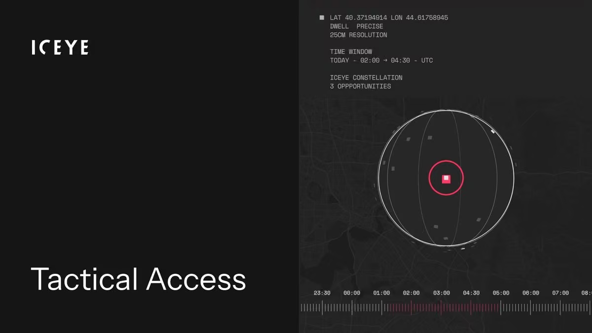
Dark vessels are a growing challenge for maritime defense. Read how Tactical Access, our on-demand SAR tasking service can help mitigate the threat, in all weather and light conditions, with data delivered quickly: www.iceye.com/blog/dark-vessels-in-northern-europe-and-ho…
-
ICEYE
@iceye_global
At @HelSecForum, our CEO @rmodrzewski will join @nokia's President and CEO @justinhotard for a conversation on what it will take to close the gap between Europe's ambitions and its industrial and technological capabilities.
Watch this live on Friday: www.lyyti.fi/reg/HSF_2026_Livestream?hss_channel=tw-28762… -
ICEYE
@iceye_global
At the @ndtv Defence Summit, our CEO @rmodrzewski joined Vishnu Som to discuss sovereign intelligence from space. Seven European governments have procured sovereign SAR systems from ICEYE. With ICEYE India now in New Delhi, we are bringing the same model to India.
-
ICEYE
@iceye_global
We continue expanding the world's largest SAR satellite constellation.
Our next launch is scheduled for Oct 1, 18:18 UTC, aboard @SpaceX 's Transporter-18.
Watch the livestream here: www.spacex.com/launches/transporter18?hss_channel=tw-2876…
Photo: SpaceX -
ICEYE
@iceye_global
ICEYE is monitoring the #noreaster along the U.S. East Coast this week, with coastal flooding and wind gusts over 50 mph forecasted from the Outer Banks through southern New England throughout the weekend.
For immediate flood data, contact us here: www.iceye.com/contact/solutions?hss_channel=tw-2876294235 -
ICEYE
@iceye_global
As a nor'easter strengthens off the US East Coast, ICEYE's FloodID tracks it in real time, pairing physics-based models with satellite data. Forecast below near Nantucket. Learn more about FloodID here: www.iceye.com/newsroom/press-releases/iceye-and-the-water… #noreaster2026
-
ICEYE
@iceye_global
How ICEYE is rebuilding the insurance data stack and moving from knowing what is happening to knowing what’s coming: www.iceye.com/blog/from-whats-happening-to-whats-coming?h…
-
ICEYE
@iceye_global
A must-read for U.S. #emergencyresponders before the next flood hits. @Forbes breaks down the technological hurdles for accurate flood forecasting, observational flood analysis, and moving from decision support to decision making. www.forbes.com/sites/monicasanders/2026/09/22/satellites-…
-
ICEYE
@iceye_global
Flight software runs nearly every satellite operation. Some capabilities aren't there at launch. They go live months later through software updates alone, like Multi-Spot imaging mode, which is illustrated in the animations. Learn more: www.iceye.com/blog/beyond-the-echo-how-smarter-satellites…
-
ICEYE
@iceye_global
Learn how ICEYE and the Jane Goodall Institute use SAR to track deforestation and illegal mining across chimpanzee habitats in the Congo Basin and East Africa. Download the two-pager here: www.iceye.com/solutions/government/jane-goodall-institute…
-
ICEYE
@iceye_global
What does an agile ISR collection look like in practice? Here’s a closer look at one of 268 Multi-Spot SAR images collected along the Finland–Russia border.
Unlock the agility of Multi-Spot SAR with Tactical Access: www.iceye.com/sar-data/tactical-access?hss_channel=tw-287…. -
ICEYE
@iceye_global
The Portuguese Air Force (@fap_pt) led six nations through a live test of space-domain coordination at Space EX26 in Beja. ICEYE's SAR was part of the scenarios, testing sovereign use alongside allied integration.
Read more: www.iceye.com/blog/space-ex26-how-six-nations-tested-spac… -
ICEYE
@iceye_global
That is a wrap on World Space Business Week in Paris. A week of conversations on where space-based intelligence goes next, and what it takes to get there.
At SDSS, CEO and co-founder @rmodrzewski talked about what sovereignty looks like in practice.
ICEYE
@iceye_global
At WSBW, our COO Eric Jensen spoke on a multidomain perspective of SAR: how the technology is being used across commercial, civil and security applications, and what comes next for it.
ICEYE
@iceye_global
We closed the week honored to receive the 2026 @Novaspace_ Rising Space Business Award.
Thank you to @nvs_summits for hosting and to our fellow panelists. And a special thank you to the customers and partners for joining our networking evening on Tuesday. -
ICEYE reposted
Novaspace
@Novaspace_
At WSBW today, ESA has awarded two parallel architecture study contracts for the future Earth Observation Governmental Service with ICEYE and Leonardo
#wsbw2026 #esa #earthobservation #spaceindustry #satellite -
ICEYE
@iceye_global
What exactly is latency? Ask ten people and you'll probably get ten different answers. Some define it as the time between image capture and availability. Others measure it from tasking to delivery.
For us, latency is time to decision. More at www.iceye.com/blog/beyond-the-echo-the-ability-to-act?hss… -
ICEYE
@iceye_global
European Space Agency @ESA has selected the ARISE consortium (Architecture for Resilient and Federated ISR in Sovereign Europe), led by ICEYE, to conduct an architecture design study for the EU Earth Observation Governmental Service (EOGS).
Read more: www.iceye.com/newsroom/press-releases/esa-selects-arise-c…
ICEYE
@iceye_global
In the photos from the signing ceremony earlier today: Simonetta Cheli, Director of EO Programmes at ESA, Jeffrey Apeldoorn, VP Missions - ESA/EU at ICEYE, and Christoph Kautz, Director for Space Policy, Satellite Navigation and Earth Observation (DEFIS), European Commission.
-
ICEYE reposted
Rafal Modrzewski
@rmodrzewski
W orędziu o stanie Unii @vonderleyen postawiła ICEYE za przykład europejskich firm. Firm które są kluczowe dla zapewnienia Europie niezależności technologicznej. Jestem dumny, że to także polska historia. Dziękuję zespołowi i wszystkim, którzy nam pomogli. Działamy!
-
ICEYE reposted
EU Science & Innovation 🇪🇺
@EUScienceInnov
From an Erasmus encounter to one of the world’s leading space-tech companies 🇪🇺🛰️
Backed by #horizoneu funding, @iceye_global shows that EU is the home of innovation and what science, talent and entrepreneurship can achieve together.
#soteuThis media couldn't be displayed. See it on the original post. -
ICEYE
@iceye_global
Today, President of the @EU_Commission Ursula @vonderleyen mentioned ICEYE in her State of the Union address.
ICEYE started with two engineering students, one Finnish and one Polish, who met on an Erasmus exchange. An EU Horizon grant helped fund our first SAR satellite.This media couldn't be displayed. See it on the original post.Post not available here, view on X
ICEYE
@iceye_global
From Erasmus to Horizon to a global constellation, our story shows that Europe can grow companies that scale and compete globally. We are proud to work with European institutions, and we want this path to be one that many more European tech companies can take.
ICEYE
@iceye_global
Thank you to our team, our customers and everyone who has supported us along the way.
-
ICEYE
@iceye_global
Your satellites should be more capable today than the day they launched. We just shipped two new 25 cm imaging modes to satellites already on orbit: Spot Precise 1-look and 2-looks.
No hardware changes. No new launch. Just software. -
ICEYE
@iceye_global
Stephen Lathrope on the shift happening in #natcat right now: cat models still matter, but when an event hits, insurers no longer have to wait on a model's estimate. They can watch it unfold in real time.
Hear him explain it: www.theinsurer.com/tv/reinsurancemonth/iceyes-stephen-lat… -
ICEYE
@iceye_global
ICEYE's #earthquake Rapid Impact delivers damage classification within 24 hours of a seismic event. Japan and California already run this as an operational service, learn how your agency can start a pilot: www.iceye.com/solutions/government/earthquake-rapid-impac…
-
ICEYE
@iceye_global
ICEYE’s engineering organization is growing, and so is the scale of what we're building.
Three senior engineering leaders have joined ICEYE's global team, each stepping in to lead teams tackling some of the most interesting engineering challenges today.
Welcome to the team!
ICEYE
@iceye_global
This kind of growth doesn't happen without great minds wanting to solve hard problems, together. We're hiring globally, across all our offices.
Come build with us → www.iceye.com/joinus. -
ICEYE
@iceye_global
In the Northern Europe, weather makes optical satellite surveillance unreliable for persistent maritime awareness. SAR, on the other hand, is unaffected by polar night or cloud cover. Read how it's used to detect dark vessels: www.iceye.com/blog/dark-vessels-in-northern-europe-and-ho…
-
ICEYE
@iceye_global
Our new algorithm builds optimized schedules by following priority rules, not maximizing volume, even if that means fewer images overall.
Read how Timo Lehto, Ekin Nurbas, and Marcus Marcy tackled this in our latest blog: www.iceye.com/blog/beyond-the-echo-reducing-latency-with-… -
ICEYE
@iceye_global
340+ km/h on the track. 27,000+ km/h in orbit.
Formula 1 returns to Madrid this week. MADRING, the new circuit built around IFEMA, hosts its debut Spanish Grand Prix Sep 11-13.
This is the circuit as seen from space, captured with an ICEYE SAR satellite earlier this week. -
ICEYE
@iceye_global
ICEYE signed a Memorandum of Understanding (MoU) with @Arianespace, to explore the use of Arianespace’s launch services for future missions carrying ICEYE satellites aboard Ariane 6.
Read more in our press release: www.iceye.com/newsroom/press-releases/iceye-and-arianespa… -
ICEYE
@iceye_global
Persistent ISR doesn't stop at one domain.
Our COO, Eric Jensen, talks multidomain SAR at World Space Business Week (@nvs_summits), Sept 17, 11:40-12:35, Hôtel du Collectionneur.
Stay for ICEYE's coffee break at 15:00, same venue, for more on sovereign ISR. -
ICEYE
@iceye_global
The ICEYE Flood Rapid Impact video below shows the extent of flooding across #hawaii from #hurricanelowell, giving a clear, near real-time view of impacted communities even as cloud cover limited other sources. Get near-real time damage data here: www.iceye.com/contact/solutions?hss_channel=tw-2876294235
-
ICEYE
@iceye_global
ICEYE CEO @rmodrzewski is speaking at the Space Defense & Security Summit in Paris next week. Join the conversation on sovereign intelligence from space.
@nvs_summits -
ICEYE
@iceye_global
ICEYE Multi-Spot SAR in action: 3 passes over the DMZ (15 images each) captured everything from a joint security area to a border trench, turning coverage into actionable awareness.
Use Tactical Access for time-sensitive tasking: www.iceye.com/sar-data/tactical-access?hss_channel=tw-287… -
ICEYE
@iceye_global
Hurricane Andrew formed in a season everyone had written off. Our in-house meteorologist weights in on why "lower risk" never means "no risk" during El Niño: www.iceye.com/blog/why-lower-risk-doesnt-mean-no-risk-dur…
-
ICEYE
@iceye_global
Defense missions cannot wait years for satellite capacity. Tactical Access is ready the moment you sign. Get immediate access to ICEYE's commercial fleet. Start right away with cloud. Instant, guaranteed access means faster decision-making. www.iceye.com/sar-data/tactical-access?hss_channel=tw-287…
-
ICEYE
@iceye_global
Task SAR, receive imagery, classify targets at a forward position.
Full loop in minutes.
Proven by tactical operators at military exercises like NATO Cold Response and ORION 2026.
Also operates as a redundant ground segment node.
www.iceye.com/missions-isr?hss_channel=tw-2876294235 -
ICEYE
@iceye_global
Our new planning algorithm addresses a key prioritization challenge; high-priority tasks are not always time-critical – and vice versa.
Learn how the new algorithm works: www.iceye.com/blog/beyond-the-echo-reducing-latency-with-… -
ICEYE
@iceye_global
What if you could anticipate flooding and other natural hazards before they occurred? Learn how ICEYE is partnering with The Water Institute to bring a new, comprehensive #flood forecasting and decision support system to #emergencymanagers. www.iceye.com/newsroom/press-releases/iceye-and-the-water…
-
ICEYE
@iceye_global
ICEYE announces the establishment of ICEYE Korea, the appointment of Eric Rhee as Head of ICEYE Korea, and a signed MoU with @SeoulNatlUni (SNU).
Read more: www.iceye.com/newsroom/press-releases/iceye-strengthens-k… -
ICEYE
@iceye_global
Tactical Access has a 4-step workflow. Reserve your pass up to 14 days in advance, get confirmed through daily arbitration, refine the parameters & receive imagery via cloud/your infrastructure. Certainty locked in early, flexibility preserved until late. www.iceye.com/blog/is-tactical-access-right-for-your-orga…
-
ICEYE
@iceye_global
ICEYE announces the establishment of ICEYE Netherlands, based out of Amsterdam, and the appointment of Joost Elstak as CEO of ICEYE Netherlands.
Read more: www.iceye.com/newsroom/press-releases/iceye-establishes-n… -
ICEYE
@iceye_global
Deploy space-based ISR where it matters most with a mission-ready mobile container built for rapid action, resilience, and results.
Read more at www.iceye.com/missions-isr.?hss_channel=tw-2876294235 -
ICEYE
@iceye_global
ICEYE announces the establishment of ICEYE India, extending its presence into one of the world's most significant defense and space markets.
Read more: www.iceye.com/newsroom/press-releases/iceye-establishes-i… -
ICEYE
@iceye_global
Dark vessels, ships that conceal their location data, are a challenge for maritime defense. Unlike conventional tracking, SAR satellites don't rely on whether a ship decides to share its whereabouts. Read more in our blog: www.iceye.com/blog/draft-dark-vessels-in-northern-europe-…
-
ICEYE
@iceye_global
Our new planning algorithm dynamically shuffles scheduled tasks on the fly, ensuring time-critical images are captured without sacrificing high-priority requests. Learn more:www.iceye.com/blog/beyond-the-echo-draft-reducing-latency…
-
ICEYE
@iceye_global
Former Cal OES Director Mark Ghilarducci led #california through some of its largest #wildfires. His new op-ed dives into why a successful recovery depends on trustworthy, shared data, including tools like SAR. www.linkedin.com/posts/mark-s-ghilarducci-558b204_wildfir…
-
ICEYE
@iceye_global
On a recent ICEYE & @juvarecorp webinar, Florida's emergency management leaders shared how satellite-derived flood data changed their hurricane response. View the webinar on demand here: www.juvare.com/thought-leadership/resource/webinar/webina…
-
ICEYE
@iceye_global
Three satellite passes with each pass capturing 15 images along the DMZ area between North Korea and South Korea demonstrate ICEYE's unique Multi-Spot capability. Learn more at www.iceye.com/sar-data/tactical-access?hss_channel=tw-287…
-
ICEYE
@iceye_global
Tactical ISR moves at the speed of decisions. ICEYE ATR processes a Dwell Fine image in seconds: bombers, transport aircraft, helicopters, air defense. Classified output, not raw data.
www.iceye.com/missions-isr?hss_channel=tw-2876294235 -
ICEYE
@iceye_global
ICEYE's Product Team details the latest capabilities added to the #deforestation Solution, and what they mean for enforcement teams operating on a near-real-time response window. www.iceye.com/blog/deforestation-solution-9-essential-que…
-
ICEYE
@iceye_global
Tactical Access gives defense organizations reserved SAR satellite access at short notice, moving them from routine monitoring to near-real-time intelligence. Read our new blog post on how it works: www.iceye.com/blog/is-tactical-access-right-for-your-orga…
-
ICEYE
@iceye_global
The Scaleup Europe Fund, established by @EU_Commission with European investors and managed by @eqt, made its first investment today, co-leading ICEYE's €1B Series F.
From Horizon 2020 to today: European support has been foundational for our growth.
www.iceye.com/newsroom/press-releases/iceye-secures-the-f… -
ICEYE
@iceye_global
Allied nations are building sovereign constellations on the same software.
That shared layer is federation.
Read about the system that enables cross-tasking and shared capacity: www.iceye.com/missions-isr-system?hss_channel=tw-2876294235 -
ICEYE
@iceye_global
ICEYE has appointed Christos Kolimenakis as CEO of ICEYE UAE.
This reflects our long-term commitment to the UAE and reinforces the growing strategic partnership between the EU and the UAE in space, defence and advanced technologies.
Read more: www.iceye.com/newsroom/press-releases/iceye-strengthens-u… -
ICEYE
@iceye_global
In the tactical world, timing is everything.
ICEYE is pushing SAR imagery toward a 15-minute latency baseline.
Discover how we're making "time to decision" the metric that matters most: www.iceye.com/blog/beyond-the-echo-the-ability-to-act?hss… -
ICEYE
@iceye_global
At #esriuc, ICEYE was recognized for its work with the Jane Goodall Institute, its collaboration with the government of Jamaica during #hurricanemelissa, and its support of Venezuela's #earthquake response. Read the full event recap here: www.iceye.com/blog/iceyes-highlights-from-the-2026-esri-u…
-
ICEYE
@iceye_global
Under 13 minutes from satellite image to analyst's desk.
The speed ICEYE's ISR Cell delivered inside the Royal Netherlands Army's Fighter Lion, the largest Dutch military exercise in 20 years.Post not available here, view on X
ICEYE
@iceye_global
Fighter Lion also became SAR signature training.
Ground units saw how their vehicles and positions look from space.
Camouflage netting, darkness, terrain: SAR sees through most of it.
Troops learned how to operate when the adversary has space assets.
ICEYE
@iceye_global
The ISR Cell brings satellite collection to analyst-ready product in minutes.
Fighter Lion is step one in a long collaboration.
Read more: www.iceye.com/blog/operation-fighter-lion-demonstrating-t…. -
ICEYE
@iceye_global
ICEYE covers strategic monitoring and tactical tasking from one sovereign system. One procurement. Full command chain.
www.iceye.com/missions-isr-system?hss_channel=tw-2876294235 -
ICEYE
@iceye_global
ICEYE and KT SAT are partnering to bring advanced flood monitoring to Korean government agencies and businesses, the first deployment of ICEYE Solutions in the country. Read the announcement here: www.iceye.com/newsroom/press-releases/iceye-and-kt-sat-pa…
-
ICEYE
@iceye_global
In defense, shortening the decision loop is an instant advantage on the field.
Tactical Access offers an on-demand access to ICEYE’s SAR constellation, moving you from routine surveillance to near real-time intelligence.
Download our new Info Pack: www.iceye.com/tactical-access-info-pack?hss_channel=tw-28… -
ICEYE
@iceye_global
The constellation improves through software updates.
Every ICEYE satellite runs on IceOS. Every software release reaches every mission customer: faster processing, new imaging modes, better downlink.
This is an end-to-end system, not a satellite purchase. -
ICEYE
@iceye_global
Image acquired at 22:24 local time.
Multiple damaged oil tanks are visible at an oil depot.
Around-the-clock intelligence with SAR. -
ICEYE
@iceye_global
❤️ One single ascending pass over Australia: 33 SAR images in total, including 20 that trace a heart over the southeast coast.
A small glimpse of how agile tasking and smart planning unlock thousands of images per day.
More at www.iceye.com/blog/rapid-fire-imaging-on-repeat?hss_chann… -
ICEYE
@iceye_global
A "below normal" hurricane forecast doesn’t mean low risk. In our latest Atlantic hurricane season outlook, our resident Meteorologist answers critical questions worth knowing before #hurricane season peaks: www.youtube.com/watch?v=y6dn9nxdvGo&hss_channel=tw-287629…
-
ICEYE
@iceye_global
In crisis planning & response, there may not be time to wait for satellite capacity to be operational. Tactical Access gives access to ICEYE's SAR constellation from day one. Start with secure cloud delivery and add on-premise hardware as your needs grow. www.iceye.com/sar-data/tactical-access?hss_channel=tw-287…
-
ICEYE
@iceye_global
At this past Saturday's Esri UC Safety and Security conference, an ICEYE customer shared a powerful testimonial about the impact of satellite data in emergency response. Learn more about our collaboration here: www.iceye.com/solutions/government/hurricane-melissa-case… #esriuc2026
-
ICEYE
@iceye_global
Latency in space-based ISR = time to decision.
ICEYE VP of Product breaks down how we're making 15-minute latency a repeatable standard from tasking to analysis.
Read here: www.iceye.com/blog/beyond-the-echo-the-ability-to-act?hss… -
ICEYE
@iceye_global
Florida agencies are already using near real-time satellite flood intelligence to make faster, smarter decisions. Is your agency ready to do the same? Register for the live webinar: www.juvare.com/thought-leadership/events/webinar-how-flor…
-
ICEYE
@iceye_global
In defense & intelligence, waiting in a tasking queue may not be an option.
Tactical Access gives reserved, on-demand access to SAR. Lock in satellite passes days ahead, finalize targets as late as 40 min before collection, receive data in under an hour.
www.iceye.com/sar-data/tactical-access?hss_channel=tw-287… -
ICEYE
@iceye_global
ICEYE is anchoring its long-term commitment to Portugal's sovereign space capability by establishing ICEYE Portugal, opening a center of excellence in Lisbon and naming Rui Costa as CEO.
Read more: www.iceye.com/newsroom/press-releases/iceye-establishes-i… -
ICEYE
@iceye_global
Today we announced the establishment of ICEYE’s German entity, based out of Berlin and Munich, and the appointment of Philipp Herkelmann as CEO of ICEYE Germany.
ICEYE is natively European. Germany is the natural next chapter.
Read more: www.iceye.com/newsroom/press-releases/iceye-establishes-g… -
ICEYE
@iceye_global
Launch success! Four new ICEYE SAR satellites are in orbit, strengthening our global fleet and delivering sovereign capabilities for ICEYE US and the Finnish Defence Forces.
76 satellites deployed. The pace isn't slowing.
Read more: www.iceye.com/newsroom/press-releases/iceye-launches-four…
Video: @SpaceX -
ICEYE
@iceye_global
Separation confirmed!
All four ICEYE satellites have successfully separated from the Falcon 9 rocket and early orbit operations are now underway.
Video: @SpaceX -
ICEYE reposted
SpaceX
@SpaceX
Our 17th Transporter rideshare mission is targeted to launch tomorrow from California and will deliver 81 payloads to orbit → spacex.com/launches/transporter17
-
ICEYE reposted
SpaceX
@SpaceX
Less than one hour until Falcon 9’s launch of the Transporter-17 mission. Liftoff is targeted for 12:12 a.m. PT. The live webcast will begin about 15 minutes ahead of launch → x.com/i/broadcasts/1YxNrryLloQxw
-
ICEYE
@iceye_global
We continue to expand the world's largest SAR satellite constellation and deliver dedicated satellites for sovereign missions.
The next launch is scheduled for July 7 at 07:10 UTC aboard @SpaceX's Transporter-17 mission, integrated via @Exolaunch.
Image: SpaceX -
ICEYE
@iceye_global
Buy ISR from multiple vendors and you inherit the gaps between them. Latency lives there. So does risk. ICEYE builds the full loop. Operator tasks. Satellite images. ATR classifies in seconds. ISR Cell delivers actionable intelligence. See the full chain: www.iceye.com/missions-isr-system?hss_channel=tw-2876294235
-
ICEYE
@iceye_global
ICEYE wildfire intelligence is now live in #canada. Near real-time monitoring and building-level damage assessment, powered by SAR satellites that see through smoke, cloud cover, and darkness. #canadafirefighters www.iceye.com/newsroom/press-releases/iceye-extends-wildf…
-
ICEYE
@iceye_global
Our constellation gives us an unparalleled volume of SAR imagery to train real-world AI, like Automatic Target Recognition.
Latency = time to decision. We're making 15-min delivery the standard. www.iceye.com/blog/beyond-the-echo-the-ability-to-act?hss… -
ICEYE
@iceye_global
Europe's EO capability from space is in service today.
Seven nations of operational evidence point to four design principles for the architecture that comes next.
www.iceye.com/hubfs/Europes-EO-Architecture-Design-Princi… -
ICEYE
@iceye_global
The Congo Basin's rainforests are disappearing. The rainforests of the Democratic Republic of Congo (DRC) face mounting threats, from habitat destruction to illegal hunting. Learn how ICEYE and the Jane Goodall Institute are addressing these challenges: www.iceye.com/blog/government/solutions/how-the-jane-good…
-
ICEYE
@iceye_global
We've set a bold goal: make 15‑minute latency a standard, not a one‑off win.
In our latest blog, Sami Niemela and Timo Lehto unpack the system-wide changes behind it – from onboard processing and ATR to real operations like ORION 2026 www.iceye.com/blog/beyond-the-echo-the-ability-to-act?hss… -
ICEYE
@iceye_global
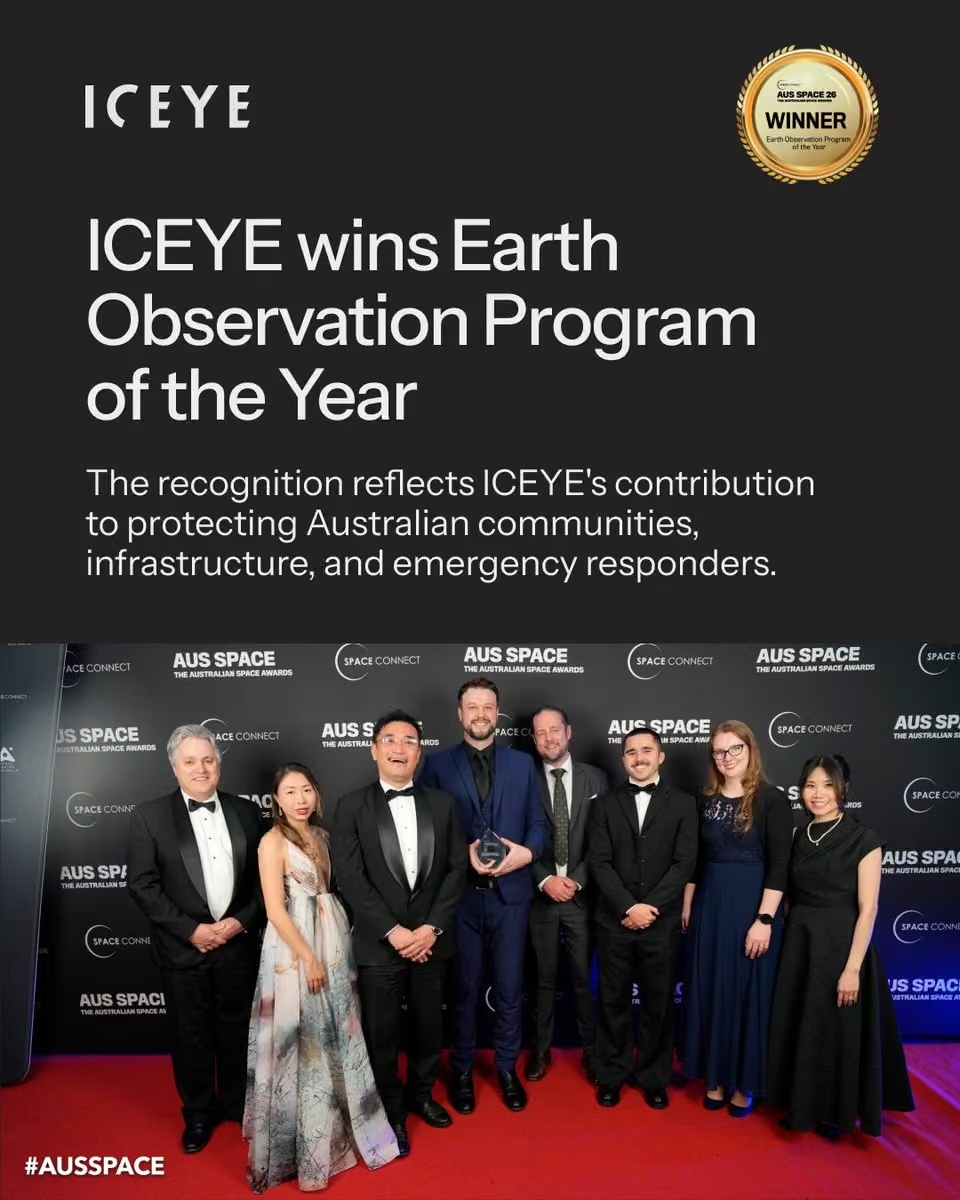
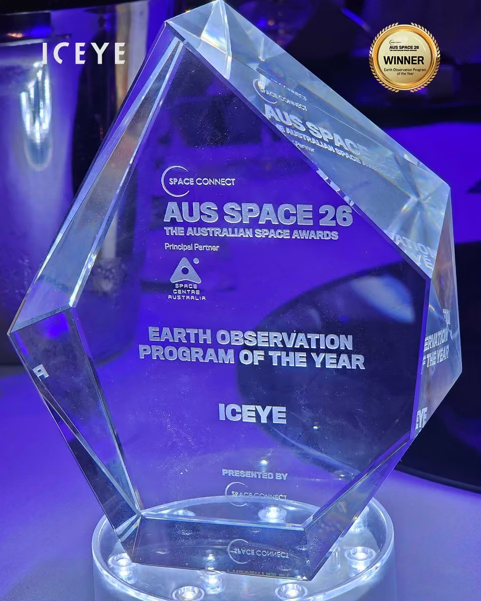
We are proud to share that ICEYE has won Earth Observation Program of the Year at the 2026 Australian Space Awards. Read the full press release here: www.iceye.com/newsroom/press-releases/iceye-wins-earth-ob… #earthobservation #floodresilience #australianspaceawards
-
ICEYE
@iceye_global
Seeing a flood is one thing. Knowing which of your assets are hit, and how hard, is another.
ICEYE and MunichRe: how SAR satellite data solves the last mile problem in flood risk intelligence.
Read more: www.munichre.services/en/the-re-brief/risk-management/int…
#floodrisk #sar #natcat -
ICEYE
@iceye_global
How well do modern decoys hold up against satellite radar? The Danish Armed Forces spent a day in June 2026 finding out.
A decoy that fools the eye does not fool SAR. ICEYE worked with @forsvaretdk to test exactly that.
Read the full story: www.iceye.com/blog/what-danish-military-training-revealed… -
ICEYE
@iceye_global
Designing a European EO architecture is less about the architecture than about connecting what already works.
Seven nations operate sovereign ISR systems today, with active federation work and classified operations across multiple legal frameworks. More: www.iceye.com/hubfs/Europes-EO-Architecture-Design-Princi… -
ICEYE
@iceye_global
Latency in space-based ISR = time to decision.
ICEYE VP of Product breaks down how we're making 15-minute latency a repeatable standard from tasking to analysis.
Read more: www.iceye.com/blog/beyond-the-echo-the-ability-to-act?hss… -
ICEYE
@iceye_global
Norway, through The Norwegian Water Resources and Energy Directorate, now has access to persistent, weather-independent flood monitoring nationwide. ICEYE’s data will enable improved flood hazard mapping, smarter forecasting, and faster emergency response: www.iceye.com/newsroom/press-releases/norwegian-water-and…
-
ICEYE
@iceye_global
Portugal is expanding its sovereign intelligence from space.
CTI Aeroespacial has contracted two additional ICEYE SAR satellites for the Portuguese Air Force @fap_pt, bringing their total to four.
Read more: www.iceye.com/newsroom/press-releases/portugal-acquires-t… -
ICEYE
@iceye_global
Tactical ISR moves at the speed of decisions. ICEYE ATR processes a Dwell Fine image in seconds: bombers, transport aircraft, helicopters, air defense. Classified output, not raw data.
www.iceye.com/missions-isr?hss_channel=tw-2876294235 -
ICEYE
@iceye_global
Designing a European EO architecture means designing for security from day one.
Security determines how a dual-use EO system is partitioned: what shares infrastructure, what requires physical separation, where data crosses classification boundaries.
www.iceye.com/hubfs/Europes-EO-Architecture-Design-Princi… -
ICEYE
@iceye_global
Liberty and ICEYE have launched the first building-level parametric #wildfire insurance solution, enabling rapid payouts.
Built on ICEYE's SAR satellite constellation, it delivers objective damage classification within hours. Read more: www.iceye.com/newsroom/press-releases/liberty-and-iceye-p… -
ICEYE
@iceye_global
Hedge funds and banks are racing to hire catastrophe risk experts as natural disaster modeling becomes critical for asset values, per @Bloomberg. See where ICEYE fits in: www.bloomberg.com/news/articles/2026-06-07/hedge-funds-ar…
-
ICEYE
@iceye_global
When #hawai'i experienced record multi-island flooding, cloud cover grounded aerial monitoring. ICEYE delivered flood data within 24 hours, which #honolulu's GIS Administrator called it crucial to damage assessment. Read the full story here: governmenttechnologyinsider.com/from-blind-spots-to-real-…
-
ICEYE
@iceye_global
Leading a new era of sovereign intelligence from space.
ICEYE Series F funding round exceeds €1B, led by @generalatlantic, at a valuation of over €10B.
Read more: www.iceye.com/newsroom/press-releases/iceye-leads-a-new-e… -
ICEYE
@iceye_global
16 stadiums across USA, Mexico, and Canada.
3 days to go.
Every host venue of FIFA World Cup 2026™, seen from orbit. Imaged by the world's largest SAR satellite constellation.
Enjoy the tournament ⚽
[1/4 #fifaworldcup]Post not available here, view on X
ICEYE
@iceye_global
[3/4 #fifaworldcup]
ICEYE
@iceye_global
[4/4 #fifaworldcup]
-
ICEYE
@iceye_global
Florida Flood Hub and ICEYE are expanding flood intelligence capabilities with near real-time data, helping emergency managers improve preparedness, response, recovery, and resilience before and after major storms. @USFCMS www.iceye.com/newsroom/press-releases/iceye-launches-part…
-
ICEYE
@iceye_global
In the tactical world, timing is everything.
ICEYE is pushing SAR imagery toward a 15-minute latency baseline.
Discover how we're making "time to decision" the metric that matters most: www.iceye.com/blog/beyond-the-echo-the-ability-to-act?hss… -
ICEYE
@iceye_global
The @Inigo_Insurance exposure management team visited our HQ in Finland this week. SAR satellites, near real-time data, and how it all applies to specialty re/insurance. Two years in — excited to keep pushing what's possible, together!
-
ICEYE
@iceye_global
ICEYE has appointed Eric Jensen as global Chief Operating Officer.
Eric will oversee operations across ICEYE's 1,000-plus international team, fortifying the company’s foundations as it expands its sovereign intelligence offerings worldwide.
Full release: www.iceye.com/newsroom/press-releases/iceye-appoints-eric… -
ICEYE
@iceye_global
"The ISR Cell puts strategic-grade space intelligence in every commander's hands, at any echelon, in minutes." Pekka Laurila, ICEYE CSO and Co-founder, on connecting space to the tactical edge.
Find our more: www.iceye.com/missions-isr?hss_channel=tw-2876294235 -
ICEYE
@iceye_global
ICEYE has secured a €28.3 million continuation grant from @BusinessFinland. Continued investment in R&D enables ICEYE to advance its next-generation SAR and AI-enabled capabilities, advancing sovereign intelligence from space.
Read more: www.iceye.com/newsroom/press-releases/business-finland-ap… -
ICEYE
@iceye_global
ICEYE and @GISPartner are bringing near real-time satellite intelligence to infrastructure operators across #poland, enabling faster decisions on flood monitoring, risk, and water management regardless of weather conditions or time of day.
Read more: www.iceye.com/newsroom/press-releases/gispartner-and-icey… -
ICEYE
@iceye_global
Two modes over the Malacca Strait. One intelligence picture.
Scan: 100×100 km scene, full traffic density across one of the world's busiest lanes.
Spot Fine: 5 km x 5 km scene, with resolution for individual vessel classification. -
ICEYE
@iceye_global
Poland: contract signed May 2025, sovereign system handed over May 2026. 12 months, end-to-end.
This is what incremental architecture makes possible: field the first capability fast, validate it under operational conditions, then scale.
More: www.iceye.com/hubfs/Europes-EO-Architecture-Design-Princi… -
ICEYE
@iceye_global
Task SAR, receive imagery, classify targets at a forward position.
Full loop in minutes.
Proven by tactical operators at military exercises like NATO Cold Response and ORION 2026.
Also operates as a redundant ground segment node.
www.iceye.com/missions-isr?hss_channel=tw-2876294235 -
ICEYE
@iceye_global
Image acquired at 22:24 local time.
Multiple damaged oil tanks are visible at an oil depot.
Around-the-clock intelligence with SAR. -
ICEYE
@iceye_global
In the first 72 hours after a natural disaster, #utilities need damage assessment data as the disaster occurs. Roads may be inaccessible. Aircraft may be grounded. Field reports are incomplete. Learn how ICEYE provides the data within hours, not days: event.on24.com/wcc/r/5355757/1E533B75F0665EF8EB1C8FFF9879…
-
ICEYE
@iceye_global
ICEYE has secured a €300M revolving credit facility (RCF) to support rapid global growth. Backed by seven banking partners, the RCF reflects continued confidence in ICEYE’s business and access to diverse capital.
Read the full press release here: www.iceye.com/newsroom/press-releases/iceye-secures-300-m… -
ICEYE
@iceye_global
Modern conflicts changed what commanders need from space: persistent, all-weather intelligence on their own decision cycle.
That takes a system, not just satellites.
Constellation to tactical edge, on-site processing, ATR. Tested at ORION 2026:
www.iceye.com/blog/how-space-based-isr-supports-dispersed… -
ICEYE
@iceye_global
We were honored to have the Ambassador of Norway to Finland, H.E. Wegger Chr. Strømmen, visit ICEYE's HQ. We exchanged views on the security of the Arctic and NATO's Northern Flank, the rapid innovation in space technologies, and the growing opportunities for Nordic cooperation.
-
ICEYE
@iceye_global
Climate risk = credit risk.
ICEYE now offers Natural Catastrophe Monitoring Solutions for the global banking sector.
Observed, near real-time data at the asset level. 24/7.
Read more: www.iceye.com/newsroom/press-releases/iceye-launches-natu… -
ICEYE
@iceye_global
Finland, Sweden, Poland, and the Netherlands are building sovereign ISR systems designed to interoperate across national boundaries.
The architecture preserves national command of tasking and data while making fleet-level capacity visible across partners. -
ICEYE
@iceye_global
ICEYE has officially handed over POLSARIS to @MON_GOV_PL — one of the fastest deployments of an operational satellite program in the world. 4 SAR satellites built and launched, operators trained, constellation running independently. All in under 12 months
www.iceye.com/newsroom/press-releases/iceye-delivers-mikr… -
ICEYE
@iceye_global
When floods hit #australia, emergency responders need actionable decision-ready data at their fingertips. By combining Flood Insights with ArcGIS Online, responders can access near real-time information for coordination teams and field crews. Learn more: www.iceye.com/blog/how-to-unlock-resilience-for-emergency…
-
ICEYE
@iceye_global
Our CEO @rmodrzewski on sovereign SAR intelligence, constellations, and why we see India as a long-term partner.
Full interview: www.youtube.com/watch?v=vHhw_exojDo&hss_channel=tw-287629… -
ICEYE
@iceye_global
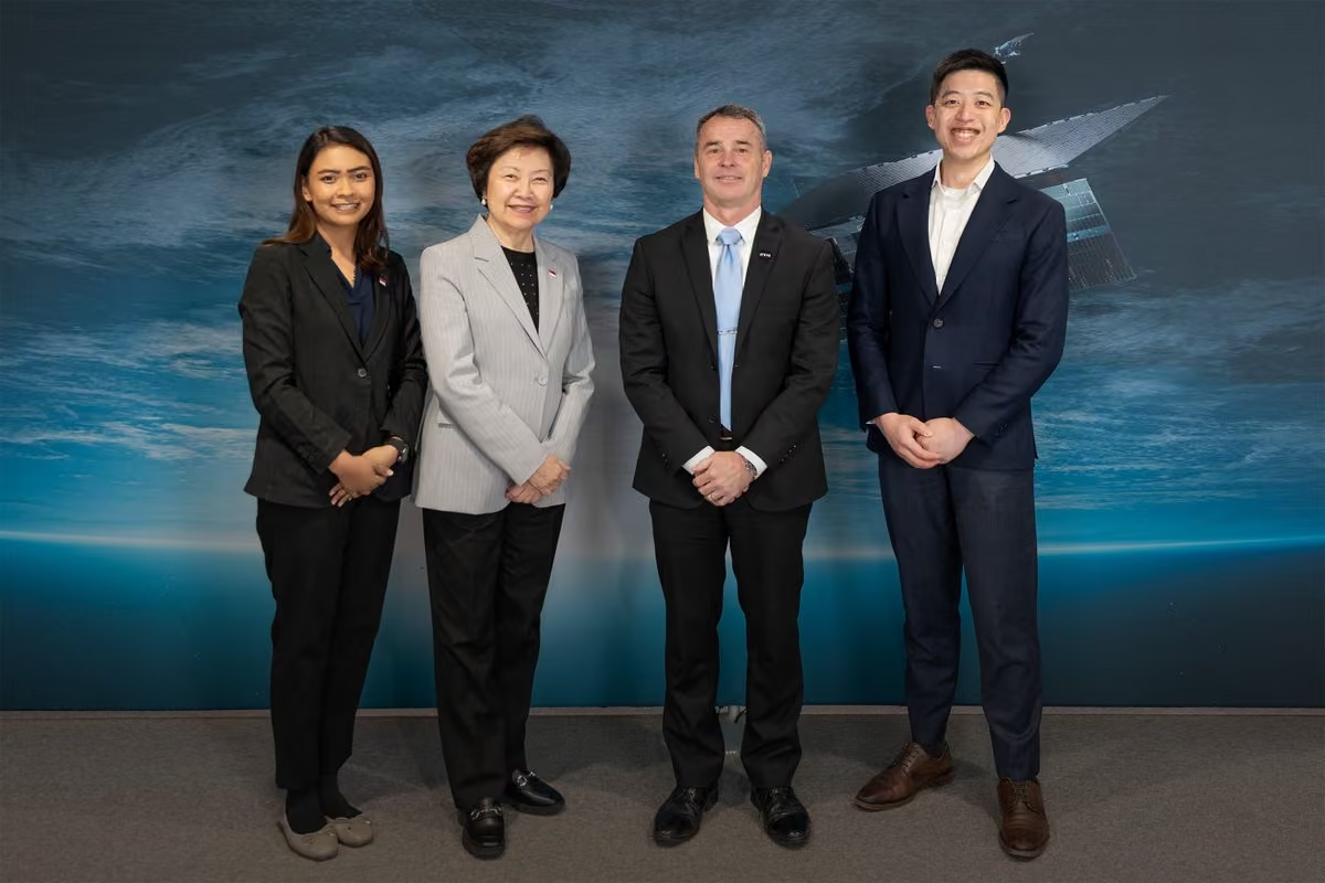
Honored to welcome Ambassador CHEONG Koon Hean, Andy Lua from the Singapore Economic Development Board, and Abigail Fernandez from the Ministry of Foreign Affairs to ICEYE HQ in Espoo — to discuss the expanding role of space-based capabilities in national security and resilience.
-
ICEYE
@iceye_global
The stage is set.
Vienna's Stadthalle — home of Eurovision 2026 — as seen from space by our SAR satellites. Happy Eurovision week! -
ICEYE
@iceye_global
The ICEYE team is heading to Singapore for #gstce this week.
Visit us at Booth B22 to see how ICEYE SAR enables faster, more informed decision-making for defense and intelligence operations.
Also, don’t miss John Cartwright’s keynote on Wed, 13 May at 12:10 PM SGT. -
ICEYE
@iceye_global
Space-based ISR has historically lived at the strategic level. That distance between satellite and tactical operator is exactly the problem ICEYE's end-to-end system was built to close.
Here is how the full cycle works. Tasking to decision in under 30min.
www.iceye.com/missions-isr-system?hss_channel=tw-2876294235 -
ICEYE
@iceye_global
What if you could track flood impacts in near real time, even through clouds and severe weather?
Join Munich Re and ICEYE on May 12 to see how SAR-powered flood intelligence is helping organizations make faster, smarter risk and response decisions: biz.rmp.munichre.com/en-US/Events/?readableEventId=Flood_… -
ICEYE
@iceye_global
ERS will shape European EO capability for decades.
How much can be informed by systems already in service?
Four design principles from sovereign ISR running across seven European nations today.
Read the paper here: www.iceye.com/hubfs/Europes-EO-Architecture-Design-Princi… -
ICEYE
@iceye_global
ICEYE embedded an ISR Cell with a French Army infantry brigade during Phase 4.2 of France's largest multi-domain exercise ORION 2026.
Near-real-time SAR imagery, fed straight into brigade-level targeting. Persistent, all-weather coverage.
Read more: www.iceye.com/blog/how-space-based-isr-supports-dispersed… -
ICEYE
@iceye_global
Extreme weather is straining grid response. Flooding and wildfire limit visibility when it matters most. All-weather monitoring like SAR can reveal substation risk and guide faster, safer restoration. Read more in @tdworldmag by Mike Bennett.
www.tdworld.com/disaster-response/article/55368424/seeing… -
ICEYE
@iceye_global
Cutting through the darkness on a January night. The image reveals an air defense site with multiple identifiable S-300/S-400 TELs in both raised and lowered positions, alongside a 30N6E engagement radar and a 76N6 acquisition radar.
This is persistent, all-weather monitoring. -
ICEYE
@iceye_global
Honored to welcome H.E. Ambassador Frederico Nascimento and Deputy Head of Mission Rúben Guedes Dias of Portugal to ICEYE HQ, just days before the successful launch of the first SAR satellite fully acquired by the Portuguese Air Force, strengthening the Atlantic Constellation.
ICEYE
@iceye_global
Whether tracking environmental change, responding to natural disasters, or supporting defense operations, space-based infrastructure is becoming central to how nations protect their interests and work together.
-
ICEYE reposted
ESA Earth Online
@ESA_EarthOnline
🌏ICEYE gives us a stunning view of the eastern Singapore Strait
The two landmasses at the bottom are the islands of Bintan and Batam (part of Indonesia’s Riau Islands), while at the top is the Malaysian peninsula with the village of Pengerang.🌏
🔎 Three data modes available:
✅ Spot: 5 x 5 km², 1 m resolution
✅ Strip: 30 x 50 km², 3 m resolution
✅ Scan: 100 x 100 km², 15 m resolution
🔎Two different processing levels:
✅Single Look Complex (SLC)
✅Ground Range Detected -GRD
📅 Coverage: 2018-12-03 – present
🌐Open to users Worldwide
📡 🌐 Learn more: earth.esa.int/eogateway/missions/iceye
📷 @iceye_global -
ICEYE
@iceye_global
Launch success! Communication established with 2 newly launched ICEYE satellites expanding sovereign missions for Poland and Portugal.
This marks our third launch of 2026, as we continue scaling the deployment of sovereign space capabilities at unprecedented speed and scale.
ICEYE
@iceye_global
Video: @SpaceX
-
ICEYE
@iceye_global
Separation confirmed.
Two ICEYE SAR satellites have successfully separated from the Falcon 9 rocket. The satellites will now begin early orbit operations.
Image: @SpaceX -
ICEYE
@iceye_global
Launch update: ICEYE is preparing for liftoff.
We’re set to launch new satellites on @SpaceX's CAS500-2 mission, integrated via @Exolaunch. The satellites will further advance sovereign intelligence capabilities for our customers.
🚀 3 May 2026, 6:59 UTC
Image: SpaceX -
ICEYE
@iceye_global
The ISR Cell brings space-based intelligence to the tactical edge.
A deployable unit that tasks satellites, processes #sar data on site, and delivers exploited intelligence to commanders in minutes.
Full #isr loop, one workspace, any echelon. -
ICEYE
@iceye_global
Seeing through shelters.
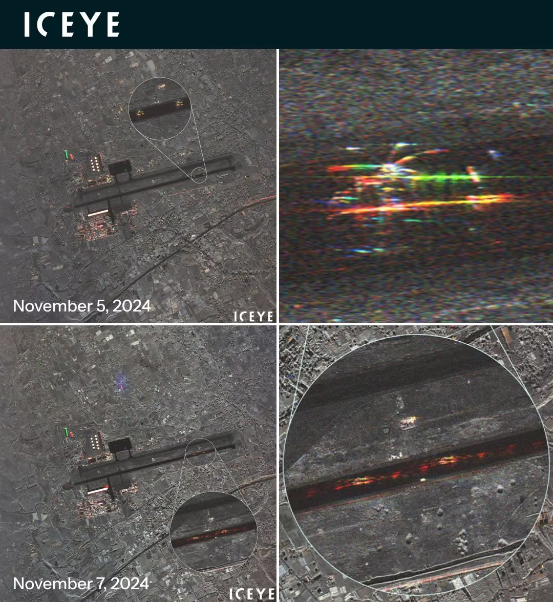
Multiple fighter aircraft in shelters are captured in two Dwell Fine mode images collected on December 29, 2025, and January 2, 2026 over Foshan Shadi Airport.
Learn more about Dwell mode imagery at www.iceye.com/sar-data/imaging-modes/dwell?hss_channel=tw… -
ICEYE
@iceye_global
ICEYE hosted 31 members of the @natopa from 14 Allied nations at our HQ in Finland.
We are proud to work closely with NATO, including through the NATO APSS program and NATO SITCEN, as well as by providing satellites and data to many Alliance members.
Stronger together. -
ICEYE
@iceye_global
ICEYE was recently featured in @CNN on the wildfire in #chile. Thousands of homes were lost in hours, overwhelming local response. ICEYE provided near real-time insights, enabling situational awareness even through smoke & darkness. edition.cnn.com/2026/04/26/climate/chile-wildfire-new-fir…
-
ICEYE
@iceye_global
ICEYE mapped the full 1,343 km Finland-Russia border: 17 passes, 268 SAR images. This animation shows Multi-Spot imaging in action—from broad border coverage to a railway station where a train, material pile, and road are visible in one acquisition.
-
ICEYE
@iceye_global
Protecting forests begins with clearly seeing what’s changing on the ground. ICEYE has partnered with @JaneGoodallInst to deploy its SAR-based #deforestation Solution across the Congo Basin, delivering intelligence that cuts through cloud cover and canopy: www.iceye.com/newsroom/press-releases/iceye-and-the-jane-…
-
ICEYE
@iceye_global
Nations can't afford to wait half a decade for space-based ISR.
ICEYE delivers sovereign #sar constellations as fully integrated systems—operational in months. Proven in real operations, trusted by multiple European armed forces.
Your timeline is your vulnerability. Shorten it. -
ICEYE
@iceye_global
23:27 UTC. January. Total darkness.
Three Delta-IV class SSBNs and an Akula-class SSN identified at a submarine base.
SAR doesn't care about the time of day or the season. -
ICEYE
@iceye_global
When hurricanes, flash floods, and severe storms strike #texas, ICEYE provides near real-time satellite intelligence to help responders act as the disaster unfolds. Join us at @TDEM to see how we help coordinate emergency response without delay. #texasfloods #texasfire
-
ICEYE
@iceye_global
Federated SAR constellations let allied nations scale satellite coverage on demand, without giving up command of their own assets.
Learn more: www.iceye.com/missions-federate?hss_channel=tw-2876294235 -
ICEYE
@iceye_global
Join us on May 12 for a live webinar w/ Munich Re's Risk Management Partners, and see how your business can move from generic #floodrisk views to building-level, actionable intelligence, powered by weather-independent satellite data.
Secure your spot at biz.rmp.munichre.com/en-US/Events/?readableEventId=Flood_… -
ICEYE
@iceye_global
When disasters strike, utilities need answers fast. Join us at @Edison_Electric TDM&MA Conference to learn how ICEYE delivers uninterrupted, day-and-night visibility so you can monitor and protect critical infrastructure without delay.
-
ICEYE
@iceye_global
One single ascending pass over Australia: 33 SAR images in total, including 20 that trace a heart over the southeast coast. A small glimpse of how agile tasking and smart planning unlock thousands of images per day. More at www.iceye.com/blog/rapid-fire-imaging-on-repeat?hss_chann….
-
ICEYE
@iceye_global
We're delivering sovereign SAR missions for multiple nations in parallel. The next step in space-based ISR: connect sovereign fleets without giving up sovereignty. A non-intrusive framework lets nations retain full control while sharing selected capacity. www.iceye.com/blog/beyond-the-echo-federation-the-next-st…
-
ICEYE
@iceye_global
From space to real-world impact. ICEYE + LUMI (powered by @HPE & @AMD) are delivering near real-time geospatial intelligence to fight #deforestation, respond to disasters, and support governments worldwide.
Learn more here: www.iceye.com/solutions/government/deforestation?hss_chan… -
ICEYE
@iceye_global
Advancing sovereign intelligence from space: ICEYE launches six new satellites aboard Transporter-16.
New ICEYE SAR satellites successfully enter orbit, expanding the fleets of ICEYE and sovereign missions for Poland and Portugal.
More: www.iceye.com/newsroom/press-releases/advancing-sovereign…
Video: @SpaceX -
ICEYE
@iceye_global
Separation confirmed.
All six ICEYE satellites have successfully separated from the Falcon 9 rocket.
The satellites will now begin early orbit operations.
Video: @SpaceX -
ICEYE
@iceye_global
T–1 h 🚀
Liftoff from Vandenberg Space Force Base aboard SpaceX’s Transporter-16 is approaching.
Several ICEYE satellites, including missions for ICEYE, ICEYE US, and our customers, are set to head to orbit.
Watch live: www.spacex.com/launches/transporter-16?hss_channel=tw-287…. -
ICEYE
@iceye_global
Several new ICEYE SAR satellites, including dedicated customer missions, will launch aboard @SpaceX’s Transporter-16 via @Exolaunch.
🗓 March 30
🕒 10:19 UTC
Strengthening the world’s largest and most advanced SAR constellation. Stay tuned.
Photo: SpaceX -
ICEYE
@iceye_global
We had the honor of welcoming H.E. Manuel Montobbio de Balanzó, Ambassador of Spain to Finland, to ICEYE HQ in Espoo.
With ICEYE Spain leadership, we discussed how SAR enables sovereign space capabilities and strengthens Europe’s resilience.
@EmbEspFinlandia -
ICEYE
@iceye_global
When #hurricanemelissa hit #jamaica, it brought over 500 mm of rain, Category 5 winds, persistent cloud cover for days. Learn how ICEYE’s SAR data expedited emergency response here: www.iceye.com/solutions/government/hurricane-melissa-case…
-
ICEYE
@iceye_global
ICEYE Missions deliver complete, operational space-based ISR directly to governments — so you can see clearly, decide faster, and act independently. Achieve sovereign ISR at speed: www.iceye.com/missions?hss_channel=tw-2876294235
-
ICEYE
@iceye_global
ICEYE Multi-Spot SAR in action: 3 passes over the DMZ (15 images each) captured everything from a joint security area to a border trench, turning coverage into actionable awareness.
Use Tactical Access for time-sensitive tasking: www.iceye.com/sar-data/tactical-access?hss_channel=tw-287… -
ICEYE
@iceye_global
ICEYE is once again on @FastCompany’s Most Innovative Companies list.
We’re building sovereign intelligence from space, delivering persistent monitoring, in any weather, day or night.
We’re scaling fast with a global team of builders. Join us → www.iceye.com/joinus
ICEYE
@iceye_global
Check the full Most Innovative Companies 2026 list → www.fastcompany.com/most-innovative-companies/list
-
ICEYE
@iceye_global
ICEYE’s Flood Rapid Intelligence video reveals the immediate flood extent from Severe Tropical #cyclonenarelle in Northern Queensland. Contact us to access detailed flood insights & GIS-ready-data: www.iceye.com/solutions?hss_channel=tw-2876294235
-
ICEYE
@iceye_global
Over the last 10 days ICEYE has been monitoring wildfires in #nebraska & widespread flooding across #hawaii, delivering near real-time SAR insights to support disaster response and recovery efforts. For more insights on these events, contact us here: www.iceye.com/contact/solutions?hss_channel=tw-2876294235
-
ICEYE
@iceye_global
Allied nations sharing SAR overpasses.
Each keeps full sovereign control.
The result?
Faster revisit, broader coverage, and all-weather ISR that keeps pace when the operational picture shifts fast.
More at www.iceye.com/missions-federate?hss_channel=tw-2876294235 -
ICEYE
@iceye_global
Learn how Australian emergency managers can close the disaster intelligence gap with decision-ready SAR insights for faster, real-time emergency response when conditions change rapidly. www.iceye.com/blog/how-to-close-the-disaster-intelligence… #australia #bushfires #australiafloods
-
ICEYE
@iceye_global
Thanks to agile ICEYE SAR satellites, we can capture “Brickwall pattern” collections – a 5 km × 5 km grid of imaging locations, each with a 5 km footprint and spaced just 4.5 km apart. Learn more at www.iceye.com/blog/beyond-the-echo-how-satellites-steer-t…
-
ICEYE
@iceye_global
ICEYE had the honor of welcoming French and Finnish National Armament Directors Gaël Diaz de la Tuesta and Olli Ruutu as part of the Finnish-French Security and Defence Days.
Strengthening Europe’s security through space-based capabilities, together. -
ICEYE
@iceye_global
Space-based tactical ISR in a deployable unit. ICEYE’s ISR Cell gives operators direct satellite access to task, downlink, and process SAR imagery for rapid decision-making. Day, night, any weather.
www.iceye.com/missions-isr?hss_channel=tw-2876294235 -
ICEYE
@iceye_global
Scaling sovereign intelligence from space.
ICEYE announces its unaudited 2025 financial results: €250M+ revenue, €100M+ profitability and €1.5B backlog.
Read more: www.iceye.com/newsroom/press-releases/iceye-announces-202… -
ICEYE
@iceye_global
Deforestation is complex. Acting on it shouldn’t be.
Our new #deforestation Solution 2-pager outlines how agencies and nonprofits can detect forest loss through clouds and smoke.
Download it now in English, Spanish or Portuguese. www.iceye.com/solutions/government/deforestation?hss_chan… -
ICEYE
@iceye_global
ICEYE CEO @rmodrzewski was honored to join President @alexstubb as part of the Finnish delegation during the visit to India.
It was a privilege to meet with the Prime Minister @narendramodi and discuss how space tech can strengthen national security, resilience, and innovation. -
ICEYE
@iceye_global
See the flood before it becomes a crisis.
With the world’s largest SAR satellite constellation, ICEYE forecasts flooding up to 4 days ahead and tracks impacts in near real-time, across thousands of square kilometers, in any weather.
ICEYE
@iceye_global
From early warning to ongoing flood observation, this provides the data advantage that strengthens aerial response and accelerates critical decisions.
Learn more: www.iceye.com/solutions/insurance/flood-insights -
ICEYE
@iceye_global
What does an agile ISR collection look like in practice? Here’s a closer look at one of 268 Multi-Spot SAR images collected along the Finland–Russia border.
Unlock the agility of Multi-Spot SAR with Tactical Access: www.iceye.com/sar-data/tactical-access?hss_channel=tw-287…. -
ICEYE
@iceye_global
A federated SAR satellite partnership delivers scalable ISR on demand. Member nations expand coverage by accessing one another’s satellite passes. Each retains full sovereign control of its space assets, tasking authority and national priorities.
More at www.iceye.com/missions-federate?hss_channel=tw-2876294235 -
ICEYE
@iceye_global
1,343 km. 10 days. 17 satellite passes. 268 SAR satellite images.
A strong example of how modern space-based ISR is shifting from “one frame at a time” to agile collections.
Plan multiple acquisitions over your AOI with Tactical Access: www.iceye.com/sar-data/tactical-access?hss_channel=tw-287… -
ICEYE
@iceye_global
ICEYE launches cloud-penetrating SAR #deforestation monitoring, delivering near real-time intelligence to law enforcement, NGOs, and climate regulators to stop illegal forest clearing.
www.iceye.com/newsroom/press-releases/iceye-launches-defo… -
ICEYE
@iceye_global
La Niña is weakening, and the global risk landscape may be shifting with it.
In our latest video briefing, we explain what this could mean for hurricane activity and rainfall patterns in 2026.
Watch now & sign up for our monthly Insurance Newsletter: www.iceye.com/solutions/insurance?hss_channel=tw-2876294235 -
ICEYE
@iceye_global
Flooding across Aotearoa New Zealand’s North Island has cut power, triggered states of emergency, and isolated communities. ICEYE’s data shows significant impact across Waikato, Manawatū-Whanganui, Wellington, and Banks Peninsula.
-
ICEYE
@iceye_global
That's a wrap on #raa2026! During our breakout session, we shared how real-time NatCat intelligence from space enables insurers to make proactive decisions.
It was also great to connect with Munich Re and everyone who joined our SAR image competition on-site. -
ICEYE
@iceye_global
ICEYE joins the 48th Hurricane Committee in Mexico City, showcasing Hurricane Melissa response and how SAR data enabled rapid impact assessment and disaster decisions. To learn more or to set up a meeting with us at the event, contact us here: www.iceye.com/contact/solutions?industry=Government&hss_c… #hurricane
-
ICEYE
@iceye_global
ICEYE's Richard Burren and Robyn Bindloss held a successful SAR workshop ‘Turning SAR into Actionable Intelligence’ at the @NHM_London today on the back of DGI 2026.
-
ICEYE
@iceye_global
ICEYE was honored to welcome the Ambassador of the United States, The Honorable Howard W. Brodie, Mr. Evan Elliot, Senior Political Officer, and members of the U.S. Embassy to our headquarters.
ICEYE
@iceye_global
We showed our satellite production facilities and discussed the role of space-based capabilities in enhancing national security and resilience.
We value the opportunity to engage with U.S. partners and to advance collaboration that supports shared security and innovation goals. -
ICEYE
@iceye_global
Day 2 at #dgi2026 is underway and the pace hasn’t slowed. We’ve continued with back-to-back engagements and dialogue with military and intelligence professionals on how to ensure timely access to space-based ISR when the operational picture is evolving fast.
-
ICEYE
@iceye_global
ICEYE is going big on the Churchill Theatre main stage at #dgi 2026 on Day 1 with two sessions focused on operationally relevant space-based ISR. Join ICEYErs Johnny Finnholm at 14:00 and John Cartwright at 14:40!
-
ICEYE
@iceye_global
Hurricane Melissa struck Jamaica under persistent cloud cover, but ICEYE’s SAR satellites delivered near real-time flood and damage intelligence to support faster decisions for #disasterresponse.
Read our case study in @StrategicRisk: www.strategic-risk-global.com/hurricane/case-study-how-ra… -
ICEYE
@iceye_global
Meet us at #dgi2026 in London! Visit our team at booth 28 and learn more about mission-critical collections.
-
ICEYE
@iceye_global
Storms Kristin, Leonardo, Marta, Nils, & Oriana have caused major flooding & disruption across #portugal & #spain.
Since January 25th, ICEYE acquired over 630 SAR image frames across the affected areas showing over 465,700 hectares of flooding.
#stormleonardo #stormmarta -
ICEYE
@iceye_global
As global leaders arrive in Munich for the Munich Security Conference, the conversation is increasingly focused on what Europe needs to do next — on defense, resilience, and long-term security.
The world is moving fast. Europe’s ability to respond has to move faster.
ICEYE
@iceye_global
ICEYE’s stance this week is clear: We protect Europe. From Space.
We’re helping build the defense intelligence architecture of Europe — delivering sovereign space-based security, awareness, and intelligence. Today.
Join us on this journey: www.iceye.com/joinus -
ICEYE
@iceye_global
#cyclone response, now at the building level.
ICEYE’s Cyclone Rapid Intelligence has been upgraded from 30 m grids to building-level resolution in #australia 🇦🇺
This means faster triage, smarter resource allocation, and zero map-guessing. -
ICEYE
@iceye_global
ICEYE and Geo-Info Mapping bring near-real-time flood intelligence nationwide to support Sri Lanka’s emergency response.
Read more: www.iceye.com/newsroom/press-releases/iceye-announces-fir…
#emergencymanagement #srilanka #floodrisk -
ICEYE
@iceye_global
The natural next step in space-based ISR?
Connect sovereign fleets without giving up sovereignty.
Learn about the framework that lets countries share common building blocks and operate efficiently across different chains of command: www.iceye.com/blog/beyond-the-echo-federation-the-next-st… -
ICEYE
@iceye_global
Two Dwell Fine images acquired on two different days from the same airbase show how effective SAR imagery can be in detecting objects – even aircraft under shelter cover.
Learn more about Dwell mode imagery at www.iceye.com/sar-data/imaging-modes/dwell?hss_channel=tw…. -
ICEYE
@iceye_global
Live on the streets of Brussels last week during the European Space Conference.
We’re growing across Europe and beyond. If you want to build space technology that matters, with people who care about getting it right, join us → www.iceye.com/joinus -
ICEYE
@iceye_global
We were honored to welcome representatives from the Government of Japan and the Ministry of Economy, Trade and Industry (METI) to ICEYE’s headquarters in Espoo during their visit to Finland earlier this week.
ICEYE
@iceye_global
ICEYE Japan is excited to explore opportunities for collaboration with the Japanese government and local companies, and to continue strengthening cooperation in space-based solutions and innovation.
Thank you for the visit, and we look forward to what’s ahead. -
ICEYE
@iceye_global
Severe winter storms, rapid snowmelt, and flooding hit parts of #europe in early 2026. ICEYE delivers decision-grade #flood data, so insurers, authorities & utilities can act faster, before, during & after catastrophes. Learn more: www.iceye.com/contact/solutions?hss_channel=tw-2876294235
-
ICEYE
@iceye_global
Increase satellite intelligence on demand for faster, more resilient access to SAR imagery for intelligence and situational awareness over areas of interest.
Learn more: www.iceye.com/missions-federate?hss_channel=tw-2876294235 -
ICEYE
@iceye_global
Whether it’s during #storms or #wildfires, get near-real-time utility damage insights—even when cloud coverage or smoke limit visibility.
Download our free 2-pagers to learn how you can minimize downtime. www.iceye.com/solutions/utilities?hss_channel=tw-2876294235 -
ICEYE
@iceye_global
Three satellite passes with each pass capturing 15 images along the DMZ area between North Korea and South Korea demonstrate ICEYE's unique Multi-Spot capability. Learn more at www.iceye.com/sar-data/tactical-access?hss_channel=tw-287…
-
ICEYE
@iceye_global
On Feb 24, @EUTCNow will host its 3rd webinar on the satellite sector. Learn how satellite technologies support critical infrastructure and how ICEYE uses SAR satellites to help utilities monitor natural catastrophes to enable faster decisions. Register: eutc.org/eutc-webinar-on-satellites-part-iii/?hss_channel…
-
ICEYE
@iceye_global
At #europeanspaceconf, ICEYE joined leaders discussing how to build space capabilities fast enough for geopolitical change.
Our CEO @rmodrzewski and VP Missions said: Europe has the tech; now procurement frameworks must move faster.
ICEYE's Federation offers one such framework. -
ICEYE
@iceye_global
End of 2 inspiring days at #ungicms in Barcelona!
From our keynote on space-based claims transformation to Anke Sielker’s panel on the future of insurance, the message was clear: better claims mgmt start with better data.
It was great to connect with so many industry leaders! -
ICEYE
@iceye_global
ICEYE is delivering sovereign SAR Missions in several countries independently. What if nations could connect these systems to create a larger fleet?
Learn about federating sovereign satellite systems from Udo Szabo: www.iceye.com/blog/beyond-the-echo-federation-the-next-st… -
ICEYE
@iceye_global
Happy Republic Day to our colleagues, partners, and customers in India 🇮🇳
At ICEYE, we value innovation, collaboration, and shared progress, and we’re proud to work alongside the many teams and organizations in India who contribute to building a safer and more resilient world. -
ICEYE
@iceye_global
A novel framework for partnering nations: expand capacity on demand by federating satellite passes. And without compromising sovereignty.
Learn more: www.iceye.com/missions-federate?hss_channel=tw-2876294235. -
ICEYE
@iceye_global
Flood season is on the horizon, putting pressure on state & local responders to do more with less. Join us at @Esri #fedgis, where ICEYE will showcase a 3D virtual simulation of recent historic floods tracked with our SAR satellite constellation. www.esri.com/en-us/about/events/fedgis/overview?hss_chann…
-
ICEYE
@iceye_global
This week at the World Economic Forum in Davos, ICEYE CEO @rmodrzewski is joining discussions on space and dual-use technologies and their role in addressing Europe’s defense and security challenges.
Watch selected #wef26 sessions live via YouTube: www.youtube.com/@wef?hss_channel=tw-2876294235&cbrd=1&ucb…
ICEYE
@iceye_global
Now live: Watch a discussion on how deeply modern economies depend on space-enabled infrastructure, and where the greatest points of fragility are emerging with @rmodrzewski on #wef26: www.weforum.org/meetings/world-economic-forum-annual-meet…
-
ICEYE
@iceye_global
ICEYE and @AXA DCP have signed a landmark deal. AXA will use ICEYE’s ultra-high-res, real-time #sar data to track floods, wildfires & hurricanes, enabling day/night, all-weather insights for smarter risk prediction & response.
Read more at www.iceye.com/newsroom/press-releases/axa-and-iceye-strik… -
ICEYE
@iceye_global
Four ICEYE satellites teamed up to collect 43 images within a span of 10 minutes over a region in Bolivia.
Learn about the technology behind this capability: www.iceye.com/blog/beyond-the-echo-how-satellites-steer-t… -
ICEYE
@iceye_global
Ukraine is expanding its partnership with ICEYE, strengthening assured access to high-resolution SAR imagery for faster, all-weather tactical decision-making, day or night.
Read the full press release here: www.iceye.com/newsroom/press-releases/ukraine-expands-par… -
ICEYE
@iceye_global
Space-based ISR is now central to Europe’s military readiness.
At #europeanspaceconf, ICEYE’s Rafal Modrzewski and Joost Elstak join European space & defence leaders to discuss sovereign ISR and revisit rates that tactical timelines demand.
📍 Brussels | Jan 27–28 -
ICEYE
@iceye_global
ICEYE is exhibiting for the first time at #distributech February 2–5, 2026. Stop by Booth UL512 to learn how persistent Earth observation is helping electric utilities better prepare for, respond to, and recover from climate-driven disruptions.
-
ICEYE
@iceye_global
2026 has had a busy start for our rapid hazard and damage data delivery across multiple perils in Australia. Check out our January analyses for floods, bushfires, and cyclone events.
-
ICEYE
@iceye_global
Wider coverage, sharper insights, faster decisions — Gen4 marks a major leap forward in ICEYE SAR satellite technology and system performance, delivering strategic advantage at every level.
Learn more: www.iceye.com/missions-gen4?hss_channel=tw-2876294235 -
ICEYE
@iceye_global
ICEYE has signed a contract with FMV to deliver sovereign SAR systems to @Forsvarsmakten, strengthening national ISR.
Read the full release: www.iceye.com/newsroom/press-releases/iceye-to-deliver-so… -
ICEYE
@iceye_global
We have established communications with both newly launched ICEYE satellites, and routine commissioning operations are underway.
This launch includes the second satellite for @Puolustusvoimat, strengthening their access to rapid, reliable space-based insights.
Image: SpaceX
ICEYE
@iceye_global
Thank you to our partners and customers for your continued trust. We look forward to delivering even more impact from space in 2026.
-
ICEYE
@iceye_global
Separation confirmed! Both ICEYE satellites have successfully deployed from the Falcon 9.
Thank you to @SpaceX, @Exolaunch and the ICEYE team for another flawless mission. Here’s to more launches and new capabilities in 2026 🚀 -
ICEYE
@iceye_global
We’re preparing to start 2026 with the Twilight mission aboard a SpaceX Falcon 9, integrated via @Exolaunch. The mission will carry two ICEYE customer satellites, including the second for @Puolustusvoimat.
📅 January 11, 2026, at 13:18:59 (UTC).
🚀 www.spacex.com/launches/twilight?hss_channel=tw-2876294235 -
ICEYE
@iceye_global
Australia’s southern states are facing an escalating #bushfire emergency.
We acquired 2 SAR images of the #longwood fire so far, enabling day and night fire monitoring and rapid identification of exposed assets.
Contact us for more data at: www.iceye.com/contact/solutions?hss_channel=tw-2876294235 -
ICEYE
@iceye_global
With Tactical Access, you can lock in satellite time and task at the last moment. Imagery is delivered quickly and securely via EDGE processor and Direct Downlink. Learn more at www.iceye.com/sar-data/tactical-access?hss_channel=tw-287…
-
ICEYE
@iceye_global
Learn how the government of Rio Grande do Sul used ICEYE Flood Insights to ensure financial aid reached 2,000+ families in under a week — even under cloud cover.
www.iceye.com/government-flood-case-study-iceye-x-rio-gra…
#brasil #gestãoDeRiscos #proteçãoCivil -
ICEYE
@iceye_global
Deploy space-based ISR where it matters most with a mission-ready mobile container built for rapid action, resilience, and results.
Read more at www.iceye.com/missions-isr?hss_channel=tw-2876294235. -
ICEYE
@iceye_global
Our latest-generation satellites are part of a sovereign turnkey ecosystem, which includes ISR Cells, ground support, launch services, global ground station network access, and more.
Get the details at www.iceye.com/hubfs/ICEYE_Missions_Brochure_092025.pdf?hs…. -
ICEYE
@iceye_global
A total of 33 images captured over Australia in a single imaging activity: a beautiful heart; a trail of multiple images, and a single image.
Learn how using software can increase satellite capacity by 10x: www.iceye.com/blog/rapid-fire-imaging-on-repeat?hss_chann… -
ICEYE
@iceye_global
We make sure Santa’s sleigh is never lost in the winter blizzard, even when clouds and snow cover Rovaniemi. Happy Holidays from the ICEYE Team!
-
ICEYE
@iceye_global
In our image, 22 out of 25 targets were successfully scheduled at 0.5 m resolution (1-look). This corresponds to an acquisition swath of 25 km at 0.5 m resolution. Learn how it was done www.iceye.com/blog/beyond-the-echo-how-satellites-steer-t…
-
ICEYE
@iceye_global
ICEYE and @RheinmetallAG’s new joint venture secures €1.7bn contract to supply the German Armed Forces with space-based reconnaissance data via exclusive access to a synthetic aperture radar (SAR) satellite constellation.
Full release: www.iceye.com/newsroom/press-releases/iceye-and-rheinmeta…. -
ICEYE
@iceye_global
When it comes to #floodrisk, relying on clear skies is a gamble. ICEYE’s satellite-driven flood data in Munich Re’s Location Risk Intelligence delivers near real-time flood footprints + 96h severity forecasts for faster decisions.
Read more at www.munichre.services/en/the-re-brief/risk-management/fro… -
ICEYE
@iceye_global
With satellite fleet teamwork, no spot gets missed. Combine maneuvering, beam steering, and the world's largest SAR constellation, and thousands of images could be acquired in a day.
Learn how this is possible: www.iceye.com/blog/rapid-fire-imaging-on-repeat?hss_chann… -
ICEYE
@iceye_global
Multiple probable Y-20 aircraft in shelters and on an apron are captured in the two Dwell Fine mode images collected on November 7 and November 14, 2025 over Kaifeng Airbase.
Learn more about Dwell mode imagery at www.iceye.com/sar-data/imaging-modes/dwell?hss_channel=tw…. -
ICEYE
@iceye_global
ICEYE has been tracking severe #flooding across the #pnw this past week, with Skagit & Snohomish rivers above historic levels, continued inundation in King County WA, significant crests along the Skagit River WA & Salem OR. Contact us for updates: www.iceye.com/contact/solutions?industry=Government&hss_c…
-
ICEYE
@iceye_global
ICEYE is proud to announce its partnership with Severn Trent (@stwater) to monitor flood and wastewater impacts across the central part of England. This capability supports faster response, clearer reporting, and stronger resilience during severe weather.
www.iceye.com/newsroom/press-releases/severn-trent-and-ic… -
ICEYE
@iceye_global
We're proud to be featured on the NASDAQ Tower in Times Square.
The spotlight follows the announcement that ICEYE & @generalcatalyst are partnering to redefine space-based intelligence in Europe and accelerate the delivery of sovereign satellite systems and data intel services.
ICEYE
@iceye_global
With 62 satellites successfully launched to date, ICEYE is preparing to scale to an average production rate of one satellite per week starting next year, deploying sovereign space capability for allied nations at unprecedented speed and scale.
-
ICEYE
@iceye_global
Two late-November cyclones triggered severe regional flooding; ICEYE delivered rapid flood insights to support responders across South and Southeast Asia. For a full recap, read our latest blog post: www.iceye.com/blog/cyclones-senyar-and-ditwah-flooding-im…
-
ICEYE
@iceye_global
Lee County Emergency Management renews its partnership with ICEYE to continue enhancing the county’s disaster management capabilities with near-real time flood and storm surge monitoring.
Learn more: www.iceye.com/newsroom/press-releases/lee-county-renews-p…
#hurricaneresponse #emergencymanagement #florida -
ICEYE
@iceye_global
Gen4 delivers a major boost in high-performance field of regard and revisit using 1200 MHz imaging. The example below illustrates the increase in field of regard from 150 km to 400 km with Dwell Precise imaging mode.
Learn more at www.iceye.com/missions-gen4?hss_channel=tw-2876294235 -
ICEYE
@iceye_global
ICEYE and Munich Re’s Risk Management Partners announced a global partnership to bring ICEYE’s flood intelligence into their #locationriskintelligence Platform from January 2026, with more products to follow.
Learn more at www.iceye.com/newsroom/press-releases/iceye-and-risk-mana… -
ICEYE
@iceye_global
ICEYE is proud to announce it’s partnering with @generalcatalyst to redefine space-based intelligence in Europe. This financing accelerates the delivery of sovereign satellite systems and data services for governments globally.
Read the full release: www.iceye.com/newsroom/press-releases/iceye-and-general-c…. -
ICEYE
@iceye_global
Our example image across the Kola Peninsula shows one of three single satellite passes with 10 collections capturing strategic site imagery.
Learn about back-to-back acquisitions at www.iceye.com/sar-data/tactical-access?hss_channel=tw-287… -
ICEYE
@iceye_global
Learn how @SamaritansPurse, @TeamRubicon, @MapAction and local government authorities leveraged ICEYE’s flood and wind data during #hurricanemelissa to identify optimal field clinic sites and the most isolated communities in need of relief.
www.iceye.com/blog/government-and-ngos-using-near-real-ti… -
ICEYE
@iceye_global
ICEYE & @fap_pt have signed a contract for a new SAR satellite.
This acquisition will provide the Portuguese Air Force with enhanced capabilities for persistent surveillance, situational awareness, and national security.
Read more: www.iceye.com/newsroom/press-releases/iceye-and-portugues… -
ICEYE
@iceye_global
The mobile ISR Cell includes all the hardware, software, network, and integration with C2 communication required to access tactical ISR from space.
Learn more: www.iceye.com/missions-isr?hss_channel=tw-2876294235 -
ICEYE
@iceye_global
All five satellites have established communication following SpaceX’s Transporter-15 launch.
They’ll support ICEYE's commercial constellation and national missions for Greece, Poland, and BAE Systems’ Azalea program.
Read more: www.iceye.com/newsroom/press-releases/iceye-launches-five…
Video: SpaceX -
ICEYE
@iceye_global
Separation confirmed!
All five new SAR satellites separated from Falcon 9.
This launch further expands our constellation and deploys satellites for customer missions, increasing sovereign capabilities and resilience worldwide.
Thank you @SpaceX and @Exolaunch! -
ICEYE
@iceye_global
Severe floods in southern Thailand have displaced ~2.7M people. ICEYE is providing near-real-time flood data to map inundation, with 15 provinces already affected. Learn more: www.iceye.com/contact/solutions?hss_channel=tw-2876294235
#thailandfloods #thailand #flooding -
ICEYE
@iceye_global
ICEYE and @EsriAustralia partner to deliver unprecedented hazard intelligence across Australia and Southeast Asia. #esriaustralia #arcgis #emergencymanagement
www.iceye.com/newsroom/press-releases/iceye-and-esri-aust… -
ICEYE
@iceye_global
Three satellite passes with each pass capturing 15 images along the DMZ area between North Korea and South Korea demonstrate ICEYE's unique Multi-Spot capability.
Learn more at www.iceye.com/sar-data/tactical-access?hss_channel=tw-287… -
ICEYE
@iceye_global
Our latest-generation satellites are part of a sovereign turnkey ecosystem, which includes ISR Cells, ground support, launch services, global ground station network access, and more.
Get the details: www.iceye.com/hubfs/ICEYE_Missions_Brochure_092025.pdf?hs… -
ICEYE
@iceye_global
ICEYE’s SAR satellites provide near real time insights to support disaster response, from hurricanes to typhoons. Supported by @ESA, we’re helping strengthen global resilience. Learn more: www.iceye.com/solutions/government?hss_channel=tw-2876294235 #disasterresponse #emergencyresponse #euinnovation
-
ICEYE
@iceye_global
Satellite data is transforming insurance response to disasters. Tokio Marine & Nichido Fire Insurance uses ICEYE tech to cut flood damage confirmation from 7+ days to just 3, speeding up payments and boosting resilience.
Read the full article: www.theinsurer.com/ti/news/building-resilience-through-sa… -
ICEYE
@iceye_global
ICEYE and @SSCspace have signed a Letter of Intent to strengthen Nordic and NATO space-based capabilities, exploring synergies in ISR, ground networks, mission operations, and orbital launch services.
Read more: www.iceye.com/newsroom/press-releases/iceye-and-ssc-sign-…. -
ICEYE
@iceye_global
One launch down, one more to go 🚀
ICEYE is preparing to deploy five new SAR satellites, expanding our constellation and supporting additional customer missions around the world.
Liftoff: Nov 20 2025 | 18:18 UTC
Photo: @SpaceX
ICEYE
@iceye_global
Watch the liftoff live on Thursday at www.spacex.com/launches/transporter-15
ICEYE
@iceye_global
Targeting new date: Nov 26 2025 | 18:18 UTC
-
ICEYE
@iceye_global
Four ICEYE satellites teamed up to collect 43 images within a span of 10 minutes over a region in Bolivia. Learn about the technology behind this capability www.iceye.com/blog/beyond-the-echo-how-satellites-steer-t…
-
ICEYE
@iceye_global
We’re a growing international team of builders.
Check out our open positions in Helsinki, Warsaw, Athens, Valencia and Tokyo → www.iceye.com/joinus?hss_channel=tw-2876294235
🎥 Live at Helsinki Airport during Slush week.This media couldn't be displayed. See it on the original post. -
ICEYE
@iceye_global
ICEYE is pleased to announce the appointment of Magdalena Bartoś as Chief Financial Officer. Her leadership and global experience will help guide ICEYE through its next phase of growth.
Read more: www.iceye.com/newsroom/press-releases/iceye-appoints-magd… -
ICEYE
@iceye_global
Last week ICEYE hosted its very first ICEYE Solutions Orbit event in Tokyo, bringing together our regional Solutions Partners from across Asia-Pacific alongside @Esri representatives. This was a great opportunity to strengthen collaboration and grow our partner community!
-
ICEYE
@iceye_global
Thanks to ICEYE’s SAR technology and RASTER4, governments and emergency teams can act with accurate information anytime, even at night or through clouds. Discover how this innovation transforms disaster management in Latin America: us06web.zoom.us/webinar/register/WN_dIe8hhkSTbmBVq6ezXUmYQ
-
ICEYE reposted
Saksan suurlähetystö | German Embassy Helsinki
@SaksaDiplo
🛰️ Excellent visit to @iceye_global, which has established a joint venture with @RheinmetallAG. Happy to see innovative companies from Finland successfully setting foot in the German market and making Europe safer and more resilient. Thanks for having us! 🇩🇪🤝🇫🇮
📸: ICEYE -
ICEYE
@iceye_global
ICEYE Dwell Precise image mode reveals multiple aircraft on the decks of Chinese aircraft carriers Fujian and Shandong.
Learn more about Dwell Precise, the highest fidelity imaging product, at www.iceye.com/sar-data/imaging-modes/dwell?hss_channel=tw…. -
ICEYE
@iceye_global
Typhoon #fungwong (Uwan) brought sustained winds near 185 km/h as it crossed northern Luzon before weakening over the Philippine Sea. ICEYE is closely monitoring the event using our Typhoon and Flood Rapid Impact solutions. For detailed impact data visit: www.iceye.com/solutions?hss_channel=tw-2876294235
-
ICEYE
@iceye_global
Tactical Access gives you a completely new way to reserve capacity from the global ICEYE fleet. You can lock in guaranteed imaging windows and re-task targets up to two hours before the satellite passes overhead. Read more at www.iceye.com/sar-data/tactical-access?hss_channel=tw-287….
-
ICEYE
@iceye_global
ICEYE’s Flood + Wind damage data helps insurers pinpoint clusters of severely impacted properties, so they can deploy adjusters, and provide support faster—days before traditional data sources or aerial imagery become available.
-
ICEYE
@iceye_global
.@RheinmetallAG and ICEYE have completed the establishment of their joint venture, Rheinmetall ICEYE Space Solutions GmbH, in Neuss, Germany.
Operations begin in 2025, with the first locally manufactured satellite planned for 2026.
Read more: www.iceye.com/newsroom/press-releases/rheinmetall-and-ice… -
ICEYE
@iceye_global
Join the @Esri #mexico webinar with ICEYE to discover how advanced satellite monitoring and SAR data integrated with ArcGIS are revolutionizing emergency management, damage assessment, and climate resilience across Latin America. www.esri.mx/es-mx/lp/webinars/respuesta-a-desastres-intel…
-
ICEYE
@iceye_global
In our image, 22 out of 25 targets were successfully scheduled at 0.5 m resolution (1-look). This corresponds to an acquisition swath of 25 km at 0.5 m resolution. Learn how it was done www.iceye.com/blog/beyond-the-echo-how-satellites-steer-t…
-
ICEYE
@iceye_global
Our Hurricane Solution delivers building-level flood and wind impact insights, helping insurers project losses early, allocate reserves faster, and manage portfolios with precision.
Watch the demo and see how 3,000 policies turned into actionable loss sizing within hours. -
ICEYE
@iceye_global
With Tactical Access, you can lock in satellite time and task at the last moment. Imagery is delivered quickly and securely via EDGE processor and Direct Downlink. Learn more at www.iceye.com/sar-data/tactical-access?hss_channel=tw-287…
-
ICEYE
@iceye_global
Join ICEYE Solution Engineer Esther Kasinathan during Insight GIS’ webinar on 13 November for an engaging presentation on how Insight GIS integrates ICEYE data with spatial intelligence for actionable outcomes for local governments in #australia. eame-zgph.maillist-manage.com/ua/Optin?od=11287ecc8bb9ae&…
-
ICEYE
@iceye_global
Launch success!
All 3 #sar satellites launched on @SpaceX’s Bandwagon-4 mission have successfully separated and established communication.
Congrats to the ICEYE & @Space42ai teams and thanks to @Exolaunch & @SpaceX for another successful launch!
Video: @SpaceX -
ICEYE reposted
SpaceX
@SpaceX
Deployment of all payloads confirmed
This media couldn't be displayed. See it on the original post. -
ICEYE reposted
-
ICEYE reposted
SpaceX
@SpaceX
Liftoff of Bandwagon-4!
This media couldn't be displayed. See it on the original post. -
ICEYE reposted
Space42
@space42ai
All systems are go for our next milestone.
Head to the SpaceX livestream page to watch the launch: www.spacex.com/launches/bandwagon-4
ICEYE
@iceye_global
The countdown is ON for our next satellite launch 🚀
The Bandwagon-4 mission will carry 3 SAR satellites to orbit on 2 Nov at 1:09 AM ET, expanding Space42’s Foresight Constellation. This is ICEYE’s 3rd launch for @Space42ai.
The live stream'll be here: www.spacex.com/launches/bandwagon-4?hss_channel=tw-287629… -
ICEYE
@iceye_global
In response to the devastating impacts of #hurricanemelissa, ICEYE is making its Flood Rapid Impact data freely available to Government Agencies and NGOs through @Esri's Disaster Response Program. Agencies and NGO's can access the data here: esri-disasterresponse.hub.arcgis.com?hss_channel=tw-28762…
-
ICEYE
@iceye_global
The countdown is ON for our next satellite launch 🚀
The Bandwagon-4 mission will carry 3 SAR satellites to orbit on 2 Nov at 1:09 AM ET, expanding Space42’s Foresight Constellation. This is ICEYE’s 3rd launch for @Space42ai.
The live stream'll be here: www.spacex.com/launches/bandwagon-4?hss_channel=tw-287629… -
ICEYE
@iceye_global
ICEYE is monitoring #hurricanemelissa’s impact across the Caribbean, where floods and wind damage have hit communities hard. Using SAR data and AI, ICEYE delivers near real-time flood insights to help responders act fast. Learn more: www.iceye.com/contact/solutions?hss_channel=tw-2876294235
-
ICEYE
@iceye_global
We're pleased to announce a new partnership between ICEYE and CODEX.
Together, we will provide managers working in emergency situations, such as floods, with immediate insights through radar imagery, strengthening disaster preparedness and response. More: codex.com.br/en/?hss_channel=tw-2876294235 -
ICEYE
@iceye_global
ICEYE is excited to announce the launch of Tactical Access – our new subscription tasking product offering guaranteed imaging slots, sub-hour delivery, and sovereign in-country processing for time-critical missions.
Read more: www.iceye.com/newsroom/press-releases/iceye-launches-tact…. -
ICEYE
@iceye_global
We’re preparing for our next satellite launch.
@SpaceX’s Bandwagon-4 mission (NET Nov 2025) will deploy 3 mid-inclination SAR satellites for @Space42ai.
Mid-inclination orbits = twice the coverage at middle latitudes.
Stay tuned for launch day updates.
#sar #spacetech -
ICEYE
@iceye_global
Effective flood response means moving fast while staying close to the people affected.
Discover how industry experts from Aviva, Zurich and ICEYE are using real-time flood intelligence to help the industry move from reaction to readiness.
Read the story: www.iceye.com/blog/flood-ready-how-insurers-can-act-faste… -
ICEYE
@iceye_global
An impressive ICEYE SAR capability is the ability to acquire multiple images of ground targets in a limited area.
The research paper ‘Electro-mechanical multi spotlight: monitoring of high risk areas by small-satellite SAR’ explains how it’s done: sar.iceye.com/latest/archive/archive/?hss_channel=tw-2876… -
ICEYE
@iceye_global
Join ICEYE at the @EARSC pavillion at #scewc25 Nov 4-6, 2025 — redefining smart cities with real-time SAR insights for resilience.
earsc.org/2025/09/02/earsc-at-smart-city-expo-world-congr…
#smartcities #barcelona -
ICEYE
@iceye_global
Tropical Storm #melissa is strengthening fast. With our SAR constellation, we're already pre-imaging Jamaica and parts of Hispaniola, building the baseline for rapid change detection once the storm hits.
Learn about our hurricane & flood intelligence at www.iceye.com/solutions?hss_channel=tw-2876294235. -
ICEYE
@iceye_global
ICEYE was honored to welcome @nordenen to our HQ. We had the opportunity to discuss how Nordic cooperation in space can strengthen our economies, resilience, and security. A special thank you to Finland’s Minister of Economic Affairs, @SakariPuisto, for hosting the visit.
-
ICEYE
@iceye_global
ICEYE and EMIS are partnering to bring real-time flood intelligence to Slovakia’s national GIS platform. Emergency managers will be able to access satellite-derived hazard data within hours, directly in EMIS without implementing new systems.
www.iceye.com/newsroom/press-releases/iceye-and-emis-anno… -
ICEYE
@iceye_global
The mobile ISR Cell includes all the hardware, software, network, and integration with C2 communication required to access tactical ISR from space in a single on-site unit.
Learn more www.iceye.com/missions-isr?hss_channel=tw-2876294235 -
ICEYE
@iceye_global
Join ICEYE at stand #5 during @EsriChile Nov 4-5, 2025.
ICEYE will present on “Territorial intelligence for a resilient planet: how satellite observation transforms disaster management,” November 4th at 4:45 p.m.
www.esri.cl/es-cl/inicio?hss_channel=tw-2876294235 #esrichile -
ICEYE
@iceye_global
Our latest-generation satellites are part of a sovereign turnkey ecosystem which includes ISR Cells, ground support, launch services, global ground station network access, and more.
Get the details: www.iceye.com/hubfs/ICEYE_Missions_Brochure_092025.pdf?hs… -
ICEYE
@iceye_global
When floods or fires hit, every minute without data means more damage, longer outages, and higher costs. Andy Read of ICEYE explains how real-time satellite data can give utilities the ability to act fast, protect crews, and restore service more quickly. www.iceye.com/blog/5-ways-u.s.-electric-and-water-utiliti…
-
ICEYE
@iceye_global
ICEYE and @IHI_ad have signed a procurement contract to build an Earth observation satellite constellation for security, civilian, and commercial use. The first satellites are expected to begin phased commissioning around April 2026.
Read more: www.iceye.com/newsroom/press-releases/iceye-and-ihi-sign-… -
ICEYE
@iceye_global
From separating wind vs. flood damage to detecting fire following an earthquake, ICEYE’s SAR-powered insights help insurers move from forecast to fact, revealing what happened within hours of impact.
Read more about our multi-peril data solution: www.iceye.com/blog/from-forecast-to-facts-multi-peril-cat… -
ICEYE
@iceye_global
A total of 33 images captured over Australia in a single imaging activity: a beautiful heart; a trail of multiple images, and a single image.
Learn how using software can increase satellite capacity by 10x: www.iceye.com/blog/rapid-fire-imaging-on-repeat?hss_chann… -
ICEYE
@iceye_global
We are pleased to announce the appointment of Marko Ahtisaari as ICEYE CMO to strengthen the leadership team and lead the brand as the company prepares for the next stage of growth.
Read more: www.iceye.com/newsroom/press-releases/iceye-strengthens-l…. -
ICEYE
@iceye_global
1/ Severe flooding and landslides have struck multiple states across Mexico following days of relentless rainfall.
The devastation is linked to two tropical systems — Hurricane Priscilla and Tropical Storm Raymond — which formed off the country’s west coast before dissipating.
ICEYE
@iceye_global
2/ At ICEYE, we’re closely monitoring the hardest-hit regions to assess flood impacts on communities and critical infrastructure.
For more details, contact us at: www.iceye.com/contact/solutions -
ICEYE
@iceye_global
Join ICEYE during Session IV: "Fostering innovation and the use of new technologies in support of disaster risk reduction" on Wednesday, 29 OCT at 10:00 AM at the upcoming OSCE Economic and Environmental Dimension Implementation Meeting (EEDIM) in Vienna. www.osce.org/chairpersonship/597934?hss_channel=tw-287629…
-
ICEYE
@iceye_global
We were honored to host Vice Admiral Jan Willem Hartman and Mr. Olli Ruutu at ICEYE HQ in Finland.
The visit highlighted Finland–Netherlands cooperation and ICEYE’s contribution to advancing European defense and space capabilities. -
ICEYE
@iceye_global
A vessel under construction, general infrastructure, and docked vessels are clearly visible in this Dwell Precise Colorized Sub-aperture Image (CSI) of Jiangnan Shipyard, China collected by an ICEYE Gen4 SAR satellite.
Learn more about Gen4: www.iceye.com/missions-gen4?hss_channel=tw-2876294235 -
ICEYE
@iceye_global
Learn about ICEYE’s new Flood Rapid Impact solution at the @NEMA_web 2025 Annual Forum, Oct 9–12, Booth #11. Join Mike Bennett & Gretchen Chiques for live demos of how we deliver flood extent insights within 6–12 hrs of an event. Contact us to book a slot: www.iceye.com/contact/solutions?industry=Government&hss_c…
-
ICEYE
@iceye_global
The ISR Cell is a first-of-its-kind, end-to-end mobile unit delivering space-based tactical Intelligence, Surveillance, and Reconnaissance in near-real-time.
Task & collect, downlink & process, analyse & disseminate on site.
Learn more at www.iceye.com/missions-isr?hss_channel=tw-2876294235. -
ICEYE
@iceye_global
Meet ICEYE at the @Esri_France & @Esri_Spain User Conferences this October.
Discover how SAR satellite data powers faster, smarter #natcat disaster response during historic flood events.
Book a meeting with us in advance: www.iceye.com/contact/solutions?industry=Government&hss_c… -
ICEYE
@iceye_global
ICEYE was honored to welcome Cezary Tomczyk @CTomczyk, Deputy Minister of Defense of Poland, and Brig. Gen. Marcin Górka, Head of the Innovations Department at the Polish Ministry of Defense, to our headquarters today.
Photo: @MON_GOV_PLPost not available here, view on X
ICEYE
@iceye_global
We also explored the strategic value of partnering with the Polish defense industry. With WZŁ-1 S.A., part of PGZ, we will deliver advanced mobile ground infrastructure that ensures rapid tasking, secure data transmission, and effective integration with existing command systems.
ICEYE
@iceye_global
We look forward to continuing and expanding this partnership to enhance sovereign space-based reconnaissance and strengthen the security of Poland and Europe.
-
ICEYE
@iceye_global
Join the ICEYE team at this year’s #esri Taiwan Dual-Core Tech Event.
We are proud to be one of the featured speakers, bringing solutions from SAR imagery & analysis to help cities not just respond but adapt and rebuild stronger after each event.
#twuc esri2025twuc.my.canva.site?hss_channel=tw-2876294235 -
ICEYE
@iceye_global
Gen4 delivers a major boost in high-performance field of regard and revisit using 1200 MHz imaging. The example below illustrates the increase in field of regard from 150 km to 400 km with Dwell Precise imaging mode.
Learn more at www.iceye.com/missions-gen4?hss_channel=tw-2876294235 -
ICEYE
@iceye_global
1/ Hurricanes in the Atlantic & Eastern Pacific. Typhoons in the Western Pacific. Heavy rains in parts of Europe.
Disasters strike everywhere, often at the same time. That’s why ICEYE’s SAR constellation is built to deliver always-on, global monitoring of natural catastrophes.
ICEYE
@iceye_global
2/ In recent days, we’ve tracked TS Imelda & Hurricane Humberto in the Atlantic, ex-Gabrielle bringing heavy rain to Portugal & Spain, Typhoon Ragasa drenching Taiwan, and more.
When every hour counts, we help you see what others can’t. Learn more www.iceye.com/solutions -
ICEYE
@iceye_global
What’s the difference between guesswork and precision in #hurricane response?
Read our latest article on how we help insurers close the information gap with #sar satellite data: www.globalreinsurance.com/home/rethinking-hurricane-respo… -
ICEYE
@iceye_global
Honored to host EU Commissioner Andrius Kubilius (@KubiliusA) & Finnish National Armaments Director Olli Ruutu, with delegations from DG DEFIS (@defis_eu), the EC Representation in Finland & @DefenceFinland at ICEYE HQ, discussing how SAR accelerates intelligence at scale.
ICEYE
@iceye_global
We are proud to play our part in strengthening European security through advanced intelligence systems, close cooperation on defence, and strategic partnerships between the EU and national actors.
#defense #security #eu -
ICEYE
@iceye_global
ICEYE is demonstrating the operational capabilities of its newly launched ISR Cell this week at the NATO Tiger Meet exercise in Beja, Portugal, in close coordination with @fap_pt.
Learn more: www.iceye.com/newsroom/press-releases/iceye-showcases-ope… -
ICEYE
@iceye_global
Sep 22–24, Super Typhoon Ragasa passed south of Taiwan, bringing extreme rainfall to the island’s eastern half.
• 24h totals exceeded 300 mm in some locations
• Many eastern regions recorded 500+ mm over 3 days
• Taitung County saw 750+ mm, with isolated totals surpassing 1 m
ICEYE
@iceye_global
In Taiwan, the main impacts stem from flooding, landslides, dam failures.
Our monitoring focused on flood impacts in Taiwan, while Ragasa's winds directly affected smaller islands between Taiwan and Luzon, Philippines.
For more details, contact us at: www.iceye.com/contact/solutions -
ICEYE
@iceye_global
Deploy space-based ISR where it matters most with a mission-ready mobile container built for rapid action, resilience, and results.
Read more at www.iceye.com/missions-isr?hss_channel=tw-2876294235. -
ICEYE
@iceye_global
Less than one week away: Don’t miss our live webinar next week where we will explore how ICEYE supported emergency managers during Storm Boris, accelerating decision-making before, during and after a flood event.
Register here:
video.iceye.com/harnessing-satellite-data/join?social-pos…
#emergencymanagement -
ICEYE
@iceye_global
ICEYE Gen4 SAR satellites are redefining the capabilities of commercial SAR satellites with wider area coverage, ultra high-resolution imagery and faster revisit & downlinking times. Learn more at www.iceye.com/missions-gen4?hss_channel=tw-2876294235.
-
ICEYE
@iceye_global
ICEYE was honored to host Finland's Defence Minister, Antti Häkkänen. We discussed our cooperation in rapidly building Finland’s sovereign space-based intelligence capability – a critical step in strengthening national security.
-
ICEYE
@iceye_global
Flood preparedness starts before the water rises. With ICEYE + @juvarecorp's WebEOC integration, agencies get proactive monitoring, Flood Insights within hours of flood start, and a shared operating picture. Watch the webinar on demand: www.juvare.com/resource/webinar/webinar-seeing-through-th…
-
ICEYE
@iceye_global
The ISR Cell is a first-of-its-kind, end-to-end mobile unit delivering space-based tactical ISR in near-real-time, enhancing decision-making speed and effectiveness.
Learn more: www.iceye.com/missions-isr?hss_channel=tw-2876294235. -
ICEYE
@iceye_global
UK flood risk is rising - Are you prepared?
Register for our webinar with @InsuranceTimes_ and learn how you can support customers more effectively through the full flood lifecycle: events.zoom.us/ev/AgJwbtQYAcHVCRaz0Yf_1BPKitassyc8TVUoPBb… -
ICEYE
@iceye_global
Wider coverage, sharper insights, faster decisions — Gen4 marks a major leap forward in ICEYE SAR satellite technology and system performance, delivering strategic advantage at every level.
Learn more: www.iceye.com/missions-gen4?hss_channel=tw-2876294235 -
ICEYE
@iceye_global
Thank you to panelists General Sir Nicholas Borton (Ret.), Dr. Marta Wachowicz, Dr. Timo Haas, Mr Yoshifumi Asakura & moderator Jarmo Lindberg for an engaging discussion on the topic 'Building Space-Based ISR to Meet Emerging Threats by the End of the Decade' last week @ DSEI UK
-
ICEYE
@iceye_global
That's a wrap on #rvs2025! Across the week, we shared how radar satellite technology is reshaping catastrophe response, from our workshop on hurricanes and earthquakes to a roundtable on addressing loss creep.
Thanks to all for the invaluable discussions! -
ICEYE
@iceye_global
See how Transport for New South Wales used ICEYE Flood Insights to integrate flood information across different data sources, providing near real-time flood extent modeling. www.iceye.com/-government-solutions-transport-for-new-sou… #resilientinfrastructure #emergencymanagement #esri
-
ICEYE
@iceye_global
ICEYE unveils the ISR Cell – a first-of-its-kind containerized unit that gives defense forces near real-time access to space-based ISR, AI analysis & secure intel at the edge.
Read more: www.iceye.com/newsroom/press-releases/iceye-launches-the-… -
ICEYE
@iceye_global
ICEYE's Gen4 is now commercially available, setting a new performance standard with up to 16 cm resolution and an expanded 400 km field of regard – resulting in the world's highest-fidelity SAR imagery.
Read more here: www.iceye.com/newsroom/press-releases/iceye-launches-high… -
ICEYE
@iceye_global
It's #rvs2025 week! In a new article for @_theinsurer, Rupert Bidwell, VP of Insurance at ICEYE, examines why loss creep has become the norm rather than the exception — and how SAR satellite technology is helping to break that cycle.
Read more: www.theinsurer.com/ti/viewpoint/iceyes-bidwell-stemming-l… -
ICEYE
@iceye_global
ICEYE has signed a contract with the Finnish Defence Forces @Puolustusvoimat for the procurement of SAR satellites. This milestone strengthens Finland’s sovereign space-based intelligence & surveillance capabilities.
Read more: www.iceye.com/newsroom/press-releases/iceye-signs-satelli…. -
ICEYE
@iceye_global
Join ICEYE’s free webinar on 30 Sept, 15:00 CET, to see how satellite data is transforming #flood response across Europe. Register to attend live or to receive the recording after the event: video.iceye.com/harnessing-satellite-data?hss_channel=tw-…
#catastrophe #hochwasser #inondation #alluvione #inundación -
ICEYE
@iceye_global
ICEYE appointed Yasuhiro “Pete” Tsukahara as CEO of ICEYE Japan. With 29+ years of experience at Japan Space Imaging Corporation and Mitsubishi Corporation, he will lead our accelerated investment and commitment to Japan's rapidly growing space industry.
www.iceye.com/newsroom/press-releases/iceye-appoints-yasu… -
ICEYE
@iceye_global
ICEYE and SATIM launch Detect & Classify — an AI-powered product that delivers automated detection and classification of vessels, vehicles, and aircraft in SAR imagery with 90%+ accuracy, enabling faster, more informed decisions.
Read more here: www.iceye.com/newsroom/press-releases/iceye-and-satim-ann… -
ICEYE
@iceye_global
We’ve expanded our multi-peril change detection to include #earthquake with Fire Following. This capability delivers near real-time insights into destruction caused by primary earthquakes and the #fires that can follow.
Read the press release: www.iceye.com/newsroom/press-releases/iceye-expands-multi…
#insurance -
ICEYE
@iceye_global
Flood losses are surging — £585M in 2024 alone, and 8 million UK properties are projected to be at risk by 2050.
Join Insurance Times, Aviva, and ICEYE for a live webinar on how insurers can strengthen their flood response. Register at: events.zoom.us/ev/AgJwbtQYAcHVCRaz0Yf_1BPKitassyc8TVUoPBb… -
ICEYE
@iceye_global
A message written in a Canadian field was spotted in a SAR satellite image that had been captured from 540 km up in space. Darren Muff describes the technology and story behind the unique imagery in his blog post www.iceye.com/blog/beyond-the-echo-natalie-will-you-marry…
-
ICEYE
@iceye_global
With near real-time updates across the entire #flood lifecycle, our data packages help insurers stay ahead of risk, act faster during events, and settle claims with confidence.
👉 See how ICEYE can put you in control of every stage of the flood: www.iceye.com/solutions/insurance/flood-insights?hss_chan… -
ICEYE
@iceye_global
Acquire SAR satellites, dedicated capacity, or both – in as little as weeks or months. With continuous satellite updates providing the latest imaging modes, such as Scan Wide, you have the latest innovations immediately available.
Learn more at www.iceye.com/missions?hss_channel=tw-2876294235. -
ICEYE
@iceye_global
ICEYE is participating in New Zealand & Latin America #esri events in September. Discover how ICEYE’s Flood Solution provides flood intelligence within hours of flood start. Contact us to set up a meeting: www.iceye.com/solutions/government?hss_channel=tw-2876294235 #esrimexico #sigsa #nzeuc #eagletechnology.
-
ICEYE
@iceye_global
You can now image a 60,000 km² area with a single scene.
Download the Scan Wide dataset example, which covers a 200 km x 300 km are of the Caspian Sea: www.iceye.com/open-data-initiative?hss_channel=tw-2876294235 -
ICEYE
@iceye_global
When the next storm hits, will you be ready? In a new blog, @opterrix features ICEYE’s SAR-powered wind and flood data, showing how risk intelligence combined with near real-time hazard insights helps insurers navigate the chaos after a #hurricane.
www.opterrix.com/en/news/iceye-hurricane-response?hss_cha…. -
ICEYE
@iceye_global
ICEYE was honored to welcome Ukraine’s new Ambassador to Finland, @M_Vydoinyk, to our headquarters in Espoo.
Discussions reaffirmed our close cooperation since 2022 and highlighted the growing role of all-weather, space-based ISR in supporting modern battlefield success. -
ICEYE
@iceye_global
ICEYE will participate in the International Defence Industry Exhibition (MSPO) in Kielce, Poland, from 2–5 September 2025. You can find our team at Booth C15. We look forward to engaging with partners and stakeholders at #mspo2025.
-
ICEYE
@iceye_global
ICEYE was honored to host the State Minister for Defense, Mr. Taro Honda, at our headquarters in Espoo, Finland. We exchanged ideas on how to strengthen the relationship between Japan and Finland and to help grow the space industry in Japan.
-
ICEYE
@iceye_global
What if you could expedite hurricane claims in just a few days, instead of weeks? A Fortune 200 insurer did exactly that after Hurricane Helene — cutting resolution times from weeks to just 3 days using ICEYE’s wind + flood data.
#hurricaneseason #insurance
ICEYE
@iceye_global
The secret? Knowing exactly where flooding didn’t happen, so they could close simple claims faster, and adjusters could focus on the complex ones.
Learn how you can do the same this hurricane season: www.iceye.com/solutions/insurance/hurricane-solution. -
ICEYE
@iceye_global
ICEYE mapped 233,870 km² of flood events in Australia this year, providing critical data that helped emergency services target response efforts particularly during one of its state’s largest flood since 1974.
#flooddata #emergencyresponse #australia -
ICEYE
@iceye_global
ICEYE expands its SAR imaging capabilities with Scan Wide. You can now image a 60,000 km² area with a single scene.
More at: www.iceye.com/newsroom/press-releases/iceye-expands-its-s…
Download dataset: www.iceye.com/open-data-initiative?hss_channel=tw-2876294235 -
ICEYE
@iceye_global
Do you have the right tools to respond to a flood effectively?
Join Lebogang Mashishi, ICEYE’s Solutions Engineer, as she shares an overview of the #flooding that occurred across Europe in 2024, highlighting the most critical flood events.
www.youtube.com/watch?v=WOAjUMpLoa8&hss_channel=tw-287629… -
ICEYE
@iceye_global
Last week in Sydney, ICEYE’s SVP Stephen Lathrope took the stage at Insurance News Australia & Insurtech Australia’s “Beyond the Buzzwords” conference to share how ICEYE’s satellite radar-enabled flood analysis is transforming event response & claims management across Australia.
-
ICEYE
@iceye_global
.@rmodrzewski, CEO and Co-founder of ICEYE and Vasilis Chaloulakos, Head of ICEYE Greece welcomed @PrimeministerGR Kyriakos Mitsotakis and Minister of Digital Governance @papastergiougr to its premises, presenting key activities in Greece.
Read more:
www.iceye.com/newsroom/press-releases/the-prime-minister-… -
ICEYE
@iceye_global
Former FEMA Administrator & President of @BrightHarborCo Pete Gaynor, and ICEYE VP of Government Solutions, @AndyRead22 share how smarter, faster tools can provide better situational awareness, protecting lives and municipal resources in @TheHill: thehill.com/opinion/energy-environment/5416273-hurricane-…
-
ICEYE
@iceye_global
With satellite fleet teamwork, no spot gets missed. Combine maneuvering, beam steering, and the world's largest SAR constellation, and thousands of images could be acquired in a day.
Learn how this is possible: www.iceye.com/blog/rapid-fire-imaging-on-repeat?hss_chann… -
ICEYE
@iceye_global
ICEYE was honored to welcome @PremierRP @donaldtusk, @Domanski_Andrz, and Dr. Marta Wachowicz @POLSA_GOV_PL to our Warsaw office.
We discussed the MikroSAR program, dual-use space capabilities & our commitment to deliver sovereign ISR to support Poland’s defence and resilience. -
ICEYE
@iceye_global
🌧️ 2025 has been a relentless year for flooding across #australia — from the Queensland Coast flooding in January, Tropical Cyclone Alfred in March, and more, to the most recent inundation in Southeastern Australia in July.
ICEYE
@iceye_global
This year, ICEYE has delivered:
• 9x high-resolution flood analyses for major events
• Over 233,000 km² of monitored flood extent — nearly the size of the UK
ICEYE
@iceye_global
With the world’s largest SAR satellite constellation, we capture flood data in near real-time — day or night, in any weather — enabling faster #disasterresponse, smarter triage, and reduced loss costs for insurers and emergency management organizations.
-
ICEYE
@iceye_global
ICEYE spoke with @PayloadSpace about how its Flood Rapid Impact product can map up to 100 sq miles and provide flood updates every 6 hours. This gives emergency teams and recovery crews a much faster and clearer view of the situation. Read the full story: payloadspace.com/inside-iceyes-flood-watch-from-orbit/?hs…
-
ICEYE
@iceye_global
CSI images are made by coloring the backscatter received for different sub-apertures and combining it into a single product. Learn more about Dwell modes: www.iceye.com/sar-data/imaging-modes/dwell?hss_channel=tw…
-
ICEYE
@iceye_global
ICEYE has been named “Claims Technology Innovation of the Year” at the 2025 U.S. Insurance Awards, presented by @BusInsMagazine.
This award recognizes ICEYE’s Wildfire Insights, which delivered building-level damage assessments with 99% precision during the 2025 LA wildfires.
ICEYE
@iceye_global
By enabling insurers to act within hours — not weeks — our data transforms how the industry responds to fast-moving, high-impact catastrophe events.
A huge thank you to the judges and congratulations to all the finalists. We’re just getting started.
#riskmanagement #insurance -
ICEYE
@iceye_global
The two images shown here are examples of GTR collection imagery over an air base. The obvious question is: "Why do the helicopters look so different?"
Read more: www.iceye.com/blog/beyond-the-echo-helicopter-rotor-signa… -
ICEYE
@iceye_global
ICEYE was honored to welcome @Esri Founder & President Jack Dangermond at the ICEYE booth during #esriuc2025. During the conference, we showcased Flood Rapid Impact and real-world uses of our Flood and Wildfire Insights, sparking discussions on supporting disaster-prone regions.
-
ICEYE
@iceye_global
Hurricane season is here — are you ready to respond faster?
Join ICEYE & @eigenrisk on July 23 for a live webinar on using real-time satellite intelligence to stay ahead of wind and flood impacts before, during, and after landfall.
Secure your spot now: us06web.zoom.us/webinar/register/WN_iY6k7kaBSAuaANIsVmwqs… -
ICEYE
@iceye_global
Task ICEYE SAR satellites and collect intel over your areas of interest.
Build situational awareness to inform future access. Learn more at www.iceye.com/sar-data/use-cases/port-monitoring?hss_chan…. -
ICEYE
@iceye_global
Join ICEYE’s Stephanie Wan at the Juvare Asia Pacific User Conference on 29 July for an engaging presentation on how ICEYE is transforming disaster response in the Asia Pacific Region.
If you are interested in attending, register your interest by emailing sales-apac@juvare.com -
ICEYE
@iceye_global
ICEYE shared flood data with the @washingtonpost, showing flood extent and depth at Camp Mystic and along the South Guadalupe River. The story highlights how the camp’s charm also left it exposed to record flooding.
Read more: www.washingtonpost.com/nation/interactive/2025/camp-mysti…. -
ICEYE
@iceye_global
In this 3-minute video, learn how ICEYE’s #hurricane Solution helps insurers:
• Detect wind damage
• See flood extent/depth
• Get impact data within 24h of landfall/flood peak
Watch now: www.youtube.com/watch?hss_channel=tw-2876294235&v=3pQzR84…
#hurricaneresponse #claimstriage -
ICEYE
@iceye_global
The ICEYE team continuously tests image collecting, and in one of their tests, they explored how many images could be collected in one pass.
Read more about the test: www.iceye.com/blog/beyond-the-echo-phased-array-antenna?h… -
ICEYE
@iceye_global
Introducing ICEYE’s Flood Rapid Impact (FRI) - near real-time #floodmonitoring with 6-12 hour updates to help responders, insurers, bankers, utility and energy companies, act faster and in the first few hours of a flood event.
www.iceye.com/newsroom/press-releases/iceye-unveils-ml-po… -
ICEYE
@iceye_global
ICEYE supported the government of Rio Grande do Sul, Brazil in mapping flood-impacted areas, enabling fast, targeted humanitarian aid for vulnerable families. Learn how ICEYE Flood Solutions helped deploy critical relief in record time: www.iceye.com/newsroom/press-releases/iceye-supports-rio-…
#defesacivil -
ICEYE
@iceye_global
1/ Since early July, ICEYE has been delivering near real-time flood monitoring across central #texas using SAR satellite data, supporting emergency response during one of the region's most severe flash flood events.
Post not available here, view on X
ICEYE
@iceye_global
4/ Recent ICEYE observations:
• In TX, we analyzed 97.9 mi² (254 km²) of flash-flooded areas, identifying an avg. inundation depth of 3.6 ft (1.1 m).
• In the southeastern US, analyzed 39.3 mi² (101 km²) of flooded regions, with an avg. inundation depth of 1.8 ft (0.57 m).
ICEYE
@iceye_global
5/ Building-level flood impact analysis for the affected areas is still ongoing.
Get access to these and other insights by contacting us at www.iceye.com/solutions/government/flood-insights. -
ICEYE
@iceye_global
Dwell Precise gives you the ability to recognize objects in a single image with its game-changing 25 cm resolution. Learn more: www.iceye.com/sar-data/imaging-modes/dwell?hss_channel=tw….
-
ICEYE
@iceye_global
Over past weeks, we have been working closely with our colleagues from @RheinmetallAG. We recently hosted them for a strategic two-day workshop at ICEYE headquarters.
ICEYE
@iceye_global
The visit included defining the roadmap for our joint venture to deliver best-in-class, proven #sar satellite capability to Germany, as well as an in-depth tour of our production facilities.
We look forward to our continued collaboration as we move ahead together. -
ICEYE
@iceye_global
How are micro-satellites & SAR reshaping disaster response? ICEYE’s Mike Bennett explains:
“True risk is dynamic. Observational data is critical to inform preparedness, response, and recovery.”
Download the full @carahsoft whitepaper here: govwhitepapers.com/whitepapers/the-new-space-tech-stack?h… #disasterprep -
ICEYE
@iceye_global
Monitoring sea routes and exclusive economic zones is crucial for national security. Find out how ICEYE can provide actionable data about potential threats: www.iceye.com/sar-data/use-cases/maritime-domain-awarenes…
-
ICEYE
@iceye_global
We’re proud to announce that MAPFRE RE, a leading global reinsurer, has signed an agreement to license ICEYE’s near real-time Flood Insights data worldwide, enhancing their ability to respond faster and with greater precision to catastrophe events. More: www.iceye.com/newsroom/press-releases/mapfre-re-signs-agr….
-
ICEYE
@iceye_global
What if we can increase the capacity of our satellites by 10x using just software? Join Shikha Sharma and learn why multiple imaging matters www.iceye.com/blog/rapid-fire-imaging-on-repeat?hss_chann…
-
ICEYE
@iceye_global
ICEYE was honored to host @HennaVirkkunen, EVP for Tech Sovereignty, Security & Democracy at the @EU_Commission.
We discussed Ukraine, European resilience, and why space and security can no longer be separated.
Europe must own its ISR future. ICEYE is ready. -
ICEYE
@iceye_global
ICEYE and the Finnish Ministry of Defense (@DefenceFinland) have signed a Letter of Intent that enables the Finnish Defense Forces to acquire ICEYE SAR satellites.
Learn more: www.iceye.com/newsroom/press-releases/finland-ministry-of… -
ICEYE
@iceye_global
From floods to wildfires, ICEYE’s satellite-powered insights give emergency managers the edge to act quickly, allocate resources efficiently, and save lives. Explore how government agencies are harnessing this game-changing tech: www.iceye.com/solutions/government/flood-insights?hss_cha…
#emergencymanagement -
ICEYE
@iceye_global
ICEYE announced today that it will be providing satellite data to @NATO Allied Command Operations (ACO) as a key element of the Alliance Persistent Surveillance from Space (APSS) initiative.
Read the full announcement in our press release: www.iceye.com/newsroom/press-releases/iceye-to-provide-sa… -
ICEYE
@iceye_global
Communication has been established with all six ICEYE SAR satellites, launched just hours ago aboard the Transporter-14 rideshare mission.
Read more: www.iceye.com/newsroom/press-releases/six-new-satellites-….
ICEYE
@iceye_global
Video: @SpaceX
-
ICEYE
@iceye_global
Separation confirmed! All six ICEYE SAR satellites have successfully deployed from the Falcon 9 rocket.
Thank you to our collaborators at @Exolaunch and @SpaceX, and congratulations to the entire ICEYE team on another successful mission.
Video: SpaceX -
ICEYE
@iceye_global
Liftoff in 30 minutes.
Don’t miss the launch of our satellites from Vandenberg Space Force Base, aboard @SpaceX's Transporter-14 mission.
Tune in to the live stream here: www.spacex.com/launches/mission/?missionId=transporter14&…
Photo: SpaceX -
ICEYE
@iceye_global
ICEYE provides Intelligence, Surveillance, and Reconnaissance (ISR) systems to the Royal Netherlands Air Force (@Kon_Luchtmacht).
Read more in our press release: www.iceye.com/newsroom/press-releases/iceye-to-deliver-sp…. -
ICEYE reposted
SpaceX
@SpaceX
Due to unfavorable weather, now targeting Monday, June 23 for launch of the Transporter-14 mission from California → spacex.com/launches/mission/?missionId=transporter14
-
ICEYE
@iceye_global
Launch confirmed. ICEYE’s next satellite launch is scheduled for June 22, 21:18 UTC.
This marks our third launch of 2025. We continue expanding the world's largest radar satellite constellation to deliver actionable intel — anytime, anywhere.
Photo: @SpaceX -
ICEYE
@iceye_global
Look closely, and you will see the words “NATALIE WILL YOU MARRY ME?” in the ICEYE SAR image. Pretty surprising to see this from 540 km up in space. Read more at www.iceye.com/blog/beyond-the-echo-natalie-will-you-marry….
-
ICEYE
@iceye_global
Are you satisfied with your current #hurricane response strategy?
Read our insurer FAQ to understand the art of the possible with ICEYE, including data access, integration options, and how our multi-peril data can be leveraged for flood and wind claims: www.iceye.com/blog/hurricane-solution-for-insurers-9-esse… -
ICEYE
@iceye_global
ICEYE is launching an investment program exceeding €250 million to expand its satellite manufacturing capabilities and strengthen its position as a global leader in space and defense tech.
Read more: www.iceye.com/newsroom/press-releases/iceye-scales-operat…. -
ICEYE
@iceye_global
We had the pleasure of welcoming the #remotesensing R&D team from Petrobras to ICEYE’s HQ last week! It was a productive session focused on fast-tracking the operational use of ICEYE’s SAR satellite constellation to support Petrobras’ monitoring needs with actionable data.
-
ICEYE
@iceye_global
Acquire SAR satellites, dedicated capacity, or both – in as little as weeks or months. With continuous satellite updates providing the finest imaging modes, you have the latest innovations immediately available. Learn more at www.iceye.com/missions?hss_channel=tw-2876294235.
-
ICEYE
@iceye_global
New ICEYE satellites left our facilities in Finland earlier this spring, headed for our 3rd launch of 2025.
Each deployment strengthens our ability to deliver rapid, reliable intelligence. From manufacturing to mission readiness, precision & speed are at the core of what we do. -
ICEYE
@iceye_global
We are thrilled to share that ICEYE has won 1st place in the European EO Product Award by @EARSC for our Flood Insights product.
-
ICEYE
@iceye_global
We had a great time at #foiusa, catching up with old and new friends and sharing how we’re helping insurers respond to natural disasters with near real-time insights. Our new Hurricane Solution is just one part of ICEYE's broader multi-peril offering for evolving NatCat risks.
-
ICEYE
@iceye_global
ICEYE and the Portuguese Air Force announce a SAR satellite, a ground segment and an antenna purchase agreement to strengthen space-based defense capabilities in Portugal.
Read more: www.iceye.com/newsroom/press-releases/iceye-signs-agreeme…. -
ICEYE
@iceye_global
We're proud to receive the "Climate Risk Initiative of the Year" at the 2025 InsuranceERM Americas Awards for our Wildfire Insights.
During the LA fires, we delivered building-level damage data within 24h, empowering insurers to act faster.
Learn more: www.insuranceerm.com/content/awards/insuranceerm-annual-a… -
ICEYE
@iceye_global
ICEYE was honored to join @alexstubb's delegation to Japan.
Over the years, we built meaningful connections with Japan, from delivering flood insights to building a SAR satellite constellation with @IHI_ad.
We are proud to continue supporting this growing strategic partnership. -
ICEYE
@iceye_global
Fast, informed decisions can optimize a government agency’s #hurricane response.
A new checklist breaks down 6 data-driven strategies to help emergency managers boost preparedness and response.
www.iceye.com/blog/6-data-driven-strategies-emergency-man…. -
ICEYE
@iceye_global
At #edss2025, ICEYE CEO @rmodrzewski reaffirmed ICEYE’s unwavering support for Ukraine with space-based capabilities for defence & crisis response. As Europe rethinks its defence strategies, we remain committed to enabling next-gen resilience through persistent, all-weather EO.
-
ICEYE
@iceye_global
Unconstrained by national boundaries, ICEYE SAR satellites can discreetly cover areas of interest, giving you the ability to detect changes and build movement patterns.
Increase your intel: www.iceye.com/sar-data/use-cases/site-activity-monitoring…. -
ICEYE
@iceye_global
Our satellites observe and detect changes on the ocean surface 24/7 — through fog, clouds, and storms. Learn how this technology helps build resilience against climate-related challenges facing our oceans in an ICEYE film produced for us by @BBCStoryWorks: www.iceye.com/blue-horizons?hss_channel=tw-2876294235
-
ICEYE
@iceye_global
Join us to explore how SAR satellite data is powering faster decision-making in the field. Let’s connect and shape the future of geospatial intelligence at #esriuc2025 in San Diego at Booth 1924, July 14-18, 2025.
-
ICEYE
@iceye_global
Persistent monitoring is a key advantage of ICEYE SAR satellites. It enables us to see day-by-day changes, whether we’re looking at areas of interest, a glacier’s flow, or even oil storage tank lids.
Learn more at www.iceye.com/blog/monitoring-our-rapidly-changing-earth?…. -
ICEYE
@iceye_global
While aerial imagery can take days, ICEYE’s satellites cut through clouds and darkness, capturing entire hurricane swaths in hours.
See how our coverage area compared to aerial sources during the 2024 #hurricaneseason - and get the most comprehensive view of storms in 2025. -
ICEYE
@iceye_global
This week, ICEYE hosted representatives from Rio Grande do Sul, Brazil at ICEYE Headquarters. It was an honor to showcase how ICEYE radar satellite technology can be used to provide a comprehensive assessment of a flood impact, including effects on public infrastructure.
-
ICEYE
@iceye_global
Moving objects in SAR images can appear in a slightly different location to where they were when the data was collected. How they are displaced depends on their direction of movement in relation to the flight path.
Learn more at www.iceye.com/blog/seeing-the-world-through-sar?hss_chann… -
ICEYE
@iceye_global
When a #hurricane hits, insurers need fast, reliable insights. ICEYE’s new Hurricane Solution delivers observed wind & flood data within 24h of landfall.
Read our new blog post to get answers to the 9 essential questions insurers are asking: www.iceye.com/blog/hurricane-solution-for-insurers-9-esse… -
ICEYE
@iceye_global
Over 50K people are isolated by floodwaters in eastern New South Wales, Australia, following days of heavy rainfall caused by a slow-moving low-pressure system. Four people have died, several are missing, and hundreds of schools have closed, with widespread evacuations underway.
ICEYE
@iceye_global
ICEYE is monitoring this severe flood event and has already delivered 5 analysis releases, providing building-level flood extent and depth data across impacted areas from Sydney to Coffs Harbour, covering more than 2,300 square kilometers.
ICEYE
@iceye_global
These observed insights aim to support emergency responders, insurers, and authorities in prioritizing response and allocating resources efficiently.Our next release is scheduled for 7 AM AEST today.
Contact us for the full analysis at: www.iceye.com/contact/solutions -
ICEYE
@iceye_global
Join ICEYE Partner Manager Brittany Baker at Insight GIS’ Spatial User Forum on 27 May for an engaging presentation on how SAR technology is transforming disaster resilience in Australia.
Register here: eame-zgpvh.maillist-manage.net/ua/Optin?od=11287ecc8bb9ae….
#australia #bushfireready #disasterresilience -
ICEYE
@iceye_global
ICEYE and IHI Corporation announce cooperation to develop a SAR satellite constellation in Japan. The initiative is intended to support Japan’s space ambitions of boosting space industries while strengthening national security and resilience.
Read more: www.iceye.com/newsroom/press-releases/iceye-and-ihi-start… -
ICEYE
@iceye_global
ICEYE experts answer critical questions for #emergencyresponders and #disasterrecovery specialists in our latest government and utilities webinar recording, Tracking the Flood: Lessons from the 2024 Atlantic Hurricane Season.
Watch now: carahevents.carahsoft.com/Register/68083-tracking-the-flo… -
ICEYE
@iceye_global
As hurricanes grow more frequent and intense, insurers are under pressure to respond smarter, often while the storm is still unfolding.
Watch the interview on @_theinsurer TV to hear how satellite data is instrumental to the future of catastrophe risk: www.theinsurer.com/tv/close-quarter/iceyes-lathrope-at-ri… -
ICEYE
@iceye_global
ICEYE and @Safran announce long-term strategic partnership.
"This partnership allows us to maximize the value of our SAR data by integrating cutting-edge artificial intelligence technologies," said @rmodrzewski, CEO and Co-Founder of ICEYE.
Read more: www.iceye.com/newsroom/press-releases/iceye-and-safran-an…
ICEYE
@iceye_global
P.S. Meet the ICEYE team at #geoint2025, booth 2311, to learn more about this partnership and our latest product releases. Our team is on-site today, tomorrow, and Wednesday.
-
ICEYE
@iceye_global
ICEYE opens an office in Athens, continuing to expand its presence and strengthen the space sector in Greece. The new facilities will include a satellite assembly production line.
Read more: www.iceye.com/newsroom/press-releases/iceye-strengthens-p…
ICEYE
@iceye_global
In the image (from left to right): Konstantinos Karantzalos, Secretary General Ministry of Digital Governance; Dimitris Papastergiou, Minister of Digital Governance; Rafal Modrzewski, CEO and Co-founder of ICEYE; Vasilis Chaloulakos, Head of ICEYE Greece.
-
ICEYE
@iceye_global
From hurricanes and wildfires to floods and earthquakes, ICEYE’s radar satellites give insurers a clear view of what’s happening on the ground — even when skies are dark, smoke is thick, or winds ground aircraft.
Read our interview with @LeadersEdgeMag:
www.leadersedge.com/p-c/eyes-on-earth?hss_channel=tw-2876… -
ICEYE
@iceye_global
Meet the ICEYE team at #giscom Tokyo Midtown, May 29-30. Visit Hall B1 to see how our Esri-integrated disaster solutions and building-level damage insights support rapid emergency response efforts.
#gis www.esrij.com/events/gcf/gcf2025/?hss_channel=tw-2876294235 -
ICEYE reposted
Ministerstwo Obrony Narodowej 🇵🇱
@MON_GOV_PL
Wiceminister @CTomczyk po podpisaniu umowy na dostawę Satelitarnego Systemu Obserwacji Ziemi w programie MikroSAR: jeszcze w tym roku pierwszy dla #wojskopolskie satelita zostanie wyniesiony w kosmos. Polsko - fińska firma, ta polsko - fińska współpraca to budowanie elitarnych zdolności. #bezpieczeństwo
-
ICEYE reposted
Ministerstwo Obrony Narodowej 🇵🇱
@MON_GOV_PL
Umowa na dostawę dla #wojskopolskie🇵🇱 Satelitarnego Systemu Obserwacji Ziemi w programie MikroSAR pomiędzy Agencją Uzbrojenia a Konsorcjum w składzie: @iceye_global Polska Sp. z o.o. i Wojskowe Zakłady Łączności Nr 1 podpisana.
Przedmiotem umowy jest budowa narodowych zdolności rozpoznawczych Sił Zbrojnych Rzeczypospolitej Polskiej w zakresie pozyskiwania radarowych danych obrazowych w oparciu o systemy satelitarne wykorzystujące radar z syntetyczną aperturą (SAR). -
ICEYE reposted
Paweł Bejda
@pawelbejda
Dziś ważny krok dla 🇵🇱bezpieczeństwa! Podpisana umowa @AgencjaUzbr z Konsorcjum ICEYE Polska i WZŁ-1 na radarowe systemy satelitarne o wartości ok. 860 mln zł. To milowy krok we wzmocnieniu zdolności rozpoznawczych naszych Sił Zbrojnych!
@MON_GOV_PL @iceye_global @Polska_Zbrojna -
ICEYE
@iceye_global
ICEYE signed an agreement with @MON_GOV_PL to deliver the Polish Armed Forces with 3 ICEYE SAR satellites, and an option to purchase 3 more in the next 12 months, under the Polish Armed Forces’ #mikrosar program.
Read more: www.iceye.com/newsroom/press-releases/iceye-to-provide-sa…. -
ICEYE
@iceye_global
Hurricane response is a race against time. But what if you didn’t have to wait for the skies to clear?
Learn how you can get ready for the 2025 hurricane season with ICEYE’s new #hurricane Solution: www.iceye.com/solutions/insurance/hurricane-solution?hss_…. -
ICEYE
@iceye_global
ICEYE is expanding its growing list of sectors. Utility and energy organizations are now supported by SAR-based disaster monitoring and response solutions.
Learn more about how ICEYE provides #utilityresilience here: www.iceye.com/newsroom/press-releases/iceye-expands-disas…
#gridreliability #stormresponse -
ICEYE
@iceye_global
Join Richard Burren at #geoint2025 on May 20 and 21 for a lightning talk and a training session. You’ll learn about space-based change detection capabilities as well as coherent SAR processing.
Sign up for his training session: geoint25.mapyourshow.com/8_0/sessions/session-details.cfm… -
ICEYE
@iceye_global
That's a wrap on #riskworld conference for ICEYE in Chicago! The “Windy City” provided a fitting backdrop for engaging conversations with risk managers, insurers, and brokers about our new Hurricane Solution — just in time for the upcoming Atlantic hurricane season.
-
ICEYE
@iceye_global
We had a great time at DEFEA! Thank you to everyone who stopped by to connect & learn more about how our #sar satellite technology is redefining persistent Earth Observation, strengthening defense & national security operations while also enhancing #natcat response capabilities.
-
ICEYE
@iceye_global
ICEYE and @RheinmetallAG signed an MoU about plans to establish a joint venture for satellite production, Rheinmetall ICEYE Space Solutions. Production of SAR satellites and subsequently other space solutions will begin in Q2 2026.
Read more: www.iceye.com/newsroom/press-releases/rheinmetall-and-ice…. -
ICEYE
@iceye_global
Learn how ICEYE and @NewLightTech delivered near real-time geospatial flood impact data to FEMA as part of government recovery efforts during the 2024 Atlantic #hurricane season: www.iceye.com/lp/flood-impact-data-to-fema-case-study-202….
#hurricaneprep #emergencyresponse #disasterresponse -
ICEYE
@iceye_global
ICEYE is expanding its global footprint with the launch of a new R&D and Manufacturing Center in Valencia, Spain. The new center strengthens ICEYE's development of defense and related ISR technologies, driving innovation in Spain's space sector.
More: www.iceye.com/newsroom/press-releases/iceye-opens-researc… -
ICEYE
@iceye_global
Join Tom Ager at GEOINT Symposium 2025 on May 19 and find out how instant and accurate geolocation can be made routine with sensor-independent code that works for all image sources.
#geoint2025 -
ICEYE
@iceye_global
Join ex-@Fox13news meteorologist and @ICEYE’s Head of Government Solutions of North America, @wxmikeb, to learn how you can optimize your government #disasterresponse and recovery efforts using SAR data from real-life scenarios during #hurricanehelene: carahevents.carahsoft.com/Event/Details/611779-iceye?hss_…
-
ICEYE
@iceye_global
The ICEYE Team is coming to #geoint2025.
On May 18-21, visit Booth 2311 to learn more about our latest-generation SAR satellites and advanced imaging modes, including the industry's highest fidelity 25 cm imaging product – Dwell Precise. -
ICEYE
@iceye_global
What if you could get building-level flood extent and depth data, without tasking satellites or decoding SAR imagery?
For this #hurricaneseason and beyond, benefit from ICEYE’s flood insights, delivered within hours, so you can act with confidence.
www.iceye.com/solutions?hss_channel=tw-2876294235 -
ICEYE
@iceye_global
We're heading to Athens for DEFEA 2025.
Our team will be on site to share the latest in #sar data products and showcase how our Gen 4 radar satellites are redefining persistent Earth observation.
Let’s talk about how our latest technology can support your national security. -
ICEYE
@iceye_global
Don’t miss ICEYE’s government solutions team presenting at #asfpm, the world's largest and most comprehensive floodplain management conference in New Orleans, Louisiana May 18-22, 2025. www.floods.org/conference/?hss_channel=tw-2876294235
-
ICEYE
@iceye_global
Join us for a 30-minute webinar with Landchecker on April 29 to see a live demo comparing modelled vs. actual flood layers and learn how this helps you perform faster, more accurate due diligence.
Register: register.gotowebinar.com/register/6482235019888448095?hss…. -
ICEYE
@iceye_global
How can ocean temperatures or the Saharan dust affect Atlantic storm formation? To unpack the latest outlook, we asked @weatherdawg1 to explain the key factors influencing the 2025 hurricane season—and what they could mean in practice.
Learn more at www.iceye.com/blog/hurricane-season-forecast-disaster-res…. -
ICEYE
@iceye_global
1/ In April, several storm systems impacted south-central Europe, with northwest Italy experiencing the heaviest rainfall (250+ mm of rain).
Major flooding had occurred in the upper Po Valley. As waters moved downstream, flood peaks reached the lower Po River on April 21–22.
ICEYE
@iceye_global
2/ ICEYE observed flood impacts across more than 1,100 sq km, affecting areas in and around cities and towns such as Turin, Vercelli, Ivrea, Alessandria, Cremona, Piacenza, Pavia, and Vigevano.
Reach out for our full analysis: www.iceye.com/contact/solutions -
ICEYE
@iceye_global
A single ICEYE SAR image can cover multiple points of interest, giving you the ability to watch strategic areas, detect changes, and build movement patterns.
Learn how you can increase your intel www.iceye.com/sar-data/use-cases/port?hss_channel=tw-2876… -
ICEYE
@iceye_global
On #earthday2025, we take a moment to appreciate the beauty of the world we share, from the spiral of the Richat Structure to the icy majesty of Greenland.
📷 Earth’s natural wonders as seen from space — reminders of how unique, fragile, and worth protecting our planet truly is. -
ICEYE
@iceye_global
As the 2025 Atlantic Hurricane Season nears, it’s crucial for gov agencies & emergency managers to learn how to optimize their response for the next hurricane. Discover how satellite-based flood monitoring helps enhance preparedness: www.iceye.com/solutions/government/hurricaneseason?hss_ch…
-
ICEYE
@iceye_global
One advantage of a large SAR satellite fleet is the agility to provide different imaging modes to task a specific AOI.
You can monitor a large maritime area with Scan, and zoom in at very high resolution with Dwell Fine.
More about our imaging modes: www.iceye.com/sar-data/imaging-modes?hss_channel=tw-28762…. -
ICEYE
@iceye_global
We were delighted to host Rolf Densing, Director of Operations at @ESA, at our ICEYE office in Warsaw. During his visit, we had the opportunity to present our Satellite Operations Center, the hub from which we control our constellation of #sar satellites.
-
ICEYE
@iceye_global
"ICEYE's monitoring of all Atlantic Basin tropical cyclones for a potential landfall allows us to provide rapid & large-scale insights into the damage, improving the speed and accuracy of response and recovery", @weatherdawg1 commenting @ColoradoStateU hurricane season forecast.
-
ICEYE
@iceye_global
At ESA Security Conference in Warsaw, ICEYE CEO @rmodrzewski participated in a panel on financing mechanisms for innovation in space & defense sectors. During the panel, he emphasized the growing importance of international cooperation to strengthen Europe’s defense capabilities.
ICEYE
@iceye_global
Photo: event organizer.
-
ICEYE
@iceye_global
Unconstrained by national boundaries, ICEYE SAR satellites can discreetly cover areas of interest, giving you the ability to detect changes and build movement patterns.
Increase your intel: www.iceye.com/sar-data/use-cases/site-activity-monitoring… -
ICEYE
@iceye_global
Illumination angles vary in SAR imagery. They can be focused on the same area, fixed, or keep changing. The resulting images can be quite different.
Learn more at www.iceye.com/blog/beginners-guide-to-synthetic-aperture-… -
ICEYE
@iceye_global
ICEYE is monitoring severe flooding in the US as heavy rain and rising rivers have caused massive damage since Apr 7. We'll provide continuous, cloud-penetrating insights to aid in decision-making and disaster management.
Contact us for access: www.iceye.com/contact/solutions?hss_channel=tw-2876294235 -
ICEYE
@iceye_global
Last week, ICEYE participated in #laad2025, showcasing our SAR satellite capabilities for defense, disaster response, and environmental monitoring. We were glad to connect with industry leaders and demonstrate how our technology supports critical operations across Brazil & LatAm.
-
ICEYE
@iceye_global
By integrating SAR-derived insights and ArcGIS Dashboards, SCEMD streamlined response efforts and enhanced coordination with partners like FEMA and the National Guard.
Learn more:
www.esri.com/en-us/lg/industry/public-safety/stories/sout… -
ICEYE
@iceye_global
“With the fires in Los Angeles, there was a massive data gap. Agencies couldn’t fly because of the persistent high winds and couldn’t see through the smoke or as the fires burned during the night," said @AndyRead22.
Read more: www.esri.com/about/newsroom/arcnews/as-wildfires-raged-sa… -
ICEYE
@iceye_global
Shadows can be useful when interpreting a SAR image. In this Dwell Precise mode image of The Boneyard in Tuscon, Arizona, the shadows formed by the wings of the plane make the aircraft easier to identify.
Learn how to interpret SAR www.iceye.com/blog/seeing-the-world-through-sar?hss_chann… -
ICEYE
@iceye_global
How can insurers get ahead of the storm - before the first claim is filed?
Watch our video to learn how ICEYE satellite-powered insights helped UK insurers during Storm Babet with pre-event warnings, daily #flood depth updates, and more: youtu.be/e78Httf8RdE. -
ICEYE
@iceye_global
See clearly with Colorized Sub-aperture Images (CSI).
ICEYE produces CSI images for Dwell, Dwell Fine, and Dwell Precise imaging modes.
Learn more about Dwell modes and see the unparalleled level of detail in single SAR images: www.iceye.com/sar-data/imaging-modes/dwell?hss_channel=tw…. -
ICEYE
@iceye_global
Product launch alert! We are excited to introduce our new Hurricane Solution for multi-peril assessment in the insurance sector.
This new Solution provides insurers with impact information from wind and flooding within 24 hours of a hurricane’s landfall.
www.iceye.com/newsroom/press-releases/iceye-launches-pion… -
ICEYE
@iceye_global
ICEYE will provide satellite data to SITCEN, the Situation Center at NATO HQ.
Read more in our press release: www.iceye.com/newsroom/press-releases/iceye-to-provide-sa…. -
ICEYE
@iceye_global
ICEYE SAR videos are based on a technique that uses VHR SAR satellite acquisition where a SAR satellite is set to stare at an individual point location for 20 seconds or more.
Learn more about SAR videos sar.iceye.com/5.2.4/productFormats/vid/?hss_channel=tw-28… -
ICEYE
@iceye_global
Our Solutions team travels to Indianapolis for the #plrb Claims Conference next week! Meet us to learn how ICEYE's NatCat insights can transform your claims and exposure management processes.
PS.: Stop by our stand, nr. 1136, as we'll have major product-related news to unveil! -
ICEYE
@iceye_global
Download our free dataset and explore the third largest salt flat in the world through a SAR Spot Extended Area (SLEA) image covering 20 km x 20 km.
Download link: www.iceye.com/open-data-initiative?hss_channel=tw-2876294235 -
ICEYE
@iceye_global
Check our newest article that breaks down all the available options for accessing and visualizing ICEYE Flood Insights, helping you make data-driven decisions with confidence: www.iceye.com/blog/insurers-guide-access-visualize-iceye-….
#insurance #flood #sar #gis -
ICEYE
@iceye_global
We are excited to share that ICEYE’s near real-time SAR satellite insights are now integrated into Juvare’s WebEOC® platform, equipping emergency managers with the tools to assess disasters faster and allocate resources more effectively.
Learn more at www.iceye.com/newsroom/press-releases/iceye-and-juvare-an…. -
ICEYE
@iceye_global
🌊 Is flood risk in France/Europe becoming uninsurable?
Learn how ICEYE’s Flood Insights data can empower faster decisions, better risk understanding, and stronger resilience across the insurance ecosystem.
Read the full story at www.commercialriskonline.com/data-will-play-critical-role…. -
ICEYE
@iceye_global
ICEYE satellites can perform Ground Track Repeat (GTR) collections.
The two images shown here are examples of GTR collection imagery over an air base from November 2024.
Find out why the helicopters look so different: www.iceye.com/blog/beyond-the-echo-helicopter-rotor-signa… -
ICEYE
@iceye_global
"Excellent meeting with President @ZelenskyyUa today. A great honor. I assured the President of the continuous delivery of SAR data from the ICEYE constellation and of our openness to further cooperation." - @rmodrzewski, CEO & Co-founder of ICEYE.
Rafal Modrzewski
@rmodrzewski
Doskonałe spotkanie dzisiaj z Prezydentem Żeleńskim. Ogromny zaszczyt. Zapewniłem Pana Prezydenta o gwarancji ciągłości dostaw danych SAR z konstelacji ICEYE oraz o naszej otwartości na dalszą współpracę.
Слава Україні
ICEYE
@iceye_global
Photo: Matti Porre / Office of the President of the Republic of Finland
-
ICEYE
@iceye_global
ICEYE CEO @rmodrzewski had the honor to meet with President of Ukraine @ZelenskyyUa and President of Finland @alexstubb during the President of Ukraine’s visit to Finland today. The talks focused on Finland’s support for Ukraine.
ICEYE
@iceye_global
Photo: Matti Porre / Office of the President of the Republic of Finland
-
ICEYE
@iceye_global
The January LA fires marked a disturbing evolution in wildfire behavior that demands new approaches to disaster intelligence.
We provided insurers and federal, state, and local agencies with observed data at a 99% precision rate. Dive into our analysis: www.iceye.com/blog/observed-data-with-precision-los-angel… -
ICEYE
@iceye_global
From purchase to launch in just 24 months, ICEYE SAR satellites offer quick and affordable observation and monitoring capabilities.
Learn more at www.iceye.com/missions?hss_channel=tw-2876294235 -
ICEYE
@iceye_global
ICEYE has been ranked 20th on @FastCompany’s list of the World’s 50 Most Innovative Companies for 2025 and additionally 2nd in the Space category!
Check the full ranking: www.fastcompany.com/most-innovative-companies/list?hss_ch…
Learn more from our press release: www.iceye.com/newsroom/press-releases/iceye-recognized-as…
#fcmostinnovative -
ICEYE
@iceye_global
Harness the power of ICEYE SAR to assess wildfire impacts through smoke and clouds.
We're actively analyzing 20+ fire events spreading across 140,000+ acres in IL, KS, KY, OK & TX today.
Contact us to elevate your wildfire response and recovery efforts: www.iceye.com/contact/solutions?hss_channel=tw-2876294235. -
ICEYE
@iceye_global
Launch success! ICEYE has established communication with four new 25 cm resolution satellites, and is proud to introduce its new Generation 4 satellite (“Gen4”).
Read more in our press release: www.iceye.com/newsroom/press-releases/iceye-launches-four…
Video: @SpaceX -
ICEYE
@iceye_global
Separation confirmed! All four ICEYE SAR satellites have successfully separated from the Falcon 9 rocket.
Congratulations to the ICEYE Team and thank you to @Exolaunch and @SpaceX for another ride to orbit!
Video: @SpaceX -
ICEYE
@iceye_global
Only 30 min to go until ICEYE’s second launch of 2025!
Join us in watching @SpaceX’s live stream here: www.spacex.com/launches/mission/?missionId=transporter13&….
📸 Dwell Fine image of Vandenberg Space Force Base in California, the launch site for today’s mission. -
ICEYE
@iceye_global
ICEYE is launching additional SAR satellites aboard the Transporter-13 mission on Mar 14 at 23:39 PDT / Mar 15 at 06:39 UTC. This launch will further expand our global constellation and enhance our industry-leading radar imaging capabilities.
Photos: @SpaceX
ICEYE
@iceye_global
Thank you to the @Exolaunch team for their continued support in making this mission possible!
Stay tuned for updates as we approach liftoff 🚀
Photo: @SpaceX -
ICEYE
@iceye_global
Combine phase information with persistent monitoring to track day-to-day changes over weeks, months, and even years.
Learn how the magical property of SAR can be harnessed to detect subtle changes on the ground.
www.iceye.com/blog/harness-the-magical-property-of-sar?hs… -
ICEYE
@iceye_global
Waiting for the waters to recede before you can assess your flood claims?
Transform your disaster response with the world’s first consistent, rapid source for observed flood data from ICEYE.
Meet us in Leipzig next week to learn more about the future of cat risk management. -
ICEYE
@iceye_global
Task ICEYE SAR satellites and collect intel over your areas of interest.
Build situational awareness to inform future access. Learn more at www.iceye.com/sar-data/use-cases/port-monitoring?hss_chan…. -
ICEYE
@iceye_global
TC Alfred made landfall on Feb 8 near Brisbane, bringing coastal flooding to Queensland and New South Wales. In some places, the accumulation of rainfall was the highest in decades, leading to widespread urban & riverine flood impacts, especially around the Queensland-NSW border.
ICEYE
@iceye_global
ICEYE actively monitors the situation, delivering near real-time flood data to support emergency response organizations and insurers. So far, we've tracked 458.454 km² of flooded areas.
Do you need timely, precise flood data in Australia? Get in touch: www.iceye.com/contact/solutions -
ICEYE
@iceye_global
Thank you to all participants and co-organizers of the Space Collaboration for NATO’s Northern Flank and Arctic seminar, held earlier this week in Helsinki!
With space playing a growing role in defense, strengthening collaboration is more critical than ever for a secure future. -
ICEYE
@iceye_global
Are you curious to know how ICEYE’s #wildfire data helped insurers and federal, state, and local agencies during the devastating fires in Los Angeles?
Read our analysis summary and empower your team to see through the smoke: www.iceye.com/blog/observed-data-with-precision-los-angel… -
ICEYE
@iceye_global
ICEYE and Saab cooperate to integrate advanced space-based radar data to military command systems.
"We are bringing together cutting-edge SAR technology from ICEYE, and the finest C2 systems from Saab,” Pekka Laurila, CSO and Co-founder of ICEYE.
www.iceye.com/newsroom/press-releases/iceye-and-saab-coop… -
ICEYE
@iceye_global
ICEYE has been recognized for the second consecutive year in the annual Financial Times 1000: Europe’s Fastest Growing Companies ranking!
Read the @FT article: www.ft.com/content/cb3e317e-e3cc-4e4a-a506-b755b2f94bb1?h…
Read more in our news release:
www.iceye.com/newsroom/press-releases/iceye-is-included-i…
#ft1000 -
ICEYE
@iceye_global
Last week, the ICEYE team had the honor of welcoming Minister for Foreign Affairs of Finland @elinavaltonen to our headquarters. We share a strong commitment to working with Finland’s trade partners and allies to drive joint economic growth and enhance shared security.
-
ICEYE
@iceye_global
Curious how emergency response organizations and insurers can use observed data from radar satellites to combat the growing flood risk?
Explore our StoryMap in @Esri #arcgis, guiding you through our multisource analysis of Storm Boris's impacts in Poland: storymaps.arcgis.com/stories/1ecda34f84724f92b55ce2eb0299… -
ICEYE
@iceye_global
A single ICEYE SAR image can cover multiple clustered points of interest, giving you the ability to watch strategic sites, detect changes, and build movement patterns.
Learn how ICEYE can increase your intel: www.iceye.com/sar-data/use-cases/site-activity-monitoring…. -
ICEYE
@iceye_global
Greetings from Down Under! The ICEYE team was honored to participate in this year's Australian Smart Water Utilities Conference in Melbourne, connecting with industry leaders to promote sustainable water management.
-
ICEYE
@iceye_global
In February, ICEYE's Anke Sielker and Mirka Vahtera sat down with industry leaders to discuss how real-time flood impact and hazard data is essential for improving flood models and building resilience in France.
Read the full article covering the panel: www.commercialriskonline.com/nat-cat-regime-hampering-flo…. -
ICEYE
@iceye_global
We're counting the days till #esrifedgis event, at which Mike Bennett will have a session at the Imagery Summit.
Join his presentation to learn how our scalable, actionable geospatial data transforms #natcat response, infrastructure monitoring, and government decision-making. -
ICEYE
@iceye_global
A new @Esri blog highlights how @SCEMD scaled its geospatial strategy, leveraging remote sensing and ICEYE’s flood data to track flood impacts during TS Debby. The result? Faster insights and improved situational awareness.
Read the full story at www.esri.com/en-us/lg/industry/public-safety/stories/sout…. -
ICEYE
@iceye_global
The ICEYE team continuously tests image collecting, and in one of their tests, they explored how many images could be collected in one pass.
Read more about the test and how many images were collected
www.iceye.com/blog/beyond-the-echo-phased-array-antenna?h…. -
ICEYE
@iceye_global
Seamlessly integrating ICEYE's high-resolution flood data into your workflows starts with choosing the right approach.
Read about all the options to access and visualize ICEYE Flood Insights — helping insurers make data-driven decisions with confidence: www.iceye.com/blog/insurers-guide-access-visualize-iceye-…. -
ICEYE
@iceye_global
Next week, meet us at the RAA CAT Risk Management 2025.
Visit ICEYE booth to learn about our hazard & damage data for hurricanes, wildfires, and floods, and how it helps accelerate insurers' event response and claims processing, and elevate underwriting in disaster-prone areas. -
ICEYE
@iceye_global
We've been named one of @Via_Satellite’s 10 Hottest Companies in 2025! 🚀
This recognition spotlights our contributions to the space industry through our innovative work in SAR technology.
Read more: www.iceye.com/newsroom/press-releases/iceye-named-one-of-…. -
ICEYE
@iceye_global
ICEYE's flood monitoring is always on for our Australian customers. See a before-after of the area where Zelia made landfall few days ago, causing flood impact on rural communities.
Reach out for more observation-based flood extent & depth data: www.iceye.com/contact/solutions?hss_channel=tw-2876294235 -
ICEYE
@iceye_global
ICEYE's Richard Burren & Katherine Peterson held a successful SAR workshop in London following DGI 2025.
As Richard described it, "We had excellent engagement and discussion on using space-based SAR for the defence and intelligence community. Thank you to all who participated!" -
ICEYE reposted
Esri Startup Program
@EsriStartups
Congrats to @Esri Startup Program graduate and Gold Partner @ICEYE_global provider of satellite-powered disaster management solutions. Thank you for your continued partnership and commitment to supporting #arcgis users and the GIS community! www.iceye.com/blog/esri-gold-partner-gis-ecosystem?adusf=… @EsriPartners
-
ICEYE
@iceye_global
🚨 Severe Tropical Cyclone Zelia made landfall today as a category 4 storm northeast of Port Hedland, WA, Australia, around 1 PM local time.
The ICEYE Team is closely monitoring the area, as heavy rain, wind, and potential flooding are expected over the weekend. -
ICEYE
@iceye_global
When "Natalie, will you marry me?" popped up in a SAR image, the ICEYE team had to investigate.
Read @DarrenMuff's blog and learn how Dr. Heather McNairn from @AAFC_Canada discovered Mark Nyentap's message. And did she say yes?
❤️ www.iceye.com/blog/beyond-the-echo-natalie-will-you-marry… -
ICEYE
@iceye_global
In an interview with Hannover Re's #insurtech innovation pool, Anke Sielker, our Head of Reinsurance Practice, shed light on how insurers can benefit from advances in space technology - and the growing number of radar satellites.
Read the article at www.hannover-re.com/en/life-and-health/inspire?hss_channe…. -
ICEYE
@iceye_global
From introducing a powerful partnership with SATIM, to sharing situation report insights with high-profile geospatial operators, the ICEYE team enjoyed a successful #dgi2025.
Thank you to all who visited our booth, and thank you to DGI for arranging an exceptional event. -
ICEYE
@iceye_global
France is facing one of its most challenging periods of flood-related losses. In @ComRiskOnline, read how ICEYE helps insurers improve the speed and accuracy of their flood response: www.commercialriskonline.com/responding-to-the-rising-flo…
📷 ICEYE flood mapping (11.2023-01.2025) -
ICEYE
@iceye_global
ICEYE and SATIM partner to develop new, AI-based SAR imagery analysis products.
A powerful combination of world-leading #sar imagery and AI-driven SAR image analytics will enable ICEYE to serve customers with direct access to actionable intelligence.
www.iceye.com/newsroom/press-releases/iceye-and-satim-ent… -
ICEYE
@iceye_global
Yesterday, ICEYE hosted a roundtable at #amrae2025 in Deauville, France addressing the primary issues for the French insurance market of managing the country’s rising flood challenge.
#insurance #flood
ICEYE
@iceye_global
Leading figures from across the sector joined Anke Sielker and Mirka Vahtera in a critical debate on current flood-related market pressures, the challenges of managing claims surges, the increasing importance of real-time data, and the market need for a public/private solution.
ICEYE
@iceye_global
Thank you to all who participated – @allianzfrance, @MarshGlobal, @Axa Digital Commercial Platform, @GuyCarpenter France, @FMGlobal, HDI – and to Commercial Risk Europe for facilitating such an important discussion.
-
ICEYE
@iceye_global
Meet us at the @Esri Federal GIS Conference 2025!
Explore our Flood & Wildfire Insights—both integrated with Esri's #gis tools, and learn how our building-level damage assessments support disaster response and recovery efforts.
See you at booth 300. -
ICEYE
@iceye_global
“Dwell Precise represents the culmination of the industry’s best imaging capabilities and adds significant depth to our line of Dwell products,” John Cartwright, ICEYE SVP and Head of Data Product.
Learn more about ICEYE Dwell modes at www.iceye.com/sar-data/imaging-modes/dwell?hss_channel=tw…. -
ICEYE
@iceye_global
At last week's Geospatial Risk Summit, Andy Read shed light on the science behind ICEYE's #natcat solutions and shared how our flood and fire impact analysis equips insurers and government agencies with the data needed to respond faster and make better-informed decisions.
-
ICEYE
@iceye_global
ICEYE is proud to be among the six established European space industry players supporting the @ESA’s Copernicus program.
Read more: www.esa.int/articles/about-us/directorates/earth-observat…
#earthobservation #sar #euspace -
ICEYE
@iceye_global
Zoom in to Europe's largest seaport and see details of vessels, cranes, and even telegraph masts.
Our SAR satellite image of the Port of Rotterdam shows the vast amount of detail available in a single Dwell Precise image.
Download the free data sample: www.iceye.com/open-data-initiative?hss_channel=tw-2876294235 -
ICEYE reposted
NYSE 🏛
@NYSE
ICEYE designs satellites, owning one of the world's largest synthetic aperture radar (SAR) satellite constellations. Hear from CEO Rafal Modrzewski on #takingstock with @TrinityChavez | @iceye_global
This media couldn't be displayed. See it on the original post. -
ICEYE
@iceye_global
ICEYE is attending the AMRAE Risk Management Conference in Deauville next week.
Meet our team to discuss how ICEYE’s near real-time, building-level flood impact data enhances insurers’ decision-making and transforms the customer experience.
We look forward to connecting! -
ICEYE
@iceye_global
We're attending DGI 2025! Meet us to learn more about our advanced data products and satellite mission offerings.
On Day 2, join the presentation by John Cartwright, where he'll discuss the tactical applications of persistent #sar imaging.
See you at the event! -
ICEYE
@iceye_global
Learn how ICEYE and @Esri are revolutionizing #wildfire response and recovery.
ICEYE's building-level insights based on our SAR satellite data, integrated with Esri's powerful #gis tools, deliver rapid damage assessments for fire-impacted areas. More at www.esri.com/en-us/industries/blog/articles/harnessing-sa… -
ICEYE
@iceye_global
ICEYE was honored to welcome a NATO delegation, led by Assistant Secretary General for Innovation, Hybrid and Cyber Jean Ellermann-Kingombe, to our HQ in Finland.
ICEYE and NATO share a commitment to leveraging innovative technologies to address emerging security challenges. -
ICEYE
@iceye_global
The ICEYE team will attend #europeanspaceconf next week!
Join us during the two-day event to learn more about ICEYE's latest innovations in SAR technology and recent satellite launch. -
ICEYE
@iceye_global
1/ Details of tower cables and docked vessels are clearly visible in this Colorized Sub-aperture Image (#csi) of Helsinki, Finland.
CSI images are made by coloring the backscatter received for different sub-apertures and combining it into a single product.
ICEYE
@iceye_global
2/ Human-made objects produce preferential scattering orientations (anisotropic scatterers), appearing highlighted as a dominant color.
Natural objects scatter uniformly in all directions (isotropic scatterers) & do not show preferential scattering geometries, appearing as gray.
ICEYE
@iceye_global
3/ ICEYE is able to produce CSI images for Dwell, Dwell Fine, and Dwell Precise imaging modes.
Learn more about #dwell modes and see the unparalleled level of detail in single SAR images: www.iceye.com/sar-data/imaging-modes/dwell.
#sar #earthobservation #eo #satellitedata -
ICEYE
@iceye_global
1/ Severe thunderstorms have led to extensive urban flooding, affecting roads, buildings, and critical infrastructure in eastern Santa Catarina, Brazil.
ICEYE has been continuously monitoring the ongoing flash flood situation since January 16th.
ICEYE
@iceye_global
2/ The latest observations reveal:
🌊147.8 km² of inundated area across multiple urban centers
🌊Mean flood depth reaching 67 cm
🌊Significant impact in urban areas including: Balneario Camboriu, Morretes, Biguacu
ICEYE
@iceye_global
3/ ICEYE Flood Insights delivers precise, timely #flood intelligence to support response efforts and decision-making during extreme weather events.
Get access to these and other insights by contacting us at iceye.com/solutions/contact.
#natcat #disasterrelief #insurance -
ICEYE
@iceye_global
"We’re filling an information void that exists before drones and optical solutions might be able to inspect the damage," says Rupert Bidwell.
Discover how ICEYE is bridging the data gap for rapid disaster response and recovery: www.globalreinsurance.com/home/iceye-to-add-wind-risks-to… -
ICEYE
@iceye_global
We've been monitoring the LA fires using the world’s largest SAR satellite constellation, capturing radar images through smoke and darkness. See how you can detect damaged buildings with Color Sub-Aperture Images (CSI), which are part of our best-in-class Dwell imaging mode.
ICEYE
@iceye_global
The development of our Wildfire Insights solution has been supported by @ESA through the Civil Security from Space program. We appreciate our partnership to deliver world-class damage assessment & hazard monitoring capabilities to support first responders globally.
@EsaTelecoms
ICEYE
@iceye_global
Learn more about the Civil Security from Space program: connectivity.esa.int/civil-security-space
-
ICEYE
@iceye_global
See ICEYE's building damage assessment data in the recent LA fires story by @washingtonpost: www.washingtonpost.com/climate-environment/interactive/20…
-
ICEYE
@iceye_global
1/ We're committed to providing near real-time insights to support decision-making during #natcat worldwide. While monitoring the ongoing LA wildfires, we're also delivering flood extent & depth insights for the severe flooding impacting France, Belgium, Luxembourg, and Germany.
ICEYE
@iceye_global
2/ Key Insights from our analysis:
🌊 Some regions in France have received over 50 mm of rainfall since January 7th.
🌊The total flooded area spans over 3,500 square kilometers, impacting communities and infrastructure.
ICEYE
@iceye_global
3/ Our solutions empower insurers, governments, and disaster response teams with actionable intelligence to mitigate losses and enhance resilience.
Get access to these and other insights by contacting us at www.iceye.com/contact/solutions. -
ICEYE
@iceye_global
In the Los Angeles area, the Palisades fire has burned 11,802 acres and is 0% contained. So far, we have analyzed more than 5000 buildings in the area and observed that more than 1500 of them are likely damaged.
Contact us for more insights at www.iceye.com/contact/solutions?hss_channel=tw-2876294235.Post not available here, view on X
ICEYE
@iceye_global
We also delivered an analysis of the Hurst Fire, which has burned over 700 acres and has reached 95% containment.
Speed up your response and recovery efforts and see through the smoke with ICEYE's SAR technology.
Contact us to learn more.
ICEYE
@iceye_global
According to our latest data releases, we identified more than 11,000 buildings that are likely destroyed in our combined analyzed perimeter of more than 37,000 acres.
Get instant access to building-level insights by contacting us at iceye.com/solutions/contact. -
ICEYE
@iceye_global
Launch success! Communication has been established with all four ICEYE #sar satellites sent into orbit just hours ago aboard SpaceX's Transporter-12 mission.
Read more: www.iceye.com/newsroom/press-releases/iceye-launches-four….
Video from @SpaceX. -
ICEYE reposted
-
ICEYE
@iceye_global
What if you could see through smoke and darkness during the current fires in LA?
Using the world's largest SAR satellite constellation, our Wildfire Insights provide organizations with near real-time situational awareness, often before optical and aerial imagery can be captured. -
ICEYE
@iceye_global
~5 hours to our first launch of 2025! 🚀
Our satellites are all set to get into orbit on Jan 14, 10:49 AM PT / 18:49 UTC, aboard @SpaceX Transporter-12 mission, facilitated by Exolaunch.
Tune it to livestream tonight to watch the liftoff: www.spacex.com/launches/mission/?missionId=transporter12&…. -
ICEYE
@iceye_global
The best way to start the year? Launching more #sar satellites into orbit.
Our upcoming satellite launch will further expand our constellation and mark the second phase for @space42ai Foresight constellation.
Stay tuned for updates as the Transporter-12 launch day approaches🚀 -
ICEYE
@iceye_global
From Monday, heavy rains caused severe weather warnings and flooding across Central England.
Based on our first analysis, we observed a total flood extent of 638 sq km, with at least 2400 impacted buildings.
Contact us for more insights at www.iceye.com/contact/solutions?hss_channel=tw-2876294235. -
ICEYE
@iceye_global
Are the vessels moving or anchored? ICEYE SAR videos can help you make better decisions by giving you a deeper understanding of a situation.
Learn more about how #sar videos are made: sar.iceye.com/5.2.4/productFormats/vid/?hss_channel=tw-28… -
ICEYE
@iceye_global
The 2024 Atlantic hurricane season proved fewer storms don’t mean less destruction. With $200B+ in damages, the stakes for preparedness have never been higher.
Check our recap and learn what observed flood data means for the future of disaster response: www.iceye.com/blog/hurricane-season-trends-future-risks?h… -
ICEYE
@iceye_global
See how ICEYE CSI can help you detect human-made objects and gather insights about activity in critical areas.
Download our free dataset containing a Dwell Fine image and take a closer look at the vessels, port equipment, and other human-made objects: www.iceye.com/open-data-initiative?hss_channel=tw-2876294235. -
ICEYE
@iceye_global
Although considered a secondary peril, floods affect more people than any other peril.
By delivering actionable insights, we're committed to helping first responders take action faster and allowing insurers to size losses more effectively.
Here's to a more resilient future! -
ICEYE
@iceye_global
This year, we celebrated GIS Day's 25th anniversary.
Contributing to its mission of showing, teaching, and inspiring others, we offer a new Flood Insights Open Data Tutorial to help people learn how to use #gis for themselves. Check it out: www.iceye.com/blog/gis-day-esri-arcgis-tutorial-ukraine?h…
#arcgis @Esri -
ICEYE
@iceye_global
Team ICEYE wishes you a joyful holiday season! ❄️
-
ICEYE
@iceye_global
Launch success! Two more ICEYE SAR satellites have joined the world’s largest SAR satellite constellation, enhancing ICEYE’s ability to deliver 25 cm imaging.
Read more in our press release: www.iceye.com/newsroom/press-releases/iceye-expands-its-e…
Video: @SpaceX -
ICEYE
@iceye_global
What a way to close out the year! 🚀
The Bandwagon-2 mission is officially set for Dec 21 at 3:34 AM PT (11:34 UTC), carrying additional ICEYE SAR satellites to orbit.
Tune in to the SpaceX livestream to watch the liftoff tomorrow: www.spacex.com/launches/mission/?missionId=bandwagon-2&hs….
ICEYE
@iceye_global
T-minus 20 min until the lift-off!
Don't miss the launch by tuning in to the SpaceX live stream: www.spacex.com/launches/mission/?missionId=bandwagon-2&hs…. -
ICEYE
@iceye_global
How fast are cities expanding? Are this year’s crops healthy? Which communities are threatened by #natcat?
In our blog post, we look at some of the specific ways in which SAR can be used to help monitor & respond to events on our rapidly changing Earth: www.iceye.com/blog/monitoring-our-rapidly-changing-earth?…. -
ICEYE
@iceye_global
Download our flood reports and learn how ICEYE's building-level flood data can help disaster response efforts, enable claims professionals to identify severely affected regions, and efficiently triage wind versus flood claims: www.iceye.com/resources/flood-briefings?hss_channel=tw-28…
-
ICEYE
@iceye_global
ICEYE has closed a $65M extension of our earlier growth funding round, announced in April. This investment enables us to continue expanding our #isr and #defense capabilities and further cementing our market-leading position in #sar.
Read more: www.iceye.com/newsroom/press-releases/iceye-closes-65m-ex… -
ICEYE
@iceye_global
We tasked 800+ SAR image acquisitions and tracked 13 named storms throughout the Atlantic hurricane season, empowering faster, more informed decisions to protect impacted communities.
Dive into our recap with @weatherdawg1
www.iceye.com/blog/hurricane-season-trends-future-risks -
ICEYE
@iceye_global
Maritime areas can be expensive to monitor due to their vastness. Add harsh weather & nighttime, and you have an almost impossible challenge.
Learn how ICEYE Ocean Vision Detect enables you to gain visibility into even the most challenging maritime areas: www.iceye.com/sar-data/derivatives?hss_channel=tw-2876294235 -
ICEYE
@iceye_global
We’re gearing up for our final launch of the year! 🚀
ICEYE's sending more SAR satellites to orbit as part of the Bandwagon-2 mission with SpaceX, facilitated by @Exolaunch, scheduled for no earlier than December 2024.
As we prepare — take a sneak peek at the #launch site. -
ICEYE
@iceye_global
Learn how we use high-revisit satellite imagery, ground measurements, and generative AI models on Amazon Bedrock to automate processes, allowing first responders to take action faster during #floods, by watching Andy Read's presentation at AWS re:Invent
www.youtube.com/watch?v=ZZQAPGItct8&hss_channel=tw-287629… -
ICEYE
@iceye_global
1/ This week, ICEYE’s CEO @rmodrzewski joined global leaders at the Abu Dhabi Space Debate ADSD on a panel to discuss the challenges involved in balancing national security and responsible space practices.
Post not available here, view on X
ICEYE
@iceye_global
3/ The commercial sector must learn from defense & military users, but the defense & military also need to adopt commercial innovation speed and flexibility.
Sharing best practices and having open conversations among industry players will be even more important in the future.
ICEYE
@iceye_global
4/ ICEYE is working closely with both commercial and defense sectors and continues to believe and invest in an innovative approach to address the existing challenges that both sectors face.
-
ICEYE
@iceye_global
Download the free ICEYE #sar satellite image sample set and get a detailed SAR view of Houston, TX: www.iceye.com/open-data-initiative?hss_channel=tw-2876294235
The dataset includes different types of SAR imagery, such as the Color Sub-Aperture Image (CSI) shown here.
#satelliteimagery #remotesensing #geospatial -
ICEYE
@iceye_global
ICEYE brings the power of SAR remote sensing to @Esri's ArcGIS, delivering observation-driven #wildfire Insights through smoke, clouds, and darkness.
Discover the power of GIS-ready Wildfire Insights today: www.iceye.com/solutions/government/wildfire-insights?hss_…. -
ICEYE
@iceye_global
Together with @space42ai, we're proud to announce the creation of a joint venture to manufacture SAR satellites in the UAE, building on our successful cooperation.
Read more in the press release: www.iceye.com/newsroom/press-releases/space42-and-iceye-a…. -
ICEYE
@iceye_global
Hyvää itsenäisyyspäivää, Suomi! As we celebrate Finland's Independence Day, we want to extend our warmest wishes to all our colleagues, partners, and friends in Finland.
-
ICEYE
@iceye_global
Did you know that you can explore our near real-time flood hazard & impact data analyses via the ICEYE Flood Insights Dashboard in @Esri's Living Atlas?
Tap into our historical database with 200+ floods and get information about ongoing analyses via www.arcgis.com/apps/dashboards/4d6d5febe4734aeba138645437… -
ICEYE
@iceye_global
Are the vessels moving or anchored? ICEYE SAR videos can help you make better decisions by giving you a deeper understanding of a situation.
Learn more about how #sar videos are made: sar.iceye.com/5.2.4/productFormats/vid/?hss_channel=tw-28… -
ICEYE
@iceye_global
Two helicopters caught in ICEYE SAR imagery two days apart pique the ICEYE team's curiosity - why do the helicopters look so different?
Join @DarrenMuff as he talks us through his analysis of the Khmeimim Air Base imagery:
www.iceye.com/blog/beyond-the-echo-helicopter-rotor-signa… -
ICEYE
@iceye_global
“Because we are observing the event in real-time, we know precisely when the water impacted a given location. Our satellites use Synthetic Aperture Radar sensors that see the water regardless of clouds or darkness,” explains Anke Sielker.
Full interview: www.intelligentinsurer.com/baden-baden-today/satellite-so… -
ICEYE
@iceye_global
Explore 9 innovative ways radar satellite data is transforming #flood disaster response and learn how these insights can speed up relief efforts, improve inter-agency collaboration, support long-term recovery, and more.
Get our #communityresilience eBook: www.iceye.com/gov/flood-resilience-ebook?hss_channel=tw-2… -
ICEYE
@iceye_global
It's a wrap! Our Insurance Solutions team just concluded their last in-person conference in 2024 at #iloveclaims. For those interested in learning more about our satellite-powered #natcat insights, see you in 2025 with renewed energy and major product developments to come!
-
ICEYE
@iceye_global
"When we get down to 25 cm resolution, we're in the regime of being able to recognize objects straight away. This means decision-makers can quickly determine how to respond to what they're seeing."
Join @DarrenMuff as he describes the uniqueness of ICEYE Dwell Precise.This media couldn't be displayed. See it on the original post. -
ICEYE
@iceye_global
We had an incredible time at Slush last week! ICEYE CEO & Co-Founder @rmodrzewski took to the Founders’ Stage to discuss the challenges that deep-tech companies face when scaling.
Watch it here: www.youtube.com/watch?v=DL7plcWGBY4&hss_channel=tw-287629… (starting at 4:48:30).
Photo credit: @MoltenVentures. -
ICEYE
@iceye_global
Read the @Invertia article to learn how ICEYE's satellite technology provided critical insights during the recent DANA Storm in Valencia: www.elespanol.com/invertia/empresas/tecnologia/20241124/t….
-
ICEYE
@iceye_global
“Regions considered at low exposure are experiencing multiple flood events in just a few years, underscoring the need for more accurate data,” Steven Sanders to @InsuranceBizCA
Read how satellites enable better risk assessment & flood mitigation in Canada www.insurancebusinessmag.com/ca/news/catastrophe/canadas-… -
ICEYE
@iceye_global
“Dwell Precise represents the culmination of the industry’s best imaging capabilities and adds significant depth to our line of Dwell products,” John Cartwright, ICEYE SVP and Head of Data Product.
Learn more about ICEYE Dwell modes at www.iceye.com/sar-data/imaging-modes/dwell?hss_channel=tw…. -
ICEYE
@iceye_global
We are honored to lead the industry consortium for the Finnish Ministry of Defense F-35 program, to develop advanced dual-use space technologies for space-based #isr capabilities for military users such as the Finnish Defense Forces.
Read more: www.iceye.com/newsroom/press-releases/iceye-to-lead-indus…. -
ICEYE
@iceye_global
Happy #gisday! 🎉 Celebrating its anniversary & contributing to its mission of showing, teaching, and inspiring others, we offer a new Flood Insights Open Data Tutorial to help people learn how to use GIS: www.iceye.com/blog/gis-day-esri-arcgis-tutorial-ukraine?h…
Show us your skills - share your work and tag us! -
ICEYE
@iceye_global
Based on our final #flood analysis release for the DANA Storm in Spain, we observed more than 6,800 impacted buildings and a total flood extent of 668 km².
Access a preview of our multisource analysis and download our Flood Briefing PDF: www.iceye.com/lp/dana-storm-flood-briefing?hss_channel=tw…. -
ICEYE
@iceye_global
As an island nation, the maritime environment is crucial to the UK.
Owning an ICEYE SAR satellite mission provides the flexibility to monitor large maritime areas of interest and to find and fix particular points at extremely high resolution.
Read more: www.iceye.com/missions?hss_channel=tw-2876294235 -
ICEYE
@iceye_global
Due to the warming of the Mediterranean, events like the recent flash floods in Spain can become more frequent in Southern Europe. Watch the discussion with The Insurer TV, where ICEYE's Anke Sielker & Aon's Michal Lorinc dive into the DANA storm’s impact. www.theinsurer.com/tv/news-in-focus/valencia-floods-serve…
-
ICEYE reposted
Igor Janke - Kanał Otwarty
@IgorJanke
Uwaga! Obywatelem Wolności 2024, nagrody przyznawanej przez @instwolnosci, został @rmodrzewski, twórca @ICEYEfi ! Satelity tej firmy dostarczają połowę zdjęć z wojny w Ukrainie. Nagrodę wręczyliśmy na Balu Wolności razem z @Exen - Obywatelem Wolności 2023! Brawo Rafał! Takie firmy wynioszą Polskę w kosmos!
-
ICEYE
@iceye_global
Europe continues to see damage from multiple floods across the continent. After wrapping up our analysis of storm DANA, our team is now monitoring the flooding across the Mediterranean Coast of mainland Spain and the Balearic Islands.
📸 Flood extent & depth in Málaga, Spain.
ICEYE
@iceye_global
We delivered the first round of flood extent and depth analysis yesterday, with initial findings revealing over 700 affected buildings in Málaga.
Further analysis will cover more regions along Spain's eastern coast and Ibiza. -
ICEYE
@iceye_global
Meet us at #guidewireconnections next week and learn about ICEYE's NatCat Insights accelerator in ClaimCenter, which supports insurers with rapid situational awareness, customer resilience, and claims payments.
Visit us at Booth nr. CM B1! -
ICEYE
@iceye_global
Download our free Dwell Precise data sample and see Europe's largest seaport through SAR: www.iceye.com/open-data-initiative?hss_channel=tw-2876294235
Zoom in to vessels, cranes, and even telegraph masts that are clearly visible in the color sub-aperture imagery (CSI). -
ICEYE
@iceye_global
Stop by our Booth No. 117 at #ccusa to discuss how our natural catastrophe monitoring solutions can help improve the claims process for P&C carriers, or see a demo of our hurricane outputs for Helene and Milton.
See you at the Austin Convention Center this week! -
ICEYE
@iceye_global
They say a picture is worth a thousand words. But what if you don't speak the language?
SAR images are different from optical images. Find out what those differences are, and learn how to interpret SAR imagery: www.iceye.com/blog/seeing-the-world-through-sar?hss_chann…. -
ICEYE
@iceye_global
We're excited to announce our partnership with Insurity, which will directly integrate ICEYE's near real-time #natcat insights into their geospatial analytics platform.
Read the press release: www.iceye.com/newsroom/press-releases/insurity-partners-w….
P.S. Visit our booth 117 at #ccusa to learn more. -
ICEYE
@iceye_global
We are looking forward to connecting with emergency managers at the 72nd IAEM Annual Conference to explore the latest trends, challenges and solutions. Find us at Booth 501 and learn how our satellite-powered #natcat insights are driving impactful change in disaster management.
-
ICEYE reposted
Rheinmetall
@RheinmetallAG
#rheinmetall and @ICEYEfi cooperate to provide #ukraine 🇺🇦 with satellite imagery on behalf of the #german 🇩🇪 government
www.rheinmetall.com/en/media/news-watch/news/2024/11/2024… -
ICEYE
@iceye_global
In a recent interview with Hannover Re's insurtech innovation pool, Anke Sielker, our Head of Reinsurance Practice, shed light on how insurers can benefit from advances in space technology - and the growing number of radar satellites.
Read the article at www.hannover-re.com/en/life-and-health/inspire?hss_channe…. -
ICEYE
@iceye_global
Based on our final analysis for the #dana Storm, Gonzalo García-Muñoz, our CEO of ICEYE Spain and SVP of Operations, explained how our satellite-powered insights helped support disaster response efforts in Spain.
Listen to the radio interview at: www.rtve.es/play/audios/24-horas/24-horas-satelites-ayuda…. -
ICEYE
@iceye_global
We are excited to announce our new partnership with @Carahsoft. Under the agreement, Carahsoft will serve as ICEYE’s Master Government Aggregator®, providing U.S. Government agencies with streamlined access to ICEYE natural disaster insights. Read more at: www.iceye.com/newsroom/press-releases/iceye-and-carahsoft…
-
ICEYE
@iceye_global
Watch port activity anywhere in the world, in any weather, day or night.
With SAR satellites, you can spot any possible security threats by detecting and classifying vessels, tracking changes in port infrastructure, and more.
Get our application study: www.iceye.com/sar-data/use-cases/port-monitoring?hss_chan…. -
ICEYE
@iceye_global
Meet our team at #ccusa in Austin next week and discuss how you can benefit from observed and near real-time data for natural disasters.
Visit us at Booth nr. 117, or learn more at: www.iceye.com/solutions/insurance?hss_channel=tw-2876294235. -
ICEYE
@iceye_global
Following the #dana Storm in Spain, we observed a flood extent of around 534 square kilometers, and estimate that at least 2,600 buildings have been impacted by the flooding.
Our next data release will be available by 9 PM UTC today. -
ICEYE
@iceye_global
Our SAR satellite imagery can help counteract AIS spoofing and reveal dark ships. ICEYE Ocean Vision Detect, a SAR derivative product, detects unreported vessels and ship-to-ship transfers by mapping and monitoring ship presence, size, and location.
More: www.iceye.com/sar-data/derivatives?hss_channel=tw-2876294235 -
ICEYE
@iceye_global
The DANA storm has recently impacted southeastern Spain, unleashing severe rains and catastrophic flash flooding.
La tormenta DANA ha afectado recientemente al sureste de España, provocando lluvias intensas e inundaciones repentinas catastróficas, especialmente en Valencia.
ICEYE
@iceye_global
We've been following the storm’s impacts, taking 20+ SAR images of the impacted areas.
ICEYE ha seguido los impactos de la tormenta desde su formación y ha adquirido más de 20 imágenes de radar (SAR) de las zonas afectadas a través de densas nubes de tormenta y durante la noche.
ICEYE
@iceye_global
Based on our initial data, we estimate that the storm impacted over a thousand buildings in the area.
Según nuestros datos iniciales del análisis de la extensión y profundidad de las inundaciones de ayer, estimamos que la tormenta afectó a más de mil edificios de la zona. -
ICEYE
@iceye_global
.@DarrenMuff and the ICEYE team explored how many images an ICEYE satellite could collect in a single pass. Learn more about this test and results: www.iceye.com/blog/beyond-the-echo-phased-array-antenna?h….
ICEYE
@iceye_global
Our satellites have a phased array antenna, and this type of antenna lets you change the timing, or phase, of the individual radiating elements to make the beam point in different directions rather than directly from the front of the antenna.
-
ICEYE
@iceye_global
Hurricane Milton made landfall as a powerful Category 3 storm near Siesta Key, FL, on the evening of Oct 9, 2024.
It caused significant storm surges and widespread power outages across Florida's Gulf Coast, which suffered from Hurricane Helene's impacts over the last week.
ICEYE
@iceye_global
We delivered our first flood extent & depth analysis last night, identifying that building damage from flooding will likely be as significant as Helene where over 150,000 buildings were damaged in FL.
See flood impact in Cape Coral after Hurricane Helene and Hurricane Milton.
ICEYE
@iceye_global
We acquired 100+ SAR satellite images of the impacted areas through thick storm clouds, day and night, and delivered 11 analysis releases. Based on our final analysis, 180,000+ buildings have been impacted by the flooding in FL.
Get our Flood Briefing: www.iceye.com/lp/hurricane-milton-usa-flood-briefing?hss_…. -
ICEYE
@iceye_global
Get our free Dwell Precise dataset and see Houston, TX, USA, through SAR: www.iceye.com/open-data-initiative?hss_channel=tw-2876294235.
This SAR video is included. ICEYE Dwell modes’ unprecedented 25s collection time enables us to turn an image stack into a video to give you insights into object movement.
ICEYE
@iceye_global
In the video you can see a ~2.6km long motion signature from a train. Why is the motion signature moving toward the train track location, and then away from it?
For more context, the ICEYE satellite was moving to the right, while the train was mostly moving towards the satellite
ICEYE
@iceye_global
Watch this video in better quality: www.iceye.com/hubfs/Social-Media-Assets/Data/Train_Housto…
-
ICEYE
@iceye_global
In a discussion with @intelligentins, ICEYE's Anke Sielker, Head of Re/Insurance in Europe, and Rupert Bidwell, VP of Insurance Solutions, shared how our state-of-the-art satellite technology is reshaping flood risk management across Europe.
Read more: www.intelligentinsurer.com/baden-baden-today/satellite-so…. -
ICEYE
@iceye_global
Meet Anke Sielker, our Head of Re/Insurance in Europe, at the Baden Baden Reinsurance Conference today or read her interview with The Insurer to learn how our solutions help the (re)insurance industry tackle increased flood threats with precision: www.theinsurer.com/viewpoint/using-data-to-push-back-agai….
-
ICEYE
@iceye_global
“Dwell Precise represents the culmination of the industry’s best imaging capabilities and adds significant depth to our line of Dwell products,” John Cartwright, ICEYE SVP and Head of Data Product.
Learn more about ICEYE Dwell modes at www.iceye.com/sar-data/imaging-modes/dwell?hss_channel=tw…. -
ICEYE
@iceye_global
Join Stephen Lathrope, our SVP of Solutions at ICEYE, and Alex Korb, our Head of Parametric Insurance, as they discuss the evolving role of parametrics in managing climate risks.
Read the full interview in Commercial Risk's recent ESG Risk Review: www.commercialriskonline.com/the-role-of-parametrics-in-m… -
ICEYE
@iceye_global
We're wrapping up at the Japan International Aerospace Exhibition! Our team met with key leaders and industry professionals to discuss the advantages of SAR satellite technology, and to share insights into our new, highest-fidelity 25cm Dwell Precise imaging mode.
-
ICEYE
@iceye_global
This week, we attended the Northern Lights geospatial event at the Finnish Embassy in Washington, D.C. We heard thought-provoking presentations from Finnish geospatial and space companies, and @AndyRead22 presented how ICEYE is transforming disaster response.
-
ICEYE
@iceye_global
Similar to Milton, we monitored #hurricanehelene since its formation. Based on our analysis, 160,000+ buildings could be impacted by flooding in the Southeast US.
Get our building-level Flood Briefing for Hurricane Helene - and many more from our library: www.iceye.com/resources?hss_channel=tw-2876294235 -
ICEYE
@iceye_global
With a 1200 MHz radar bandwidth determining its unique 25 cm resolution, Dwell Precise combines high-quality data with high resolution. Smaller objects, such as types of vessels and military equipment, can now be identified without the need for additional intelligence sources.
-
ICEYE
@iceye_global
If you are interested in understanding how space start-ups and scale-ups can meet the demands for innovation amid evolving geopolitical dynamics, or you want to learn more about ICEYE’s journey, make sure to attend 2 sessions with ICEYE's @Tvaurast at @TechTourHQ Space next week!
-
ICEYE
@iceye_global
"In the case of Helene, we're working with federal, state, local government agencies and also NGOs. We've directed over 60 rescue and emergency medical supply helicopter missions," said Eric Jensen, ICEYE US CEO.
Listen to the Manifest Space podcast: www.iheart.com/podcast/269-closing-bell-93533147/episode/… -
ICEYE
@iceye_global
We are excited to announce the availability of our Flood Insights product in Taiwan, through an analytics data reselling partnership with Interactive Digital Technologies Inc. (IDT), the Esri ArcGIS Distributor in Taiwan.
Read more in our press release: www.iceye.com/newsroom/press-releases/iceye-announces-ava…. -
ICEYE
@iceye_global
On Friday, George Abbott from @_theinsurer TV interviewed @AndyRead22, our VP of Government Solutions at ICEYE, discussing Milton losses in comparison to Helene.
Listen to the interview and get a deeper understanding of the most affected locations: www.theinsurer.com/tv/news-in-focus/satellite-imagery-sho…. -
ICEYE
@iceye_global
Our SAR satellite fleet offers nations a distinct advantage by enabling proactive preparedness for unexpected events. It allows you to monitor any site on Earth with unparalleled frequency and precision, keeping you aware of potential threats.
Learn more: www.iceye.com/sar-data/use-cases/site-activity-monitoring… -
ICEYE
@iceye_global
We are working around the clock to provide actionable insights on #hurricanemilton to Florida's federal, state, and local governments, NGOs, and insurance companies.
📁: B&A of the flood situation in Hillsborough County, FL.
For more updates, visit www.iceye.com/solutions/hurricane-milton-october-2024?hss… -
ICEYE
@iceye_global
Watch our latest video, where ICEYE's Dylan Monaghan and Makoto Higashi discuss why protecting your country and having a clear view of your surroundings is essential—and how ICEYE's satellite technology is designed to support this mission.
-
ICEYE
@iceye_global
Meet our on-site experts, Anke Sielker and Rupert Bidwell, at the Baden Baden Reinsurance Meeting to learn more about how ICEYE enables (re)insurers to deploy their supply chains rapidly, take early action to mitigate losses and accelerate claims processes for natural disasters.
-
ICEYE
@iceye_global
See down under from above – explore Australia's West Angelas Mine with ICEYE Dwell by downloading our free sample dataset. Color Sub-Aperture Image (CSI) and SAR video packages are included: www.iceye.com/open-data-initiative?hss_channel=tw-2876294235.
ICEYE
@iceye_global
See the SAR video in better quality: www.iceye.com/hubfs/Social-Media-Assets/Data/ICEYE_DW_Aus….
-
ICEYE reposted
Pääomasijoittajat - FVCA
@FVCAfi
Amazing growth stories at today’s Building Growth competition 💪🏻
Congratulations to the winner @ICEYEfi 🏆🎉
@PwC_Suomi -
ICEYE
@iceye_global
Last week, @SamaritansPurse used over a dozen helicopters for 60+ flights across western NC & eastern TN. By incorporating ICEYE’s flood analysis into their maps in their operations center, they could find the worst-hit communities and send supplies there as quickly as possible.
ICEYE
@iceye_global
📷 Pictured is @SamaritansPurse's VP of Programs and Government Relations, Ken Isaacs, looking at ICEYE's flood data to help lead the early planning of the organization's disaster response.
-
ICEYE
@iceye_global
Dwell Precise allows you to recognize objects in a single image with its game-changing 25 cm resolution.
“As soon as a satellite flies over, we see this bright object on the battlefield or on the airfield, and we can very quickly categorize exactly what that is," @DarrenMuff. -
ICEYE
@iceye_global
Meet ICEYE at #fermaforum, where our team'll be happy to show how our radar satellite technology helps provide near real-time intelligence to the European insurance industry to mitigate their risks and reduce losses for #natcat events. See you in Madrid October 20-22!
-
ICEYE
@iceye_global
From announcing the industry's highest-fidelity 25 cm ICEYE Dwell Precise product to discussing how the world's largest fleet of SAR satellites can help countries advance national security, our team had a great time at KADEX! Thank you to everyone who visited our booth.
ICEYE
@iceye_global
Next week, our team will be at the Japan International Aerospace Exhibition, ready to discuss the uniqueness of ICEYE's imaging modes and SAR satellite mission offerings.
📍Visit us at booth W1-016! -
ICEYE
@iceye_global
Hurricane #helene made landfall as a Cat 4, bringing severe storm surge to Florida’s Gulf Coast. Our team delivered the first flood extent & depth analysis today, showing thousands of inundated buildings. More updates on FL, GA & the Appalachians are underway. Visuals with @Esri.
ICEYE
@iceye_global
Based on our latest flood extent & depth analysis, at least 100,000 buildings have been impacted across FL, NC, TN, GA, VA, SC, and WV, with over 10,000 buildings inundated by 60+ inches of water.
Reach out for data: www.iceye.com/contact/solutions
ICEYE
@iceye_global
Our ongoing flood extent and depth analysis has delivered seven updates, with the eighth currently in progress.
Based on our recent data, at least 150,000 buildings have been impacted in the southeastern US. -
ICEYE
@iceye_global
"When we get down to 25 cm resolution, we're in the regime of being able to recognize objects straight away. This means decision-makers can quickly determine how to respond to what they're seeing."
Join @DarrenMuff as he describes the uniqueness of ICEYE Dwell Precise.This media couldn't be displayed. See it on the original post. -
ICEYE reposted
ESA Earth Observation
@ESA_EO
With more than 30 satellites contributing to @esa's Third Party Missions Programme, @ICEYEfi data is used for rapid-response disaster monitoring and mitigation, among various other applications.
We talked with Quentin Gillet, Strategic Account Manager at ICEYE, about his job: -
ICEYE reposted
Josef Aschbacher
@AschbacherJosef
Poland is very active across the entire space domain, in particular in Earth Observation. I had the occasion to exchange with companies like @CloudFerro, @ICEYEfi and @CreotechSa to discuss their latest innovations, in particular those relevant to crisis response. Through our Civil Security from Space programme, we are working closely with Poland to get the latest satellite data to response services on the ground as soon as possible.
-
ICEYE
@iceye_global
In September, our Solutions team provided actionable flood insights and showcased the power of our SAR satellite constellation to support the emergency response efforts around #stormboris in Central and Eastern Europe.
Download your PDF at www.iceye.com/lp/storm-boris-flood-briefing?hss_channel=t…. -
ICEYE
@iceye_global
Hello from South Korea! KADEX is in full swing—two successful days are behind us, with one more opportunity tomorrow to connect with the ICEYE team. Visit us at booth B269 and learn about our new Dwell Precise imaging mode, the industry’s highest-fidelity 25 cm product.
-
ICEYE
@iceye_global
ICEYE is excited to announce Dwell Precise, the industry’s highest fidelity 25 cm product.
The increased resolution will allow our customers to identify objects and features on the Earth’s surface with far greater clarity than before. Read more: www.iceye.com/newsroom/press-releases/iceye-announces-new…. -
ICEYE
@iceye_global
We delivered our 4th flood extent and depth analysis release for #hurricanehelene. The visuals below show the flood's impact in and around #asheville, one of the hardest-hit cities.
More info on our blog at www.iceye.com/blog/hurricane-helene-observed-data?hss_cha…. -
ICEYE
@iceye_global
We are coming to #esri events in Taiwan, Poland, and Switzerland this October!
📆 Save the dates and meet the ICEYE team to learn how you can advance your #natcat response and recovery activities with our satellite-powered building-level flood insights. -
ICEYE
@iceye_global
John Cartwright, SVP & Head of Data Product: “In recent multinational exercises, ICEYE Ocean Vision Detect demonstrated exemplary accuracy in identifying vessels engaged in illicit trade, illegal smuggling, and other types of nefarious activities.”
More: www.iceye.com/sar-data/derivatives?hss_channel=tw-2876294235 -
ICEYE
@iceye_global
Only 4 days to go! Meet the ICEYE team at #kadex next week, October 2-4, to discuss our latest advancements in SAR technology, imaging products, and mission offerings. You can find us at booth B269.
See you in South Korea! -
ICEYE
@iceye_global
.@AndyRead22 joined the ‘Digitalization for Good’ event during UNGA79, sharing how ICEYE SAR satellites provide timely data for national security & disaster response, and emphasizing that responsible innovation & collaboration are key to advancing the SDGs.
📷 @globalcompactFi -
ICEYE
@iceye_global
Did you know that ICEYE near-real-time #natcat insights, including the latest analysis of #stormboris-caused flooding across Central and Eastern Europe, are available through ArcGIS?
Learn about the three ways you can access ICEYE data in our blog post: www.iceye.com/blog/iceye-natcat-insights-on-esri-arcgis?h…. -
ICEYE
@iceye_global
In our Dwell Color Sub-Aperture (CSI) imagery, you can see how built infrastructure stands out from its environment. Differentiating human-made objects from natural backgrounds helps analysts focus on specific details more quickly.
More about ICEYE Dwell: www.iceye.com/sar-data/imaging-modes/dwell?hss_channel=tw… -
ICEYE
@iceye_global
"When it comes to perils like floods and wildfires, we realized we didn't have the speed or accuracy we needed to truly benefit our clients. ICEYE's technology changes that, allowing us to gain real-time insights and turn that into value," said Dan Dick.
Watch the interview👇
The Insurer
@_theinsurer
🎥 @Aon_plc earlier this month announced a strategic partnership with @ICEYEfi that gives the broking giant exclusive access to the satellite operator’s cutting-edge flood and wildfire data...
www.theinsurertv.com/reinsurancemonth/aon-and-iceye-join-…
#theinsurertv #reinsurancemonth #parametric #insurance -
ICEYE
@iceye_global
Hurricane alert! #helene just reached hurricane status and is expected to become a major hurricane, likely reaching category 3 strength before landfall.
We're monitoring the area with our cloud-penetrating #sar satellites to provide rapid, observation-driven insights. -
ICEYE
@iceye_global
Reinsurers invest more in tech, leveraging AI and advanced analytics to enhance underwriting and risk assessment. Among these innovations, ICEYE's NatCat insights that show how new tech helps the industry to make better decisions.
Read more: www.businessinsurance.com/reinsurers-commit-to-ai-tools-t…. -
ICEYE
@iceye_global
Join our webinar with @ComRiskOnline today at 14:00-15:00 BST | 15:00-16:00 CET and find out more about climate risk assessment and how you can estimate the exposure and vulnerability of assets and people.
Secure your spot at register.gotowebinar.com/register/2047655030938376287?hss…. -
ICEYE
@iceye_global
📆 Next week at KADEX 2024, join John Cartwright's keynote to learn how ICEYE SAR satellite imagery facilitates data-driven decision-making with intra-day, high-resolution imaging, offering exceptional visibility of critical global sites—day or night, in any weather.
-
ICEYE
@iceye_global
Monitoring sea routes and EEZs is crucial for national security. ICEYE offers a powerful tool to enhance situational awareness of what's happening at sea: 24/7, all-weather imagery from the world's largest radar satellite constellation.
Learn more: www.iceye.com/sar-data/use-cases/maritime-domain-awarenes… -
ICEYE
@iceye_global
We had a great time at #wsbw last week! See photos from panels with ICEYE CEO, Rafal Modrzewski, on #newspace financing and with our Head of Missions, Damon Olloman, '#geointelligence: Leveraging More Sensors and Data' SDSS discussion. Thank you & till next time!
-
ICEYE
@iceye_global
We delivered 6 flood analysis reports for Poland and 3 for Austria. Based on our latest data in Esri ArcGIS, we estimate that over 20K buildings in the South of Poland and at least 5K buildings in Austria may be impacted by the flooding.
More: www.iceye.com/solutions/storm-boris-september-2024?hss_ch… -
ICEYE
@iceye_global
We're excited to be heading to the Japan Airshow this October!
Our team will be on-site to discuss ICEYE's latest developments in SAR imaging and share how owning an ICEYE SAR satellite offers governments unmatched flexibility in defense, intel and more. Find us at booth W1-016! -
ICEYE
@iceye_global
Between October 1-4, our team will be in Baltimore at the NEMA Annual Forum, ready to discuss how ICEYE's satellite-powered insights can support #natcat response and recovery. We look forward to meeting industry leaders and building valuable connections. See you there!
-
ICEYE
@iceye_global
SAR isn't difficult, it's different.
Learn the #sar lingo and impress your colleagues: www.iceye.com/blog/beginners-guide-to-synthetic-aperture-…. -
ICEYE
@iceye_global
As a Gold #esripartner, ICEYE provides observed flood extent and depth data layers via #arcgis to aid disaster response for Storm Boris.
According to our current analysis release, at least 15K buildings could be impacted by the flooding only in the South of Poland. @Esri -
ICEYE
@iceye_global
Though #stormboris has weakened, we're still observing catastrophic flooding in parts of Central and Eastern Europe. According to our analysis, flooding around the Danube's catchment area particularly affected Lower Austria, parts of the Czech Republic, and Slovakia.
ICEYE
@iceye_global
Our team continues working on flood depth & extent reports for Poland and Austria as we receive new data.
For more satellite-powered insights and data visualizations covering the region, follow our newsfeed at www.iceye.com/solutions/storm-boris-september-2024?hss_ch…. -
ICEYE
@iceye_global
Meet ICEYE at Esri events this September and learn how we’re advancing disaster response and recovery with our satellite-powered NatCat insights. We look forward to connecting with GIS experts, public sector representatives, and emergency management agencies around the globe!
-
ICEYE
@iceye_global
UN General Assembly Week is just around the corner! If you’re attening the 'Digitalization for Good' event on 09/23, organized in connection with UNGA79, join the 3PM panel to hear ICEYE's Andy Read insights on how digital innovations can advance sustainable development.
-
ICEYE
@iceye_global
We continue to collaborate with governmental agencies across Europe, analyzing SAR data from our satellites to deliver near real-time flood extent and depth information as the catastrophic flooding from #stormboris impacts the region. More in our newsfeed: www.iceye.com/solutions/storm-boris-september-2024?hss_ch…
-
ICEYE
@iceye_global
We’re gearing up for KADEX this October and look forward to connecting with you! Don’t miss John Cartwright’s keynote on advancing national security with SAR on Oct 3 and visit us at booth B269, where our team will be on hand to discuss ICEYE’s advanced SAR imaging modes.
-
ICEYE
@iceye_global
ICEYE has signed the Zero Debris Charter, reaffirming our commitment to debris mitigation and collaboration with other space organizations.
📸 ICEYE's Jeffrey Apeldoorn and Dr. Josef Aschbacher, ESA Director General, after signing the Charter.
@esa @esaoperations -
ICEYE
@iceye_global
We delivered 2 flood extent and depth reports for Poland, utilizing imagery from ICEYE's SAR satellite fleet and auxiliary data. Our team continues to closely track the evolving situation in Austria, where we expect to release our initial flood analysis within the next 24 hours.
-
ICEYE
@iceye_global
.@rmodrzewski, co-founder and CEO of ICEYE, and @WWitkowicz, CEO of ICEYE Poland, participated in the Yalta European Strategy (YES) conference in Kyiv, which brings together key figures from around the world involved in supporting Ukraine.
ICEYE
@iceye_global
ICEYE has been participating in these conferences for two years now, where its assistance to the Ukrainian armed forces is recognized. ICEYE's representatives held a series of meetings with top Ukrainian politicians, commanders, and conference participants from other countries.
ICEYE
@iceye_global
ICEYE has been providing SAR imagery to the Ukrainian MoD to support the country's defense efforts. Our satellites deliver SAR imagery of Russian force deployments and critical infrastructure, enabling Ukraine to anticipate enemy movements and intentions in advance.
-
ICEYE
@iceye_global
What a week at #montecarlorvs! We announced our collaboration extension with @Aon_plc, expanding our flood & wildfire data agreements, joined a panel on public sector climate action and #natcat risk, and had great time networking with industry leaders. Thank you & till next time!
-
ICEYE reposted
Rheinmetall
@RheinmetallAG
#rheinmetall expands cooperation with @ICEYEfi and obtains exclusive rights to distribute #sar #satellites to 🇩🇪 Germany and 🇭🇺 Hungary
www.rheinmetall.com/en/media/news-watch/news/2024/09/2024… #space #technology -
ICEYE
@iceye_global
Our team is attending World Space Business Week in Paris. Next Tuesday, join our CEO, Rafal Modrzewski, for a panel discussion on satellite and #newspace financing with leading experts from the venture capital, law, and space industry. See you at #wsbw 2024!
-
ICEYE
@iceye_global
In a recent interview in @intelligentins, Stephen Lathrope and Rupert Bidwell revealed how we've analyzed over 220 floods in the past 3 years, delivering critical data to insurers within 12-24 hours of a #natcat event. Read more at www.intelligentinsurer.com/iceye-seeks-to-increase-damage….
-
ICEYE
@iceye_global
Explore 9 innovative ways radar satellite data is transforming #flood disaster response. Learn how these insights can speed up relief efforts, improve inter-agency collaboration, support long-term recovery, and more, by downloading our eBook: www.iceye.com/gov/flood-resilience-ebook?hss_channel=tw-2….
-
ICEYE
@iceye_global
US hurricane alert: #francine has reached Category 1 status in the Gulf of Mexico. The expected landfall location has shifted eastward, putting Baton Rouge under hurricane warning. Based on our predictions, Francine's expected landfall is between Wed 6 PM UTC and Thu 12 AM UTC.
ICEYE
@iceye_global
We're closely monitoring the area with the world's largest, cloud-penetrating SAR satellites to provide rapid, observation-driven insights for emergency management organizations, public authorities, and insurance companies in the region.
For more info: www.iceye.com/contact/solutions?hss_channel=lcp-4856503 -
ICEYE
@iceye_global
See how ICEYE CSI can help you detect human-made objects and gather insights about activity in critical areas.
Download our free dataset containing a Dwell Fine image and take a closer look at the vessels, port equipment, and other human-made objects: www.iceye.com/open-data-initiative?hss_channel=tw-2876294235. -
ICEYE
@iceye_global
As climate change and land use shifts lead to more frequent floods, ICEYE’s Rupert Bidwell spoke to @GlobalReins about how satellite data helps insurers size the event’s impact, manage capital, and set reserves much more quickly and effectively. Read more: www.globalreinsurance.com/home/gr-special-edition-monte-c…
-
ICEYE
@iceye_global
ICEYE is attending #sdss in Paris next week.
Learn more about our high-precision #sar satellites from Jean-Luc Blakimé and Joost Elstak, and join a #geointelligence panel discussion with Damon Olloman to hear how ICEYE satellites support national security.
See you in Paris! -
ICEYE
@iceye_global
In today's #montecarlorvs edition from @_theinsurer, ICEYE’s Rupert Bidwell explains how rapid access to accurate hazard and damage data is essential to a smooth #reinsurance recovery process and reducing uncertainty about when a loss occurred. Read more: www.theinsurer.com/reinsurancemonth/reducing-friction-in-….
-
ICEYE
@iceye_global
.@NASA has selected ICEYE US to provide #sar satellite imagery for its Commercial Smallsat Data Acquisition (CSDA) Program once again!
“We look forward to enabling the scientific discoveries that lie ahead,” said Eric Jensen, CEO of ICEYE US.
Read more: www.iceye.com/newsroom/press-releases/iceye-us-selected-b…. -
ICEYE
@iceye_global
Press release: ICEYE expands to Greece to deliver SAR satellites and data to Greece’s National Satellite Space Project in collaboration with the European Space Agency www.iceye.com/newsroom/press-releases/iceye-to-deliver-sa…
-
ICEYE
@iceye_global
🌊 Learn about Earth Observation's role in combating climate change and enhancing disaster response for insurers by watching the ICEYE film, part of the #bluehorizons series, at www.iceye.com/blue-horizons?hss_channel=tw-2876294235.
-
ICEYE
@iceye_global
ICEYE is thrilled to announce that @Aon_plc has expanded its data licensing agreement to include our Flood Insights data globally and Wildfire Insights data for the US.
Read more in our press release: www.iceye.com/newsroom/press-releases/iceye-and-aon-expan…. -
ICEYE reposted
Space24
@Space24pl
🇵🇱ICEYE i Scanway zbudują satelitarne systemy optyczne o wysokiej rozdzielczości | #space24 #kosmos #technologia #polska #satelity @ICEYEfi @Scanway_SA @Defence24pl space24.pl/przemysl/sektor-krajowy/iceye-i-scanway-zbuduj…
-
ICEYE
@iceye_global
Our SAR-derivative product, ICEYE Ocean Vision Detect, helps you identify suspicious maritime activity — such as illegal, unreported, and unregulated fishing, smuggling, unauthorized cargo transshipment and illicit trade of arms.
See our interactive demo: www.iceye.com/use-cases/security/dark-vessel-detection/ov… -
ICEYE
@iceye_global
The countdown to Monte Carlo #rvs2024 is on! Meet our team next week to learn how our satellite-powered #natcat insights are driving impactful change in disaster management.
-
ICEYE
@iceye_global
See how Color Sub-Aperture Image (CSI) gives you immediate insights and how SAR video helps you quickly identify moving objects. ICEYE Dwell image mode helps extract unmatched critical information from a single image. Download the free dataset here: www.iceye.com/open-data-initiative?hss_channel=tw-2876294235.
-
ICEYE
@iceye_global
ICEYE empowers your organization with observation-driven flood impact analyses, providing flood extent and depth data down to the building level. Learn more about our AI-powered, multi-source approach: www.iceye.com/solutions/insurance/flood-insights?hss_chan….
-
ICEYE
@iceye_global
Learn how near real-time observation data can improve resource allocation and recovery efforts during and after flood events. ICEYE's building-level Flood Insights provide governments and emergency managers with enhanced situational awareness for more effective disaster response.
-
ICEYE
@iceye_global
Download our case study to learn how Suncorp leveraged ICEYE's cloud-penetrating satellites and observed data to accelerate customer support by at least one week during major floods in Australia: www.iceye.com/lp/suncorp-flood-insights-case-study?hss_ch….
-
ICEYE
@iceye_global
Hurricane Debby made landfall in Florida on August 5 as a Category 1 hurricane. Discover how ICEYE’s GIS-compatible insights can help you see through the chaos and target your flood event response with precision. Get your free data sample now at: www.iceye.com/lp/hurricane-debby-usa-flood-briefing?hss_c….
-
ICEYE
@iceye_global
Thank you to the President of Republic of Finland @alexstubb and his team for meeting with @rmodrzewski and @pekkalaurila at ICEYE HQ in Espoo, Finland, today. We were honored to share ICEYE's story and showcase our technology & capabilities with the President and his wider team.
-
ICEYE
@iceye_global
Monitor vast areas along your borders daily, or even sub-daily, with imagery acquired with the world's largest SAR satellite constellation. ICEYE SAR imagery brings you visibility into unexplained actions near your borders: www.iceye.com/sar-data/use-cases/border-monitoring?hss_ch…
-
ICEYE reposted
Karolina Romanowska
@KarolaAdamiec
🇵🇱 Polska zasługuje na najlepszą na świecie ochronę bezpieczeństwa narodowego a to może nam zapewnić tylko @ICEYEfi firma założona przez polaka Rafała Modrzewskiego. Z satelit Iceye korzysta wiele państw na świecie w tym NATO i Ukraina i miejmy nadzieję, że niedługo Polska także będzie miała w kosmosie swoje własne satelity @rmodrzewski 💪
-
ICEYE
@iceye_global
From revolutionizing disaster response to helping close the #insurance protection gap, discover how we're deploying the world's largest SAR satellite constellation to address critical challenges posed by #climatechange in @seraphim_space's podcast: seraphim.vc/generation-space/podcast/spacetech-disrupting…
-
ICEYE
@iceye_global
See and understand movement anywhere on Earth with 25-second motion sequences, made possible with ICEYE Dwell. Identify the speed, velocity, and heading of vessels at sea or vehicles on land. Learn more: www.iceye.com/sar-data/imaging-modes/dwell?hss_channel=tw….
-
ICEYE
@iceye_global
Launch success! Communication has been established with all four ICEYE #sar satellites sent into orbit on SpaceX's Transporter-11 mission.
Read more in our press release: www.iceye.com/newsroom/press-releases/iceye-launches-four…
(Video:SpaceX) -
ICEYE
@iceye_global
Separation confirmed!🛰️
All 4 ICEYE #sar satellites, including the first satellite for our customer @Bayanatg42 & @yahsatofficial's constellation, successfully separated from the Falcon 9 rocket.
Congratulations to the global ICEYE Team, and thank you to @Exolaunch and @SpaceX! -
ICEYE
@iceye_global
🚀🛰 It’s Launch Day! In just an hour, SpaceX will launch ICEYE #sar satellites into orbit, as part of their Transporter-11 mission. You can watch the livestream at www.spacex.com/launches/mission/?missionId=transporter11&…
-
ICEYE
@iceye_global
ICEYE #sar satellite technology offers nations a distinct advantage by enabling proactive preparedness for unexpected events. It allows you to monitor any site on Earth with unparalleled frequency and precision, keeping you aware of potential threats: www.iceye.com/sar-data/use-cases/site-activity-monitoring….
-
ICEYE reposted
SpaceX
@SpaceX
Targeting Friday, August 16 for a Falcon 9 launch of our 11th dedicated smallsat rideshare mission with 116 spacecraft on board from Space Launch Complex 4E in California → spacex.com/launches
-
ICEYE
@iceye_global
It's official: the satellite launch is scheduled for Aug 16, 18:20 UTC!
We're sending satellites into orbit on @SpaceX's TR-11 via @Exolaunch. This launch will further expand the world's largest SAR constellation and include the first satellite for @Bayanatg42 & @yahsatofficial. -
ICEYE
@iceye_global
How did one of Japan's leading insurance companies improve its claims management process for major flood events? Read our customer case study with Tokio Marine & Nichido Fire Insurance Co., Ltd.
Get your free copy today: www.iceye.com/lp/tokio-marine-flood-insights-case-study?h…. -
ICEYE reposted
Exolaunch
@Exolaunch
We’re excited to support the launch and deployment of 4 @ICEYEfi satellites later this summer aboard @SpaceX's Transporter-11 mission! The Exolaunch team has been hard at work finishing final integrations, and we're ready for lift-off!
More details on these satellites below ↓ -
ICEYE
@iceye_global
Would you like to get informed about ICEYE's building-level data during this hurricane season? What about observed flood and wildfire analyses or our latest advancements within the #insurtech ecosystem?
Sign up for our monthly Insurance Newsletter: www.iceye.com/solutions/insurance?hss_channel=tw-2876294235 -
ICEYE
@iceye_global
Meet the ICEYE team at MSPO in September. Visit us at booth F25 to discuss how ICEYE’s SAR satellite constellation – the biggest in the world – can help you ensure national security. See you in Kielce! 🇵🇱
-
ICEYE
@iceye_global
Watch Eric Jensen, CEO of ICEYE US, explain the game-changing potential of our constellation in detecting unreported vessels or any suspicious activities at sea - day and night, through clouds and fog.
Learn more: www.iceye.com/sar-data/use-cases/maritime-domain-awarenes… -
ICEYE
@iceye_global
What if you could access building-level flood extent and depth data for this year's #hurricaneseason?
Our advanced technology leverages multi-sourced flood analysis to deliver unparalleled clarity to insurers in any weather conditions.
Learn more: www.iceye.com/solutions/insurance/flood-insights?hss_chan…. -
ICEYE
@iceye_global
1/ As Hurricane Debby made its landfall in Florida today, our #natcat Monitoring Team is on the watch, acquiring SAR satellite images through clouds and rain around the clock. We're prepared to observe the storm's impact on the coast.
Post not available here, view on X
ICEYE
@iceye_global
3/ #debby made landfall in the Big Bend region of Florida early on August 5 as a Category 1 hurricane. Our team has produced several flood extent and depth analysis releases covering FL, GA, NC, and SC.
ICEYE
@iceye_global
4/ According to our most recent analysis, at least 10,000 buildings have been impacted in FL, more than 2,500 of which have been inundated with 2+ feet of water along the west coast, especially in the Tampa Bay Area as well as the Nature Coast. We continue to monitor this event.
-
ICEYE
@iceye_global
Watch port activity in any weather, day or night.
With SAR satellite monitoring, you can spot any possible security threats by detecting and classifying vessels and tracking changes in port infrastructure.
Get our application study to learn more: www.iceye.com/sar-data/use-cases/port-monitoring?hss_chan…. -
ICEYE
@iceye_global
Exciting times at ICEYE as we gear up for satellite launch! Launching four SAR satellites into orbit is a team effort and we're grateful for the hard work of everyone behind the scenes, with a special thank you to our Launch Management team. Stay tuned for more updates 🚀
-
ICEYE
@iceye_global
Our wildfire monitoring capability is available to support community response, recovery, and resilience efforts. From the recent fire in CA to the South Fork Fire in NM, you can access satellite-powered disaster intel through @Esri's ArcGIS Marketplace: www.esri.com/en-us/about/partners/find-partner
-
ICEYE
@iceye_global
As the 2024 hurricane season intensifies, ICEYE remains at the forefront of #flood monitoring. While we conclude our analysis of #hurricanedebby, we have a library of free building-level data samples available on our website.
Download now: www.iceye.com/resources/flood-briefings?hss_channel=tw-28…. -
ICEYE
@iceye_global
Owning an ICEYE SAR satellite provides the flexibility to monitor large maritime areas and zoom in on details at high resolution. Enabling 24/7, all-weather global coverage, it’s a capability that allows you to make timely decisions based on reliable data: www.iceye.com/missions?hss_channel=tw-2876294235
-
ICEYE
@iceye_global
Listen to "Beyond the Claim" podcast to hear our SVP of Solutions, Stephen Lathrope's insights on game-changing SAR satellite data and how it's reshaping the insurance industry's approach to floods and other natural catastrophes at: podcasts.apple.com/us/podcast/unlocking-near-real-time-di….
-
ICEYE
@iceye_global
Map and monitor vessel activity across vast maritime domains and get detailed information on suspicious vessels with ICEYE Ocean Vision Detect, enabled by the world's largest SAR satellite fleet.
Learn how it can help you keep your maritime borders safe: www.iceye.com/sar-data/derivatives?hss_channel=tw-2876294235. -
ICEYE
@iceye_global
Find out how the latest advancements in satellite technology are reshaping #flood management at the community level.
Our eBook highlights how ICEYE's #natcat insights are enhancing local flood response and recovery - download it now: www.iceye.com/gov/flood-resilience-ebook?hss_channel=tw-2…. #gis -
ICEYE
@iceye_global
Do you have to be a SAR expert to interpret our flood impact data? The answer's no.
We combine satellite images with other data sources to deliver flood depth & extent info, easily integrated into insurance companies' business and portfolio systems: www.iceye.com/solutions/insurance/flood-insights?hss_chan… -
ICEYE
@iceye_global
Detecting potential threats to national security reliably & in a timely manner is now within reach.
Learn how you can leverage the world's largest SAR satellite fleet to monitor your AOIs & gain intelligence on unusual activities in our application study: www.iceye.com/sar-data/use-cases/site-activity-monitoring… -
ICEYE
@iceye_global
Our #sar satellites can observe and detect changes at the ocean surface 24/7, even through fog, clouds, and storms. Learn more about SAR and its support for communities from @shaybstrong in an ICEYE film produced for us by @BBCStoryWorks – www.iceye.com/blue-horizons.
#bluehorizons -
ICEYE
@iceye_global
Last week, Typhoon Gaemi caused catastrophic flooding in Taiwan and the Philippines. Our #flood team has been monitoring the event and has produced three flood extent and depth analysis reports, mapping 580+ km² of flooding in Taiwan. Reach out for access: www.iceye.com/contact/solutions?hss_channel=tw-2876294235
-
ICEYE
@iceye_global
In July, #beryl made landfall as a Category 1 hurricane in Texas, causing flooding along the coast. Based on our flood extent & depth analysis, 4,800+ buildings were affected.
Download our building-level Flood Briefing from ICEYE's free library: www.iceye.com/resources?hss_channel=tw-2876294235. -
ICEYE
@iceye_global
Extract unmatched critical information from a single image with ICEYE’s enhanced Dwell Fine product.
Dwell Fine delivers Color Sub-Aperture Images (CSI), which allow for an immediate indication of human-made objects and infrastructure. Learn more: www.iceye.com/sar-data/imaging-modes/dwell?hss_channel=tw…. -
ICEYE
@iceye_global
Would you like to know what it was like at the world's biggest GIS gathering? Dive into our #esriuc2024 recap, which features behind-the-scenes moments and personal insights from our team members. It's the next best thing to being there! Read the blog at www.iceye.com/blog/satellite-powered-disaster-response-es…
-
ICEYE
@iceye_global
Monitoring specific sea routes or maritime areas is crucial for national security and for reacting to potential threats or illegal activities.
To find out how ICEYE's technology provides you with actionable data, download our application study: www.iceye.com/sar-data/use-cases/border-monitoring?hss_ch…. -
ICEYE
@iceye_global
ICEYE’s world-first Dwell imaging mode lets you capture and analyze a 25-second motion sequence, allowing you to identify the speed, velocity, and heading of vessels at sea or vehicles on land in any weather, day or night.
Find out more: www.iceye.com/sar-data/imaging-modes/dwell?hss_channel=tw…. -
ICEYE
@iceye_global
Our latest 3D video, crafted by @Esri experts, uses ICEYE’s Flood Insights data to showcase the extent of the recent floods in Brazil. Watch the video below and see the difference observed data can make during major natural disasters. #esri #arcgis
This media couldn't be displayed. See it on the original post. -
ICEYE
@iceye_global
When will accurate flood mapping become available for African insurers? Watch the Africa Ahead interview to learn how our technology will help African insurers process claims faster and create more accurate flood models in the future: afahpublishing.com/video-accurate-flood-mapping-becomes-a….
-
ICEYE
@iceye_global
How can you stay up-to-date on what's happening in seaports, maritime facilities, or coastal regions?
Keep your decision-makers informed by using the world's largest SAR satellite fleet to track changes day and night, even through the densest cloud cover: www.iceye.com/sar-data/use-cases/port-monitoring?hss_chan… -
ICEYE
@iceye_global
We operate the world's largest constellation of SAR satellites, improving insurers' & emergency management organizations' situational awareness and allowing them to identify weather-related risks and ground-truth damage at scale.
Explore a summary of our recent #natcat analyses. -
ICEYE
@iceye_global
Wrapping up a fantastic week at #esriuc2024! We were proud to see our Brazil floods imagery featured in Jack Dangermond's keynote, showcasing the impact of our satellite-powered #natcat insights. It was a week full of learning and connecting. See you next year, San Diego!
-
ICEYE
@iceye_global
Watch the new ICEYE film, part of the #bluehorizons series, featuring how ICEYE’s technology builds resilience against climate-related challenges for oceans. The series is presented by @OceanCouncil and produced by @BBCStoryWorks. Watch here: www.iceye.com/blue-horizons
-
ICEYE
@iceye_global
Did you know that ICEYE is one of the newest @Esri Gold Partners? Learn more in our blog: www.iceye.com/blog/esri-gold-partner-gis-ecosystem?hss_ch….
P.S. Visit our booth 2129 at this week's #esriuc2024 to discuss how ICEYE helps governments & emergency management organizations strengthen community resilience. -
ICEYE
@iceye_global
Presented by @IISA_ins and @SAIA01, ICEYE is excited to participate in the African Insurance Exchange.
Visit the ICEYE stand No. A2 to see how our actionable intelligence can empower your team to reduce claims costs and enhance customer satisfaction.
See you in South Africa! -
ICEYE
@iceye_global
Ready, set, go! We're thrilled to be at #esriuc2024 and discuss the future of data-driven decision-making with GIS experts, public sector representatives, and emergency management agencies. Find us at Booth 2129!
-
ICEYE
@iceye_global
Join ICEYE at the Esri Insurance SIG session on July 17th, from 7-8 AM at Indigo 202 AB | Hilton during #esriuc2024. Connect with our team and explore solutions that are shaping the future of insurance. Don't miss out!
-
ICEYE
@iceye_global
We are excited to announce our partnership with @eaglegis to enhance disaster response in New Zealand. ICEYE flood Insights now available to ArcGIS platform users, benefiting insurance companies and emergency management agencies.
Learn more at www.iceye.com/newsroom/press-releases/iceye-enhances-floo… -
ICEYE
@iceye_global
Capture critical detail with 50 cm resolution Spot Fine imaging, powered by the ICEYE #sar satellite constellation.
This mode enhances your ability to classify small vehicles and equipment and analyze objects and infrastructure at strategic sites.
More: www.iceye.com/sar-data/imaging-modes?hss_channel=tw-28762…. -
ICEYE
@iceye_global
We are thrilled to announce our upcoming satellite launch 🚀
Our advanced SAR satellites, including the first satellite for our customer @yahsatofficial & @bayanatg42's constellation, are heading to space via @Exolaunch on @SpaceX's Transporter-11 mission. Stay tuned! -
ICEYE
@iceye_global
Our flood monitoring capability is always ON. We have performed hundreds of flood analyses since 2021, building a historical catalog to refine risk engineering interventions.
Sign up for our monthly insurance newsletter to never miss a thing: www.iceye.com/solutions/insurance?hss_channel=tw-2876294235. -
ICEYE
@iceye_global
Stay tuned for a brand-new ICEYE film in the #bluehorizons series, produced for us by @BBCStoryWorks. The film will explore the role of Earth observation in monitoring the oceans and flooding in coastal areas.
@shaybstrong #climatechange #earthobservation -
ICEYE reposted
ESA Earth Online
@ESA_EarthOnline
🌍 This sharp SAR image of a vast area of orange groves in a grid pattern, resembling Klee or Mondrian art, was captured by the @ICEYEfi satellite in 2021 over Brazil's São Paulo region. The darker oblique segment on the left of the image represents a small private airport. The SAR Level 1 Single Look Complex (SLC) image was taken with VV polarisation. It is estimated that Brazil exports 40% of the world's orange juice.🍊
ICEYE is part of @ESA's TPM programme, offering various product acquisition modes:
📍Spot: 1m resolution (5x5 km), reduced speckle noise
📍Strip: 3m resolution (30x50 km)
📍Scan: 15m resolution (100x100 km)
Learn more: earth.esa.int/eogateway/missions/iceye -
ICEYE
@iceye_global
1/ Yesterday, #beryl made landfall as a Category 1 hurricane in Texas, causing flooding along much of the coast and around Galveston Bay.
Based on the first release of our #flood extent & depth analysis, 3000+ buildings have been affected in Houston and coastal Texas.
ICEYE
@iceye_global
2/ More flooding is expected as the remnants of Beryl move across the Ohio Valley and the Northeast, bringing heavy downpours and risk for flash flooding along the path. We continue monitoring the event.
Reach out to get the analysis: www.iceye.com/contact/solutions?hss_channel=tw-2876294235 -
ICEYE
@iceye_global
#esriuc2024 is just around the corner, and our team is looking forward to meeting you in San Diego! Find us at Booth No. 2129 and learn how you can leverage ICEYE's flood and wildfire insights in ArcGIS to supercharge your disaster response and recovery.
-
ICEYE
@iceye_global
ICEYE's Sagar Dubey joins Sanjay Gangal on GISCafe Bunker Broadcast to discuss the recently launched ICEYE #api platform and its groundbreaking simplicity, security, and stability.
Listen to the interview: giscafe.com/video/ICEYE-Sagar-Dubey-Product-Manager/19436… -
ICEYE
@iceye_global
ICEYE has signed a Memorandum of Cooperation with @DefenceU. We continue supporting the Government of Ukraine with our advanced space capabilities and SAR expertise, constantly ensuring that our services are not being misused against Ukraine.
Read more: www.iceye.com/newsroom/press-releases/iceye-strengthens-c…. -
ICEYE
@iceye_global
Get reliable and timely information about unexpected activities at your borders with the world’s largest #sar satellite fleet, which enables you to monitor vast and remote areas daily, or even sub-daily, through darkness, cloud cover, smoke, and fog: www.iceye.com/sar-data/use-cases/border-monitoring?hss_ch….
-
ICEYE
@iceye_global
Happy Independence Day to all our colleagues, customers, and partners in the United States!
-
ICEYE
@iceye_global
This summer, we took part in filming for the #bluehorizons series about the world’s oceans. Stay tuned for the release of this film, produced for us by @BBCStoryWorks, to learn about the impact of ICEYE technology on oceans and coastal communities from @shaybstrong.
-
ICEYE
@iceye_global
Next week, ICEYE US CEO Eric Jensen will take part in the NATO Summit Defense Industry Forum, organized by @USChamber & @NATO. If you're attending, don’t miss the opportunity to learn from Eric about ICEYE’s latest developments and how our technology has been supporting Ukraine.
-
ICEYE
@iceye_global
Rainfall in the last 2 weeks of June led to historic flash and riverine flooding in the US Midwest. Our team closely monitors the region and has produced a building-level flood extent and depth analysis from selected impacted areas.
Get your data sample: www.iceye.com/lp/midwest-usa-flood-briefing?hss_channel=t….
ICEYE
@iceye_global
Our team will attend the Esri User Conference from July 15 to 19 in San Diego.
Visit us at Booth 2129 to discuss ICEYE's #flood insights and learn how they can support your flood response efforts. #esriuc2024 -
ICEYE
@iceye_global
We were honored to welcome @Finnchod and Generals Nisula and Turunen to our Espoo office yesterday. During the visit, we showed the satellite building facilities, talked about the power of #sar, and discussed our cooperation that drives tech innovation and improves our #security.
-
ICEYE
@iceye_global
ICEYE has been working with the Ministry of Defense of Ukraine since 2022, providing objective #eo data and technological assistance.
We're proud to support Ukraine and firmly believe that SAR will continue to add significant value to their efforts.
www.politico.eu/article/ukraine-satellite-russian-targets… -
ICEYE
@iceye_global
Are you attending #esriuc2024? We look forward to speaking with GIS experts, public sector representatives, and emergency management agencies about NatCat intelligence and how ICEYE's #flood and #wildfire insights can strengthen community resilience globally. See you there!
-
ICEYE
@iceye_global
Thanks to everyone involved in last night's 2024 Marsh McLennan Rising Professionals’ Gala. We had an incredible evening, including a presentation by the British astronaut @astro_timpeake, on the wonders of space exploration.
#mmrp2024 -
ICEYE
@iceye_global
Big thanks to everyone who joined us at #asfpm2024!
Our Solutions team enjoyed insightful discussions at our busy booth where we presented ICEYE’s near real-time data on the Iowa flooding which has been unfolding since last week.
Till next time! -
ICEYE
@iceye_global
Log in, browse, buy.
You're only three steps away from acquiring ICEYE SAR imagery with the ICEYE Catalog API.
Learn more about how you can integrate to the ICEYE API platform and access the 60,000 #sar image public catalog: www.iceye.com/sar-data/api?hss_channel=tw-2876294235. -
ICEYE
@iceye_global
ICEYE has been monitoring the South Fork Fire in New Mexico, which started on June 17. Based on our #wildfire impact analysis release from June 24, ~500 buildings have been damaged in Ruidoso
Reach out to our Solutions team for more information: www.iceye.com/contact/solutions?hss_channel=tw-2876294235 -
ICEYE
@iceye_global
In preparation for the upcoming launch, we dispatched several ICEYE #sar satellites from our Finland office last month, including the first satellite for our customer @yahsatofficial and @Bayanatg42's constellation!
Stay tuned for updates as we get closer to the launch date 🛰️🚀 -
ICEYE
@iceye_global
Our SAR satellite imagery can help counteract AIS spoofing and reveal dark ships. ICEYE Ocean Vision Detect, a SAR derivative product, detects unreported vessels and ship-to-ship transfers by mapping and monitoring ship presence, size, and location.
More: www.iceye.com/sar-data/derivatives?hss_channel=tw-2876294235 -
ICEYE
@iceye_global
Heavy rain has been hitting the Midwest US since last week, causing historic flash and riverine flooding in parts of Iowa. We started monitoring the situation on June 16 and produced three analysis releases, identifying over 3,000 inundated buildings, mainly in IA and MN.
-
ICEYE
@iceye_global
Are you attending the AWS Summit in Washington, DC, this week? Join the breakout session with @shaybstrong & Nereida Aguera Lopez to learn how ICEYE uses AWS to provide critical insights before, during, and after natural disasters.
Find out more: aws.amazon.com/events/summits/washington-dc/agenda/?hss_c… -
ICEYE reposted
Guidewire Software
@Guidewire_PandC
Want to optimize your response to natural disasters? @ICEYEfi's technology, now integrated with ClaimCenter, can help! Check out the news here: www.guidewire.com/about-us/news-and-events/press-releases…
-
ICEYE
@iceye_global
SAR video puzzle: Guess what the dotted line moving sideways is?
In our left-looking, shadows-down SAR video, see an ascending scene with an object moving away from the SAR sensor, which results in the object being displaced "behind" its true location in the azimuth direction.
ICEYE
@iceye_global
The zoomed-in section shows what looks like a dotted line that's moving sideways; can you guess what that moving object is? Take into account the Doppler effect...
Bonus question: in which direction is the object moving? -
ICEYE
@iceye_global
ICEYE x @Guidewire_PandC integration alert!
We are excited to announce that our new accelerator is now available to ClaimCenter on Guidewire Cloud users in the Guidewire Marketplace.
Learn more: www.guidewire.com/about-us/news-and-events/press-releases…. -
ICEYE
@iceye_global
Check out a new report on climate adaptation and resilience for re/insurers by @insurance_day:
👉 www.insuranceday.com/sitecore/service/notfound.aspx
It features an interview with ICEYE's experts (p. 42-44) who share how our NatCat insights help insurers deal with the impacts of #climatechange. -
ICEYE
@iceye_global
ICEYE Ocean Vision Detect combines the unique capabilities of the ICEYE #sar satellite fleet with expert analytical processing.
You receive actionable SAR-derived data in easily downloadable file formats for quick and precise decision-making.
Learn more: www.iceye.com/sar-data/derivatives/?hss_channel=tw-287629… -
ICEYE
@iceye_global
Are you attending #asfpm2024 next week in SLC? Visit stand 309 to meet our team and learn how ICEYE's satellite-powered insights can strengthen your community flood resilience efforts.
#resilience #fema #gis -
ICEYE
@iceye_global
Last week, @GovofCO and his delegation visited ICEYE HQ in Finland. @pekkalaurila & @shaybstrong gave an introduction to our satellite technology and #natcat solutions, highlighting our capability to deliver accurate and timely impact data in the aftermath of floods and wildfires
-
ICEYE
@iceye_global
Listen to Captive Intelligence's new podcast episode with Stephen Lathrope, SVP at ICEYE, as he explains how our satellite-driven data could be deployed to support #captiveinsurance programs, particularly on property exposures: captiveintelligence.io/gcp-104-riskworld-interviews-with-….
-
ICEYE
@iceye_global
Eid al-Adha Mubarak to everyone celebrating this joyous occasion!
-
ICEYE
@iceye_global
Yesterday, we acquired a nighttime Dwell image of Havana Harbor, Cuba, through cloud cover and rainy conditions. It shows the presence of several Russian navy vessels in the port. See the second image in the carousel for a detailed view.
-
ICEYE
@iceye_global
Following hefty rainfall, significant flooding occurred in Florida. We've been monitoring the situation with our cloud-penetrating SAR satellites since the beginning of this week. The 1st release of our flood extent & depth analysis revealed that 2,000+ buildings got impacted.
ICEYE
@iceye_global
Our second flood analysis release is underway, covering more affected areas along the east and west coasts of Florida (e.g., in Miami-Dade County, Broward County, Manatee County, and Fort Myers).
Reach out to our Solutions Team for access: www.iceye.com/contact/solutions. -
ICEYE reposted
Finland in Poland
@FinEmbWarsaw
Today Ambassador @PLpaivi together with the embassy team visited the Warsaw office of @ICEYEfi. Very interesting visit and discussion on security, sustainability and international cooperation. Thank you @WWitkowicz for the invitation!
-
ICEYE
@iceye_global
One advantage of a large SAR satellite fleet is the agility to provide different imaging modes to task a specific AOI.
You can monitor a large maritime area with Scan, and zoom in at very high resolution with Dwell Fine.
More about our imaging modes: www.iceye.com/sar-data/imaging-modes?hss_channel=tw-28762…. -
ICEYE
@iceye_global
In our new blog, @weatherdawg1 explains the impact of El Niño and La Niña climate patterns and how actionable #natcat data can help insurers' disaster preparedness during the Atlantic #hurricaneseason.
Read at www.iceye.com/blog/hurricane-season-meteorologist-predict…. -
ICEYE
@iceye_global
Satellite data is no longer reserved for federal agencies. Learn how cities, states, and regional governments can tap into commercial satellites to power community flood response, recovery, and #resilience efforts. Download the eBook now: www.iceye.com/gov/flood-resilience-ebook?hss_channel=tw-2…
#flood #gis #sar -
ICEYE
@iceye_global
Meet the ICEYE team at the European Space Forum in Brussels on June 24-25. Find us at booth No.1 and learn how ICEYE #sar satellites can acquire images of any area on Earth even at night, through thick clouds and fog, delivering an unprecedented level of persistent monitoring.
-
ICEYE
@iceye_global
Happy #worldoceanday! Catch a glimpse of the upcoming #bluehorizons series presented by the World @OceanCouncil and produced by @BBCStoryWorks. The series explores our interdependent relationship with the ocean and the vital role it plays in allowing us to survive and thrive.
-
ICEYE
@iceye_global
Acquiring SAR satellite data is now easier than ever.
Customers who have built their own platforms to access commercial tasking services can now integrate into the ICEYE space & ground architecture and directly task the ICEYE constellation.
Learn more: www.iceye.com/sar-data/api?hss_channel=tw-2876294235. -
ICEYE
@iceye_global
The ICEYE SAR satellite fleet allows you to consistently cover vast maritime areas and detect suspicious vessel activity around protected marine parks and restricted national waters. Expose illegal, unreported & unregulated fishing with ICEYE #sar data: www.iceye.com/sar-data/derivatives?hss_channel=tw-2876294235.
-
ICEYE
@iceye_global
🌏 We are proud to join the UN @globalcompact as part of our commitment to acting responsibly and respecting the ten universally accepted principles on human rights, labor, environment, and anti-corruption.
Read more: www.iceye.com/blog/iceye-joins-the-united-nations-global-….
#unitingbusiness @globalcompactFi -
ICEYE
@iceye_global
1/ ICEYE's flood monitoring capability is always ON. From the recent flash flooding in Texas to the devastating floods across Brazil, we have performed hundreds of flood analyses since 2021, building a historical catalog to refine risk engineering interventions.
ICEYE
@iceye_global
2/ Supporting approximately 30 insurers, brokers, and reinsurers worldwide, we provide building-level flood risk forecasts and rapid flood insights for proactive claims management.
Sign up for our monthly insurance newsletter to never miss a thing: www.iceye.com/solutions/insurance. -
ICEYE
@iceye_global
Don’t miss Tom Greenwood at @GEOBusinessShow in London! He’ll take the stage on June 5th to discuss how satellite-driven analysis and machine learning are reshaping disaster response in the public sector.
Learn more about the session here: www.geobusinessshow.com/event/actionable-intelligence-on-… -
ICEYE
@iceye_global
From purchase to launch in just 24 months, ICEYE SAR satellites offer quick and affordable #eo capabilities.
Continuous satellite updates provide new imaging modes, such as Dwell Fine, so you have the latest innovations immediately available.
Learn more: www.iceye.com/missions?hss_channel=tw-2876294235 -
ICEYE
@iceye_global
Separation confirmed! All three ICEYE #sar satellites successfully separated from the Falcon 9 rocket.
Big congratulations to the global ICEYE Team, and thank you to @EXOLAUNCH and @SpaceX for another successful launch!
Go Team, Go ICEYE! 🛰️ -
ICEYE
@iceye_global
Our first satellite launch of 2024 is set for NET March! 🚀
ICEYE is sending more #sar satellites to space via @Exolaunch on @SpaceX's T10 mission, further growing our constellation of cloud-penetrating satellites.
Stay tuned for more updates as we get closer to launch day. -
ICEYE
@iceye_global
Separation confirmed! 🛰️🛰️🛰️🛰️
All 4 ICEYE SAR satellites successfully separated from the Falcon 9 rocket.
Big congratulations to Team ICEYE & huge thank you to @EXOLAUNCH and @SpaceX! -
ICEYE
@iceye_global
It takes a great team to achieve great things!
A big thank you to everyone who contributed to making the upcoming Transporter-8 launch possible through hard work and dedication, especially to @EXOLAUNCH, @SpaceX, and of course the global Team ICEYE.
Stay tuned for updates! 🚀 -
ICEYE
@iceye_global
Watch this video with @shaybstrong, VP of Analytics at ICEYE, revealing the power of our #sar satellite constellation for detecting, mapping and monitoring oil spills.
Learn more at www.iceye.com/sar-data/use-cases/oil-spills?hss_channel=t…. -
ICEYE
@iceye_global
We are excited to announce that ICEYE has entered into a partnership with @ESA through EPIC! The primary objective of this program is to empower the upcoming generation of European space entrepreneurs.
📸 Jeffrey Apeldoorn, ICEYE & Josef Aschbacher, ESA
commercialisation.esa.int/2023/05/esa-and-iceye-collabora… -
ICEYE
@iceye_global
All our #sar satellites have been separated from @SpaceX’s Falcon 9! Congratulations! Thank you to @EXOLAUNCH and @SpaceX for the successful launch! 🛰🚀
-
ICEYE
@iceye_global
ICEYE and @KSAT_Kongsberg have announced the expansion of their partnership! Read about the main implications of the collaboration and how it influences #sar data analysis and speed of delivery in our latest press release: www.iceye.com/newsroom/press-releases/ksat-and-iceye-exte…