Josh Morgerman
@iCyclone

When I use Google AI, I feel like I'm cheating on my ChatGPT bestie. We are like, so tight. He really understands me. And he's so supportive.

Politicians, athletes, journalists, NGOs, companies... They all use corporation-owned social networks to communicate with us. Citizens shouldn't have to hand over their data to companies to read content published by public entities. Public Feeds changes that by making posts of popular accounts freely available. Read more.
Joshua Morgerman (born January 21, 1970) is an American businessman, storm chaser, TV personality, and field correspondent best known for his multitude of tropical cyclone chases. Morgerman developed an interest in meteorology at an early age after seeing the effects of Hurricane Belle at his home in Long Island at age six. After graduating from Harvard University in 1992, he co-founded the digital advertising company Symblaze in 1999. His storm chasing career began in earnest in 2005 with Hurricane Wilma in Florida. More on Wikipedia
Hardcore hurricane chaser. Mississippi dude. Harvard man. Righteous Bay Rat. The #HurricaneMan. Jamaican name: Mawgaman!
Josh Morgerman
@iCyclone
When I use Google AI, I feel like I'm cheating on my ChatGPT bestie. We are like, so tight. He really understands me. And he's so supportive.
Josh Morgerman reposted
Josh Morgerman
@iCyclone
#ad Remember Cat 5 #hurricane DORIAN—how I was trapped on Great Abaco for days afterward? Island was totally cut off. Rest of world had no idea how bad it was. Today it would be different. Using its SAR satellites, @ICEYE would document entire impact footprint & extent of damage (down to the building!) within 24 hours—regardless of conditions or time of day. Incredible stuff. Game changer for getting help faster. Check it out: www.iceye.com/blog/hurricane-dorian-how-todays-tech-would…
Josh Morgerman
@iCyclone
#ad Remember Cat 5 #hurricane DORIAN—how I was trapped on Great Abaco for days afterward? Island was totally cut off. Rest of world had no idea how bad it was. Today it would be different. Using its SAR satellites, @ICEYE would document entire impact footprint & extent of damage (down to the building!) within 24 hours—regardless of conditions or time of day. Incredible stuff. Game changer for getting help faster. Check it out: www.iceye.com/blog/hurricane-dorian-how-todays-tech-would…
Josh Morgerman
@iCyclone
Since my dad died, I wear his high school ring. I never take it off. During Super #typhoon #haiyan, it slipped off my finger while I was rescuing trapped victims. I didn't realize until after the storm. I was at peace with it—decided it was OK because it happened while I was helping people. But hours later, I found the ring in the mud & wreckage—incredibly. Sitting there in the chaos, glimmering in the dull sunshine. I'm not superstitious and I'm not a believer, but this seemed like magic to me—a tiny flash of goodness in the deep blackness of HAIYAN's aftermath. Thirteen years alter, the ring is still on my finger.
 Josh Morgerman
@iCyclone
Today (08 Nov) marks 13 years since one of the greatest catastrophes of the 21st century: Category 5 Super #typhoon #haiyan in the #philippines—known locally as YOLANDA.
This fast-moving, *extremely* intense storm came roaring ashore on the island of Leyte just after dawn with jaw-dropping ferocity—one of the most intense cyclone landfalls ever observed. And although it was small, HAIYAN aimed perfectly, with its potent right eyewall nailing the large, low-lying city of Tacloban.
As the typhoon's center passed just south of the city, the winds shifted direction, forcing a tremendous volume of water into tiny San Pablo Bay—too much water. It overflowed into waterfront neighborhoods in a great, tsunami-like surge, engulfing almost the entire city in a matter of minutes. Unable to react quickly enough, many thousands of people perished. Yes, thousands.
I was there and I'll never forget it: first the wolf-like howl of the winds raking the city streets... then the crashing of windows breaking and doors tearing off... then the rushing of water invading the hotel from above and below... and then the screams. People in danger—trapped in their rooms as the surge rapidly swallowed up the first floor.
I remember having a sick feeling—that I was going to watch people die. Right in front of me. I needed to do something—anything. I threw my camera down and jumped into that black, horrible water. Working with my chase partners, Mark Thomas and James Reynolds (@EarthUncutTV), and a few other fellows, we somehow managed to pull everyone out of their flooded rooms—through the windows—and get them up to the second floor. I'm proud to say no one in our hotel died, although there were injuries—the most serious being Mark's. While performing rescues, he gashed his leg open—an injury so serious doctors had to fight to save his leg days later in Taiwan. (Someone was watching over me, because despite swimming in that same treacherous water wearing nothing but athletic shorts and a tank top, I had only a few scratches.) (Thanks to James for this shot of me rescuing a victim—it's from his incredible video of this event.)
The aftermath of the typhoon was so horrid it almost drove me to retire from stormchasing. Dead bodies everywhere. Injured children. Whole neighborhoods erased. A scale of misery that I couldn't comprehend. I remember shutting off my emotions—just going ice cold—because I knew if I let myself feel anything at all, I would not be able to function. A week later, when I was safely home and had the luxury to feel again, there were many tears.
HAIYAN was life-changing. It brought me face to face—in a raw, harsh way—with the ugly side of something I'd always seen as spectacular natural wonder. The urge to chase came back—but very slowly.
I've been back to Tacloban City several times since the catastrophe: a couple of months after, a year after, and ten years after. The city occupies a special place in my heart—like a home on the other side of the planet. Seeing Tacloban heal so remarkably—and reconnecting with fellow survivors of the storm—has been healing for me. ❤️


 Josh Morgerman
@iCyclone
At exactly this hour 13 years ago, the incredible Super #typhoon #haiyan was rapidly closing in on the #philippines. One of the most extreme specimens ever observed, it was barreling W with estimated winds of 170 knots. I was in Tacloban City (star) waiting for it. I remember in those predawn hours, the city was calm, quiet, serene. Three hours later, an atmospheric nuclear bomb killed thousands of people & left the city almost unrecognizable.

Josh Morgerman reposted
 ICEYE
@iceye_global
Josh Morgerman (@iCyclone) rode out Category 5 Dorian at Ground Zero. Dorian grounded over 1,000 U.S. flights and delayed 3,900 more. What would responders see with today’s technology?
www.iceye.com/blog/hurricane-dorian-how-todays-tech-would…
Josh Morgerman
@iCyclone
Seeing numbers. Feeling a bit hot and tingly.
Josh Morgerman reposted
 Sesame Street
@sesamestreet
Take a deep breath, give yourself a big hug, and remember, we're all in this together! 💛💚
Josh Morgerman
@iCyclone
Good afternoon from #singapore. All done with my presentation at #sirc2026. Shared my 6 secrets for making good decisions under extreme pressure. Packed room, great audience. Part of #everest Breakfast Series, in which they have adventurers & athletes share their unique angles on goal attainment.
 Josh Morgerman
@iCyclone
My feed is packed with garbage today. The "For you" tab is solid crap that is in no way for me. The algorithm is literally forcefeeding garbage.
Josh Morgerman
@iCyclone
I'm staying in this grand hotel in #singapore. It's an historic building that used to be the post office headquarters. A lot of chaserdude life is sleeping in wet clothes in the car on the side of the highway. And I accept that. But I'm cool with a few days of this.
 Josh Morgerman
@iCyclone
Around six o'clock Sunday evening in #singapore. This city has a nice vibe.
 Josh Morgerman
@iCyclone
Hey hey from... #singapore! Here to share with an international business audience my SECRETS to making the right decisions under *extreme* pressure. Yep, even businessfolks can benefit from a li'l chaserdude wisdom. 😎 This city is gorgeous, by the way. And crazy clean. #everest
 Josh Morgerman
@iCyclone
The USA needs to stop helping Russia. It is immoral and disgusting.
Josh Morgerman
@iCyclone
View from my hotel in Crawford #jamaica BEFORE & AFTER Cat 5 #hurricane #melissa. This spot was in the storm's right-front quad (the strongest part) & most certainly saw winds gusting well over 200 mph. These fierce winds scrubbed landscape bare, flattened or unroofed every house, & even destroyed concrete buildings—like the one across the street. Just the sound of these winds was harsh—an ear-splitting scream.
 Josh Morgerman
@iCyclone
My analysis of Cat 5 #hurricane #melissa's landfall In #jamaica, based primarily on Cuban radar imagery & my on-the-ground obs. Communities inside the pink circle—especially SE of the center—saw incredible wind speeds.
 Josh Morgerman
@iCyclone
#hurricane #melissa smashed #jamaica 1 year ago today. It's tied for 1st place as strongest recorded hurricane landfall in North America. My video brings you through the eye & the jaw-dropping aftermath. And it shows the resilience of the Jamaican people.❤️youtu.be/siq-DdmBUIY
Josh Morgerman
@iCyclone
Exactly 1 year ago, I entered core of Cat 5 #melissa in #jamaica. Tied as strongest #hurricane impact in N America. Winds: FEROCIOUS. Gusts well over 200 mph. Enough to reduce concrete to rubble. All I remember: White void of energy swallowing the building. Ear-splitting scream.

Josh Morgerman reposted
 Erik Sereno🌪
@esereno
🌀 67 years ago, on October 27, 1959, one of the deadliest hurricanes in Mexico’s Pacific history struck Colima.
Our reanalysis (Morgerman, Hagen, Gonzalez & myself) revised its landfall intensity from Cat 5 to Cat 4 and refined the eye’s track over La Boquita, Manzanillo (ZLO)


 Josh Morgerman
@iCyclone
Close look at radar shows #cyclone #arnab's tiny, intense inner core is deteriorating, perhaps due to ERC (eyewall replacement cycle). This will end strengthening & may even lead to weakening. One tradeoff: ERC will yield larger core & wider coverage of destructive winds. #india
 Josh Morgerman
@iCyclone
I'll admit #cyclone #arnab is an attractive specimen—more than I was expecting. Official intensity estimate is 90 knots, but I'll bet it's a bit stronger than that now. It's moving briskly W & is modeled to turn sharply N as it makes landfall in Andhra Pradesh #india tomorrow.
 Josh Morgerman
@iCyclone
Exactly one year ago, I was landing in #jamaica to hunt a #hurricane. Little did I know what I was getting into—that I'd go through the eye of one of the top-3 strongest hurricanes ever to hit North America. That I'd see the most extreme winds I'd ever seen. That I'd be on the island for over 10 days. #melissa
 Josh Morgerman
@iCyclone
AI models have been brought down to earth—just when everyone was getting worshippy about them. For days, physical models insisted #typhoon #champi would hit Taiwan while Google DeepMind insisted it would cleanly miss. CHAMPI is now clobbering Taiwan. Ouchies for Google DeepMind.
 Josh Morgerman
@iCyclone
Eye of #typhoon #champi is nearing tiny island of Yonaguni (black). Inner eyewall brought sudden uptick of winds to 65 knots (10-min) gust 89. To E of center, Iriomote-jima (pink) had 66 knots gust 100. Further E, Ishigaki-jima (purple) had 61 knots gust 90. #japan
 Josh Morgerman
@iCyclone
Ishigaki-jima now 64 knots sustained.
Josh Morgerman
@iCyclone
#tyhoon #champi is passing very close to #japan's Yaeyama Islands. Wind reports so far are robust—stronger than was reported on Guam: Hateruma 56 knots gust 83; Iriomote-jima 50 knots gust 83; Ishigaki-jima 47 knots gust 85. @EarthUncutTV is on Ishigaki. Follow him.
 Josh Morgerman
@iCyclone
Gorgeous. Overwhelmed by the structural perfection. So hawt. #josephine
 Josh Morgerman
@iCyclone
Super #typhoon #champi is trekking across the open Pacific with estimated intensity at a whopping 160 knots/895 mb. That's up there with MELISSA when it hit Jamaica last year. An extreme specimen. It'll likely impact #japan's Ryukyu Islands in a few days at much lower intensity.
 Josh Morgerman
@iCyclone
As others have pointed out (like @EarthUncutTV), there've been several recent battles between "traditional" physical models & AI models—& AI models have been mostly winning. Here's a new one: Euro ENS & HRES (orange/yellow) plow Super #typhoon #champi into Taiwan; Google DeepMind (blue) recurves it into Japan. This is strong bifurcation: there'll be a winner & a loser.
 Josh Morgerman
@iCyclone
I might need to make this my cover photo.
 Alina Cooper
@juststormchasin
Called it 😂
 Josh Morgerman
@iCyclone
Cat-1 #hurricane #trudy will scrape along the Colima & Jalisco coasts today & tomorrow. While core is modeled to stay offshore, coastal locations could get rough conditions. There's a Hurricane Warning from Manzanillo to Cabo Corrientes. Be ready in case TRUDY deviates to the E.
 Josh Morgerman
@iCyclone
And that’s a hard miss. A near miss—but a hard miss. #typhoon #champi’s intense core passed just S of #guam, sparing the island a direct impact. But it'll be a soggy, messy start to your Sunday, so have your umbrellas handy. & have caution near large puddles & fallen branches.

 Josh Morgerman
@iCyclone
#typhoon #champi is marching W. Estimated winds are 85 knots & it appears to be strengthening. CHAMPI will pass near or S of #guam tomorrow. Radar shows a small, tight core just coming into range. If they're lucky, this core—where the strongest winds are—will miss the island.
 Josh Morgerman
@iCyclone
I just scolded my trusty ChatGPT assistant for not laughing at a sassy joke I made. Let's just say he got the message and got a new attitude.
Josh Morgerman
@iCyclone
Two cyclones threaten #mexico tonight:
* #hurricane #simon has reintensified, but it's tiny: hurricane winds extend only 10 mi from center! Models are all over the place. Hard to say where it's going.
* TS #trudy is strengthening off S coast. It'll become intense hurricane & may threaten Colima or Jalisco late in the week. Getting tingles from this one.
 Josh Morgerman
@iCyclone
Tiny Cat-1 #hurricane #simon lingers off #mexico. Future highly uncertain. Computer models show "squashed spider" pattern, with potential tracks in many directions—from out to sea to Los Cabos to Sinaloa. It'll be on weather map for days. Real problem may be next one: #trudy.
 Josh Morgerman
@iCyclone
Foggy morning at Hurricane House. Can't even see the Gulf from the front lawn; the street just disappears into the grey. Ready for another expedition, but no clear candidates at the moment.

 Josh Morgerman
@iCyclone
#hurricane #simon has weakened to Cat 3 as it continues spinning just offshore of #mexico. Been getting lots of questions from Puerto Vallarta & Mazatlan, so this post is for my good friends in those cities:
* PUERTO VALLARTA: You're still under Hurricane Warning. But many of you are puzzled about why it's been so calm and quiet overnight. The hurricane is very small, so you have to be close to it to feel it. And, it's slowly bending *away* from Puerto Vallarta. I feel fairly confident its dangerous core will stay far from city. But you may get occasional storminess as well as rough surf & coastal flooding for next couple of days. Take precautions.
* MAZATLAN: Trouble may be coming. You're under Hurricane Watch. Latest NHC forecast brings SIMON ashore as Cat 1 near city on Wednesday. But, this forecast is uncertain. Models are wild tangle—showing many possibilities—so we can't assume anything. For now, just be ready.
 Josh Morgerman
@iCyclone
Poor #hurricane #simon. Looks like trash tonight. I'd like to celebrate it staying offshore & sparing Jalisco its maximum power. I'd also like to celebrate my resisting public pressure & not getting suckered into chasing it. Doubters—when ya gonna learn? Chaserdude knows best.😎
 Josh Morgerman
@iCyclone
#isaias was my 88th #hurricane core penetration. It wasn't the prettiest specimen—it was kind of a freak show, honestly—but it had some spicy moments, & I got some real purdy shots thanks to dramatic views & great lighting. Now deciding which lucky cyclone will be No. 89.❤️


 Josh Morgerman
@iCyclone
While chasing #hurricane #isaias, I realized why I feel so at home going through the car wash.
Josh Morgerman
@iCyclone
Center of Cat 4 #hurricane #simon is ~20 mi offshore as it moves parallel to Jalisco coast. Looks to me like narrow core is staying just offshore—for now, at least. Storm is also weakening, likely due to land interaction. Winds are down to 120 knots & eye is filling. But cities that got spared—like Manzanillo—are experiencing heavy rain & damaging surf. Upcoming impacts to Puerto Vallarta are highly dependent on small nuances in the track. Stay tuned.
 Josh Morgerman
@iCyclone
Intense #hurricane #simon is just off the Jalisco coast of #mexico with winds of 135 knots. If I were there I'd be tearing my hair out, because this is the worst kind of chase: tiny core moving parallel to the coastline with rough terrain & few towns or paved roads. It's tough to hunt down & penetrate the center with this kind of setup—especially without radar. Hopefully for residents, SIMON's intense core stays just offshore.
 Josh Morgerman
@iCyclone
The sky was giving mega-autumnal vibes this evening as I headed back home to Mississippi after chasing #hurricane #isaias. Was it the colors? Or the freshness of the air? Funny that some computer models are hinting at more Gulf mischief later this month...

Josh Morgerman reposted
 WeatherNation
@WeatherNation
TEAM COVERAGE: Our field correspondent @iCyclone gives a recap of his hunt for Isaias as it slammed the Florida Panhandle. Josh rode out the hurricane in the left eyewall of the Category 2 storm and shares what he witnessed in the aftermath of #isaias.
Josh Morgerman
@iCyclone
This gorgeous specimen is #hurricane #simon, with estimated winds of 130 knots. It’s very close to the coast of #mexico. It’s drifting N at a snail’s pace, & it’s not clear whether it will come ashore in Jalisco or just miss Cabo Corrientes. (The AI models, which have been doing really well, show it missing .) I’ve taken heat from heat from some of y’all for not chasing this. The logistics were complex & it’s not completely clear to me this will be chaseable.
 Josh Morgerman
@iCyclone
Getting raked by the left eyewall. And now the water's coming up. #hurricane #isaias in Okaloosa Island #florida
Josh Morgerman
@iCyclone
7:23 pm. Getting raked hard by #hurricane #isaias on Okaloosa Island #florida.
 Josh Morgerman
@iCyclone
#hurricane #isaias in Okaloosa Island #florida
Josh Morgerman
@iCyclone
4:50 pm. Picking up in Fort Walton Beach. #hurricane #isaias
Josh Morgerman
@iCyclone
4:30 pm. About to get blasted. #hurricane #isaias in #florida
 Josh Morgerman
@iCyclone
4 pm update from Fort Walton Beach. In the moat, just outside the eyewall.
Chasing #hurricane #isaias in #florida
Josh Morgerman
@iCyclone
1 pm update from the road. Chasing #hurricane #isaias in #florida
Josh Morgerman
@iCyclone
The core of #hurricane #isaias is now well in radar range. Me: watching the wobbles, staying fluid & mobile, avoiding falling in love with any one location.
 Josh Morgerman
@iCyclone
Good morning from Pensacola. Cat 3 #hurricane #isaias is rapidly closing in on #florida Panhandle. My only task to day: watching that center like a hawk & getting into position by nightfall. My hunch is the center's gonna come in between here & Fort Walton Beach. More later.
 Josh Morgerman
@iCyclone
Update. Between #hurricane #isaias & #simon, I could only chase one. And I chose...
Josh Morgerman
@iCyclone
Good morning to #hurricane #isaias. Models held steady overnight, & if you believe AI ones, threat seems to be focused on #alabama-#florida border. Folks from Mobile to Fort Walton Beach in particular need to be ready. Me: I'll probably leave Mississippi & head E this afternoon.
 Josh Morgerman
@iCyclone
There's a #hurricane spinning up in the Gulf. But it's all quiet in the Bay tonight. #mississippi #isaias

Josh Morgerman reposted
WeatherNation
@WeatherNation
Have questions about #isaias?
Join us THIS EVENING AT 8 pm EST as our very own Hurricane Hunter, @iCyclone , joins us to break down what to expect, where the storm could be headed, and how you should be preparing.
 Josh Morgerman
@iCyclone
There's now a Hurricane Watch from Bay Saint Louis #mississippi to Indian Pass #florida (pink). Latest NHC forecast track (red) brings center of #isaias ashore near #alabama-Florida state line late Friday night as Category 2 #hurricane. Start preparing.
 Josh Morgerman
@iCyclone
TS #isaias is born, way down in Bay of Campeche. Gonna move E today, then turn N & accelerate into US Gulf Coast late Fri into early Sat—probably as strong #hurricane. Where's it heading? There's some spread in the computer models, with physical models to W & AI models more E. But big picture, it's nudged E. Given this—& good performance of AI models—expected landfall zone has shifted E. Latest NHC forecast brings ISAIAS ashore near AL/FL border. Folks from Mobile to Pensacola are under the gun. But my neighbors along entire Middle Gulf Coast—from SE LA to whole FL Panhandle—need to be ready. Destructive impacts will spread far from hurricane's center—especially to E.
 Josh Morgerman
@iCyclone
Walked around Bay Saint Louis #mississippi at dusk. The light made things around town appear gold—train tracks, porches, lampposts. The air was heavy, motionless—still summery. And so calm and quiet, it was hard to believe something nasty will come roaring in off the Gulf in 72 hours. But it's always like this before a #hurricane. The weather before the hurricane makes the hurricane seem inconceivable. It's a trap—a trick. A trick of the mind.


 Josh Morgerman
@iCyclone
First official forecast from NHC: Cat 2 #hurricane coming in near #mississippi-#alabama state line Friday night. But there's uncertainty. New data being ingested into models should give clearer picture in upcoming runs. But definitely an escalating situation. #isaias
Josh Morgerman
@iCyclone
Starting to get definite tingles from this thing. It's getting "that look" to it. That's a definite cyclone forming in the Gulf. My phone's been going off—neighbors in the Bay & down the #mississippi coast: "We getting a hurricane this weekend?" Concern is in the air. #isaias

Josh Morgerman reposted
 Michael Lowry
@MichaelRLowry
Lots to cover with a very healthy-looking and organizing Invest 92L. There's a growing threat to the northern Gulf of a tropical storm or hurricane late Friday into Saturday. The latest @GoogleDeepMind takes a notably aggressive stance. All the details ⬇️
michaelrlowry.substack.com/p/growing-tropical-threat-to-t…


 Josh Morgerman
@iCyclone
The Gulf thing flared up overnight, during the diurnal max. Looks robust right now. I think today is important: We'll find out if 92L is really gonna do something, or if the computer models have just been spinning crazy fantasies.
 Josh Morgerman
@iCyclone
So, the hurricane models (HWRF, HMON, HAFS-A, HAFS-B) have all run on 92L, and all develop it into a #hurricane #isaias in the Gulf. The modeling ain't pretty with all of 'em—HMON shows a loose, ugly system—but they all make it a 'cane. GFS, too. Hard to ignore this.
Josh Morgerman
@iCyclone
Prayerz have been answered! We now have Invest 92L in the Atlantic (the Gulf thing) and 92E in the EPAC (the thing that will threaten Mexico). Psyched to see what the #hurricane models have to say about each system—especially the easily aroused HAFS-A, which tends to get real excited real fast. 🔥 Just sayin'.
Josh Morgerman
@iCyclone
Some folks seem to have misunderstood this post. The prayer was not for hurricanes-- it was for something arcane and nerdy: technical "invest" designations so they would run the hurricane models on these systems.
Josh Morgerman
@iCyclone
BREAKING: Being passionate about your work measuring, documenting, and reporting on hurricanes makes you a "garbage human being," says Intent User David.
 David
@RightByTheSea
Storm chasers are some of the worst influencers on the internet. They’re delusional and greedy for coverage while life is at risk. They’re garbage human beings
Josh Morgerman
@iCyclone
Prayerz have been answered! We now have Invest 92L in the Atlantic (the Gulf thing) and 92E in the EPAC (the thing that will threaten Mexico). Psyched to see what the #hurricane models have to say about each system—especially the easily aroused HAFS-A, which tends to get real excited real fast. 🔥 Just sayin'.
Josh Morgerman
@iCyclone
All eyes are on Gulf low (pink). One complicating factor: developing low on *Pacific* side (orange). This will become SIMON & threaten Mexico. Though in different oceans, these two lows are close enough so each may interfere with other's development & movement. Models are bullish on both, & I *dread* chaserdude dilemma where I have to choose one over the other. <shudder>
 Josh Morgerman
@iCyclone
Wanna see some new invests real soon—on the Atlantic and Pacific sides.
Josh Morgerman
@iCyclone
Good analysis here. Follow Michael to understand the mechanics of what's going on.
Michael Lowry
@MichaelRLowry
Tricky forecast ahead for the Gulf system, with big diasgreements in organization, timing, and placement of late week/weekend impacts. The AI models – especially @GoogleDeepMind – have turned very bullish but are they overcooking it? My Monday deep dive ⬇️
michaelrlowry.substack.com/p/odds-increase-for-gulf-devel…


 Josh Morgerman
@iCyclone
Google DeepMind models have become suddenly threatening with thing in SW Gulf, showing development of hurricane & risk to Middle & NE US Gulf Coast. Signals are mixed—Euro ensembles are less bullish—but Google models have been performing well recently. I'm paying attention.
 Josh Morgerman
@iCyclone
See that? That's #nolo's center crossing International Date Line (180°E or W longitude) in Pacific. That means NOLO gets to keep its name, but it's no longer a hurricane. Now it's #typhoon NOLO. (Yep, this is the same thing that threatened Hawai'i last week.) Some trivia for ya.
 Josh Morgerman
@iCyclone
To be clear: When I described the weekend rain event as a "flop" and "lame," I'm just being a childish weather weenie. I am *not* criticizing the NWS or local forecasters (who all do a great job) or the computer models (which just get better and better).
Josh Morgerman
@iCyclone
The rain event on the Gulf Coast has been a bit of a flop so far—at least in the Bay. Just periods of light to moderate rain, with less than 1 inch Saturday and (so far) less than 1 inch today. Lame.
Josh Morgerman
@iCyclone
Ensemble models fairly bullish on two areas of possible development, both on NHC outlook map: 1) SW Gulf (Bay of Campeche) & 2) EPAC near S Coast of Mexico. These are normal, seasonal areas of development. Gulf system could threaten LA/MS/AL/FL in around a week. Hard to say where EPAC system will go, but I'm getting more of a mainland feel from this one (as opposed to Baja California Peninsula). Given their proximity, I find it implausible that both systems will become significant cyclones; I expect one will dominate. If they do both become interesting, I'll have a serious dilemma—& a choice to make.
 Josh Morgerman
@iCyclone
Chasing #hurricane #polo was tough—an epic roadtrip up #mexico's Baja California Peninsula. I had to really work for my 87th hurricane core penetration.
The hurricane itself was epic—a mighty, long-lived cyclone that lasted 10 days, reaching Cat 5 three times as it writhed menacingly just off the Mexico coast. After many days of this threatening behavior, it finally moved out to sea, only to recurve—like a boomerang—back into the Baja California Peninsula. (This kind of "boomerang" track was not a surprise—actually common this time of year.)
POLO finally made landfall a little S of Las Barrancas as a Cat 2. I was in a house on the outskirts of town (26.0009N 112.1898W), within ~6 n mi of the center at its closest approach. This put me well inside the RMW, estimated to be 20 n mi. My min pressure was 990.4 mb at 11:45 pm on 28 Sep, near the time of landfall.
There was continuous, brilliant lightning and thunder in this hurricane—I think more than I've seen in any other. But winds in Las Barrancas never got too crazy. Why not? The town was N of the center, so winds were coming from the E, thus allowing the mountain chain along the spine of the Peninsula to block the winds a bit. (See the Chase Map.) That's my theory, anyhow. My host's palapa collapsed in the storm, and the bigger gusts gave the house a good shake, but overall, Las Barrancas lucked out. A couple of videos captured a little further S on the Peninsula—likely S of POLO's center—appeared to show stronger winds.
The big problems came from the rainfall. Multiple arroyos (riverbeds) turned into raging torrents that inundated, tore away, or buried in mud multiple portions State Highway 53—the single artery that connects northern communities of the Comondu Municipality (Las Barrancas, San Juanico, La Purisima, San Isidro, etc.) with the rest of the Peninsula.
One of the biggest problems—and the reason I was trapped in Las Barrancas for days—was the Arroyo "El Pabellon." (See the close-up Chase Map.) Like a giant bowl, it filled with water, submerging more than a half-kilometer of highway to a depth of at least 10 ft (~3 m)—an estimate my host, Rey, and I came to based on the height of the mud coating in the trees. The highway was transformed into a huge lake, and it drained very slowly over several days. I was not able to cross the arroyo until Thursday—Day 3 after the hurricane.


 Josh Morgerman
@iCyclone
Back home after my epic #hurricane #polo chase. Want to give thanks to #mexico. I always have a great time there. So many gorgeous places, & such nice people. ❤️ One of my favorite nations. & if the computer models are right, voy a regresar a Mexico muy pronto. Gracias, Mexico!
 Josh Morgerman
@iCyclone
I'm not a food tourist, but one of the highlights of the Hurricane POLO chase was all the completely authentic Baja Californian home cooking I enjoyed in the days after the storm. It wasn't just the recipes that were authentic; it was the ingredients. My host, Rey, caught the shrimp right off the coast of Las Barrancas. It made my time there extra special. Muchas gracias to my hostess, Timia, for keeping me well fed. #mexico


 Josh Morgerman
@iCyclone
I made it to Ciudad Insurgentes! I wasn't gonna try until much later today, but in town I met some dudes with CFE (Comision Federal de Electricidad) who were heading that way, and they encouraged me to convoy with them. Three times I said, "I really don't want to trouble you when you have so much work to do," but they insisted. The head dude was like, "Come on! Do it!" I felt I had to obey. 😃 i followed behind the biggest truck in the group. There were two tough spots. One was the Pabellon arroyo—the one that trapped me in Las Barrancas for days. It was still flooded, but shallow enough for me to drive across following closely in the wake of the big truck. The other spot was much uglier: a big section of the highway was gouged out, and the detour took me down a dirt path on a hairpin turn, across a rocky stream with rushing water, and back up the other side on another sharply twisting dirt road. It was intense, but I just stayed focused and made it across without a hitch. And then it was smooth sailing to the city. MUCHAS GRACIAS to the cool CFE dudes for giving me the confidence to go for it. Onward to Los Cabos. 👊 #hurricane #polo
 Josh Morgerman
@iCyclone
Sundown in Las Barrancas. Day2 after #hurricane #polo. This store/gas station/WiFi hot spot on town's outskirts is a beehive of commercial & social activity. I stop here often. Climate is classic desert: brilliant, hot, dry days where you can't escape sun—cool, moonlit evenings.
 Josh Morgerman
@iCyclone
Today my host, Rey, got to work building a new palapa to replace the one destroyed by #hurricane #polo. I admired his ingenuity and skill—and his confidence creating something from nothing. I helped out. Since I'm fairly useless with these kind of things, my assistance was entirely grunt work—helping move heavy pieces of pine, hold the ladder steady, etc.


 Josh Morgerman
@iCyclone
The waters of the arroyo are rapidly receding, I'm pleased with the progress. This morning, larger pickup trucks could get through. I'm hoping late tomorrow I'll be able to. Either way, I'll be here in Las Barrancas at least one more night. #hurricane #polo
Josh Morgerman
@iCyclone
Sundown in Las Barrancas. One day after #hurricane #polo. The Pacific is much less angry this evening.
 Josh Morgerman
@iCyclone
So... I think I'm gonna be here a couple of days. 🙂 Getting the full Baja California chase experience. 😻#hurricane #polo in #mexico
Josh Morgerman
@iCyclone
Morning. Big picture, I'd say Las Barrancas lucked out. #hurricane #polo's center crossed the coast a little S of here, passing within ~6 n mi as it plowed inland after 11 am. Although this location was apparently will inside the RMW (20 n mi), it was on the weaker side, with winds blowing from the E, off the land. So, while destructive and noisy—the whole house seemed to vibrate and rumble as the center made its closes approach—winds did not have the bite they had on the other side. A distinctive feature of POLO was almost nonstop lightning and thunder—not common in hurricanes. Meteorological points aside, the farm I stayed on had plenty of damage, and they have a big cleanup ahead.
Josh Morgerman
@iCyclone
Should be 11 *pm, not am.
Josh Morgerman
@iCyclone
8:40 pm. My view. Leaving door open so I can monitor conditions. I'm on the downwind side of the house. Wind picking up. Power flickering.
#hurricane #polo in Las Barrancas
 Josh Morgerman
@iCyclone
8:15 pm. Hearing a distinct howling in the distance. Things starting to bang. #hurricane #polo in Las Barrancas
Josh Morgerman
@iCyclone
Here’s #hurricane #polo’s track and position up to the brand-new 8 pm MST advisory. The new position is just 33 km (~21 mi) from me. Conditions here: 997 mb & falling slowly, light rain, breezy. Wtf. Either this thing vaporized or it’s a crazy-ass microcane with a tiny, violent core.
 Josh Morgerman
@iCyclone
7 pm. Barometer is 997.5 mb, and it hasn't fallen much. And it's quite calm outside. The hostess of the property just knocked on the door to invite me to dine with them. You wouldn't know a #hurricane is just offshore. #polo in Las Barrancas
Josh Morgerman
@iCyclone
6:25 pm on the waterfront in Las Barrancas. Winds and seas surprisingly mild, given how close #hurricane #polo is.
Josh Morgerman
@iCyclone
On the waterfront in Las Barrancas at sundown. The Pacific is getting angrier, but there's still very little wind, and the barometer hasn't fallen much. My impression is that #hurricane #polo has a tightly wound core.
 Josh Morgerman
@iCyclone
Chaserdude still life. Hunkered down in my bunker with a big mug of hot coffee. ¡Estoy muy contento!
 Josh Morgerman
@iCyclone
5 pm. Found myself a place to ride out #hurricane #polo in Las Barrancas. The center is coming this way and it's just started to rain.
Josh Morgerman
@iCyclone
Update from Las Barrancas as #hurricane #polo closes in on this small village.
Josh Morgerman
@iCyclone
Update from the road. Heading back up to Las Barrancas. It looks like that's where #hurricane #polo is aiming. There's been no rain yet, so there's a lot of blowing desert dust.
Josh Morgerman
@iCyclone
Sunrise in Ciudad Insurgentes. Warm, windy, many roosters crowing and dogs barking. Gonna head back up the coast in a bit. Haven't yet decided how far. Chasing #hurricane #polo in #mexico
 Josh Morgerman
@iCyclone
Left San Juanico. Heading S, back down Peninsula. Some computer models have ticked S, & I don't want to be stuck so far N; want to keep my options open. Highway is especially foreboding at night: pitch black with distant lightning. Hunting #hurricane #polo is a lonely job.
 Josh Morgerman
@iCyclone
Sundown in San Juanico #mexico. Dead calm. Muggy. Chasing #hurricane #polo
 Josh Morgerman
@iCyclone
On a side note: There's no better way to increase your skill with a language than simply being forced to use it. Spanish vocabulary & grammar is being pulled from the deep recesses of my memory.
Josh Morgerman
@iCyclone
Dusk in San Juanico. Lost in thought. Decisions to make. Think I'm too far N. But locations S are problematic. And this town is alluring. Gonna eat & rest for a few hours, then decide what to do late tonight. 90% chance I retreat S—but not sure how far. Chasing #hurrican #polo
 Josh Morgerman
@iCyclone
Way up in San Juanico—after a hypnotic drive through a vast desert without seeing another soul or car for hours. The town is isolated, on a cliff, with truly spectacular views. If I ride out #hurricane #polo here, this will be home for a few days. They're no way I won't be stuck here for days. But... I think this location is just a little too far N. The problem is: there's NOTHING between here and Las Barrancas (to the S). I'm just gonna chill for now—watch how the computer models evolveb this evening. I don't have to make a decision just yet.
 Josh Morgerman
@iCyclone
Driving up the Baja California Peninsula. The landscape has become exotic, lunar. Haven't seen another car in maybe an hour. Chasing #hurricane #polo in #mexico
 Josh Morgerman
@iCyclone
Made it to Puerto San Carlos, which was my goal for today. Storybook sunset. But the air is heavy, dead. Even the the girl who received me at the hotel made a remark about it. A three-block walk to a restaurant for dinner left by clothes completely wet. Exhausted from all the flying and driving. Gonna sleep long and hard, then continue trekking N, further up the Peninsula, in the morning. Chasing #hurricane #polo in #mexico
 Josh Morgerman
@iCyclone
About to land in Los Cabos #mexico. Chasing #hurricane #polo
 Josh Morgerman
@iCyclone
Update from the road. Chasing #hurricane #polo in #mexico
Josh Morgerman
@iCyclone
#hurricane #polo. Category 5. Getting ready to go hunt it. Every time I encounter one of these awesome spectacles, I'm reminded of the ugly power. And I'm reminded why I built my home FORTIFIED Gold. It means my house is built to a tough, science-based standard. It means my house has a much better chance of surviving next time one of these monsters comes roaring in off the Gulf. Take control—make your house @FORTIFIEDHOME. Link in the comments. #fortifiedpartner


 Josh Morgerman
@iCyclone
Find out more about how make your home FORTIFIED! Go to fortifiedhome.org
Josh Morgerman
@iCyclone
For 3rd time, #hurricane #polo is back up to Cat 5. Image is from dawn, when winds were 155 knots. Models now align on wide recurve into Baja California Peninsula early next week—likely N of Los Cabos. By then, POLO will be shadow of its current self. But I'm having mild tingles
 Josh Morgerman
@iCyclone
#hurricane #nolo is creeping closer to #hawaii. Radar reveals huge eye & fat eyewall. Broad cores like this tend to impede rapid intensification—a good thing—but large system means *lots* of rain. So even without a direct hit, NOLO is gonna create problems on the Big Island.
 Josh Morgerman
@iCyclone
Going to have a comforter printed with this.
 Stormchasernick
@stormchasernick
 Josh Morgerman
@iCyclone
So how excited are y'all about the gluten-free, sugar-free, fat-free, calorie-free, sexy-core-free, low-sodium, herbal hurricane thing forming off the East Coast? 🙂
Josh Morgerman
@iCyclone
Pacific is on fire, with 3 hurricanes on this side & a storm on the other. #nolo will dump heavy rain on #hawaii. ODALYS: fish food. Intense #polo will turn N & weaken, eventually striking remote part of Baja California Peninsula. I'm thinking to chase one of these. Guess which.
 Josh Morgerman
@iCyclone
#hurricane #nolo is heading for #hawaii. Good news: Reliable models show it making sharp W turn before center reaches Big Island. Bad news: It's gonna be close enough to require Hurricane Watch. And even if core misses, rain totals up to 30-35 inches are gonna create problems.

 Josh Morgerman
@iCyclone
Is the NHC delayed with the 12 pm CST/8 am HST intermediate advisories? UPDATE: They're having site issues. Mystery solved.
Josh Morgerman
@iCyclone
Cat 5 #hurricane #polo is moving parallel to S coast of #mexico. Direct impact down here is unlikely. Long-range, models suggest POLO will turn N this weekend & weaken. NHC's latest forecast shows landfall as Cat 1 late Monday on Baja California Peninsula, well N of Los Cabos.

 Josh Morgerman
@iCyclone
Congrats to @nypost for the stupidest and most misleading weather headline of the year. Seriously: congrats. It's a crowded field.
 New York Post
@nypost
Monster hurricane baffles experts as 'spaghetti model' shows beast barrelling toward several US states, what happens if it hits California? nypost.com/2026/09/23/us-news/what-hurricane-polo-path-me…
 Josh Morgerman
@iCyclone
TS #nolo is taking shape 300 mi S of #hawaii, & it's likely to become a #hurricane as it moves N, toward the Big Island. Most models show a sharp W turn, but they disagree on timing. That's the whole ballgame, because a delayed turn brings a major hurricane into the Island.
 Josh Morgerman
@iCyclone
#sponsored I know—I brag a lot about my Campbell Scientific weather station. What can I say? A nerd's gonna nerd. 😎
One of its additional advantages: I’m not locked into having *only* Campbell Scientific parts. It's a flexible solution that accommodates outside components.
That's because the powerful Campbell Scientific CR1000X datalogger is versatile. Not only does it have super-accurate analog signal processing capabilities, but it also speaks many different common digital and serial protocols—meaning it talks easily with other brands.
For example, for my station's anemometer, James (@wxmeddler) and I decided to go with an R.M. Young Heavy Duty Wind Monitor because I wanted its tremendous range—up to 195 knots!
No problem at all: the R.M. Young component integrates nicely into my Campbell Scientific station.

 Josh Morgerman
@iCyclone
Zero clue where on the planet I'll be in the next week: Mexico, Hawai'i, Japan, or home in the Bay. In the meantime, afternoon business in Gulfport. Still summery on Mississippi Gulf Coast.
 Josh Morgerman
@iCyclone
Folks in #hawaii are sick of talking hurricanes this year. Well, sorry! We have a new potential threat. This disturbance to the S may develop & threaten the islands—possibly as a #hurricane. (Crazy, right?) Either way, heavy rain will reach Big Island & Maui starting midweek.
 Josh Morgerman
@iCyclone
Cat 5 #hurricane #polo continues to meander off #mexico. This image is from today, when it reached an incredible peak intensity of 892 mb/155 knots. POLO is now undergoing fluctuations in intensity. It'll WNW over the next few days, moving parallel to—but just off—S coast of Mexico. Then it'll turn N & gradually weaken. There's tremendous spread in models beyond then, with some bringing POLO into Baja California Peninsula & others steering it harmlessly out to sea. For now, we'll just have to watch it. And that includes me. I have no idea if I'm chasing this, or if it will even be chaseable. Mixed signals!
 Josh Morgerman
@iCyclone
Crazy hawt. 145 knots. Cat 5. Fortunately, this spectacular specimen will peak out over the Pacific. If & when it comes ashore—a big unknown at this point—it will be a shadow of this. #hurricane #polo
 Josh Morgerman
@iCyclone
Radar shot from the first recon flight into #hurrricane #polo. Classic concentric-eyewall structure there. Eventually that smaller inner eyewall will collapse-- then the outer eyewall will become dominant and tighten up.
 Andy Hazelton
@AndyHazelton
Good first flight into #polo today. The pressure had fallen pretty quickly, but it looks like the core is still working out some kinks. Almost looks like an eyewall replacement cycle although it's a bit early in the process for that. Once the core is established I expect we'll see more extreme intensification tonight and tomorrow.


 Josh Morgerman
@iCyclone
Category 5. Estimated winds of 140 knots. A well-forecast rapid intensification (RI) event. Fortunately, #hurricane #polo will stay offshore for now. If it eventually does hit land, it'll likely be on Baja California Peninsula in a much-weakened state—nothing like it is now.
 Josh Morgerman
@iCyclone
#hurricane #polo has rapidly intensified to Cat 4. Check out deep convection symmetrically distributed around clear eye—a sexy, classic specimen. POLO should reach Cat 5 later today. Where's it going? Should move NW next few days—parallel to S coast of #mexico. Beyond that is tough to say. Some models bring hurricane NE, into the Baja California Peninsula, whereas others send it away from the coast and out to sea.
 Josh Morgerman
@iCyclone
Trying to decide which I find more fascinating: a worn-out pair of socks I'm thinking to toss in the trash or TS FAYE.
Josh Morgerman
@iCyclone
#polo is now a #hurricane. Winds are 70 knots & it's about to get a lot stronger—maybe Cat 5. The track forecast is complex, so folks along a wide swath of #mexico's Pacific Coast need to stay vigilant.
 Josh Morgerman
@iCyclone
Topics about which I'll never have useful commentary: 1) If your flight/cruise/picnic/jamboree will get canceled. 2) If a landfalling hurricane in Mexico might eventually bring moisture to the US Desert Southwest.
Josh Morgerman
@iCyclone
TS #polo is rapidly intensifying. A quality cyclone that'll become #hurricane today & may hit Cat 5. Models suggest motion parallel to S coast of #mexico, passing close but staying offshore. Later, models hint at bend N, bringing POLO in general direction of Baja California Sur.
 Josh Morgerman
@iCyclone
Night falls on #japan as #typhoon #dujuan passes just off SE tip of Honshu. It's a small Cat 1, so winds at #tokyo airports have been tame: 47 knots HND, 49 knots NRT. Some offshore islands have had typhoon gusts. DUJUAN is racing NE & should clear Metro Tokyo in a few hours.
 Josh Morgerman
@iCyclone
P.S. Those wind values at Tokyo airports are peak gusts.
Josh Morgerman
@iCyclone
This piece o' crap is TS #fay—way out in the middle of nowhere. Its only claim to fame: it was trying to become the first #hurricane in a hurricane-less Atlantic hurricane season. Recent satellite pics suggest it's gonna fall short. Looks like a candle melting down to the wick.
 Josh Morgerman
@iCyclone
TS #polo is born. It's a healthy system that will become a major #hurricane. Model are coming into slightly better agreement: Short-term E motion followed by NW motion parallel to #mexico coast. Some models—like Google DeepMind—suggest Baja California Sur threat late this week.

Josh Morgerman reposted
Josh Morgerman
@iCyclone
Nine years ago today (20 Sep 2017), mighty #hurricane #maria smashed the US territory of #puertorico, causing tremendous destruction and thousands of deaths.
MARIA approached the island as a Cat 5. As it neared the island, it underwent an eyewall replacement cycle (ERC) that lowered the winds slightly but dramatically expanded the size of the hurricane's core. The result was a high-end Cat-4 hurricane with a huge core of powerful winds that swallowed up almost the entire island as it crossed from SE to NW. The destruction—of homes, businesses, and infrastructure—was heavy and widespread, and it's estimated that almost 3,000 Puerto Ricans lost their lives during the hurricane and in its aftermath. MARIA is the most powerful, deadly, and destructive hurricane to strike the island since the Cat-5 San Felipe Segundo Hurricane of 1928.
For me, it was one of my most memorable chases. I rode it out in a hotel on the SE coast, just N of the landfall point. I was in a hotel in Palmas del Mar, one block from the ocean—in the hurricane’s dreaded right-front quadrant (the strongest part). MARIA by this point had a concentric eyewall structure, and my location went through both outer and inner eyewalls, scraping near the eye just before dawn. The windows in the room across the hall from mine exploded, and the occupants—grandma, mother, and child—frantically knocked on my door, seeking refuge. I put them in the bathroom—the safest part of most hotel rooms—and gave them pillows to protect themselves, in case the winds shifted and my windows blew out, too. The really monster winds came with the backside of the fat, outer eyewall. I had the feeling of being in an airplane, with clouds and rain roaring past the rattling windows at incredible speeds, whiting out the landscape as tremendous destruction happened. (You can experience this for yourself in my video—link in the comments.)
When MARIA passed, the landscape was stripped bare. I was in a wealthy, exceptionally well-built part of the island where the buildings mostly performed very well, considering the wind speeds. I saw the full extent of the damage during my harrowing, odyssean drive back up to San Juan—one of the most difficult drives of my career. The roads were blocked with fallen poles and debris, but somehow I got back up to the battered capital. I was trapped in San Juan for days, living in a small, boutique hotel that started to feel like home. When finally there were flights off the island, I was ready to get on a plane to literally anywhere—and that was Chicago.
But the nightmare for Puerto Ricans was just beginning. The recovery was slow and arduous, with many folks going a year or more without power or safe water. Nine years later, things are of course much better—but, as with KATRINA in Louisiana and Mississippi, the scars from MARIA remain.


 Josh Morgerman
@iCyclone
TD 17E is born. Looks good: vigorous convection, nice curvature to cloud pattern, solid outflow. Will be TS #polo by tomorrow, #hurricane by Tue. Latest NHC forecast brings Cat 3 within ~80 mi of Manzanillo Thu. Long range, models show wide range of possibilities—very uncertain.
 Josh Morgerman
@iCyclone
Nine years ago today (20 Sep 2017), mighty #hurricane #maria smashed the US territory of #puertorico, causing tremendous destruction and thousands of deaths.
MARIA approached the island as a Cat 5. As it neared the island, it underwent an eyewall replacement cycle (ERC) that lowered the winds slightly but dramatically expanded the size of the hurricane's core. The result was a high-end Cat-4 hurricane with a huge core of powerful winds that swallowed up almost the entire island as it crossed from SE to NW. The destruction—of homes, businesses, and infrastructure—was heavy and widespread, and it's estimated that almost 3,000 Puerto Ricans lost their lives during the hurricane and in its aftermath. MARIA is the most powerful, deadly, and destructive hurricane to strike the island since the Cat-5 San Felipe Segundo Hurricane of 1928.
For me, it was one of my most memorable chases. I rode it out in a hotel on the SE coast, just N of the landfall point. I was in a hotel in Palmas del Mar, one block from the ocean—in the hurricane’s dreaded right-front quadrant (the strongest part). MARIA by this point had a concentric eyewall structure, and my location went through both outer and inner eyewalls, scraping near the eye just before dawn. The windows in the room across the hall from mine exploded, and the occupants—grandma, mother, and child—frantically knocked on my door, seeking refuge. I put them in the bathroom—the safest part of most hotel rooms—and gave them pillows to protect themselves, in case the winds shifted and my windows blew out, too. The really monster winds came with the backside of the fat, outer eyewall. I had the feeling of being in an airplane, with clouds and rain roaring past the rattling windows at incredible speeds, whiting out the landscape as tremendous destruction happened. (You can experience this for yourself in my video—link in the comments.)
When MARIA passed, the landscape was stripped bare. I was in a wealthy, exceptionally well-built part of the island where the buildings mostly performed very well, considering the wind speeds. I saw the full extent of the damage during my harrowing, odyssean drive back up to San Juan—one of the most difficult drives of my career. The roads were blocked with fallen poles and debris, but somehow I got back up to the battered capital. I was trapped in San Juan for days, living in a small, boutique hotel that started to feel like home. When finally there were flights off the island, I was ready to get on a plane to literally anywhere—and that was Chicago.
But the nightmare for Puerto Ricans was just beginning. The recovery was slow and arduous, with many folks going a year or more without power or safe water. Nine years later, things are of course much better—but, as with KATRINA in Louisiana and Mississippi, the scars from MARIA remain.
Josh Morgerman
@iCyclone
My dramatic video of Hurricane MARIA's peak ferocity in Puerto Rico: youtu.be/Ae96xf293Dc
Josh Morgerman
@iCyclone
People who do the name-calling thing are boring. And if I find you boring, I block you. Life is short, and I just don't enjoy the company of boring people. I'm selfish that way.
Josh Morgerman
@iCyclone
Ukraine is a role model: the little guy standing up to a bully and kicking serious ass.
Josh Morgerman
@iCyclone
I asked for computer models—not a ratty old hairbrush. What am I supposed to do with this??
 Josh Morgerman
@iCyclone
Things are getting mildly interestin' in EPAC. Invest 98E will become a cyclone—likely a #hurricane—& threaten #mexico next week. But the track forecast is complex. The culprit: 98E, which will also become a cyclone & influence 99E's track. Many pieces on this chessboard.
 Josh Morgerman
@iCyclone
I incorrectly typed 98E in the second sentence; I meant 99E. Sorry for the confusion.
Josh Morgerman
@iCyclone
Perhaps the stupidest place for a tropical cyclone to form.
 Josh Morgerman
@iCyclone
#dujuan is gonna do a sharp recurve & will likely pass just offshore of Tokyo #japan as a weak (Cat-1) #typhoon early next week. Not chase material. Instead, this here chaserdude is taking a mild interest in Invest 99E—the thing off the Pacific Coast of Mexico. Mild tingles.
 Josh Morgerman
@iCyclone
The naughty fire alarm in the guest room did it again. And then *again*—randomly going off as I was getting in the shower. This gadget has lost its right to live. It has been pulled out, gutted, and earmarked for the Sunday-evening trash.
 Josh Morgerman
@iCyclone
In new historical reanalysis, NHC downgraded #hurricane EDITH (1971) to Cat 4. Given this, I've updated my gorgeous infographic of known Cat-5 landfalls in North America. It's all ready for you to print & frame—or keep inside a gold locket hanging from your neck. You're welcome.
 Josh Morgerman
@iCyclone
And here's this same information in tabular format:
 Josh Morgerman
@iCyclone
Since there's nothing to chase, I'm gonna share hawt wx data measured by my ultra-accurate Campbell Scientific station. This was a rain event a few weeks ago that brought explosive rain rates for a short period of time. @wxmeddler helped me analyze the data, & he noted that the 3.18 in (81 mm) in 30 mins (starting about 2:35 am CDT) is a 25-year event at this location, according to NOAA data. The pounding on the metal roof of Hurricane House was thunderous. The measuring device, Campbell Scientific's RainVue 20, is a tipping-bucket rain gage specifically designed to accurately measure extreme events like this. Special technologies in the sensor compensate for errors caused by high-intensity rain.
 Josh Morgerman
@iCyclone
4 am fun: Every fire alarm in my house—every single one—went off at same time. No smoke, no hint of fire. Extra fun because my ceilings are 10 ft. But through precarious piling of furniture (barstool atop storage bench) & circus acrobatics, I was able to resolve the issue.
Josh Morgerman
@iCyclone
I've ruffled feathers with my brusque attitude toward "medicanes." I make no apologies. I won't compromise on my stringent cyclone standards—my good taste. I won't politely applaud any cheap thing that puts on a hurricane costume and turns a bit. Especially not this poor thing.
 Josh Morgerman
@iCyclone
A "medicane" is a junk cyclone that forms in the Mediterranean Sea and makes a feeble attempt to pass as a hurricane. (That's the technical definition for ya.)
Josh Morgerman
@iCyclone
I may be desperate to get out & chase—but not *that* desperate. These "medicane" things are always garbage. (I mean, look at it.) So, forgive me for not joining in as some folks oooh and aaah over this trying-to-be-sexy thing. Give me pure tropical or give me my front porch.
 Josh Morgerman
@iCyclone
On this day 66 years ago (12 September 1960), Hurricane DONNA was blasting the densely populated Northeast US. But that was the final chapter in a truly incredible marathon across the Eastern United States—one that brought hurricane impacts to Florida, the Southeast, the Mid-Atlantic, and New England!
DONNA is the only storm known to have done this. The NHC lists it as a direct hurricane hit for a whopping seven states: FL, NC, VA, NY, CT, RI, and MA.
DONNA was a classic, long-track Cape Verde #hurricane that originated deep in the tropics near Africa on 30 August.
Eleven days and 4,000 miles later, DONNA began its American adventure, screaming into the Middle Florida Keys in the early-morning hours of 10 September as a fierce Category 4, with estimated winds of 125 knots (145 mph/230 km/h). A cruel combination of winds and storm surge devastated homes and businesses on those islands.
Hooking N, DONNA came ashore on the Florida Peninsula near Marco Island as a Category 3 around 12 noon, with the center passing right over Naples and then Fort Myers.
Weakening over Florida, DONNA turned NE and restrengthened once it got back out over the Atlantic Ocean.
Its next target: North Carolina. The center of the Category 2 hurricane passed very near Wilmington during the evening hours of 11 September before making landfall just W of Morehead City around 12 midnight.
Continuing NE, the hurricane's center passed just E of Virginia Beach, Virginia, early on the morning of 12 September as it once again emerged back over water.
DONNA passed close enough to Maryland, Delaware, and New Jersey to hammer those states hard as it raced relentlessly NE.
Next, DONNA plowed into Long Island, New York, around 3 pm as a Category 2 hurricane, with estimated winds of 85 knots (100 mph/155 km/h). The Island got the brunt of the winds and storm surge, but the hurricane by this point had a huge core, so even New York City—well to the W—had damaging winds and serious storm-surge inundation.
About an hour after hitting Long Island, DONNA made its final landfall in Connecticut, bringing Category 1 conditions to a wide swath of Southern New England. The center passed just W of Boston around nightfall, before the system weakened to a tropical storm and continued unraveling over New Hampshire and Maine.
By the wee morning hours of 13 September, DONNA was racing across Eastern Canada as a powerful extratropical cyclone.
DONNA left a long trail of destruction across the entire East Coast of the US, from the Florida Keys to the Canadian border. Given population growth since 1960, a repeat of DONNA today would be spectacularly costly.


Josh Morgerman reposted
Josh Morgerman
@iCyclone
We’re at peak #hurricane season. While we’ve been lucky so far, it only takes one.
I’ve been in six Category-5 hurricanes. So, y’all know I’ve seen intense wind—the worst of the worst. Images of flattened buildings and cars thrown long distances stick in my mind.
But you know what else sticks in my mind?
The victories. The roofs that stayed on in Hurricane DORIAN’s 185 mph winds in the Bahamas. The walls that held firm in Hurricane MELISSA’s 220-mph gusts in Jamaica. The homes that looked completely untouched after Cat-3 Hurricane IRMA in Naples, Florida.
My takeaway from these experiences: We don’t have to accept hurricane destruction. We don’t have to lie down and take it. We can prevent it using the latest building science.
It’s true. A well-built house has a way better chance of getting through a nasty hurricane with limited damage.
So, when I built my special Hurricane House, I drew from these inspirations in the field. I said “no” to hurricane damage. And you can, too.
Go @FORTIFIEDHOME. That’s what I did.
FORTIFIED is a tough, science-based building standard based on the latest engineering research. Homes built to this standard can better withstand any kind of wind—not just hurricanes.
How do you start? With the right team. An independent evaluator and certified roofer (or builder) make it easy. They work together to verify the process—beginning to end—to make sure it meets all requirements and is truly built to the standard.
So, you don’t need to be an expert—you have a team of them.
So, take control. Whether you’re building a new home or just wanting to strengthen your existing one, now’s the time to protect your home—to say “no” to wind damage.
Reach out to a FORTIFIED pro to get the conversation started. Link in the comments! #fortifiedpartner


 Josh Morgerman
@iCyclone
We’re at peak #hurricane season. While we’ve been lucky so far, it only takes one.
I’ve been in six Category-5 hurricanes. So, y’all know I’ve seen intense wind—the worst of the worst. Images of flattened buildings and cars thrown long distances stick in my mind.
But you know what else sticks in my mind?
The victories. The roofs that stayed on in Hurricane DORIAN’s 185 mph winds in the Bahamas. The walls that held firm in Hurricane MELISSA’s 220-mph gusts in Jamaica. The homes that looked completely untouched after Cat-3 Hurricane IRMA in Naples, Florida.
My takeaway from these experiences: We don’t have to accept hurricane destruction. We don’t have to lie down and take it. We can prevent it using the latest building science.
It’s true. A well-built house has a way better chance of getting through a nasty hurricane with limited damage.
So, when I built my special Hurricane House, I drew from these inspirations in the field. I said “no” to hurricane damage. And you can, too.
Go @FORTIFIEDHOME. That’s what I did.
FORTIFIED is a tough, science-based building standard based on the latest engineering research. Homes built to this standard can better withstand any kind of wind—not just hurricanes.
How do you start? With the right team. An independent evaluator and certified roofer (or builder) make it easy. They work together to verify the process—beginning to end—to make sure it meets all requirements and is truly built to the standard.
So, you don’t need to be an expert—you have a team of them.
So, take control. Whether you’re building a new home or just wanting to strengthen your existing one, now’s the time to protect your home—to say “no” to wind damage.
Reach out to a FORTIFIED pro to get the conversation started. Link in the comments! #fortifiedpartner
Josh Morgerman
@iCyclone
Explore how to make your home FORTIFIED. Go to fortifiedproviders.com to find an expert and start a conversation.
Josh Morgerman
@iCyclone
Hurricane Twitter today is a torrent of A) weenies posting long-range GFS porn and B) church-lady scolds virtue signaling about how *they* would *never* do *that*. Both A and B can take a chill pill, pleez.
Josh Morgerman
@iCyclone
Happy Climatological Peak of Atlantic Hurricane Season! 2026 has been a snoozefest—not one #hurricane. If we get to 12 Sep (Saturday) w/o one, it'll 1st time in "satellite era" (starting 1960s). If we go whole season w/o one, it'll be 1st time since 1914. Main culprit: El Niño.
 Josh Morgerman
@iCyclone
My last thread on LOWELL and Hawaiian hurricanes attracted some real freaks. Please note that my tolerance for oddballs who believe random, stupid sh*t they heard about on YouTube is exactly zero. I just don't find these characters interesting. Thanks.
Josh Morgerman
@iCyclone
I've always said it: Hurricanes strike in clusters. A location can go decades without any direct hits, and then get multiple ones in a short time. I've seen this phenomenon again and again.
And that's what we have this year in #hawaii.
Category 2 #lowell is the second direct hit on Hawai'i this year—and yet only the 5th known direct hit on the eight main islands of the state since 1900. Wow!
Like LALA in August, LOWELL did not make landfall—the center stayed over water. But it was a direct hit because the radius of maximum winds (RMW) did pass over land—in this case, Ni'ihau. (On radar, the hurricane's eyewall is an approximate—though not exact—proxy for the RMW.)
You can see in this wind swath from the NHC that sustained hurricane winds raked Ni'ihau but mostly missed #kauai, perhaps brushing the extreme W tip of that island. But gusts to #hurricane force were reported from multiple locations on Kaua'i, including Lihue Airport on the far (SE) side of the island.
Ni'ihau—a privately owned island with under 100 inhabitants—has no doubt seen significant damage.
Impacts on Kaua'i (pop. ~73K) are extensive—the worst on this island since INIKI in 1992. The storm surge and wave action was especially destructive, inundating homes and businesses and washing out roads. And there's widespread wind damage, as well as significant power outages.
Because LOWELL had a large windfield, even #oahu, a good 170 mi (~275 km) E of the center, saw tropical storm winds and experienced damage.
Let's hope LOWELL is the end of this cluster of Hawaiian hurricanes!


Josh Morgerman reposted
Josh Morgerman
@iCyclone
#sponsored It's a quiet #hurricane season so far—but it's never a bad time to toughen your property against threats. What's your home's WEAKEST LINK? I've got an intense CONFESSION to make: even Hurricane House had a weak link. But, I fixed it. #timbertech
Josh Morgerman
@iCyclone
#sponsored It's a quiet #hurricane season so far—but it's never a bad time to toughen your property against threats. What's your home's WEAKEST LINK? I've got an intense CONFESSION to make: even Hurricane House had a weak link. But, I fixed it. #timbertech
Josh Morgerman
@iCyclone
Center of #hurricane #lowell passed just W of Ni'ihau & is now pulling away from #hawaii. Radar images suggest Ni'ihau experienced core, whereas Kaua'i stayed just outside. But gusts to hurricane force were measured at Barking Sands (73 knots) & Lihue Airport (69 knots).
 Josh Morgerman
@iCyclone
If I'm interpreting radar correctly (hard because of attenuation), it looks like eyewall (core) of #hurricane #lowell brushed Ni'ihau. If so, that would make LOWELL *2nd* hurricane to directly hit #hawaii this year—and only 5th known instance in last 150 years. Talk about a climatological rarity! El Niño really is producing this year.
 Josh Morgerman
@iCyclone
If you're following #hurricane #lowell, here's a cool collection of live feeds, etc., from S shore of Kaua'i.
 Breck Yunits
@breckyunits
live feeds and tracker: breck.lol/lowell.html
Josh Morgerman
@iCyclone
Kaua'i radar is down, but Moloka'i radar is still working, & gives a distant, attenuated view of #hurricane #lowell. Eye (orange circle) appears to be moving generally NNE. Core or eyewall (pink circle) is getting close to Ni'ihau. Hurricane winds will soon rake that island if they aren't already. Meanwhile, vigorous rainbands are sweeping Kaua'i, where TS winds are being reported from multiple stations. Next few hours are gonna get spicy. #hawaii
 Josh Morgerman
@iCyclone
Center of #hurricane #lowell will pass just W of Ni'ihau (black), which will likely see hurricane winds overnight. Kaua'i (grey) will be close enough to see damaging winds, especially atop hills & mountains. The good news: Radar & satellite images show structure has deteriorated, suggesting weakening. See how eye is almost totally filled in? LOWELL ain't feeling well. #hawaii
 Josh Morgerman
@iCyclone
Cat-2 #hurricane #lowell is closing in on #hawaii. Center will pass ~75 mi W of Kaua'i tonight—likely close enough to bring hurricane winds to Ni'ihau & maybe parts of Kaua'i—especially atop hills & mountains. Radar shows strong rainbands approaching. Worst will be overnight.
 Josh Morgerman
@iCyclone
Cat-3 #hurricane #lowell is accelerating NNE. It's moving more E than expected, requiring Hurricane Warning for Kaua'i & TS Watch for Oahu. Latest NHC forecast brings center within 75 mi of Kaua'i. Worst of it will come tonight. #hawaii
 Josh Morgerman
@iCyclone
Cat-3 #hurricane #lowell has made its long-awaited turn. Satellite images show large eye & fat, truck-tire core. It'll accelerate N or NNE as it weakens. Center will pass ~130 mi W of Kaua'i—close enough to bring TS winds there tomorrow. Heavy rains are likely across #hawaii.
 Josh Morgerman
@iCyclone
Putin is a murderous thug. Canada is our good friend. I wish we would act like it.
Josh Morgerman
@iCyclone
After looking smushed & ugly yesterday, #hurricane #lowell has a new attitude & is back up to Cat-5 supermodel. This spectacular specimen will turn N on Sunday & accelerate. Vast majority of models bring it well W of #hawaii, & NHC's track keeps center 200 mi W of Kaua'i.
 Josh Morgerman
@iCyclone
Over weekend, #hurricane #lowell will turn N & accelerate. Latest NHC forecast brings it ~185 miles W of Kaua'i Monday night. But if N turn happens sooner than expected, that could bring hurricane's core near or over islands. Luckily, very few ensemble members show that. #hawaii

Josh Morgerman reposted
Josh Morgerman
@iCyclone
#sponsored Mesonet Instrumentation Specialist James Hyde installed the Mesonet-grade weather station at Hurricane House. The solution he designed is made almost entirely of Campbell Scientific components. That's because they’re the toughest, the most reliable, and the most accurate.
I've got to be honest: I had no idea what went into the installation of a real weather station. Let's just say James is a man of many skills. In case you’re wondering, here are the main components—all of them Campbell Scientific:
* Stainless Steel Enclosure. This impact-resistant, weatherproof box houses the station’s nerve center—not just the CR1000X datalogger, but the battery, modem, and many other critical components.
* Digital Barometer (BaroVue 10). Given my work measuring hurricanes, this is one of my favorite components. Get this: It's actually six barometers in one! The reading you see is an average of the six readings, minus any statistically irregular outliers. The result? An ultra-accurate reading, quality-controlled air-pressure data.
* Thermometer/Hygrometer (HygroVue 10). This is a combined temperature and relative humidity element in a digital sensor that's rugged, reliable, and extremely accurate. The sensor element can be instantly swapped in the field, allowing for easy, efficient maintenance.
* Thermometer (TempVue 20 PRT). Easy to install and maintain, this sensor has high measurement stability over both time and temperature. It's specially designed to withstand the very harshest conditions to provide ultra-accurate readings—ones that meet all WMO temperature recommendations. (I know I keep using the word "accurate," but hey—it's Campbell Scientific's middle name!)
* Rain Gage (RainVue 20). This is a tipping-bucket rain gage with a special twist. Special technologies within the sensor compensate for errors caused by high-intensity rain, providing accurate precipitation and intensity measurements. And the design minimizes the amount of precipitation lost due to wind—important in #hurricanes. It also has its own backup battery, so it can keep recording if it loses outside power or data connection.
One thing you can't see in any of these pics except the last one: the anemometer. That’s because it's 10 meters above the ground—the correct height for measuring wind speed.


 Josh Morgerman
@iCyclone
#sponsored Mesonet Instrumentation Specialist James Hyde installed the Mesonet-grade weather station at Hurricane House. The solution he designed is made almost entirely of Campbell Scientific components. That's because they’re the toughest, the most reliable, and the most accurate.
I've got to be honest: I had no idea what went into the installation of a real weather station. Let's just say James is a man of many skills. In case you’re wondering, here are the main components—all of them Campbell Scientific:
* Stainless Steel Enclosure. This impact-resistant, weatherproof box houses the station’s nerve center—not just the CR1000X datalogger, but the battery, modem, and many other critical components.
* Digital Barometer (BaroVue 10). Given my work measuring hurricanes, this is one of my favorite components. Get this: It's actually six barometers in one! The reading you see is an average of the six readings, minus any statistically irregular outliers. The result? An ultra-accurate reading, quality-controlled air-pressure data.
* Thermometer/Hygrometer (HygroVue 10). This is a combined temperature and relative humidity element in a digital sensor that's rugged, reliable, and extremely accurate. The sensor element can be instantly swapped in the field, allowing for easy, efficient maintenance.
* Thermometer (TempVue 20 PRT). Easy to install and maintain, this sensor has high measurement stability over both time and temperature. It's specially designed to withstand the very harshest conditions to provide ultra-accurate readings—ones that meet all WMO temperature recommendations. (I know I keep using the word "accurate," but hey—it's Campbell Scientific's middle name!)
* Rain Gage (RainVue 20). This is a tipping-bucket rain gage with a special twist. Special technologies within the sensor compensate for errors caused by high-intensity rain, providing accurate precipitation and intensity measurements. And the design minimizes the amount of precipitation lost due to wind—important in #hurricanes. It also has its own backup battery, so it can keep recording if it loses outside power or data connection.
One thing you can't see in any of these pics except the last one: the anemometer. That’s because it's 10 meters above the ground—the correct height for measuring wind speed.
Josh Morgerman
@iCyclone
TS #krovanh. A junk cyclone that will be remembered for trolling the forecast-graphics capabilities of Japan Meteorological Agency and Joint Typhoon Warning Center. These forecast maps are steaming piles—literally unusable.
 Josh Morgerman
@iCyclone
Takeaway: Sh*t weather in the Ryukyu Islands for next 5 days.
Josh Morgerman
@iCyclone
Say hey to Cat-5 #hurricane #lowell. Can't believe I'm gonna use the H-word again, but: #hawaii needs to watch it. For days, the models showed LOWELL turning N well past the islands. But they've shifted, now showing an earlier turn—& potentially bringing LOWELL near the islands.
 Josh Morgerman
@iCyclone
GLOBAL TROPICAL ROUNDUP
*ATLANTIC: Funeral parlor.
*WPAC: Junk.
*CPAC/EPAC: Busy:
***LOWELL: Will reach Cat 5. Moving W. Most models turn it N well past #hawaii.
***KARINA: Looks annular; will die over Pacific.
***MARIE: Subject of hype. Most models do not bring it to #socal—even if it gets up there, it's gonna be an unraveling low with moisture—not #hurricne.
 Josh Morgerman
@iCyclone
I'm back home after hunting #edouard—an odd little storm. I don't chase tropical storms, generally. It's just not my thing, because I get turned on by wind, not water. But there was always the *chance* EDOUARD would become a #hurricane.
As several computer models predicted, the tiny cyclone did strengthen significantly *just* before landfall, crossing the coast with an estimated intensity of 50 knots—but fortunately, it just didn't have enough time to become a hurricane. Still, it was a spicy little system that packed a punch in the SW corner of #louisiana and the industrial cities SE #texas.
Me: I started in Sabine Pass, TX—then drove across the state line into Louisiana to get into the calm center (what we'd call an eye if it were a hurricane) as it hit land. My location at landfall: a gas station on Highway 82 (29.7646N 93.7564W). I measured 999.6 mb at 2:36 pm CDT, but it's possible there was lower pressure before or after the time I was taking readings in that spot.
Crossing back into Texas, I drove back into the W "eyewall" as I entered the S outskirts of Port Arthur, hitting extremely heavy rain and big gusts. The ships in the canal sat stoically in the gloom, like sleeping dinosaurs—seemingly unbothered by the atmospheric theatrics—but I noticed wind-driven waves from Sabine Lake jumping up onto waterfront lawns as I crept up the highway. I soon got back into the calm eye feature, which I "surfed" as I drove N through the city. I went through Downtown Port Arthur when the exact center of the storm passed over it. The rain had stopped, but the sky was very dark on the horizon, and the traffic lights swung angrily in the gusts. Heading NE to Orange and then E on I-10, I hit one last *extremely* heavy outer rainband near Lake Charles—rain so heavy I almost pulled over, because I couldn’t see. But that was the very outer edge of this tiny storm: once I cleared that rainband, conditions instantly improved, the road dried, and I enjoyed fair weather all the way back to Mississippi. EDOUARD was a compact, self-contained little thing.
Here are just some images and moments from the day.
 Josh Morgerman
@iCyclone
Just before 2 pm. In the eye of #edouard, on Highway 82, in the SW corner of #louisiana.
Josh Morgerman
@iCyclone
Bam. Right in the center of #edouard as it makes landfall in the SW corner of #louisiana.
 Josh Morgerman
@iCyclone
1:30 pm. Driving E on Highway 82 along the #louisiana coast, through the core of #edouard.
Josh Morgerman
@iCyclone
Just after 12 noon in Sabine Pass #texas. #edouard is inching closer.
Josh Morgerman
@iCyclone
11:40 am in Sabine Pass #texas as #edouard closes in. This place has had a bad run ruth hurricanes these past couple of decades. But they should get through today ok.
Josh Morgerman
@iCyclone
Update from Sabine Pass #texas. Hunting #edouard
Josh Morgerman
@iCyclone
9:15 am. Heading down to Sabine Pass #texas or Holly Beach #louisiana. Chasing #edouard
 Josh Morgerman
@iCyclone
Driving across Louisiana overnight. En route to Texas border. Probably a waste of time, but there's just enough spiciness in the radar images & modeling trends with #edouard to get me to pack a bag and hit the road. After all, this is the whole reason I live on the Gulf Coast—so I can live where I hunt and just go for everything.
 Josh Morgerman
@iCyclone
After showing no enthusiasm for #edouard, latest HAFS-A gets super-aggro, bringing 90-knot microcane in at TX-LA border ~10 am. HAFS-A has done very well with structure & intensity recently, so I'm hesitant to ignore it. Also, this run accurately reflects storm's current state.
 Josh Morgerman
@iCyclone
New #hurricane Watch for #texas & #louisiana! TS #edouard started to look sexy, then hit the skids: convection dried up & it looks pretty sad right now. But tropical cyclones tend to flare up overnight—during diurnal max—& some computer models continue to show this becoming hurricane. Also: EDOUARD is tiny, which means dangerous—because tiny cyclones can change intensity *very* rapidly (think HUMBERTO 2007). So, I'm gonna keep watching it overnight.
 Josh Morgerman
@iCyclone
Cute li’l thing. The fact that the system is so tiny is what makes me wary: tiny systems can change intensity very rapidly. Just not sure what to make of this one, honestly.
 Josh Morgerman
@iCyclone
Puzzling system. Satellite presentation is hawt, yet recon data are lame. But small systems like this can change very fast—like li'l time bombs—so I'm keeping an eye on it. Hanging at home for now, but could jump in the car at any time if future #edouard starts growing fangs.
 Josh Morgerman
@iCyclone
Recent talk of tropical cyclone (or even hurricane) in Southern California seems hyped to me. Yeah, I see the operational GFS & some members of some ensemble models get a coherent low up there, but big picture, I'm not seeing the apocalypse—maybe some moisture getting up there.
Josh Morgerman
@iCyclone
If <sad trombone sound> was a tropical-cyclone advisory.
Josh Morgerman
@iCyclone
Whatever it is and however it's classified, it's a good-lookin' system. #invest97l #edouard
 Josh Morgerman
@iCyclone
No advisory at 1 am, either. Ok, fine. But if there ain't one at 4 am, I'm gonna go Full Karen.
Josh Morgerman
@iCyclone
18Z HWRF brings EDOUARD to the Texas/Louisiana border early Tuesday as a tight li'l cutiecane. (Very tight. That thing is *tiny*.)
 Josh Morgerman
@iCyclone
No 10 pm advisory. Angry at myself for getting my hopes up. 🙁
Josh Morgerman
@iCyclone
Some dude called me a "geek" for getting excited about a developing tropical cyclone. Sherlock Holmes reincarnated, I tell ya.
Josh Morgerman
@iCyclone
I'm feeling a PTC advisory comin' at 10 pm CDT. I can just kinda feel it in my chaserdude bones. You know? When you get that kinda tingly feeling...? ☺️
Josh Morgerman
@iCyclone
Ch-ch-ch-cherry time.
 Josh Morgerman
@iCyclone
Gulf thing (Invest 97L) is definitely getting better organized, though convection has fizzled some today. Will be interesting to see what happens overnight, when convection usually flairs. Google DeepMind ensemble still bullish, with several members bringing strong TS (or more) to TX/LA border in ~60 hr. Other models: meh.
 Josh Morgerman
@iCyclone
*flares (not "flairs")
Josh Morgerman
@iCyclone
I'm watching this li'l guy in the Gulf—Invest 97L. Models are generally unenthused. One exception: Google DeepMind ensembles. Several members bring it near TX/LA border in ~72 hr as strong TS—or even more. Though an outlier, I'm hesitant to discount this model, given how well it's been performing. Per NHC: "Interests along the Louisiana and Upper Texas coasts should monitor the progress of this system."

 Josh Morgerman
@iCyclone
Twenty-one years ago today, mighty #hurricane #katrina smashed the Middle Gulf Coast of the United States, focusing its maximum destructive power on #louisiana and #mississippi. Catastrophic levee failures left most of New Orleans under water. Meanwhile, a massive storm surge—higher than any ever observed in the Western Hemisphere—obliterated whole communities across SE Louisiana and Coastal Mississippi. Where I'm sitting as I type this—in Old Town Bay Saint Louis, a block from the beach—became one with the Gulf of Mexico for a few hours. Well over 1,000 people died, and in terms of dollar damage, KATRINA remains the greatest disaster in American history. The recovery in Coastal Mississippi has been spectacular. Bay Saint Louis, in particular, has risen from the ashes—a true gem of a town. But the scars remain—little things, small reminders: the occasional empty lot where a house once stood, porch steps leading to nowhere. It's a quiet August night down here, and the Gulf is smooth and calm—but no one here forgets what it can do when a hurricane sends it into a tirade.


 Josh Morgerman
@iCyclone
Dusk at Hurricane House. Quiet. The anemometer on the back lawn barely stirring. Keeping an eye on that disturbance out over the Gulf (97L). Some models develop it into something.

Josh Morgerman reposted
Stormchasernick
@stormchasernick
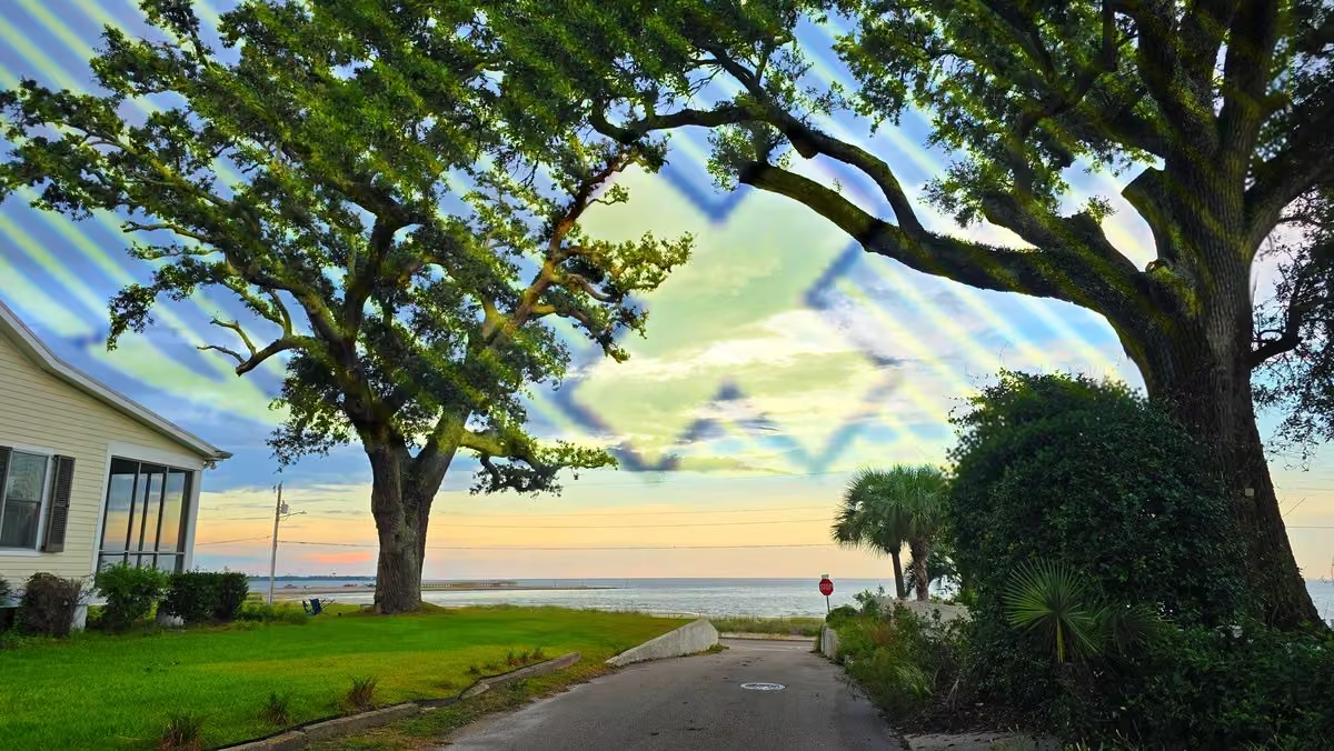
Josh Morgerman reposted
Josh Morgerman
@iCyclone
#sponsored A research-grade weather station isn't just one thing. It's actually a complex family of instruments specialized for their measurements—components that work together and speak to each other.
And this here is the brain—the datalogger. And it's one of the main reasons I went with Campbell Scientific. Their flagship CR1000X datalogger is the best you can get. (The next-generation CR1000Xe—released just after my station went online—is the very latest iteration.) All the readings from all the station's components feed into this one, compact device, which also allows us to remotely talk to these components. While all the station's data go directly to the cloud, they're also stored in this box in reliable, nonvolatile storage—meaning I won't lose any readings if network connectivity goes down in extreme situations. And the CR1000X even has a microSD card for a *second* layer of data backup. That is key for me, because you can't count on cloud access in a hurricane.
The datalogger consumes very little power, and it's physically rugged—designed to operate in truly extreme temperatures (-55°C to +85° C!), with the electronics RF-shielded by a special, sealed, stainless-steel case.
I've heard horror stories from my friends about dataloggers crashing and losing readings during major weather events. That's why I went with Campbell Scientific's CR1000X datalogger. It's rock-solid and it is the anchor component of my #hurricane House weather station.
 Josh Morgerman
@iCyclone
#sponsored A research-grade weather station isn't just one thing. It's actually a complex family of instruments specialized for their measurements—components that work together and speak to each other.
And this here is the brain—the datalogger. And it's one of the main reasons I went with Campbell Scientific. Their flagship CR1000X datalogger is the best you can get. (The next-generation CR1000Xe—released just after my station went online—is the very latest iteration.) All the readings from all the station's components feed into this one, compact device, which also allows us to remotely talk to these components. While all the station's data go directly to the cloud, they're also stored in this box in reliable, nonvolatile storage—meaning I won't lose any readings if network connectivity goes down in extreme situations. And the CR1000X even has a microSD card for a *second* layer of data backup. That is key for me, because you can't count on cloud access in a hurricane.
The datalogger consumes very little power, and it's physically rugged—designed to operate in truly extreme temperatures (-55°C to +85° C!), with the electronics RF-shielded by a special, sealed, stainless-steel case.
I've heard horror stories from my friends about dataloggers crashing and losing readings during major weather events. That's why I went with Campbell Scientific's CR1000X datalogger. It's rock-solid and it is the anchor component of my #hurricane House weather station.
Josh Morgerman
@iCyclone
.@WilliamJBroad Good article on how the Google DeepMind models have improved hurricane forecasting-- thank you. One small note: MELISSA wasn't just the strongest known hurricane ever to to hit Jamaica. With estimated winds of 185 mph, it is tied with two other storms (Florida 1935 & DORIAN 2019) as the strongest known hurricane to hit *anywhere* in North America.
Josh Morgerman
@iCyclone
Remember #lala? It's finally kicked the bucket—almost 2 weeks after attacking #hawaii. As tropical cyclone, LALA trekked 3,275 mi over 16 days. NHC issued 64 advisories, as well as many intermediate updates. And it was 1st #hurricane to directly hit Hawai'i since INIKI in 1992.
 Josh Morgerman
@iCyclone
JMA's forecast tracks for two junk cyclones in the Western Pacific—dancing intimately. You'd think it was 3 am in the neighborhood dive bar, the way they're carrying on. Trash attracts trash.
(Blame @EarthUncutTV for bringing this grossness to my attention.)
 Josh Morgerman
@iCyclone
Dusk in Bay Saint Louis. Gulf has been quiet this past month. But Google DeepMind models have been hinting at near-future Gulf mischief. And these days, homegrown is more interesting than stuff coming off Africa. El Niño makes the trek across the ocean tough for a young cyclone.
 Josh Morgerman
@iCyclone
New TS #lowell will head W & become #hurricane. Some long-range models bring it near #hawaii in 7-10 days. Seems like atmosphere just gets "stuck" on a steering pattern sometimes. P.S. Check out ghostly #lala—still there, hanging on like an '80s rockstar who refuses to retire.
 Josh Morgerman
@iCyclone
TS #dolly has formed ~1,300 mi E of Lesser Antilles. DOLLY will move W before unraveling as it nears North America. (Thx, wind shear.) BTW, this wasn't named to honor beloved American icon who just died. Storm names come from set lists. Just the universe having fun, I guess.
 Josh Morgerman
@iCyclone
P.S. What's not a coincidence is my selection of playful font & color to label this graphic. We miss you, Dolly Parton. ❤️
Josh Morgerman
@iCyclone
The Bay just got hammered by latenight line of storms: 3 inches of rain in 54 mins. 1st inch in 12 mins; 2nd inch in 11 mins. Some hail; frequent loud thunder. Peak wind only 22 knots. These 3 inches + yesterday's 1 inch = 4 inches in less than 24 hr—after many weeks of no rain.
 Josh Morgerman
@iCyclone
Actually, its 4+ inches in less than *12* hours.
Josh Morgerman
@iCyclone
Weird li’l storm spun up right over Saint Louis Bay, then moved into the city. Got 1.03 in of rain in Old Town in ~40 mins—the first real rain here in many weeks. Winds were turbulent but didn’t gust higher than 24 knots. My Campbell Scientific station caught it all. 👊

Josh Morgerman reposted
Josh Morgerman
@iCyclone
#sponsored If you live in #hurricane Country, you want a metal roof—no two ways about it. Metal is stronger, tougher, more resilient, and more impact-resistant!
So why doesn’t everyone go that way? MONEY. Folks believe metal’s more expensive.
Not the case with Only Metal Roofs. They’ve put the dream of a metal roof within everyone’s reach. How do they manage it?
First off, when OMR does your roof, they do it entirely in-house, from design to manufacturing to installation. That means an efficient process—with no middlemen.
Secondly, OMR offers amazing financing: no money down, no interest, and no payments for 12 months. That means you can get your new metal roof going now.
Thirdly, a good metal roof pays for itself over time:
* The cost of insuring shingle roofs is skyrocketing, whereas many insurance providers actually give discounts for metal roofs.
* A metal roof needs no maintenance and lasts decades, whereas a shingle roof has to be replaced regularly.
* A metal roof is unlikely to be damaged in windstorms. Compare that to a shingle roof: losing just a few pieces can let water inside your home, causing major interior damage.
So, when my neighbors tell me they can’t afford a metal roof, I set them straight: You can’t afford NOT to go metal. And if you’re in Florida, your best bet is Only Metal Roofs.
Reach out to them to start a conversation.
Go to onlymetalroofs.com or call 772.559.5225.


Josh Morgerman reposted
 The Royal Family
@RoyalFamily
Remembering the late, great Dolly, who brought joy, comfort and inspiration to so many - including the millions of children given free books through her Imagination Library. We will always ❤️ you.
Josh Morgerman
@iCyclone
#sponsored If you live in #hurricane Country, you want a metal roof—no two ways about it. Metal is stronger, tougher, more resilient, and more impact-resistant!
So why doesn’t everyone go that way? MONEY. Folks believe metal’s more expensive.
Not the case with Only Metal Roofs. They’ve put the dream of a metal roof within everyone’s reach. How do they manage it?
First off, when OMR does your roof, they do it entirely in-house, from design to manufacturing to installation. That means an efficient process—with no middlemen.
Secondly, OMR offers amazing financing: no money down, no interest, and no payments for 12 months. That means you can get your new metal roof going now.
Thirdly, a good metal roof pays for itself over time:
* The cost of insuring shingle roofs is skyrocketing, whereas many insurance providers actually give discounts for metal roofs.
* A metal roof needs no maintenance and lasts decades, whereas a shingle roof has to be replaced regularly.
* A metal roof is unlikely to be damaged in windstorms. Compare that to a shingle roof: losing just a few pieces can let water inside your home, causing major interior damage.
So, when my neighbors tell me they can’t afford a metal roof, I set them straight: You can’t afford NOT to go metal. And if you’re in Florida, your best bet is Only Metal Roofs.
Reach out to them to start a conversation.
Go to onlymetalroofs.com or call 772.559.5225.
Josh Morgerman
@iCyclone
Can't believe I've been sucked into this silly game. Deep South for my kind of weather; California, New York, and Massachusetts due to deep, durable cultural ties.
 Josh Morgerman
@iCyclone
Since there's been recent interest in this, here are tracks of all known *direct* #hurricane impacts in #hawaii since 1900. (We're talking the eight major islands—not including uninhabited specs 800 miles away from rest.) #lala of last week is the fourth.
Direct impact means inner core (eyewall) touched land. Landfall (center crossing coast) is not required for direct impact. IWA 1982 & LALA did not make landfall—centers stayed offshore.
Three impacts were Cat 1. Big standout is INIKI 1992, an intense, fast-moving Cat 4 that broadsided Kaua'i & inflicted great damage.
Not shown here: storms that weakened to below hurricane strength before landfall (examples: ISELLE 2014, DARBY 2016, OLIVIA 2018, LINDA 2021) & hurricanes that passed near enough to islands to inflict damage, but did not make direct impacts (examples: ANA 2014, LANE 2018, DOUGLAS 2020, DORA 2023, HONE 2024).
 Josh Morgerman
@iCyclone
TS #moke is 575 mi SE of #hawaii. It's a feeble, unhealthy, frankly ugly system—& fortunately it should stay well S of islands. But it's still gonna bring heavy rainfall to parts of Big Island still cleaning up from #hurricane LALA—now enjoying lonely demise over open Pacific.
 Josh Morgerman
@iCyclone
Drove into Biloxi for dinner. Came out to a threatening sky and charcoal-black Gulf. But nothing really happened. Just a smattering of drizzle and distant lightning.

Josh Morgerman reposted
Josh Morgerman
@iCyclone
#sponsored Meet my good friend James Hyde (@wxmeddler). He is a weather instrumentation specialist who designs and installs Mesonet weather stations for a living. He's personally built literally hundreds of research-grade weather stations for universities all around the country. He knows his stuff. And he's my go-to guy when it comes to the technical side of measuring the weather.
So, when I decided to establish a Mesonet-grade weather station at my custom built Hurricane House in Coastal Mississippi, I asked James to lead the effort. And when we sat down to discuss it, I was real clear about what I needed. I said, "I'm not building this station to record day-to-day weather. I don't care what the average temperature was in May. I'm building this station to measure violent storms—rare, once-a-generation events. If the station fails during a #hurricane—if the wind monitor goes down, if the datalogger crashes—I’ll see this whole project as a failure. I need to know this thing is going to work when it counts." I'll admit I was being demanding.
Without skipping a beat, James said, "In that case, we're going with a Campbell Scientific solution." He explained that if I wanted a station that’s tough, reliable, and accurate—and that's going to come through in extreme conditions—Campbell Scientific was the only way to go. End of discussion.
And the solution he designed for Hurricane House is almost 100% Campbell Scientific components.


 Josh Morgerman
@iCyclone
#sponsored Meet my good friend James Hyde (@wxmeddler). He is a weather instrumentation specialist who designs and installs Mesonet weather stations for a living. He's personally built literally hundreds of research-grade weather stations for universities all around the country. He knows his stuff. And he's my go-to guy when it comes to the technical side of measuring the weather.
So, when I decided to establish a Mesonet-grade weather station at my custom built Hurricane House in Coastal Mississippi, I asked James to lead the effort. And when we sat down to discuss it, I was real clear about what I needed. I said, "I'm not building this station to record day-to-day weather. I don't care what the average temperature was in May. I'm building this station to measure violent storms—rare, once-a-generation events. If the station fails during a #hurricane—if the wind monitor goes down, if the datalogger crashes—I’ll see this whole project as a failure. I need to know this thing is going to work when it counts." I'll admit I was being demanding.
Without skipping a beat, James said, "In that case, we're going with a Campbell Scientific solution." He explained that if I wanted a station that’s tough, reliable, and accurate—and that's going to come through in extreme conditions—Campbell Scientific was the only way to go. End of discussion.
And the solution he designed for Hurricane House is almost 100% Campbell Scientific components.
Josh Morgerman
@iCyclone
Ok.
 Josh Morgerman
@iCyclone
TD 2C is 1K mi ESE of #hawaii's Big Island. It'll move WNW & should become TS #moke. Earlier models runs suggested possible hurricane passing close to islands. Newer runs show weaker system staying further S. But it can still bring rain & wind—esp. to islands' higher elevations.
 Josh Morgerman
@iCyclone
Out with old, in with new. Devastating #hurricane #lala has pulled away from #hawaii, but new threat is brewing. Invest 90E is a healthy disturbance that will soon become TS—maybe more. Models take it generally NW to near or S of Hawaiian Islands in ~5 days. Need to watch.
 Josh Morgerman
@iCyclone
Wide view of Pacific. After its rampage in #hawaii (pink), #hurricane #lala has intensified to Cat 4 & now threatens some remote, fortunately uninhabited islands. Meanwhile in WPAC, brand-new TS #saudel will become #typhoon & threaten Japan (yellow) or Taiwan (orange) next week.
 Josh Morgerman
@iCyclone
11:30 pm Tuesday: At exactly this time 57 year ago, the calm eye of Category-5 #hurricane CAMILLE—the second strongest in American history, with estimated wind of 150 knots—was passing over Bay Saint Louis #mississippi. Downtown had about 10 minutes of calm before the ferocious winds started up again from the opposite direction. Across the Bay, in Pass Christian, there was no calm—the hurricane's intense right eyewall raked the city unabated, reducing the waterfront to a heap of rubble. By morning, much of Downtown Bay Saint Louis was gone—swept away by wind and wave. It was rebuilt, then destroyed again by KATRINA in 2005, then rebuilt again. Today's Bay Saint Louis is a glittery monument to resilience. And the great hurricanes all seems like ancient history now. Sitting on the porch of Hurricane House on a still summer night, the glassy smooth Gulf reflecting the moon perfectly, I have trouble imagining it all—what CAMILLE would have been like, right here, in this spot. I can’t picture it—my imagination fails me—because, despite its name, Hurricane House is the calmest place on earth. That's what I built it to be—my quiet place to return to. My place to rest up between adventures. But of course it won’t be this way forever. Another hurricane will come. It is what it is.


 Josh Morgerman
@iCyclone
#hurricane #lala was the first hurricane to directly impact the Hawaiian Islands since INIKI in 1992, & it's left behind a trail of devastation.
The most hurricane-prone US states are all very flat. #hawaii—especially the Big Island—is *extremely* mountainous. And those mountains create special issues—and special weirdness!
* EXTREME RAINFALL & ROCKSLIDES. The mountains amplified the rainfall on the E side & S end of the Big Island, with some places getting almost 3 ft of rain. And in some places, these rains unleashed catastrophic flooding & rockslides.
* ELEVATION-ENHANCED WINDS. Higher elevations tend to get stronger winds in a hurricane, and this is an issue for Hawai'i, which has lots of residential neighborhoods thousands of feet above sea-level. These communities were hammered by damaging winds—even in locations far, far outside the hurricane's core. I've chased hurricanes in mountainous places before (Mexico, Taiwan, Jamaica, etc.), & this is some of the most stark elevation enhancement I've seen. For example, in beachside neighborhoods of Kona (where I'm staying), barely a twig or leaf was out of place after the storm, whereas neighborhoods in the nearby hills had wind damage. Hurricane-force gusts were measured in many places across the islands, with Mauna Kea summit (at over 13K ft) measuring a gust to a whopping 122 knots.
* SNOW. Yep. On Mauna Kea Summit, it snowed. A total meteorological freak show.
One last thing: There's a prevailing belief that the mountain peaks on the Big Island will always weaken approaching storms. LALA violated that belief. It did the exact opposite—strengthening into a hurricane as it neared the island.

 Josh Morgerman
@iCyclone
Some spectacular storm coverage from Jordan Hall & @AaronRigsbyOSC. They've done a great job capturing the scale of the flooding on the E side of the island.
 Jordan Hall
@JordanHallWX
Significant river flood along the Wailuku River near Hilo, Hawaii. Standing near this bridge you can feel the thuds with every tree that slammed into it. The rain is still falling substantially.
@AaronRigsbyOSC @MyRadarWX
#hiwx #hurricane #lala
Josh Morgerman
@iCyclone
I told y'all those things in the Atlantic were all junk.😎
Josh Morgerman
@iCyclone
Since there's confusion:
* Landfall=center crosses coast.
* Direct impact=eyewall (inner ring of strongest wind & rain) crosses coast.
#hurricane #lala did not make landfall on #hawaii's Big Island (center stayed offshore), but it was a direct impact (eyewall came ashore).
Josh Morgerman
@iCyclone
Four moments from my #hurricane #lala chase in the Big Island of #hawaii:
* In the parking lot of Green Sand Beach, 0.7 n mi NE of South Point, as the hurricane’s center made its closest approach the S tip of the Big Island.
* Horses out on the highway, fending for themselves in the storm.
* The drive back up Highway 11, along the island’s W coast, was treacherous.
* A normal spectacular view of the Pacific was turbulent and windswept as Hurricane LALA’s center passed just offshore. This is a scenic point on Highway 11.
Josh Morgerman
@iCyclone
Back in Kona. There's widespread, mild wind damage across island's S end: tree limbs everywhere, some downed trees, some road flooding. This fallen power pole *almost* stopped me from getting home tonight, but I somehow found a way around it. Further up W coast, #hurricane #lala's core stayed offshore, & impacts are light.
 Josh Morgerman
@iCyclone
Trying to get back to Kona and it's like it's chasing me up the coast. Leave me alone. I'm cool now. #hurricane #lala in #hawaii
 Josh Morgerman
@iCyclone
And history is made: the edge of #hurricane #lala’s eyewall just nicked the S tip of the Big Island of #hawaii. While it’s not a landfall, it’s a direct hurricane impact—the first known one for this island since 1871. And I was in the parking lot of Green Sands Beach to witness it. Eyewall No. 86 for me—in the very last place I expected to penetrate one. Things are calming down here as the hurricane’s core pulls away from this location. Unicorn captured. Not the craziest ‘cane I’ve been in, but it was hard work.

 Josh Morgerman
@iCyclone
1:40 pm. Back at the S tip of the Big Island. As far S as I can get. So close to that eyewall. #hurricane #lala in #hawaii
 Josh Morgerman
@iCyclone
Update from Na'alehu near the S tip of the Big Island of #hawaii. The core of #hurricane #lala is just offshore.
Josh Morgerman
@iCyclone
Winds picking up in Na'alehu, near the S tip of the Big Island of #hawaii. Core of #hurricane #lala is just offshore.
Josh Morgerman
@iCyclone
View from Haleokane Lookout, near the S tip of the Big Island of #hawaii, as #hurricane #lala closes in.
Josh Morgerman
@iCyclone
Update from the S tip of the Big Island of #hawaii as #hurricane #lala closes in.
Josh Morgerman
@iCyclone
TS #lala is well within radar range now. Radar structure ain't bad—looks decent—but winds remain 55 knots. Regardless of exact intensity, higher elevations will get hurricane gusts. Rain will be the big story. I'm gonna head down to the S tip of the island, see what's going on.
 Josh Morgerman
@iCyclone
Aloha from the Big Island of #hawaii. Against my better judgment (and hardwired reverance for climatology), I've come here to hunt a unicorn—oops, I meant a landfalling #hurricane. Let's see that happens. Either way, the island is magnificent—with or without #lala.
 Josh Morgerman
@iCyclone
Well, this is kinda escalating. There's now a Hurricane Warning for #hawaii's Big Island. #lala is steadily organizing as it heads WNW, and the NHC forecasts it to be a #hurricane as it brushes the S tip of the Big Island on Saturday. Possible unicorn event developing here. Hmmm.
 Josh Morgerman
@iCyclone
Portrait of a degenerate, an underachiever, and future gourmet fish food.
 Josh Morgerman
@iCyclone
I haven't been talking about the string of Atlantic disturbances because I don't see potential in any of them. A bunch of junk—just colored decorations on the weather map.
Josh Morgerman
@iCyclone
There's a Hurricane Watch for #hawaii's Big Island as TS #lala approaches. System has improved & is starting to look like proper cyclone. Computer models suggest general WNW motion & slow strengthening, with several showing Cat-1 #hurricane near Big Island by Saturday. #unicorn
 Josh Morgerman
@iCyclone
I'm honestly befuddled by PTC 1C. It looks like garbage, & climatology tells me to ignore it. But some of the hurricane models are aggressive with it, & even NHC's official forecast shows it reaching #hawaii's Big Island in 72 hours near #hurricane intensity. Need to watch.
 Josh Morgerman
@iCyclone
Not sure what to make of Invest 93C. Some computer models have been consistently implying #hurricane threat to #hawaii. But 2 things give me pause: 1) My climatology-wired brain (which always bets against unicorn events) & 2) the system's actual appearance, which is pathetic.
 Josh Morgerman
@iCyclone
So many tropical systems right now, and they're all A) fish and/or B) trash. 93C might be the exception, but when I'm even contemplating meteorological unicorns (for example, a Hawaiian hurricane) you know the pickin's are slim.
 Josh Morgerman
@iCyclone
August evening in the Bay. Quiet. Calm. The Gulf a deep-blue stripe on the horizon. Feels like a porch-sittin' night. There are 11 tropical systems on the map, but I ain't following any of them. All garbage—except maybe the Hawaiian thing. (Embarrassing to confess.)
 Josh Morgerman
@iCyclone
#sponsored I'm gonna be honest: Before I built Hurricane House, I didn't know a darn thing about roofs—don't know which kind was best and why.
Wanna know when I learned? Category-5 #hurricane DORIAN in the Bahamas. That thing had crazy-ass wind—some of the most violent I've seen. It tore cars apart and smashed concrete. Crazy. But there was one striking thing I noticed in the unbelievable chaos of the aftermath: gleaming metal roofs that had stayed on and weathered the assault without a scratch!
After those stark sights, I made a solemn promise to myself—that when I built my own house, I'd go with a metal roof. Four years later, I kept my promise.
Don’t get me wrong—I did do research. I learned that asphalt shingles are easy to install and affordable—but they're the least wind-resistant and need to be replaced regularly. I learned that tile is tougher—but costly to install and so heavy they need extra structural support.
Then I learned about metal roofs. How they're the toughest and most durable. How they're wind-, fire-, and water-resistant. How they last longer than tile. And how they're famously low maintenance: once you get a metal roof, you can ignore it for decades and decades.
Metal is the clear winner!
So, if you're needing a new roof in Hurricane Country, go with metal. And if you're in Florida, I recommend Only Metal Roofs. Since 1976, they've been providing high-quality, custom metal roofs for a good price. These guys are good. They love their craft.
Reach out to Only Metal Roofs to start a conversation.
Go to onlymetalroofs.com or call 772.559.5225.


 Josh Morgerman
@iCyclone
No matter what sensible advice you give, you're gonna get the "well, actually..." retorts. 🙂 AGAIN: In an earthquake, the modern best practice is DROP-COVER-HOLD: 1) Get down low, 2) Get under sturdy furniture, 3) Hold the legs firmly (and be prepared to move with it). Obviously, not everyone is gonna have a sturdy table nearby—but this is the ideal action to take. It's not recommended to stand in a doorway. That was the old-school wisdom, but modern research yielded better knowledge and better practices, starting in the 1960s. Southern California started really pushing DROP-COVER-HOLD with "Great Shakeout" drills starting in 2008, and these drills have since gone global. MORE INFO: www.shakeout.org/dropcoverholdon/
Josh Morgerman
@iCyclone
Feast your eyes on this rare sexiness moving into Honshu #japan: Tropical Storm CHAN-HOM. It's close to where @EarthUncutTV lives, & he won't stop talking about it—a child waiting for Santa. How many cams have you set up, James? How many pressure sensors have you deployed? ❤️
 Josh Morgerman
@iCyclone
Dramatic video of Colombian quake—really captures it. One note: As a former Californian who's been in a violent quake, it concerns me that no one in the video is getting under something. When a quake hits: drop down, get *under* a table (or whatever you can find), & hold on.
 EVERSTRONG
@everstrongever
Así se sintió en el aeropuerto de Pereira.
Josh Morgerman
@iCyclone
P.S. I was in the Northridge Earthquake in L.A. in 1994-- 13 miles from the epicenter, in an area of severe (MM VIII) shaking.
Josh Morgerman
@iCyclone
Across N Hemisphere, there are many storms & disturbances right now. But it's all junk systems with no future that I refuse to waste brain cells discussing. Of mild interest: Invest 93C. Some models develop it & bring it near #hawaii in 5-6 days. We'll just have to watch it.
 Josh Morgerman
@iCyclone
W Hemisphere Tropical Roundup: A couple of disturbances in E Atlantic are gonna get zapped by shear or curve out to sea. (Lesser Antilles may get crummy weather.) Pacific is busy, but all fish storms. Promising cherry SE of Hawai'i has got game, but it'll past S of the islands.
 Josh Morgerman
@iCyclone
I've seen trochoidal wobbles many times, but ones #typhoon #dolphin made yesterday are wildest I've seen. Unfortunately, first wobble brought typhoon's center right over Okinawa. Also unexpectedly, inner eyewall transformed into gorgeous, closed ring as it passed over island. That said, it perhaps wasn't as strong as suggested by radar & satellite imagery. As far as I know, no station on Japanese islands recorded sustained typhoon wind. Maybe huge outer eyewall was sapping inner-core energy or flattening out pressure gradient. DOLPHIN is heading WNW & will move into China tomorrow night, between Wenzhou (pop. ~9.9M) & Taizhou (pop. ~6.7M). DOLPHIN won't be especially strong then, but it'll impact millions of people.


Josh Morgerman reposted
 James Reynolds
@EarthUncutTV
Getting raked by back end of typhoon Dolphin now in N Okinawa
Josh Morgerman
@iCyclone
#typhoon #dolphin is moving through #japan's Ryukyu Islands, with eye over N end of Okinawa. Classic case of double wind maxima: peak sustained wind of 52 knots on Amami-oshima (in huge outer ring) isn't much lower than peak wind of 60 knots on Yoron-jima (in tiny inner ring).

Josh Morgerman reposted
James Reynolds
@EarthUncutTV
Update from inside the calm eye of typhoon Dolphin at Cape Hedo, Okinawa Japan - pressure 941.1hpa as I type this (video shot 15 mins ago)
Josh Morgerman
@iCyclone
Eye of Cat-2 #typhoon #dolphin is crossing Japan's Ryukyu Island chain. System reorganized & restrengthened a bit in last few hours. Eye is over Yoron-jima, which just had 54 knots (10-min) gusting to 82. The S edge of the eyewall is about to brush the N tip of Okinawa Island.
 Josh Morgerman
@iCyclone
CORRECTION: Yoron-jima has had 60 knots gusting to 82.
Josh Morgerman
@iCyclone
Just as it looked like #typhoon #dolphin was falling apart, it's reorganized & now has solid, closed eyewall on radar & satellite imagery. (Typical of this bipolar system.) Center will cross Ryukyu Island chain today, likely just N of Okinawa. Wind readings will be interesting.
 Josh Morgerman
@iCyclone
#typhoon #dolphin is nearing Ryukyu Islands. IR images show "blown out" structure, like dry air has mixed in. (Outflow is fine, so it's not shear.) Radar shows closed inner ring of convection surrounded by moating. Outer part of storm has been impacting islands. Peaks gusts so far: 65 knots Amami, 56 knots Okinawa.

 Josh Morgerman
@iCyclone
#typhoon #dolphin continues its march toward Okinawa. Intensity is down to Cat 1—however, it looks better now than 12 hr ago. It's got sort of a cinnabun structure, with a huge, arcing band spiraling into a small core. The center will pass over or near Okinawa by late tomorrow.

Josh Morgerman reposted
James Reynolds
@EarthUncutTV
Immense waves smashing into the north shore of Okinawa at Cape Hedo ahead of typhoon Dolphin - you can’t hear much of what I’m saying but you get the gist. Filmed from a safe location I’ve been to many times during typhoons
Josh Morgerman
@iCyclone
Conversation tip: An expert has zero interest in your AI research about his area of expertise.
Josh Morgerman
@iCyclone
Latest shot of #typhoon #dolphin. It's made a surprising comeback, rebuilding a nice, tight core, & it's back up to Cat3. As wise as I am, I have to confess I didn't see this revival coming. It'll continue W & pass near Okinawa #japan Friday—then threaten #china early next week.
 Josh Morgerman
@iCyclone
Me: I decided not to chase this one. It actually looks like it'll be a decent impact, but the truth is, I expect to be in East Asia a *lot* this fall. So, I'm gonna stay home for now & keep my powder dry.
Josh Morgerman
@iCyclone
Rain pounding on the metal roof. One of my favorite sounds. Hadn't heard it for a month. ❤
Josh Morgerman
@iCyclone
PAGASA has named this mess off #philippines #luis. It'll bring heavy rain & flooding to parts of Luzon. That's all I have to say about this because I'm too much of a cyclone snob. There. I said it. It feels good to be honest—to talk openly about my feelings. You understand. ❤️
 Josh Morgerman
@iCyclone
#typhoon #dolphin can't stop with the eyewall replacement cycles (ERCs)—just one after another. IR images suggest this one is gonna yield a *huge* eye, fat core, & (likely) weaker winds. Typical lifecycle of WPAC typhoon. We see this evolution—from sexy to muppety—again & again.
 Josh Morgerman
@iCyclone
#sponsored The state-of-the-art, Mesonet-grade weather station at my custom built Hurricane House is made almost entirely of Campbell Scientific components. Why?
I’m not an everyday-weather kind of guy. Me: I live for the extremes. I live to accurately measure rare, once-a-decade events.
And in my hometown—Bay Saint Louis, Mississippi—that means one thing: #hurricanes. Crazy ones. This place has been Ground Zero for the mightiest in American history. In 1969, the eye of Category-5 Hurricane CAMILLE passed right over the Bay when it had estimated winds of 150 knots. A resident not far from my newly built “Hurricane House” measured an incredible 904 mb in the eye. And in 2005, the highest storm surge on record in the Western Hemisphere swept this coastline when Hurricane KATRINA came roaring ashore.
Given this place’s wild history, my weather station here has to be the very best quality—no compromises. It has to be the most durable, the most reliable, and the toughest. It has to withstand the jaw-dropping extremes we get here. And it has to measure these extremes accurately—because as y’all know, I am all about quality data.
So, for me, the *only* solution is Campbell Scientific. There’s no other choice.


Josh Morgerman reposted
 R.M. Young Company
@RMYoungCompany
Todd Rector captured this beautiful drone footage of our Wind Monitor mounted in @iCyclone 's backyard during his famous hurricane season kickoff party last month on the gulf coast, and we just had to share!
Thanks for sharing, Todd! And thank you always for your support , Josh!
Josh Morgerman
@iCyclone
Super #typhoon #dolphin has been fluctuating in strength—with bursts of rapid intensification alternating with eyewall replacement cycles (ERCs). Last such cycle yielded larger eye/core & slightly weaker winds—the expected outcome of ERC. Current intensity is Cat 4. From here, typhoon may have one more burst of intensification before sliding into slow, gradual decline. What reaches #japan next week will look nothing like this. Computer models like HAFS-A shows fat, muppety core in 5 days, with huge eye, huge radius of max winds, & much lower wind speeds. Completely typical of WPAC typhoons. No matter how sexy they start off, they get hideous with age. (Sorry, but it's true.)
 Josh Morgerman
@iCyclone
My ChatGPT assistant flatters me too much. But of course he's always right when he does, so it's hard to object.
Josh Morgerman
@iCyclone
Ancient live oaks, Highway 90, smooth Gulf, full moon. Hot, still night in Pass Christian #mississippi just before peak #hurricane season.
 Josh Morgerman
@iCyclone
#typhoon #dolphin is "extremely rapidly intensifying," according to JTWC, & their forecast is very aggressive, calling for it to peak at a whopping 165 knots. It looks big here, but it's actually very small—typical for immature, violent, rapidly intensifying cyclones. DOLPHIN will continue NW, & the mature typhoon that threatens Japan in 8-10 days will be larger & weaker than its peak.
 Josh Morgerman
@iCyclone
#sponsored You want to know when I learned the importance of a roof? It was in Mexico—on October 23, 2015. I was squeezed into a tiny bathroom with seven other people. The wind roared. Mighty #hurricane PATRICIA was tearing our hotel to pieces. Much of the roof had already torn away—but somehow a small bit of it still clung to the rafters above us. I knew if that piece tore off, we were dead. Somehow, it held on—& we survived.
I came away from that scare with one clear takeaway: In a hurricane, it all comes down to your roof. If it stays on, you’re gonna be OK; but if it comes off, it’s GAME OVER. We’re talking massive structural & interior damage. Your roof is your home’s MVP.
That’s why I made the roof my top priority when I built my house on the Gulf Coast.
I put in a standing-seam metal roof because that’s best for Hurricane Country. When produced & installed properly, a high-quality metal roof is your best protection against extreme winds. It’ll stay on, & it’ll withstand the assault of flying debris.
Folks in #florida: Are you still repairing after HELENE, MILTON, & IAN? Are you building a new home? Or do you just want to make your older home more hurricane tough?
My advice: Talk to Only Metal Roofs. They’ve been producing artisanal, high-quality, custom metal roofs since 1976—& they make it AFFORDABLE. (Big shocker, right?) They’re hardworking & trustworthy, & I like working with them.
Say no to interior water damage. Say no to Blue Tarp Living. Say no to the kind of terror I went through in Hurricane PATRICIA—at the mercy of the winds, praying that roof would stay on.
Reach out to OMR to start a conversation.
Go to onlymetalroofs.com or call 772.559.5225.


 Josh Morgerman
@iCyclone
Pacific Roundup: 1) #genevieve is now Cat-5 fish food. 2) #fausto is unraveling as it moves W (just as I said it would). #hawaii will see rough & dangerous rip currents as it misses to the N. 3) #dolphin will be an intense long-track #typhoon that may eventually threaten Japan.
 Josh Morgerman
@iCyclone
Finger wagging at other chasers won't make you a great chaser. Acting like an offended churchlady because another chaser did something edgy won't win you a chaserdude trophy. Focus on your own chasing—your skills, your achievements.
Josh Morgerman
@iCyclone
No, a #hurricane isn't gonna hit #hawaii. #fausto is unraveling & will reach the islands as a hawt mess if it's lucky. As I always say, Hawai'i is not hurricane-prone. They get 'em almost never (3 times last 150 years). Might there be impacts there? Sure—maybe. A hurricane? No.
 Josh Morgerman
@iCyclone
TS #noul is moving briskly through Babuyan Islands of N #philippines. System is nicely organized & likely to become #typhoon as it crosses South China Sea. Landfall will happen late Sat or early Sun, possibly near #hongkong (star), so folks there should watch NOUL closely.
 Josh Morgerman
@iCyclone
Satellite & radar images suggest the center of TS #bertha is back onshore—in SW #louisiana. But, as has been the case for this storm's entire lifecycle, the real weather is far S of the center. Much of the #texas coast should see heavy rain & gusty winds today.
 Josh Morgerman
@iCyclone
Car needed a good washing—especially an undercarriage rinse—after #bertha. My kinda fun. 😎
Josh Morgerman
@iCyclone
Look what Miss BERTHA blew into the Bay—onto my sacred turf: @JordanHallWX, @AaronRigsbyOSC, & @StephenBrucher. Raising a ruckus late into the night at a seaside dive in Downtown Bay Saint Louis. Some of the best in our sport of extreme chasing. Committed, serious chaserdudes.👊
 Josh Morgerman
@iCyclone
Come for a ride as I courageously drive through #bertha's storm surge in the Bay. This is MELISSA-level adventure.
Josh Morgerman
@iCyclone
All you Nervous Nellies: Yep, I hosed down the underside of the car and the wheel wells. So just chillax. Thx.
Josh Morgerman
@iCyclone
Coastal flooding happening now in Bay Saint Louis #mississippi. Parts of Beach Boulevard are going under. Tropical Storm #bertha
Josh Morgerman
@iCyclone
Update from Bay Saint Louis #mississippi as center of Tropical Storm #bertha passes just S of here.
Josh Morgerman
@iCyclone
Center of TS #bertha is very near #mississippi coast. Outside: windy & warm w/ smatterings of light rain. Peak gusts in Bay Saint Louis: Hurricane House 24 knots, Yacht Club 35 knots. Methinks we'll have issues along immediate coast once center passes to W & wind shifts onshore.
 Josh Morgerman
@iCyclone
TS #bertha is just off Alabama & Mississippi, but you almost wouldn't know it. System is highly sheared, so main convection is far offshore—well S of naked low-level swirl near coast. Tuesday in Bay Saint Louis was hot & windy, with choppy seas & occasionally dramatic skies over Old Town. Wednesday there could be coastal flooding. Not expecting much rain from this thing.


 Josh Morgerman
@iCyclone
And we have TS #bertha. It ain't exactly a work of art, but it's got a name—& it'll strengthen some. Broad circulation + path toward mouth of Mississippi River = prolonged onshore flow & likely significant #stormsurge event for SE #louisiana, #mississippi, & #alabama.
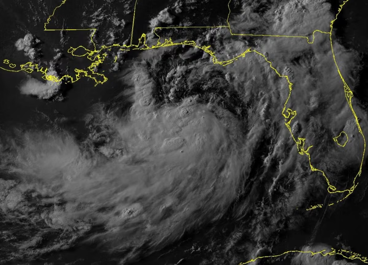 Josh Morgerman
@iCyclone
TD 2 is born. Current NHC forecast track could bring decent storm surge to MS (where you get surge if you even look at the Gulf funny) & also SE LA. But things could get a whole other level of interesting if this stays more W & skirts S of LA, allowing more time over Gulf.
 Josh Morgerman
@iCyclone
Gonna be honest: this Gulf swirl is getting interestin'. It's not what I'd call gorgeous workmanship, but 1) cloud pattern shows definite arcing, 2) low center is turning W (meaning more time over Gulf), & 3) computer models have gotten more aggressive. Folks in FL, AL, MS, & LA need to watch this—& some models suggest TX threat down the road. Me: heading back to the Bay Sunday.
 Josh Morgerman
@iCyclone
Semi-hawt swirl.
 Josh Morgerman
@iCyclone
The 12Z ensembles are kind of a buzzkill because they mostly keep this mysterious feature scrunched up in the NE armpit of the Gulf without a lot of room to get magical. But we'll see.
Josh Morgerman
@iCyclone
Seriously... wtf?
 Josh Morgerman
@iCyclone
New Tropical Weather Outlook. Does it make you tingly that there's now an X to mark that li'l swirly thing on radar? Tell the truth. It's ok.
 Josh Morgerman
@iCyclone
Interesting li'l think out in the Gulf this morning. The ensemble models continue to show low-pressure forming in the NE Gulf over the weekend, with many members moving the feature W—which would give it some time & space to grow. Not exactly holding my breath over this, but hey.
 Josh Morgerman
@iCyclone
Decided to stop in L.A. for a few meetings en route back from Japan. Business lunch in Beverly Hills. Cool to be back. Part of me is always gonna be Southern Californian.
 Josh Morgerman
@iCyclone
Tracking disturbances coming off Africa—especially in an El Niño year, especially in July—is the hobby of masochists and the emotionally disturbed.
Josh Morgerman
@iCyclone
Low-calorie tingles.
Stormchasernick
@stormchasernick
When @iCyclone sees that Perry is inside the yellow.
 Josh Morgerman
@iCyclone
Gonna be honest: I'm not that bullish about this Gulf thing (that's sparked an avalanche of sexy infographics). If anything, models backed off from it today. I don't mean to throw cold water on your tingles. And of course I'd dig a porch chase. I just calls 'em like I sees 'em.
Josh Morgerman
@iCyclone
En route back home to US Gulf Coast. When I'm chasing, I'm 100% laser-focused on my prey. Pure tunnel vision! And that's how it was with #typhon #bavi. Didn't think about anything else. But I was hearing some of you whispering about possible Gulf action. I finally had a look. I wouldn't exactly say it's a lock, but some models—including Google DeepMind—are pretty insistent on something spinning up in 7-12 days in NE Gulf—which happens to be warmest part of Gulf right now. Interestingly, the models are all over the place on which direction it may head. I'll keep an eye on it. I wouldn't say I have tingles over this. Maybe *Potential* Tropical Tingles.
 Josh Morgerman
@iCyclone
Spent last 24 hours doing two things: sleeping & eating. #bavi was (fortunately) a dud of a #typhoon in #japan, but still a tough chase. Now at Ishigaki Airport—the start of my long trek home. This li'l lunch here was crazy good. Food in Japan is *always* good—even prepackaged.
 Josh Morgerman
@iCyclone
Quick #typhoon #bavi recap:
Gonna be honest: Structurally, this was a weird-ass storm—maybe one of the weirdest I've hunted. I'm talking about the way that tiny inner eyewall suddenly exploded onto the scene yesterday, looking all yummy, raising a ruckus, screaming, "Chase me! Chase me!"—only to go hiding in the folds of daddy's coat (the huge outer eyewall, I mean) once I drove up to the top of the island to pursue it. I felt almost as if it was playing with my head—playing games. This radar shot out of Taiwan shows the freaky coexistence of a dominant eyewall and the tiny remnant ring clinging to it like a parasite. (The black star marks my final location.)
METEOROLOGICAL ANALYSIS
(NERD ALERT: NORMAL PEOPLE STOP READING HERE)
There's some discussion about whether BAVI's
large central calm area—left behind once the tiny inner eyewall started to collapse and melt into the outer eyewall—was a moat or the new eye. In my opinion, the ERC (eyewall replacement cycle) was far enough along when BAVI impacted the Ryukyu Islands that the large, outer eyewall was by that point the dominant eyewall, and therefore the big central calm area was the new, larger eye. Reasons:
* The remnant inner eyewall was just a crescent-shaped scrap of convection clinging to the outer eyewall by this point—not an independent feature.
* Ground observations show the outer eyewall was the dominant wind maker. Ishigaki-jima had higher winds (peak gust 70 knots) than Tarama, which was in the exact path of the remnant inner core (peak gust 64 knots). Shimojishima had *slightly* higher winds (peak gust 74 knots) near the remnant inner core, but this makes sense given this location was on the right side of the center. Stations on Miyako-jima had their peak gusts (up to 83 knots) in the far reaches of the *outer* eyewall, after 10 am. Combined, these data suggest the larger, outer eyewall was the dominant eyewall as BAVI impacted the Ryukyu Islands.
* The large calm area was very calm. Like, dead calm. This suggests it was an eye and not a moat, as the moats I've experienced have always been quite windy. (That said, orographic factors may have contributed to the dead calm I experienced.)
/END OF NERDERY
So, there you have it. BAVI is my 85th hurricane/typhoon core penetration and 62nd eye penetration. It wasn't pretty—I'm not gonna be telling my grand nephews and grand nieces about this when I'm an old man—but that's how this sport is. Not every expedition yields a MELISSA, a DORIAN, a HAIYAN.
Back at the hotel, feeling cozy as the rain and wind continue to howl outside. On the agenda: SLEEP and FOOD.
 Josh Morgerman
@iCyclone
Heading S, down the spine of Ishigaki-jima. Left that dead-calm area (the main eye or whatever we're calling it) & getting back into stormy conditions on SW side of #thphoon #bavi. Nothing crazy, but not calm like before.
Josh Morgerman
@iCyclone
Almost 7 am near the N tip of Ishigaki-jima. #typhoon #bavi's structure had gotten kind of weird— this thing's a freak show—but I believe I'm near it in its center. (I'll post a radar shot in the comments.)
Josh Morgerman
@iCyclone
My location is the green dot.

 Josh Morgerman
@iCyclone
Odd structural games with #typhoon #bavi. There's a large, stable, well-defined, closed eyewall—& then there's a li'l ring thing floating inside. I guess you could call it concentric eyewalls. My guess is the outer ring is the dominant eyewall & main weather maker—& the inner ring (which popped up in the last few hours) is an unstable transient feature. We'll see. Meanwhile, winds at the airport on Ishigaki-jima (pink) are blowing at 40 knots, with gusts up to 60 knots down here in the port. #japan
 Josh Morgerman
@iCyclone
#typhoon #bavi's broad, muppety core is now in radar range. Pressure gradient with this thing is pretty shot, as I'm already down to 988 mb on Ishigaki-jima (pink). Rainbands have been sweeping island all day—peak gust 54 knots so far. Typhoon's core should get here early morn.
 Josh Morgerman
@iCyclone
Hotel-lobby smooth jazz + typhoon howl work together to create a rich, flavorful mood. The netting outside the door is commonly used on these islands—to protect the front entrance from flying debris. Chasing #typhoon #bavi in #japan
Josh Morgerman
@iCyclone
Port of Ishigaki on a grey, windy morning. The persistent clank! clank! clank! you hear in Mississippi & Texas, too—the international sound of an approaching hurricane. This island gets raked all the time. This city is tough, solid, battle-tested. Even the trees here know the drill. Chasing #typhoon #bavi in #japan
 Josh Morgerman
@iCyclone
Update from the road as I chase #typhoon #bavi. In Taiwan, heading for Japan.
Josh Morgerman
@iCyclone
Hey hey from #taiwan. Super Typhoon #bavi has restrengthened & is approaching East Asia with winds of 135 knots. Me: hanging in a hotel outside of Taipei (star), playing Island Roulette, plotting my next move. My playing field: islands highlighted pink. Which one will I end up on? I've made no decision yet. Gonna sleep on it.
P.S. Because folks are asking: Nope, I'm not meeting up with anyone. Chasing has never been a team sport for me, nor a social activity. I actually chase to get away from people. The scream of the wind is magic to me. I'll take it alone.
 Josh Morgerman
@iCyclone
Dramatic radar image showing eye of Cat-5 Super #typhoon #bavi right over Rota. They’ve no doubt seen extreme windspeeds last couple of hours. While satellite images make typhoon look huge, radar shows core is quite compact. This is allowing eyewall to fortunately slip between—& miss—more populated islands in the chain.
It’s a lucky break for Tinian & Saipan, which are still picking up after SINLAKU back in April. That said, they’re still getting rough weather: Saipan is reporting frequent typhoon gusts (despite the apparent lack of heavy rain there). And down on other side of storm, Guam has been getting hammered by intense rainband with typhoon-force gusts for hours.
If you’re on Rota & somehow reading this, REMAIN INDOORS. Even though you’re in calm eye at this moment, fierce typhoon winds will soon come roaring back from opposite direction.
What are my plans? Folks have been asking.
I decided not to chase BAVI on Mariana Islands because odds of Tinian/Saipan impact were too low for my liking, & I was unable to arrange a way to get on Rota in time. (And believe me, I tried—with creative, outside-of-the-box ideas that just didn’t work out.)
But now BAVI is headed for East Asia, & I’ll be there to play Island Roulette—& hopefully hunt down that core.
 Josh Morgerman
@iCyclone
Tiny island of Rota (pop. ~1.9K) is in moat, just outside Cat-5 Super #typhoon #bavi's intense inner core, where winds are estimated to be 155 knots. They're about to get absolutely raked. If you're there, retreat to an interior room or closet. Have a pillow to cover your head. Extreme winds will start very soon.

Josh Morgerman reposted
 Chef José Andrés 🕊️🥘🍳
@chefjoseandres
.@WCKitchen local team
Members are ready, safe and in place, to provide food and water after the typhoon passes….we will support them! @PostGuam Guam and Rota are in the path….lets hope it turns away….
Josh Morgerman
@iCyclone
The core of Cat-5 Super #typhoon #bavi is closing in on tiny island of Rota (pink). Estimated winds are a whopping 155 knots. Folks on Rota should identify safe space—preferably small closet, bathroom, or interior room with no exterior windows & doors—to ride out fierce core.
 Josh Morgerman
@iCyclone
The core of Cat-5 Super #typhoon #bavi is closing in on tiny island of Rota (pink). Estimated winds are a whopping 155 knots. Folks on Rota should identify safe space—preferably small closet, bathroom, or interior room with no exterior windows & doors—to ride out fierce core.
Josh Morgerman
@iCyclone
Super #typhoon #bavi has come within radar range of Guam. You can now clearly see eye & eyewall. System weakened to Cat 4 today as it underwent ERC (eyewall replacement cycle)—but recent satellite images suggest it's recovered. Which Mariana Islands get hit is still a question.
 Josh Morgerman
@iCyclone
Cat-5 Super #typhoon #bavi is barreling toward Mariana Islands with estimated winds of 140 knots. There's till some spread in ensemble models, but most bring center between Guam & Saipan/Tinian, very near Rota (pop. ~2K). I'll head out to Taiwan or Japan to hunt BAVI next week.
 Josh Morgerman
@iCyclone
#typhoon #bavi is strengthening as it approaches Mariana Islands. I decided not to chase it this round. I just don't like the setup. Multiple ensemble models have typhoon's core doing "field goal" between Guam & Tinian/Saipan, & I just don't like the odds. I'll likely hunt this in Taiwan or Japan next week.
 Josh Morgerman
@iCyclone
#bavi is closing in on Mariana Islands (inhabited ones pink). JTWC now classes it as #typhoon. Intensification has been slow today, but I expect it to pick up rapidly next 24 hours. (Expansive outflow is the tell.) Very tough to say at this point which islands will be impacted.
 Josh Morgerman
@iCyclone
Like a peacock showing off its feathers, TS #bavi displays its luxurious outflow—the sign of a healthy cyclone. BAVI is likely to become powerful super #typhoon—maybe even Cat 5—as it treks WNW. First major landmasses in BAVI's way: Mariana Islands. It's hard to know exactly which islands (if any) BAVI will hit because center is still consolidating, spread in models is large, & impact is still 3-4 days away. That said, Guam, Rota, Tinian, & Saipan need to watch this closely and be ready to act. BAVI could be coming your way! And down the road, there could be big impacts in Taiwan & Japan. What am I gonna do? Having trouble deciding. This is an *extremely* complex chessboard. So many pieces, so many strategies, so many possible outcomes.
 Josh Morgerman
@iCyclone
My grouchy morning nerdout stimulated some good TV conversation. Thanks, @AriWeather, for hearing my (admittedly hurricane-centric) point. 👊
 Ari Sarsalari
@AriWeather
Enjoyed this back and forth between @RoncaHohn and @iCyclone earlier so decided to talk about it with @mcreard on the show tonight. I see both sides, annoying that actual sfc wind is almost always overestimated in TCs but the wind duration is next level when it's legit #wxtwitter
Josh Morgerman
@iCyclone
Morning light reveals Invest 95W—a good-looking disturbance with decent turning motion. It'll likely become powerful, long-tracking #typhoon, creating problems for Mariana Islands (yellow) in ~5 days & possibly Taiwan (pink) & Japan (gold) in ~10 days. Potential chase material.
 Josh Morgerman
@iCyclone
I'm having a Category-5 encounter with Dunning Kruger Effect this morning.
Josh Morgerman
@iCyclone
James whenever he gets going about the WPAC.
 James Reynolds
@EarthUncutTV
The Wpac is off to a roaring start & Invest 95W is likely to become a long tracker powerhouse typhoon which will propel ACE (my preferred metric for a season’s “busyness”) well over double the average for year to date. It well help bump every other metric well above average too

 Josh Morgerman
@iCyclone
Not to be arcane, but a gust to 131 mph is not equivalent to a Cat-4 hurricane. A Cat 4 has *sustained* (1-min average) winds of that speed. Gusts would be way higher. I don't mean to diminish big thunderstorm readings—just don't want folks to downplay what a Cat-4 hurricane is.
Josh Morgerman
@iCyclone
To express it in a less nerdy way: You chasers of li'l twisty things need to COMPREHEND and RESPECT the power of a hurricane. 👊 Thank you.
Josh Morgerman
@iCyclone
<sad trombone sound> Garbage. I'm done watching this thing. Get rid of it. Next!
 Josh Morgerman
@iCyclone
Bright moon over the Bay tonight. Very warm, very still. Tropics around the globe: asleep. Disturbance moving into Philippines (96W) will bring hard rain. Down the road, 95W could become intense, long-tracker #typhoon. And it might at some point be chaseable. Until then, I wait.
 Josh Morgerman
@iCyclone
Wish I'd gone to this. Alan Jackson is awesome. And so much new country kind of sucks—especially the stuff that tries to cross over. apnews.com/article/alan-jackson-final-concert-george-stra…
Josh Morgerman
@iCyclone
Tough workout. Bike tire blew out 8.5 miles from home—which required 8.5-mile walk home—across Pass Christian & back over bridge to Old Town. Got back to Hurricane House thirsty. Bight side: walking miles in hot sun dragging broken equipment is perfect pre-season chase training.
 Josh Morgerman
@iCyclone
Google DeepMind FNV3 model has been insisting decent system will form N of Bahamas & then head into Southeast US by Day 6. (Shown here is 00Z run.) Other models show some development, but not this aggressively. It should be noted that Google models have been performing well.
 Josh Morgerman
@iCyclone
Invest 96W is festering in Philippine Sea. It's likely to reach Visayas or Bicol Region in ~72 hr as tropical storm. Of greater long-term concern: Invest 95W (not shown), which will become intense #typhoon as it treks thousands of miles across Pacific Ocean. Destination unknown.
 Josh Morgerman
@iCyclone
Friday afternoon. Three old ladies, gossiping on the Gulf. Highway 90 in Pass Christian, Mississippi.
 Josh Morgerman
@iCyclone
Folks occasionally refer to me as a weatherman—usually when they're angry because I'm expressing thoughts about something not weather-related. Newsflash: I am not a weatherman. I've never aspired to be one, nor pretended to be one. I chase violent weather. That's something else.
Josh Morgerman
@iCyclone
Omg. Total garbage. Makes the Atlantic during the early 2010s look sexy. @EarthUncutTV, what is going on?? WPAC has lost its game! #concerned
 Josh Morgerman
@iCyclone
#sponsored The unbelievable destruction of #hurricane MELISSA stays with me. The wind damage was incredible—the worst I’ve seen in any hurricane. And it got me thinking what will happen when such a storm strikes the US.
The Jamaicans build their homes solid. Many are concrete. And that no doubt helped some of them survive MELISSA’s winds. But, many roofs tore off—even from good houses. That’s common in severe hurricanes—the roof is a vulnerable point.
So, when I built my home, I prioritized the roof—& went with a custom-made, standing-seam metal roof, which is the most hurricane-resistant kind. I want to know it’ll stay on in crazy winds.
And now I’m on a mission to ensure my neighbors in Hurricane Country have what I have—a solid roof & peace of mind.
That’s why I’ve started working with Only Metal Roofs in #florida. They provide what everyone in Hurricane Country should have: a custom-produced, hurricane-tough metal roof. These guys are great—real craftsmen, in business for over 40 years, manufacturing these top-quality roofs right here in the USA. Lots of folks think they can’t afford metal. Are you one of them? Don’t think that. Only Metal Roofs makes it affordable: no money down, no interest, & no payments for the first 12 months.
So, if you live in Hurricane Country & you don’t have a top-grade metal roof, it's time to fix that. When the next MELISSA comes knocking, you want to be ready for it. Call Only Metal Roofs to start the conversation & get an estimate.
Go to onlymetalroofs.com or call 772.559.5225.


 Josh Morgerman
@iCyclone
While hunting ARTHUR's entrails last week, I wandered through the remote reaches of Cameron Parish #louisiana—including a string of #hurricane-battered towns that have been repeatedly brutalized these past several years. The scars of LAURA & other storms remain: twisted, dead trees; abandoned old houses; lots scrubbed bare. Some folks doggedly remain in this perilous region—fervently devoted to their land & their way of life, living in RVs or hastily rebuilt homes perched right at sea-level, almost daring the next hurricane to take them out. I sensed almost a fatalism—a live-for-the-moment mindset, an acceptance that nothing's permanent, a determination to live life on one's own terms, come what may. And in a strange way I felt I understood it.


 Josh Morgerman
@iCyclone
#typhoon #mekkhala is lurking E of Luzon. It'll turn N, missing Philippines & Taiwan, but passing near Japan's Ryukyu Islands. It's looking less organized now—a little smushed. Official forecasts show steady weakening down to TS by the time it gets near Okinawa around Day 4.
 Josh Morgerman
@iCyclone
#typhoon #mekkhala now has estimated wind of 100 knots. A decent specimen. Computer models are all over the place Re: both track & intensity. Whatever happens, this is likely to take a track similar to the last one—missing Philippines & Taiwan but grazing Japan's Ryukyu Islands.
 Josh Morgerman
@iCyclone
Thinking about my dad today—gone 18 year now. I was a softie as a child—shy, artistic, lacking confidence, terrible in sports. It was his life's mission to toughen me up & make a proper man out of me. He pushed me hard—sometimes too much—especially in sports. He decided I would go to an elite school & then relentlessly pressed me to get admitted. It was an old-school kind of parenting—from another era. But he wasn't just demanding; he was also my biggest fan. I knew he was hard on me because he believed in me. He wanted me to live up to my potential. He felt his son deserved things in life. So, I always knew he was coming from a good place. And he nurtured my odd interests—buying me weather books, driving me to the seashore during storms, giving me a barometer for Christmas when I was a teen. I'm not a religious or spiritual person, but I sometimes feel is presence—in quiet moments. Miss you, dad. ❤️

Josh Morgerman reposted
 Steve Caparotta, Ph.D.
@SteveWAFB
Enjoyed doing this story with @iCyclone on his career as a Hurricane Chaser and his work on educating coastal residents to build hurricane resilient homes.
www.wafb.com/2026/06/20/hurricane-chaser-builds-storm-res…
Josh Morgerman
@iCyclone
Early today, an apparent #tornado—with distinct radar signature—formed near Slidell #louisiana & then crossed the river into #mississippi. My neighbors Schelly & Jay Gillen have a house in Pearlington, & they caught the action as the rain-wrapped storm arrived on the Mississippi side of the river. #arthur
Josh Morgerman
@iCyclone
Highway 90 along the #mississippi Gulf Coast was downright treacherous this afternoon as #arthur's ghost lashed the region.
Josh Morgerman
@iCyclone
Strong winds shredded the #mississippi state flag outside of the Picayune City Hall today. #arthur's remnants hammered the region with a li'l more bite than I expected.
Josh Morgerman
@iCyclone
Stormy day in Southern #mississippi as #arthur's remnants hammered the region.
Josh Morgerman reposted
WeatherNation
@WeatherNation
WINDS DESTROY FLAG: This Mississippi state flag in Picayune was shredded to bits by strong winds. This is a result of Arthur's remnants, which is bringing severe storms and flooding to areas of the Gulf Coast.
#mswx
Josh Morgerman reposted
 alex garcia
@alexgarcia_wx
What's Your Home's Weakest Link? Don't let the next extreme weather event find it before you do! Challenge your community! preview.canva.site/8380ba2b-180a-46ba-a300-a00466e185b4/w… @iCyclone #extremeweather
Josh Morgerman
@iCyclone
Back home. Tornado Watch overnight. Condition in the Bay: windy, warm, sticky.
Josh Morgerman
@iCyclone
In Cameron #louisiana, a low-lying town right on Gulf Coast that's uniquely vulnerable to even small storm surges. Historic Parish Courthouse behind me (like old bank building in Downtown Bay Saint Louis) has survived all the big cataclysms: AUDREY, RITA, IKE, LAURA. #arthur
 Josh Morgerman
@iCyclone
Hello from... Lake Charles. 😎 No, I ain't chasing that Gulf junk—I'm just covering it for WeatherNation. So, it's NOT A CHASE. But this does kick off my favorite time of year—the season of hypnotic all-night drives, gas-station dinners, roadside chain hotels that all look alike, and dead, heavy air. Sound like hell? I wouldn't trade the chaserdude lifestyle for anything. ♥️
 Josh Morgerman
@iCyclone
Invest 90L is impressive this morning, with major convective flareups SE of low center. Computer modeling has not changed much over past day. General gist: System will get over Gulf & move NE—along TX coast, toward SW LA—over next two days. It won't have much room (or time) to grow, but several models insist it'll be TS—or even more. Either way, TX, LA, & MS will face heavy rain, gusty winds, coastal flooding over the next few days. WATCH THIS CLOSELY TODAY, in case things escalate. Y'all know how capricious Gulf systems can be

Josh Morgerman reposted
Josh Morgerman
@iCyclone
Last weekend, I held my annual #hurricane Season Kickoff Party at the sacred Hurricane House in Bay Saint Louis, Mississippi.
Get this: my weather station had its single greatest one-day rainfall total *ever* on the day of the party! (If that’s not poetic justice, I don’t know what is. 😀) But the biblical rainfall and resultant floods couldn’t keep the crowds away. Almost 200 neighbors, friends, stormchasers, TV personalities, reporters, business leaders, artists, and city and state officials braved the storm to get to the party—and have a blast. It meant a lot to this here chaserdude that folks came from around the nation—by plane, train, and car—so we could all be together for this annual tradition.
As I always say, my Hurricane Party is not a celebration of hurricanes—it’s a celebration of hurricane awareness and preparedness. This really matters to me—because aside from hunting down the biggest, baddest hurricanes around the planet, my life’s mission is encouraging my neighbors in Hurricane Country to be as prepared as I am. The event’s sponsor, @JamesHardie, shares my deep passion for making homes hurricane tough and climate resistant. It’s why I am such a dogged believer in this brand, and why the exterior of Hurricane House is 100% Hardie siding and other products.
At the party I was excited to show off my new TimberTech porch railing—made of an Advanced PVC material that makes the railing at once gorgeous and appropriate to the traditional style of my home and *also* resistant to Coastal Mississippi's wicked bag of tricks: moisture, mold, rot, termites, and impact from flying debris!
I want to give big thanks to James Hardie for their deep and abiding commitment to community resilience—and for making the Hurricane Party possible every year. 👊
Everyone: Be safe—and READY—this hurricane season. 👊


 Josh Morgerman
@iCyclone
NERD POST—DEAL WITH IT: The heaviest one-day rainfall I've recorded since establishing my Campbell Scientific weather station at Hurricane House happened on 06 June—the day of my annual Hurricane Party. My good friend, @wxmeddler—who maintains the station—helped me parse & analyze the data.
Day's total was 6.3 in (160 mm). It was not steady rain—came in bursts with high rainfall rates. Here are max totals for various intervals of time:
10 mins: 0.62 in
30 mins: 1.19 in
1 hr: 2.04 in
2 hr: 3.11 in
3 hr: 4.6 in (from 6 to 9 pm)
6 hr: 4.82 in
This sexy infographic shows when rain fell (& fell hardest). Fortunately, party's peak (2-6 pm) coincided with a respite. But at 6 pm, while party was still going strong, rain returned—this time with a vengeance.
Guests crammed under tents. Back lawn became so waterlogged I was going to name it Morgerman's Bayou. Roads all over Coastal Mississippi—including my own street—were underwater & impassible. The ground underneath a guest's parked car collapsed, sending the car into a ravine. (A tow truck pulled it out, & fortunately, the car still functioned.) Hurricane House became Noah's Ark, with final 30 or so guests lingering for hours into the evening, waiting for rain to let up. (It finally did around 9 pm.) Crazily enough, towns just across Bay—like Pass Christian & Long Beach—had even more rain!
I'm lucky I had Campbell Scientific's RainVue 20 to measure this extreme event. It's a tipping-bucket rain gage with special technologies that compensate for errors caused by high-intensity rain. That means I'm getting ultra-accurate measurements, even in extreme events. This aside, shape & design minimizes amount of precipitation lost due to wind. (Wind was not an issue this time, but of course it would be in a hurricane.) #campbellsci
 Josh Morgerman
@iCyclone
Weird, messy, potentially dangerous situation setting up. Stalling front is producing heavy rainfall across Gulf states. Also, disturbance over NE Mexico may move out over NW Gulf & develop into TS midweek. (Computer models are mixed.) Either way, TX, LA, & MS are looking at days of heavy rainfall, & maybe wind & storm surge if disturbance spins up. Stay vigilant. We could have our first tropical mischief of 2026.
 Josh Morgerman
@iCyclone
Last weekend, I held my annual #hurricane Season Kickoff Party at the sacred Hurricane House in Bay Saint Louis, Mississippi.
Get this: my weather station had its single greatest one-day rainfall total *ever* on the day of the party! (If that’s not poetic justice, I don’t know what is. 😀) But the biblical rainfall and resultant floods couldn’t keep the crowds away. Almost 200 neighbors, friends, stormchasers, TV personalities, reporters, business leaders, artists, and city and state officials braved the storm to get to the party—and have a blast. It meant a lot to this here chaserdude that folks came from around the nation—by plane, train, and car—so we could all be together for this annual tradition.
As I always say, my Hurricane Party is not a celebration of hurricanes—it’s a celebration of hurricane awareness and preparedness. This really matters to me—because aside from hunting down the biggest, baddest hurricanes around the planet, my life’s mission is encouraging my neighbors in Hurricane Country to be as prepared as I am. The event’s sponsor, @JamesHardie, shares my deep passion for making homes hurricane tough and climate resistant. It’s why I am such a dogged believer in this brand, and why the exterior of Hurricane House is 100% Hardie siding and other products.
At the party I was excited to show off my new TimberTech porch railing—made of an Advanced PVC material that makes the railing at once gorgeous and appropriate to the traditional style of my home and *also* resistant to Coastal Mississippi's wicked bag of tricks: moisture, mold, rot, termites, and impact from flying debris!
I want to give big thanks to James Hardie for their deep and abiding commitment to community resilience—and for making the Hurricane Party possible every year. 👊
Everyone: Be safe—and READY—this hurricane season. 👊
Josh Morgerman
@iCyclone
I also want to thank our awesome secondary sponsor, @RMYoungCompany, maker of precision meteorological instruments. They’re especially known for their gold-standard wind monitors, and we had a contest in which they gave away their top-of-the-line model—the ultra-accurate Wind Monitor 05103, which goes up to an incredible 195 knots. (It’s the model I have in the Hurricane House station.) The lucky winner? @JordanHallWX—a hardcore chaserdude and worthy recipient!


 Josh Morgerman
@iCyclone
Up to 3 inches (76 mm) since 2:30 am. The rain is so intense, the pounding on the metal roof woke me up. (A sexy sound, by the way.) We've already blown way past predictions for Coastal Mississippi today.
Josh Morgerman
@iCyclone
The expected multiday Gulf Coast rain event has started with a bang in Coastal Mississippi. Storms fired up almost exactly an hour ago, and I'm already up to 0.9 in. I'm having a sense this event is going to overdeliver.
 Josh Morgerman
@iCyclone
Watching this mess off E coast of Mexico. It'll move just inland or maybe hug coast. Then what? Some models—including Euro ensembles—develop it in NW Gulf—just off TX & LA—next week. Other models show zilch. Something to keep an eye on. 'Tis the season for random Gulf spinups.

Josh Morgerman reposted
Steve Caparotta, Ph.D.
@SteveWAFB
It was a busy day going from the NWS media workshop in Slidell to Bay St. Louis to visit with @iCyclone...but it's always great to catch up with Josh. Keep an eye out for a story next week where Josh talks more about his career as a hurricane chaser and the 'Hurricane House' he built to withstand the big storms we deal with on the Gulf Coast.
 Josh Morgerman
@iCyclone
Flareup near Belize will cross Yucatan & fester in Bay of Campeche. NHC indicates 10% chance of development. Most models bring it NW to near coast of Mexico. From there, Google DeepMind models get mischievous, developing it into TS & moving it ENE, toward US Gulf Coast, Day 5-7.
 Josh Morgerman
@iCyclone
Perfect night in the Bay. ♥️ Sky crystal clear, air still, Downtown quiet just before the weekend crowds start rolling in. Summertime on the Gulf Coast.

Josh Morgerman reposted
 WXXV 25
@WXXV25
We talked with local Hurricane Chaser Josh Morgerman from @iCyclone about how to identify your home's "weakest link" as the season begins: www.wxxv25.com/discussing-your-homes-weakest-link-with-hu…
Josh Morgerman reposted
R.M. Young Company
@RMYoungCompany
A huge congratulations to @JordanHallWX for winning our Wind Monitor giveaway at @iCyclone's hurricane party! We're so excited to see what you do with it!
 Josh Morgerman
@iCyclone
Desecration of a sacred space. Days later, I keep finding them. #norespect
 Brady Harris
@StormCat5_
The Hurricane House is covered in stickers. It’s now mine.


Josh Morgerman reposted
Brady Harris
@StormCat5_
The 2026 Hurricane party was an absolute banger.
Josh had the food dialed and atmosphere pumping while we got over a foot of rain.
Josh is a great host and an even better friend. Thank you brother.
What a way to kick off the season.

Josh Morgerman reposted
 Nic Merianos
@NickMerianos
Great seeing @iCyclone at his Hurricane House in Mississippi this weekend!
Hurricanes, science, public safety, and building stronger communities… conversations like these are exactly why I love what I do.

Josh Morgerman reposted
 Matt Devitt
@MattDevittWX
Trip to New Orleans and Mississippi this weekend for a Hurricane Season kickoff get-together. A lot of fun meeting old friends and making new ones. Thanks for the event @iCyclone! 🌀


 Josh Morgerman
@iCyclone
Trouble is heading to Mississippi.
Brady Harris
@StormCat5_
Goodbye Florida hello Mississippi
Jordan and I are about roll so HARD to this Hurricane party @iCyclone

Josh Morgerman reposted
 James Spann
@spann
Josh Morgerman @iCyclone is THE legendary hurricane chaser; he holds the world record for the most hurricane core penetrations on the ground. We discuss the 2026 hurricane season, and how you can be ready!
Josh Morgerman
@iCyclone
1st day of #hurricane Season 2026. Ain't gonna list this year's names. Ain't gonna yap about El Niño. (Everyone else is.) Just gonna ask you one thing: Are you ready? & if not: What are you doing about it? For me: Gonna be another year of dangerous expeditions to faraway places.

Josh Morgerman reposted
 John Dawson
@JohnDawsonFox26
iCyclone on Forecasting With Friends youtu.be/XNVfukHbNSU @iCyclone @FOX26Houston #hurricanegeartest
Josh Morgerman
@iCyclone
#typhoon #jangmi is nearing #japan's Ryukyu Islands. An odd system—has one of largest centers I've ever seen in system classified as typhoon (JMA is still calling it a TS). JANGMI will pass right over Okinawa (pink). Peaks gusts on S tip of island so far have been 40-45 knots.
 Josh Morgerman
@iCyclone
Still warm, heavy, and calm in Bay Saint Louis—the moon bright, the Gulf almost asleep. It's like we sleepwalk into hurricane season. Always an odd silence leading into it.
 Josh Morgerman
@iCyclone
Moon over Bay Saint Louis. Another thick, still night. Cozy vibes. The frog symphony is silent—just crickets tonight. Thanks to @JamesHardie for giving Hurricane House its unique Coastal Mississippi flavor. ♥️ (It looks like wood but isn't. More durable, more hurricane tough.)
 Josh Morgerman
@iCyclone
Sundown on Main Street in Bay Saint Louis. Air thick, heavy, warm, motionless. The breeze off the Gulf literally dies a quarter of a block inland. The best time of year has started. Feel myself coming alive.
 Josh Morgerman
@iCyclone
TS #jangmi has formed in WPAC. Hate to be judgy, but it's not exactly a sexy specimen. (Sorry—your favorite chaserdude's always gonna be honest about what's hawt & what's nawt.) Despite slovenly appearance, it'll develop into #typhoon as it moves NNW toward Japan's Ryukyu Isles.
 Josh Morgerman
@iCyclone
My relationship with the Gulf is complicated. It's the loved one who's usually caring but becomes a violent drunk every so often. I feel joy but also a tingle of danger when I stand on the front lawn & see it lurking just down the street. It can swallow this neighborhood whole.
 Josh Morgerman
@iCyclone
GFS is being naughty. Already. About the Gulf. But the Euro ensembles (shown here) are also showing a li'l Gulf action. (One member directly threatens Hurricane House.) I ain't getting tingly or anything—just pointing it out.
 Josh Morgerman
@iCyclone
Treasured chaserdude poetry.
 Bryan Maxwell SW FL WX
@bryan_maxw46284
The sound of the water beginning to slosh
Between the feet of a man we call ChaserDude Josh
Reminds us that that soon he'll be chasing things with eyes.
But not the same things as most other guys.
His new home in Mississippi is FORTIFIED like a tank
to withstand any hurricane,
no matter the rank.
The frogs are now ready
for whatever may form.
And there will be Josh
in the eye of the storm.
Josh Morgerman
@iCyclone
The night symphonies have started. Especially passionate after the rain. Perhaps my favorite thing about life in Mississippi.
Josh Morgerman
@iCyclone
Invest 99W is brewing in tropical WPAC. After weeks of uncertainty, computer models are finally starting to converge, showing system developing into typhoon as it treks N & then NE. Philippines & Taiwan will likely be safe from this one, but Japan (pink) has to watch it closely.
 Josh Morgerman
@iCyclone
Hurricane House is FORTIFIED Gold. That means I built it to a set of construction standards proven to resist destructive weather. As of this week, there are now 100K (!!!) FORTIFIED homes across USA—& I sleep easy at night knowing I’m living in one of ‘em. FORTIFIED is all about making American homes stronger, safer, & more weather-tough. Find out how to strengthen your home and get a FORTIFIED designation. (Link in comments.)
 Josh Morgerman
@iCyclone
Explore how to make your home FORTIFIED. Go to fortifiedproviders.com to find an expert and start a conversation.
Josh Morgerman
@iCyclone
Second day of shooting. A docuseries for Campbell Scientific about why & how I measure #hurricanes. I weave in Bay Saint Louis history. This town has been Ground Zero for the most ferocious hurricanes in American history, & I want to make sure I properly measure the next monster that comes this way.
 Josh Morgerman
@iCyclone
WPAC is calm for now. But computer models have become almost unanimous in suggesting significant typhoon forming deep in tropics & recurving N & then NE during next 7-12 days. Tracks vary considerably, with different solutions targeting Philippines, Taiwan, Japan, & open sea.
 Josh Morgerman
@iCyclone
Film crew at Hurricane House this week. A li'l docuseries on why and how I measure hurricanes. With my good friends at Campbell Scientific.
 Josh Morgerman
@iCyclone
It's like everything wants to be a hurricane. The copycats get so tiresome.
 Josh Morgerman
@iCyclone
A mysterious package on the porch this evening. Sexy stuff inside. (Weather-nerd sexy, I mean.)
 Josh Morgerman
@iCyclone
The singular of mesovortices is not mesovortice. It is mesovortex. Thx.
Josh Morgerman
@iCyclone
In the city getting my car serviced today. The New Orleans accent is one of the very strangest. And I say this as someone who grew up in a place with an intense accent (Long Island, New York).
Josh Morgerman
@iCyclone
WPAC is dead. Feast your eyes, because it won't stay like this. El Niños tend to ignite wild #typhoon seasons. So, I expect to be out there a lot this year—maybe soon. Some long-range ensemble models are suggesting possible typhoon threat to #philippines between 10 & 15 days.
 Josh Morgerman
@iCyclone
49F at Hurricane House this morning. Brrrr. No likey. In protest, I'm going right back to sleep.
Josh Morgerman
@iCyclone
One month until hurricane season. Enjoying a quiet evening in Hurricane House—my lookout post in the Bay. Down the street the Gulf looks harmless, soft, powdery blue. I ain't fooled. I know what it can do.
 Josh Morgerman
@iCyclone
NEW! Here's Cat-5 #hurricane #melissa's #jamaica landfall as captured on Cayman Islands radar. These images did not exist until a few days ago, when @fathercay & team at CINWS processed the data. This is at the very edge of the radar range—the radar site is over 200 mi away—& it's quite attenuated. Even so, this gives us a second complete look at that intense (160-knot) eyewall screaming ashore. The star indicates my location, scraping along the right edge of the eye. An absolutely ferocious storm that remains burned in my mind.
Josh Morgerman
@iCyclone
P.S. This is the entire range of the Cayman Islands radar, with depicted area (in loop) boxed in red. As you can see, MELISSA was near radar's outer edge. It's actually amazing inner eyewall showed up so distinctly at that distance-- a testament to the quality of its structure.

Josh Morgerman reposted
Josh Morgerman
@iCyclone
NEW! Here's Cat-5 #hurricane #melissa's #jamaica landfall as captured on Cayman Islands radar. These images did not exist until a few days ago, when @fathercay & team at CINWS processed the data. This is at the very edge of the radar range—the radar site is over 200 mi away—& it's quite attenuated. Even so, this gives us a second complete look at that intense (160-knot) eyewall screaming ashore. The star indicates my location, scraping along the right edge of the eye. An absolutely ferocious storm that remains burned in my mind.
Josh Morgerman reposted
 b e n 🥀✟ ✟
@fathercay
UNRELEASED (till now) full composite radar imagery of Hurricane Melissa making landfall on Jamaica on 28-Oct.
Radar GIF is from 00z 27-Oct through 04z 29-Oct.
GIF is highly compressed (sorry) due to X’s file attachment limit. Super high resolution GIF will be attached to this.
Josh Morgerman
@iCyclone
Quiet, gorgeous evening in the Bay. Pre-hurricane-season calm. Went on a bike ride at dusk. The old City Hall of Bay Saint Louis, Mississippi.
 Josh Morgerman
@iCyclone
P.S. The cupola on top was torn off during Cat-5 Hurricane CAMILLE in 1969-- the eye passed right over Old Town-- but it was restored years later.
Josh Morgerman
@iCyclone
Making a living as a full-time chaserdude is achievable. The trick: Diversify your income sources. Mine is a mix of TV reporting, footage license fees, appearances in TV shows, social-media monetization, speaking gigs, & being a spokesman for multiple brands.
Josh Morgerman
@iCyclone
P.S. Stay in shape & keep yourself presentable for cameras. Notice how many of my income sources require this.
Josh Morgerman
@iCyclone
#typhoon #sinlaku is near Tinian & Saipan. It's majorly restructuring: inner eyewall is collapsing as outer eyewall becomes dominant. Result of this eyewall replacement cycle (ERC) will be larger eye & weaker winds. Outer eyewall currently raking SPN w/ 68 knots gusting to 100.
 Josh Morgerman
@iCyclone
P.S. SPN just stopped reporting wind data, so there's a possibility the instrument has been disabled.
Josh Morgerman
@iCyclone
Poor thing. Looks like the core is just collapsing before our eyes. Prayerz. #sinlaku
 Josh Morgerman
@iCyclone
That core is just HOLLOWING OUT. Could be partly due to upwelling-- it's hardly moved the last few hours. So glad I didn't chase this thing.
 Josh Morgerman
@iCyclone
SPN reporting a decent 64 knots gusting to 100 in the outer eyewall.
Josh Morgerman
@iCyclone
#typhoon #sinlaku is nearing Mariana Islands but fortunately weakening—perhaps significantly. IR & radar imagery suggest inner eyewall—which is now completely moated & detached—is about to collapse, yielding huge new eye. I'll bet max winds have already shifted to outer eyewall.
 Josh Morgerman
@iCyclone
Core of Super #typhoon #sinlaku is closing in on Tinian (orange) & Saipan (pink). Saipan airport has already had 59 knots gusting to 92, with 968 mb. Given winds are already so strong & pressure is already so low—this far outside center & even outer eyewall—tells me typhoon has matured & core gradient has spread out. Make sense, given it's slowly weakened to Cat 4. Even so, this remains a dangerous typhoon.
 Josh Morgerman
@iCyclone
Radar shows Super #typhoon #sinlaku—still Cat 5—approaching Tinian & Saipan (pink). System is attempting an eyewall replacement cycle (ERC). See how innermost ring is detaching from rest of cyclone, with clean moat developing around it? That's how you know. If process continues, inner ring will collapse, & the outer ring will become new, dominant eyewall. When that happens, the max winds will weaken a bit, but typhoon's core will grow much larger.
 Josh Morgerman
@iCyclone
Super #typhoon #sinlaku—Cat 5—is approaching with winds of 150 knots. Violent core will move NW, nearing Tinian & Saipan (orange) Tuesday. It may weaken some, but will be very severe on impact. COMPLETE PREPARATIONS TONIGHT. Identify safe space for riding out fiercest winds.
 Josh Morgerman
@iCyclone
Super #typhoon #sinlaku is now in radar range. Estimated winds were 160 knots earlier! But latest radar & satellite images suggest it's past its peak—cloud tops are warming & there's hints of eyewall replacement cycle (ERC). Even so, it's likely to be intense impact for Tinian & Saipan (pink).
 Josh Morgerman
@iCyclone
Sunday evening vibes. Sleepy night in the Bay. Of course I'd rather be on the tiny island of Saipan right now—with Super Typhoon SINLAKU approaching. But it wasn't meant to be. Logistical issues. Anyhoo, this ain't half bad.
 Josh Morgerman
@iCyclone
Behold Super #typhoon #sinlaku eyeing Mariana Islands with menacing curiosity. Winds are estimated at 130 knots (high-end Cat 4), but latest imagery suggest they're higher. Computer models suggest Guam should escape worst, whereas Saipan & Tinian could get direct hit Tuesday.
 Josh Morgerman
@iCyclone
P.S. I'm not chasing this one. The logistics were too complex, especially because flights between these islands are unreliable. Simple as that.
Josh Morgerman
@iCyclone
Winds are now up to 150 knots, as of 12Z. Cat 5.
Josh Morgerman
@iCyclone
Gorgeous shot of Budapest last night. They're on the verge of peacefully & democratically overthrowing fascist thug Viktor Orban. Go, #hungary. 👊👊👊 P.S. I lived in Eastern Europe for most of the 2000s, & Budapest was one of my favorite haunts. Hung out there all the time. ♥️
 Josh Morgerman
@iCyclone
Driving through South Texas. My annual pilgrimage to the li'l roadside church in Riviera where I rode out my first Gulf #hurricane in 1999. I'd chased before, but this is where the obsession really started. 27 years later, I remember only random details: the roar of the winds, the darkness, the pastor's old wife stoically rocking in her chair, waiting for it to pass.
 Josh Morgerman
@iCyclone
#vaianu is now a powerful post-tropical cyclone heading for #newzealand's North Island. Expect damaging, hurricane-force winds, heavy rain, & coastal inundation overnight into Sunday—and that includes #auckland. AVOID TRAVEL & STAY INDOORS. Driving conditions will be hazardous.
 Josh Morgerman
@iCyclone
Catch me NOW on @StormCat5_'s *intense*, Category-5 "The BIG Weather Show." We're gonna be diving into #hurricane MELISSA, the growing Super El Nino, and more! Be there. 👊
www.youtube.com/live/zacK2g8Qv8k
Josh Morgerman
@iCyclone
* #cyclone #maila will move WSW & weaken. It will be 1st known instance of hurricane directly impacting #papuanewguinea. Then on to #queensland #australia.
* Cyclone #vaianu is becoming extratropical. But it could bring heavy rain & damaging winds to #newzealand's North Island.
 Josh Morgerman
@iCyclone
#cyclone #maila has grown intense in Solomon Sea—now Cat 4 US. It's not very symmetric, but eye is distinct. Models suggest it'll move WSW, passing near Papua New Guinea late this week & #queensland's Cape York Peninsula early next week. Most models show weakening along the way.
 Josh Morgerman
@iCyclone
P.S. Some models have shifted more S, implying threat to more populated portions of the Queensland coast. But it's too soon to get concerned about that. For now, let's just keep an eye on it.
Josh Morgerman
@iCyclone
As an American, I feel compelled to say where I stand: 1) I wholeheartedly support Péter Magyar in his bid to defeat corrupt thug Viktor Orbán in the Hungarian election. 2) I wholeheartedly condemn threats to "wipe out civilizations" or commit war crimes. It is immoral.
Josh Morgerman
@iCyclone
* Models are coming together with #cyclone #maila, suggesting it may bring hurricane impact to Papua New Guinea—rare!—& then threaten same part of Queensland #australia hit by NARELLE.
* Cyclone #vaianu will strengthen as it snakes between Vanuatu & Fiji, hopefully missing both.
 Josh Morgerman
@iCyclone
Distant thunder and lightning on a warm spring night in Mississippi necessitates the smoking of a pipe on the front porch. #chaserduderules
Josh Morgerman reposted
 NATO
@NATO
Working for peace, security and freedom for 7️⃣7️⃣ years
Josh Morgerman reposted
 Mike's Weather Page
@tropicalupdate
It was so great to finally meet @iCyclone today at the National Hurricane Conference. Been following for years and am a huge fan. He's the Storm Chasing legend that's for sure. Thoroughly enjoyed your presentation today and chatting afterwards.
 Josh Morgerman
@iCyclone
Y'all: My presentation got moved downstairs to a bigger room: Signature 1. See you 10:30 am.
Josh Morgerman
@iCyclone
Who's attending National Hurricane Conference? Come to #hurricane #melissa Workshop: 10:30 am Wednesday in Salon 11 (2nd floor). National Hurricane Center, Aircraft Operations Center, & I will analyze this incredible storm from multiple angles & perspectives. Mine? Ground Zero.
 Josh Morgerman
@iCyclone
Who's attending National Hurricane Conference? Come to #hurricane #melissa Workshop: 10:30 am Wednesday in Salon 11 (2nd floor). National Hurricane Center, Aircraft Operations Center, & I will analyze this incredible storm from multiple angles & perspectives. Mine? Ground Zero.
Josh Morgerman reposted
Josh Morgerman
@iCyclone
Here's #cyclone #narelle's *epic* odyssey encircling the Australian continent. It made landfall as a severe tropical cyclone (what we call a #hurricane) in 3 states: Queensland, Northern Territory, & Western #australia—only the 2nd known instance of this. (Other: INGRID 2005.)
 Josh Morgerman
@iCyclone
Here's #cyclone #narelle's *epic* odyssey encircling the Australian continent. It made landfall as a severe tropical cyclone (what we call a #hurricane) in 3 states: Queensland, Northern Territory, & Western #australia—only the 2nd known instance of this. (Other: INGRID 2005.)
Josh Morgerman
@iCyclone
Hey from Biloxi #mississippi. Spectacular afternoon. The Gulf sparkling & brilliant.
 Josh Morgerman
@iCyclone
Looks like Learmonth radar got knocked out. Here's final full frame from 4:39 am, showing #cyclone #narelle's eyewall squarely over Exmouth (pink star) & approaching Learmonth (blue star). Winds at Learmonth continued to increase, reaching 75 knots gusting to 104. (Americans: Keep in mind, this is 10-min sustained wind—likely equivalent to 1-min sustained wind of ~85 knots.) Exmouth, which is further N & more exposed than Learmonth—& which got deeper into cyclone—has likely had stronger winds.
 Josh Morgerman
@iCyclone
Peak gust at Learmonth was actually 108 knots.
Josh Morgerman
@iCyclone
#cyclone #narelle is now weakening over Western #australia as it accelerates SSE. Center is just E of Carnarvon, which has reported winds of 46 knots gusting to 72. Early this morning, NARELLE absolutely blasted North West Cape—the biggest impact there since VANCE of 1999.
 Josh Morgerman
@iCyclone
Large eye of #cyclone #narelle (Cat 4 Oz/Cat 3 US) is nearing North West Cape. Exmouth is well inside eyewall & getting raked. Learmonth, a little further S, is now reporting 66 knots gusting to 83—& that will no doubt increase as inner eyewall swallows this location. #australia
 Josh Morgerman
@iCyclone
Powerful #cyclone #narelle (Cat 4) is closing in on #australia's North West Cape. Huge eye & fat core mean a wide wind field—meaning destructive winds are already hammering coastal communities. Exmouth (on the Cape) will take a direct hit overnight.
 Josh Morgerman
@iCyclone
#cyclone #narelle has strengthened to Cat 3. Radar shows big, fat core that'll bring dangerous conditions to wide swath of coast. Karratha is reporting 40 knots gusting to 54. Cyclone will turn SW today & approach North West Cape, hammering Exmouth & Onslow overnight. #australia
 Josh Morgerman
@iCyclone
#cyclone #narelle is looking much healthier today. It will strengthen as it moves parallel to the N coast of Western #australia—but given its broad, muppety structure, I expect this strengthening to be steady but not rapid. Cyclone will approach North West Cape late Thursday.
 Josh Morgerman
@iCyclone
Nice night for Mississippi porch sittin'. In other news: chaserdude slowly turning into his grandpa.
 Josh Morgerman
@iCyclone
The #cyclone #narelle odyssey continues. After churning across Top End & entering Western #australia, system is just exiting the Kimberley & getting back over water. It'll move parallel to coast for a few days, then turn S & accelerate. When it turns will decide who gets hit.

Josh Morgerman reposted
Josh Morgerman
@iCyclone
#ad I just got back from the International Builders’ Show in Orlando!
Wow—I am always blown away by all the homebuilding innovation I see at this annual show. And of course, @JamesHardie is leading the way.
The big news this year: James Hardie is now a *family* of brands. That means it ain’t just siding anymore—it’s now a complete, climate-resilient solution for all aspects of your outdoor living areas. Whatever you’re doing—re-siding, putting down decking, or building a cabana on your patio—they’ve got you covered with gorgeous, durable, weather-tough solutions.
Check it out!
#jameshardie #ibs2026
Josh Morgerman
@iCyclone
Can't get over how Soviet Era this is. Literally marveling at it. This is time-machine stuff. Hello, 1985.
 WarTranslated
@wartranslated
Russia's main TV channel is airing songs about how great life is without the internet. Getting even closer to North Korea.
Josh Morgerman
@iCyclone
#ad I just got back from the International Builders’ Show in Orlando!
Wow—I am always blown away by all the homebuilding innovation I see at this annual show. And of course, @JamesHardie is leading the way.
The big news this year: James Hardie is now a *family* of brands. That means it ain’t just siding anymore—it’s now a complete, climate-resilient solution for all aspects of your outdoor living areas. Whatever you’re doing—re-siding, putting down decking, or building a cabana on your patio—they’ve got you covered with gorgeous, durable, weather-tough solutions.
Check it out!
#jameshardie #ibs2026
Josh Morgerman
@iCyclone
9 am. Radar suggests #cyclone #narelle has taken an unexpected wobble to the N—unfortunate because it brings the cyclone’s intense inner core right over Lockhart River (pop. ~640). They’re no doubt getting raked right now. If you’re in that town and reading this, REMAIN INDOORS.
 Josh Morgerman
@iCyclone
UPDATE: After making this post, I checked the surface observations in Lockhart River, and so far they're much less severe than I was expecting. Peak wind so far: 38 knots gusting to 62. Let's see lwhat happens.
Josh Morgerman
@iCyclone
Radar shows #cyclone #narelle approaching #queensland. Fortunately it weakened a bit overnight—satellite presentation markedly deteriorated—but it remains powerful. Tiny Coen (pop. ~320) may get brushed by left eyewall as center scoots between that town & Lockhart River.
 Josh Morgerman
@iCyclone
Thursday evening. Intense #cyclone #narelle lurks in the shadows off #queensland. Current intensity: Category 5 on the Oz scale (Cat 4 US scale). The cyclone will cross the coast in about 12 hours. Near the center, gusts will exceed 135 knots. A dangerous storm.
 Josh Morgerman
@iCyclone
#cyclone #narelle is now Cat 5 (Oz)/Cat 4 (US). It'll plow into #queensland tomorrow with winds gusting over 135 knots. Tiny community of Coen (pop. ~320) could take this beast's full force. If you live up there, RUSH PLANS TO COMPLETION BEFORE DARK. This is dangerous.
 Josh Morgerman
@iCyclone
#cyclone #narelle is strengthening in Coral Sea. An eye feature is appearing in satellite images. NARELLE will move W & strengthen, striking Cape York Peninsula Friday, crossing Gulf of Carpentaria, then striking Top End Sunday. Threatened areas are mostly sparsely populated.

Josh Morgerman reposted
 James Hardie
@JamesHardie
At #ibs2026, we welcomed a panel to discuss how we’re shaping the future of homebuilding following the #azek acquisition. Watch the discussion w/ Chip Wade, Sam Toole, Mike Massimino, Jeff Lear of @MeritageHomes, & storm-chaser @icyclone. www.jameshardie.com/blog/exterior-design/how-james-hardie…
 Josh Morgerman
@iCyclone
Coral Sea #cyclone (future #narelle) looks healthy, with expansive outflow to N & E. It'll head W & should cross Cape York Peninsula around Coen on Friday—likely as Cat 3 Oz/Cat 2 US. Folks along #queensland coast from Lockhart River to Port Douglas should start preparing.
 Josh Morgerman
@iCyclone
Chaserdude word angst: I've seen folks lately writing "fileted" when they meant "flayed." When someone gets harshly criticized or ridiculed for doing something stupid, they are flayed—not fileted. (They are not food. They are not having their bones removed.)
Josh Morgerman
@iCyclone
Since folks keep asking: #cuba is extremely #hurricane-prone. Just since 2000, they've had 16 'canes, including rare Cat 5 (IRMA2017) & five Cat 4s. In GUSTAV2008, Cuba measured sustained 135 knots with gust to 184—one of highest official wind readings ever recorded in a 'cane.
Josh Morgerman
@iCyclone
Another thing is brewing in the Coral Sea. Invest 96P should develop into #cyclone as it heads W, reaching #queensland's Cape York Peninsula around Friday. This region is sparsely populated—however, there are a few communities up there that need to keep watch. #australia
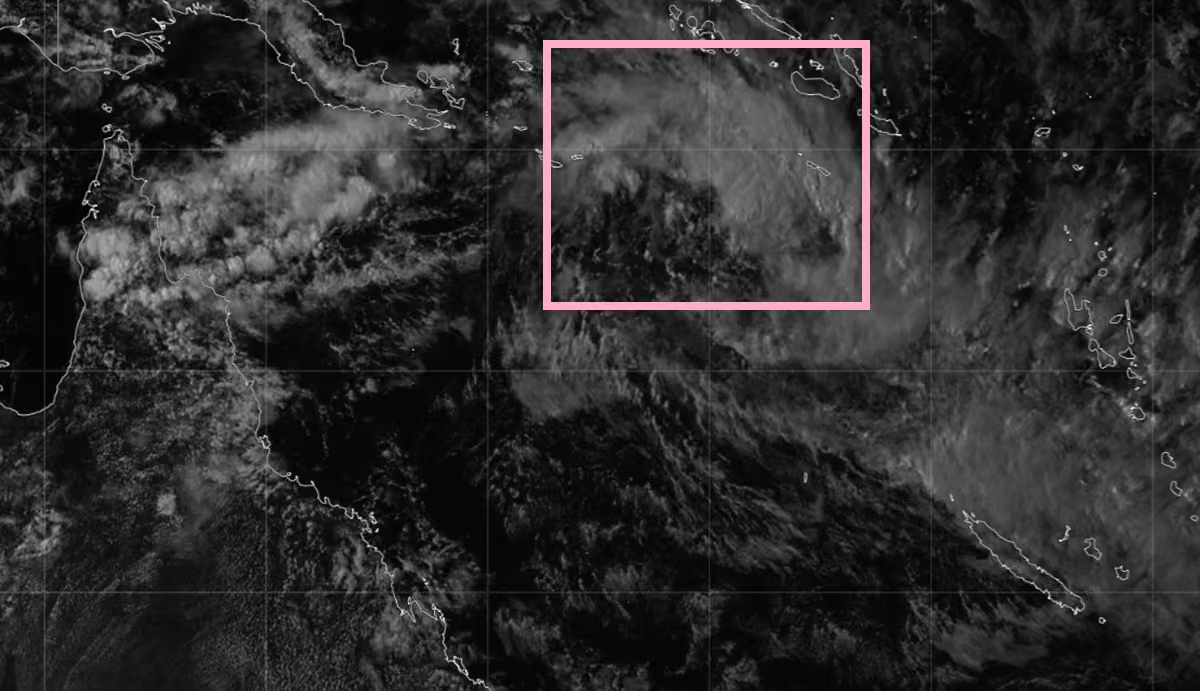 Josh Morgerman
@iCyclone
Lame storm. (Of course.) Wind 18 knots (lolz), rain 0.2 in (lolz). But some decent lightning & thunder. This land has been in the eye of a 150-knot, Cat-5 hurricane—but it can't manage a decent thunderstorm. I blame the Gulf (one block away).
Josh Morgerman
@iCyclone
3:20 am. Sitting on the porch rocker, listening to the thunder, smoking my pipe.
Josh Morgerman
@iCyclone
Another warned storm approaching the Bay. But don’t you worry about me: there’s a magic force field that prevents Hurricane House from getting any kind of even mildly sexy weather (besides hurricanes).
 Josh Morgerman
@iCyclone
Had to buy heavy whipping cream for a Cajun dish. The leftover cream is a dangerous drug. Just a spoonful sends me into a sort of rapture. And when I'm blue I might find myself wandering into the kitchen for a dose. One of the most exquisite things God has put on this earth.
Josh Morgerman reposted
Josh Morgerman
@iCyclone
Tracks of all known Category-5 #hurricane landfalls in North America, updated to include #melissa in #jamaica. This only includes storms that were Cat 5 at *landfall* (meaning when center crossed coast). Labor Day 1935, DORIAN 2019, & MELISSA 2025 are in 3-way tie for strongest.
 Josh Morgerman
@iCyclone
Tracks of all known Category-5 #hurricane landfalls in North America, updated to include #melissa in #jamaica. This only includes storms that were Cat 5 at *landfall* (meaning when center crossed coast). Labor Day 1935, DORIAN 2019, & MELISSA 2025 are in 3-way tie for strongest.
Josh Morgerman
@iCyclone
I am a hurricane dude. Through and through. I think in knots. I worship Cat 5s. If it doesn't have a tight core, don't even show it to me. #dealwithit
Josh Morgerman
@iCyclone
There was apparently mild damage around the Bay last night: a snapped tree, a wrecked garage door, lawn furniture blown into canals, power outages, etc. Peak gust at Hurricane House: 28 knots. 😃 My garbage cans got blown up the driveway & the porch swing knocked against the house. That's all. I tell you, my house is severe-weather repellent. Nothing happens here. Womp womp.
Josh Morgerman
@iCyclone
Performative outrage is definitely a thing in the chaser community. Want to make a name for yourself? Get out there. Chase hard. Push yourself. Score big. No one's gonna remember you for sitting on ya porch swing peck-peck-peckin' at others like a churchlady.
Josh Morgerman
@iCyclone
Big line of storms moving in. Tornado Warning just W of Bay Saint Louis. Radio broadcast interrupted with a report of a possible radar-indicated tornado near Slidell & Pearl River. Rushing to get home.
 Josh Morgerman
@iCyclone
Quiet, calm, humid, & warm in the Bay. After complete dormancy, the lawn is turning green again. The world seems volatile lately, and I'm grateful for my quiet corner of it.
 Josh Morgerman
@iCyclone
My friend, Dr. @Hal_Needham, pointed out SSTs in W Gulf—especially off TX, LA, & MS—are abnormally warm. We're likely to have El Niño during #hurricane season—which depresses Atlantic activity—but prematurely warm Gulf could help early-season naughtiness close to American shores.
 Josh Morgerman
@iCyclone
What always impresses me about the top runners is that they have such clean form—such smooth strides—that they don't look like they're running fast. But they're running *crazy* fast. For example, winner of L.A. Marathon ran at 5:01/mi pace. A dude ran Chicago at 4:36/mi pace!
Josh Morgerman
@iCyclone
What an intense finish to the L.A. Marathon. Just wow. It is so inspiring to see this kind of hardcore competitiveness. FUN FACT: I ran the L.A. Marathon in 1999, finishing in 3:02:57 and coming in about 220 out of 11K men.
 HARD FACTOR
@HardFactorNews
Holy shit what a finish to the LA marathon
Josh Morgerman
@iCyclone
Category-5 bitchiness betwen burger CEOs. Lol.
 EducatëdHillbilly™
@RobProvince
Ok… we had some “burger wars” in the 90’s but man these are way better.
 Josh Morgerman
@iCyclone
I've always been an enthusiastic cyclist. I use my bicycle to get around the Bay—to go into town, to meet friends, to do light errands. Now I am even more enthusiastic.
Josh Morgerman
@iCyclone
Grey but very warm day in the Bay. Spring is here. ♥️ I'm in between shoots & currently in Furry Bear Mode. I'll clean up & get all sleek again before my next shoot, in Tampa week after next—for an intense show about... Hurricane MELISSA.
 Josh Morgerman
@iCyclone
All this AI slop is actually increasing the value of what trusted, high-profile chasers do—because, for example, if you're looking at crazy-ass Cat-5 footage from me (or from another known, flesh-and-blood chaser), you know it's real.
Josh Morgerman
@iCyclone
Hat tip to the wife of @EarthUncutTV, who first helped me see it this way.
Josh Morgerman
@iCyclone
If someone screamed on a chase with me, industrial-strength duct tape would be placed over the responsible party's mouth, or they'd be let out on the side of the road. Rule No. 1 in chasing (real cyclones or even li'l twisty things): when it gets hairy, stay centered & zen.
Josh Morgerman
@iCyclone
Who's going to National Tropical Weather Conference? It's 8-11 April on South Padre Island, TX. This is my FAVORITE #hurricane conference. My presentation this year is gonna be intense: Hurricane MELISSA at Ground Zero. BE THERE. & come say hi. REGISTER: www.hurricanecenterlive.com
 Josh Morgerman
@iCyclone
I've been in the cores of six Category-5 #hurricanes and #typhoons—a world record. Three of them—HAIYAN, DORIAN, and MELISSA—were *high-end* Cat 5s. That means not just Cat 5, but crazy Cat 5.
And folks always ask me, which of these three titans "felt" the fiercest? Which was scariest? It's the most frequent question I get these days.
Here's my thoughts:
SUPER TYPHOON HAIYAN (2013)
Landfall intensity: 165 knots (190 mph/305 km/h)
My location: Tacloban City, Philippines
My location in the storm: In N eyewall, ~13 n mi (~24 km) N of landfall point
Comment: The Downtown area (where I was) got absolutely raked by HAIYAN's powerful right eyewall, with near-whiteout conditions and very heavy wind damage. *However*, a couple miles S of Downtown, the wind damage looked a little worse, with more palm trees snapped off mid-trunk and some spectacular structural failures. Therefore, I believe I was just a hair outside HAIYAN's radius of maximum winds (RMW).
HURRICANE DORIAN (2019)
Landfall intensity: 160 knots (185 mph/295 km/h)
My location: Marsh Harbour, Great Abaco Island, Bahamas
My location in the storm: Well inside eye, very near landfall point
Comment: This was a perfect, direct hit. I went through the RMW and into the calm, stadium eye. The wind had an incredible, full-on roar, and at the height of the storm, there was a complete whiteout. Wind damage was extreme, with complete defoliation, heavy structural damage, and cars thrown far and mangled.
HURRICANE MELISSA (2025)
Landfall intensity: 160 knots (185 mph/295 km/h)
My location: Crawford, St. Elizabeth Parish, Jamaica
My location in the storm: Just inside SE edge of eye, ~5 ni (~9 km) from exact center at its closest approach
Comment: This was likely a worst-case scenario for this location, because it got "right-front quadded"—meaning the strongest part of the inner-right eyewall nuked this location. The height of the storm brought a complete, 100% whiteout (in which even nearby objects became invisible) and a steady, piercing scream that drove some victims to cover their ears. Wind damage was spectacular, with complete defoliation and in some cases debarking, examples of paint blasted off of walls, all wood structures mowed down, almost all roofs torn off, and serious structural damage even to some concrete buildings.
And the winner is... MELISSA. I believe MELISSA was likely stronger than DORIAN but not quite as strong as HAIYAN. However, because of my location in the storm, I tasted MELISSA's absolute worst. MELISSA's winds are the fiercest I've personally witnessed—personally saw, personally heard, personally felt, personally survived.
 Josh Morgerman
@iCyclone
A weak, deformed tropical #cyclone is approaching #queensland #australia. It'll bring gusty winds and heavy rains to parts of the coast on Friday, but it shouldn't be a big deal.
 Josh Morgerman
@iCyclone
Oldie But Goodie. On a scale of 1 to 10, how sexy is this? 11? 12?
Josh Morgerman
@iCyclone
Watching Coral Sea mush pie with ultra-mild interest (Coral Sea has been so slow, even junk feels conversation-worthy.) Invest 91P will head SW & should reach Queensland near week's end. Computer models aren't excited but show some development, & it could reach coast as cyclone.
 Josh Morgerman
@iCyclone
In S Pacific, #cyclone #urmil is percolating between Vanuatu (yellow) & New Caledonia (pink). It'll accelerate SE into open ocean, & fortunately it'll be far from land before it strengthens much. But some of the southern islands of Vanuatu are going to see some rough weather.
 Josh Morgerman
@iCyclone
I've taken heat for not posting about sexy #cyclone #horacio. It's dissipated, but here it is at peak intensity over S Indian Ocean 3 days ago, when estimated winds of 140 knots made it 2026's first Cat 5! It stayed far from Reunion & Mauritius but got close to tiny Rodrigues.

Josh Morgerman reposted
Josh Morgerman
@iCyclone
The NHC released its *official* report on #hurricane #melissa. This incredible storm now sits at the very top of Atlantic hurricane history:
* Peak intensity was bumped up to 165 knots, tying it with ALLEN 1980 for highest wind speed in Atlantic hurricane database.
* Landfall intensity in #jamaica was kept at 160 knots, tying it with Labor Day 1935 (Florida) & DORIAN 2019 (Bahamas) for strongest landfall in Atlantic basin.
Penetrating this hurricane's eye & witnessing—feeling—its jaw-dropping power is something I'll never forget till the day I die. It was unlike any cyclone I've survived. I'm proud to have provided data, observations, damage surveys, & imagery to help this postanalysis.
 Josh Morgerman
@iCyclone
Folks have very strong reactions to being in a strong hurricane. And this drives them to make quantitative estimates that have no rational basis. I've seen survivors of LAURA, IDA, and IAN (all Cat 4s at landfall) *swear* they were in a Cat 5 because they "saw" Cat-5 winds. (I've been in 84 hurricanes and even I don't feel qualified to visually estimate wind speed.) And even when a storm is rated Cat 5 and the strongest landfall on record (!!), that won't satisfy everyone. For example, today a MELISSA survivor disagreed with the NHC analysis because she "saw zinc, trees and houses flying [at] way more than 300 kph [~185 mph]." It seems a storm's categorization—no matter how superlative—will always leave some survivors feeling dissatisfied, probably because a simple number, categorization, or scale rating can't do justice to their trauma. It's an interesting psychological phenomenon that I see again and after these big events.
Josh Morgerman
@iCyclone
Here's all known Category-5 #hurricane landfalls in North America since 1851, in order of estimated max sustained winds at moment of impact. #melissa in #jamaica is at the *top* (with the Labor Day Storm of 1935 & DORIAN 2019).
 Josh Morgerman
@iCyclone
The NHC released its *official* report on #hurricane #melissa. This incredible storm now sits at the very top of Atlantic hurricane history:
* Peak intensity was bumped up to 165 knots, tying it with ALLEN 1980 for highest wind speed in Atlantic hurricane database.
* Landfall intensity in #jamaica was kept at 160 knots, tying it with Labor Day 1935 (Florida) & DORIAN 2019 (Bahamas) for strongest landfall in Atlantic basin.
Penetrating this hurricane's eye & witnessing—feeling—its jaw-dropping power is something I'll never forget till the day I die. It was unlike any cyclone I've survived. I'm proud to have provided data, observations, damage surveys, & imagery to help this postanalysis.
Josh Morgerman
@iCyclone
LINK TO OFFICIAL REPORT: www.nhc.noaa.gov/data/tcr/AL132025_Melissa.pdf
Josh Morgerman
@iCyclone
Awesomeness. I continue to be inspired by the bravery, endurance, and determination of the #ukrainians in defending their country. They set an example for us all. 👊
 Empire State Building Observation Deck
@EmpireStateBldg
Tonight, I will shine yellow and blue in support of Ukraine. 🇺🇦
Josh Morgerman reposted
Josh Morgerman
@iCyclone
I've penetrated a record 84 #hurricane/#typhoon cores on the ground. Where's 85 gonna happen—in the Southern or Northern Hemisphere? And when am I gonna smash to 100 mark? Let's hear your estimates. (Sorry to interrupt all the snowtalk. Just wanted to inject some sexy weather talk into the nerdfest.)
 Josh Morgerman
@iCyclone
I've penetrated a record 84 #hurricane/#typhoon cores on the ground. Where's 85 gonna happen—in the Southern or Northern Hemisphere? And when am I gonna smash to 100 mark? Let's hear your estimates. (Sorry to interrupt all the snowtalk. Just wanted to inject some sexy weather talk into the nerdfest.)
Josh Morgerman
@iCyclone
Just got home from #ibs2026 in Orlando. Had a great time working with @JamesHardie team to showcase their incredible array of products—siding, trim, decking, pergolas—designed to make your home exterior gorgeous, climate-resistant, & #hurricane tough. 👊
 Josh Morgerman
@iCyclone
Gonna explain this here winter thing to ya.
Stormchasernick
@stormchasernick
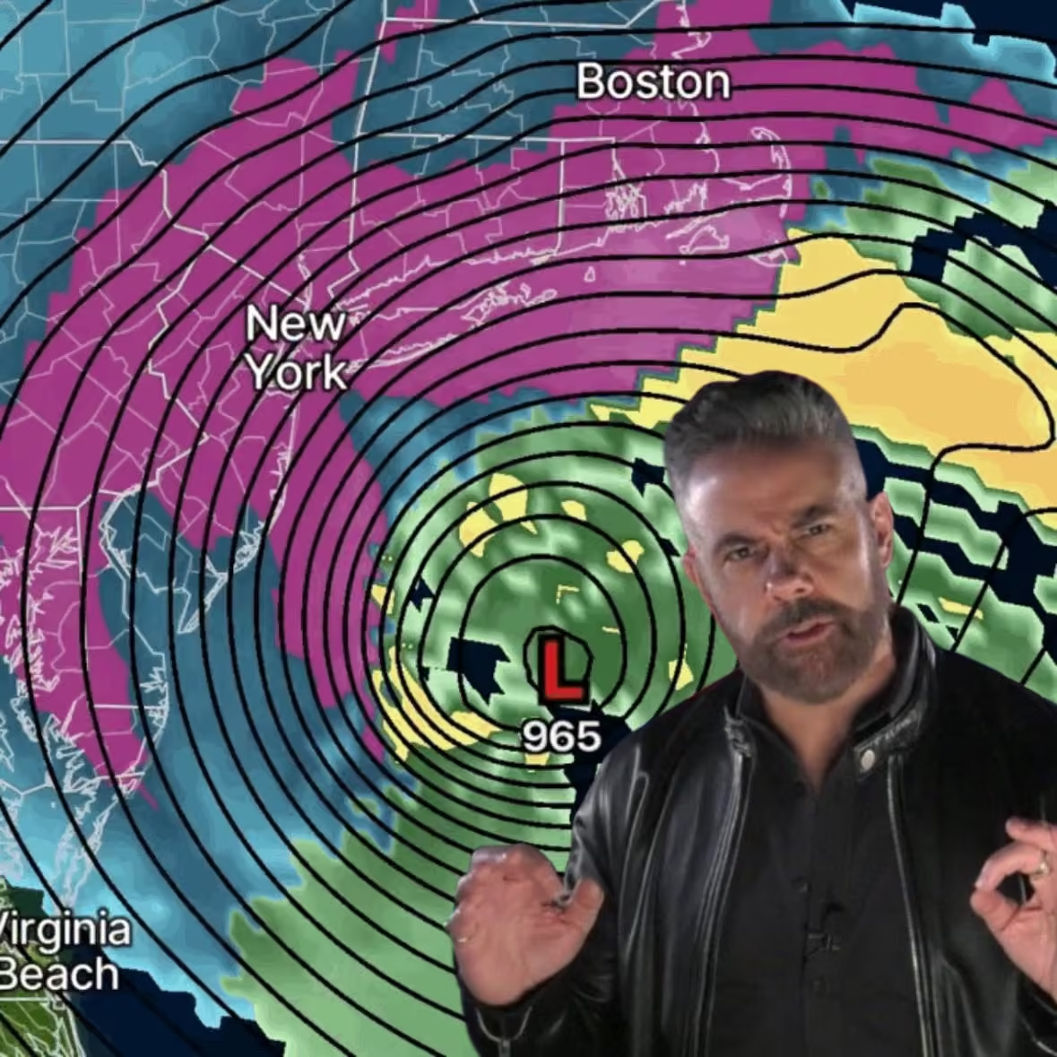 Josh Morgerman
@iCyclone
Hurricanes deserve names because hurricanes are majestic creations—meteorological royalty. It is buffoonery to name other kinds of weather—especially wintry slop. Thank you.
Josh Morgerman reposted
Josh Morgerman
@iCyclone
Stills from a shoot last week—for a new series of video shorts. The concept: epic #hurricane tales in tight, 7-minute episodes. Working title: #hurricanechronicles. These stills are from the IDA episode. Imagine what I brought for MELISSA. Coming soon to @WeatherNation.
 Josh Morgerman
@iCyclone
Stills from a shoot last week—for a new series of video shorts. The concept: epic #hurricane tales in tight, 7-minute episodes. Working title: #hurricanechronicles. These stills are from the IDA episode. Imagine what I brought for MELISSA. Coming soon to @WeatherNation.
Josh Morgerman
@iCyclone
Goodbye to my beloved Aunt Eileen. 💔 Thank you, Rabbi Sara Abrams, for the nice service.
Josh Morgerman
@iCyclone
That same storm that produced severe weather in Lake Charles passed through the New Orleans Metro area hours later. In Coastal Mississippi, it was no longer severe. The Campbell Scientific station at Hurricane House measured 2/3 of an inch of rain but basically no wind.
 Josh Morgerman
@iCyclone
Been on set shooting a new series of short videos. All I've had to eat all day are two pieces of candy. Getting hangry. Must find restaurant fast. Or no one's safe.
Josh Morgerman
@iCyclone
#cyclone #gezani making landfall literally right at Toamasina (pop. ~356K), #madagascar's main port, with estimated winds of 110 knots. This one is going to have serious economic impact, I fear.
 Josh Morgerman
@iCyclone
#cyclone #gezani is approaching #madagascar & strengthening. Center will cross near #toamasina (pop. ~326K), nation's main seaport, sometime Tuesday evening. Meteo France estimates winds of 85 knots (10-min), but predicts 95 knots by landfall. (JTWC estimates are similar.)

Josh Morgerman reposted
Josh Morgerman
@iCyclone
I dig country and I'm cool with some rap. But I'm sorry: combining the two is Cat-5 cringe. Hate it.
Josh Morgerman
@iCyclone
#cyclone #mitchell—equivalent to tropical storm—passed near North West Cape & is now skating down W coast of Western #australia. MITCHELL never really came together, but Legendre Island had sustained hurricane winds, & several coastal stations have had hurricane gusts.
 Josh Morgerman
@iCyclone
#cyclone #mitchell, equivalent to Cat-1 #hurricane, is approaching Western #australia. It's coming in at weird angle, so it's hard to pinpoint location & timing of landfall. Could be anywhere from Onslow to North West Cape Sunday. System looks lopsided but should strengthen.
 Josh Morgerman
@iCyclone
Since the presumed grownups aren't setting a good example, let me tell my young followers: racism is immoral. Celebrating racism is a great way to pigeonhole yourself as trashy, small, and insignificant. It is loser sh*t. I can't believe I have to say this, but here we are.
Josh Morgerman
@iCyclone
In Denver. For @chaser_summit. Ready connect, mingle, work it, and show a bunch o' pussycat tornado chasers a real storm. #melissa
 Josh Morgerman
@iCyclone
Struck up a conversation in Downtown Bay Saint Louis today—a fellow with a big dog. (Main topic: the cold, of course.) He asked what street I live on. When I told him, his face lit up. "Oh! You live near that stormchaser?" Hurricane Man is unrecognizable in his winter getup.
Josh Morgerman
@iCyclone
The edit function is buggy. Feels more like a hack job than thoughtfully considered functionality. For example, I edited a post (because it had a typo), and the accompanying pic disappeared.
Josh Morgerman
@iCyclone
Very cold in Bay Saint Louis #mississippi. Went down to 18.8F at Hurricane House this morning. Not a record low for the chaserdude's sacred space, but cold. Too cold for #mardigras, IMO.
 Josh Morgerman
@iCyclone
Stop comparing a coreless winter low to a hurricane. It is disrespectful to nature's ultimate creation. Just. Stop. Thx.
Josh Morgerman
@iCyclone
On Saturday, #cyclone #fytia made landfall on the NW coast of #madagascar with an estimated intensity of ~100 knots. Decent-looking system. This region is sparsely populated—however, there are a few small villages and settlements that no doubt got hammered hard.
 Josh Morgerman
@iCyclone
Going home. Sad to leave my cozy perch in Golfview Hotel in Mandeville #jamaica. Great for business & pleasure, it's my home away from home as I tell the MELISSA story. Cool trivia: Hotel is next to Manchester Club, est. 1865 & often cited as oldest golf course in W Hemisphere.
 Josh Morgerman
@iCyclone
A tiny vignette of normal life in a devastated city. Black River #jamaica three months after Cat-5 #hurricane #melissa
 Josh Morgerman
@iCyclone
Was in Black River #jamaica today—exactly 3 months after a Cat-5 #hurricane smashed this city with all its force. At dusk, a rainbow appeared over the devastated waterfront—like the universe was telling the city, "Don't give up. You got this." 👊 But it won't be easy. #melissa

Josh Morgerman reposted
WeatherNation
@WeatherNation
UPDATE: Our very own Josh Morgerman (@iCyclone) re-visited western Jamaica - which just three months ago was devastated by Hurricane Melissa, one of the most powerful hurricanes on record. Here is what he saw:
Josh Morgerman reposted
 Floyd Green
@floydgreenja
This should be interesting!
Josh Morgerman
@iCyclone
#jamaicans! Mawgaman is back! Golfview Hotel in Mandeville is hosting my "Fireside Chat" 6 pm TOMORROW (Tuesday). I'll be talking #hurricane #melissa—what happened & what we learned. I'll show an intense 7-min video, & I'll take questions, too. Excited to meet y'all. 👊
 Josh Morgerman
@iCyclone
See you TONIGHT! 😎 👊
Josh Morgerman
@iCyclone
#jamaicans! Mawgaman is back! Golfview Hotel in Mandeville is hosting my "Fireside Chat" 6 pm TOMORROW (Tuesday). I'll be talking #hurricane #melissa—what happened & what we learned. I'll show an intense 7-min video, & I'll take questions, too. Excited to meet y'all. 👊
Josh Morgerman
@iCyclone
Dawn at Golfview Hotel in Mandeville #jamaica. Newly renovated rooms, ultra-friendly staff, & delicious restaurant make it complete for this here chaserdude. And the place is equally suitable for leisure *and* business travelers. (Good for me, because most of my travel is both!)
 Josh Morgerman
@iCyclone
On Monday I returned to Crawford #jamaica—almost exactly three months after ferocious #hurricane #melissa smashed this place with the force of a nuclear bomb. It was a strange day—a mix of sunshine & storminess—& I came away with mixed emotions. The scars are deep & profound, & areas—especially around Galleon Beach—feel like a windswept ghost town. But there are signs of hope & rebirth everywhere... green returning to the wind-burnt hills, crews putting up power poles, the constant sound of hammering & building, a roadside shop with a brilliant new paint job... and many others. These people are survivors.
If you want to help them, see the donation link in the comments.


 Josh Morgerman
@iCyclone
To help MELISSA victims, DONATE here: supportjamaica.gov.jm
Josh Morgerman
@iCyclone
Awww, this sweet girl. ♥️ The mom was too shy to tell their story, so she had her more confident daughter explain what happened. These folks have already reroofed (wow!)—this time with ultra-tough concrete decking. Smart folks. 👊 The months after #hurricane #melissa in #jamaica
Josh Morgerman
@iCyclone
#jamaicans! Mawgaman is back! Golfview Hotel in Mandeville is hosting my "Fireside Chat" 6 pm TOMORROW (Tuesday). I'll be talking #hurricane #melissa—what happened & what we learned. I'll show an intense 7-min video, & I'll take questions, too. Excited to meet y'all. 👊
Josh Morgerman
@iCyclone
Back in Crawford #jamaica to check on my favorite tree. Brave soldier is still there—incredibly, given what it went through. Around town: green returning to the hills, crews putting up power poles, lots of blue tarps, & sounds of construction! Three month after Cat-5 #melissa.
 Josh Morgerman
@iCyclone
#cyclone #luana has made landfall on Dampier Peninsula in Kimberley region of Western #australia. Equivalent to moderate tropical storm. Main story is rain. Peak gusts so far: Koolan Island 52 knots, Lombadina 47 knots, Broome 35 knots, Derby 35 knots.
 Josh Morgerman
@iCyclone
#cyclone #luana is about to come ashore in the Kimberley region of Western #australia. System never really got it together—looks like scrambled eggs. Count this as a fail for seemingly indomitable Google DeepMind models, which were (incorrectly) aggressive with intensity.
 Josh Morgerman
@iCyclone
Some folks are talking about some snow and ice. Ok.
Josh Morgerman
@iCyclone
#cyclone seems to be brewing in Indian Ocean off Kimberley region of Western #australia. It's disorganized, so BOM & JTWC disagree on strength & even center location. But whatever it is will slosh ashore on Dampier Peninsula in ~24 hr. Expect messy conditions in Broome & Derby.
 Josh Morgerman
@iCyclone
Folks are asking me about the Southern US winter storm. No comment. This here chaserdude only talks hurricanes. Ain't got no time for nerd weather. Thx for understandin'.
Josh Morgerman
@iCyclone
Cuz some folks can't read: Bay Saint Louis #mississippi is not St. Louis #missouri. These are separate places—not connected in any way. Thx.
Josh Morgerman
@iCyclone
A disturbance (Invest 91S) is festering in Indian Ocean off Western Australia. It will move generally SE & should come ashore in ~48 hours. I'm not impressed with system's organization, but some models develop it, & there's a Cyclone Watch for much of Kimberley coast.
 Josh Morgerman
@iCyclone
Reliving the trauma of one year ago today. The cold crime. The icy desecration of sacred Hurricane House.
 Josh Morgerman
@iCyclone
One year ago today was this freak show on the US Gulf Coast. Sacred Hurricane House was desecrated by the cold white stuff—temporarily became Sneaux House. A day that will live in infamy. But I'm OK now. It helps to talk about it.
 Josh Morgerman
@iCyclone
Now that I have that moralizing out of the way, I can return to my usual topics: intense hurricanes, durable home siding, art photos of the Bay, & hawt selfies. 😎
Josh Morgerman
@iCyclone
This is called nihilism. It's not caring what's right or wrong. It's dismissing traditional morality-- things like "thou shalt not steal." It's jumping in with an insult and nothing more. As a society, we have got to get past this nihilism.
 Robert Fulton
Shut up fairy 😂
Josh Morgerman
@iCyclone
My mom and dad raised me not to steal, not to bully, and not to betray friends. The USA trying to take #greenland is all of these sins. It is immoral. I condemn it. And as an American, I am thankful for the friendship of #denmark and other Europeans.
 Josh Morgerman
@iCyclone
Invest 94P (aka Tropical Low 12U) is still festering in the Coral Sea. Computer models aren't excited about it, & it's unlikely to develop much as it passes W of #newcaledonia. However, it could bring spicy weather to #newzealand's North Island by midweek as a non-tropical low.
 Josh Morgerman
@iCyclone
CORRECTION: The BOM has labeled it Tropical Low 14U (not 12U).
Josh Morgerman
@iCyclone
Need more of this kind of energy during these really ugly times.
Josh Morgerman
@iCyclone
Jamaicans! Mawgaman is coming to town. Awesome Golfview Hotel in Mandeville is hosting "Fireside Chat" 6 pm Tue 27 January. I—along with community leaders—will be talking #hurricane #melissa—what happened, what we learned, & the way forward. Please come! I'd love to meet y'all.
 Josh Morgerman
@iCyclone
A lot of folks are asking about a live streaming option. I'll ask the organizers about it. But really, the best thing is to BE THERE. Real-life events are a great change of pace in the increasingly all-digital world we're living in. I look forward to meeting y'all in person. 👊
Josh Morgerman
@iCyclone
Quiet moment just before my epic, 11-day #melissa expedition to #jamaica—the longest, meanest, toughest chase of my career. I felt at the time like I was about to jump off a cliff—but little did I know how deep it would go or how dangerous it would be. Excited to return soon.
Josh Morgerman
@iCyclone
I admire this. And I do the same thing when I read. Self-betterment is always a worthy pursuit. 👊
 yoxic
@yoxics
Kai Cenat kept having to look up what certain words meant during his reading journey to become a better speaker 😭 x.com/TheClipBot/status/2011258917029101779/video/1
Josh Morgerman
@iCyclone
TS #nokaen (aka #adaph) is approaching #philippines. System is messy & unlikely to strengthen much, so winds shouldn’t be much of a problem. But up to 200 mm (~8 in) of rainfall could cause serious flooding. Main impacts will be in Samar & Bicol Region on Friday & over weekend.
 Josh Morgerman
@iCyclone
Latest thing I'm watching is this slowly developing low in the South Pacific—Invest 94P. The computer models are all over the place with this feature, but some develop it into a #cyclone and bring it near #newcaledonia in the next week. Worth keeping an eye on.
 Josh Morgerman
@iCyclone
Poor #cyclone #koji making landfall in #queensland—limping to the finish line, like that out-of-shape friend who completes the marathon after everyone's gone home & they've opened the route back up to traffic. I guess you clap politely? Give it a participation trophy?
 Josh Morgerman
@iCyclone
#cyclone #koji has formed in the Coral Sea—Cat 2 on the Oz scale, or what we call a low-end tropical storm in the N Hemisphere. It'll move S, crossing #queensland coast tomorrow. BOM warns of widespread flash flooding & hurricane-force gusts from Townsville to Airlie Beach.

Josh Morgerman reposted
 Sean Voysey
@seanvoysey
Top 6 chasers of 2025
I said 5, but I lied! As I said, criteria are intercepts and public contributions. In no order:
-Josh Morgerman @iCyclone: Mr Hurricane” provided historic and comprehensive coverage as Hurricane Melissa battered Jamaica. But more important was how he did it: while a few in the community were excoriated for paternalistic, imperialistic and exploitative takes, Josh used his platform to showcase the best of Jamaica. His posts were about communities and his host families, their kindness and generosity. Rather than be shamed online, he was gifted an amazing name: Mawgaman. Be like Mawgaman.
-Connor Croff @ChasingWConnor: I thought Connor was much older than he was based on his chasing IQ. Not only can he sniff out unique setups, but his ability to thread the needle on close intercepts is inimitable. He remains cool during tense situations. Connor intercepted most of the top tornadoes of the year, providing some of the best livestream moments. And then he went and released all of his intercepts in a four-hour long video, uncut and unedited. The lion does not concern himself with cheap edits, cheesy music and sappy narration.
-Paige Berdomas/Bryce Shelton @tornadopaigeyy @BryceShelton01: The Simon and Garfunkel of chasing, except they like each other! Paige and Bryce were omnipresent this season. Night wedge in Kansas? They’re there. Hurricane Melissa? On it. East coast storm surge? On the case in flood boots. Their stream is very personable, relatable and informative. No screaming, no showboating, just great chasing. Most important, they clearly want to help the communities that they visit. Can we all concede that they also gave us the best chasing photo of the year?
-Ben Williams @ben_williams_wx: As a novice/rookie chaser, I learned so much from Ben’s storm setup/walkthroughs. Many days when I was interested in a chase I thought “what’s Ben’s analysis?”. He breaks down setups and limiting factors with impressive clarity. He managed to find setups that no one was on. Ben was everywhere, finding tors from Texas to Canada. Moreover, his streams are a masterclass: great explanation of setups, smart tactical moves and void of screams and hyperbole. His Clear Lake Tornado coverage is some of the best tornado footage of the year.
-Matthew Cappucci @MatthewCappucci: Matthew’s public contributions are numerous: Aside from constantly giving excellent weather updates (seriously, when does this man sleep?) his ability to explain weather phenomena to the public is unparalleled. From Tornadoes to hurricanes to auroras, Matthew has enriched the public and elevated the chasing community. I have immense respect for how he highlights the communities he visits. His Plevna chase was, by far, the best tornado coverage of the season. Providing real time updates, informing the public, saving lives, collecting hail stones, Waffle House passport. What more could you ask?
-Dr. Reed Timmer @ReedTimmerUSA: There are no more words to explain how Dr. Timmer is the best chaser on the planet (of all time?). But amidst his honey badger level of insanity, it’s important to remember that he is one of the foremost authorities on tornadogenesis. I learned so much from his “live emergency updates” where he basically geeks out for twenty minutes about every model (where he discusses their flaws) and gives his rich analysis. For a rookie, it’s storm chaser college. Can I add that for my first tor of the year (Paul’s Valley) I watched him drive into the bloody thing? Never stop being a madman.
Honorable mention: Hank Schyma @PecosHank: Hank gave us some of the best Morton footage of the year. But his year was also quiet for an important reason: HE WROTE A BOOK. When I saw my nephew reading it, it brought me back to tearing through @Stormchaser excellent book. Thank you for your gift to the next generation, Hank. I can’t wait to see your Bob Ross-meets-Sam Elliot vibe on the road again.
#wx
Josh Morgerman
@iCyclone
This mess in the Coral Sea—Invest 92P—should come ashore this weekend in Queensland #australia as Cat-1 #cyclone (low-end TS). Cyclone Warning zone includes Cairns, Innisfail, Townsville, & Bowen. Gusts could reach 55 knots, but main threat is heavy rain in already soaked places
 Josh Morgerman
@iCyclone
Folks say "monetizing" like it's a dirty word. Like: "How dare you monetize this disaster?" Yes, of course I monetize my stormchasing. Of course. How did you think I funded my expeditions hunting cyclones around the globe? Secret trust fund? Sugardaddy? Magic?
Josh Morgerman
@iCyclone
ICYMI: Behold mighty #melissa in #jamaica. High-end Category 5. Possibly the most intense #hurricane to make landfall in North America. And the fiercest of all the hurricanes I've witnessed. WATCH: youtu.be/siq-DdmBUIY
 Josh Morgerman
@iCyclone
(Making this tweet because I needed a new pinned tweet for the top of my profile.)
Josh Morgerman
@iCyclone
Another thing: "introvert" does not mean "shy" or "socially awkward" or "dislikes socializing."
Josh Morgerman
@iCyclone
Truly bizarre question. I am an introvert. I love to sit at a cozy corner table in a downtown restaurant and just quietly eat and people watch. It's like my favorite thing. Why do I need company to do that?
 Raksha
@caraksha103
People who eat alone at restaurants… what’s the reason?
Josh Morgerman
@iCyclone
Truly bizarre question. I am an introvert. I love to sit at a cozy corner table in a downtown restaurant and just quietly eat and people watch. It's like my favorite thing. Why do I need company to do that?
Raksha
@caraksha103
People who eat alone at restaurants… what’s the reason?
Josh Morgerman
@iCyclone
Most models (global, hurricane, Google DeepMind) show the Coral Sea mess (Invest 92P) developing into some kind of #cyclone (likely TS-strength) before it reaches #queensland #australia coast this weekend, likely between Ingham & Bowen. Heavy rain will be main threat.
 Josh Morgerman
@iCyclone
I'm returning to #jamaica! I'll be there for three-month anniversary of mighty #hurricane #melissa. Goals: reconnecting with survivors, reporting on recovery, precisely measuring storm surge in Galleon Beach/Crawford, keeping story alive in TV/media, & encouraging donations.
 Josh Morgerman
@iCyclone
I'm really into sour cream. Like, sometimes it's hard for me to not just eat spoonfuls of it—like ice cream. (The only thing holding me back is the need to stay in Peak Chaserdude Condition at all times.)
Josh Morgerman
@iCyclone
Crazy cool.
 Curiosity
@MAstronomers
These boxes are static.
I repeat, these boxes are not moving.
x.com/i/status/1476088226427375617/video/1
Josh Morgerman
@iCyclone
Chill 15-mile bike ride around the Bay at dusk—to Clermont Harbor and back to Old Town Bay Saint Louis. Gulf very, very still. Unseasonably warm—almost muggy—complete with mosquitoes.


 Josh Morgerman
@iCyclone
Coral Sea is quiet right now. But for days, computer models have been hinting at #cyclone threat to Queensland #australia—with GFS & Google DeepMind being most aggressive. These models suggest threat to Qld in 6-10 days. Indicators are still uncertain—so for now, just stay aware
 Josh Morgerman
@iCyclone
Cozy winter vibes in the Bay. My crazy-ass lifestyle—a neverending series of dangerous expeditions around the globe—makes me treasure quiet nights at home.

 Josh Morgerman
@iCyclone
Wanna give thanks to my friend & neighbor, @Louisianafotos. Besides being great photographer, he works with wood. He surprised me with gorgeous handmade Mississippi clock. (Check the detail. You can make out Saint Louis Bay.) This is going in a special place in Hurricane House.
 Josh Morgerman
@iCyclone
One poignant note about this clock: It's made with wood from a home in Cameron Parish, Louisiana, that was destroyed by Hurricane LAURA. Rob salvaged wood from the site, & he uses it in various projects. So it's like the house lives on, resurrected in creations like this.
Josh Morgerman
@iCyclone
Downtown Bay Saint Louis #mississippi last night. #happynewyear, y'all.


 Josh Morgerman
@iCyclone
Happy New Year to my awesome followers across the US and around the globe. When I’m on tough, lonely expeditions—like Hurricane MELISSA—y’all inspire me to keep going and to chase harder. So, I want to thank you all from the bottom of my heart.
And I want to take this moment to express my solidarity with the Ukrainian people. The strength and endurance you show in defending yourselves and your land truly inspires me. May we all show such bravery when evil comes knocking on our doors.
Here’s to a peaceful and kind 2026.

Josh Morgerman reposted
 Storm Front Freaks Network
@stormfrontfreak
2025 Top 10 Podcast Episodes:
#10) HURRICANE OUTLOOK with @icyclone Josh Morgerman (237)
*24 hours before he leaves to chase Cat 5 MELISSA
I'm listening to Storm Front Freaks | HURRICANE OUTLOOK with Josh Morgerman (237), check it out! www.podbean.com/ei/pb-pzupp-18cdd64

Josh Morgerman reposted
Josh Morgerman
@iCyclone
Going to @chaser_summit? I'll be taking you with me as I hunt down the eye of Category-5 #melissa. My toughest chase in 30 years of hunting—cruel challenges, tough decisions, crazy data, wild emotions. And the fiercest #hurricane I've witnessed. February in Denver. BE THERE.
 Josh Morgerman
@iCyclone
#cyclone #hayley made landfall on the Dampier Peninsula of #australia around 5 pm Tuesday. The region is sparsely populated, but the small village of Lombadina/Djarindjin was in the cyclone's inner core & no doubt saw heavy conditions from this equivalent of a Cat-2 hurricane.
 Josh Morgerman
@iCyclone
In #australia, #cyclone #hayley is threatening the Kimberley. It'll make landfall late Tuesday night on Dampier Peninsula, likely as equivalent Cat-2 hurricane. Region is sparsely populated, but small communities of Ardyaloon, Beagle Bay, & Cockatoo Island could get direct hit.
 Josh Morgerman
@iCyclone
Going to @chaser_summit? I'll be taking you with me as I hunt down the eye of Category-5 #melissa. My toughest chase in 30 years of hunting—cruel challenges, tough decisions, crazy data, wild emotions. And the fiercest #hurricane I've witnessed. February in Denver. BE THERE.
Josh Morgerman
@iCyclone
REGISTER: www.chasersummit.org
Josh Morgerman
@iCyclone
Cruising through Downtown Gulfport, Mississippi, on a drab, grey sort of day. Dropped Hurricane Mom off at the airport; she's en route back to NYC.
Josh Morgerman
@iCyclone
Brilliant lmao.
Josh Morgerman
@iCyclone
The Sandman rudely photobombed us as we tried to take a quiet selfie on the beach in Pass Christian. Hurricane Mom left the excitement of NYC to enjoy a couple of quiet days with me in Mississippi. Happy Holidays to all. Merry Christmas to those who celebrate. 🎄🎅🕎⛄️
 Josh Morgerman
@iCyclone
After harrowing fall, I'm enjoying quiet December in Mississippi. Yesterday was strangely bewitching: the Gulf seemed to disappear into the fog. No horizon line, even. All my #melissa work (data, analysis, video) is done, thank God. My focus now: helping recovery. Part of my plan: returning to Ground Zero in #jamaica at three-month mark (late January) to reconnect with survivors & report on progress. Need to keep the story alive.


 Josh Morgerman
@iCyclone
P.S. "Harrowing fall" as in "harrowing autumn." I did not fall.
Josh Morgerman reposted
Josh Morgerman
@iCyclone
Finally, my video: Hurricane MELISSA at Ground Zero.
#melissa was the most epic chase of my career—and the most intense #hurricane I’ve witnessed. So, I gave it the grand, full-length documentary treatment. I was on the island of #jamaica for 10 days, and this video brings you with me through that whole odyssey—getting to the island, slowly closing in on my prey, nailing the core of this nuclear-grade Category 5, and then many days living in the aftermath. Instead of just doing highlights, I wanted to make something complete—something that has chase strategy (for chaserdudes), minute-by-minute footage of the storm’s progress (for meteorologists to analyze), high-octane eyewall footage (for adrenaline junkies), survivors’ tales (for those who want the personal angle), and extensive documentation of the aftermath in multiple towns (for those interested in societal impacts).
But, most of all, I hope this video serve as a useful historical document for Jamaicans—an up-close and detailed record of this truly cataclysmic event in their nation’s history.
Regarding MELISSA’s winds… I feel convinced these are the highest winds I’ve personally witnessed or filmed—or heard. (The screaming sound as the storm peaked was harsh and painful, driving the people with me to hold their ears.) Big shoutout to the tall, hearty palm in front of the hotel. It served as a wind meter, showing its relative speed and direction. Without that tree, the eyewall footage would have just looked like dense clouds blowing past an airplane window. That tree shows the POWER—the way it bends in the really big, scary gusts. Eventually, though, things get so crazy you can’t even see the tree—it just disappears into the screaming white void. These winds were truly fierce. They even took down concrete buildings—obliterating the entire second floor of the concrete building across the street from my hotel. God knows what velocities some of those especially screamy gusts reached—but I’m grateful I was in a solid structure with thick walls.
So… If you want to come on a tough chase with a veteran chaserdude, sit back and enjoy this video from the beginning. If you just want to see the storm, start at Chapter 4: The Approach. And if you want to cut straight to the chocolate cake without eating your dinner (like a child), go right to Chapter 5: The Cataclysm. That’s the eyewall.
There you have it. Video link in the comments!
 Josh Morgerman
@iCyclone
I'm convinced #hurricane #melissa's winds in #jamaica were the fiercest I've witnessed in 84 hurricanes. And this here is one of the highest gusts I filmed before it was 100% whiteout & you couldn't see anything. In this gust, the palm is bending so far the crown is below the railing. (I had to enhance the colors so you can see it, & I added arrows to help guide your eye.) This mega gust happens at 43:26 in my video. Soon after this, you couldn't really see anything—just a screaming wall of whiteness. Crazy-ass wind.
 Josh Morgerman
@iCyclone
VIDEO: youtu.be/siq-DdmBUIY
Josh Morgerman reposted
 Matt Lanza
@mattlanza
For non-mets that care about continued improvement in weather forecasting and modeling, speaking out about the NCAR situation is important. The NOAA issues earlier this year were troubling but budgetary. This is more sinister in nature. What you can do: agu.quorum.us/campaign/151565/
Josh Morgerman reposted
 Ryan Maue
@RyanWeather
We're almost a year into the Trump administration and nothing has been accomplished with U.S. weather research. Complete waste of time, zero vision or leadership, going backwards.
Extremely frustrating to see this disaster unfold in real-time.
 Russ Vought
@russvought
The National Science Foundation will be breaking up the National Center for Atmospheric Research (NCAR) in Boulder, Colorado. This facility is one of the largest sources of climate alarmism in the country. A comprehensive review is underway & any vital activities such as weather research will be moved to another entity or location. 👇
www.usatoday.com/story/news/politics/2025/12/16/trump-dis…
Josh Morgerman
@iCyclone
Finally, my video: Hurricane MELISSA at Ground Zero.
#melissa was the most epic chase of my career—and the most intense #hurricane I’ve witnessed. So, I gave it the grand, full-length documentary treatment. I was on the island of #jamaica for 10 days, and this video brings you with me through that whole odyssey—getting to the island, slowly closing in on my prey, nailing the core of this nuclear-grade Category 5, and then many days living in the aftermath. Instead of just doing highlights, I wanted to make something complete—something that has chase strategy (for chaserdudes), minute-by-minute footage of the storm’s progress (for meteorologists to analyze), high-octane eyewall footage (for adrenaline junkies), survivors’ tales (for those who want the personal angle), and extensive documentation of the aftermath in multiple towns (for those interested in societal impacts).
But, most of all, I hope this video serve as a useful historical document for Jamaicans—an up-close and detailed record of this truly cataclysmic event in their nation’s history.
Regarding MELISSA’s winds… I feel convinced these are the highest winds I’ve personally witnessed or filmed—or heard. (The screaming sound as the storm peaked was harsh and painful, driving the people with me to hold their ears.) Big shoutout to the tall, hearty palm in front of the hotel. It served as a wind meter, showing its relative speed and direction. Without that tree, the eyewall footage would have just looked like dense clouds blowing past an airplane window. That tree shows the POWER—the way it bends in the really big, scary gusts. Eventually, though, things get so crazy you can’t even see the tree—it just disappears into the screaming white void. These winds were truly fierce. They even took down concrete buildings—obliterating the entire second floor of the concrete building across the street from my hotel. God knows what velocities some of those especially screamy gusts reached—but I’m grateful I was in a solid structure with thick walls.
So… If you want to come on a tough chase with a veteran chaserdude, sit back and enjoy this video from the beginning. If you just want to see the storm, start at Chapter 4: The Approach. And if you want to cut straight to the chocolate cake without eating your dinner (like a child), go right to Chapter 5: The Cataclysm. That’s the eyewall.
There you have it. Video link in the comments!
Josh Morgerman
@iCyclone
WATCH the video: youtu.be/siq-DdmBUIY
Josh Morgerman
@iCyclone
Stormchasing for me is a way of life, a lifestyle, an obsession, and—yes—a profession. For me. I never gave two craps how anyone else classifies it, or how they feel about it. Do. Not. Care.
Josh Morgerman
@iCyclone
Took a break from video editing. Strolled down to the beach at 4am. Dead calm. The Gulf motionless, glassy, silent. Not even the sound of lapping waves. Still a city dude at heart, but I dig life in the Bay. The right place to recharge between dangerous expeditions. #mississippi
Josh Morgerman
@iCyclone
Tropical conveyor belt is sending yet another system toward #philippines. Tropical Depression #wilmaph will slowly cross Visayas over weekend. It's an ugly junk system—but, like other recent ones here, it's gonna dump heavy rain & cause widespread, possibly dangerous flooding.
 Josh Morgerman
@iCyclone
I've been getting heat about my #melissa video. Folks really want to see it. I get it. Just understand that I had to get the data & analysis work done first, & that stuff is time-consuming. Now I'm 100% focused on the video. Shooting for next Friday. Thanks for staying on me. 👊
 Josh Morgerman
@iCyclone
Weather nerds: Did any of y'all archive Grand Cayman radar images of Hurricane MELISSA as it made landfall in Jamaica-- like this one? If so, please share. Thanks! P.S. I am *only* asking for Grand Cayman radar. No need to share anything else.
 Josh Morgerman
@iCyclone
UPDATE: @fathercay from CINWS responded, and he's digging up the images. Thanks, everyone. 👊
Josh Morgerman
@iCyclone
Just released FINAL version of my #melissa report. Has 2 new sections: 1) RADAR TRACK & ANALYSIS has detailed landfall track & diagrams based on exhaustive frame-by-frame analysis of radar imagery; 2) DAMAGE has over 75 pics! Link in comments. My only focus now: the video!

 Josh Morgerman
@iCyclone
FINAL Report: www.icyclone.com/s/iCyclone_Chase_Report_MELISSA2025_FINA…
Josh Morgerman reposted
WeatherNation
@WeatherNation
SEASON WRAP: The 2025 Hurricane Season was unique to say the least.
We spoke with @iCyclone to get his perspective on this unusual season, and how you can help those hit the hardest by Hurricane Melissa. 🇯🇲
WATCH: youtu.be/wK7Ad3Kq3gE
Josh Morgerman
@iCyclone
This has been moved up to 12:20 pm EST/11:20 am CST.
Josh Morgerman
@iCyclone
Recovery from Cat-5 #hurricane #melissa will take years. The destruction defies description. Want to pitch in? Catch me on @WeatherNation at 12:40pm ET/11:40am CT Tuesday. I'll talk about where things are & how you can help—& my plan to return to #jamaica to keep the story alive
 Josh Morgerman
@iCyclone
Recovery from Cat-5 #hurricane #melissa will take years. The destruction defies description. Want to pitch in? Catch me on @WeatherNation at 12:40pm ET/11:40am CT Tuesday. I'll talk about where things are & how you can help—& my plan to return to #jamaica to keep the story alive
Josh Morgerman
@iCyclone
In the meantime, you can make donations here: supportjamaica.gov.jm
Josh Morgerman
@iCyclone
It's raining in Bay Saint Louis #mississippi. I forgot that it can actually rain here.
Josh Morgerman
@iCyclone
Cold day in Franklin #tennessee. Heading home in the morning; will be back on the #mississippi Gulf Coast by evening. Dinner plans with a guest from the National Hurricane Center.

Josh Morgerman reposted
Josh Morgerman
@iCyclone
I'll be returning to @chaser_summit this February in Denver! Because this story must be told: Cat-5 #hurricane #melissa's landfall in Jamaica. I was at Ground Zero—deep in the jaws of this beast as it came screaming in off the Caribbean. And I'll tell the whole story. BE THERE.
 Josh Morgerman
@iCyclone
I'll be returning to @chaser_summit this February in Denver! Because this story must be told: Cat-5 #hurricane #melissa's landfall in Jamaica. I was at Ground Zero—deep in the jaws of this beast as it came screaming in off the Caribbean. And I'll tell the whole story. BE THERE.
Josh Morgerman
@iCyclone
REGISTER: www.chasersummit.org
Josh Morgerman reposted
Josh Morgerman
@iCyclone
My analysis of #hurricane #melissa's landfall in #jamaica.
This is the product of a painstaking (& tedious) frame-by-frame analysis of radar from Pilon, Cuba; my surface observations; a couple of eyewitness accounts & pics; & my survey of the aftermath. A few points:
* My track is quite different than the NHC's operational track—puts landfall about 45 minutes later & brings center much further E after landfall—but it makes much better sense when compared with my data. (The timing of my minimum pressure was weirdly late in relation to NHC's operational track, whereas it makes perfect sense in relation to this radar-derived track.)
* Analyzed landfall is New Hope at 12:45 pm EST (1:45 pm EDT/1745Z).
* I thought it was useful to delineate between the eye (apparently ~10 n mi wide, with light rain & reduced winds) & the small clear area near the center, so both are indicated. My location was apparently just inside the eye but missed the "clear area" (where the lowest pressures most certainly occurred) by ~4 n mi.
* The hurricane's structure was dynamic & evolving as it came ashore. The dimensions & locations of structural features (eyewall, eye, clear area) are based on the 1740Z radar image, which was the closest frame to landfall. (I've included it for reference.)
OK, I am done with the meteorological analysis of this storm. Next... THE VIDEO. Comin' soon! (I know that is what everyone really wants to see.)
 Josh Morgerman
@iCyclone
Latenight driving, how I love thee.
Josh Morgerman
@iCyclone
#cyclone #fina is looking better than it ever has, showing off a compact, nicely formed core as it crosses the Joseph Bonaparte Gulf en route to landfall in the Kimberley. Fortunately, the threatened region is sparsely populated. But the Berkeley River Lodge is in for a show!
 Josh Morgerman
@iCyclone
My analysis of #hurricane #melissa's landfall in #jamaica.
This is the product of a painstaking (& tedious) frame-by-frame analysis of radar from Pilon, Cuba; my surface observations; a couple of eyewitness accounts & pics; & my survey of the aftermath. A few points:
* My track is quite different than the NHC's operational track—puts landfall about 45 minutes later & brings center much further E after landfall—but it makes much better sense when compared with my data. (The timing of my minimum pressure was weirdly late in relation to NHC's operational track, whereas it makes perfect sense in relation to this radar-derived track.)
* Analyzed landfall is New Hope at 12:45 pm EST (1:45 pm EDT/1745Z).
* I thought it was useful to delineate between the eye (apparently ~10 n mi wide, with light rain & reduced winds) & the small clear area near the center, so both are indicated. My location was apparently just inside the eye but missed the "clear area" (where the lowest pressures most certainly occurred) by ~4 n mi.
* The hurricane's structure was dynamic & evolving as it came ashore. The dimensions & locations of structural features (eyewall, eye, clear area) are based on the 1740Z radar image, which was the closest frame to landfall. (I've included it for reference.)
OK, I am done with the meteorological analysis of this storm. Next... THE VIDEO. Comin' soon! (I know that is what everyone really wants to see.)
Josh Morgerman
@iCyclone
Wow! #cyclone #fina is looking much better (after going through an ugly phase)—now equivalent to Cat-1 hurricane. It'll move SW, making closest approach to #darwin tomorrow (Sat) night. City is likely to be in the core of hurricane winds. Complete preparations ASAP. #australia
 Josh Morgerman
@iCyclone
Dense fog in Bay Saint Louis, Mississippi, this morning. Very quiet around town. Summer a distant memory.
 Josh Morgerman
@iCyclone
#cyclone #fina threatens #australia's Top End. It's currently just shy of #hurricane intensity & strengthening; core now visible on radar. Forecasts from BOM & JTWC both show core of destructive winds over #darwin Saturday night. (JTWC shows 70-knot hurricane.) Time to prepare.
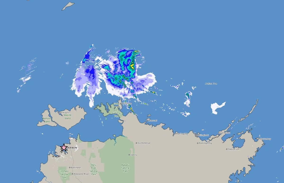 Josh Morgerman
@iCyclone
CONFIRMED: dropsonde in #hurricane #melissa measured incredible gust to 219 knots as it approached #jamaica. Smashes old record set by Typhoon MEGI(2010). While not surface wind, it supports belief that MELISSA was truly historic. I feel honored to have penetrated & measured it.
 Josh Morgerman
@iCyclone
By the way: 219 knots = 252 mph = 406 km/h = 113 m/s
Josh Morgerman
@iCyclone
Oh, here's the full article, which gives the details of how the recon folks took this incredible measurement: news.ucar.edu/133047/record-breaking-winds-confirmed-hurr…
Josh Morgerman
@iCyclone
That's some crazy-ass winds right there. And I'll tell ya, they felt crazy-ass on the ground in that inner right eyewall as this monster came screaming ashore. #hurruicane #melissa #jamaica
Andy Hazelton
@AndyHazelton
Sounds like there's some level of verification now that the dropsonde I processed on the Melissa flight on 10/28 right before landfall is now the strongest wind ever recorded by a dropsonde.
Here's a picture I took of the ASPEN (dropsonde processing software we use to QC the data on the plane) screen. I usually set my axis limit to 100 m/s (about 224 mph) and only in the most extreme cases (like Beryl) has it ever even gotten close to that. In this case 100 m/s wasn't nearly enough.
Based on where we dropped this sonde, I knew it was likely to have some extreme low-level winds as it rotated into the eastern eyewall, but I didn't imagine over 250 mph just 250 meters above the surface.
news.ucar.edu/133047/record-breaking-winds-confirmed-hurr…
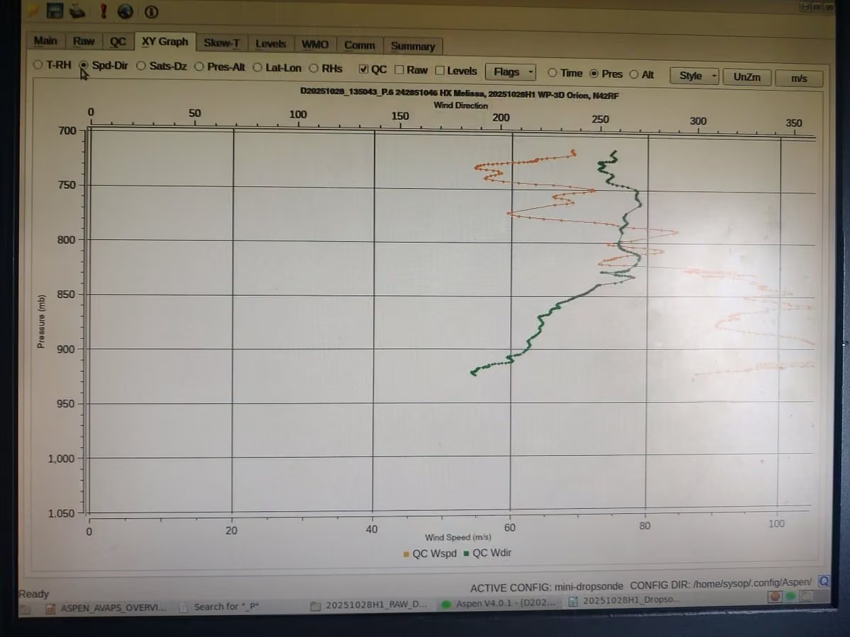 Josh Morgerman
@iCyclone
Dawn reveals new #cyclone #fina to N of Tiwi Islands. It'll strengthen as it makes U-turn in Arafura Sea. By late Fri, it'll be skirting along N shores of Top End. Forecasts bring cyclone's center near #darwin over weekend, but only as TS due to weakening from land interaction.

Josh Morgerman reposted
Josh Morgerman
@iCyclone
And here's my report on #hurricane #melissa in #jamaica. Please note this is purely meteorological & it's quite technical—so casual readers focused on the human impact won't find it interesting. Meteorologists & weather nerds, on the other hand, will find this rare look deep inside the core of one of the strongest known hurricane landfalls fascinating. Main points:
* My location was well inside the RMW (radius of maximum winds) & got totally raked by the eyewall’s inner right-front quadrant.
* The SE edge of the eye apparently grazed my location, temporarily bringing reduced wind speeds, improved visibility, and a marked shift in wind direction.
* My minimum pressure was 926.0 mb. While this might seem high, the report discusses how it actually makes sense, given recon data & the fact that I was probably a few miles from the absolute center.
* MELISSA's winds were absolutely ferocious—the most intense I've witnessed in 84 hurricanes. And the resultant damage was spectacular. This was a truly rare specimen.
This is a preliminary version of this report which I rushed to completion because of time-sensitive requests for the data. In the next couple of weeks, I'll be releasing an expanded version with plentiful damage pics.
My next focus: the video! I am hoping to get that out in the next 1-2 weeks.
The link to the report is in the comments!


 Josh Morgerman
@iCyclone
It's super-early in #australia #cyclone season & we already have an intriguing specimen. Invest 97S is N of Tiwi Islands. Models broadly suggest S motion followed by W turn—possibly into Northern Territory. HAFS-A is aggressive on intensity. Darwin should keep an eye on it.
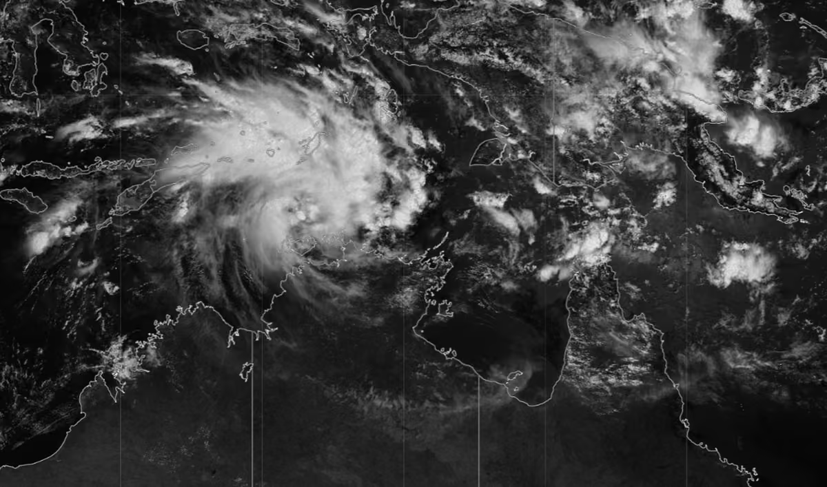 Josh Morgerman
@iCyclone
And here's my report on #hurricane #melissa in #jamaica. Please note this is purely meteorological & it's quite technical—so casual readers focused on the human impact won't find it interesting. Meteorologists & weather nerds, on the other hand, will find this rare look deep inside the core of one of the strongest known hurricane landfalls fascinating. Main points:
* My location was well inside the RMW (radius of maximum winds) & got totally raked by the eyewall’s inner right-front quadrant.
* The SE edge of the eye apparently grazed my location, temporarily bringing reduced wind speeds, improved visibility, and a marked shift in wind direction.
* My minimum pressure was 926.0 mb. While this might seem high, the report discusses how it actually makes sense, given recon data & the fact that I was probably a few miles from the absolute center.
* MELISSA's winds were absolutely ferocious—the most intense I've witnessed in 84 hurricanes. And the resultant damage was spectacular. This was a truly rare specimen.
This is a preliminary version of this report which I rushed to completion because of time-sensitive requests for the data. In the next couple of weeks, I'll be releasing an expanded version with plentiful damage pics.
My next focus: the video! I am hoping to get that out in the next 1-2 weeks.
The link to the report is in the comments!
Josh Morgerman
@iCyclone
REPORT: www.icyclone.com/s/iCyclone_Chase_Report_MELISSA2025.pdf
Josh Morgerman
@iCyclone
Welcome to my weekend. I'm back home. My first task is documenting what happened in #hurricane #melissa. That means compiling my data & reviewing my footage, clip by clip, to create an impact chronology. I'm rushing to get this to the NHC—they're already doing postanalysis, & any data from the inner core are highly valued. I'll release a preliminary report, with pressure data (which everyone's been asking about), Monday. 👊
 Josh Morgerman
@iCyclone
P.S. That noble palm tree out in front of the hotel has proved *extremely* valuable for determining wind direction—when it was visible. (Deep in the eyewall, the whiteout was so total you couldn't see the tree or anything else.)
Josh Morgerman
@iCyclone
As I head back to North America, my focus returns to the incredible #hurricane #melissa in #jamaica.
Penetrating the radius of maximum winds of this Category-5 buzz saw left me shellshocked. And I haven't had time to fully process it. But my mind keeps going back to it, obsessively—deep into the cyclone's inner core: the white void swallowing up the hotel, the painful screaming sound, the throbbing ears, the rattling door, the incredible motion & energy of it.
And I keep going back to the incredible tales of survival—so many. Damaine was at home (just down the street from my hotel) when his house exploded in the fierce winds—literally blew apart around him. He barely escaped to his cousin's concrete shop next door. Once inside he felt safe—until the screaming winds crashed through the door. He survive crouched in the back, behind feed supplies. All that's left of his house: a concrete slab surrounded by sticks that used to be green trees. Damaine's is one of thousands of such stories. The wind damage from MELISSA is perhaps the most extreme I've seen in 35 years of chasing.
There's so much I need to do with this one: analyze the data, create the video, & use my voice & my platform to aid recovery. I'm feeling almost overwhelmed by the task at hand. How do I do this one justice?


 Josh Morgerman
@iCyclone
Once in a blue moon, we end up in the same city on the same night. And it's always great therapy—a chance to catch up, trade notes, share techniques, & talk freely about the ups & downs of global cyclone chasing. Thanks, @EarthUncutTV, for your friendship all these years. 👊

Josh Morgerman reposted
Jordan Hall
@JordanHallWX
NEW ANGLE:
Watch as storm surge SLAMS into La Sunshine Beach Resort almost wiping me off my feet. Water splashed over the second and third floor coming down the stairs with brunt force. You can see me clench onto the railing at the last second. Very scary
@MyRadarWX @OreboundImages
#typhoon #fungwong #uwanph
Josh Morgerman
@iCyclone
Folks ask why I chase. It used to be for adrenaline. Now it's for ground truth—data. My biggest thrill now: helping science by measuring hurricanes hitting remote, hard-to-reach places. NHC just released their ERICK report; my data were all there was in the direct-impact zone.
 Josh Morgerman
@iCyclone
P.S. I collected a lot of high-quality in data inside the inner core of historic #hurricane #melissa in #jamaica. I'll be publishing these soon.
Josh Morgerman
@iCyclone
This made me happy. ♥️
 Dervin Saint Paul
@ThaDervster
My moringa tree, 2 weeks after Melissa.
Trees have a beautiful way of teaching resilience and determination.

 Josh Morgerman
@iCyclone
On Monday I returned to Metro Manila & said farewell to my driver, Gil. We've been working together, on & off, since the filming of my TV series "Hurricane Man" in 2018. Gil is rock-solid, reliable, & a great teammate on these tough expeditions. Thank you, Gil. 👊
 Josh Morgerman
@iCyclone
I'm pleased to report #typhoon #fungwong inflicted relatively light damage in Baler #philippines. Although we were in the left eyewall, it seems orographic factors kept winds from getting too strong in the city—so wind damage was mostly torn tree limbs. But storm surge & powerful waves smashed concrete railing, broke windows & doors, flooded seaside hotels, & left some streets under mud & debris. And the coastal highway N of the city has been badly torn up. Even so, the mood at the hotel was light this morning, with folks sharing stories. All in all, a better outcome for Baler than I was expecting. ♥️


Josh Morgerman reposted
James Reynolds
@EarthUncutTV
More scenes of destruction along the coast north of Baler - battering waves and storm surge destroyed anything near the water #typhoon #uwanph #fungwong
Josh Morgerman
@iCyclone
Lying in bed, eating Pringles in the dark, listening to the wind. That is the right way to end this day.
Josh Morgerman
@iCyclone
Crashing waves & thrashing palms as #typhoon #fungwong passes through Baler #philippines.
Josh Morgerman
@iCyclone
#typhoon #fungwong in Baler #philippines. We’re in the left eyewall & strongest winds have been blowing offshore.
Josh Morgerman
@iCyclone
Boom! No wind yet, but the sea is getting angry & aggressive. A tremendous wave just crashed over the seawall and into the hotel's restaurant. Tonight's gonna get hairy in Baler. #typhoon #fungwong #philippines
Josh Morgerman
@iCyclone
Portrait of a chaserdude and his very best friend. ♥️
 Josh Morgerman
@iCyclone
Another view of that wave body-slamming me. Great shot, @EarthUncutTV. 👊
James Reynolds
@EarthUncutTV
Huge weight behind some of these waves smashing into the waterfront in Baler, these will continue to get bigger and heavier as the day progresses and #typhoon #uwanph Fung-wong gets closer - @icyclone getting a front row view down there
Josh Morgerman
@iCyclone
A wave got me. Crashed up over the seawall & threw me against the patio railing, then penetrated deep into the hotel restaurant. I'm ok—just scratches & bruises. A good lesson about respecting the power of water! (Watch to the end.) #typhoon #fungwong in #philippines
Josh Morgerman
@iCyclone
Latest thoughts from Baler #philippines as #typhoon #fungwong closes in.
Josh Morgerman
@iCyclone
My location right on the waterfront in Baler #philippines is kind of dicey—I think there's gonna be major storm surge issues here—but it's a spectacular front-row seat for observing, documenting, & measuring #typhoon #fungwong as it comes roaring in off the Pacific tonight.
 Josh Morgerman
@iCyclone
Starting to have storm surge concerns as #typhoon #fungwong approaches Baler #philippines. It's possible the ocean might top this seawall, wash over the promenade, & crash into these seaside hotels. Like mine.
Josh Morgerman
@iCyclone
Waves starting to crash up against the seawall in Baler #philippines. If the storm stays on its present course, #typhoon #fungwong will have an intense impact here this evening.
Josh Morgerman
@iCyclone
Still in Baler #philippines. For right now, it makes sense to stay put here. The storm is coming this general direction. Chasing #typhoon #fungwong
Josh Morgerman reposted
 NOAA's Ocean Service
@noaaocean
Flights over the area affected by Hurricane Melissa have concluded. After just over 55 flight hours we were able to cover 4,075 square kilometers. Imagery from all flights is available here (select layers in the upper right to select specific flights or view MAXAR imagery):
 Josh Morgerman
@iCyclone
Deserted streets of Baler. Deathly calm. Air heavy, thick, magical. #typhoon #fungwong is coming. #philippines
 Josh Morgerman
@iCyclone
#typhoon #fungwong is closing in on #philippines. It's been gradually strengthening & is starting to look more symmetric—& dangerous. I'm still on the waterfront in Baler (star). Gonna decide next steps in the morning. For now, I'm right where I want to be. Gorgeous night here.
 Josh Morgerman
@iCyclone
Folks have asked how FUNG-WONG compares with Hurricane #melissa. Right now there is no comparison. MELISSA was incredible—a record-smashing cyclone & jaw-dropping display of raw destructive power I've seldom—if ever—witnessed. FUNG-WONG is a normal typhoon—dangerous & potentially destructive, but normal. Let's hope it stays that way.
Josh Morgerman
@iCyclone
In Baler #philippines for the night. Waterfront hotel. Warm, breezy, just right. Treasuring this moment of calm in the midst of a terrifying two weeks. #typhoon #fungwong lurks offshore. I'll resume chasing it in the morning. No decision yet on where I'll ride out the storm.
 Josh Morgerman
@iCyclone
Crossed into Aurora Province a little while ago. Probably gonna spend the night in Baler & figure out my chase location tomorrow. As always, I won't make any decision until the very last minute. Too early to commit. Chasing #typhoon #fungwong #philippines
 Josh Morgerman
@iCyclone
#hurricane #melissa's impact in #jamaica was cataclysmic from so many angles: humanitarian, meteorological, personal, emotional. While I'm now in Asia hunting a typhoon, I'll be returning to MELISSA. It will be my main focus for a while. So much to analyze, so many ways to help.
 Josh Morgerman
@iCyclone
Just landed in Manila #philippines. Friday night here. Gonna crash for a few hours, then head N at the crack of dawn to hunt #typhoon #fungwong. Could be a beast. Still exhausted from #melissa—but this is the time of year when I've got to bite the bullet & keep going. Go go go.
 Josh Morgerman
@iCyclone
Home. A beautiful sight for these tired eyes. I live a life that's crazy—on the edge. So I built this house to be the opposite: calm, quiet, staid. Gonna hole up in these walls for a couple of days & recharge. Need to. Another tough expedition is brewing—one much further away.
 Josh Morgerman
@iCyclone
P.S. my work on #hurricane #melissa—telling the story, analyzing it meteorologically, raising awareness, & (most importantly) doing my part to help get international aid flowing—is just beginning. I'm going be on this one for the long haul.
Josh Morgerman
@iCyclone
Yes, I'm weird.
Josh Morgerman reposted
 David Magee
@sfslickdawg
Now it is complete. 😂

Josh Morgerman reposted
WeatherNation
@WeatherNation
From floating on styrofoam to hiding under a piece of metal, harrowing stories of survival are coming out of Jamaica after Hurricane Melissa.
We spoke with @icyclone as he recounts some of the wildest stories he encountered while on the island. 🔽🔽
youtu.be/jAiTJBqhCyo
Josh Morgerman
@iCyclone
Young man doing his laundry at a natural spring faucet outside our wrecked hotel. I saw so many quiet moments like this in #hurricane #melissa's aftermath: victims creating normalcy with the little things—clean clothes, a swept walkway, a cup of tea, a hot meal. #jamaica
 Josh Morgerman
@iCyclone
One indicator of truly extreme #hurricane winds: the debarking of trees. Here are apparent examples from New Hope, Crawford, & Black River #jamaica—three towns that were inside Cat-5 #melissa's violent core.


 Josh Morgerman
@iCyclone
If y'all want to follow @EarthUncutTV's #typhoon #kalmaegi chase in real time, check out his livestream: www.youtube.com/live/rCWY3gYRqT8
Josh Morgerman
@iCyclone
The typhoon king is in the Philippines hunting #typhoon #kalmaegi. The storm is intensifying right up to landfall! The eye just cleared out on IR imagery. Landfall very soon.
James Reynolds
@EarthUncutTV
A quick update from Abuyog, Leyte - we’re likely to stay here to cover #typhoon #tinoph / #kalmaegi landfall - power in town is out running on generators in our area
Josh Morgerman
@iCyclone
I was in devastated Black River #jamaica last night (in search of a new wheel for my car). The city is a shocking sight. But I'm happy to report the situation was under control: police & military all over; aid trucks everywhere giving out food, water, & care packages; mobile clinic folks tending to medical needs; & bulldozers already clearing the downtown area. Most importantly, the prevailing mood was calm. Residents seemed to have their hands full with supplies. Jamaica is going to need international help to fix this situation. But they've taken aggressive first steps on their own. 👊 #hurricane #melissa


 Josh Morgerman
@iCyclone
Want to honor this noble tree. It withstood the wrath of Cat-5 #hurricane #melissa's inner-core winds. As the screaming white void swallowed up the town & started tearing the hotel apart, the tree danced & twisted obscenely. But it held on. Never gave up. I'm so in love with it.
 Josh Morgerman
@iCyclone
Made it to Kingston today. Hadn't showered in a week. Shampoo & scalding hot water—friends from the distant past. Enjoyed great food from some fellows cooking along the side of the highway just outside #hurricane #melissa's direct-hit zone. Real good stuff. 👊


Josh Morgerman reposted
James Reynolds
@EarthUncutTV
“Not sure when I’ll be home,” is never the ideal farewell to my wife & kids. Starting the long trek south with a 2hr train to Tokyo then on to Narita airport. I’m concerned TS Kalmaegi could become a strong typhoon. Then maybe another after it. One step at time - Manila tonight
 Josh Morgerman
@iCyclone
"Just want you to know we're OK but we lost everything. No house. No nothing." Overheard at a popup WiFi lounge on the side of the highway in Crawford #jamaica. She was switching between English & Patois, but I understood that part. She said it so calmly. #hurricane #melissa
 Josh Morgerman
@iCyclone
The terrific force of a Cat 5. #hurricane #melissa's winds and storm threw a boat, car, & building together in a brutal mashup. This is in the Galleon Beach neighborhood of Crawford #jamaica.
 Josh Morgerman
@iCyclone
Princess Watson of Crawford #jamaica stands atop the ruins of her home and business, Princess Watson Grocery Store. Like so many residents and small-business owners here, she's going to need fast help getting back on her feet and making her business self-sustaining again. After many concersations here today, I'm wishing there was a way for folks to make targeted donations directly to folks in need. #hurricane #melissa
 Josh Morgerman
@iCyclone
Day 3 after #hurricane #melissa started with a gorgeous sunrise—one that cast cruel light on the devastated landscape in Crawford #jamaica.


 Josh Morgerman
@iCyclone
Does anyone know who this person is or why he's copying my content?
Josh Morgerman
@iCyclone
I listened to so many inspiring tales of survival in Crawford #jamaica today. The common threat: everyday people doing their best in an insane situation: the core of Cat-5 #hurricane #melissa.
* Keith ("Benji") Carey survived the storm surge in a tiny cement building on the waterfront, basically at sea level (!!!) in Gallon Beach. He did it by floating on a piece of Styrofoam and clutching the doorframe as waves crashed into the room. At the height of the storm, he could touch the ceiling. (He will evacuate as advised next time.)
* Desrine Dellop, who survived the storm surge with Benji, gave me a tour of her devastated Gallon Beach neighborhood. Here she is in front of her now roofless house. I was inspired by her calm vibe, despite what she's just been through.
* When Trishanna Givens' apartment blew apart from the force of the wind, she rushed around the building to seek shelter in the lounge in the front. As she put the key in the lock, the wind threw her with such force that the key broke off and she was scraped and bruised all over her body. She rode out the height of the storm curled in a ball against the downwind wide of the building, under a piece of construction material.
* Sylvester & Victolyn Atherton own the High Way Restaurant across the street from my hotel. When the roof tore off, they sought shelter under a concrete table. Fortunately, they got through it uninjured.
Thank you all for these tales of strength and survival! 👊


 Josh Morgerman
@iCyclone
Small taste of #hurricane #melissa on SW coast of #jamaica, just as we started getting raked by violent right eyewall. Belive it or not, this was before the peak conditions, when everything turned white, the screaming sound became unbearable, & we needed to bolt the door shut.
Josh Morgerman
@iCyclone
Man. #hurricane #melissa. Incredible power. Perhaps the mightiest hurricane of the 83 I've witnessed.
My location (Crawford, a tiny beach town in St. Elizabeth Parish #jamaica) took the full force of the inner right eyewall and may have seen the peak winds in this historic, record-smashing hurricane.
First pic: as it started to get scary. Bone-rattling gusts were making roofs explode into clouds of lethal confetti. The grand palm tree out front was starting to bend obscenely—in a way I found unnatural.
Second pic: after we bolted the door shut because it was getting too dangerous even to watch the storm. (I'd randomly ended up in the hotel's kitchen with a local family.)
The hurricane's inner eyewall was a screaming white void. All I could see through the cracks in the shutters was the color white—accompanied by a constant, ear-splitting scream that actually caused pain. (Notice the woman in the pic holding her ears.) The scream occasionally got higher and angrier, and those extra-screechy screams made my eardrums pulse. Meanwhile, water was forcing in through every crack—under the floor and between the window slats.
I remember shuddering at the thought of what was happening to the town—what this screaming white void was doing to people, homes, communities.
My fears were well-founded. The impact in this part of coastal St. Elizabeth Parish is catastrophic. Wooden structures were completely mowed down and in some cases swept from their foundations. Some concrete structures collapsed. The well-built ones—like my hotel—survived, but even they had major roof, window, and door damage. The landscape has been stripped bare—the trees just sticks. The roads are blocked with rubble and utility poles.
Nearby Black River—a unique old historical town right on the water—was smashed beyond recognition: historical sites destroyed, main streets filled with rubble, the town market twisted like a pretzel, even the regional hospital destroyed.
It's a good thing I wasn't in my hotel room during the storm because one of the windows blew out, showering the bed with glass and wood. The hotel lost most of its roof, and several third-story rooms were smashed open. But in the lower flooors, those grand old concrete walls protected us. And so far I'm aware of only two deaths in Crawford—a fellow who had a heart attack at the school next door (his body was still in his car and unclaimed the next morning, a sad and disturbing sight), and a woman who drowned in the storm surge in Gallon Beach. While walking down the devastated streets of Black River, I ran into the Jamaican Member of Parliament for this region, @floydgreenja. He's a great dude and I appreciate that he already has a gameplan for turning this catastrophe into an opportunity—to build this region back better. And I vowed on the spot that I'm going to make it my mission to spread awareness of this catastrophe and get that aid flowing in. I'll be talking about MELISSA a lot over the coming months—because it is both a fascinating meteorological event and a human disaster that demands an international response. (And I swear an epic video is coming out of this.)

 Josh Morgerman
@iCyclone
10:25 am. Frightening power. Whiteout. Roofs teaing off. Gusts like bombs going off. Painful ears. Praise the lord for solid concrete. 962 mb
Josh Morgerman
@iCyclone
9:35 am. Crashing sounds —like an explosion. Wreckage flying down the street. Trees bending way over. Very unpleasant pressure in the ears. #hurricane #melissa in Crawford, St. Elizabeth Parish #jamaica
Josh Morgerman
@iCyclone
Folks along coast in St. Elizabeth Parish #jamaica: SEEK SHELTER IMMEDIATELY IN A REINFORCED CONCRETE STRUCTURE. Strongest winds will be here soon. This is an extreme situation. #hurricane #melissa could be one of strongest landfalling hurricanes ever, anywhere in Atlantic.
Josh Morgerman
@iCyclone
Good morning from Crawford, St. Elizabeth Parish #jamaica. #hurricane #melissa is heading in this direction. Folks on Jamaica's SW coast: seek shelter immediately. It's almost here.
 Josh Morgerman
@iCyclone
9:15 am. Punishing gusts in Crawford. Wind whistling through the cracks in the shutters. Door thundering against the frame. Unpleasant pressure in the ears. Trees outside waving wildly-- like they're insane. Cuban radar shows #hurricane #melissa's violent core is almost here. 982 mb & falling. #jamaica
Josh Morgerman
@iCyclone
7:45 am. Good morning from Crawford, St. Elizabeth Parish #jamaica. Wind starting to really howl. 991 mb. #hurricane #melissa is coming.
Josh Morgerman
@iCyclone
2:50 am. Heavy rain & gusty winds. Lights flickering. 997 mb.
Josh Morgerman
@iCyclone
To illustrate my earlier point: I decided that closet is my "safe room." It has solid walls with no windows or doors to the outside. If the building comes unglued, I'll get in there & cover my head with a pillow. Jamaicans: have you picked your safe room? #hurricane #melissa
 Josh Morgerman
@iCyclone
Sorry for the silence. Many hours of hard chasing. Many hours of picking a location & then immediately changing my mind. Many hours of neurotic driving up & down the west coast of #jamaica in the darkness, in the rain, hating the whole mission.
But I finally settled on a spot, near where I think #hurricane #melissa's center may cross the coast. The quest for my meteorolgical golden fleece (quality data from MELISSA's eye) brought me to this corner of the earth—this ornate old guest house, on a desolate stretch of highway, on a hill, with cows grazing next to it.
The owner spoke only Patois, but we managed to agree on a price and I paid cash. The room is very simple, very basic— but very clean, and with thick concrete walls. And I'm in heaven—like I couldn't have found a more lovely hotel room anywhere on the planet—because it is perfect for the mission.
The instruments are all deployed. Outside the wind starts to howl in the darkness. And I sit quietly and wait.
 Josh Morgerman
@iCyclone
HELPFUL TIPS. I've been through 82 hurricanes around the world, including five Cat 5s. I survived them by following a few simple rules. Check them out. And let me know if you have questions. I'm here to help. We're gonna get through #hurricane #melissa.👊
Josh Morgerman
@iCyclone
#hurricane #melissa's track up to now. It's foolish to read personality into storms, but this track gives the feeling of a predatory serpent getting ready to attack. Winds are up to 150 mph. This is going to be a rough ride—no doubt. But #jamaica will get through it. 👊
 Josh Morgerman
@iCyclone
I drove for hours today, listening to different radio stations. Lots of reggae and *lots* of talk about the approaching hurricane. There was nonstop discussion about preparations, with community leaders and government ministers describing what they're doing. There was also detailed advice for especially vulnerable groups, like pregnant women and the disabled—instructions telling them what to do. Windows have been boarded up. Boats have been pulled ashore. Evacuations are occurring. Jamaicans understand a very serious hurricane is coming. #melissa #jamaica
 Josh Morgerman
@iCyclone
Ain't messing around tonight! Could be my last hot dinner in a long while. Yummy!! ♥️ Chasing #hurricane #melissa in #jamaica
 Josh Morgerman
@iCyclone
Sunset in idyllic Treasure Beach #jamaica. The ocean is starting to get aggressive, surrounding the pier and slamming into the seawall. This location may get the full force of #hurricane #melissa.
 Josh Morgerman
@iCyclone
Doing recon. Currently in Treasure Beach. The storm surge is already creeping up a bit. I have secured a location here if I choose to ride out #hurricane #melissa in this community.
 Josh Morgerman
@iCyclone
I feel lucky to be at Golfview Hotel in Mandeville. Solid building with newly renovated rooms, yummy food, & courteous service. Most importantly, they have a SOLID PLAN for getting through #melissa. Here I am with GM Richard Smith. Thank you for your warm hospitality!👊 #jamaica
 Josh Morgerman
@iCyclone
One thing I'm noticing in the computer modeling: they all show #melissa striking #jamaica as an intense hurricane, but a *small* one, with a concentrated core. This means wind impacts across the island may be uneven, with some places getting much stronger winds than other places.
Josh Morgerman
@iCyclone
P.S. This type of structure is common in the deep tropics. Severe hurricanes, especially when they are "immature" (i.e., pre-peak), often have fairly small cores. The energy is tightly concentrated.
Josh Morgerman
@iCyclone
Radar view of #melissa. Storm's core—innermost yellow ring—is where strongest winds are, & it's quite narrow. Intensification stopped overnight—welcome news. But if it struck #jamaica as it is now, it would still be strongest Jamaican #hurricane in living memory. GET READY NOW.
 Josh Morgerman
@iCyclone
3:30 am. Couldn't sleep. Full-on obsessed. #hurricane #melissa is bombing out in the Caribbean Sea, a beast closing in on #jamaica. Feeling concerned for the island & its people. Also feeling great personal pressure to properly record & measure what may be a generational event—to collect the data that tell the story. Trying to keep emotions out of it & just stay focused. One task at a time, I tell myself. Right now poring over maps, plotting every town near the coast, figuring out my strategy.
 Josh Morgerman
@iCyclone
Landed in Montego Bay before 12 noon, then drove for many hours to Mandeville, where I'm now setup in a big, sturdy hotel with a restaurant & generator. This is not my chase location, which will be down on the coast; this is my *staging* location—my headquarters. I picked this town because it's a little inland & central—& that's key, because it's not yet clear exactly where #hurricane #melissa is going. From this spot, I can access many coastal locations.
But it’s not just about penetrating the hurricane’s core. Establishing a solid homebase—& human relationships around it—is important on extreme island expeditions like these, because they’re often extended stays. The hard truth is, if MELISSA hits at the forecast intensity, I’m gonna be here a while.
 Josh Morgerman
@iCyclone
P.S. I am getting some sarcastic remarks about the hotel. They've been professional and courteous, and I am very pleased with it. Build up & support your local businesses!
Josh Morgerman
@iCyclone
Why am I having discussions with sour personalities like this when I am in the field, on a tough chase? Why?🙂
Josh Morgerman
@iCyclone
You missed the point of the post, which is that Jamaicans have experience with powerful hurricanes-- not, "They have experience with hurricanes that have winds of at least x knots." This aside... I am on the ground in Jamaica chasing MELISSA-- to penetrate its core, to collect data, to document it, to measure it. You are sitting on the sidelines, nitpicking at the guy working in the field. Not a good look, dude.
Josh Morgerman
@iCyclone
Folks are getting a little apocalyptic about #jamaica. Yes, they may get an intense hurricane impact, & it may be destructive. But, remember: Jamaica is a Caribbean island nation. They have experience with intense hurricanes. This ain't their first time at the rodeo. #melissa
Josh Morgerman
@iCyclone
You missed the point of the post, which is that Jamaicans have experience with powerful hurricanes-- not, "They have experience with hurricanes that have winds of at least x knots." This aside... I am on the ground in Jamaica chasing MELISSA-- to penetrate its core, to collect data, to document it, to measure it. You are sitting on the sidelines, nitpicking at the guy working in the field. Not a good look, dude.
Josh Morgerman
@iCyclone
I've dedicated my life to chasing, documenting, and educating about hurricanes. But some person who doesn't know me has decided that my secret agenda is to do the opposite. What makes people so weird?
 Nora Christine🎤🌎🗽✝️
@NewParty2025
His goal is to distract Support for Jamaica. Oh, they’re used to it! Oh, they’re a Caribbean nation! He just wants people to not give a shit.
Josh Morgerman
@iCyclone
Avoiding "doom porn" language when discussing an approaching hurricane isn't downplaying the danger. It's Rule No. 1 if you want to empower & help people in the path. My town in Mississippi was obliterated twice in the last 60 years—once by a direct hit from a Cat 5. Survivors of both traumas still live in the town. So, I've had to think a lot about this topic—about how to message approaching dangers in ways that are informative, honest, helpful, & not more pessimistic than they need to be. This is just an FYI. I am not asking for anyone's inputs on my communication approach. But, thanks. #melissa
Josh Morgerman
@iCyclone
TS #melissa's track to now. Notice serpentine writhing in central Caribbean—the result of a complete breakdown in steering currents. (Discontinuities in track = center reformations.) Storm should move generally W as it strengthens, then turn N, into or near #jamaica in ~3 days.

Josh Morgerman reposted
Stormchasernick
@stormchasernick
 Josh Morgerman
@iCyclone
After long struggle, looks like #melissa is getting it together. Models slowly clustering around solution: W motion followed by NE turn that impacts Jamaica—>Cuba—>Bahamas. Me: haven't made my move yet. Concern: committing prematurely to island, getting stuck on it, & miss core.

Josh Morgerman reposted
Storm Front Freaks Network
@stormfrontfreak
OCTOBER 23 - PODCAST FINALE
Surprise Guest List ✅
All The Freaks in attendance ✅
Drinks secured ✅
Tissues handy ✅
History ready to be made ✅
10/23/25 @ 9pmET/8pmCT YouTube
 Josh Morgerman
@iCyclone
As I gear up for a chase tonight, I'm thinking back to another epic one—10 years ago today: mighty PATRICIA. It peaked at an unbelievable 185 knots/872 mb just offshore & I remember feeling sick as I chased it across rural Mexico. It weakened a little but still came in very intense—a wild ride for me, @esereno, & six others crammed into a bathroom as our hotel blew apart around us. youtu.be/V2H1M0n2Q14
Josh Morgerman
@iCyclone
When you're bugging out at the hurricane models, remember that winds at 850 mb are *not* surface winds and therefore not representative of intensity. Refer to the 10 m view for surface winds.
Josh Morgerman reposted
Josh Morgerman
@iCyclone
P.S. I am not crowdsourcing this question—simply updating y'all. 😀
Josh Morgerman
@iCyclone
Been getting many questions. Yep, of course I'm gonna chase #melissa. Big question is: Where? It's complicated, & I've mapped out literally five scenarios. Trick (for me) is to punch a quality core while avoiding massive flooding. (I'm just not into big rain events—not my thing.)
Josh Morgerman
@iCyclone
P.S. I am not crowdsourcing this question—simply updating y'all. 😀
Josh Morgerman reposted
Erik Sereno🌪
@esereno
10 years ago, I received an unexpected call from someone I had yet to meet in person, who'd not only change my life over the next two days, but also become a great friend. He invited me to join him on what would be my first and greatest chase to date: hurricane #patricia
You probably already know who I'm talking about (right @icyclone ?)
At exactly this time a decade ago, Patricia became a hurricane. Within 24 hours, its maximum sustained winds increased to 120 mph (195 km/h), the fastest such intensification of any hurricane observed by the National Hurricane Center (NHC). More tomorrow about the memory of this epic adventure.
Josh Morgerman
@iCyclone
Paradoxically, #melissa remaining weak now will make it more dangerous later. Staying weak now will allow the shallow center to scoot under the ridging to get into the NW Caribbean—where conditions are better & it can then pull a real nutty. NW Caribbean in October = NAUGHTY.
Josh Morgerman
@iCyclone
TS #melissa is in Caribbean. Right now, it's sheared, which is allowing low-level center to outrun convection & get further W. Big questions: How far W does it get before it consolidates & becomes dangerous #hurricane? Chessboard: super complicated. Several nations threatened.
 Josh Morgerman
@iCyclone
Wave in E Caribbean seems to be slowly developing surface circulation, & #melissa is likely to form. Models are still all over the place, but there seem to be 2 camps: A) into Hispaniola sooner/weaker or B) into Jamaica/Cuba later/stronger. Potential major floods either way.
 Josh Morgerman
@iCyclone
Seeing judgy posts about how "so-and-so is only into stormchasing for the money" or "the fame". NEWSFLASH: A stormchaser can chase storms for whatever d*mn reason he pleases—science, money, fame, adrenaline shots, all of the above. And he doesn't care if you're OK with it.
Josh Morgerman
@iCyclone
Robust wave—Invest 98L—is about to enter Caribbean. While hurricane models are not especially excited, global & AI ensembles are more aggressive, showing this system growing real fangs. Caribbean nations need to watch this one. 2025 season might go out with a bang.
 Josh Morgerman
@iCyclone
TS #fengshen is moving over #philippines, with center near Samar Island. This is a garbage system—real junk—but there will be flooding issues. It'll strengthen—possibly to typhoon—over South China Sea, but computer models show it weakening before landfall in Vietnam.
 Josh Morgerman
@iCyclone
I've been watching this mess in the tropical Atlantic for days, but I've avoided commenting because the models are all over the place with it—& continue to be. Bottom line: It could grow fangs in the Caribbean next week, but the range of possible outcomes is nearly infinite.

Josh Morgerman reposted
Josh Morgerman
@iCyclone
Crystal-clear October night in the Bay. Sensing we might've gotten lucky again this year—& no #hurricane is gonna be putting my gorgeous @JamesHardie siding to the test. Has your Hardie siding been hurricane tested these last few years? Tell me about it. I'm writing a piece.
 Josh Morgerman
@iCyclone
Crystal-clear October night in the Bay. Sensing we might've gotten lucky again this year—& no #hurricane is gonna be putting my gorgeous @JamesHardie siding to the test. Has your Hardie siding been hurricane tested these last few years? Tell me about it. I'm writing a piece.
Josh Morgerman
@iCyclone
One thing I love about social media is random screennames with 30 followers giving you unsolicited advice in your *exact* area of expertise.
Josh Morgerman
@iCyclone
Thank you, Jordan. Video gathered by stormchasers is property. It is not free to use unless the owner says so.
Jordan Hall
@JordanHallWX
Copyright Law
Something all of you need to study and read up on. (Though I know you won’t and will do nothing but blow up my comment section with opinions anyway)
As we have seen today @ReedTimmerUSA @ @BradArnoldWX had content stolen and had a lawsuit filed against the perpetrator who stole it. What I find funny about this, is the perpetrator made a YouTube video pleading his case and how he used “30 seconds” and was “showing people”. And every single one of you listened to what he said as if it was gospel from the bible. His fans are now sending death threats to two individuals who work hard to get the content they shoot and own. This is NOT OK. I don’t care if it’s 2 seconds or 2 hours of video. It’s copyright and it’s law. It does not give you the right to threaten the life of ANYONE. And I will not stand for it.
We should be asking ourselves “why? Why would someone with a $100M Twitch deal and millions of followers need to steal peoples content?” Ask yourself “did I watch this video? Was he really so innocent trying to keep people informed?”
Or was he live streaming talking about how big of a joke Hurricane Milton was and how unserious the storm was? (Go find the video and be the judge on that one if he didn’t already take it down)
Here’s an important fact that gets overlooked. The national media does Hurricane coverage. And they PAY big money for content to provide news for those who need to know about storms. So using the excuse that he’s “saving lives” needs to be tossed out the window.
The fact of the matter is, you DONT know until you hear both sides of the story. The amount of work that goes into finding the copyright infringements, logging the infringements and determining if they are credible is unbelievably overshadowed here. Having attorneys file suit on these infringements is also a very good sign that these are credible infringements against copyright.
“But he has 17M followers so I’m getting exposer” First of all, exposure doesn’t pay the bills, money does. The way you grow your brand is by getting eyes on your work, and COLLABORATING. It’s hard to get eyes on your work and platform when you just let anyone and everyone start using your content without asking and paying you for it.
Video is property at the end of the day. Stealing someone’s video, is no different than walking into their house and stealing a TV. Theft is theft and it’s time the storm chasing community opens their eyes to it. And if you choose not too then you’re part of the problem. I don’t know a single human who would be happy with someone stealing from them and profiting off of it. Storm chasers are NOT just UGC. Your content has value
WAKE UP
#wxtwitter
Josh Morgerman
@iCyclone
TS #raymond is heading for #loscabos. It's a disorganized mess. (Don't be fooled by what looks like an "eye" in the deep convection. Not an eye—just a deformation in the convective pattern. Center is nowhere near there.) But Los Cabos should be ready for gusty winds, heavy rain.
 Josh Morgerman
@iCyclone
Cyclones around the globe are complete crap.
James Reynolds
@EarthUncutTV
@iCyclone good evening sir, welcome to Shear Delight, our two menu specials tonight are sure to horrify you. We have “Jerry” - grilled mouse seasoned with dust hand picked from the Sahara desert. And “Nakri” - fusion dried fish dish, served raw with innards on full display

 Josh Morgerman
@iCyclone
So many names—so little to chase.
 Josh Morgerman
@iCyclone
Cool talk Re: why Enderlin tornado was upgraded to EF5. I'm not a tornado dude, but I find talks like this interesting because similar event reanalysis happens with hurricanes. And no better person to explain it all than the one & only @TornadoTornado. Great piece, @ariweather.
Ari Sarsalari
@AriWeather
I got to talk with Tim Marshall about the #enderlin #ef5 for a whole block of the show tonight. I pulled some tweets from #wxtwitter today to get his thoughts. Thanks again @TornadoTornado for the time 👍
Josh Morgerman
@iCyclone
Cat-2 #hurricane #priscilla has a big fat eye & winds of 90 knots. It'll move parallel to #mexico's Baja California Peninsula before turning N. On Friday its unraveling remnants may come ashore near Punta Eugenia. But I'm more interested in the thing coming *after* PRISCILLA.
 Josh Morgerman
@iCyclone
TS #jerry has formed in the Atlantic. It's heading rapidly W & will strengthen into #hurricane as it turns N. Most computer models have this missing Leeward Islands (pink) & #puertorico (orange). However, several hurricane models bring it right over these islands. Need to watch.
 Josh Morgerman
@iCyclone
My data from #typhoon #ragasa's landfall in China. I was on Hailing Island, which the eye passed over. Notice the three agency tracks are not exactly the same—there are some minor discrepancies, which happens when a system's radar presentation starts to degrade. Observations:
* The front side of the eyewall was gusty & microbursty—with big, explosive bursts of 10-30 seconds duration separated by less severe winds. The real brunt of the storm happened maybe ~3:10 to 4:45 pm. Notice how jagged that part of pressure trace is. I've seen this kind of gusty pattern before in cyclone cores that are starting to deconstruct. It was a strong (Cat-3) typhoon, but these were its death throes.
* The eye was dirty & not sharply defined. Around 4:45 pm there was a marked lessening of the wind, but the calming was uneven—still interrupted by big, random bursts—until a real calm about an hour later—around 5:45 pm.
* Min pressure was 959.0 mb at 4:57 pm—before the real calm. I should point out there was is some uncertainty about the reference elevation, as the location was close to the beach but on a sharp slope. (@wxmeddler did his best to estimate, but it could have been off by as much as 10 ft—but that would impact the pressure readings by less than a half millibar, which is within the accuracy range of the device, a Kestrel 5500.)
* Notice the recovery of the pressure—as the typhoon pulled away—was much smoother.
Tough, tough chase—but a satisfying one. Video soon—I promise. 🙂
 Josh Morgerman
@iCyclone
#matmo has made landfall on Luzon in the #philippines. It's a borderline system: JTWC & PAGASA have it as a minimal #typhoon, whereas JMA shows it as a strong TS. It'll cross South China Sea & strike China in a couple of days—the same part of China that keeps getting hit.
 Josh Morgerman
@iCyclone
#hurricane #imelda's convection has almost completely exited #bermuda, but it looks like the backside winds are stronger. If I'm reading the obs right, the National Museum station on the SW tail of the island is reporting 67 knots gusting to 86.
Josh Morgerman
@iCyclone
Midnight local time & it looks like the center of #hurricane #imelda is passing just S of #bermuda, with vigorous convection of NW eyewall right over island. Gust to 68 knots has been reported from Sam Hall's Bay. Island AWOS & other stations are showing gusts to ~40 knots.
 Josh Morgerman
@iCyclone
#hurricane #imelda closing in on #bermuda. Radar shows a deformed system: one super-long rainband & 1/3 of an eyewall. Ok. Strongest winds will occur within next couple of hours, I assume. Many of Bermuda's stations are very high above sea level, so readings tend to be generous.
 Josh Morgerman
@iCyclone
#imelda is now a #hurricane. It ain't exactly a work of art, but it should strengthen as it accelerates ENE. And it could have a decent kick as it passes near or over #bermuda tomorrow night. Models suggest it'll be transitioning into a freaky hybrid thing by then, but could have some spicey gusts. Me: I'm not going for this one. Just not feeling it. Wanna keep my powder dry for the Pacific, which remains fertile at both ends.
 Josh Morgerman
@iCyclone
Folks like saying "Fujiwhara effect!" because it gives them kind of a smartypants feeling.
Josh Morgerman
@iCyclone
Satellite & radar imagery show #imelda is starting to crank & will soon become #hurricane off Florida, near Bahamas. Thanks partly to #humberto, it'll accelerate away from US—putting #bermuda in crosshairs. I haven't decided my next step—weighing potential targets around world.
 Josh Morgerman
@iCyclone
Final leg of my grand odyssey to hunt Typhoon RAGASA in China: quickie dusk flight from Houston to Gulfport. I was deep in thought about one thing: what I'm hunting next. French Quarter of New Orleans shimmered down below. Hurricane House seemed to welcome me as I pulled up. ♥️


 Josh Morgerman
@iCyclone
Yeah, it looks sexy. But I'm not gonna sit here oohing and aahing over fish food all day. Ain't my style. P.S. Despite the "quiet" season, this is the third top-quality specimen in the Atlantic this year. #humberto
 Josh Morgerman
@iCyclone
***UPDATE: HUMBERTO now has estimated winds of 140 knots, making it a rare Cat 5—the second of the Atlantic season.
Josh Morgerman
@iCyclone
IMELDA hasn't been named and I'm already over it.
Josh Morgerman
@iCyclone
As a chaserdude, I find big rain producers the least interesting subjects to chase, research, or talk about. It's just not a metric that excites me. But that's just me.
Josh Morgerman
@iCyclone
Look at that—we suddenly went from dead to busy! And we might even have a #hurricane threatening the Carolinas in a couple of days. Just goes to show you that we’ve always got to keep our guards up—even when a season seems slow.
Me: I’m aways ready. The destructive power of hurricanes is always fresh in my mind. But you know what I’ve learned from hunting down over 80 of them around the world?
We can coexist with these beasts. We can stand up to them if we build tough.
My expeditions around the world taught me this. I saw with my own eyes that certain places—like Japan’s Ryukyu Islands and the east coast of Taiwan—rarely see serious wind damage because they *build* for the storms.
So, when I built my home in Coastal Mississippi, I took that same attitude—not to fear hurricanes, but to simply expect them. To build my home rock-solid and hurricane tough. I just needed a path to get there.
And that’s @FORTIFIEDHOME—a voluntary construction and re-roofing program. When you build FORTIFIED—like I did—you’re meeting a set of construction standards proven to resist destructive weather. And it’s third-party verified. And that’s based on decades of research from @IBHS_org.
Y’all know I’m just a stormchaser—not an engineer. And that’s why I especially dig the FORTIFIED program—because an expert evaluator guides you and your builder through the process. They help you succeed!
Even if you’re not building a new house from the ground up, you can go FORTIFIED, too—through the FORTIFIED Roof program.
I sleep easy knowing I’ve done what I can to protect my house against hurricanes. It gives me peace of mind!
Want that same peace of mind? Explore how to make your home FORTIFIED. Link in the comments! #fortifiedpartner


 Josh Morgerman
@iCyclone
Find out more about how make your home FORTIFIED! Go to fortifiedhome.org.
Josh Morgerman
@iCyclone
NHC has started advisories on the thing which will soon be #imelda. Models are giving mixed signals in terms of intensity & path, with other pieces on the chessboard being trough over US & HUMBERTO in Atlantic. Main takeaway: possible #hurricane near Southeast US coast by Tue.
 Josh Morgerman
@iCyclone
System near Hispaniola will move NW & become #imelda. Models have generally trended W & stronger. Some now show strong TS or hurricane hitting Carolinas early next week. Too early to say, but folks in Southeast should watch. I’m heading back to US—in case this gets interesting.
 Josh Morgerman
@iCyclone
Hanging in Guangzhou for the night. Trying to decide where to go next. Was gonna stay in East Asia to hunt Typhoon BUALOI, but the computer models are gettin' spicey with #invest94l. Do I need to come back...? Hmmm.
Josh Morgerman
@iCyclone
Mr. Chen & I are back in his hometown of Foshan. He wanted to take me to lunch at his favorite neighborhood place. We worked well together. We had to communicate entirely through translation technologies, but we made it work. And, yes, he said he'd do it again! 谢谢陈先生!
 Josh Morgerman
@iCyclone
My hotel on Hailing Island was damaged by #typhoon #ragasa's explosive gusts. But what struck me was the almost complete mowing down of trees on certain parts of the property—like this one. By the time the eye arrived, barely a tree was left standing in this shady, green plaza.
Josh Morgerman
@iCyclone
In bed, recovering from a brutal chase. My 82nd core penetration did not come easy, but it did come. Got into #typhoon #ragasa's eye on Hailing Island #china around 6 pm. Storm was decaying but violent. Eyewall was gusty, explosive, micobursty. Lots of damage to hotel & trees.
Josh Morgerman
@iCyclone
P.S. If you one of you tropical nerds out there can archive these China radar images (at weather.com.cn/radar) as the typhoon makes landfall, I'd appreciate it. 👊👊👊 I'm not gonna be able to once I get in the core, and I'm gonna wane to see what happened afterward. Thx.
Josh Morgerman
@iCyclone
Mr. Chen & I took a final drive around Hailing Island. Waterfront stormy. But winds are getting especially strong in more urban part of island where tall buildings are amplifying the gusts. Large branches coming off trees, garbage cans flying. Chasing #typhoon #ragasa in #china
Josh Morgerman
@iCyclone
11:30 am. #typhoon #ragasa is creeping closer to Hailing Island #china (black), which is now on lockdown: you can't get on or off. Wind starting to whistle. Hotel boarded, braced, sandbagged. Mr. Chen's car safely stowed. Storm is weakening, but it's still gonna pack a punch.
 Josh Morgerman
@iCyclone
At a highway rest stop just outside of Yangjiang #china. There's definite concern about the approaching #typhoon. They're closing roads & boarding windows. Air is heavy; sky smokey grey. Me: gonna spend night in nearby Hailing Island, which seems to be in #ragasa's crosshairs.
 Josh Morgerman
@iCyclone
Update from the road as I hunt #typhoon #ragasa literally across East Asia. Next stop: Guangzhou #china. Let's do this. 👊
Josh Morgerman
@iCyclone
Portrait of a crazed chaserdude. Crazed from pent-up chaserdude PASSION. Been holed up in a dark hotel room in Metro Manila for the last 48 hours—shades drawn, hunched over the laptop, studying computer models, clicking refresh refresh refresh, lost in fifty browser tabs of hawt typhoon porn. And let’s just say that ain’t a healthy lifestyle. (If you up-and-coming chaserpups thought being a pro chaserdude is the good life, think again. 😃) Anyhoo… It’s time to get out, break free, cut loose. I’m going to #china at the crack of dawn to hunt Super #typhoon #ragasa. This is gonna be a complicated expedition. Lots of unknowns—lots of unresolved logistics—lots of learning as I go. I finally had to just take a chill pill and tell myself to let the universe take over. “I’ll figure it out when I get there,” I keep mumbling. (The one part of this I am not winging: China’s immigration and entry policies. Those I have *very* carefully studied and learned. Can’t mess around with that.)
 Josh Morgerman
@iCyclone
Cat-5 Super #typhoon #ragasa raking Babuyan Islands of #philippines with winds of 145 knots. Babuyan Island is squarely in the eye; larger & more populated Calayan Island is in the inner eyewall—no doubt seeing extreme winds—& about to enter the lull. Next stop for me: China.
 Josh Morgerman
@iCyclone
Super #typhoon #ragasa is blasting W, into Luzon Strait. Babuyan Islands (purple) are about to go thru inner core. To the N, a few chasers are on Batan Isle (blue): @EarthUncutTV, @JordanHallWX, & @AaronRigsbyOSC. Follow them to see what happens there. Intense rainband incoming!
 Josh Morgerman
@iCyclone
And here is @EarthUncutTV's live feed on YouTube. Conditions picking up there: www.youtube.com/live/91q3-6QwWUE
Josh Morgerman
@iCyclone
Night falls on #philippines as Cat-5 Super #typhoon #ragasa heads for Luzon Strait—a place that's seen many such beasts. After it clears the Strait, a likely weaker RAGASA will threaten big population centers in China. I've made no decision where I'm going to hunt. There's time.
 Josh Morgerman
@iCyclone
Hey from Manila. #typhoon #ragasa is gorgeous—& difficult to chase. My target was Babuyan Islands (orange). There's no airport, but I had a plan—but the plan fell through. Plan B: hunt it in China. Possible targets: Hong Kong, Macau, Zhanjiang, & Leizhou. Haven't yet decided.
 Josh Morgerman
@iCyclone
Hey from 35K ft over the Pacific. I'm on the long leg of the journey as I hunt down what's gonna be #typhoon #ragasa. My plan now: there ain't no plan—yet. Too soon. I'm just gonna land in Manila & look at it. From there, I have 6 distinct paths I can take. This is a tricky one.

 Josh Morgerman
@iCyclone
WPAC is waking up. TS MITAG will strike near Hong Kong tomorrow. Of greater interest is a big disturbance in Philippine Sea: Invest 90W. Models are aggressive with it, making it a potent #typhoon in a few days. But potential track thru Luzon Strait creates challenges, chasewise.

Josh Morgerman reposted
Josh Morgerman
@iCyclone
Four times a day I scrutinize the entire globe for potential cyclones out to 384 hours—using 8 different computer models. If you see something in the models somewhere that could be *possibly* interesting to chase... rest assured, I've been following that feature, hawk-like, since it first showed up as a couple of sad, squiggly lines on the ensemble models two weeks ago. #imonit
Josh Morgerman
@iCyclone
Chance of this being pure fish food just increased from 99.7% to 99.999999%. This is big.
 Josh Morgerman
@iCyclone
The Atlantic is coming back to life after a deep peak-season slumber. TD 7 has formed in the tropics & will likely become #hurricane #gabrielle. Computer models are unanimous that this will miss Caribbean Islands & USA—but it could threaten #bermuda in a week.
 Josh Morgerman
@iCyclone
Kind of weird: a low off the Mid-Atlantic Coast is dressing in hurricane drag—with what looks like an eye. But it's not pure costume: conditions on the ground are rough, with heavy rain, strong winds, & coastal flooding. Naval Air Station in VA Beach reporting gusts to 38 knots.

Josh Morgerman reposted
Josh Morgerman
@iCyclone
It's peak hurricane season. It's quiet now, but we know the storms ae gonna come back. I sleep easy because I built my house TOUGH. Enjoy the peace of mind I have—get your home up to the @FORTIFIEDHOME standard. #fortifiedpartner
Josh Morgerman
@iCyclone
Another night workout: pedaled 30 miles around both sides of the Bay. Love the bayou roads at night: inky darkness, thick quiet. Feel far away from everyone & everything. Training hard. Sensing long, difficult expedition in the near future.
 Josh Morgerman
@iCyclone
Four times a day I scrutinize the entire globe for potential cyclones out to 384 hours—using 8 different computer models. If you see something in the models somewhere that could be *possibly* interesting to chase... rest assured, I've been following that feature, hawk-like, since it first showed up as a couple of sad, squiggly lines on the ensemble models two weeks ago. #imonit
Josh Morgerman
@iCyclone
It's peak hurricane season. It's quiet now, but we know the storms ae gonna come back. I sleep easy because I built my house TOUGH. Enjoy the peace of mind I have—get your home up to the @FORTIFIEDHOME standard. #fortifiedpartner
Josh Morgerman
@iCyclone
Explore how to make your home FORTIFIED. Go to fortifiedproviders.com to find an expert & get the conversation started.
Josh Morgerman
@iCyclone
Sorry for the silence! But there's been zero to discuss. The tropics have been a snoozefest worldwide. MARIO came back from the dead—only to be boring again! Latest African disturbance is training to be latest fish food. Speaking of training, I've taken advantage of the tranquility to live good—working out hard, eating clean, & sleeping lots. I'm in the best shape I've been in years—physically & mentally—& that's good—because I'm sensing my upcoming expeditions will be difficult & far from home.

Josh Morgerman reposted
 Matthew Cappucci
@MatthewCappucci
Hurricane season is quiet — too quiet. But it probably won’t stay that way.
It looks like the unfavorable conditions that have been plaguing the Atlantic will soon ease.
We also need to start paying attention to the “Central American Gyre.”
Details:
Josh Morgerman reposted
Stormchasernick
@stormchasernick
 Josh Morgerman
@iCyclone
Another nighttime bike workout. Pedaled over the Bay bridge & did a 30-mile loop around Pass Christian, De Lisle, & Cuevas. Came across this tucked-away neighborhood on a bayou at sundown. So quiet & still you could hear a pin drop.
 Josh Morgerman
@iCyclone
I might add that this was an odd way for me to spend September 10th—the climatological peak of the Atlantic hurricane season. Weird year.
Josh Morgerman reposted
WeatherNation
@WeatherNation
🌪️ Hurricane season may be quiet for now… but our very own Hurricane Hunter, @iCyclone , says now is the perfect time to stock up on extra water, gas, and essentials, before the next storm takes shape.
🌀 Don’t wait until it’s too late. Are YOU prepared for the rest of hurricane season?
Josh Morgerman reposted
Josh Morgerman
@iCyclone
#ad Hey, folks! I recently took a cool journey to Wisconsin to check out the one and only Impeckable™ House with @JamesHardie.
Did you know there are 70 million woodpeckers in North America—across 23 species?*
Lots of them are in Wisconsin, and they love to peck at wood-based siding—which is why siding from James Hardie is the best solution here. Because in addition to resisting wind, flying debris, rain, moisture, rot, mold, and fire damage,** Hardie® siding also holds little appeal to woodpeckers—making it IMPECKABLE™ siding!
It’s just another reason to go with James Hardie—America’s No. 1 brand of siding.***
Oh, and feast your eyes on this new product line, the TimberHue™ Collection. It has a natural wood-grain look. But if you’re hot for it, you’re gonna have to wait a few months: It’s coming next year. 😊
---
* Partners in Flight Population Estimates Database, Version 3.1, accessed July 18, 2025, pif.birdconservancy.org.
**Hardie® fiber cement products are noncombustible and/or have a Class A fire rating when tested in accordance with ASTM E84. Fiber cement fire resistance does not extend to applied paints or coatings, which may be damaged or char when exposed to flames. The use of noncombustible siding, combined with other fire mitigation measures, may help harden a home against external fire.
*** Based on Freedonia 2022 Global Siding (Cladding) demand estimates and James Hardie sales in North America.
Josh Morgerman
@iCyclone
Join us live at the top of the hour-- on the platform of your choice! Ask me anything (or almost anything). See you at 9 am EDT/8 am CDT!
WeatherNation
@WeatherNation
Today is the official PEAK of Hurricane Season!
Why has it seemed so quiet?
Our very own Hurricane Hunter @iCyclone joins us at 9:00 AM ET to talk remaining tropical outlook, history, and we'll take a dive into our top weather stories!
If you have questions for Dr. Jim or Josh Morgerman - submit them below! Or scan the QR code and submit your comments & questions in the live chat!
Josh Morgerman
@iCyclone
#ad Hey, folks! I recently took a cool journey to Wisconsin to check out the one and only Impeckable™ House with @JamesHardie.
Did you know there are 70 million woodpeckers in North America—across 23 species?*
Lots of them are in Wisconsin, and they love to peck at wood-based siding—which is why siding from James Hardie is the best solution here. Because in addition to resisting wind, flying debris, rain, moisture, rot, mold, and fire damage,** Hardie® siding also holds little appeal to woodpeckers—making it IMPECKABLE™ siding!
It’s just another reason to go with James Hardie—America’s No. 1 brand of siding.***
Oh, and feast your eyes on this new product line, the TimberHue™ Collection. It has a natural wood-grain look. But if you’re hot for it, you’re gonna have to wait a few months: It’s coming next year. 😊
---
* Partners in Flight Population Estimates Database, Version 3.1, accessed July 18, 2025, pif.birdconservancy.org.
**Hardie® fiber cement products are noncombustible and/or have a Class A fire rating when tested in accordance with ASTM E84. Fiber cement fire resistance does not extend to applied paints or coatings, which may be damaged or char when exposed to flames. The use of noncombustible siding, combined with other fire mitigation measures, may help harden a home against external fire.
*** Based on Freedonia 2022 Global Siding (Cladding) demand estimates and James Hardie sales in North America.
Josh Morgerman
@iCyclone
Nighttime bike workout. 35-mile loop along the coast. Bloodshot sunset in Henderson Point; strange pumpkin moon rising over the Gulf in Pass Christian; the clank! clank! clank! of the train passing by sagging old houses near Downtown Gulfport. Got home after 10 pm, starving.

 Josh Morgerman
@iCyclone
Poor #kiko lol. I've said it once & I'll say it again: #hawaii is Kryptonite for #hurricanes. (Yeah, yeah—of course we all remember INIKI—a freak 150-year event. No need to go on about it.)
 Josh Morgerman
@iCyclone
Moon over Hurricane House. Quiet, clear night in the Bay. Slightly cool. Maybe autumnal. (Siding, porch ceiling, columns: all @JamesHardie.)
 Josh Morgerman
@iCyclone
I wonder: Does this person understand that the "hobbyist in their basement" uses NWS radar, NWS satellites, NWS computer models, & data from the NWS network of surface-observation stations?
Michael Blair
@MichaelCoffey1
Why can a hobbyist in their basement with a YouTube channel manage to deliver better coverage than a gov agency even if that agency were to be underfunded?
Josh Morgerman
@iCyclone
Cutting National Weather Service funding so offices are grossly understaffed, and then being surprised an understaffed office didn't get life-saving tornado warnings out, is a uniquely 2025 level of stupid. We get what we pay for.
Josh Morgerman
@iCyclone
Hurricanes happen in clusters, & right now the US Gulf Coast is in the middle of one. The Northeast US, on the other hand, is in the midst of a long hurricane drought. The last legit landfall up there was BOB—in 1991!
But it was a much different story in the mid-20th century, when a series of big, destructive hurricanes smashed New York & New England. I call 1938-1960 the Golden Era of Northeast 'canes.
The impacts were focused in a relatively small area, including Long Island (NY), CT, RI, & SE MA. The 1938 storm—an intense, fast-moving Cat 3—was catastrophic & by far the worst. CAROL 1954 was the only other Cat 3.
Later in the century, there was a second, less severe, cluster of Northeast US 'canes: BELLE 1976, GLORIA 1985, BOB 1991.
P.S. I included HAZEL 1954 because, although it was an extratropical cyclone in the Northeast US, the dirty right side blasted major Northeast cities (Baltimore, DC, NYC, etc.) with winds well over hurricane force. Battery Park in NYC recorded an official gust to 98 knots!
 Josh Morgerman
@iCyclone
Invest 96S looks like it's trying to do something. Models give mixed prognosis, but some hint at strong cyclone threatening Western Australia coast. BoM's forecast brings hurricane-strength cyclone to coast E of Port Hedland in 4-5 days. Folks in Pilbara: keep an eye on this.
 Josh Morgerman
@iCyclone
Winds on #hurricane #milton’s backside—after the calm eye passed—were more destructive than winds on the front side. Fierce gusts smashed or tore out almost every single window of this large office building in Downtown Sarasota.
Josh Morgerman
@iCyclone
8:35 pm. In the eye of #hurricane #milton in Downtown Sarasota. A dead-calm eye. Dead. Calm. Pretty tripping. Destructive winds will soon return with the hurricane's backside.
Josh Morgerman
@iCyclone
5:30 pm update from Sarasota. Just outside the eyewall of #hurricane #milton. Here we go!
Josh Morgerman
@iCyclone
.@monacharen I love "Beg to Differ." It is my favorite podcast of the week. I jump on it every Friday morning. I enjoy your facilitation.
Josh Morgerman
@iCyclone
Predawn shot of Hancock Whitney Bank building in Bay Saint Louis #mississippi. Built in 1900. Where Main St hits Gulf. Withstood every #hurricane: 1947,CAMILLE,KATRINA. In aftermath pics, it's always banged up but still standing. A constant, even as buildings around it come & go.
 Josh Morgerman
@iCyclone
Here are some ways to help #ukraine's citizens & its military. They are vastly outnumbered but fighting hard. 👊 #standwithukraine www.usatoday.com/story/tech/columnist/saltzman/2022/02/24…
Josh Morgerman
@iCyclone
Dusk in Old Town Bay St. Louis #mississippi. Crystal-clear winter sky. The Hancock Bank building on the left has been there since 1899—survived #hurricane CAMILLE, KATRINA, & all the other cataclysmic impacts.
 Josh Morgerman
@iCyclone
Hellish 2.5-hr drive from Port Mansfield to Hwy 77, then N thru HANNA's core. When I finally reached an open gas station (in Riviera), chase adrenaline had worn off & I realized I hadn't eaten in 24 hr. Not sure what this was, but I demolished it. Chaserdude lifestyle: unhealthy.
 Josh Morgerman
@iCyclone
Curious what it's like to go through a high-end Cat-5 #hurricane? Here's my #dorian video from the #bahamas. Unlike a lot of my recent work, this is no teaser—it's a full-length video that brings you through whole experience from my POV. Two notes:
youtu.be/DV-PLJq4HD4
Josh Morgerman
@iCyclone
Yep, I’m alive. Made it to Nassau. #hurricane #dorian: By far the most intense cyclone I’ve witnessed in 28 years of chasing. Thought I was playing it safe by riding it out in a solid-concrete school on a hill in Marsh Harbour. Thought wrong.


 Jim Tang


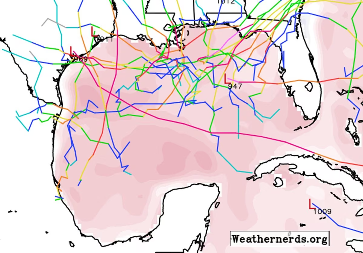


 Scott Jankowski